A new standard for wildfire risk intelligence
Wildfires are no longer isolated incidents, but part of a broader, systemic hazard profile. Environmental conditions that influence the ignition, behavior, and spread of wildfires must be taken into consideration. Key factors include:
- Drought conditions that dry out vegetation, creating abundant fuel
- Low humidity that accelerates combustion
- High winds that rapidly spread flames and embers
- Heatwaves that intensify fire behavior and strain response systems
- Topography (slope, aspect, and terrain) that influences fire intensity, direction, rate of spread, and accessibility
- Early detection that supports early action
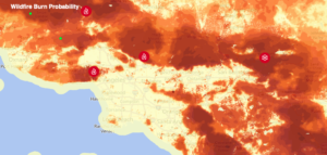
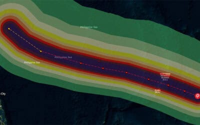
DisasterAWARE brings together information about these converging factors, which create environments where fires ignite more easily, burn more intensely, and spread more unpredictably—often in places densely populated or previously considered lower risk.
“Wildfire weather represents a shift in how we understand and manage fire risk—from reactive suppression to proactive intelligence. As conditions continue to evolve, so must the tools and strategies used to address them,” said PDC’s Dr. Hughey.
“By integrating global data, predictive analytics, and real-time ignition detection into DisasterAWARE, PDC has built a powerful tool to empower emergency and disaster managers to stay ahead of wildfire threats—transforming uncertainty into actionable insight.”
In a world where wildfire weather is growing in threat to populations and critical infrastructure, preparedness depends on visibility, speed, and informed decision-making. With the right tools in place, agencies can move from reacting to disasters to anticipating them—and ultimately, building more resilient communities.


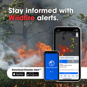
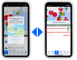 Disaster managers should set up Smart Alerts in DisasterAWARE to ensure their notifications are ready to fire the moment a wildfire is detected.
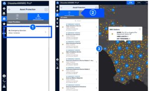 To protect the safety of assets and receive alerts about threats to essential systems that communities depend on, be sure to integrate your critical asset data using our secure protocols.