


Careers and Culture
Fuel your passion for innovation and public service by working with a leading tech organization that routinely pushes the limits of lifesaving possibility. For 30 years, Pacific Disaster Center (PDC) has been a pioneer in the innovation of early warning technologies, exercise scenario design, advanced analytics, and risk reduction science and research. Headquartered in Hawai‘i, PDC is regarded as a global leader in risk reduction and resilience-enhancing tools—a reputation built on the dedication and expertise of our team from across disaster management, technology, academic, and scientific disciplines. The Center’s products and services support the most demanding government customers, international, regional, and nongovernmental organizations worldwide in reducing risk and building safer, more resilient communities. As an applied science and research center managed by the University of Hawai‘i, we are always experimenting with new technologies, including applications for artificial intelligence in hazard alerting, monitoring, and predictive risk analytics. Our products benefit public users, government, humanitarian, and private sector decision makers. To learn about job opportunities with PDC, visit the Research Corporation of the University of Hawai‘i site at www.rcuh.com or through our LinkedIn postings.
Internships
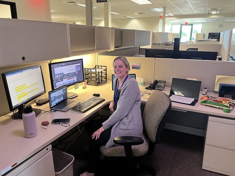
PDC provides mentored internship opportunities to self-motivated students who take pride in their work, have a passion for learning, and a commitment to problem-solving. Our internships allow individuals to apply learned skills and theory to real-world problems.
If you are interested in applying for an internship with PDC, please review the programs below to see if there is a good match. You should also examine the criteria for a direct internship before submitting your resume with the link below.
Quick Facts:
More than
Full-time employees
Rated among the top
High-tech companies in Hawai‘i
Over
%
PDC staff recruited through internships
Programs Available
Akamai Workforce Initiative
Offered to college students in Hawaii. Applications accepted in November. Please check the site for details.
https://akamaihawaii.org/interning/
University of Hawai‘i Student Employment & Cooperative Education (SECE)
Available only to college students within the UH system. PDC posts internship position descriptions to this site.
https://sece.its.hawaii.edu/sece/login
CareerLink – UH Maui College Cooperative (Co-Op) Education program
Available only to UH-MC students. Please check the site for details.
http://maui.hawaii.edu/careerlink/
Ke Alahele Program
Offered through Maui Economic Development Board (MEDB) internship program
http://www.medb.org/programs/education-to-workforce/ke-alahele-education-fund/
Direct Internships
Direct internships with PDC are also available on an as-needed basis. Please inquire per the guidelines below.
Internship Criteria
- All internships are based on the island of Maui in Hawaii. PDC does not support internships outside of Maui.
- All internship programs are paid internships. However, we do not offer relocation or housing support.
- Technical internships are for summer undergraduate and graduate students. Communications internships are offered year-round.
- U.S. Citizenship is not required, however:
- Candidates MUST have permission to work in the U.S. for the duration of internship; and
- PDC does NOT sponsor visas for international students.
- Long-term internships (for graduate students) may be as long as 6 months. Candidates must submit a resume as part of the submission. Areas of interest for internship may also be submitted.
- For PDC’s direct internship program, the applicant must submit a resume. Area(s) of interest for internship may also be submitted. Internship is contingent upon need and availability.
Skills We Need
Over the years, interns have made valuable contributions to PDC projects and activities with such skills as:
Computer or GIS skills and literacy
- Computer programming (C++, Java, Jscript, …)
- Scripting (PHP, Python, Shell, …)
- Web/App development (HTML, CSS, JSON, …)
- AI experience and/or interest
- GIS (data processing, visualization, …)
- Imagery and/or Image analysis
- Physical sciences and/or modeling
- Data analysis and/or statistics
Communications or design skills and literacy
- Public relations, communications, content development experience
- Web UX / UI design principles
- Graphic design using latest Adobe products
- Video editing
- Marketing copy development
- Social media content management
Follow Us

Typhoon Champi (now Category 3-equivalent strength) is forecast to pass just east of Taiwan on Friday and Saturday (local time). Monitor DisasterAWARE for updates with each new advisory to track Champi's progress, as well as for early warnings and potential impacts.
Disaster managers and humanitarian assistance practitioners can request access at: disasteraware.pdc.org. The public can download our free Disaster Alert mobile app for updates and hazard alerts.
#SaferWorld #EarlyWarningforAll #Taiwan#Storm#Typhoon #Flood #DisasterAWARE #TyphoonChampi
U.S. Pacific Command
United Nations OCHA
World Food Programme
International Federation of Red Cross and Red Crescent Societies
@NCDR

At 7 p.m. ChST on October 17 (Guam local time), dangerous Category 4 Typhoon Champi was located about 140 miles east-southeast of Guam, with maximum sustained winds of 130 mph. Champi is expected to continue strengthening as it approaches Guam.
Attached is the latest PDC Event Brief, highlighting potential impacts and exposure to damaging winds. Access critical updates and data through DisasterAWARE:
- Disaster managers and humanitarian assistance professionals can request access to DisasterAWARE Pro (disasteraware.pdc.org).
- The public can download our free Disaster Alert mobile app for updates and hazard alerts.
#SaferWorld #EarlyWarningForAll #Guam #rota #Marianas #cnmi #storm #tropicalstorm #typhoon #flood #disasteraware #TyphoonChampi
Guam Homeland Security/Office of Civil Defense
CNMI Office of Planning and Development
Guam National Guard
FEMA Federal Emergency Management Agency
American Red Cross
#samoa #planprepareprotect #ndpba #disasteraware #SaferWorld #EarlyWarningForAll #ohdaca #humanitarianassistance
Disaster Management Office - Samoa
Ministry of Natural Resources and Environment Samoa
US Embassy Apia, Samoa
University of Hawai‘i News
Center for Excellence in Disaster Management & Humanitarian Assistance
This content isn't available right now
When this happens, it's usually because the owner only shared it with a small group of people, changed who can see it or it's been deleted.
#samoa #ndpba #disasteraware #SaferWorld #EarlyWarningForAll #ohdaca #humanitarianassistance
Disaster Management Office - Samoa
Ministry of Natural Resources and Environment Samoa
US Embassy Apia, Samoa
University of Hawai‘i News
Center for Excellence in Disaster Management & Humanitarian Assistance
This content isn't available right now
When this happens, it's usually because the owner only shared it with a small group of people, changed who can see it or it's been deleted.
At 1am ChST on October 17 (local time in Guam), Tropical Storm Champi was located about 425 miles east-southeast of Guam and is expected to become a typhoon later today. Champi is currently anticipated to move over or close to Guam Sunday morning, possibly as a category 3 typhoon.
Monitor DisasterAWARE for updates with each new advisory!
- Disaster managers and humanitarian assistance professionals can request access to DisasterAWARE Pro (disasteraware.pdc.org).
- The public can download our free Disaster Alert mobile app for updates and hazard alerts.
#SaferWorld #EarlyWarningForAll #Guam #Marianas #cnmi #storm #tropicalstorm #typhoon #flood #disasteraware
Guam Homeland Security/Office of Civil Defense
CNMI Office of Planning and Development
Guam National Guard
FEMA Federal Emergency Management Agency
American Red Cross
We express our sincere gratitude for our partners at Disaster Management Office - Samoa and the US Embassy Apia, Samoa for their support of this important work together on this National Disaster Preparedness Baseline Assessment initiative that will have long lasting benefits for all.
This content isn't available right now
When this happens, it's usually because the owner only shared it with a small group of people, changed who can see it or it's been deleted.
Hawaiʻi’s Pacific Disaster Center (PDC) and Samoa Launch Resilience-Building Initiative
As El Niño-driven drought and shifting weather patterns increase risks to Pacific Island communities from cyclones, fires, flooding, and other hazards, Hawaiʻi and Samoa are joining forces on a National Disaster Preparedness Baseline Assessment (NDPBA) to exchange knowledge and strengthen disaster risk reduction, preparedness, and resilience in Samoa.
As forecasters warn that El Niño could reach historic strength this year, the Government of Samoa and the University of Hawaiʻi’s Pacific Disaster Center (PDC) launched a yearlong assessment on October 14, 2026, to evaluate the island nation’s disaster risk down to the district level. Led by Samoa’s Disaster Management Office (DMO) under the Ministry of Natural Resources and Environment (MNRE), with support from the U.S. Embassy in Apia, the NDPBA kickoff drew more than 60 participants from across sectors.
“The National Disaster Preparedness Baseline Assessment provides an opportunity to bring together national data, technical assessments, institutional knowledge, and stakeholder perspectives to develop a clearer picture of our country’s disaster risk and preparedness,” said Afioga Suʻemalo Talie Foliga, Acting Chief Executive Officer of Samoa’s MNRE. “I would like to acknowledge and thank the United States through its embassy here in Samoa, as well as the team from the Pacific Disaster Center for their immense support and continued partnership.”
In his opening remarks, U.S. Chargé d’Affaires to Samoa Matthew Younger said, “Today is a monumental step forward in our journey together. We are breaking new ground with this assessment. Resilience is not built overnight, nor is it built by the government alone. It requires data, technology, community-level awareness, and above all, unwavering partnership, which we are here to offer today and to celebrate by launching the National Disaster Preparedness Baseline Assessment. Today, we are equipping Samoa’s villages, disaster managers, and leaders with the precision tools needed to anticipate threats, protect families, and safeguard Samoa’s sustainable future.”
PDC’s findings from the assessment will feed directly into DisasterAWARE, the early warning and decision-support platform used by decision-makers across the Pacific to plan, prepare for, and respond to disasters. The approach enables agencies to make immediate use of assessment data during this El Niño season rather than waiting for a final report.
Over the next year, the program will produce district-level risk profiles, an analysis of Samoa’s disaster management capabilities, and a five-year plan of action.
#Samoa #NDPBA #DisasterAWARE #SaferWorld #EarlyWarningForAll #ohdaca #humanitarianassistance
Disaster Management Office - Samoa
Ministry of Natural Resources and Environment Samoa
US Embassy Apia, Samoa
University of Hawai‘i News
Center for Excellence in Disaster Management & Humanitarian Assistance
A powerful M7.6 earthquake has occurred 10km WSW of Pitaloza Arriba, Panama. Monitor DisasterAWARE for updates as this event unfolds.
Hazardous tsunami waves from this earthquake are possible within the next three hours along some coasts of Panama, Colombia, Costa Rica, Ecuador, Peru, Nicaragua, Guatemala, El Salvador and Mexico.
Attached are preliminary earthquake exposure estimates for Moderate or stronger shaking intensity, as well as tsunami travel times for those countries listed above.
Disaster managers and humanitarian assistance professionals can request access to DisasterAWARE Pro (disasteraware.pdc.org). The public can download our free Disaster Alert mobile app for updates and hazard alerts.
#earthquake #tsunami #panama #colombia #costarica #ecuador #peru #Nicaragua #Guatemala #ElSalvador #mexico
Isaias is now a dangerous Category 3 major hurricane. See attached for more details on potential impacts, critical layers, advanced analytics, and more!
Continue to monitor DisasterAWARE and the Disaster Alert mobile app for the latest updates as this events unfolds.
Disaster managers and humanitarian assistance professionals can request access to DisasterAWARE Pro (disasteraware.pdc.org). The public can download our free Disaster Alert mobile app for updates and hazard alerts.
#hurricane #hurricaneisaias #cyclone #storm #gulfcoast #louisiana #florida #alabama #mississippi #tennessee #georgia #flood #flashflood
Louisiana Governor's Office of Homeland Security and Emergency Preparedness
Florida Division of Emergency Management
Alabama Emergency Management Agency
Mississippi Emergency Management Agency
Georgia Emergency Management and Homeland Security Agency
Tennessee Emergency Management Authority
The National Guard
American Red Cross
Isaias has intensified into a hurricane in the central Gulf. Isaias is forecast to continue strengthening into a Category 2 hurricane later tonight before reaching the northern Gulf Coast late Friday into early Saturday.
A life-threatening storm surge is expected from the Mouth of the Mississippi River to Suwannee, Florida. Damaging hurricane force-winds are expected over portions of the Florida Panhandle, southern Alabama, and southern Mississippi where a Hurricane Warning is in effect. Damaging wind gusts are possible over much of central and northern Alabama and portions of western and northern Georgia, especially in areas of higher terrain. Isaias will bring heavy rainfall to the central U.S. Gulf coast and much of the Southeast Friday into the weekend. Considerable flash and urban flooding, along with significant river flooding, will be possible.
Get the full picture at DisasterAWARE.pdc.org—including updates and alerts, potential impacts (e.g. wind, rainfall, storm surge), exposure analytics, critical infrastructure, live cameras, and more!
Disaster managers and humanitarian assistance professionals can request access to DisasterAWARE Pro (disasteraware.pdc.org). The public can download our free Disaster Alert mobile app for updates and hazard alerts.
#hurricane #tropicalstormisaias #cyclone #storm #gulfcoast #louisiana #florida #alabma #mississippi #flood #FlashFlood
Louisiana Governor's Office of Homeland Security and Emergency Preparedness
Florida Division of Emergency Management
Alabama Emergency Management Agency
Mississippi Emergency Management Agency
The National Guard
American Red Cross
FEMA Federal Emergency Management Agency
Tropical Storm Isaias is currently located in the southern Gulf near the Yucatan of Mexico. Isaias is forecast to rapidly strengthen over the next few days into a Category 2 hurricane before reaching the northern Gulf Coast by the end of week.
There is a high risk of dangerous wind and storm surge impacts along portions of the northern Gulf Coast from Louisiana to the Florida Panhandle. Hurricane and Storm Surge Watches have been issued for portions of the northern Gulf coast. Tropical Storm Isaias will bring heavy rainfall to the central U.S. Gulf coast and much of the Southeast Friday into the weekend. Flash and urban flooding, along with isolated river flooding, will be possible.
Get the full picture at DisasterAWARE.pdc.org—including updates and alerts, potential impacts (e.g. wind, rainfall, storm surge), exposure analytics, critical infrastructure, live cameras, and more!
Disaster managers and humanitarian assistance professionals can request access to DisasterAWARE Pro (disasteraware.pdc.org). The public can download our free Disaster Alert mobile app for updates and hazard alerts.
#cyclone #storm #tropicalstorm #gulfcoast #louisiana #florida #alabma #mississippi #flood #flashflood #hurricane #tropicalstormisaias
Louisiana Governor's Office of Homeland Security and Emergency Preparedness
Florida Division of Emergency Management
Alabama Emergency Management Agency
Mississippi Emergency Management Agency
The National Guard
American Red Cross
Sending aloha and a big mahalo (thank you) to our long-time partners at the Philippines Office of Civil Defense (OCD)! The team was excited to be back in Manila recently to upgrade PhilAWARE and provide advanced administration training. We also commend OCD for its continued commitment to leveraging the latest technology and data to strengthen early warning, preparedness, and resilience across the region.
PhilAWARE serves as a mission-critical tool within OCD's Emergency Operations Center (EOC) for hazard early warning and decision support. These enhancements and training efforts reflect our ongoing collaboration with OCD and help ensure continued access to real-time situational awareness, advanced analytics, hazard information and alerts, and actionable risk insights. Together, these capabilities support informed decision-making, resource prioritization, and coordinated disaster planning and response when it matters most.
PhilAWARE is part of PDC’s advanced DisasterAWARE ecosystem and a custom version created for the Philippines. Learn more!
• DisasterAWARE: www.pdc.org/disasteraware/
• PhilAWARE in action: www.pdc.org/empowering-readiness-before-impact-m7-8-mindanao-earthquake-response-case-study/
#SaferWorld #EarlyWarningforAll #Philippines #Manila #PhilAWARE #DisasterAWARE #EarlyWarning #Preparedness #Hazard #DisasterPrepareness
Civil Defense PH