Access country-specific layers
Types of country layers available in DisasterAWARE
While information varies from country to country, the common datasets offered in DisasterAWARE include: critical infrastructure, population and demographics, transportation, risk and vulnerability, and hazard zones information.
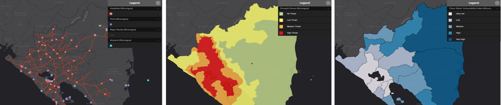
Example subset of country map layers for Nicaragua
(Infrastructure, hazard zones, clean water vulnerability index)
Explore country layers
 |
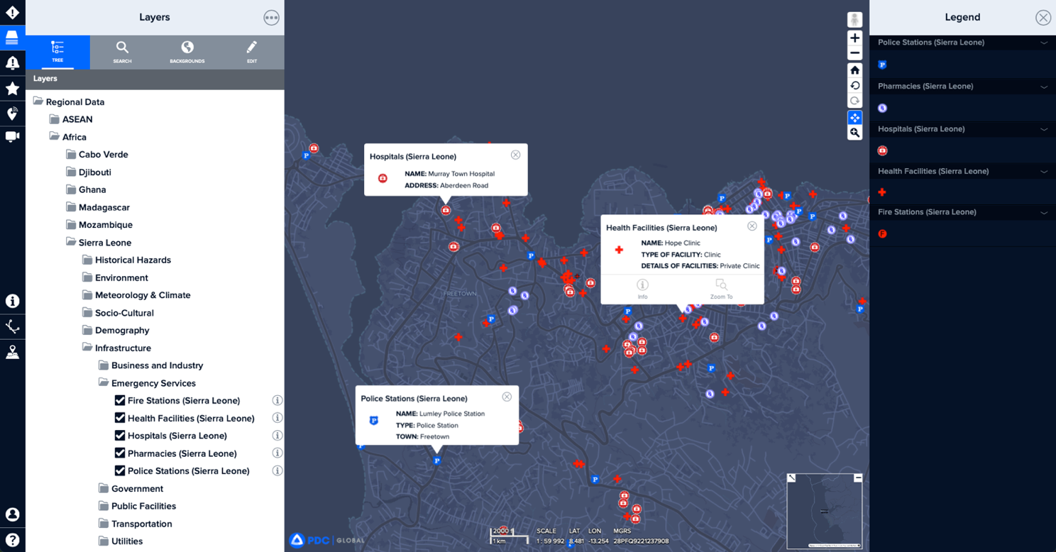
Click the Layers icon in the left toolbar to view a list of PDC’s country layers. Scroll down to the Regional Data folder. |
 |
Open the regional folder that includes the country you are interested in. |
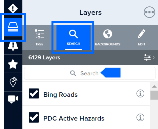
Search for country layers
 |
With the Layers panel open, click the Search tab to search for layers by country name or keyword. |