

Current Snapshot
For all the latest updates visit: DisasterAWARE
ec
3
051442_earliest_reasonable_toa_34M
goes18_ir_13E_202609051545_lat21.6-lon-120.1M
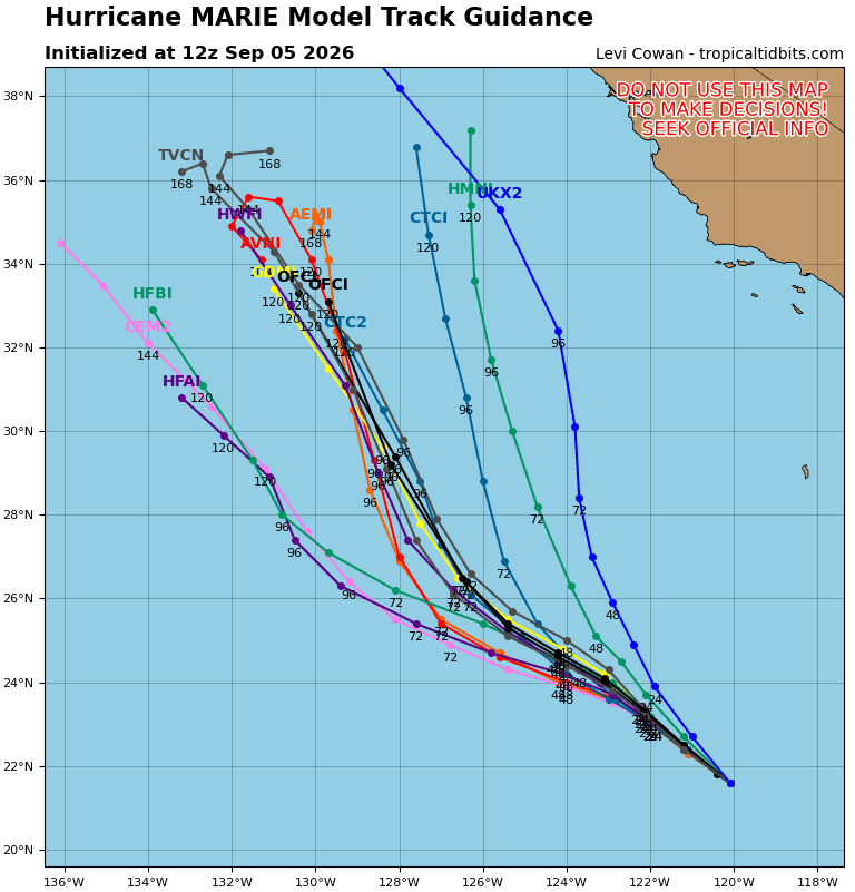
13E_tracks_latest
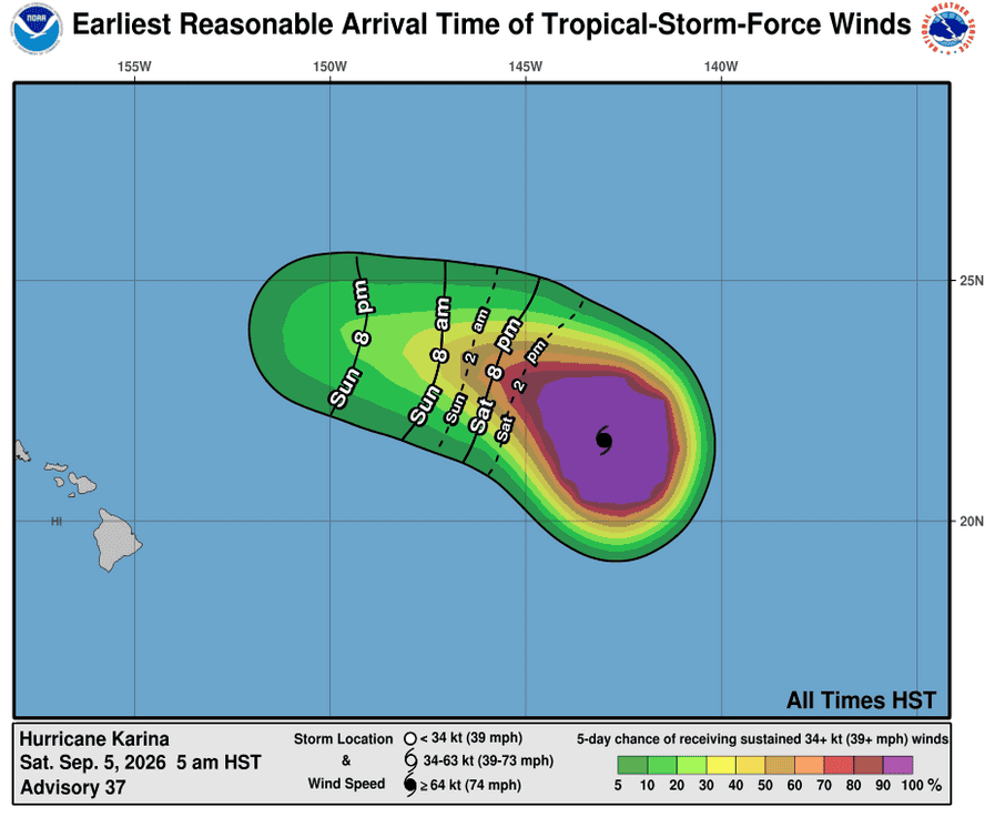
051440_earliest_reasonable_toa_34K
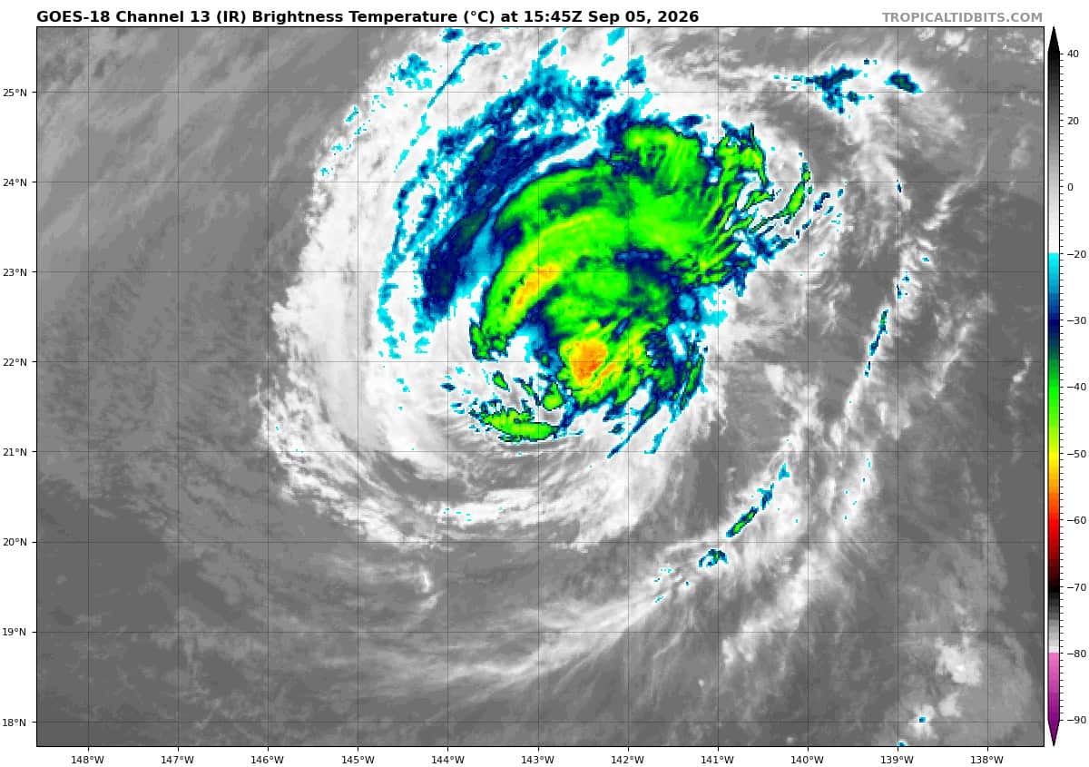
goes18_ir_11E_KKK
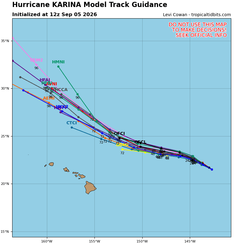
11E_tracks_latestK
051441_earliest_reasonable_toa_34LLL
goes18_ir_12E_202609051545_lat13.4-lon-162.4
12E_tracks_latest
051441WPCQPF_sm
wp2226
22W_051200sair
himawari9_ir_22W_202609051540_lat25.5-lon128.2
22W_tracks_latest
wp2326
23W_051200sair
himawari9_ir_23W_202609051540_lat28.5-lon133.8
23W_tracks_latest
By PDC’s Senior Weather
Specialist Glenn James

The Pacific Disaster Center’s (PDC Global) Saturday, September 5, 2026, Tropical Cyclone Activity Report…for the Pacific Ocean, the Indian Ocean, and adjacent Seas.
Tropical Cyclones
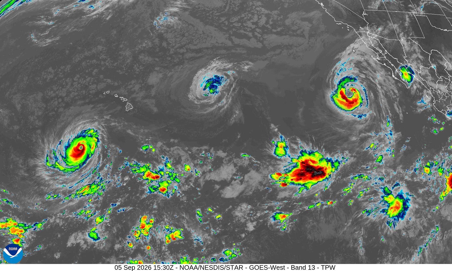
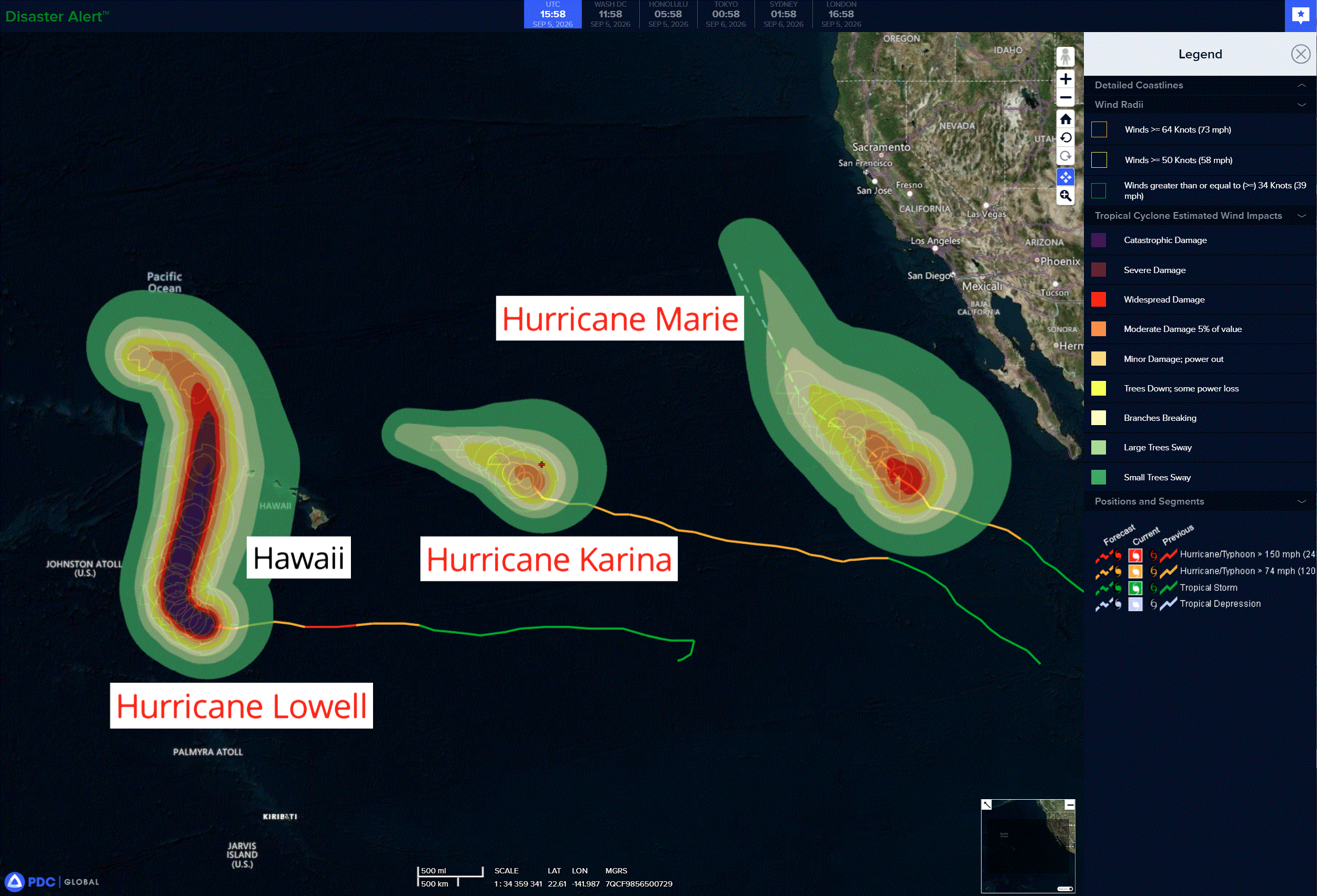
Tropical Cyclone 11E (Karina) is located about 795 miles east-northeast of Hilo, Hawaii
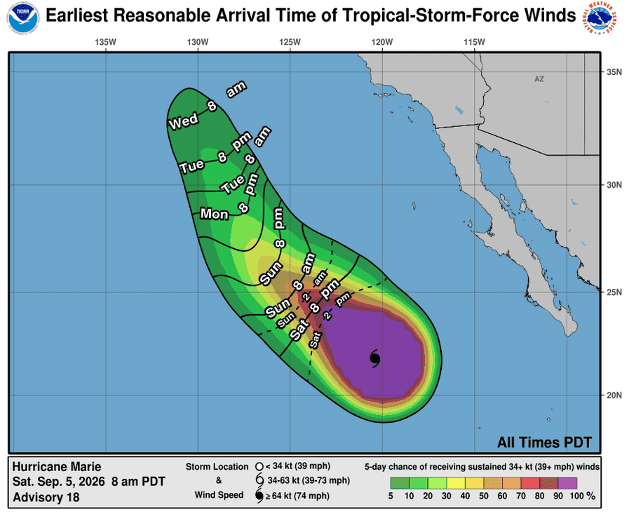
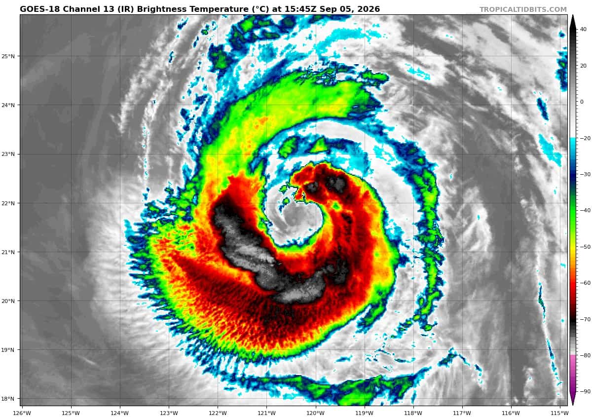
Tropical Cyclone 13E (Marie) is located about 675 miles west of of the southern tip of Baja California
Tropical Cyclone 12E (Lowell) is located about 630 miles south-southwest of Lihue, Hawaii
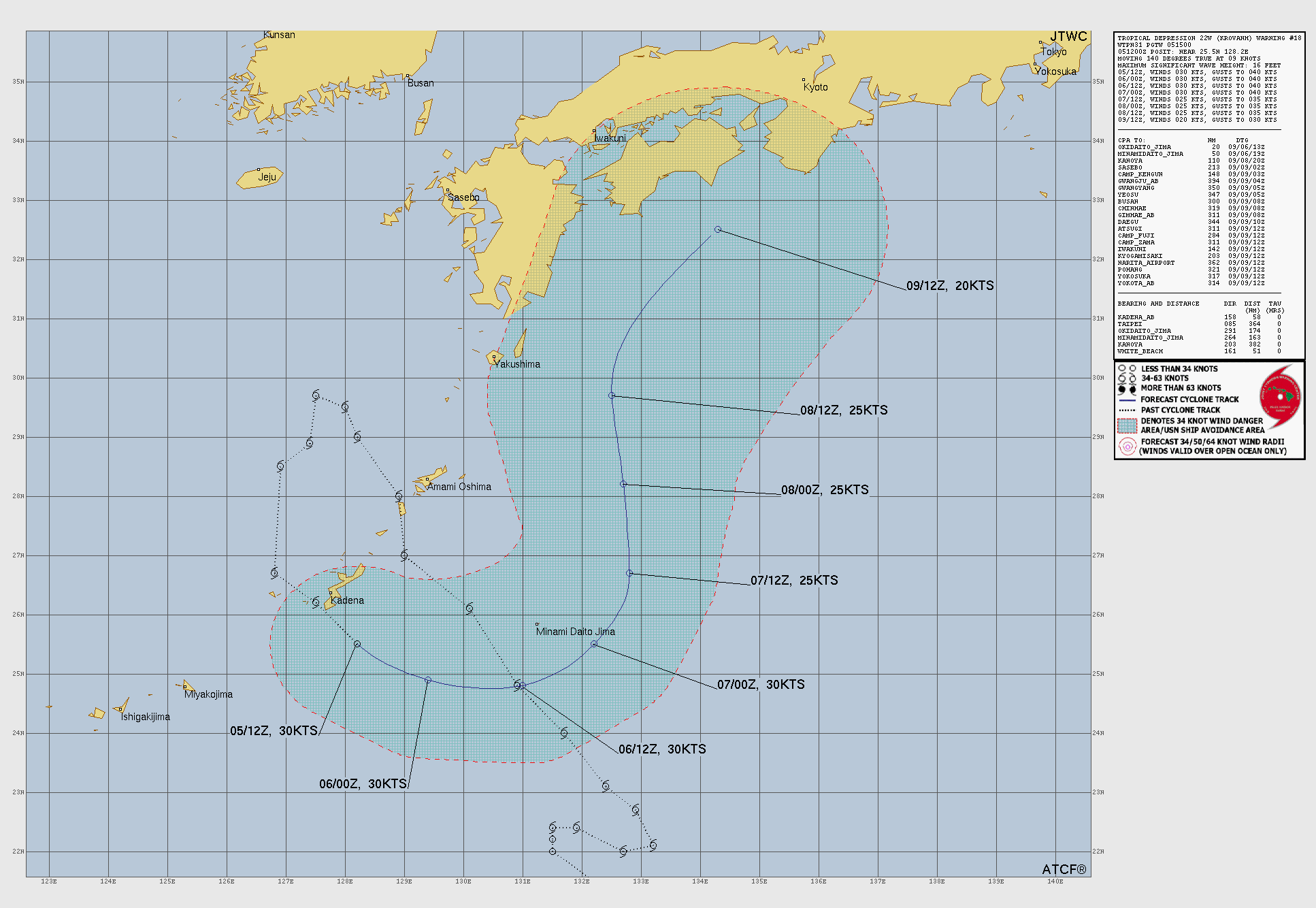
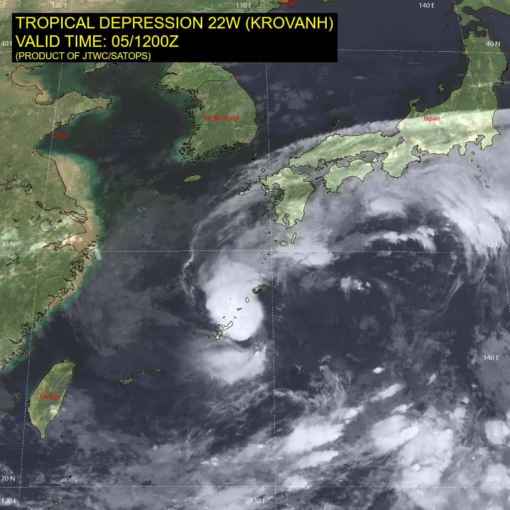
Tropical Cyclone 22W (Krovanh) is located approximately 64 miles south-southeast of Kadena AB
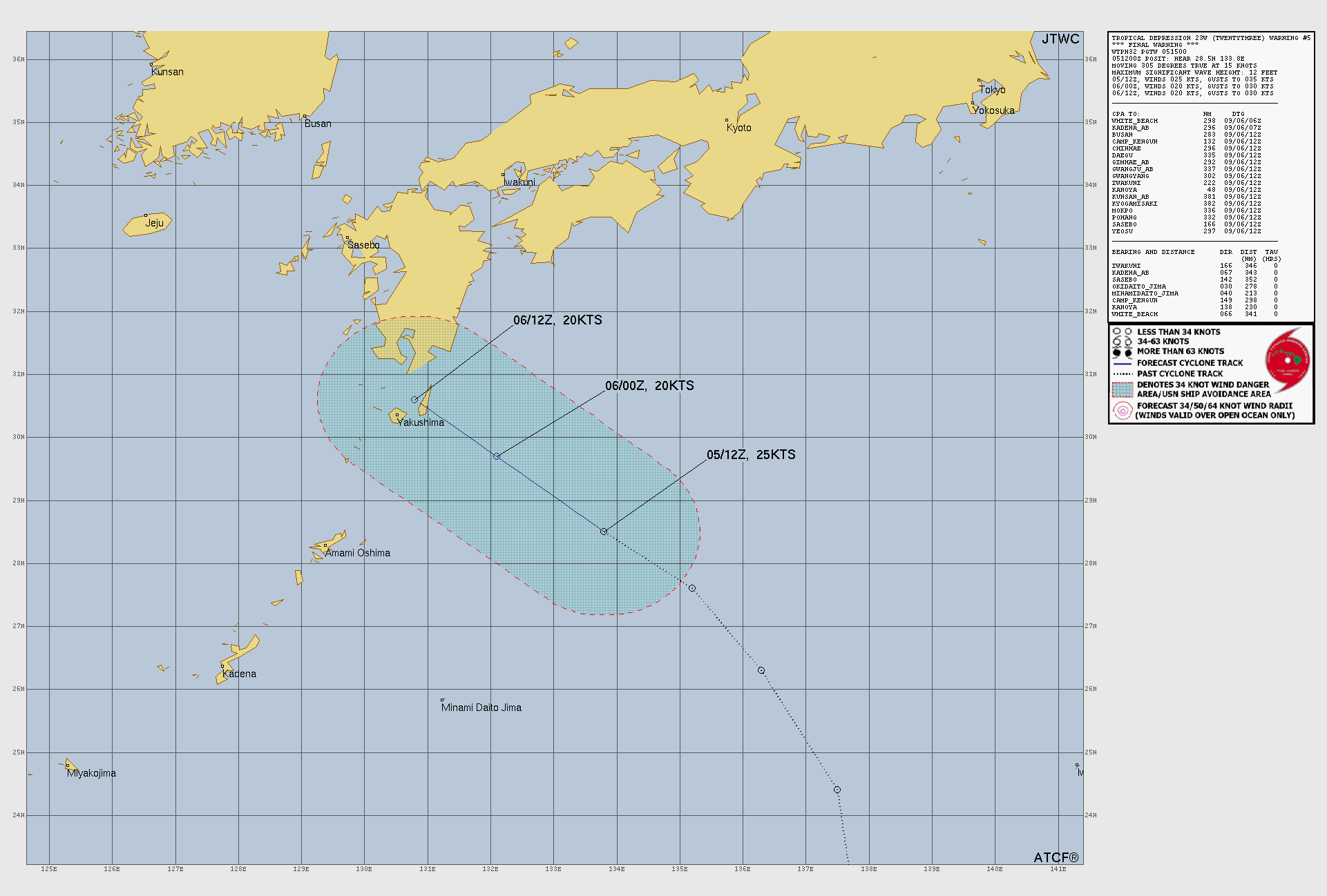
Tropical Cyclone 23W is located approximately 341 miles east-northeast of Kadena AB – Final Warning
Northeast Pacific:
Tropical Cyclone 13E (Marie)
MARIE EXPECTED TO WEAKEN DURING THE NEXT FEW DAYS
According to the NHC advisory number 18…
Marie is moving toward the northwest near 9 mph (15 km/h). A similar motion is expected today. A slight decrease in forward speed with a brief turn toward the west-northwest is possible on Sunday. Marie is then expected to resume a northwestward heading at a faster forward speed. Maximum sustained winds are near 90 mph (150 km/h) with higher gusts. Steady weakening is forecast through early next week. Hurricane-force winds extend outward up to 50 miles (85 km) from the center and tropical-storm-force winds extend outward up to 205 miles (335 km). The estimated minimum central pressure is 970 mb (28.65 inches).
HAZARDS AFFECTING LAND
SURF: Swells generated by Marie will continue to affect portions of the coast of southwest Mexico, the Baja California Peninsula, and Southern California for the next few days. These swells are likely to cause life-threatening surf and rip current conditions.
Central North Pacific:
Tropical Cyclone 11E (Karina)
KARINA FORECAST TO QUICKLY WEAKEN THROUGH EARLY NEXT WEEK
According to the NHC advisory number 37…
Karina is moving toward the northwest near 8 mph (13 km/h). A turn toward the west is expected by late Sunday, and the system is expected to continue westward early next week until it dissipates. Maximum sustained winds are near 75 mph (120 km/h) with higher gusts. Steady weakening is anticipated. Karina is forecast to dissipate late Monday or early Tuesday. Hurricane-force winds extend outward up to 35 miles (55 km) from the center and tropical-storm-force winds extend outward up to 140 miles (220 km). The estimated minimum central pressure is 985 mb (29.09 inches).
Tropical Cyclone 12E (Lowell)
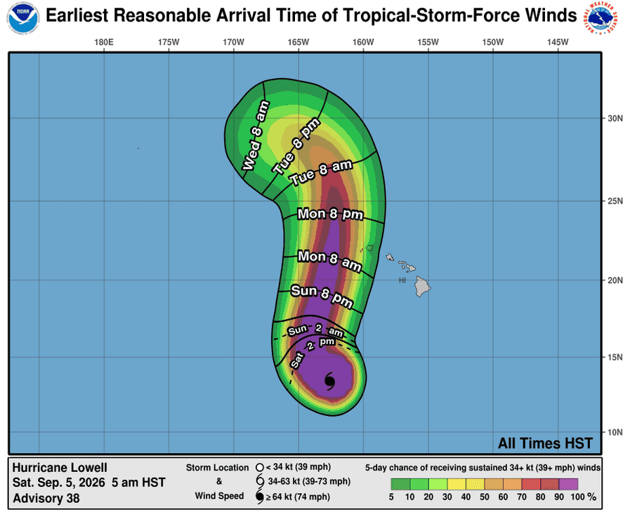
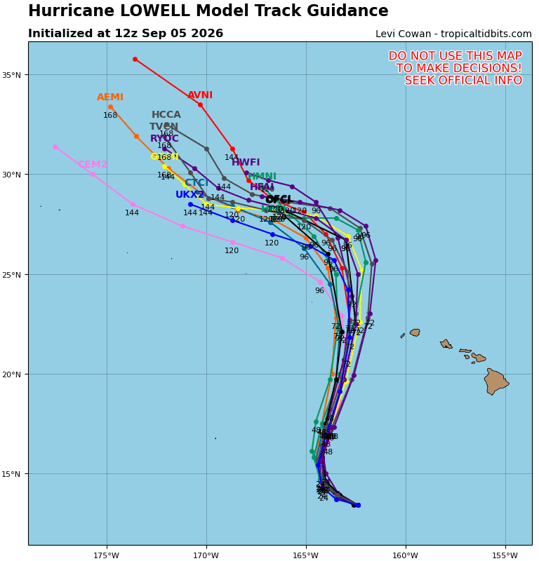
LOWELL FORECAST TO TURN NORTHWARD ON SUNDAY AND APPROACH THE WESTERN HAWAIIAN ISLANDS ON MONDAY…INTERESTS IN HAWAII SHOULD CLOSELY MONITOR LOWELL’S PROGRESS
According to the NHC advisory number 38…
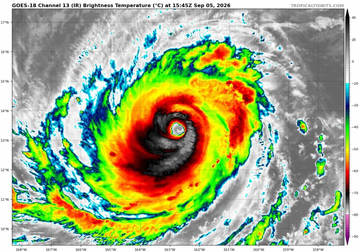
Lowell is moving toward the west near 7 mph (11 km/h). A turn toward the northwest is expected by tonight, followed by a faster motion toward the north and north-northeast on Sunday and Monday. On the forecast track, the center of Lowell will move across portions of the Papahanaumokuakea Marine National Monument, just to the west of the main Hawaiian Islands, Monday night. Maximum sustained winds are near 150 mph (240 km/h) with higher gusts. Lowell is a category 4 hurricane on the Saffir-Simpson Hurricane Wind Scale. Fluctuations in intensity are possible during the next day or so, followed by a gradual weakening trend on Sunday and Monday. Hurricane-force winds extend outward up to 60 miles (95 km) from the center and tropical-storm-force winds extend outward up to 160 miles (260 km). The estimated minimum central pressure is 931 mb (27.50 inches).
HAZARDS AFFECTING LAND
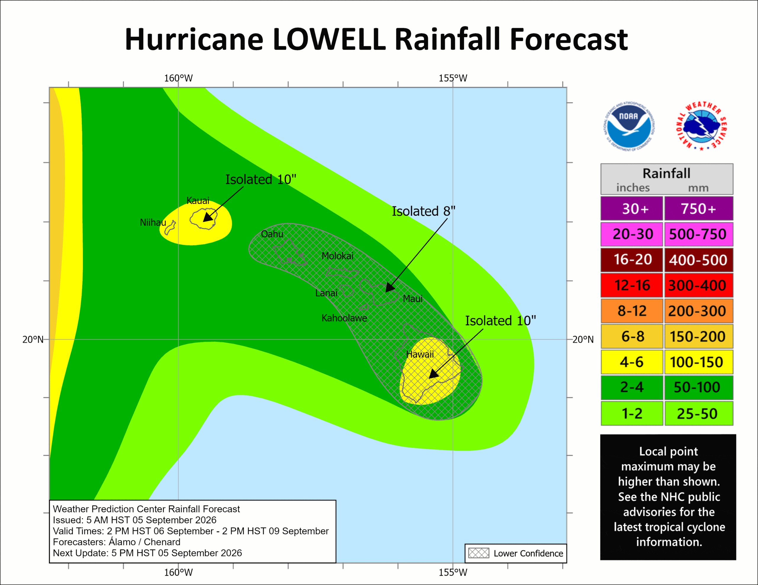
RAINFALL: Hurricane Lowell is expected to produce rainfall totals of 3 to 6 inches, with maximum totals exceeding 10 inches possible, for Kauai and the Big Island. For Maui, 2 to 4 inches of rain is expected, with isolated maximum totals of 8 inches possible. Across the remaining islands, rainfall of 1 to 2 inches with maximum amounts of 4 inches is possible. This rainfall may produce locally significant flash flooding and mudslides, especially in areas of steep terrain.
SURF: Swells from Lowell are likely to cause life-threatening surf and rip current conditions during the next several days across many of the Hawaiian islands.
Western Pacific, Indian Ocean, and adjacent Seas:
Western Pacific
Tropical Cyclone 22W (Krovanh)
According to the JTWC warning number 18…sustained winds were 30 knots with gusts to 40 knots
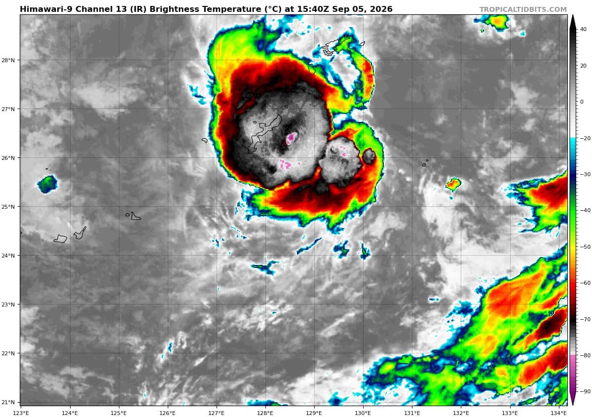
Animated enhanced infrared (eir) satellite imagery depicts tropical depression 22W (Krovanh) with a loosely-defined low-level circulation center (llcc) that is partially obscured by flaring
convection to the south. The convection that was previously displaced far to the north has shifted southward and is now closer to the llcc. A 051036z f16 ssmis 91 ghz microwave image revealed an ill-defined llcc with convective activity located about 50 nm to the northeast of Kadena AB.
Environmental analysis indicates that 22W is located within a marginal environment characterized by strong poleward outflow aloft, low to moderate (15-20 kts) vertical wind
shear, significant dry air entrainment, and warm (29-30 c) sea surface temperatures.
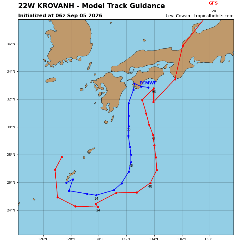
TD 22W is forecast to track east-southeastward through 24 hours under the steering influence of the ner to the south. After 24 hours, 22W will begin to turn poleward as it tracks
along the western periphery of the str positioned southeast of Japan through 72 hours. 22W will then approach southeastern Kyushu and turn northeastward once it begins to round the str axis.
In terms of intensity, 22W is forecast to maintain an intensity of around 30 kts through 36 hours under the effects of the marginal environment. After 36 hours, dry air entrainment from the west along with decreasing ocean heat content will cause the system to weaken. Around 72 hours, the system will begin to tap into a strong poleward outflow channel, however southwesterly vertical wind shear will also greatly increase, preventing any chances for intensification.
Around 96 hours, the circulation will likely become extremely stretched as it interacts with the hostile upper-level winds. as a result, 22W is forecast to dissipate over water south of Shikoku near 96 hours with a shallow and elongated vortex.
Tropical Cyclone 23W – Final Warning
According to the JTWC warning number 5…sustained winds were 25 knots with gusts to 35 knots
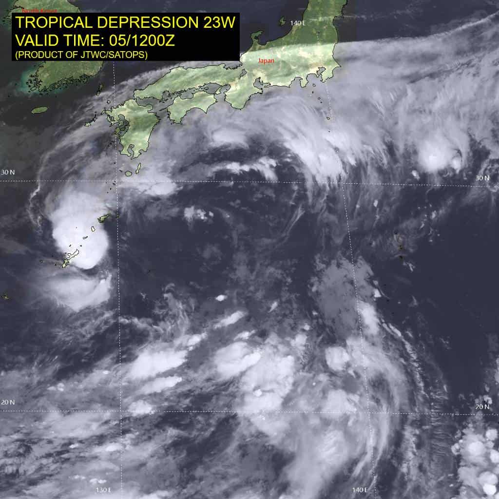
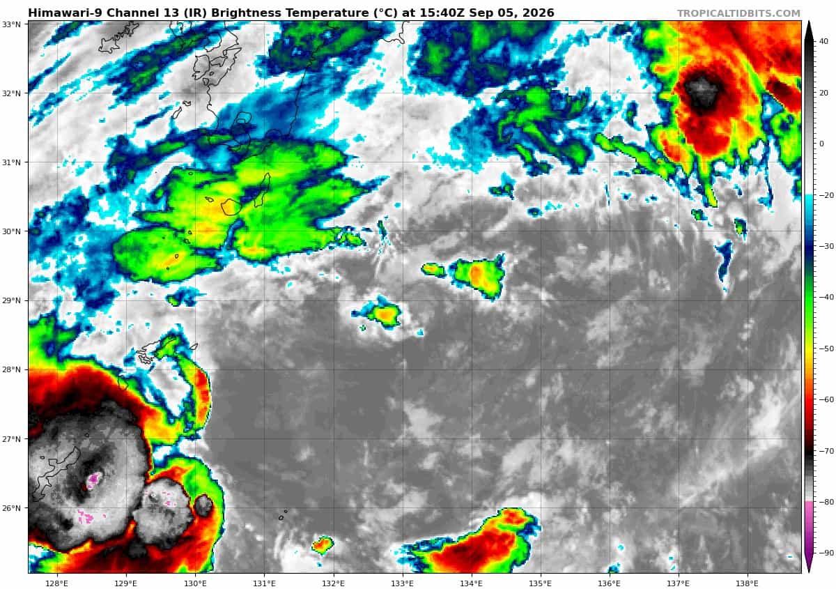
Animated enhanced infrared satellite imagery depicts tropical depression 23W with a small and fully-exposed low-level circulation center (llcc). A 051216z metop-b ascat pass revealed that the western side of the circulation has started to unravel with no clear northerlies wrapping into the center. The ascat also showed a small patch of 25 kt winds in the northern semicircle, supporting the assessment of the inital intensity.
23W is forecast to continue tracking northwestward toward southern Kyushu as it washes out within the larger-scale low-level cyclonic flow over the next 12-24 hours.