
")
Current Snapshot
For all the latest updates visit: DisasterAWARE
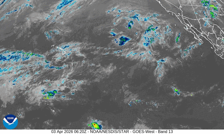
GOES18-TPW-13-900×540
indusa
29S_030600sair
meteosat9_ir_29S_202604031451_lat-16.5-lon72.2
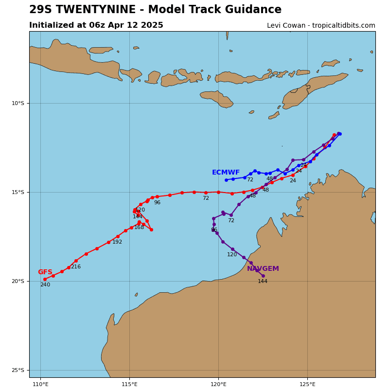
29S_tracks_latest
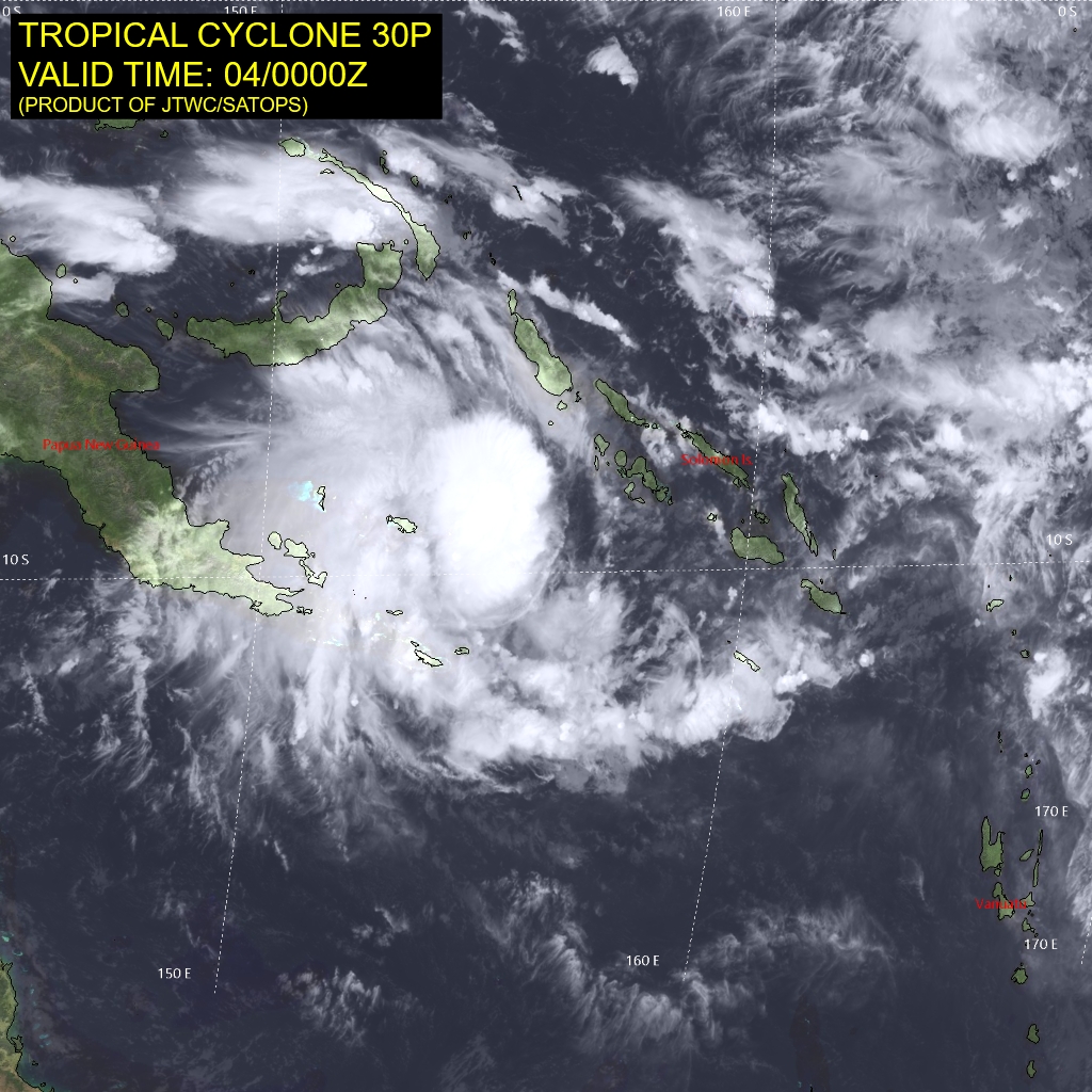
30P_040000sair
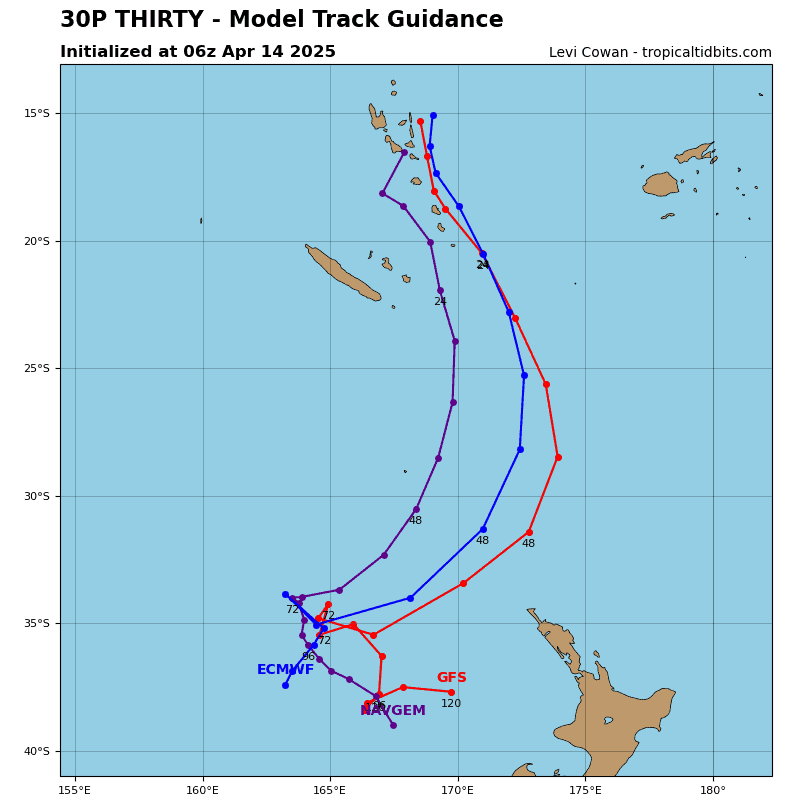
30P_tracks_latest
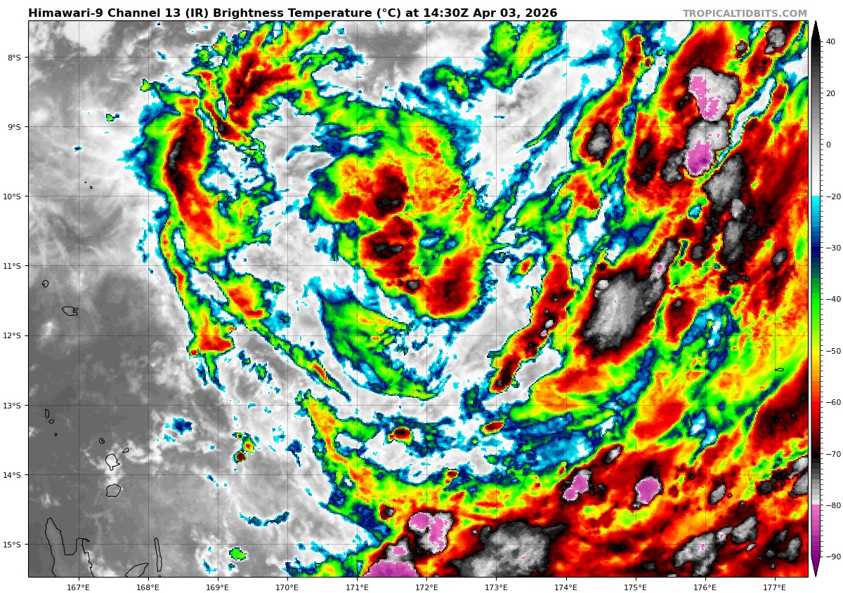
himawari9_ir_91P_202604031430_lat-10.9-lon172.3
91P_tracks_latest
By PDC’s Senior Weather
Specialist Glenn James

The Pacific Disaster Center’s (PDC Global) Friday, April 3, 2026, Tropical Cyclone Activity Report…for the Pacific Ocean, the Indian Ocean, and adjacent Seas
Current Tropical Cyclones:
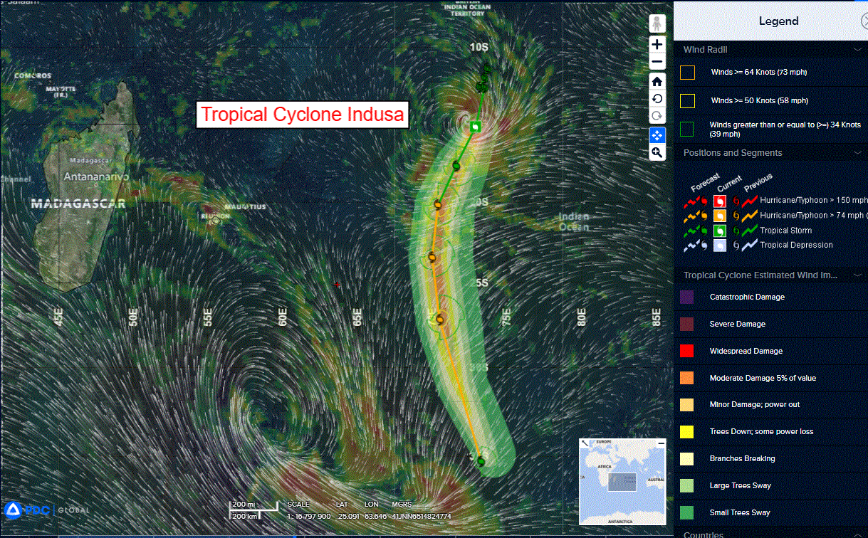
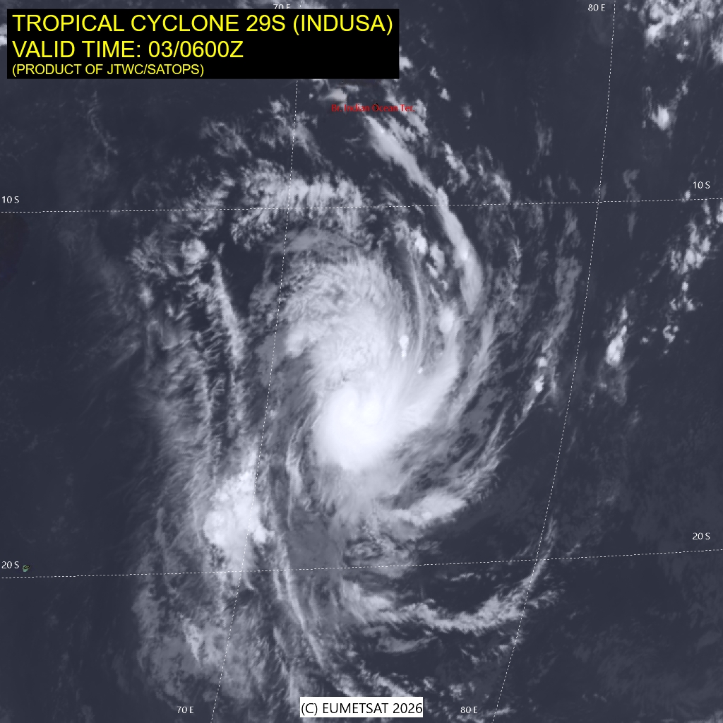
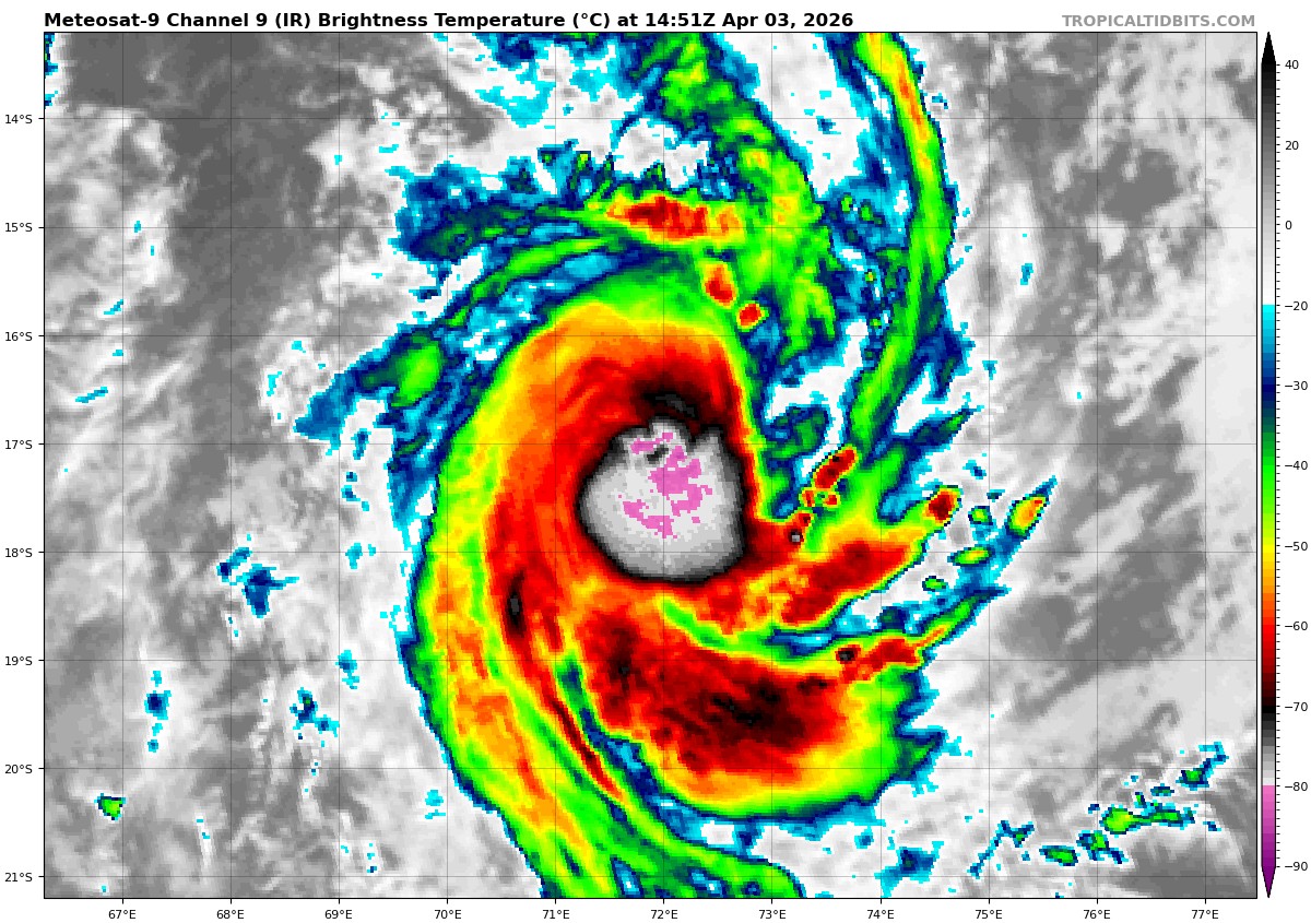
Tropical Cyclone 29S (Indusa)…is located approximately 644 NM south of Diego Garcia
Tropical Cyclone 30P…is located approximately 717 NM northeast of Cairns, Australia
Northeast Pacific Ocean: There are no Tropical Cyclones
The last regularly scheduled Tropical Cyclone Activity Report of the 2025 eastern North Pacific Hurricane Season has been issued. Routine issuance of this section of the PDC product will resume on May 15, 2026. During the off-season, Special Tropical Weather Outlooks will be issued as conditions warrant by the NHC.
Central Pacific Ocean: There are no Tropical Cyclones
The 2025 central North Pacific hurricane season has ended. As such, the final routine Tropical Cyclone Activity Report for the 2025 season has been issued. Routine issuance of this section of the PDC product will resume on June 1, 2026. During the off-season, Special Tropical Weather Outlooks will be issued as conditions warrant by the CPHC.
Western Pacific, Indian Ocean, and adjacent Seas:
South Indian Ocean
Tropical Cyclone 29S (Indusa)
According to the JTWC warning number 6, sustained winds are 65 knots with gusts to 80 knots
Animated multi-spectral satellite imagery (msi) depicts tropical cyclone 29S (Indusa) still struggling with dry air intrusion throughout the circulation putting a hold on any significant intensification. The otherwise favorable environment is characterized by warm (28-29 c) sea surface temperatures (sst), low (5-10 kts)
vertical wind shear (vws), and robust poleward outflow.
Despite the compact structure of the system, it failed to oppose the dry air
entrainment and therefore remained stagnant at 55 kts over the last 12 hours.
TC 29S is forecast to maintain its trajectory along the northwestern periphery of the subtropical ridge through 36 hours. The environment is expected to remain generally favorable, supporting a period of sustained intensification, contingent upon the core remaining insulated from dry air entrainment. If the
system is not able to maintain a moist core and symmetrical structure, intensification may be slowed down significantly or halted entirely.
Peak intensity is currently forecast to reach 70 kts around 36 lhours, immediately preceding a recurvature towards the south-southeast and around the ridge axis. Post-recurvature, TC Indusa will begin to interact with an upper-level jet, initiating a weakening trend and the onset of extratropical transition (ett). The synoptic and oceanic environment will become increasingly hostile,
characterized by persistent dry air advection, rapidly increasing vertical wind shear, and cooling sea surface temperatures, reaching 22-23 c by 72 hours.
Around that time, the wind field of TC 29S is expected to expand and become increasingly asymmetric as core wind speeds decrease further. TCc 29S is anticipated to complete the ett around 72 hours as it becomes embedded within the deep-layer mid-latitude westerlies and weakens to 35 kts.
Southwest Pacific Ocean
Tropical Cyclone 30P
According to the JTWC warning number 1, sustained winds are 35 knots with gusts to 45 knots
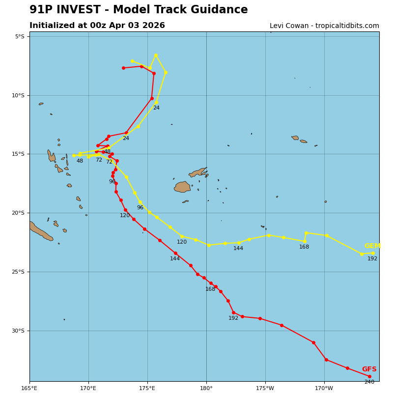
>>> There’s an area of disturbed weather being referred to as Invest 91P, which is located approximately 590 NM north-northeast of Port Vila
Animated enhanced multi-spectral satellite imagery (msi) and a 030047z oceansat depicts an area of calmer winds (5-10 kts) closer to the center, while
more elevated winds (10-15 kts) are observed along the northern flank of the circulation.
Within the structure of 91P, multiple mesovorticies rotating cyclonically are identifiable. Upper air analysis indicates a marginally favorable environment for further development with low (10-15 kts) vertical wind shear, warm (29-30 c) sea surface temperatures and a moderate poleward outflow channel
assisting the system.
Model guidance is in good agreement on a southwestward track with steady intensification over the next 24-48
hours.
Maximum sustained surface winds are estimated at 23 to 28 knots.
The potential for the development of a significant tropical cyclone within the next 24 hours remains low.