
")
Current Snapshot
For all the latest updates visit: DisasterAWARE
GOES18-TPW-13-900×540
naerlle
27P_251200sair
himawari9_ir_27P_202603251450_lat-17.9-lon117.9
27P_tracks_latest
ss
himawari9_ir_28P_202603251430_lat-35.5-lon163.9
28P_tracks_latest
By PDC’s Senior Weather
Specialist Glenn James

The Pacific Disaster Center’s (PDC Global) Wednesday, March 25, 2026, Tropical Cyclone Activity Report…for the Pacific Ocean, the Indian Ocean, and adjacent Seas
Current Tropical Cyclones:
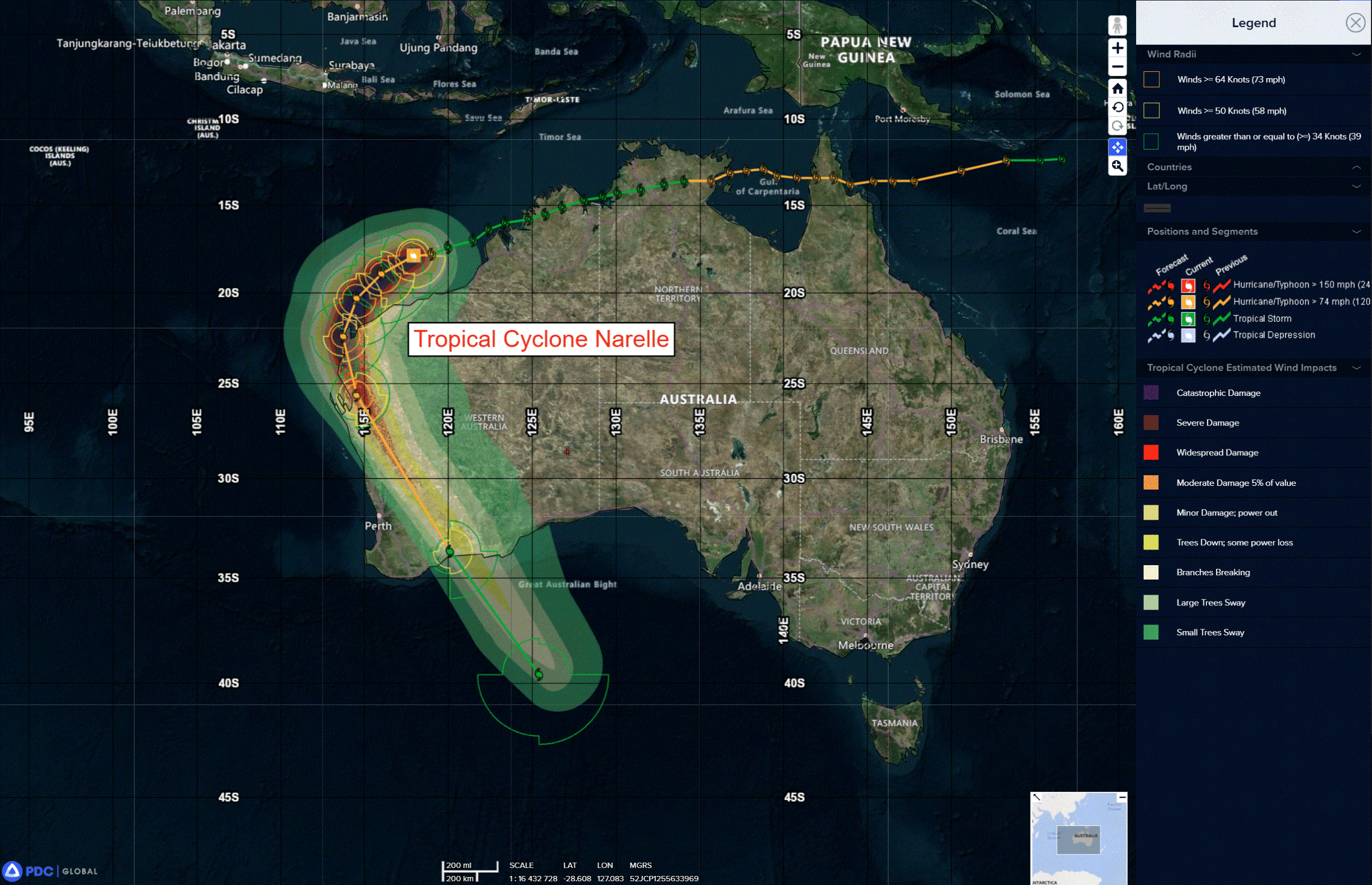
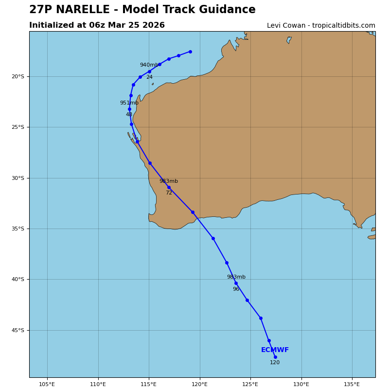
Tropical Cyclone 27P (Narelle)…is located approximately 238 NM north-northeast of Learmonth, Australia
Northeast Pacific Ocean: There are no Tropical Cyclones
The last regularly scheduled Tropical Cyclone Activity Report of the 2025 eastern North Pacific Hurricane Season has been issued. Routine issuance of this section of the PDC product will resume on May 15, 2026. During the off-season, Special Tropical Weather Outlooks will be issued as conditions warrant by the NHC.
Central Pacific Ocean: There are no Tropical Cyclones
The 2025 central North Pacific hurricane season has ended. As such, the final routine Tropical Cyclone Activity Report for the 2025 season has been issued. Routine issuance of this section of the PDC product will resume on June 1, 2026. During the off-season, Special Tropical Weather Outlooks will be issued as conditions warrant by the CPHC.
Western Pacific, Indian Ocean, and adjacent Seas:
South Indian Ocean
Tropical Cyclone 27P (Narelle)
According to the JTWC warning number 33, the sustained winds were 105 knots with gusts to near 130 knots
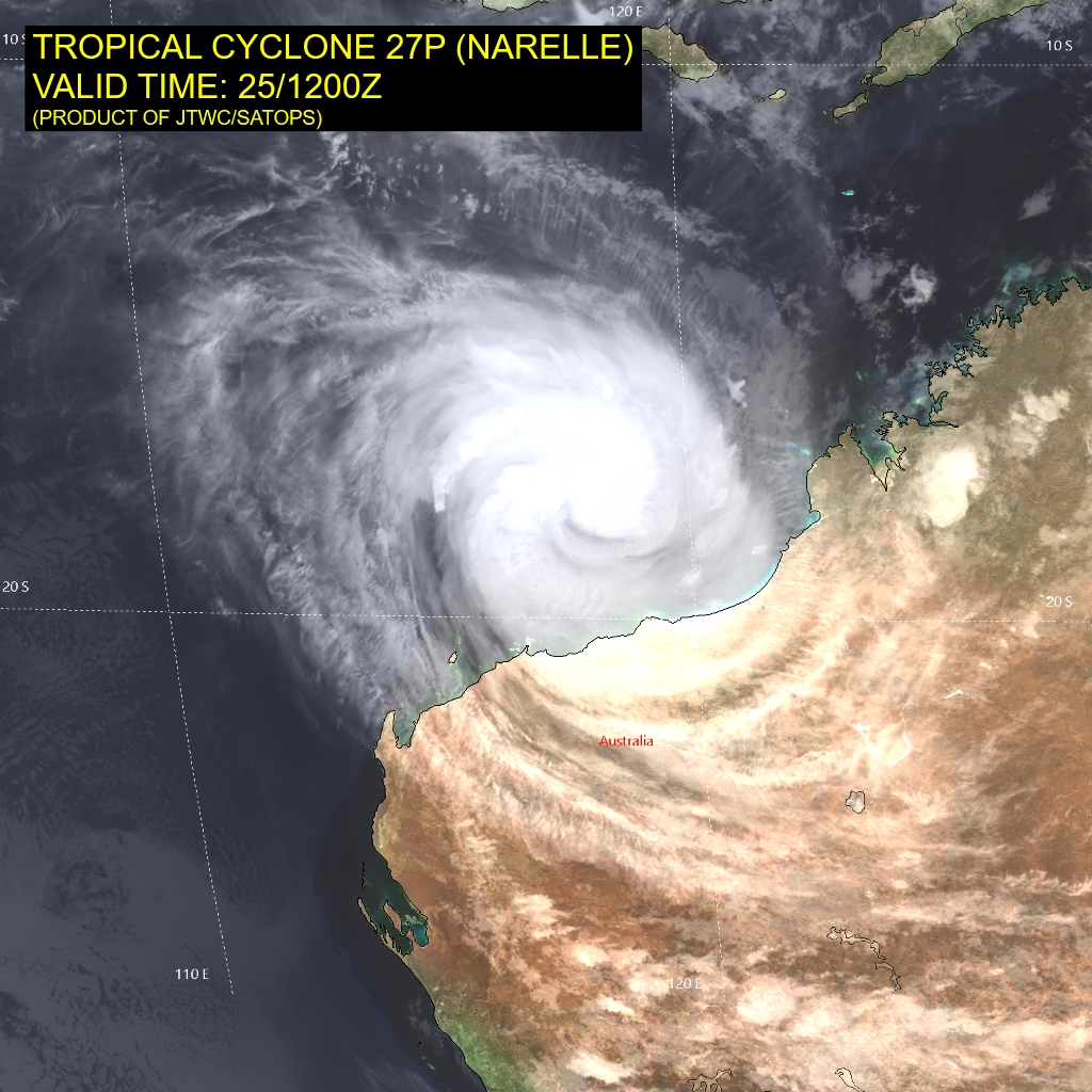
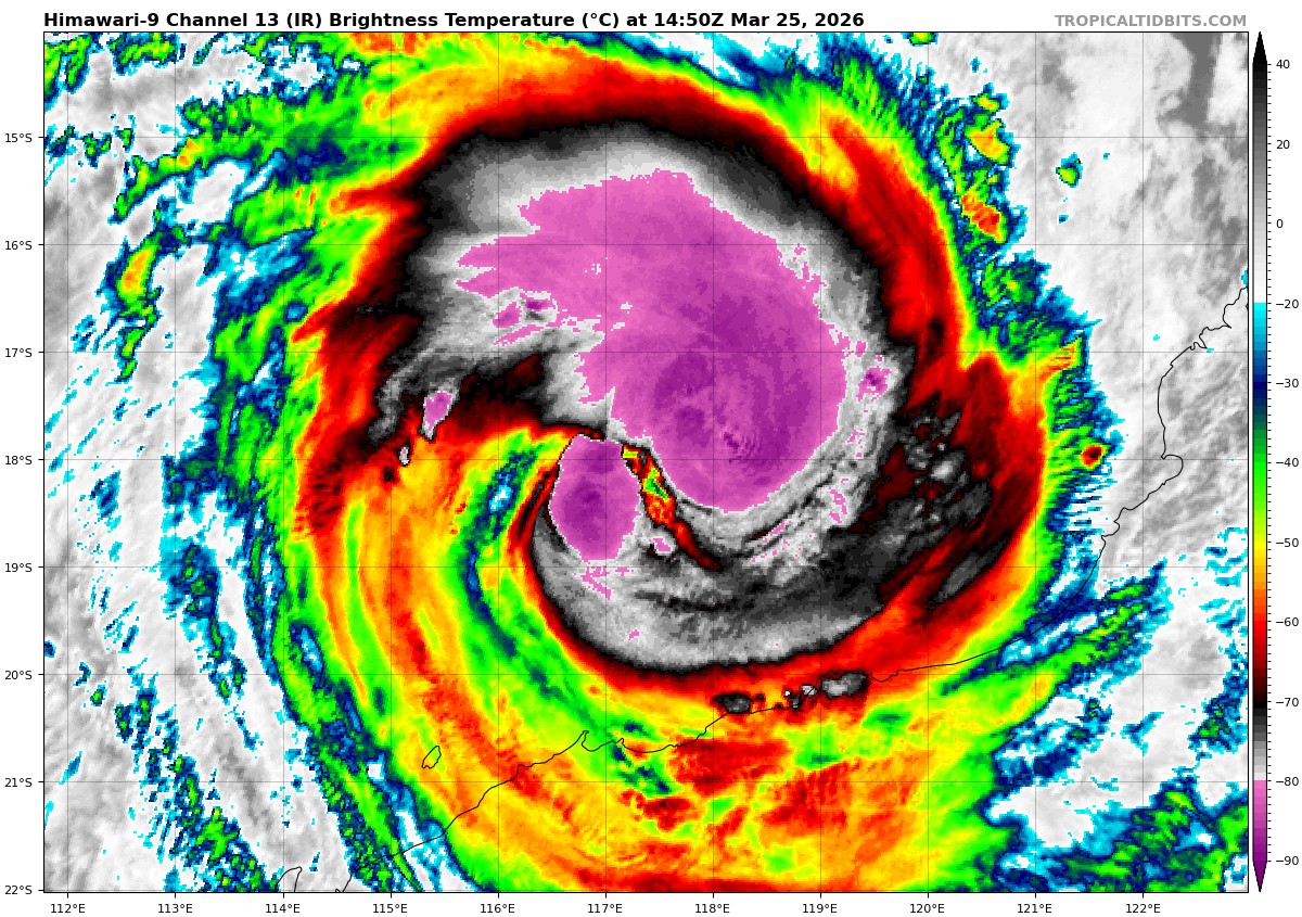
Animated enhanced infrared (eir) satellite imagery depicts tropical cyclone 27P (Narelle) as it propagates southwestward under the steering influence of a subtropical ridge (str) centered over Australia. The system has been rapidly intensifying as witnessed by a 45 kts maximum wind speeds over the last 24 hours, with significant improvement in the size and structure of the convection, as well as development of a banding eye feature.
Rapid intensification (ri) is supported by warm (29-30 c) sea surface temperatures (sst), robust radial outflow, and low (5-10 kts) vertical wind shear (vws).
TC Narelle is forecast to propagate southwestward towards the north west Cape, western Australia. Landfall in the vicinity of the Peninsula is anticipated after 24 hours and just before 36 hours. Further rapid intensification is expected due to a persistently conducive environment, and the system is forecast to reach a peak intensity of 115-120 kts between 24 and 36 hours.
The forecast track is positioned slightly west of the towns of Exmouth and Learmonth, with the 64 kt wind radii still fully encompassing the area. Post-landfall, TC 27P will begin to round the axis of the steering ridge and track southeastward, over land, throughout the remainder of the forecast period.
A weakening trend is expected through 96 hours due to increasing vws, dry air
entrainment and terrain-induced friction. By 96 hours, TC 27P will complete its extratropical transition (ett), which is expected to commence around 72 hours. The system is forecast to re-emerge over waters just south of western Australia with an intensity of around 45 kts.
SW Pacific Ocean
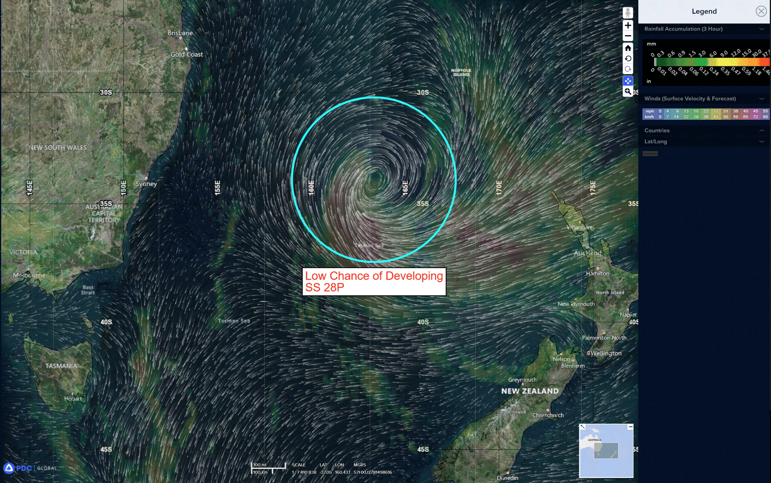
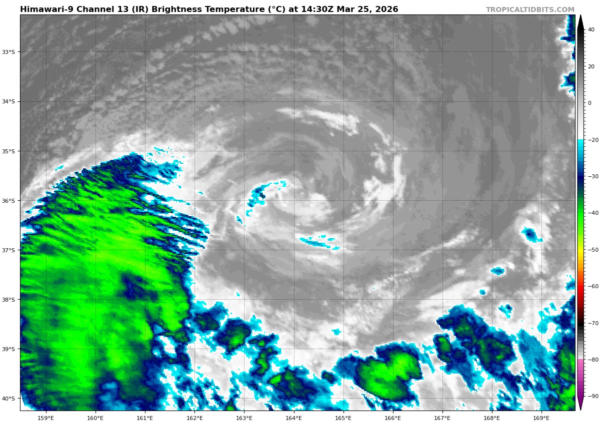
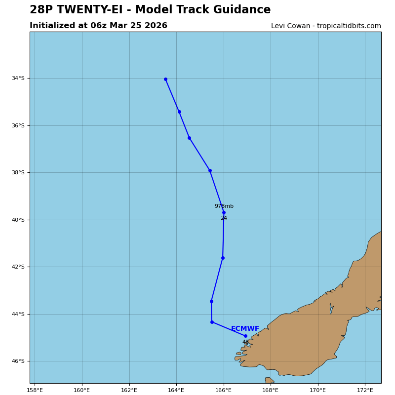
>>> There’s an area of disturbed weather being referred to as SS 28P, which is located approximately 776 NM east-southeast of Port Kembla.
The system is currently classified as a subtropical cyclone, generally characterized as having both tropical and mid-latitude cyclone features.
Animated multispectral satellite imagery (msi) depicts a broad yet defined low-level circulation with weak convection continuing to flare near the center. A developing frontal feature can be seen extending equatorward along the eastern side of the system.
Environemntal analysis indicates highly unfavorable conditions for tropical development characterized by cold (20-21 c) sea surface temperatures, high (30-35 kts) northwesterly vertical wind shear, and significant dry air entrainment.
Numerical model guidance agrees on a southward track, toward southern New Zealand, over the next 24 hours with gale force winds persisting primarily within the southeastern quadrant.
Maximum sustained surface winds are estimated at 38 to 43 knots.
The potential for the development of a significant tropical cyclone within the next 24 hours remains low.