

Current Snapshot
For all the latest updates visit: DisasterAWARE
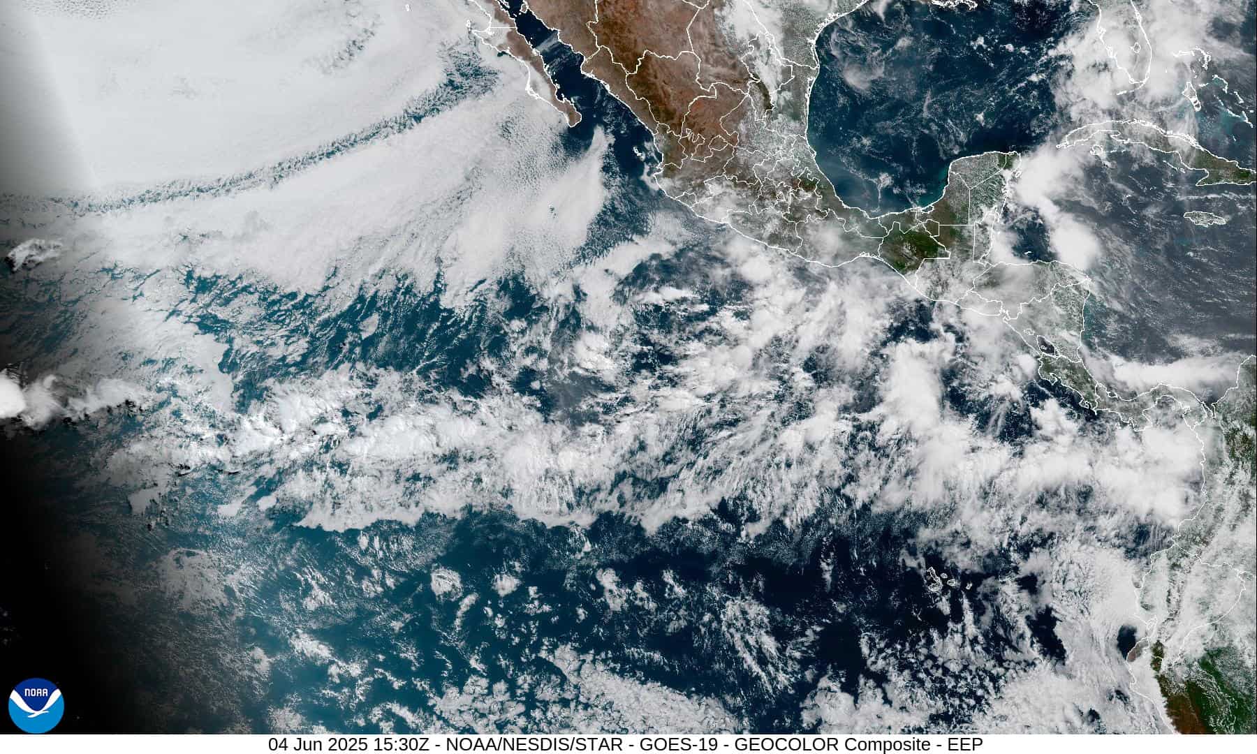
1800x1080e
2e
7e
15E_tracks_latest
1800x1080ec
dujuan
24W_171200sair
24W_tracks_latest
By PDC’s Senior Weather
Specialist Glenn James

The Pacific Disaster Center’s (PDC Global) Thursday, September 17, 2026, Tropical Cyclone Activity Report…for the Pacific Ocean, the Indian Ocean, and adjacent Seas.
Tropical Cyclones
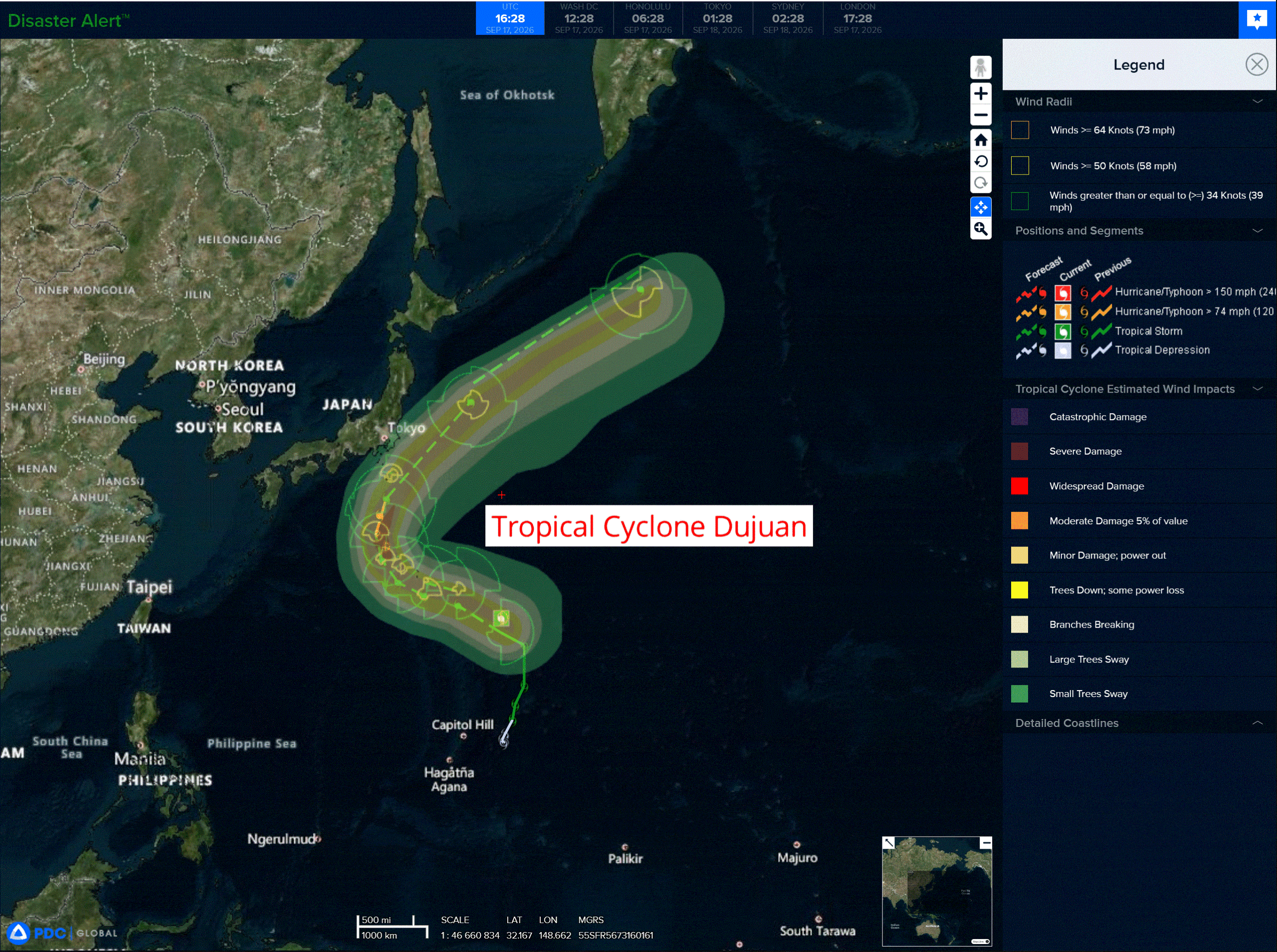
Tropical Cyclone 24W (Dujuan) is located about 404 NM east of Iwo-To
Northeast Pacific: There are no Tropical Cyclones
Western East Pacific:
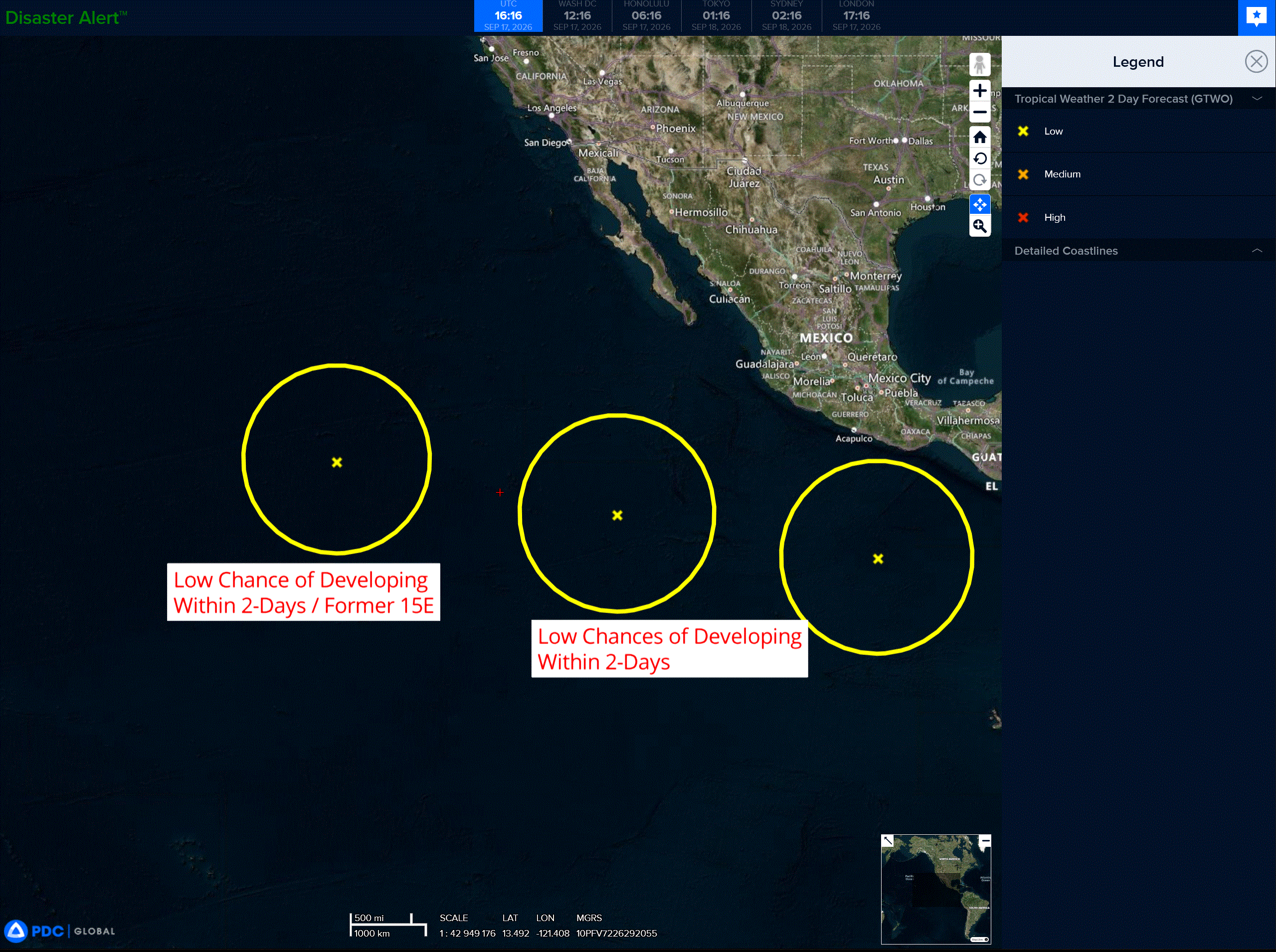
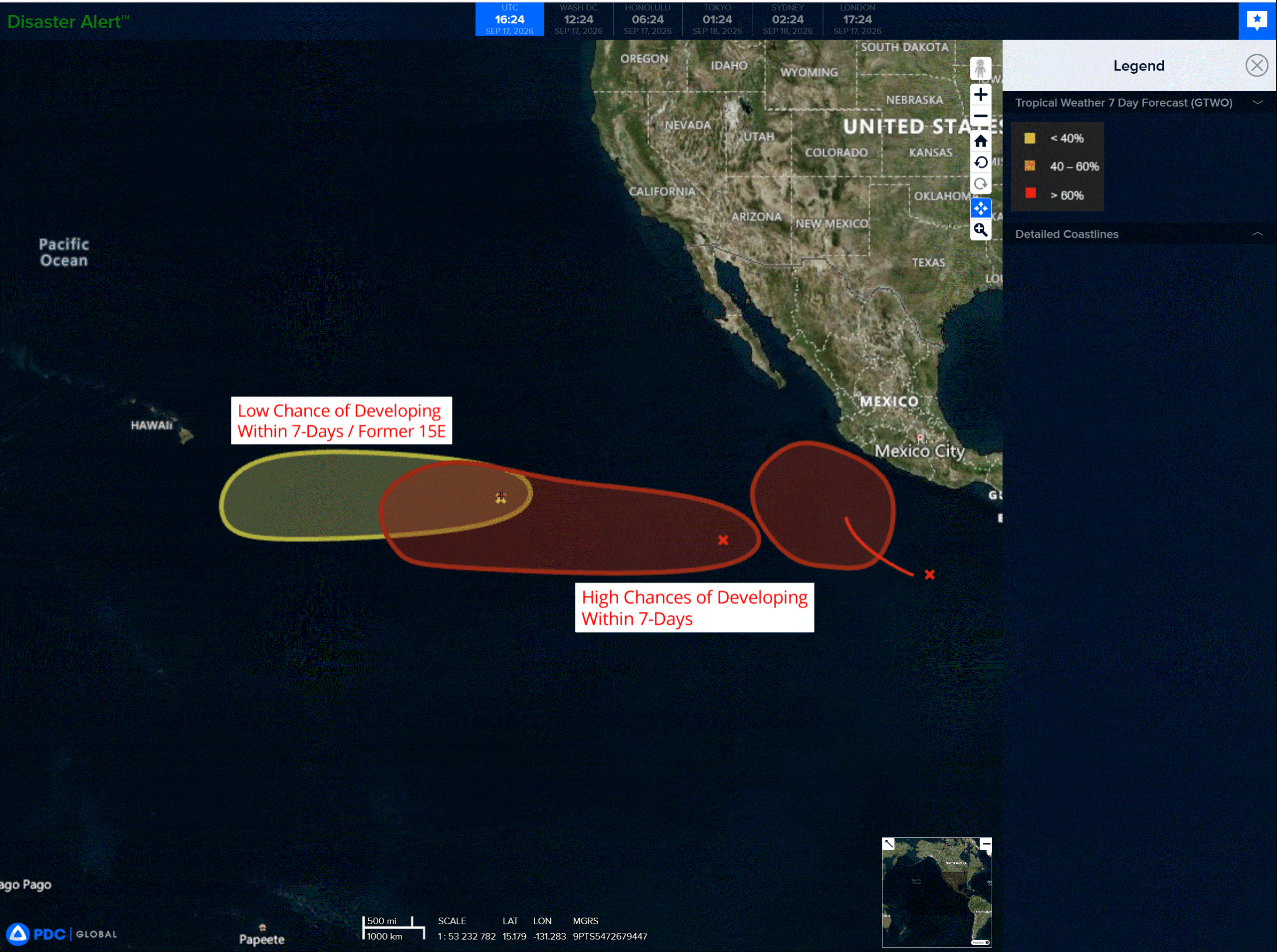
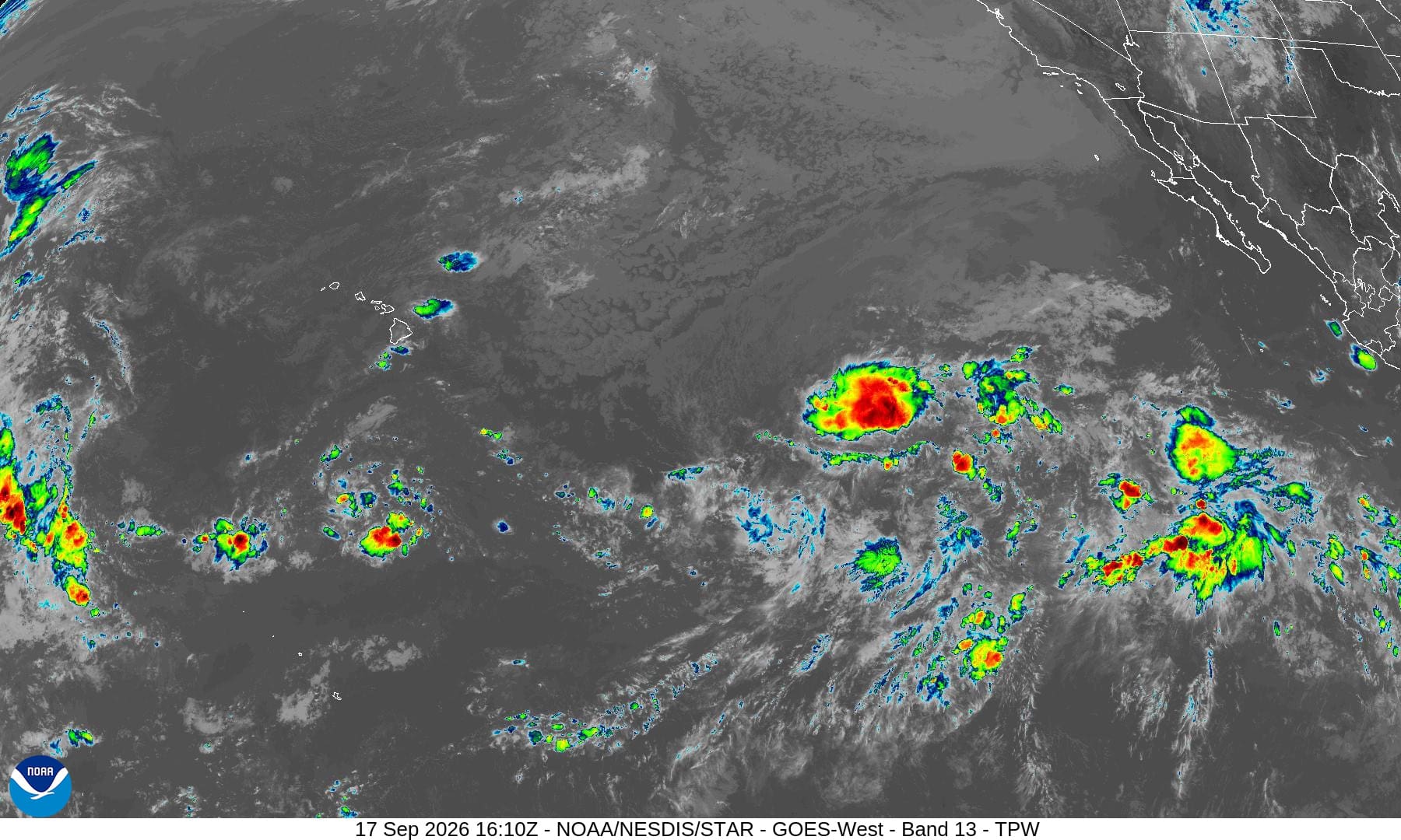
>>> A tropical wave continues to produce disorganized showers and thunderstorms well to the south-southwest of the southern tip of the Baja California Peninsula. Environmental conditions appear conducive for gradual development of this system, and a tropical depression is likely to form this weekend or early next week as it moves westward at 10 to 15 mph across the western part of the East Pacific.
* Formation chance through 48 hours…low…20 percent
* Formation chance through 7 days…high…70 percent
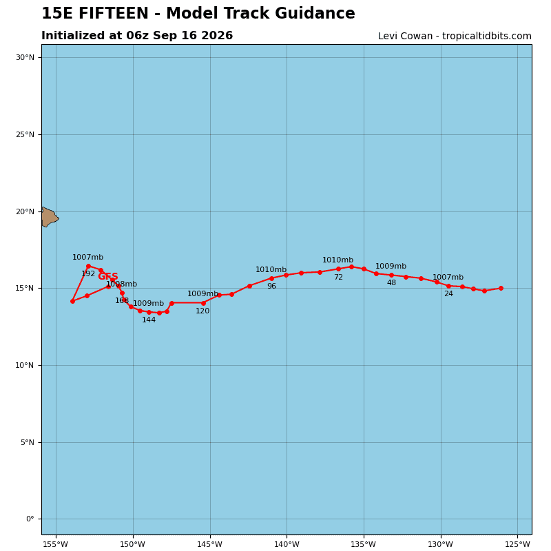
>>> Well East-Southeast of the Hawaiian Islands (Former TD 15E):
Showers and thunderstorms have increased somewhat with an area of low pressure related to the remnants of Tropical Depression 15E. Environmental conditions appear only marginally conducive for some development of this system as it moves gradually westward, remaining east-southeast of the Hawaiian Islands.
* Formation chance through 48 hours…low…10 percent
* Formation chance through 7 days…low…10 percent
>>> Southwest of Southwestern Mexico:
Another tropical wave is producing disorganized showers and thunderstorms several hundred miles south of southwestern Mexico. Environmental conditions also appear conducive for gradual development of this system, and a tropical depression is likely to form late this weekend or early next week while it moves gradually northwestward turning northward off the coast of southwestern Mexico.
* Formation chance through 48 hours…low…near 0 percent
* Formation chance through 7 days…high…80 percent
Central North Pacific: There are no Tropical Cyclones
Western Pacific, Indian Ocean, and adjacent Seas:
Western Pacific
Tropical Cyclone 24W (Dujuan)
According to the JTWC warning number 9
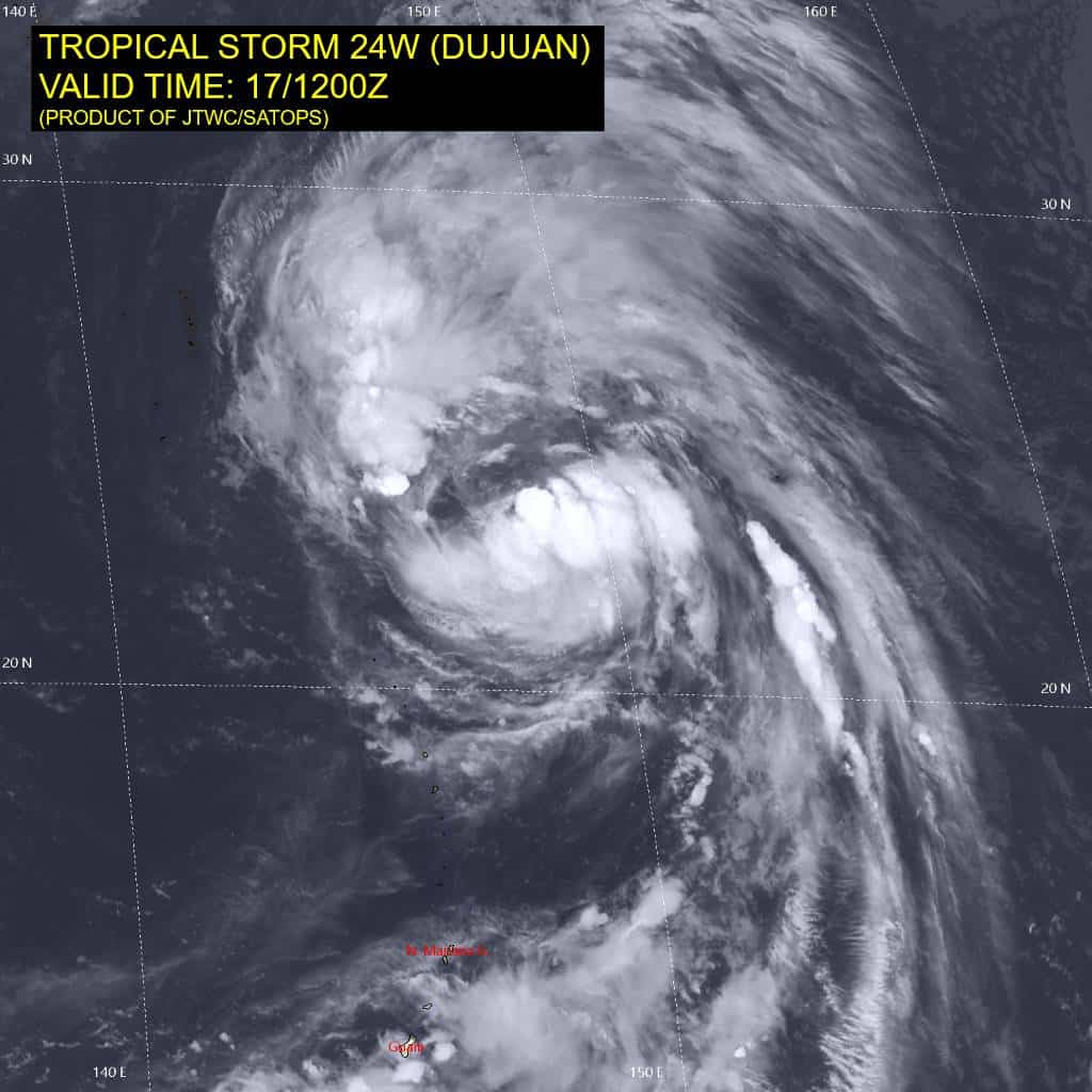
Animated enhanced infrared (eir) satellite imagery depicts tropical storm 24W (Dujuan) as a highly compact system still embedded within the elongated surface trough. Spiral bands of deep convection
are newly forming, indicating 24W is organizing and intensifying. Animated brightness temperature reveals the upper-level cloud tops are struggling to remain colder than -80c. The 170812z wsfm suite of
microwave images suggested that 24W was poorly organized throughout the vertical column, with a weakly defined and partially open microwave eye in the lower levels and disjointed upper-level convection. However, the more recent 171148z ascat data reveals 24W is approaching typhoon strength, with a handful of 60 kt wind barbs in the northeastern quadrant.
Environmental analysis reveals a favorable environment, characterized by moderate to high (20-25 kts) vertical wind shear, warm (28-29 c) sea surface temperatures, and good divergence aloft.
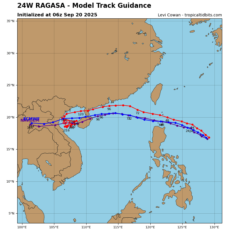
TS 24W (Dujuan) will track northwestward through 48 hours while the southward extension of the steering ridge retreats and the steering str shifts equatorward. As Dujuan approaches the ridge axis, speed of advance will slow particularly between 24-60 hours. 24W will round the ridge axis just before 60 hours and begin accelerating to the northeast for the remainder of the forecast period. Around 96 hours, Dujuan is expected to cross the 26c isotherm and encounter an increasingly hostile environment characterized by high (30-40 kts) vertical wind shear, dry air, and jet interaction
inducing weak thermal advection.
Regarding intensity, 24W is expected to very gradually intensify through its peak at 48-60 hours. the
environment is expected to remain relatively consistent through 60 hours, though the slightly elevated wind shear may prohibit significant intensification or even stagnate intensification entirely. Wind shear is currently not expected to have a major impact on intensity, and 24W is still forecast to reach typhoon strength as other environmental factors remain favorable. The main inhibitor to significant intensification remains the storm’s asymmetric core.
Around 48-60 hours, vertical wind shear is expected to abate slightly and divergence aloft is expected to increase, contributing to the intensification period as 24W approaches the ridge axis. Dujuan will remain at tropical-storm strength while it undergoes and completes extratropical transition. 24W is forecast to begin extratropical transition around 96 hours and complete transition after 120 hours.