

Current Snapshot
For all the latest updates visit: DisasterAWARE
1800x1080e
vance
280845_earliest_reasonable_toa_34
goes18_ir_22E_202610281105_lat18.0-lon-108.7
280845INTQPF_sm
22E_tracks_latest
arn
02B_280600sair
02B_tracks_latest
infa
30W_280600sair
himawari9_ir_30W_202610281050_lat15.1-lon158.9
30W_tracks_latest
By PDC’s Senior Weather
Specialist Glenn James

The Pacific Disaster Center’s (PDC Global) Wednesday, October 28, 2026, Tropical Cyclone Activity Report…for the Pacific Ocean, the Indian Ocean, and adjacent Seas.
Tropical Cyclones
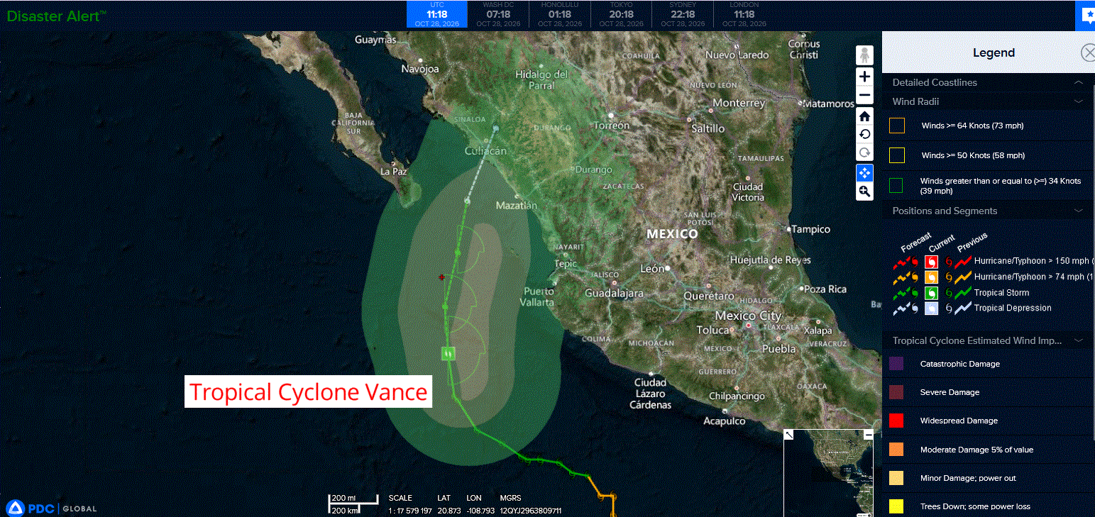
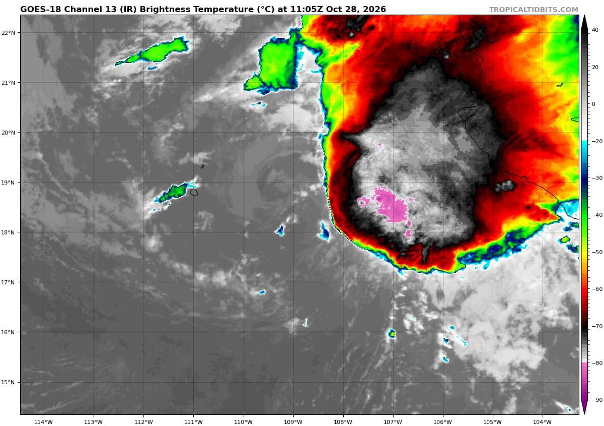
Tropical Cyclone 22E (Vance)…is located 285 miles west-northwest of Manzanillo, Mexico
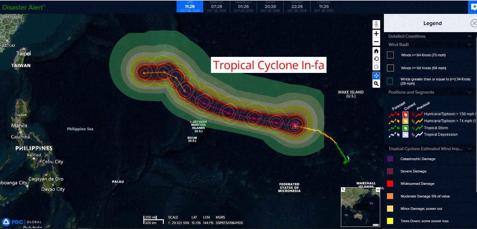
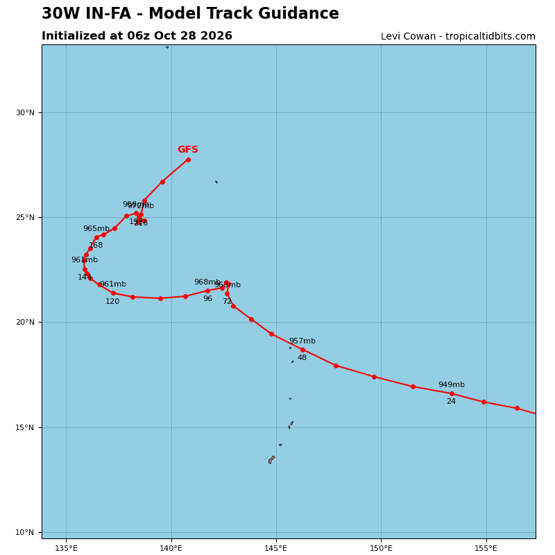
Tropical Cyclone 30W (In-fa)…is located approximately 493 NM north of Oroluk
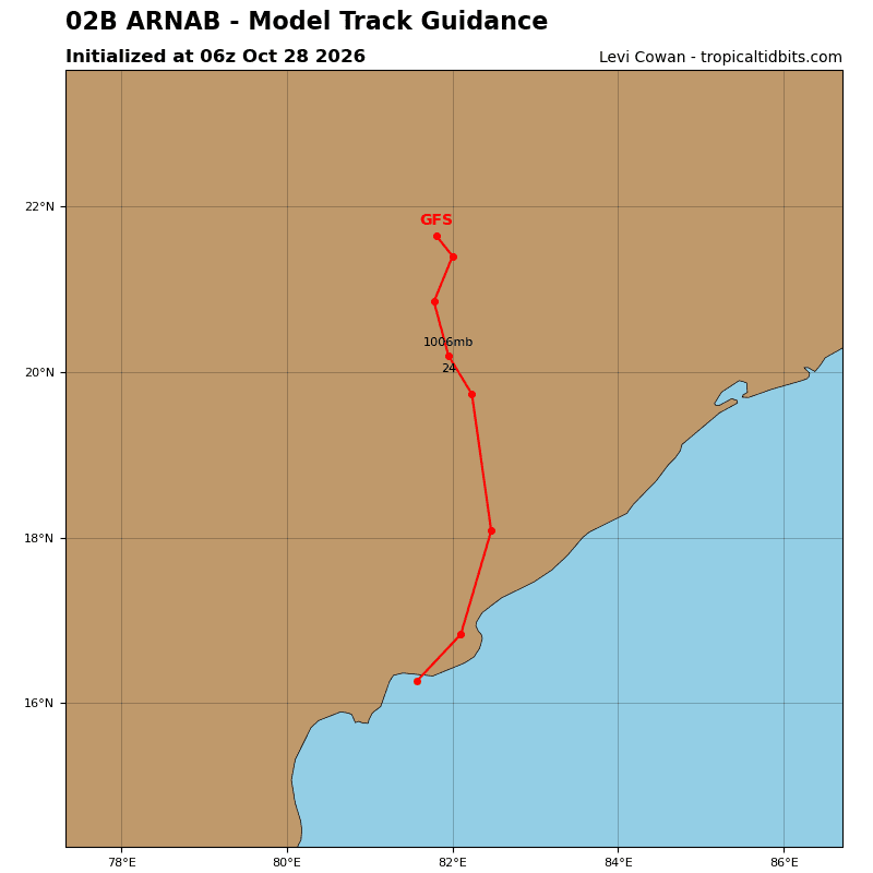
Tropical Cyclone 02B (Arnab)…is located approximately 527 NM southwest of Kolkata, India – Final Warning
Northeast Pacific:
Tropical Cyclone 22E (Vance)
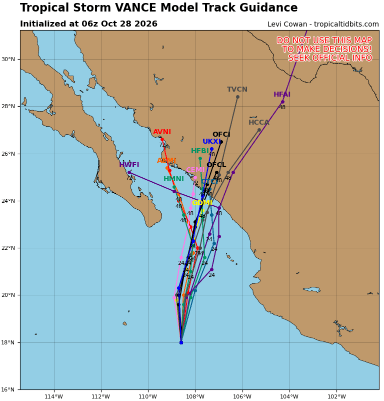
VANCE HOLDING STEADY ON A NORTHWARD TRACK
According to the NHC advisory number 28
Vance is moving toward the north near 12 mph (19 km/h). A turn toward the north-northeast is expected later today.
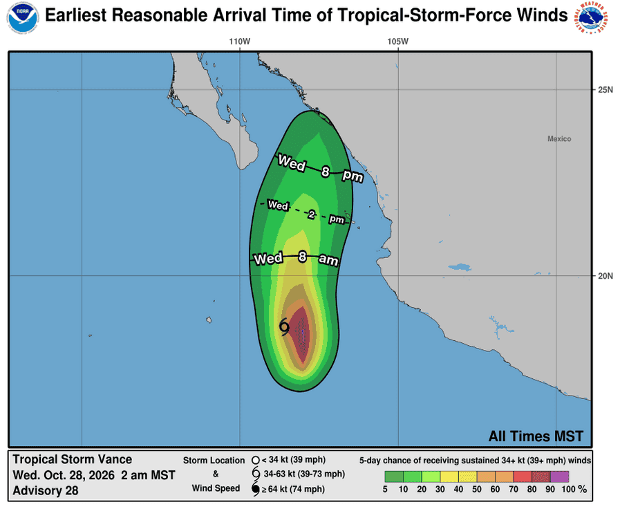
Maximum sustained winds are near 40 mph (65 km/h) with higher gusts. Little change in strength is forecast during the next 24 h, followed by gradual weakening. Vance is expected to become a post-tropical remnant low on Thursday as it approaches the coast of northwestern Mexico.
Tropical-storm-force winds extend outward up to 80 miles (130 km) from the center. The estimated minimum central pressure is 1003 mb (29.62 inches).
HAZARDS AFFECTING LAND
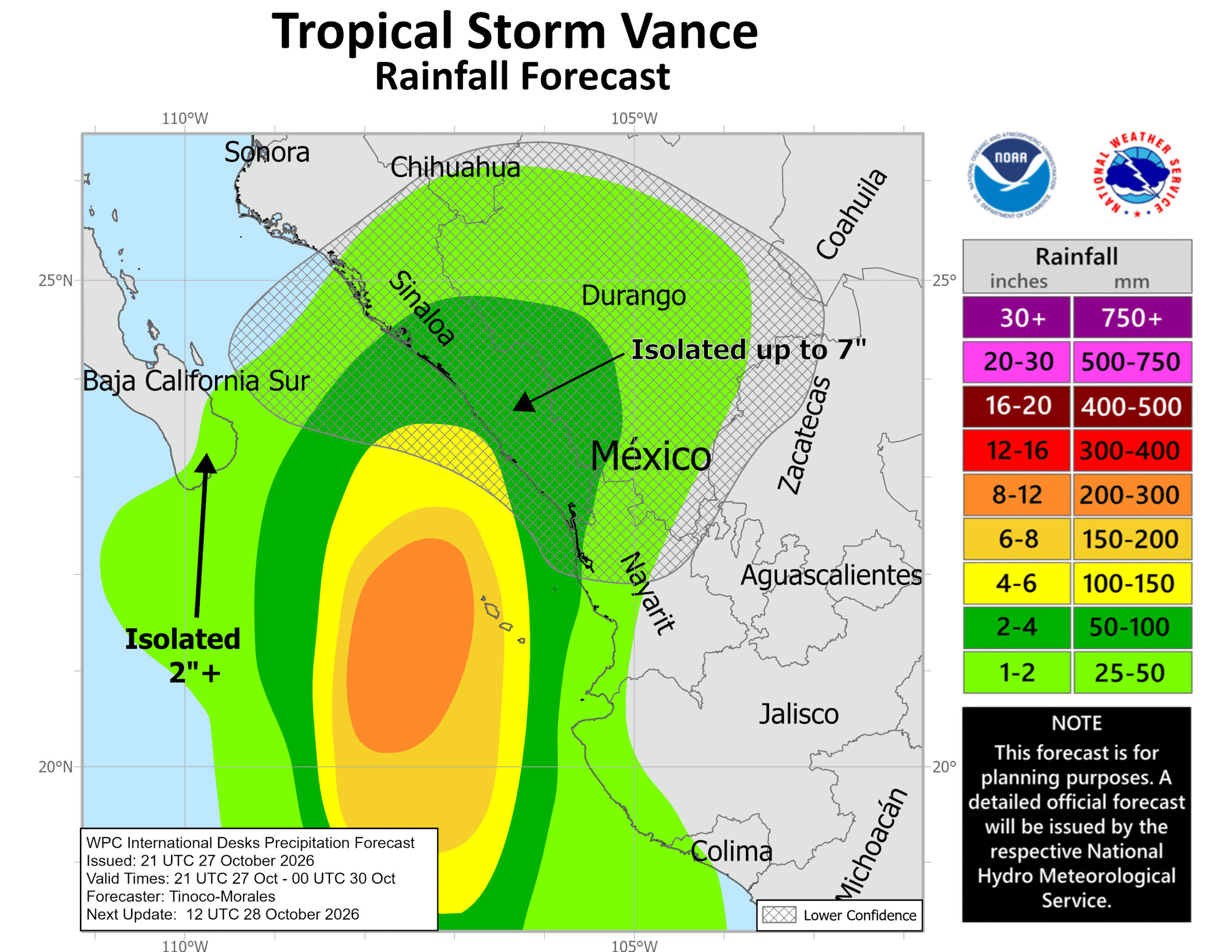
RAINFALL: Through Thursday, Vance is expected to produce 2 to 4 inches of rain across central and southern Sinaloa, western Durango, and northwestern Nayarit, with isolated higher totals of 7 inches possible over central and southern Sinaloa. This rainfall may produce flooding and mudslides, especially in areas along steep terrain.
SURF: Swells generated by Vance will affect coastal portions of southwestern, west-central Mexico, and the southern portion of the Baja California Peninsula during the next few days. These swells are likely to cause life-threatening surf and rip current conditions.
Central North Pacific: There are no Tropical Cyclones
Western Pacific, Indian Ocean, and adjacent Seas:
Western Pacific
Tropical Cyclone 30W (In-fa)
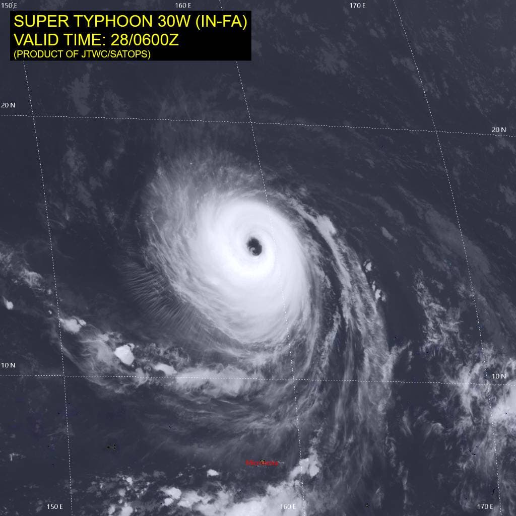
According to the JTWC warning number 20…sustained winds were 130 knots with gusts to 160 knots
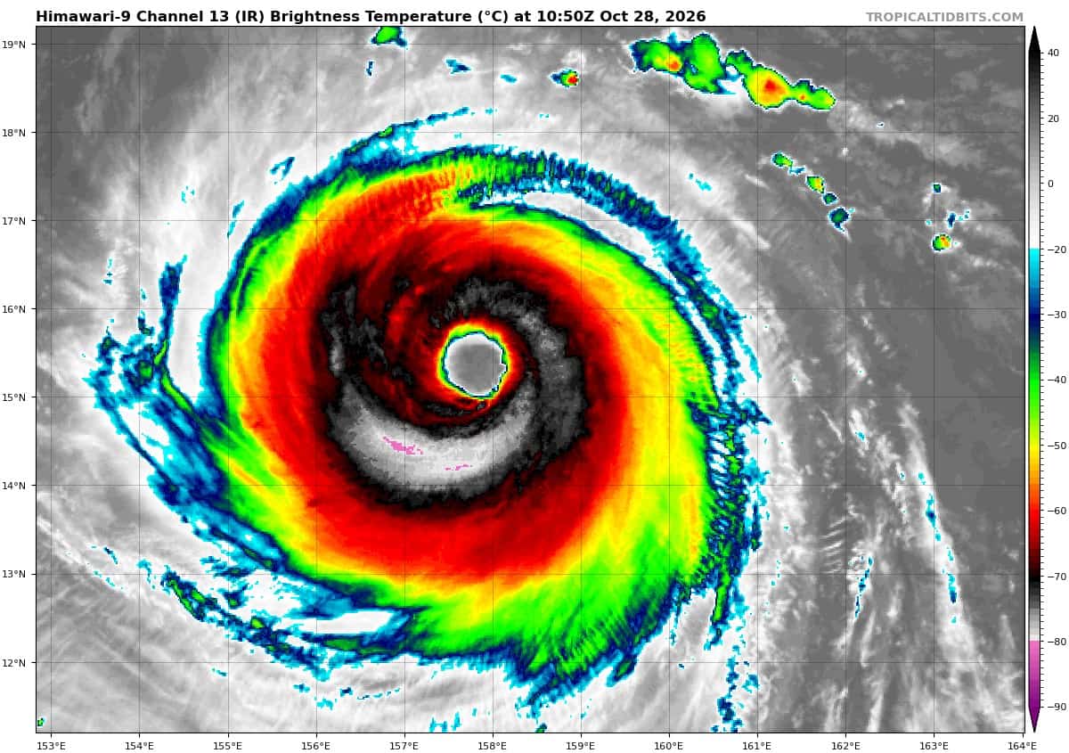
Animated multi-spectral satellite imagery (msi) depicts a relatively compact system characterized by a 40 nm wide eye and a symmetric, cold, central dense overcast (cdo). The wide eye exhibits a wavenumber-3 asymmetry, with three mesovortices rotating along the interior of the eyewall, which displays a pronounced stadium effect. A 280526z ssmis 89 ghz microwave image revealed a uniform, convectively robust eyewall with an absence of prominent spiral banding features.
Based on these structural characteristics, super typhoon (sty) 30W is assessed as an annular typhoon. In the upper-levels, the synoptic environment is dominated by deep easterly flow, which is imparting steady easterly vertical wind shear (vws).
Jowever, a robust upper-tropospheric anticyclone directly overlaying sty 30W is providing vigorous radial outflow aloft, effectively insulating the inner core and reducing local vws to less than 10 knots.
Environmental conditions remain highly favorable, characterized by low inner-core shear, high sea surface temperatures (ssts), moderate to high ocean heat content (ohc), and strong radial outflow aloft.
STY 30W has transitioned to a westward track following the dissipation of the near-equatorial ridge (ner) to the southeast. Now firmly under the steering influence of the str to the north-northeast, sty 30W is forecast to accelerate northwestward through 36 hours, when it will reach a peak translational speed of 17 kts. By 60 hours, the str to the northeast will propagate eastward, while a secondary ridge over eastern China builds eastward.
Between the two ridges, a col will begin to develop in response to a passing mid-latitude trough. By 72 hours, sty 30W will decelerate as it enters the southern portion of the col. By 96 hours, the system will become quasi-stationary within the weak steering environment between the strengthening ridges to the east and west. However, this quasi-stationary period is expected to be transient as the str to the east propagates eastward and erodes, while the western ridge continues to build eastward. This synoptic evolution will strengthen the steering gradient on the northwestern flank of sty 30W, deflecting it west-southwestward after 96 hours.
Regarding intensity, as an annular system, sty 30W exhibits enhanced structural stability and is less susceptible to adverse environmental forcing, making rapid intensity fluctuations unlikely. consequently, steady-state intensity is forecast for the next 36 to 48 hours.
Around 60 hours, dynamical guidance, including hafs-a and hwrf, indicates a degradation of the annular structure followed by the onset of an eyewall replacement cycle (erc) by 72 hours, which will induce moderate weakening.
additional weakening is expected as the system becomes quasi-stationary over an area of relatively low ohc, resulting in upwelling of significantly cooler subsurface waters.
However, while positioned within the col, the cyclone will tap into an enhanced poleward outflow channel aloft, which should partially mitigate oceanic cooling effects, particularly as the system accelerates westward and exits the upwelled cold wake after 96 hours.
Tropical Cyclone 02B (Arnab) – Final Warning
According to the JTWC warning number 10…sustained winds were 55 knots with gusts to 70 knots
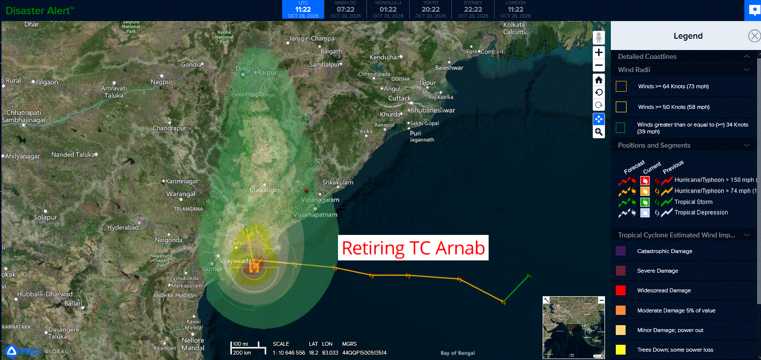
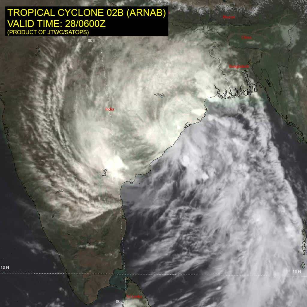
As tropical cyclone (tc) 02B approached land this morning, it rapidly decelerated, and turning southwestward, due to the combined effects of land interaction and binary interaction with invest 90B to the east. The system skirted the coast of the
Godavari River Delta, reaching a position southwest of Narsapur by 0000z.
Since that time, the system has slowly drifted northward and is now situated along the coastline, in the vicinity of Narsapur based on animated multi-spectral satellite imagery (msi) and radar data from imd.
Surface obs from Narsapur report light winds, and mean sea level pressure of 988mb, which supports the initial intensity of 55 knots with medium confidence.
Now that invest 90B has made landfall and is moving rapidly northwestward into interior India, 02B should start lifting northward, moving along the western side of the subtropical ridge (str) to the east. 02B will continue to steadily weaken over the next 36 hours, before dissipating over northeastern India.
>>> There’s an area of disturbed weather, being referred to as Invest 91B, which is located approximately 347 NM southeast of Port Blair
Maximum sustained surface winds are estimated at 23 to 28 knots.
Minimum sea level pressure is estimated to be near 1009 mb.
The potential for the development of a significant tropical cyclone within the next 24 hours is low.