

Current Snapshot
For all the latest updates visit: DisasterAWARE

1800×1080
vance
241453_earliest_reasonable_toa_34
goes19_ir_22E_202610241615_lat12.6-lon-102.9
22E_tracks_latest
1800x1080ec
2
7
champi
29W_241200sair
himawari9_ir_29W_202610241610_lat27.8-lon123.3
29W_tracks_latest
infa
30W_241200sair
30W_tracks_latest
98b
himawari9_ir_98B_202610241610_lat16.1-lon90.6
98B_tracks_latest
By PDC’s Senior Weather
Specialist Glenn James

The Pacific Disaster Center’s (PDC Global) Saturday, October 24, 2026, Tropical Cyclone Activity Report…for the Pacific Ocean, the Indian Ocean, and adjacent Seas.
Tropical Cyclones
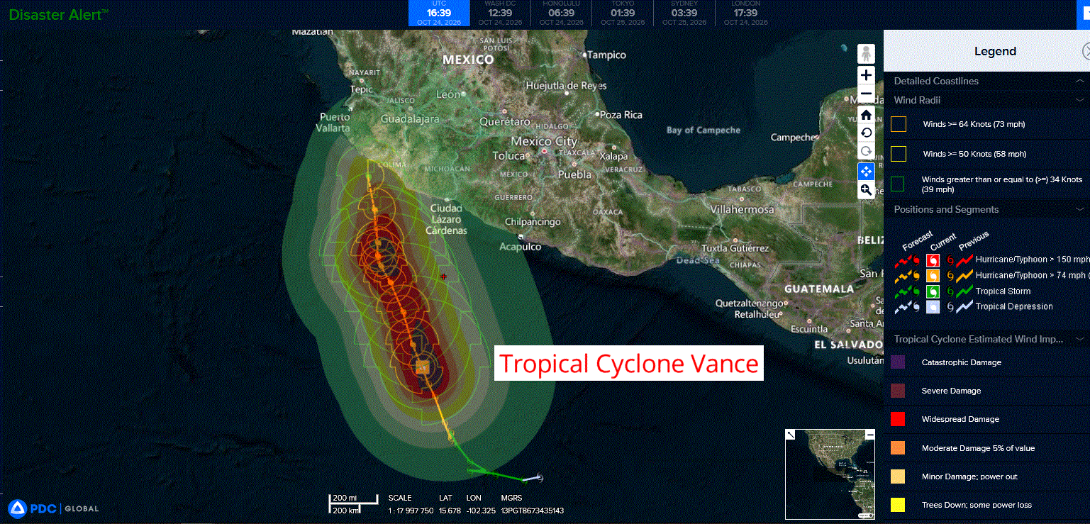
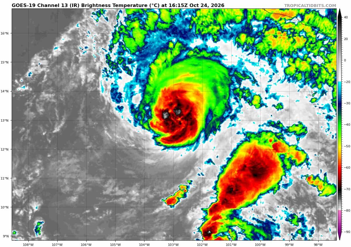
Tropical Cyclone 22E (Vance)…is located 430 miles south-southeast of Manzanillo, Mexico
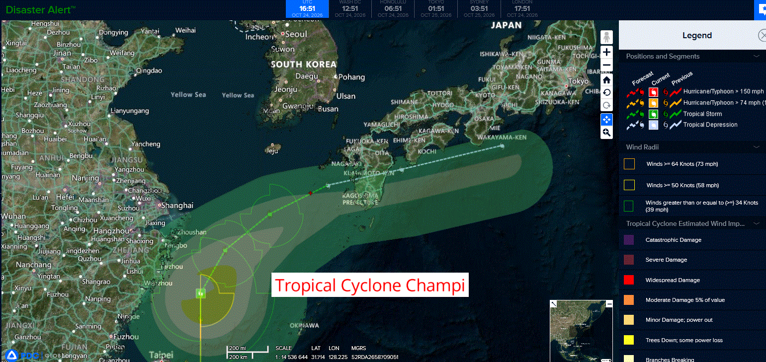
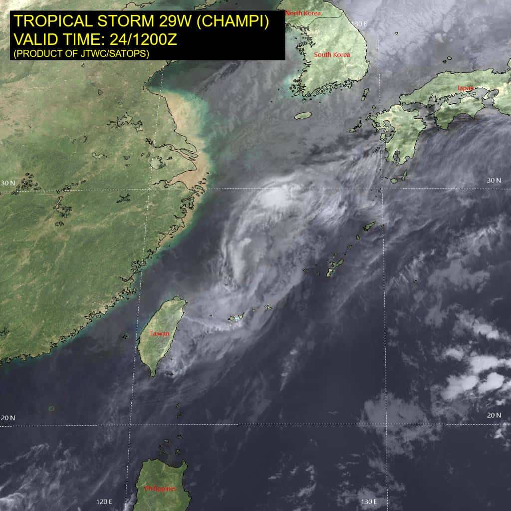
Tropical Cyclone 29W (Champi) is located approximately 253 NM west-northwest of Kadena AB
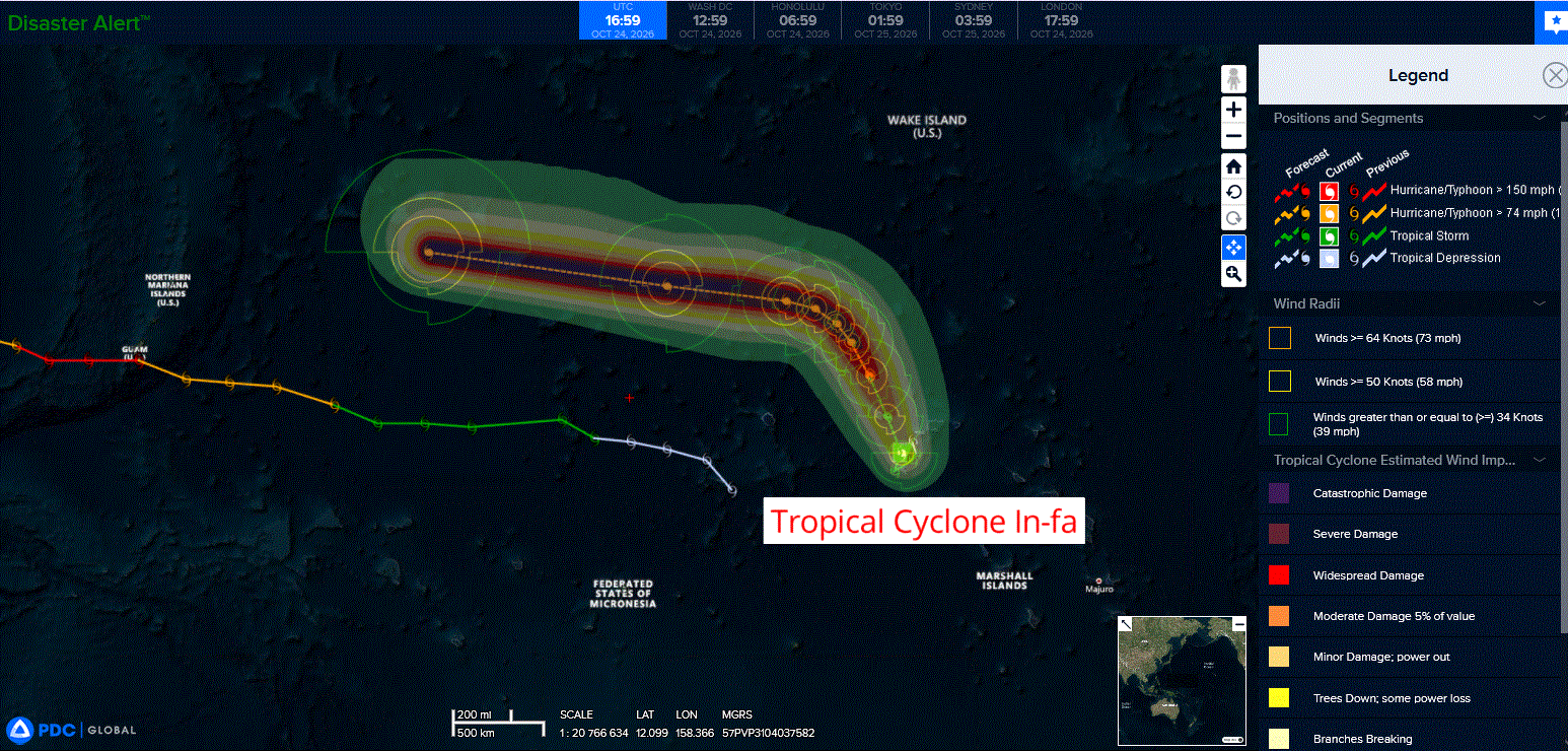
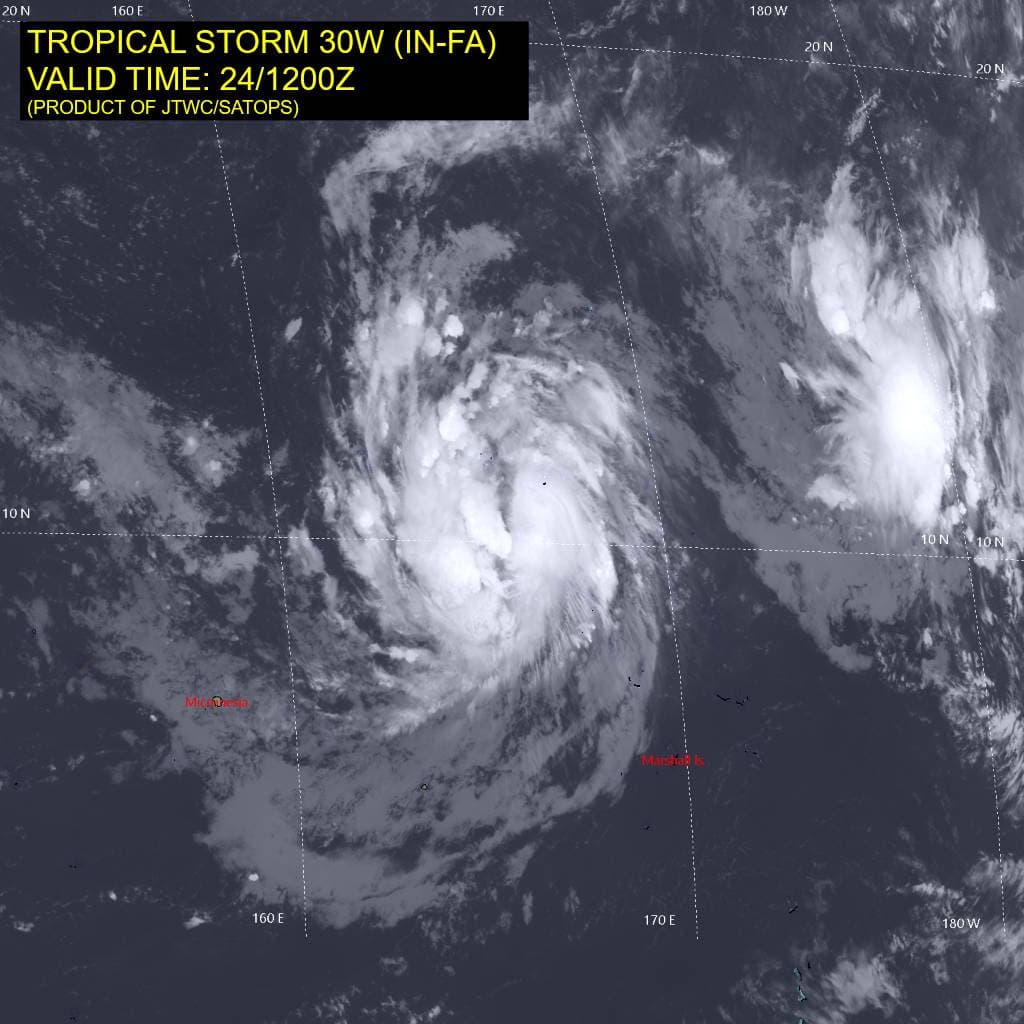
Tropical Cyclone 30W (In-fa) is located approximately 160 NM northwest of Kwajalein
Northeast Pacific:
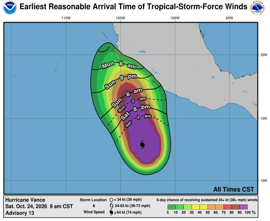
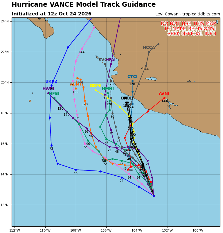
Tropical Cyclone 22E (Vance)
VANCE WEAKENS A LITTLE AS IT MOVES SLOWLY NORTH-NORTHWESTWARD
According to the NHC advisory number 13
Vance is moving toward the north-northwest near 6 mph (9 km/h), and a slow motion toward the north-northwest is expected to continue through the weekend.
Maximum sustained winds are now near 105 mph (165 km/h) with higher gusts. Gradual weakening is expected through Sunday. Some re-intensification will be possible beginning Sunday night or Monday.
Hurricane-force winds extend outward up to 30 miles (45 km) from the center and tropical-storm-force winds extend outward up to 150 miles (240 km). The estimated minimum central pressure is 970 mb (28.65 inches).
HAZARDS AFFECTING LAND
RAINFALL: Through next Thursday, Vance is expected to produce 3 to 6 inches with isolated higher totals around 10 inches across Colima and western portions of Michoacán and Jalisco. This rainfall may produce life-threatening flooding and mudslides, especially in areas along steep terrain.
SURF: Swells generated by Vance will affect portions of the coast of southern and southwestern Mexico this weekend and continue into next week. These swells are likely to cause life-threatening surf and rip current conditions.
Central North Pacific: There are no Tropical Cyclones
>>> Western Central Pacific:
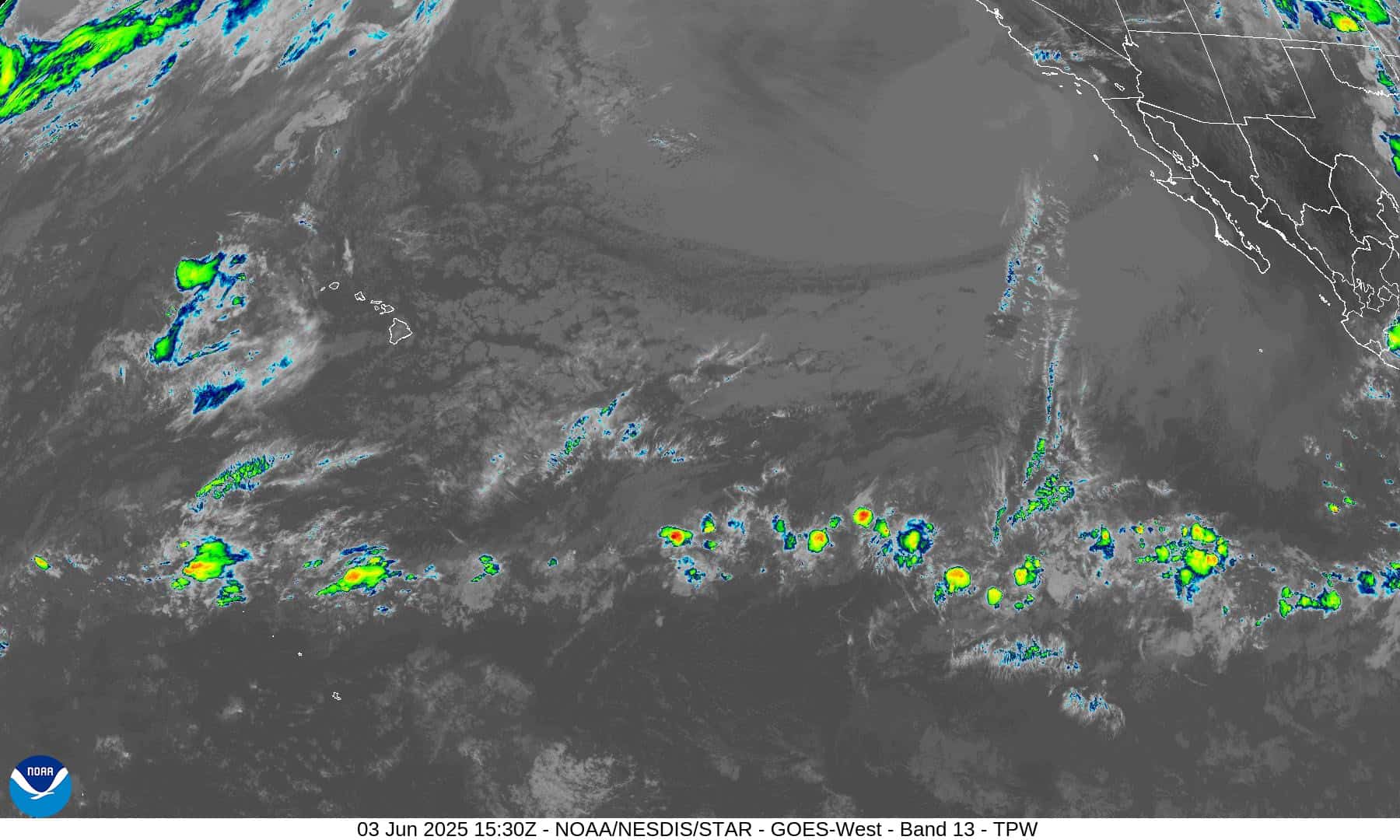
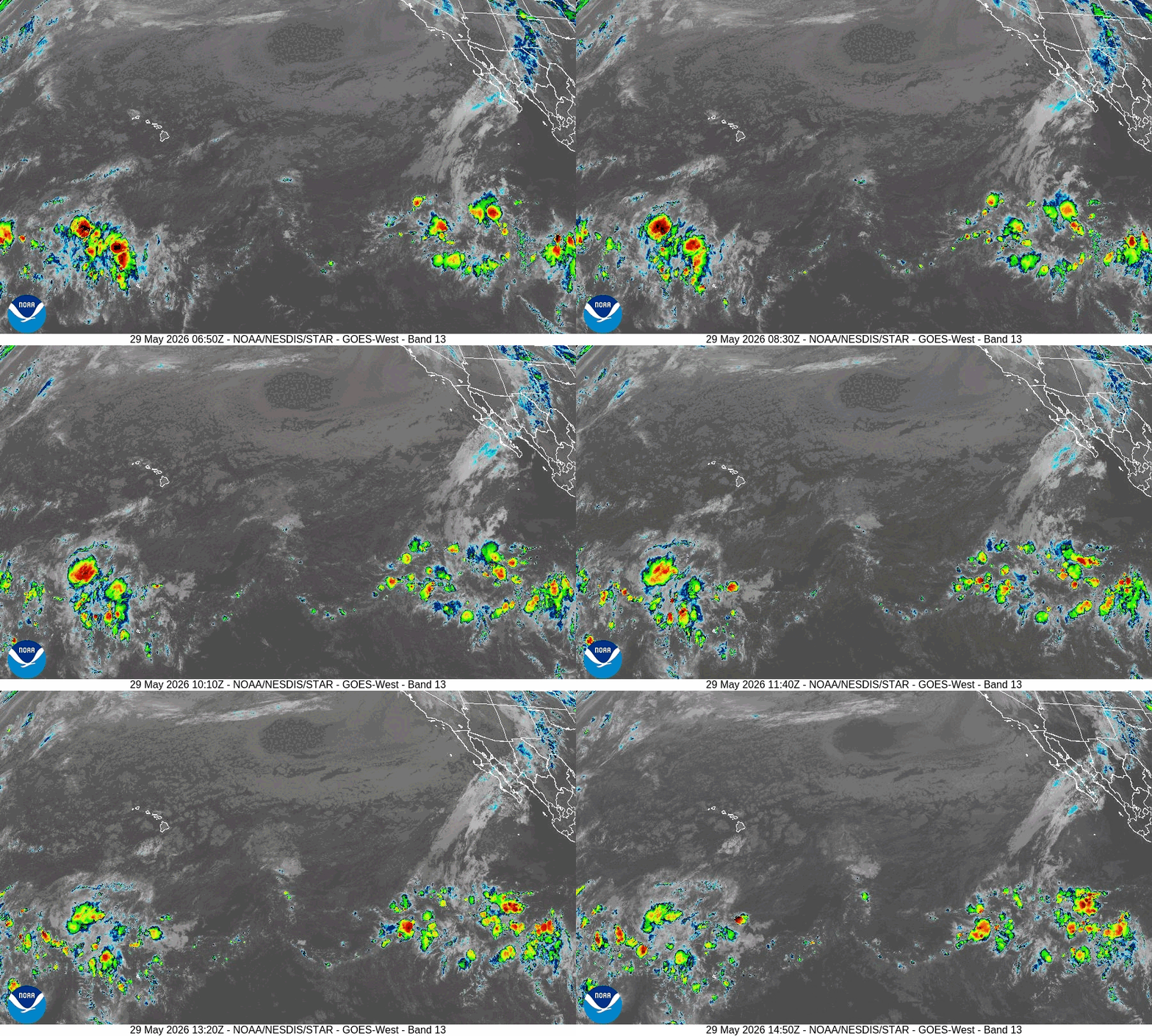
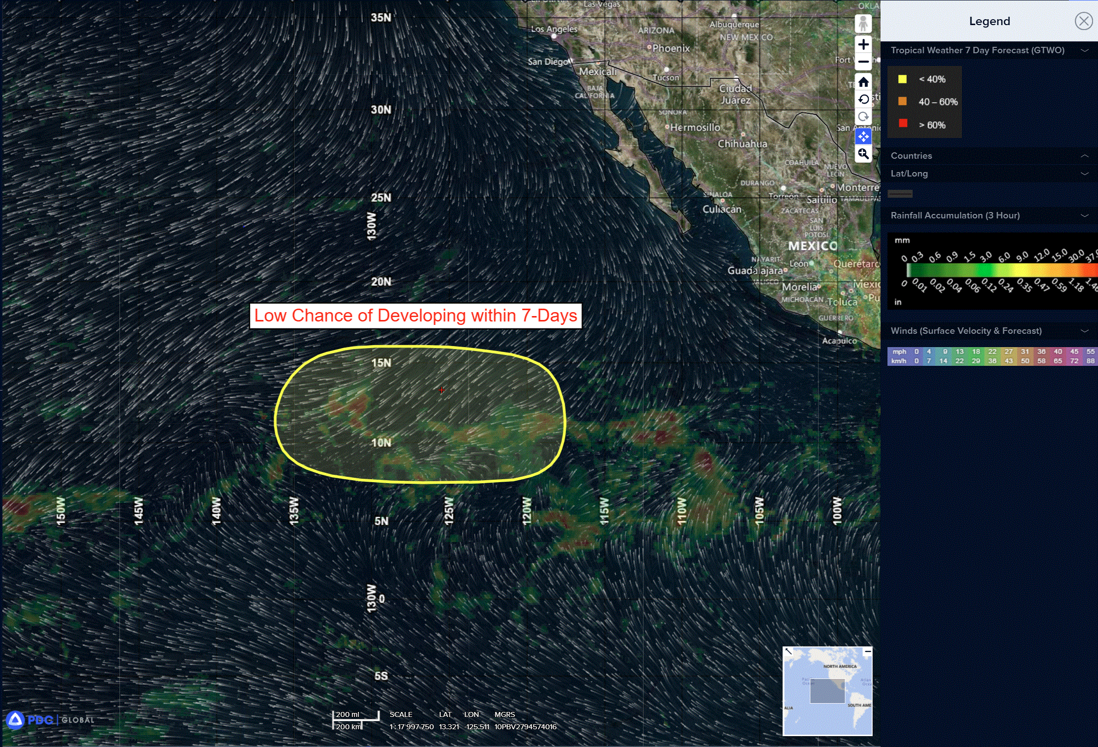
A broad area of low pressure located near or just west of the International Date Line, several hundred miles west of Johnston Atoll, is producing disorganized showers and thunderstorms.
Environmental conditions could support some slow development while the system moves generally eastward to east-northeastward.
* Formation chance through 48 hours…low…10 percent
* Formation chance through 7 days…low…20 percent
Western Pacific, Indian Ocean, and adjacent Seas:
Western Pacific
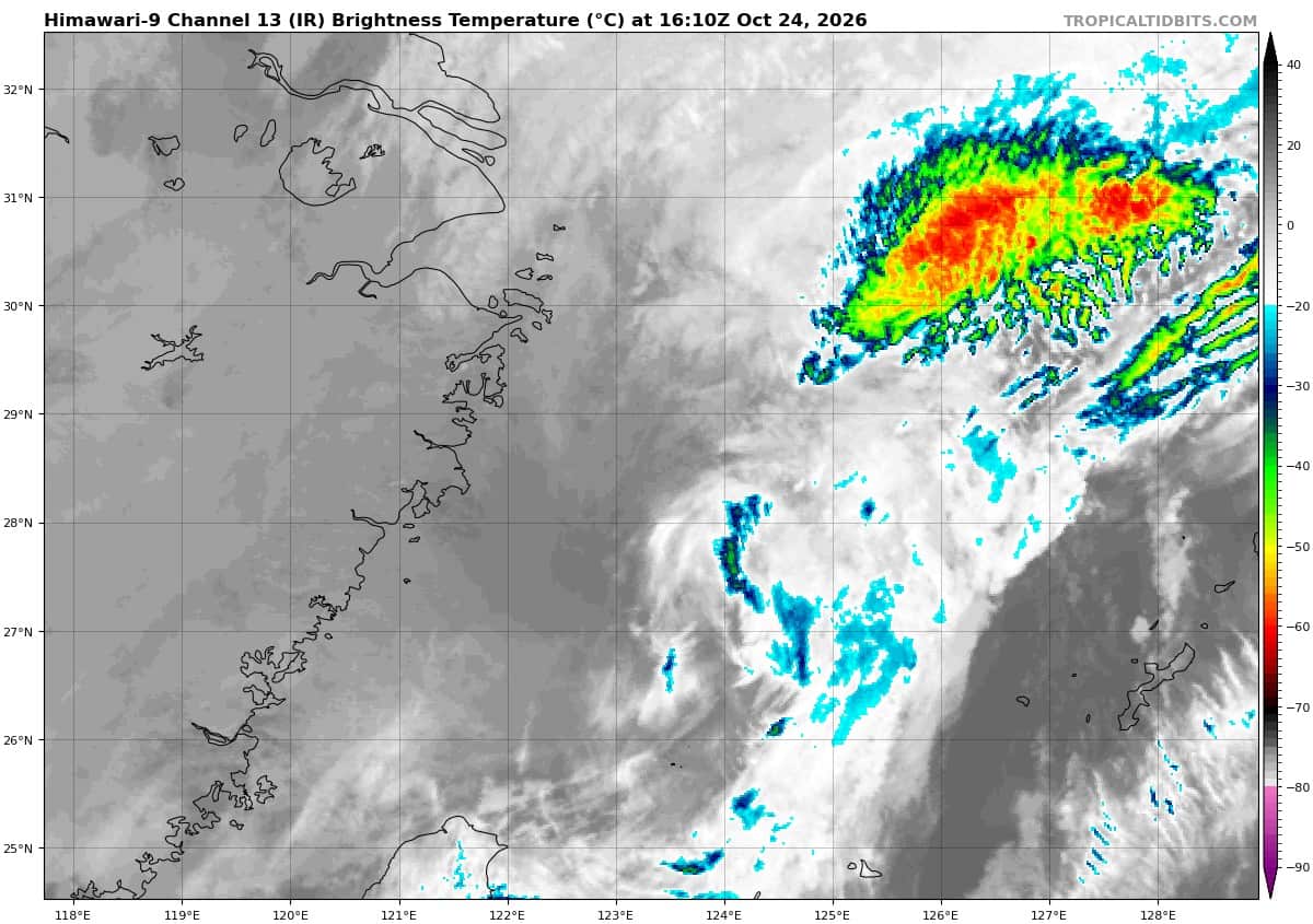
Tropical Cyclone 29W (Champi)
According to the JTWC warning number 41…sustained winds were 50 knots with gusts to 65 knots
Animated enhanced infrared (eir) satellite imagery depicts an expansive swirling mass of low-level clouds. A 241105z ssmis pass indicates rather shallow convection along the outer eastern periphery. tropical storm (ts) 29W has been without central convection for over 12 hours and is now moving over waters cooler than 26 degrees celsius under moderate to high northeasterly vertical wind shear (vws). Furthermore, an extensive area of dry air from the Asian continent is wrapping into the circulation. These factors constitute a highly unfavorable environment for development.
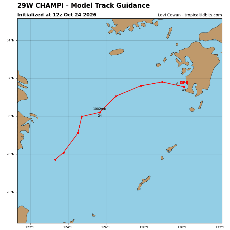
TS 29W is now rounding the ridge axis and beginning to turn east, which will continue over the next 36 hours, along the northwest periphery of the str and gradually gain forward speed. The environment is becoming even more hostile, with sea surface temperatures (sst) decreasing to 25 degrees celsius and vertical wind shear (vws) increasing to 30-40 kts by 24 hours. These conditions will result in continued weakening as the system enters the baroclinic zone, begins extratropical transition (ett) near 24 hours, and completes ett by 48 hours.
As the system spins down, it is quite possible that the low-level circulation will degenerate into a trough, with maximum winds decreasing to 30 kts, before dissipating prior to reaching Kyushu. The forecast spans 60 hours
to indicate the path of the circulation center if it remains intact.
Tropical Cyclone 30W (In-fa)
According to the JTWC warning number 5…sustained winds were 50 knots with gusts to 65 knots
Animated enhanced infrared (eir) satellite imagery depicts deep convection obscuring a compact low-level circulation center (llcc). Upper-level outflow remains healthy in all directions, though the convective structure has not appreciably improved over the past six hours. A 241039z ascat-c pass revealed gale-force winds extending a short distance from the center, but it may not have resolved the maximum winds. The wind field was also somewhat asymmetric.
Tropical storm (ts) 30W is traversing a generally favorable environment of very warm sea surface temperatures (sst) of 29-30 degrees celsius and moderate radial outflow aloft; however, moderate mid-level southeasterly shear may be inhibiting more rapid development.
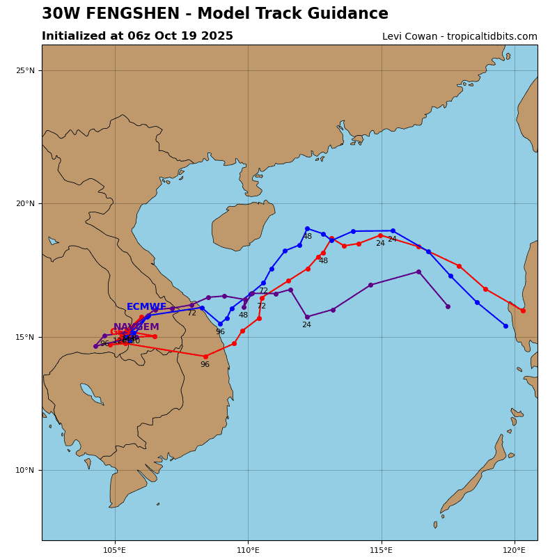
TS 30W may have begun its anticipated north-northwestward motion. The current weak steering environment, produced by competing influences from a near-equatorial ridge (ner) to the southeast and a subtropical ridge (str) to the northwest, will transition over the next 24 hours. As the ner builds, it will become the primary steering influence and drive the system north-northwestward at a relatively slow speed of 5-6 kts. Near 48 hours, a deep trough passing over the Korean Peninsula and approaching Honshu will cause the str to reorient eastward and consolidate north of ts 30W by 96 hours.
As a result, the system will slow to 3-4 kts from 48 to 72 hours and turn sharply westward. During 96-120, the ner and str will merge into a stronger ridge. Concurrently, a hybrid system will form east of the date line and expand eastward, further enhancing the westward steering flow. These features will cause ts 30W to accelerate westward during the latter part of the forecast period.
Although the intensity has changed little over the past six hours and moderate mid-level shear persists, very warm sst and moderate divergence aloft will support further development. The forecast calls for steady intensification through 12 hours, allowing time for the compact circulation to become more axisymmetric. Rapid intensification (ri) is forecast
thereafter, with ts 30W reaching 90 kts by 36 hours.
Between 36 hours and 72 hours, the slow translation speed may promote ocean mixing and upwelling of cooler subsurface waters, limiting further intensification and possibly inducing weakening. Once the system gains sufficient forward speed after 72 hours, the generally favorable environment of low to moderate vertical wind shear (vws) and very warm sst will support re-intensification.
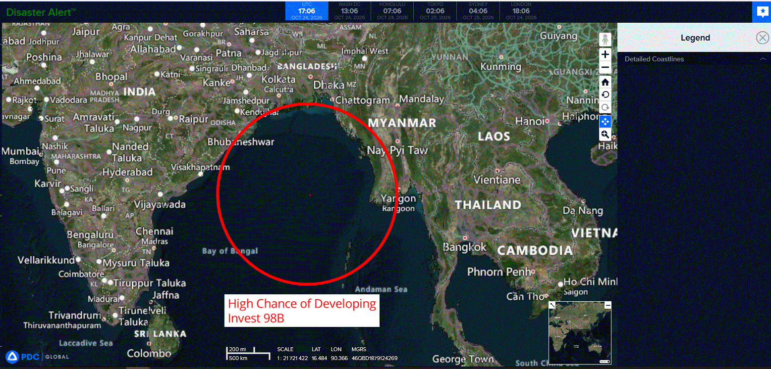
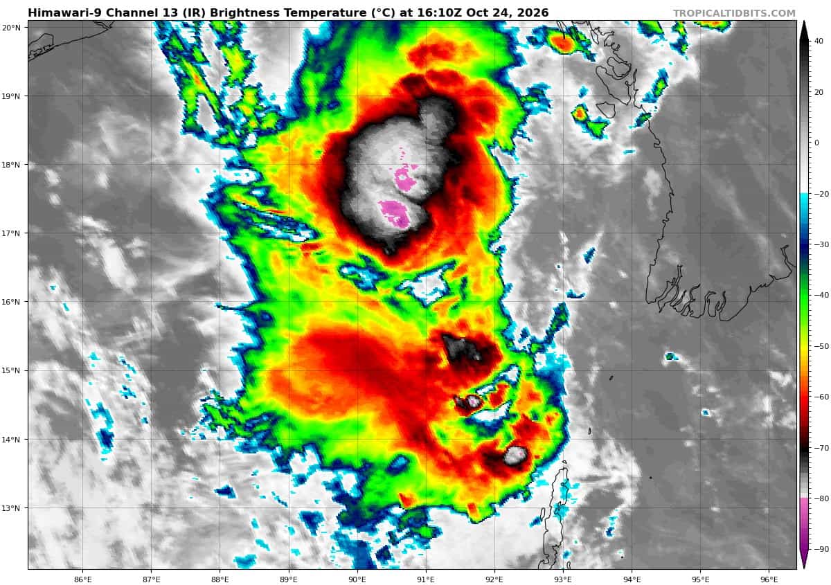
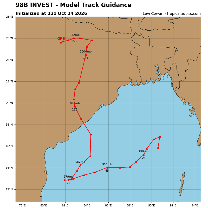
>>> There’s an area of disturbed weather that’s being referred to as Invest 98W, which is located approximately 290 NM north-northwest of Port Blair
Multi-spectral satellite imagery (msi) depicts a slowly consolidating, partially exposed low level circulation center (llcc) with deep convection confined to the northern periphery and convective banding forming to the east and south. A 240234z ascat pass reveals winds of 25kts to the southwest of the storm center.
Environmental analysis indicates a favorable area for development with moderate vertical wind shear (15-20kts), good poleward and equatorward outflow, and very warm sea surface temperatures (29-30c).
Global deterministic and ensemble models are in agreement of formation within 24 hours and a reversal in storm motion toward the west.
Maximum sustained surface winds are estimated at 23 to 28knots.
Minimum sea level pressure is estimated to be near 1004 mb.
The potential for the development of a significant tropical cyclone within the next 24 hours is upgraded to high.