

Current Snapshot
For all the latest updates visit: DisasterAWARE

1800x1080e
vance
251456_earliest_reasonable_toa_34
goes19_ir_22E_202610251515_lat13.9-lon-103.6
251456INTQPF_sm
22E_tracks_latest
03c
goes18_ir_03C_202610251515_lat14.3-lon-179.8
03C_eps_latest
champi
29W_251200sair
29W_tracks_latest
infa
30W_251200sair
30W_tracks_latest
98b
98B_251100sair
98B_tracks_latest
By PDC’s Senior Weather
Specialist Glenn James

The Pacific Disaster Center’s (PDC Global) Sunday, October 25, 2026, Tropical Cyclone Activity Report…for the Pacific Ocean, the Indian Ocean, and adjacent Seas.
Tropical Cyclones
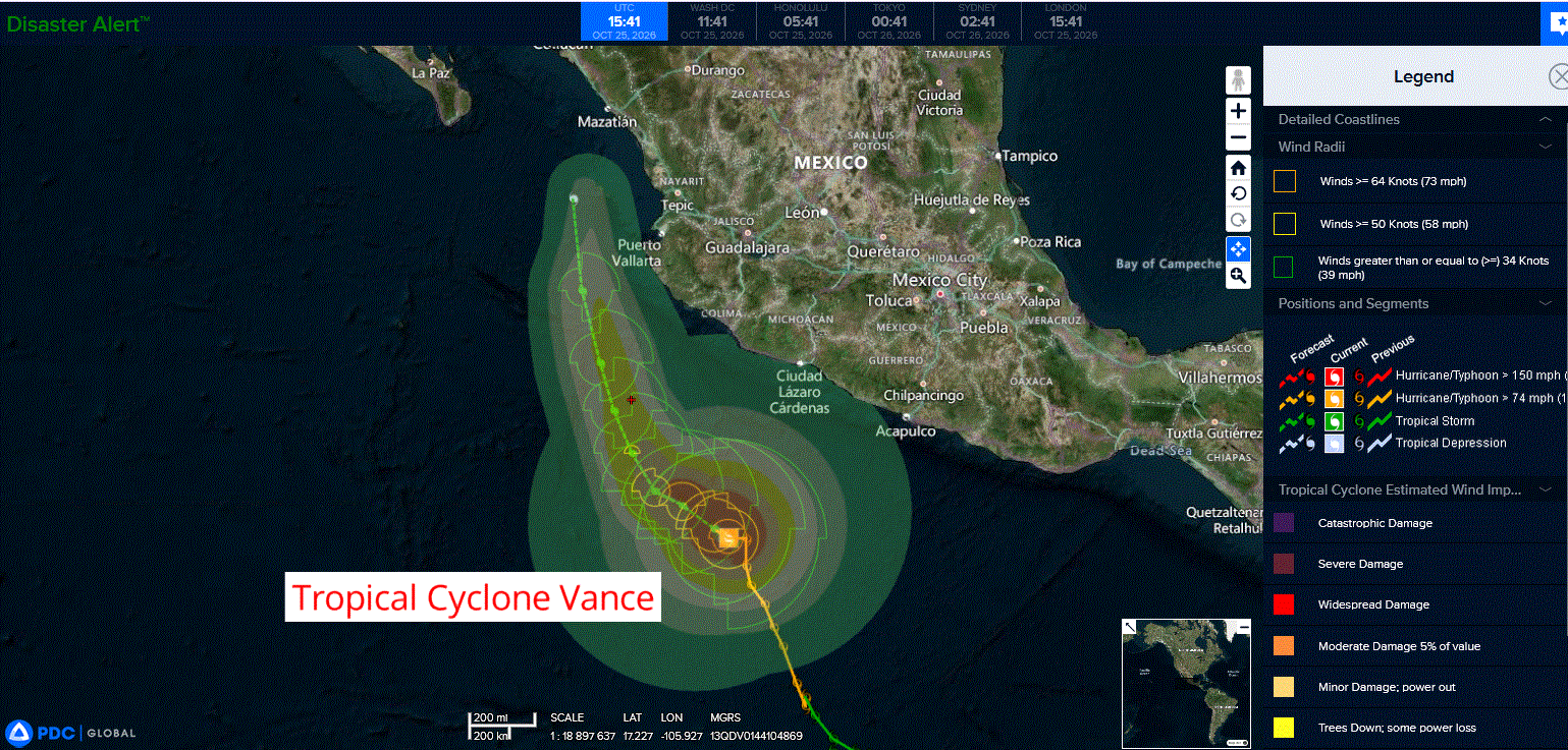
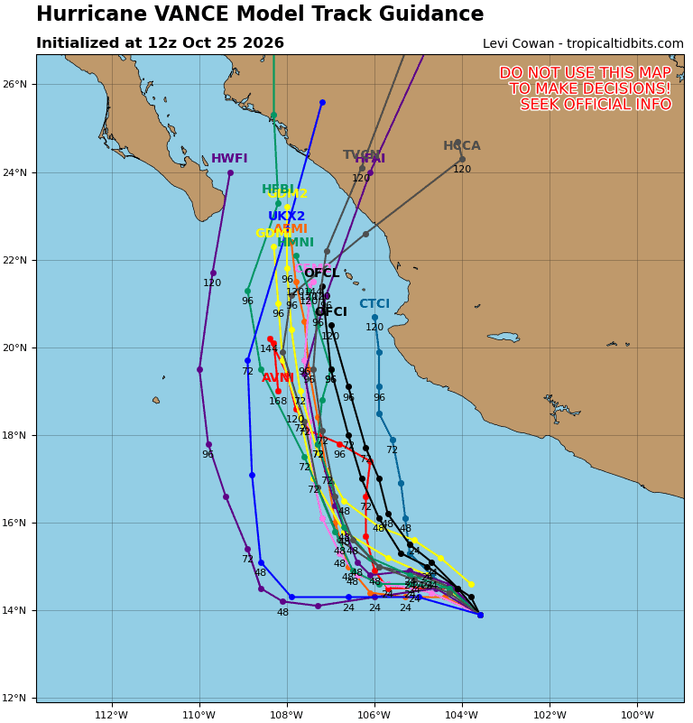
Tropical Cyclone 22E (Vance)…is located 325 miles south of Manzanillo, Mexico
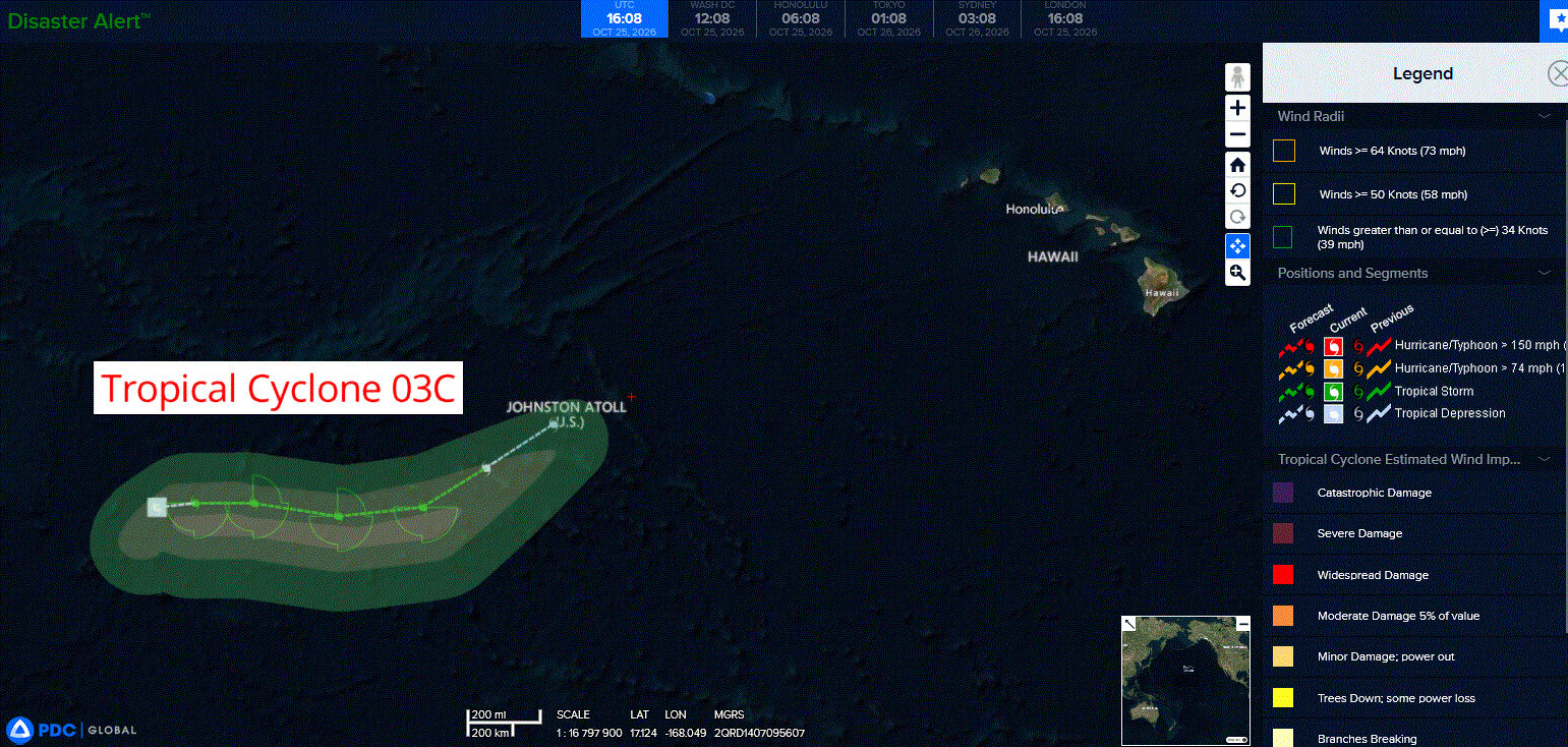
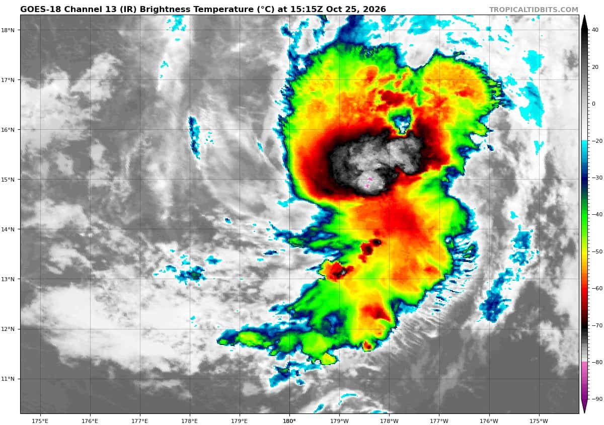
Tropical Cyclone 03C…is located 665 miles west of Johnston Island
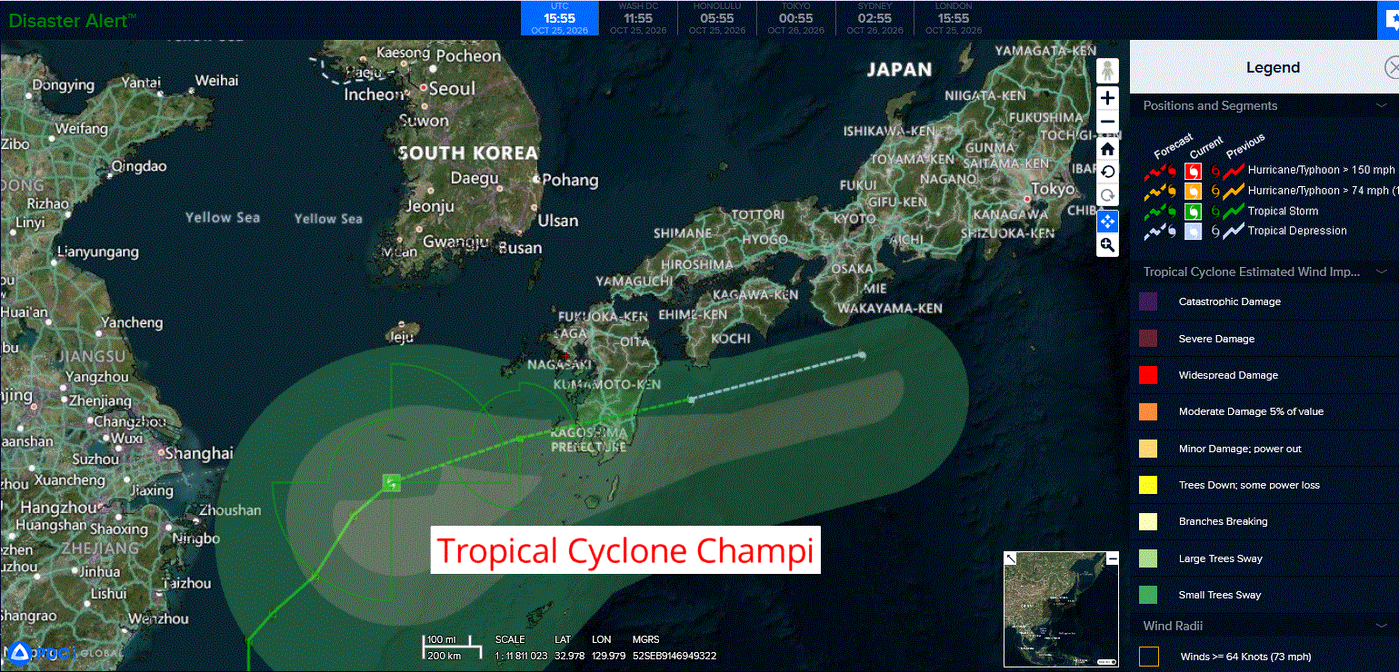
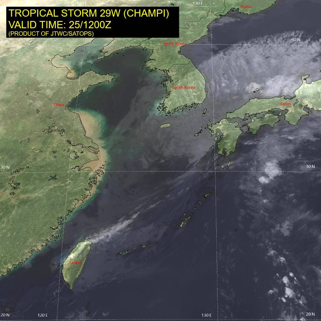
Tropical Cyclone 29W (Champi) is located approximately 225 NM southwest of Sasebo, Japan
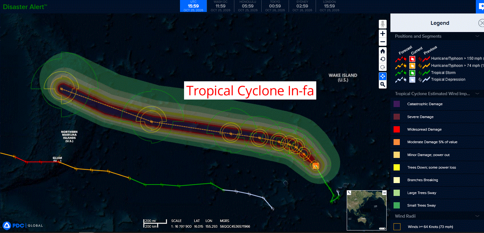
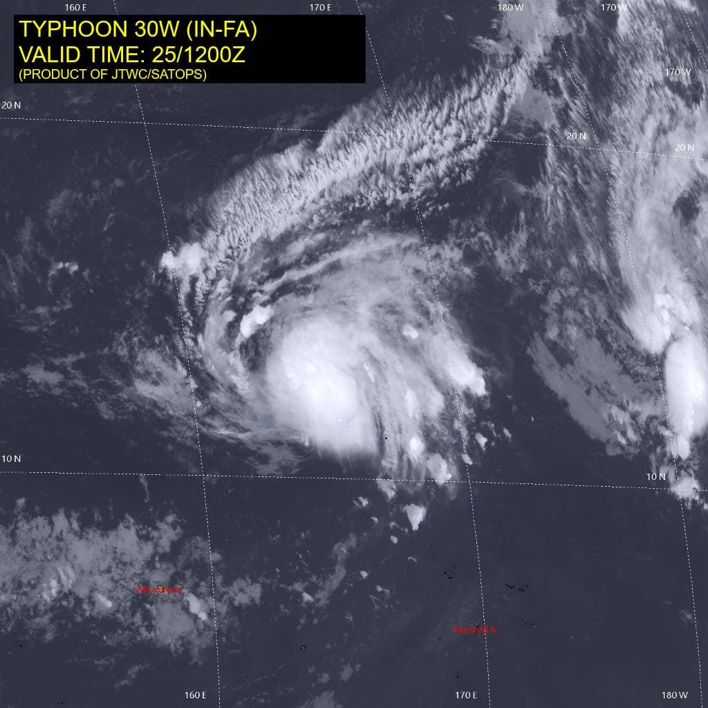
Tropical Cyclone 30W (In-fa) is located approximately 314 NM northwest of Kwajalein
Northeast Pacific:
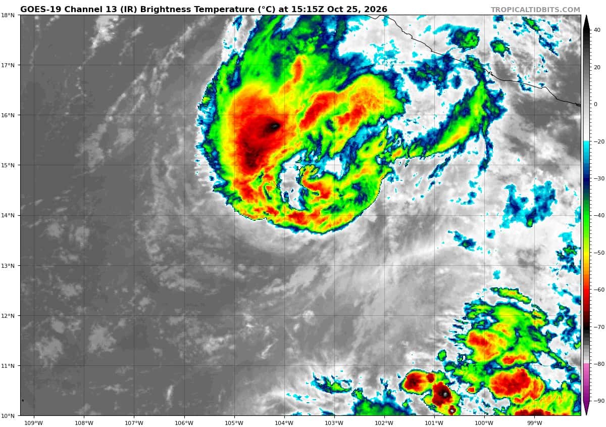
Tropical Cyclone 22E (Vance)
VANCE CONTINUES TO WEAKEN
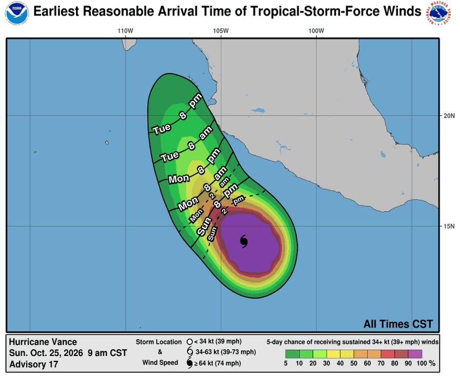
According to the NHC advisory number 17
Vance is moving toward the northwest near 5 mph (7 km/h). A northwestward to west-northwestward motion at a slower forward speed is expected over the next couple of days, followed by a turn toward the north-northwest around midweek.
Maximum sustained winds have decreased to near 75 mph (120 km/h) with higher gusts. Gradual weakening is forecast the next several days.
Hurricane-force winds extend outward up to 30 miles (45 km) from the center and tropical-storm-force winds extend outward up to 150 miles (240 km). The estimated minimum central pressure is 989 mb (29.21 inches).
HAZARDS AFFECTING LAND
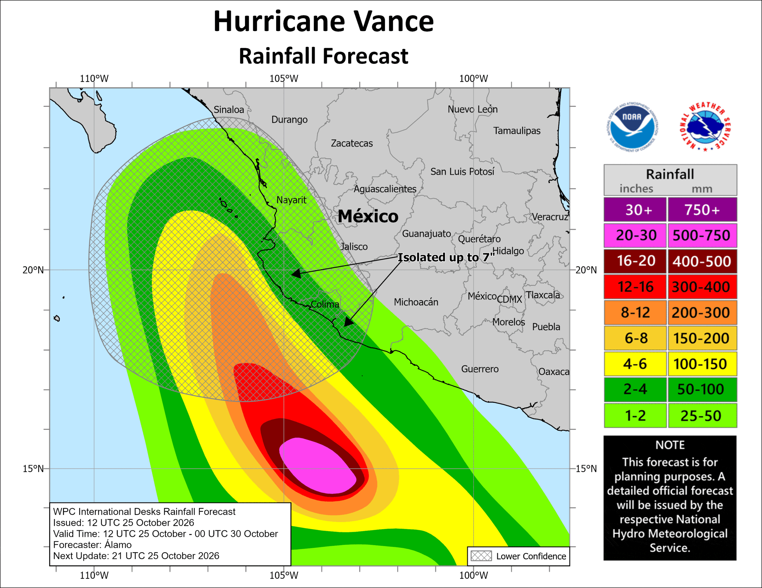
RAINFALL: Through Thursday, Vance is expected to produce 2 to 4 inches of rain, with isolated higher totals of 7 inches possible, across Colima and western portions of Michoacán and Jalisco. This rainfall may produce flooding and mudslides, especially in areas along steep terrain.
SURF: Swells generated by Vance will affect portions of the coast of southern and southwestern Mexico during the next several days. These swells are likely to cause life-threatening surf and rip current conditions.
Central North Pacific:
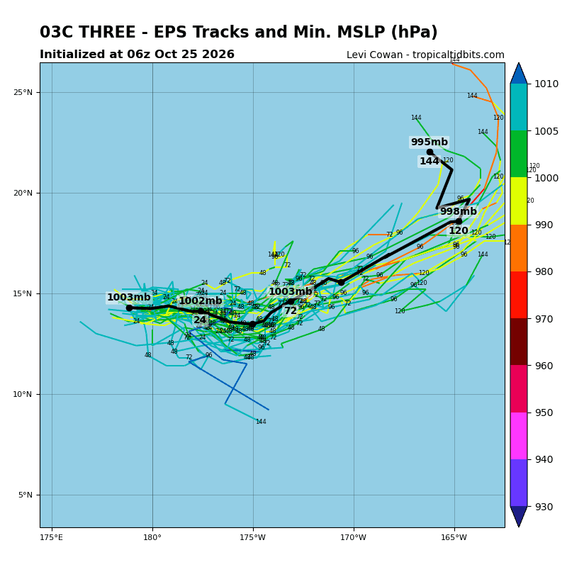
Tropical Cyclone 3C
NEW TROPICAL DEPRESSION FORMS IN THE CENTRAL PACIFIC JUST EAST OF THE INTERNATIONAL DATE LINE
The depression is moving toward the east-northeast near 7 mph (11 km/h) and a general eastward motion is expected to continue for the next several days.
Maximum sustained winds are near 35 mph (55 km/h) with higher gusts. Some slight intensification is possible later today and the depression could become a tropical storm over the next day or so.
The estimated minimum central pressure is 1006 mb (29.71 inches).
Western Pacific, Indian Ocean, and adjacent Seas:
Western Pacific
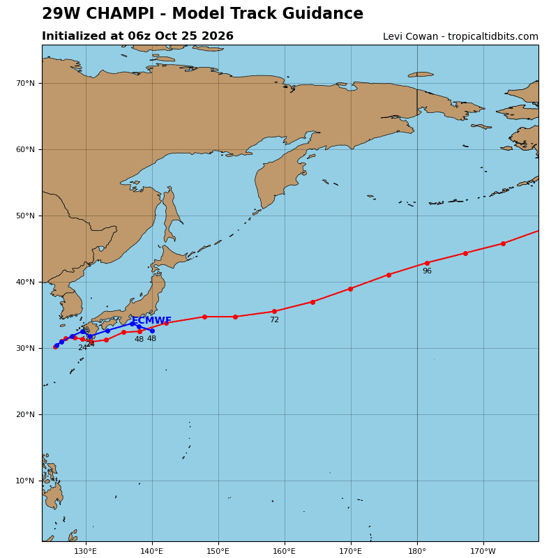
Tropical Cyclone 29W (Champi)
According to the JTWC warning number 45…sustained winds were 40 knots with gusts to 50 knots
Tropical storm (ts) 29W remains devoid of convection with widespread cirrus over the northern periphery associated with a jet stream to the north. Animated enhanced infrared (eir) satellite imagery depicts a partially exposed low-level circulation center that continues to elongate along a north-northeast to south-southwest axis. An ascat-b pass at 251144z and an rcm-1 sar pass at 250932z indicate a highly asymmetric wind field consisting of a long fetch of gale-force winds along the northern periphery as low-level air is funneled equatorward from the korea strait.
TS 29W is traversing a highly unfavorable environment of sea surface
temperatures (sst) cooler than 26 degrees celsius in a dry, stable airmass with moderate to high vertical wind shear.
TS 29W will continue to turn eastward as it becomes embedded in deep-layer westerly flow, making landfall over southern Kyushu between 12-24 hours if the low-level circulation remains coherent. It is becoming increasingly likely that the circulation will degenerate into a trough as it approaches or just after it passes over Kyushu.
SST will remain cool, and vertical wind shear will increase to 30-40 kts by 12 hours. Baroclinic intensification is also unlikely, given the weak thermal advection and lack of strong upper-level support. Extratropical
transition (ett) will continue as the system approaches kyushu.
If the low level circulation remains coherent, the system is expected to complete ett within 24 hours. Otherwise, the circulation may degenerate into a trough as it approaches or passes over Kyushu.
Tropical Cyclone 30W (In-fa)
According to the JTWC warning number 9…sustained winds were 75 knots with gusts to 90 knots
Animated enhanced infrared (eir) satellite imagery depicts persistent vortical hot towers associated with a seemingly ragged central dense overcast (cdo). The system maintains a strong connection to a poleward outflow channel feeding into an upper-level trough well to the northeast, although equatorward ventilation is suppressed. Moderate mid-level shear persists, which is likely a primary reason for the ragged nature of the cdo.
However, the very warm sea surface temperatures (sst) of 29-30 degrees celsius and the poleward outflow channel have still enabled the vortex to intensify. In fact, a 250718z sar pass by rcm-2 indicated typhoon-force winds surrounding a 15-nm wide eye, which is not visible in conventional satellite imagery. A 250709z wsf-m pass also revealed a lower-level eye feature that does not yet extend to the upper troposphere.
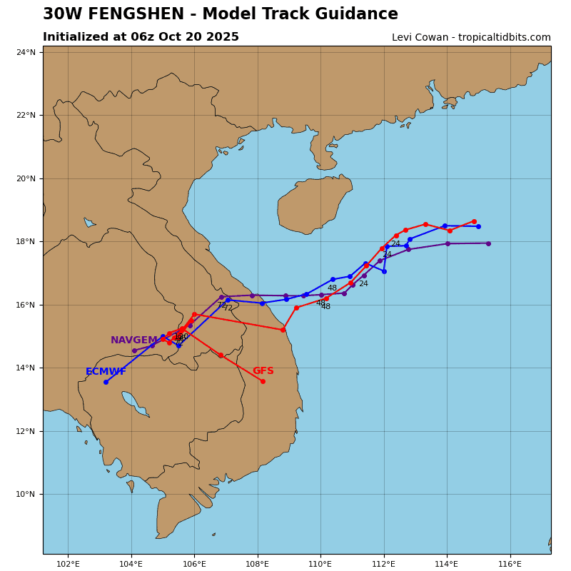
TY 30W is traveling north-northwestward along the northwestern periphery of the ner. Over the next 48 hours, a deep mid-level trough will pass over the Korean Peninsula and approach Honshu. This feature will reorient the subtropical ridge (str) and shift it eastward, eventually consolidating nearly due north of ty 30W. therefore, TY 30W will gradually turn westward and slow down over the next 48 hours as it encounters deep-layer easterly flow along the southern flank of the str.
Thereafter, the system will accelerate westward to west-northwestward along the southern side of the str. By 120 hours, ty 30W will reach the
southwestern flank of the ridge and begin to turn more poleward.despite moderate mid-level shear entraining dry air into the vortex, the system has managed to steadily intensify. the very compact core will likely undergo additional intensification, potentially rapid under similar conditions of moderate shear, very warm sst, and robust poleward ventilation through 24 hours.
After that time, the upper-level trough will travel well downstream, and the poleward outflow channel will shut off. Additionally, the slower motion from 24 to 48 hours will increase the potential for upwelling of cooler subsurface waters. Therefore, the forecast holds the intensity nearly steady during this time.
A second round of intensification will begin once the system gains sufficient forward speed and continues over very warm sst. Difficult-to-predict internal tropical cyclone dynamics during the latter part of the forecast period introduce additional intensity uncertainty, so the forecast holds the intensity at the same level at 96 and 120 hours.
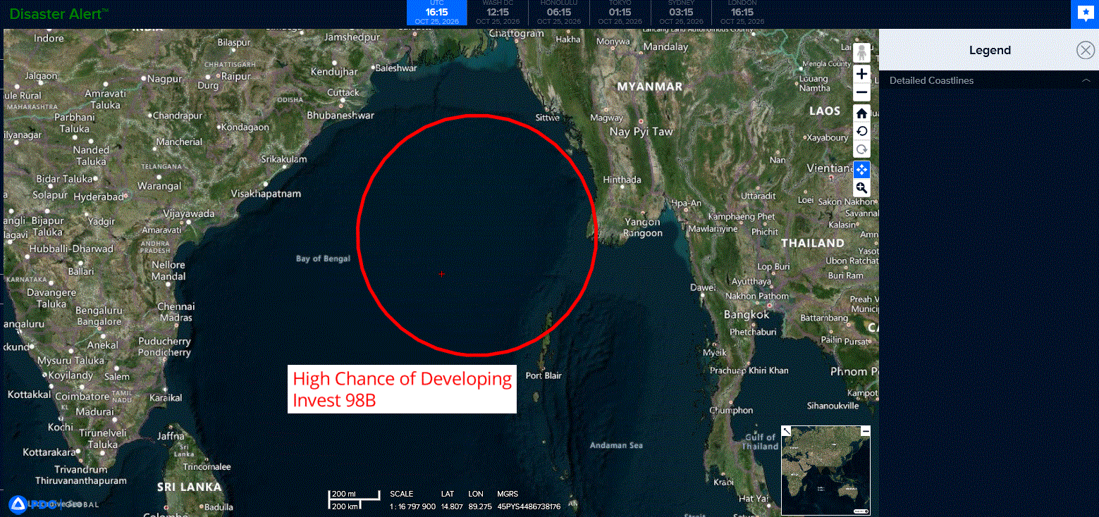
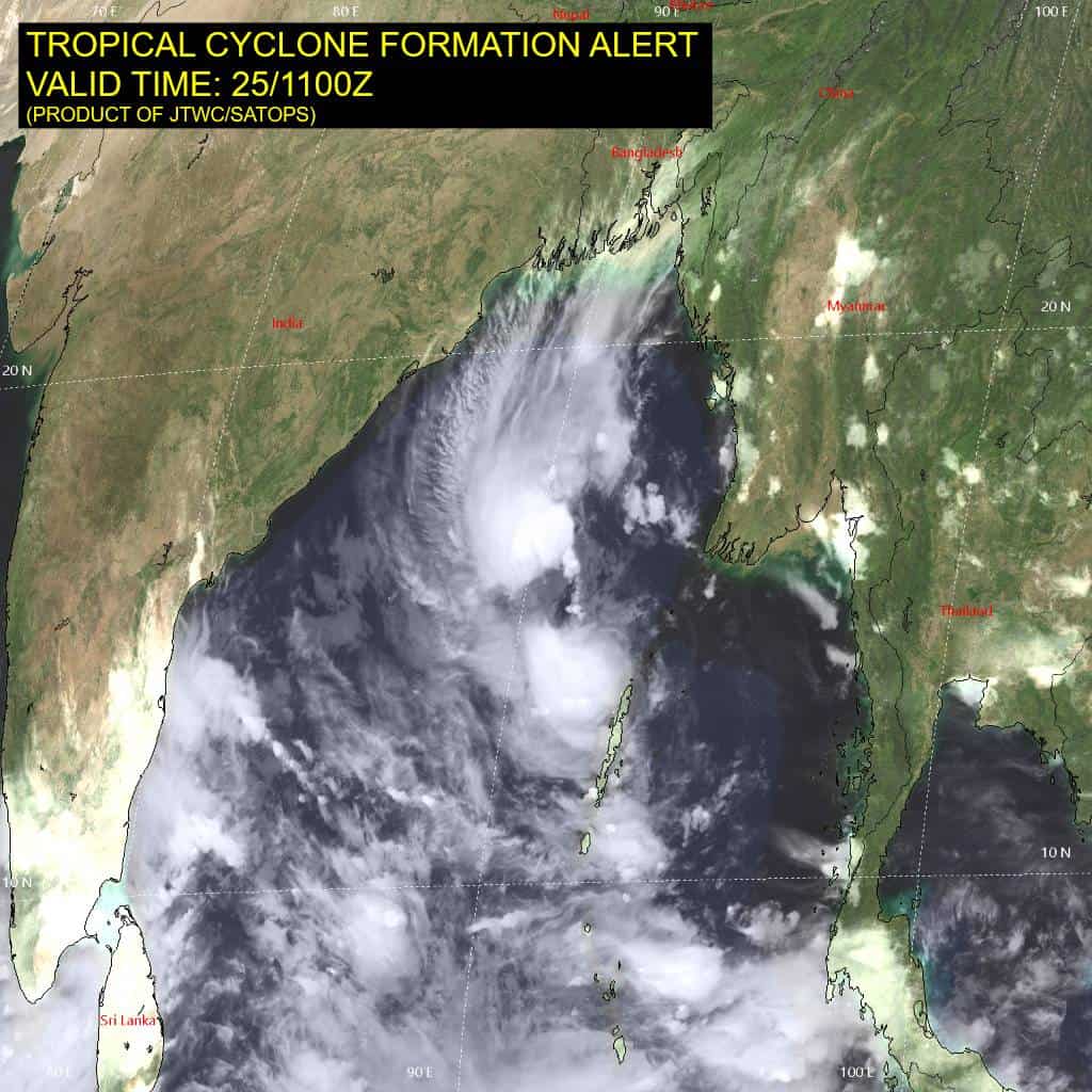
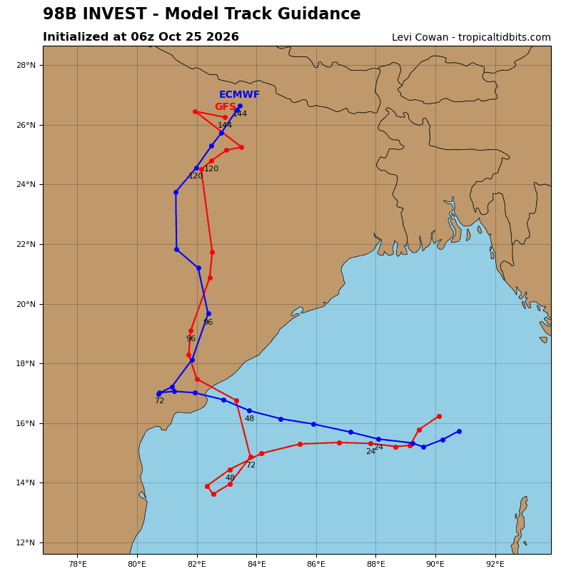
>>> There’s an area of disturbed weather that’s being referred to as Invest 98W, which is located approximately 290 NM north-northwest of Port Blair
Multi-spectral satellite imagery (msi) depicts a slowly consolidating, partially exposed low level circulation center (llcc) with deep convection confined to the northern periphery and convective banding forming to the east and south. A 240234z ascat pass reveals winds of 25kts to the southwest of the storm center.
Environmental analysis indicates a favorable area for development with moderate vertical wind shear (15-20kts), good poleward and equatorward outflow, and very warm sea surface temperatures (29-30c).
Global deterministic and ensemble models are in agreement of formation within 24 hours and a reversal in storm motion toward the west.
Maximum sustained surface winds are estimated at 23 to 28knots.
Minimum sea level pressure is estimated to be near 1004 mb.
The potential for the development of a significant tropical cyclone within the next 24 hours remains high.