

Current Snapshot
For all the latest updates visit: DisasterAWARE
1800x1080e
22e
211436_earliest_reasonable_toa_34
goes19_ir_22E_202610211515_lat9.5-lon-99.0
22E_gefs_latest
1800x1080ec
c
champi
29W_211200sair
29W_tracks_latest
agueda
02S_210600sair
02S_tracks_latest
By PDC’s Senior Weather
Specialist Glenn James

The Pacific Disaster Center’s (PDC Global) Wednesday, October 21, 2026, Tropical Cyclone Activity Report…for the Pacific Ocean, the Indian Ocean, and adjacent Seas.
Tropical Cyclones
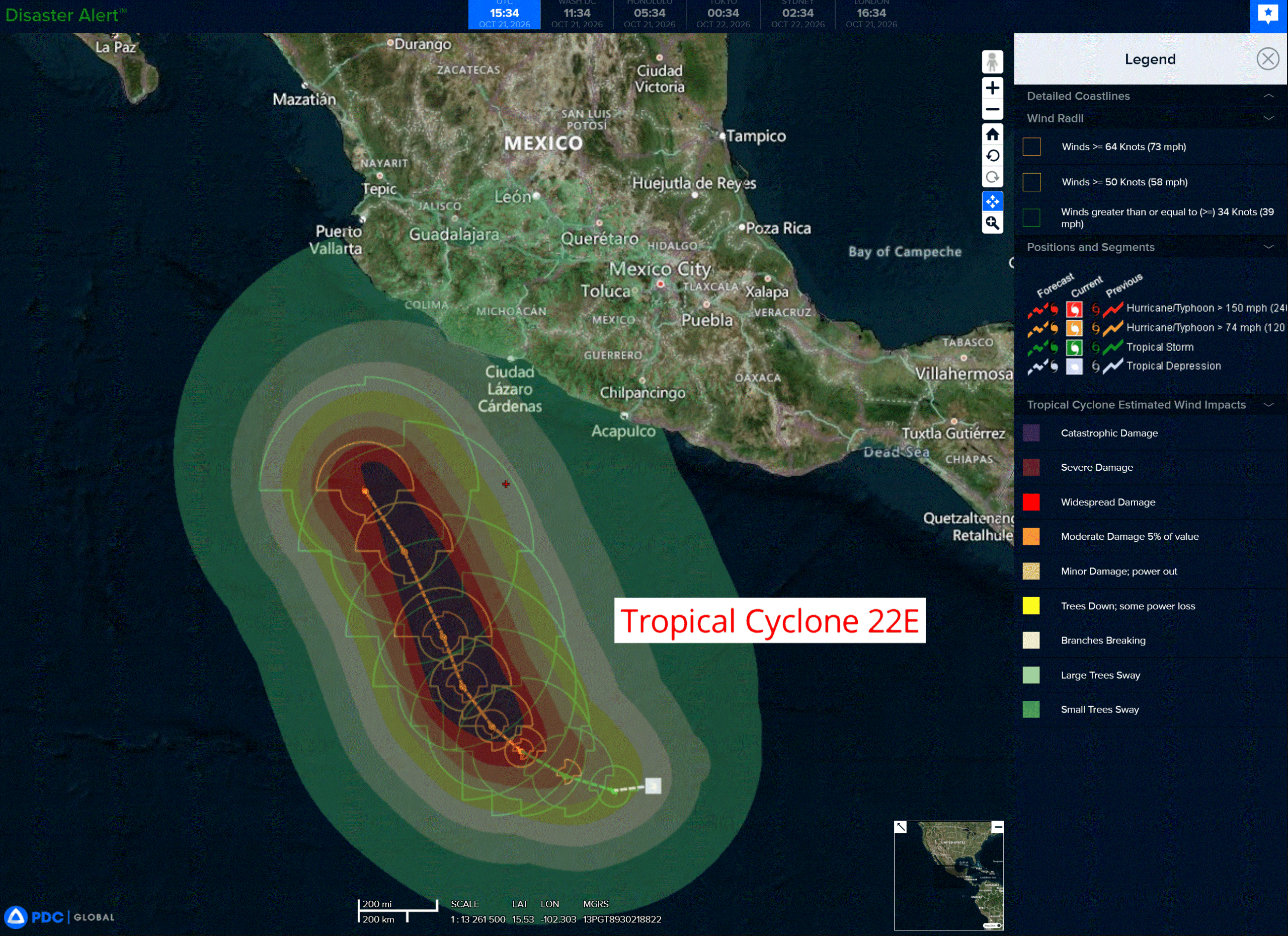
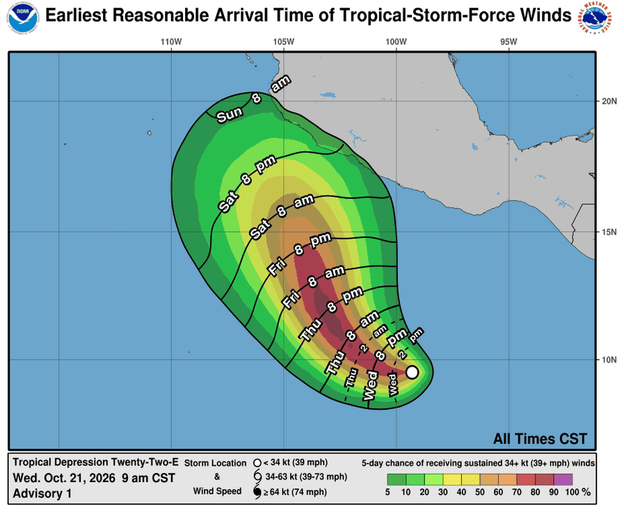
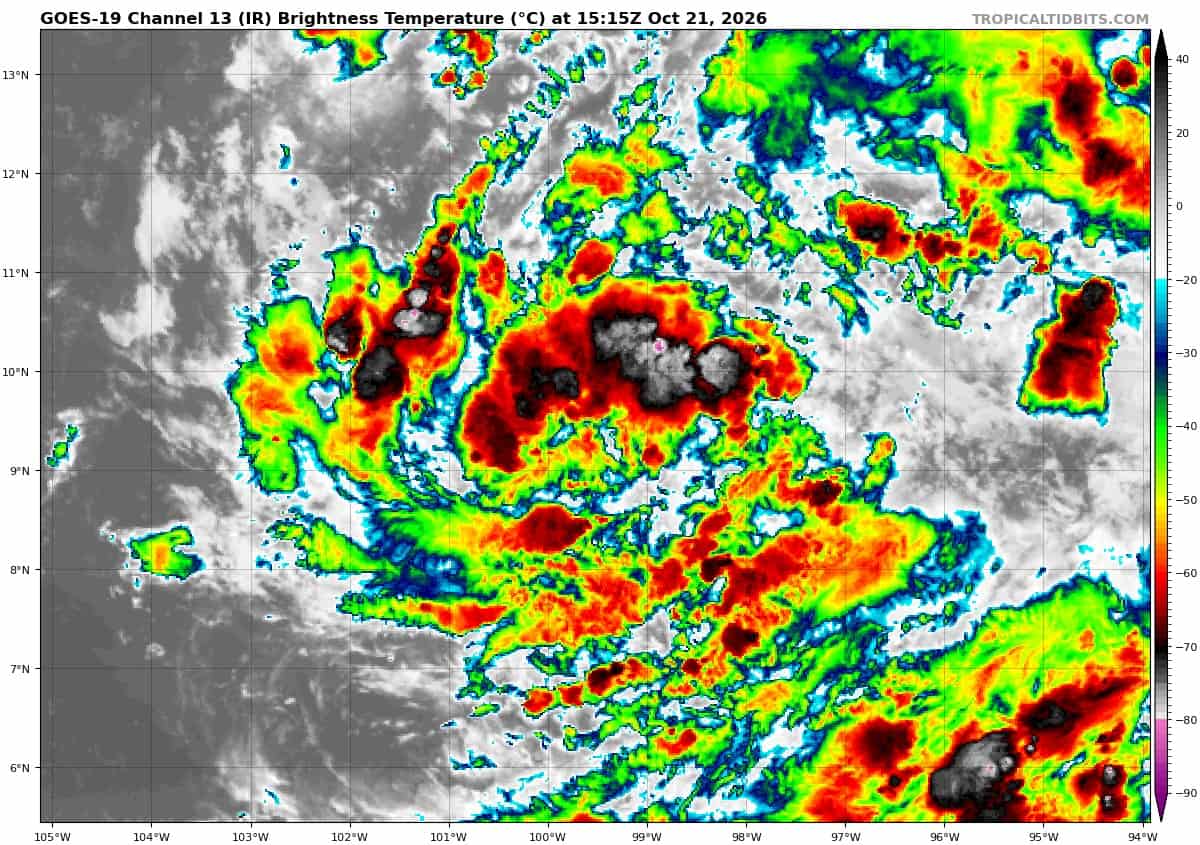
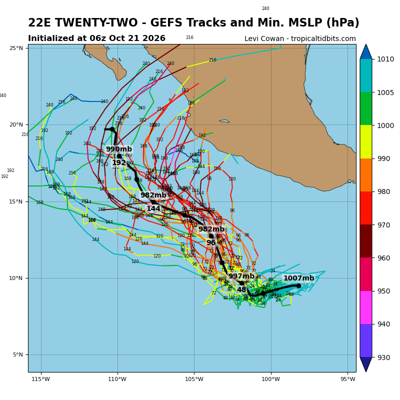
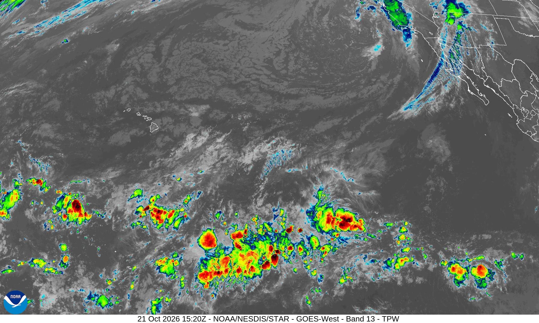
Tropical Cyclone 22E (Vance)…is located 734 miles south-southeast of Manzanillo, Mexico
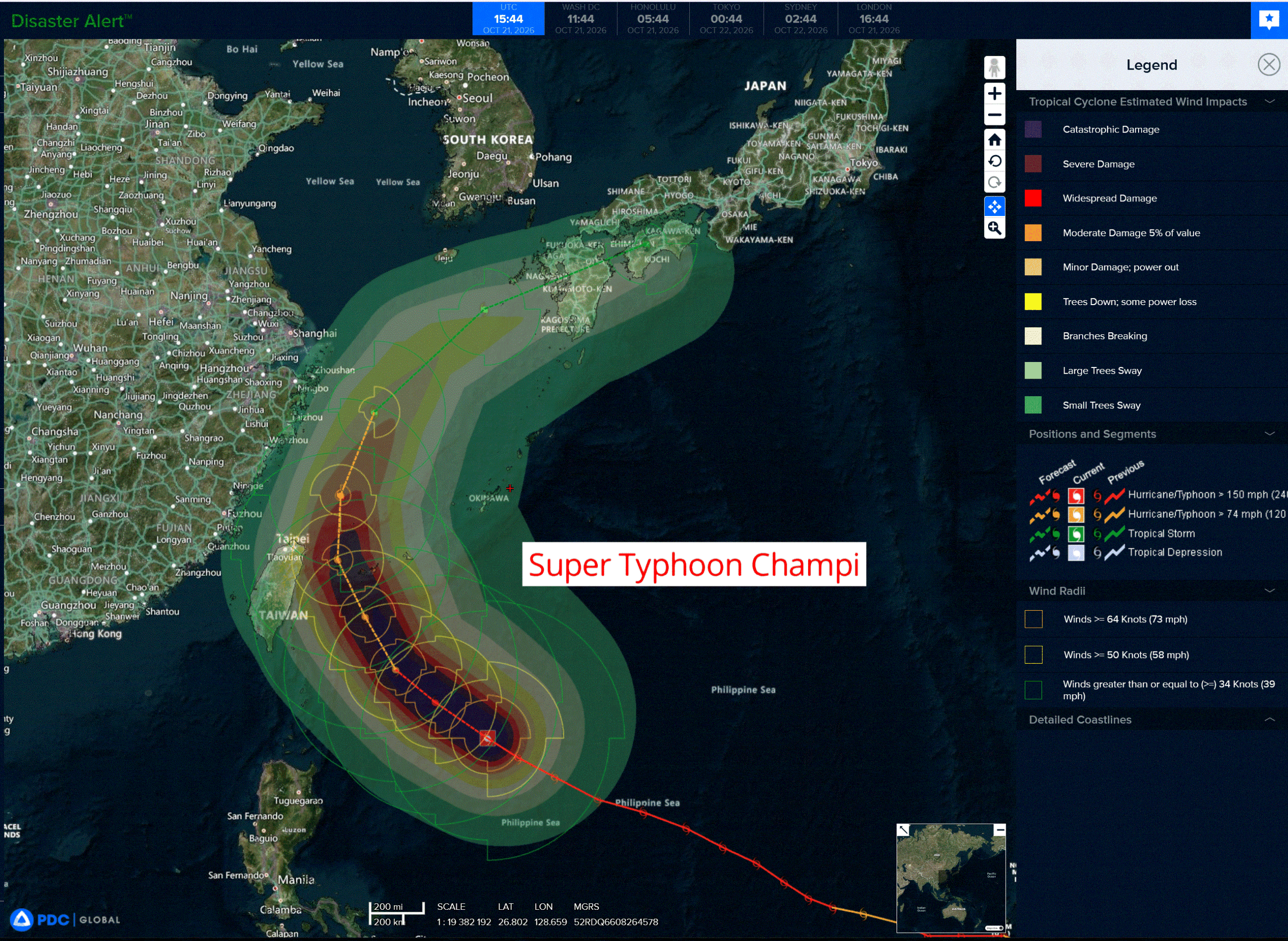
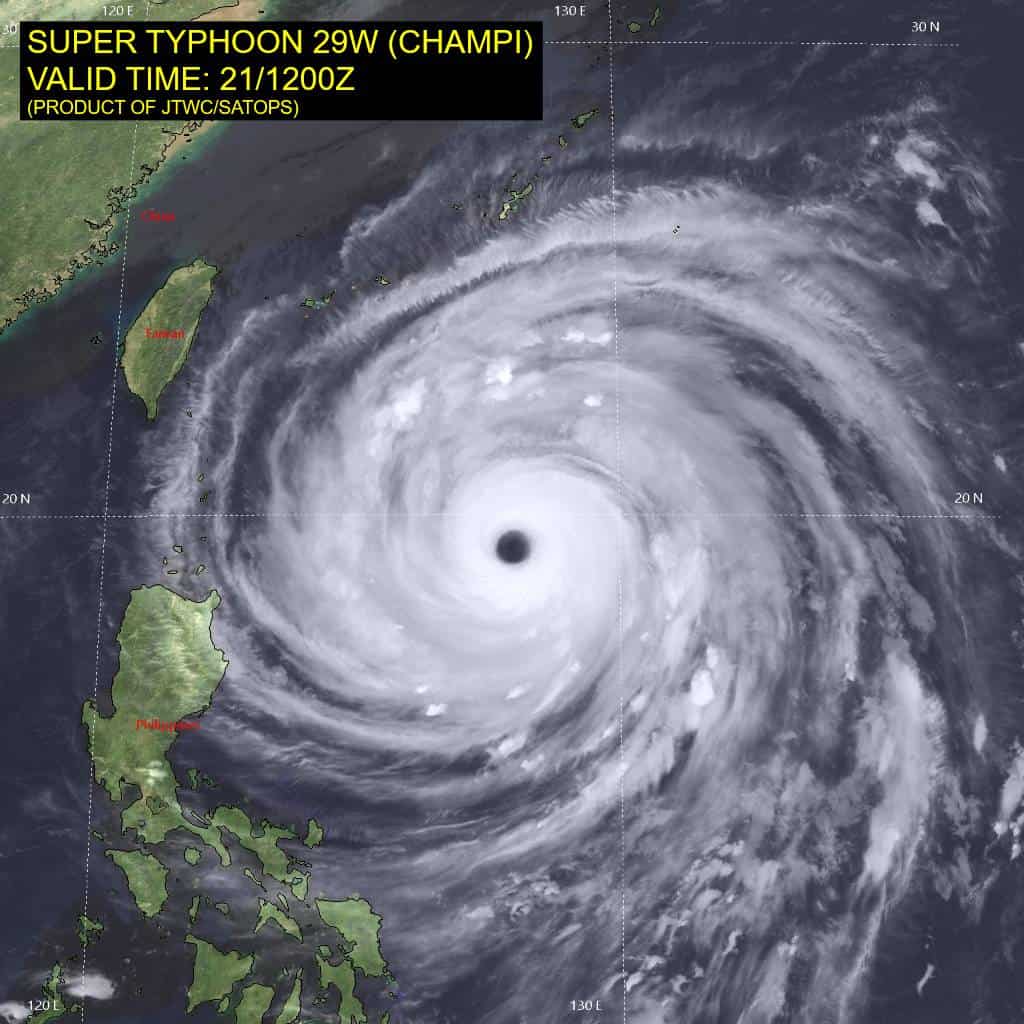
Tropical Cyclone 29W (Champi) is located approximately 432 NM south of Kadena AB
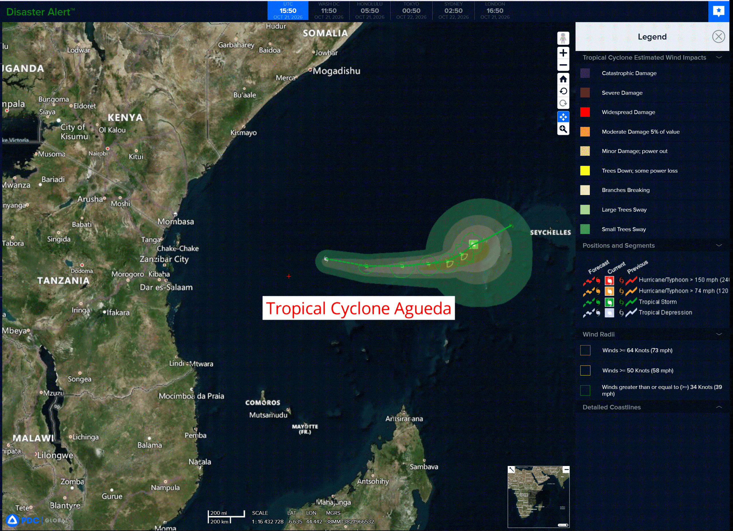
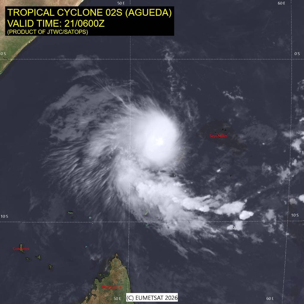
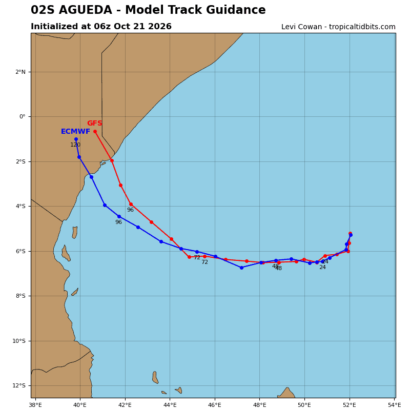
Tropical Cyclone 02S (Agueda) is located approximately 775 NM east of Dar Es Salaam, Tanzania
Northeast Pacific:
Tropical Cyclone 22E (Vance)
VANCE STRENGTHENS SLIGHTLY…FORECAST TO RAPIDLY INTENSIFY
According to the NHC advisory number 3
The depression is moving toward the west near 7 mph and this general slow forward motion with a turn towards the northwest then north-northwest is expected the next few days.
Maximum sustained winds are near 35 mph with higher gusts. Steady to rapid intensification is expected, and the system is forecast to become a hurricane on Friday.
The estimated minimum central pressure is 1005 mb (29.68 inches).
HAZARDS AFFECTING LAND
SURF: Swells generated by Tropical Depression Twenty-Two-E are expected to begin affecting portions of the coast of southern and southwestern Mexico this weekend and continue into next week. These swells are likely to cause life-threatening surf and rip current conditions.
Central North Pacific: There are no Tropical Cyclones
>>> Western Central Pacific:
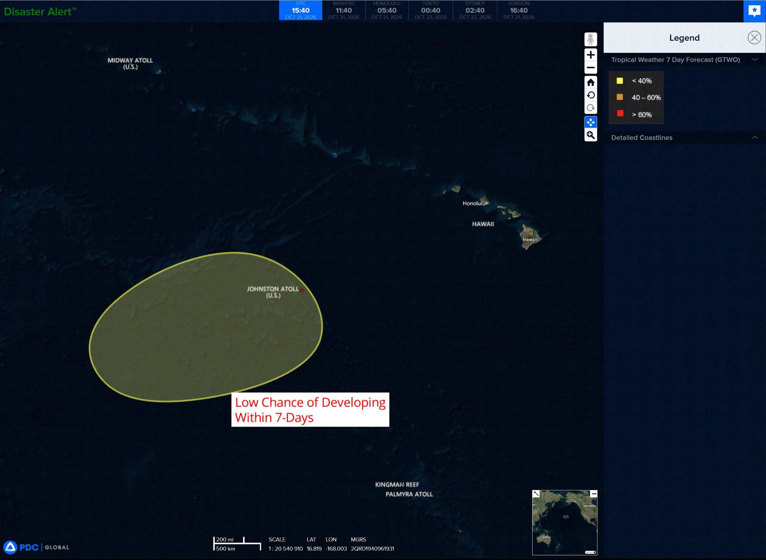
An area of low pressure is forecast to form in the far western central Pacific a few hundred miles southwest of Johnson Atoll late this weekend of early next week. Environmental conditions appear conducive for some gradual development thereafter while the system moves generally eastward to east-northeastward.
* Formation chance through 48 hours…low…near 0 percent
* Formation chance through 7 days…low…30 percent
Western Pacific, Indian Ocean, and adjacent Seas:
Western Pacific
Tropical Cyclone 29W (Champi)
According to the JTWC warning number 29…sustained winds were 145 knots with gusts to 175 knots
Super typhoon (sty) 29W maintains a very impressive appearance in animated enhanced infrared (eir) satellite imagery, featuring a 30-nm-wide eye embedded in a symmetric central dense overcast with
extensive banding features and excellent upper-level outflow. Cloud top temperatures gradually warmed over the past 18 hours but have since reversed course. In bd-curve-enhanced imagery, a ring of white and cold-medium-gray shades has encircled the eye. This follows ssmis microwave passes at 210922z and 211003z, which revealed concentric convective rings and indicated the potential for an eyewall replacement cycle (erc). it is difficult to determine whether the recent cloud-top cooling is associated with the inner eyewall or the outer ring. Thus far, the eye has shown no indication of disruption, remaining clear, circular, and as warm as +20 degrees celsius.
The environment remains favorable with low vertical wind shear (vws). however, the system is traversing cooler sea surface temperatures (sst) of 27-28 degrees celsius and ocean heat content (ohc) of 50-70 kj per cm2, which is less supportive of maintaining super typhoon intensity.
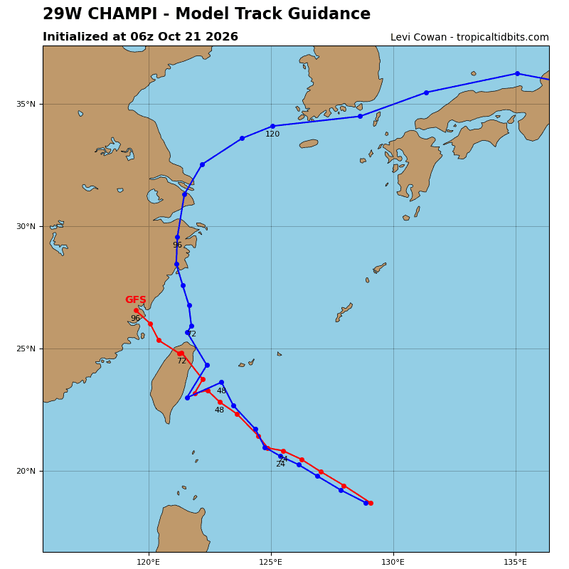
STY 29W will continue northwestward along the southwestern periphery of a deep-layer str through 24 hours. During this time, vws will remain low, but cooler sst and low ohc will promote rapid weakening. The circulation is also very large, with gale-force winds extending far from the center. Currently, the system is moving toward a weakness in the str caused by a deep trough passing over Honshu. The str will rebuild westward over the next 48-72 hours. Uncertainty associated with the evolution of this ridge leads to a range of possibilities, from landfall over northern Taiwan to recurvature toward Kyushu.
South Indian Ocean
Tropical Cyclone 02S (Agueda)
According to the JTWC warning number 3…sustained winds were 45 knots with gusts to 55 knots
Tropical cyclone (tc) 02S remains a sheared system. Persistent convection continues to struggle to wrap around the partially exposed low-level circulation center (llcc), and upper-level outflow remains restricted to the east. A 210235z wsf-m mwi pass revealed a westward vortex tilt with height, with the upper-level circulation displaced west of the llcc. However, animated multi-spectral satellite imagery (msi) indicates that convective banding along the southern and western periphery is beginning to improve, and the llcc has begun to tighten.
Despite moderate mid-level vertical wind shear (vws), tc 02S is traversing warm sea surface temperatures (sst) of 27-28 degrees celsius and is supported by modest to moderate westward upper-level divergence. The overall environment is marginally favorable and may support limited intensification over the next 24 hours.
TC 02S is moving southwestward along the western periphery of a str to the east. Over the next 24 hours, a
str will build to the south of the system, turning tc 02S westward. The westward motion will continue through 48 hours. Thereafter, as the circulation becomes increasingly shallow, the system will turn slightly equatorward as it moves within the low-level southeasterly flow. While conditions may support limited intensification over the next 24 hours, elevated vws and the tilted vortex will preclude significant development.
By about 24 hours, persistent mid-level shear will facilitate dry air entrainment from the west into the
circulation. Therefore, the forecast continues to depict a peak intensity of 50 kts from 12 through 24 hours, followed by steady weakening. The system will dissipate near 72 hours.