

Current Snapshot
For all the latest updates visit: DisasterAWARE
1800x1080e
trudy
171437_earliest_reasonable_toa_34
2026291022425_GOES18-ABI-MESO-GEOCOLOR-19N-106W-1000×1000
171437INTQPF_sm
21E_tracks_latest
7e

1800×1080
10
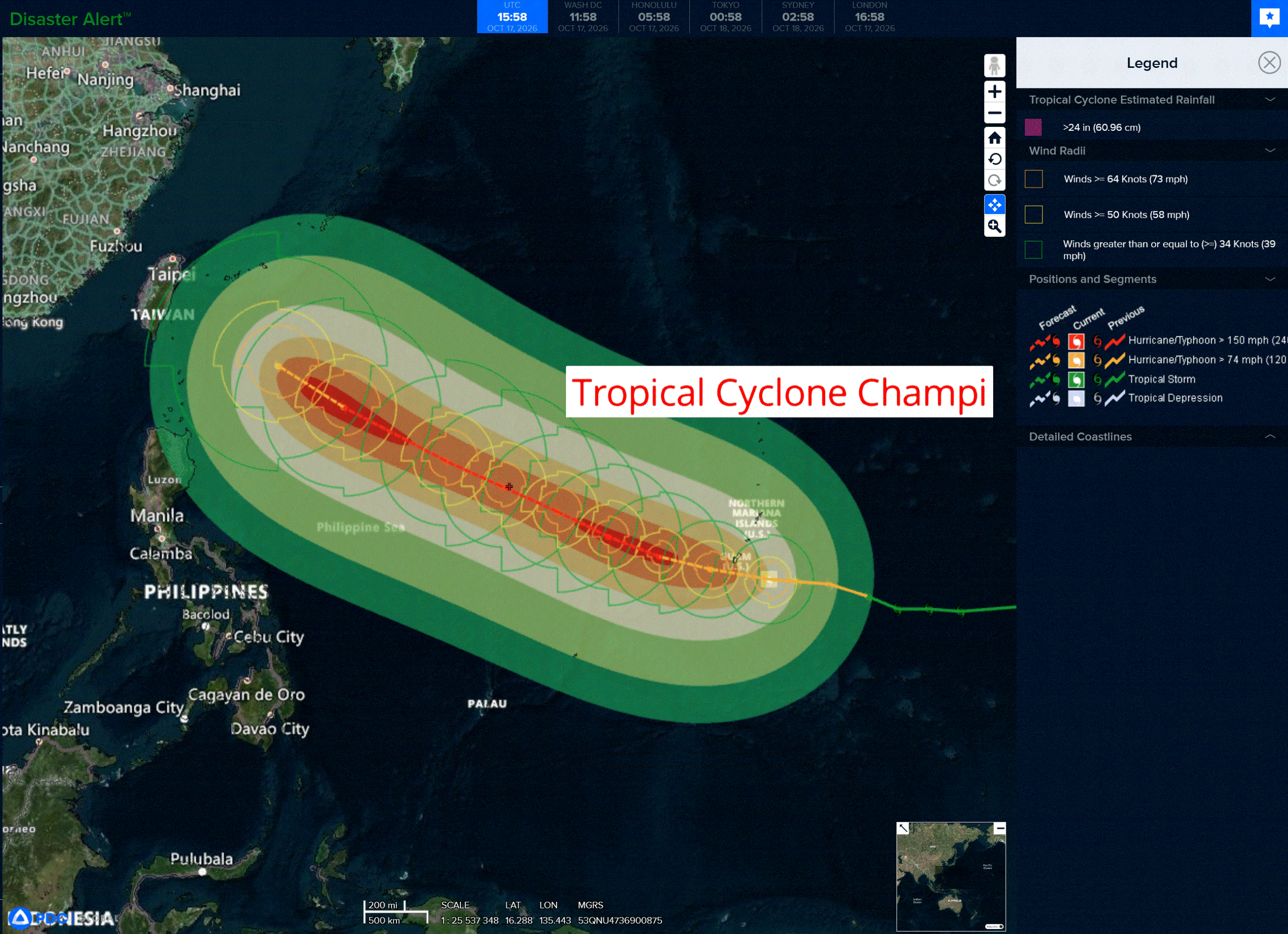
champi
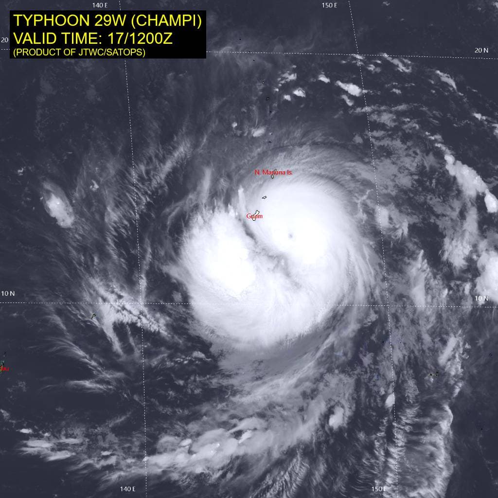
29W_171200sair
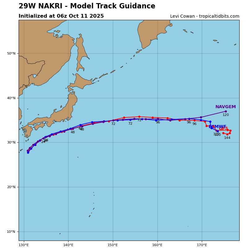
29W_tracks_latest
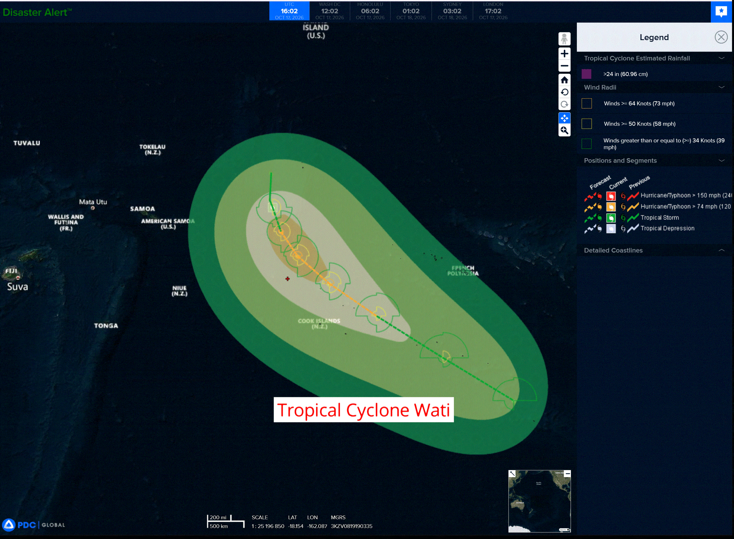
wati
01P_170600sair
01P_tracks_latest
By PDC’s Senior Weather
Specialist Glenn James

The Pacific Disaster Center’s (PDC Global) Saturday, October 17, 2026, Tropical Cyclone Activity Report…for the Pacific Ocean, the Indian Ocean, and adjacent Seas.
Tropical Cyclones
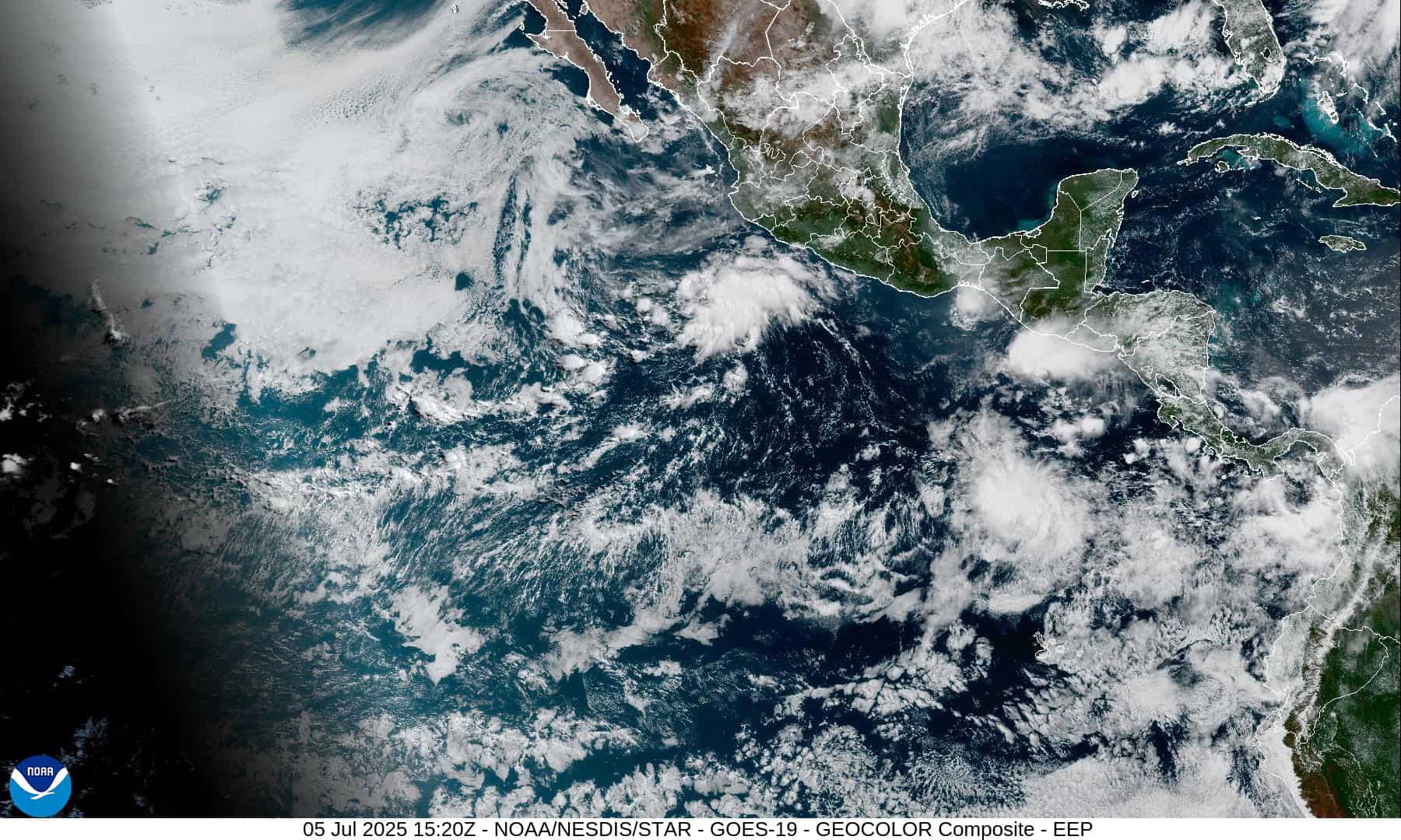
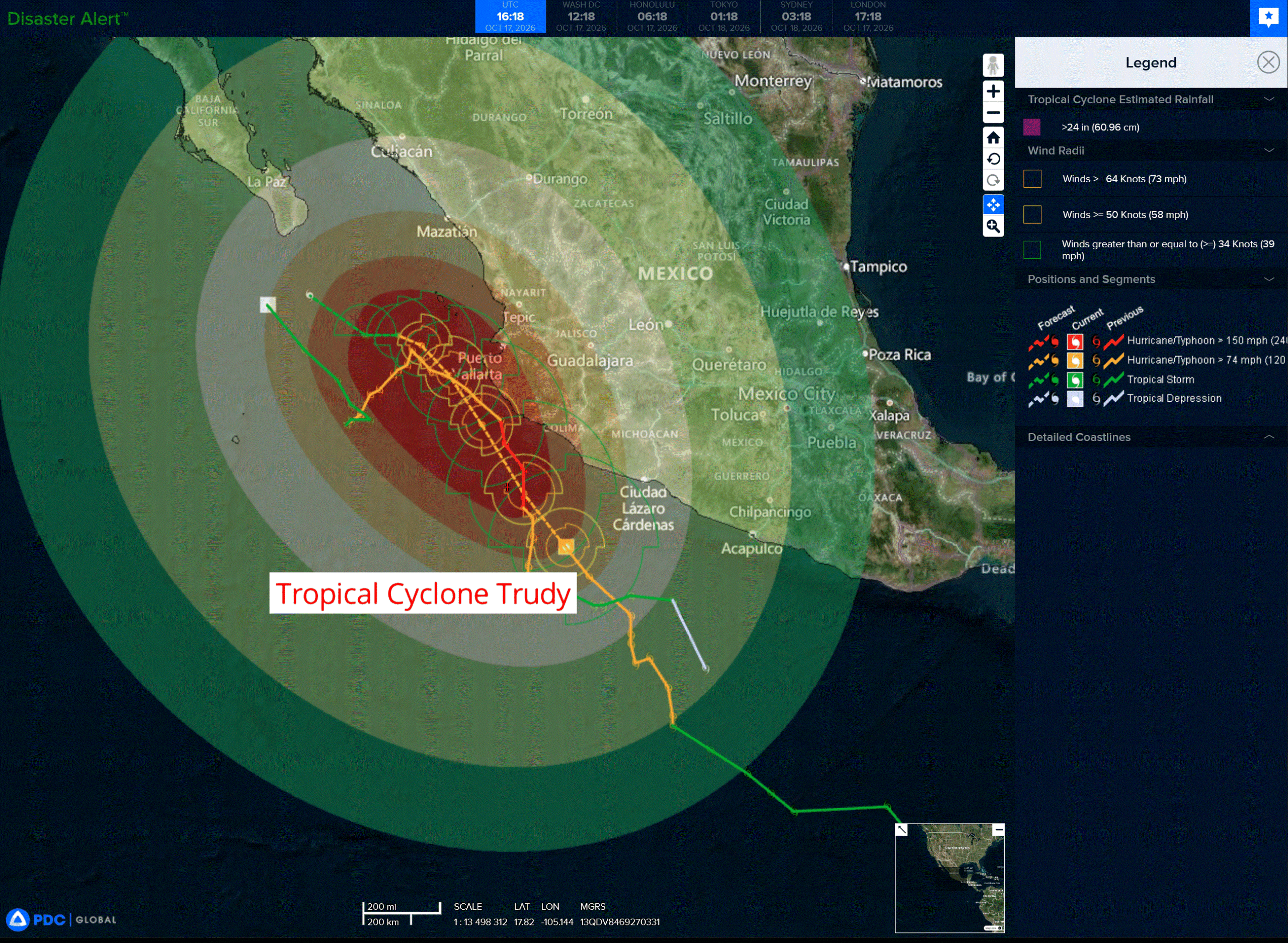
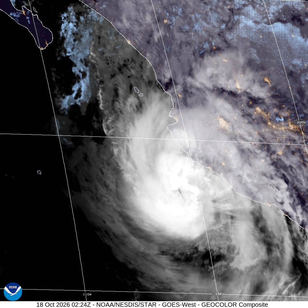
Tropical Cyclone 21E (Trudy) is located about 170 miles south of Manzanillo, Mexico
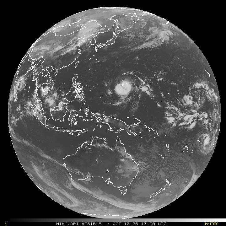
Tropical Cyclone 29W (Champi) is located approximately 96 NM southeast of Andersen AFB
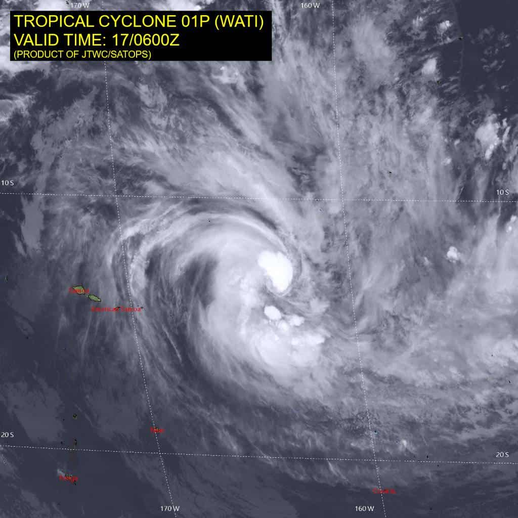
Tropical Cyclone 01P (Wati) is located approximately 442 NM east of Pago Pago
Northeast Pacific:
Tropical cyclone 21E (Trudy)
TRUDY MOVING NORTHWESTWARD WITH LITTLE CHANGE IN STRENGTH…EXPECTED TO PASS NEAR THE COAST OF WEST-CENTRAL MEXICO LATER TODAY INTO SUNDAY
According to the NHC advisory number 17
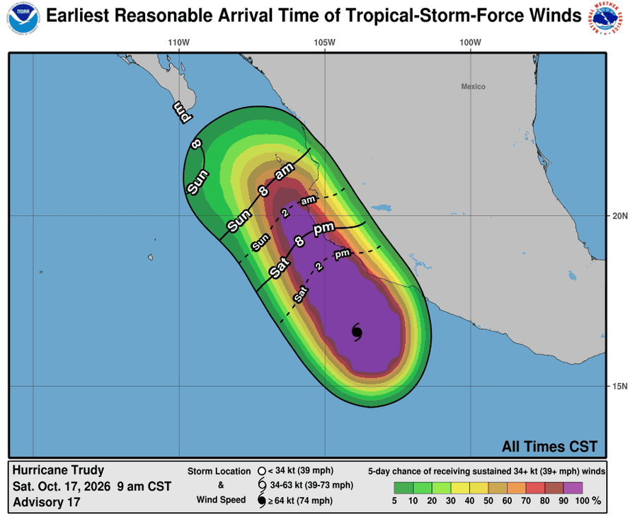
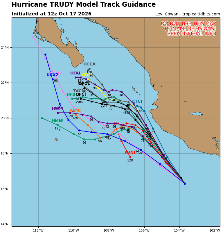
Trudy is moving toward the northwest near 10 mph (17 km/h), and this general motion is forecast to continue through Sunday. On the forecast track, the center of Trudy will approach the coast of southwestern and west-central Mexico today and pass near the coast tonight into Sunday.
Maximum sustained winds are near 90 mph (150 km/h) with higher gusts. Some strengthening is possible today, followed by weakening beginning on Sunday.
Hurricane-force winds extend outward up to 35 miles (55 km) from the center and tropical-storm-force winds extend outward up to 140 miles (220 km). The estimated minimum central pressure is 979 mb (28.91 inches).
HAZARDS AFFECTING LAND
WIND:
Hurricane conditions are expected in the Hurricane Warning area by tonight, with tropical storm conditions spreading across the area today. Tropical storm conditions are expected within the Tropical Storm Warning area today. Hurricane conditions are possible in the Hurricane Watch area by late today. Tropical storm conditions are possible in the Tropical Storm Watch area by Sunday.
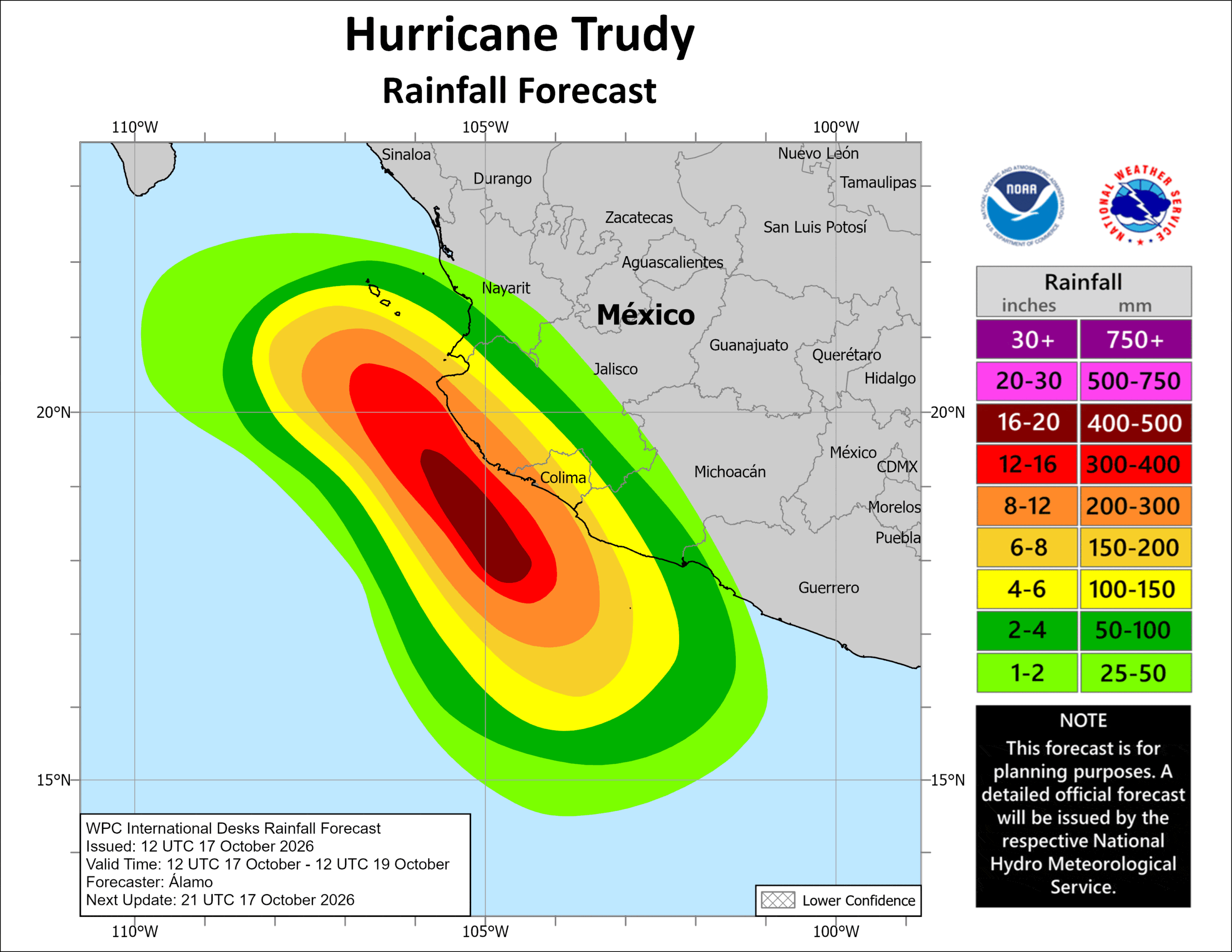
Through the weekend, Trudy is expected to produce 4 to 8 inches with isolated higher totals around 12 inches along and near the southwest Mexican coast in Michoacán, Colima and Jalisco. This rainfall may produce life-threatening flooding and mudslides, especially in areas along steep terrain.
Elsewhere, Trudy’s outer bands are expected to produce 2 to 4 inches with isolated higher totals around 6 inches along the southwest Mexican coast in Guerrero and Nayarit. This rainfall may result in localized flash flooding through the weekend, especially in areas along steep terrain.
STORM SURGE: Coastal flooding from storm surge is possible in areas of onshore winds. Near the coast, the surge will be accompanied by large and destructive waves.
SURF: Swells generated by Trudy are affecting portions of the coast of southwestern Mexico and will spread northward toward west-central Mexico through the weekend. These swells will cause life-threatening surf and rip current conditions.
>>> South of Southern Mexico:
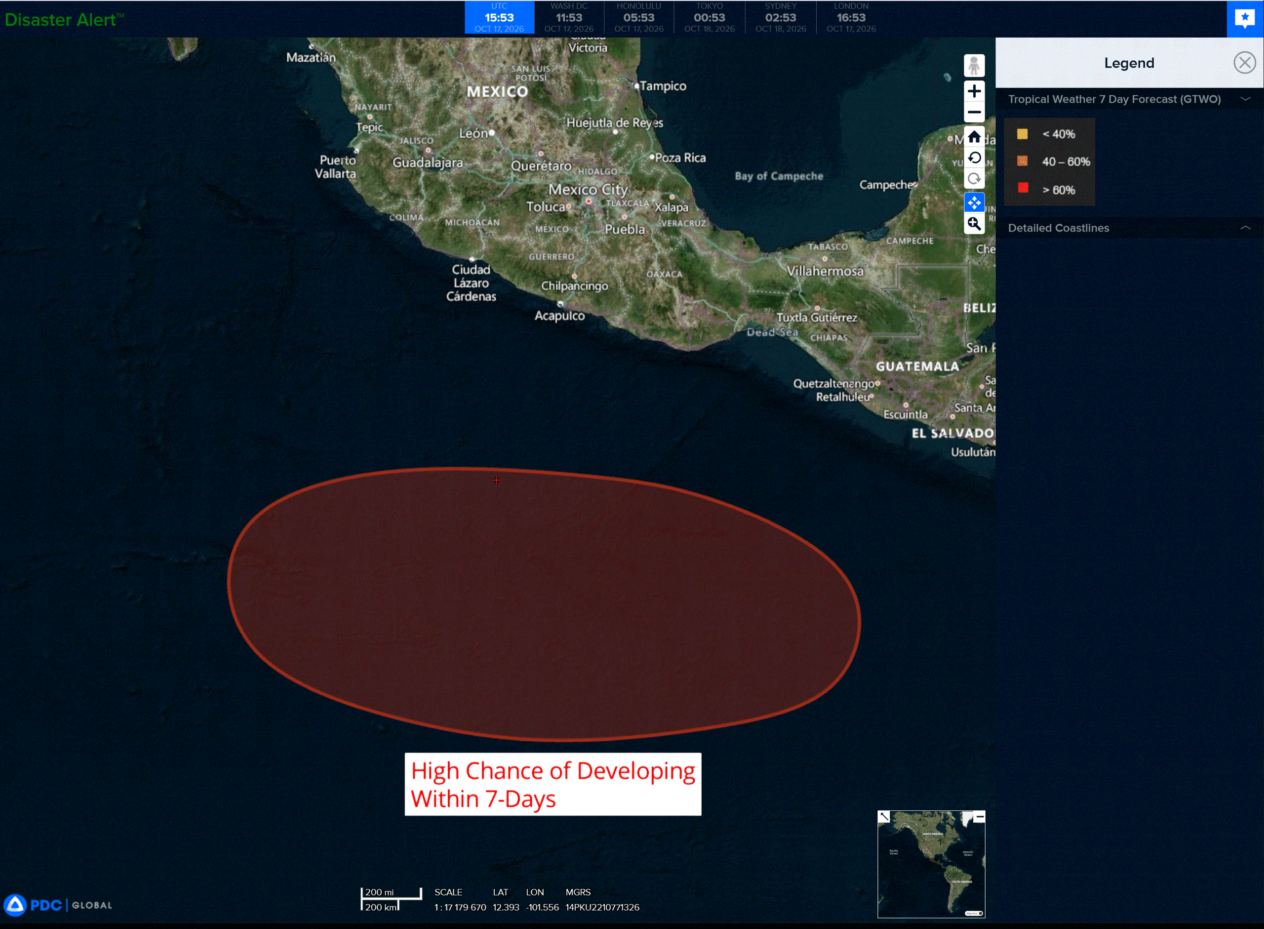
An area of low pressure is forecast to form offshore of southern Mexico during the early to middle part of next week.
Environmental conditions appear conducive for gradual development thereafter, and a tropical depression is likely to form during the latter half of next week while it moves generally westward to west-northwestward over the eastern and central portions of the East Pacific.
* Formation chance through 48 hours…low…near 0 percent
* Formation chance through 7 days…high…70 percent
Central North Pacific: There are no Tropical Cyclones
Tropical cyclone formation is not expected during the next 7 days.
Western Pacific, Indian Ocean, and adjacent Seas:
Western Pacific
Tropical Cyclone 29W (Champi)
According to the JTWC warning number 13…sustained winds were 120 knots with gusts to 145 knots
The overall structure of TY 29W in animated enhanced infrared (eir) satellite imagery has deteriorated over the past six hours, as the the previously cloud-free, pinhole eye has filled in due to an ongoing eyewall replacement cycle (erc). The eye remains detectable in eir imagery, and appears to be slightly larger than six hours ago. However, the eye temperatures are very cold (approximately -50c). Animated radar imagery from Guam shows that the eye took a a temporary west-southwestward trochoidal jog over the past six hours; however, the integrated motion vector remains stable at 280 degrees at 14 knots based on the best track.
Over the past two hours, the system has resumed a west-northwestward heading amid trochoidal oscillation. Radar data clearly resolves a concentric eyewall morphology, highlighted by a thickening inner eyewall, a distinct radar moat, and a secondary outer eyewall situated approximately 30 NM distant from the geometric center-strong structural signatures confirming erc progression.
The environment remains highly conducive independent of core-scale erc dynamics, supported by low deep-layer vws, extremely warm ssts (29-30c), and vigorous radial outflow aloft.
Typhoon 29W is tracking westward in the aggregate, although erratic trochoidal motion is projected to persist pending completion of the erc. The exact frequency and amplitude of this motion, which remain highly uncertain, will govern the precise cpa and track geometry when passing Guam. The cyclone will transit the southern tip of Guam within the next six to eight hours. The core will then veer progressively northwestward as the str to the north slides eastward, replaced by a secondary high-pressure cell translating rapidly west-to-east to the north.
By 96 hours, the str will position southeast of Honshu, developing a broad weakness over the east China
Sea. Consequently, TY 29W will decelerate sharply while maintaining a general northwestward heading past 96 hours as the steering gradient relaxes.
Regarding intensity: the active erc introduces competing thermodynamic and structural influences. Specifically, the duration of the eyewall reorganization and the timing of new eye emergence. Hafs-a
projects new eye stabilization prior to the cyclone crossing the longitude of Guam, whereas the hwrf delays erc completion, until post-passage by Guam. The JTWC forecast favors the hwrf scenario, projecting the core intensity to stabilize or decay slightly in the near-term, followed by re-intensification onset by 12 hours.
By 24 hours, 29W is projected to re-attain super typhoon intensity, progressing to a peak of 140 knots by 36 hours. After 36 hours, hafs-a projects multiple erc extending through 72 hours; however, the timing and periodicity remain highly uncertain. The forecast holds intensity stable at 130 knots during this time frame, although short-term structural fluctuations occurring above and below this mean are probable. Post-96 hours, 29W will encounter progressively lower ssts, exacerbated by self-induced cold water upwelling amid decreasing translation speeds, initiating a gradual decay through the balance of the forecast.
Southwest Pacific
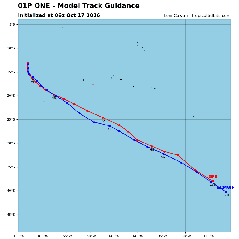
Tropical Cyclone 01P (Wati)
According to the JTWC warning number 3…sustained winds were 60 knots with gusts to 75 knots
Animated enhanced infrared (eir) satellite imagery depicts a compact inner core of deep convection with slightly asymmetric spiral banding features wrapping concentrically into an obscured low-level circulation center (llcc). A 170441z wsf-m color-enhanced 37ghz microwave pass revealed a well-defined microwave eye signature, characterized by a cyan ring encircling the eye and deep convective cores along the western and northern flanks of the inner core.
Environmental conditions are favorable for continued development, characterized by weak deep-layer vertical wind shear (vws), warm sea surface temperatures (ssts), and robust poleward outflow aloft.
TC 01P (Wati) exhibited erratic, looping motion earlier in the day today, but since 00z, has steadied up on a
southeastward trajectory based on multiple microwave image passes. The system is forecast to accelerate southeastward along the southwestern flank of the str throughout the entirety of the forecast period.
Regarding intensity: TC 01P resides within a conducive environment and is projected to intensify steadily, reaching a peak intensity of 75 knots near 24 hours. Should inner-core consolidation accelerate rapidly, an onset of rapid intensification (ri) remains a possibility, potentially driving peak surface winds toward 80-85
knots. By 24 hours, however, deep-layer vws is projected to increase sharply, initiating a weakening trend that will persist through the balance of the forecast.
TC 01P will pass south of the 26c isotherm within 36 hours, and this will accelerate the decay rate. By 60 hours, the cyclone will begin to interact with a baroclinic zone to the south, phasing with the polar jet stream to initiate frontogenesis and marking the start of extratropical transition (ett). Completed transition to a cold-core gale is forecast no later than 72 hours.