

Current Snapshot
For all the latest updates visit: DisasterAWARE
1800x1080e
trudy
181432_earliest_reasonable_toa_34
goes18_ir_21E_202610181535_lat18.9-lon-106.6
181432INTQPF_sm
21E_tracks_latest
7
1800x1080ec
10
champi
29W_181200sair
himawari9_ir_29W_202610181530_lat13.5-lon141.4
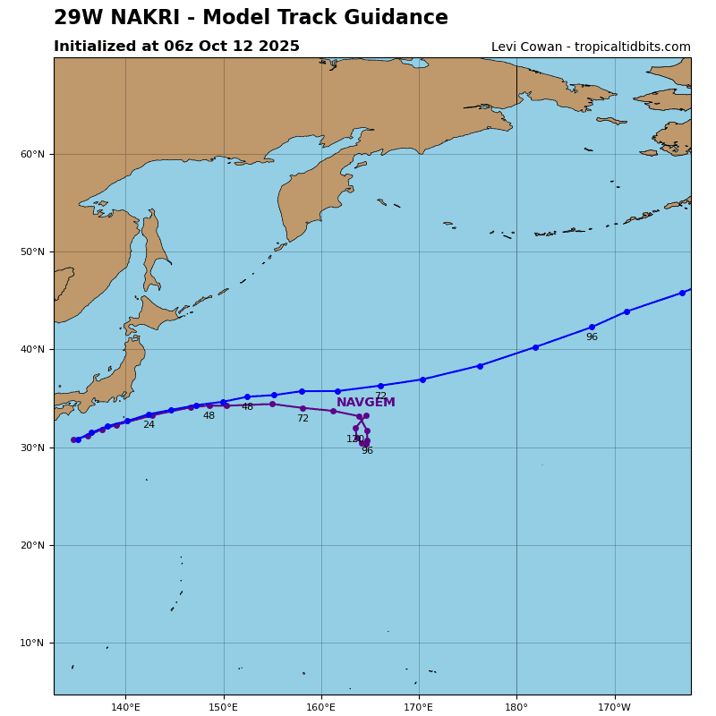
29W_tracks_latest
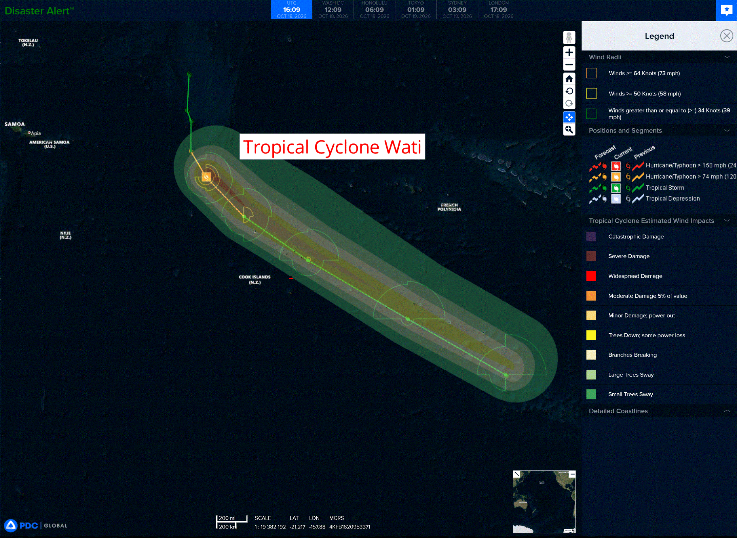
wati
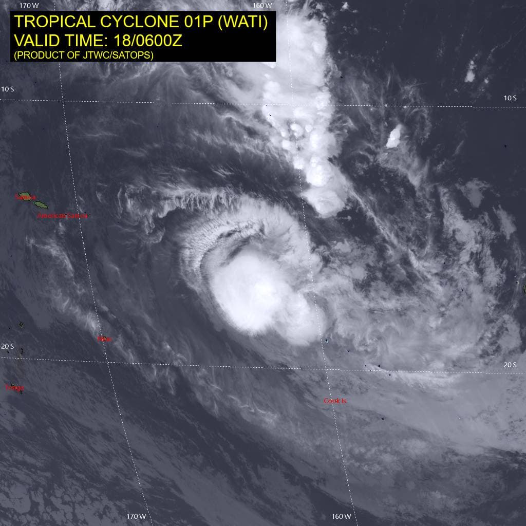
01P_180600sair
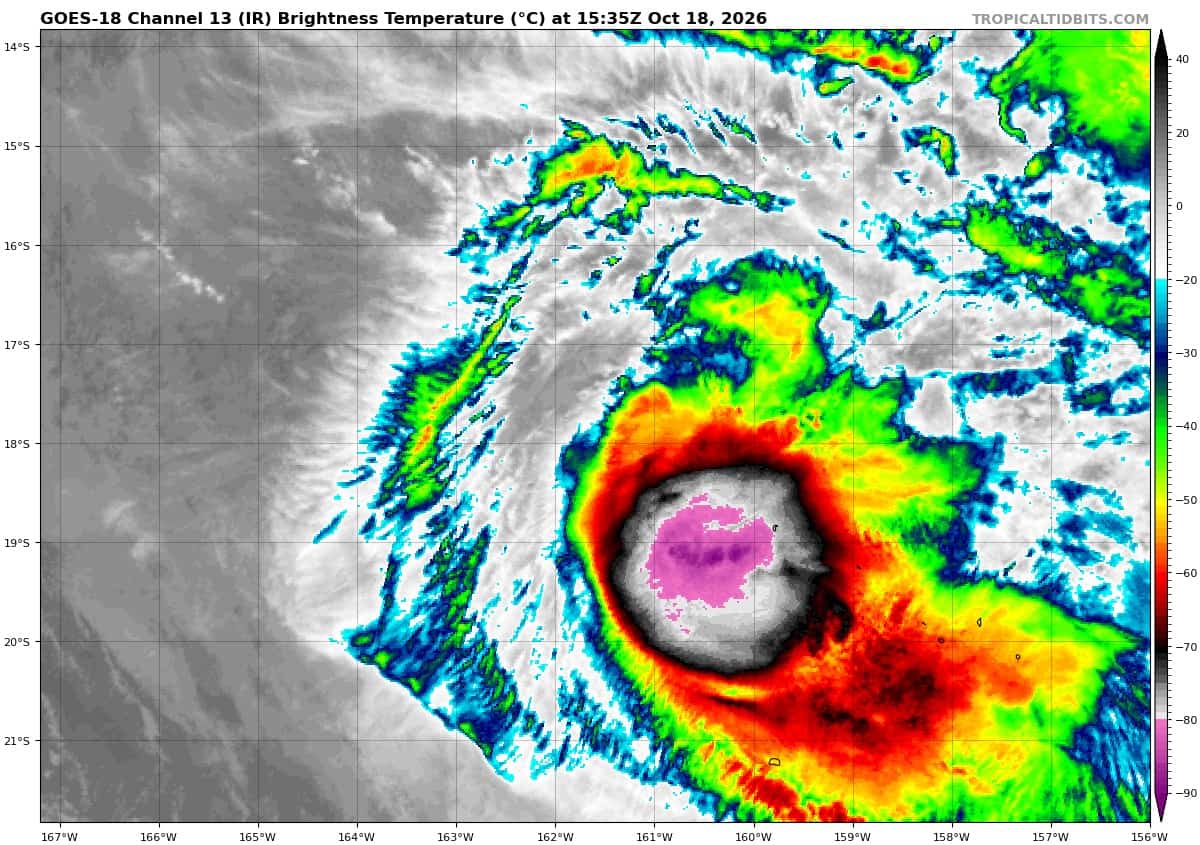
goes18_ir_01P_202610181535_lat-17.4-lon-161.8
01P_tracks_latest
96a
meteosat9_ir_96A_202610181521_lat7.1-lon58.7
96A_tracks_latest
By PDC’s Senior Weather
Specialist Glenn James

The Pacific Disaster Center’s (PDC Global) Sunday, October 18, 2026, Tropical Cyclone Activity Report…for the Pacific Ocean, the Indian Ocean, and adjacent Seas.
Tropical Cyclones
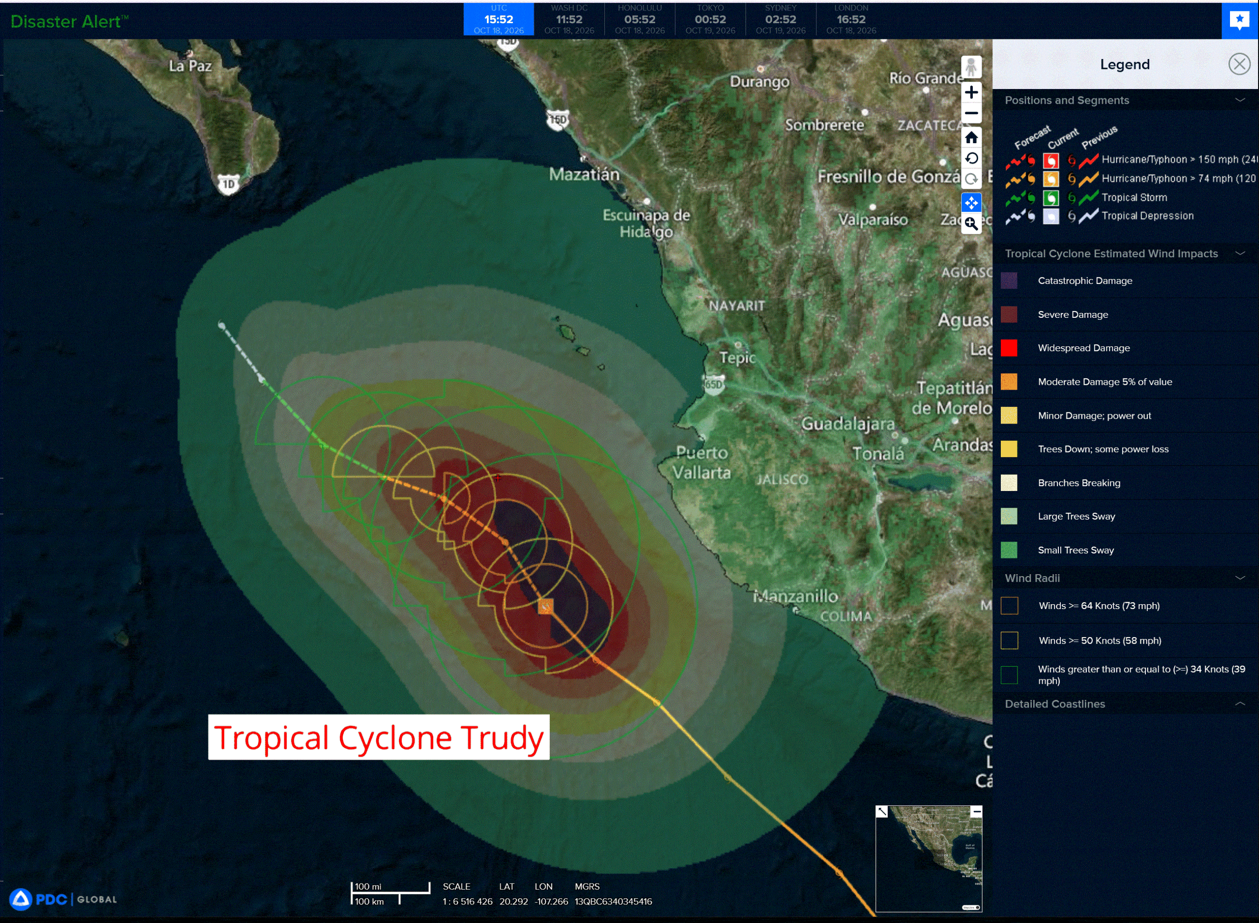
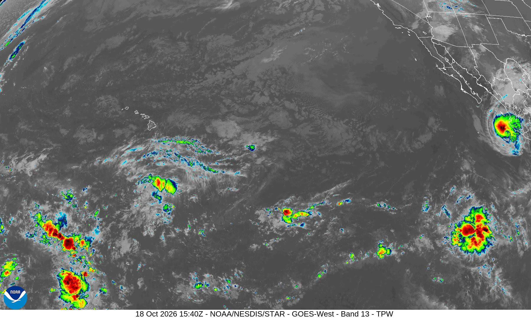
Tropical Cyclone 21E (Trudy) is located about 165 miles west of Manzanillo, Mexico
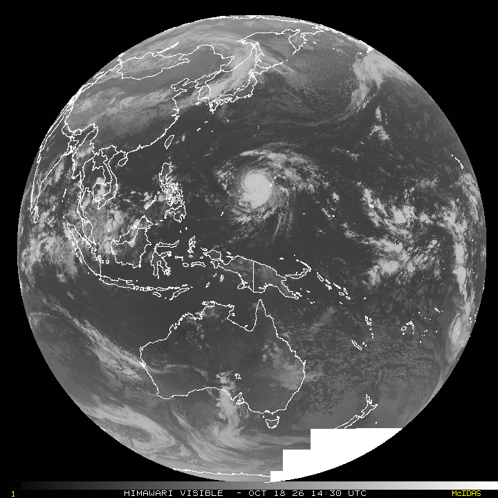
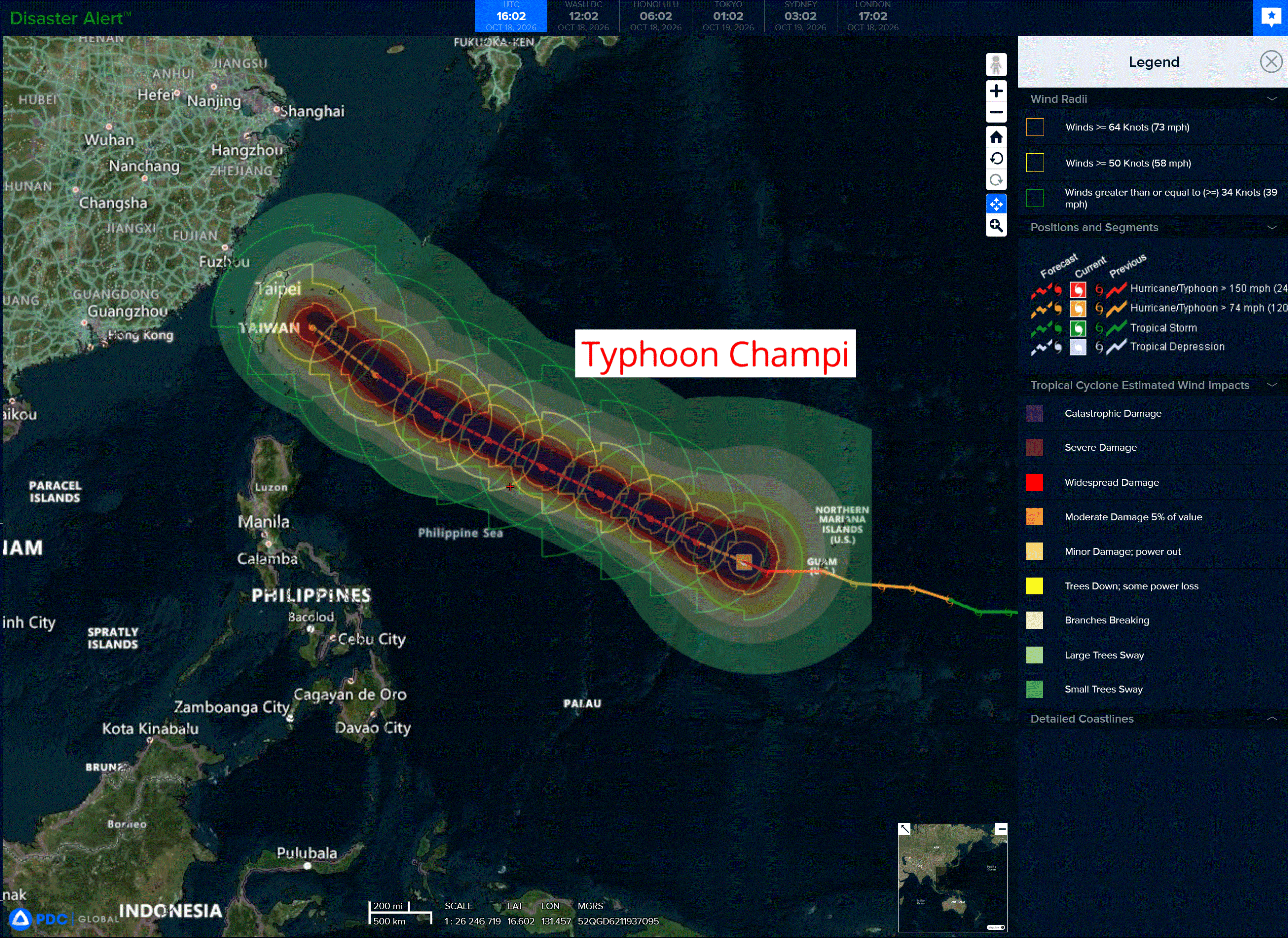
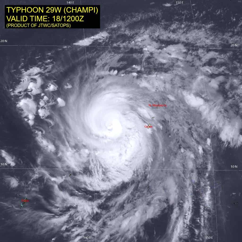
Tropical Cyclone 29W (Champi) is located approximately 187 NM west of Navsta Guam
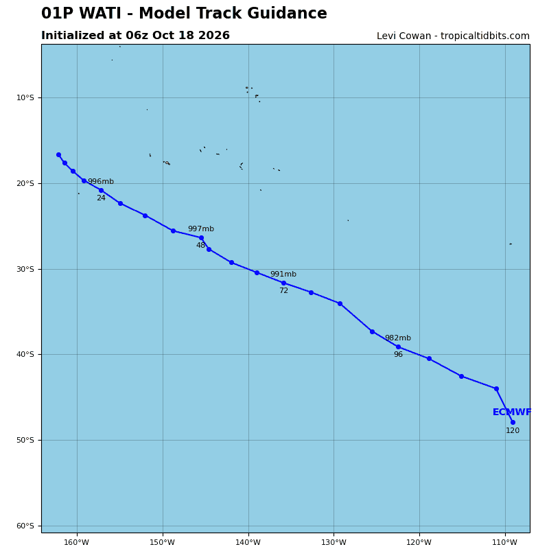
Tropical Cyclone 01P (Wati) is located approximately 340 NM north-northwest of Rarotonga
Northeast Pacific:
Tropical cyclone 21E (Trudy)
TRUDY EXPECTED TO MOVE AWAY FROM THE COAST OF MEXICO THIS AFTERNOON …HEAVY RAINS AND GUSTY WINDS IN PORTIONS OF SOUTHWEST AND WEST-CENTRAL MEXICO
According to the NHC advisory number 21
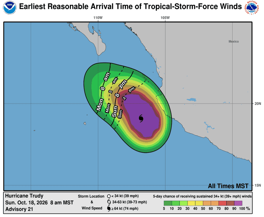
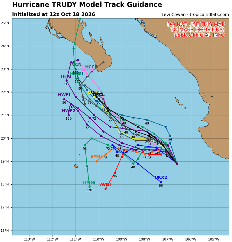
Trudy is moving toward the northwest near 8 mph (13 km/h). A general northwestward motion is expected today, followed by a turn toward the west-northwest tonight. On the forecast track, the center of Trudy will start moving away from the coast of mainland Mexico this afternoon and then move south of Baja California Sur on Monday and Tuesday.
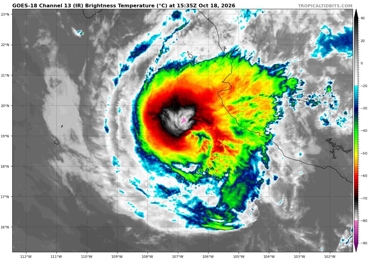
Maximum sustained winds are near 105 mph (165 km/h) with higher gusts. Rapid weakening is expected to begin tonight, and Trudy could degenerate to a post-tropical low by Tuesday night.
Hurricane-force winds extend outward up to 30 miles (45 km) from the center and tropical-storm-force winds extend outward up to 105 miles (165 km). The estimated minimum central pressure is 970 mb (28.65 inches).
HAZARDS AFFECTING LAND
WIND: Tropical storm conditions are expected within the mainland Mexico portion of the Tropical Storm Warning area during the next few hours, and in Las Islas Marias this afternoon.
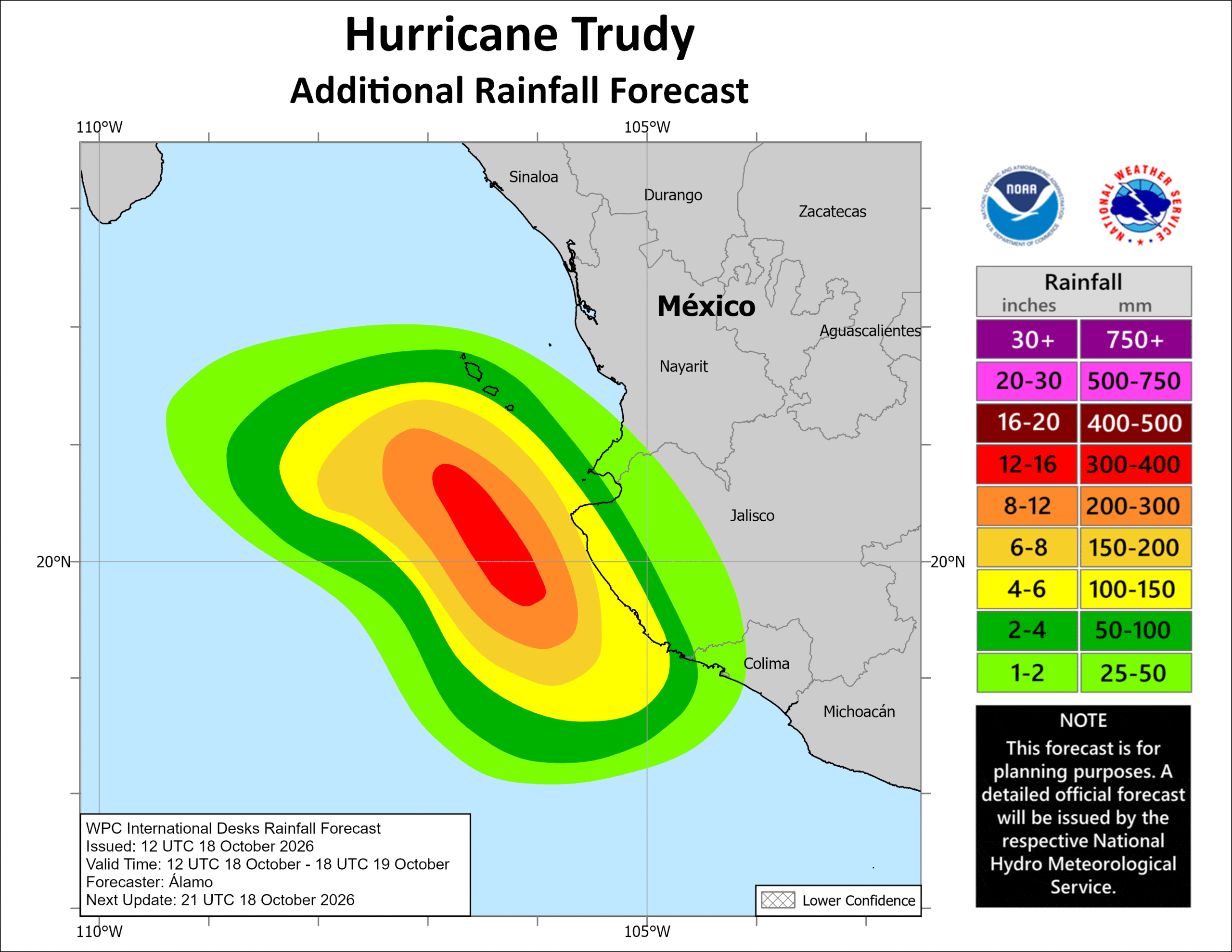
RAINFALL: Through today, Trudy is expected to produce an additional 2 to 6 inches with isolated storm totals around 12 inches along and near the southwest Mexican coast in Jalisco. This rainfall may produce life-threatening flooding and mudslides, especially in areas along steep terrain.
Elsewhere, Trudy’s outer bands are expected to produce an additional 1 to 2 inches with isolated higher totals around 4 inches along the southwest Mexican coast in northern Colima and southern Nayarit. This rainfall may result in localized flash flooding, especially in areas along steep terrain.
STORM SURGE: A dangerous storm surge accompanied by damaging waves is likely in areas of onshore winds within the warning areas.
SURF: Swells generated by Trudy are affecting portions of the coast of southwestern and west-central Mexico. These swells will cause life-threatening surf and rip current conditions.
>>> South of Southern Mexico:
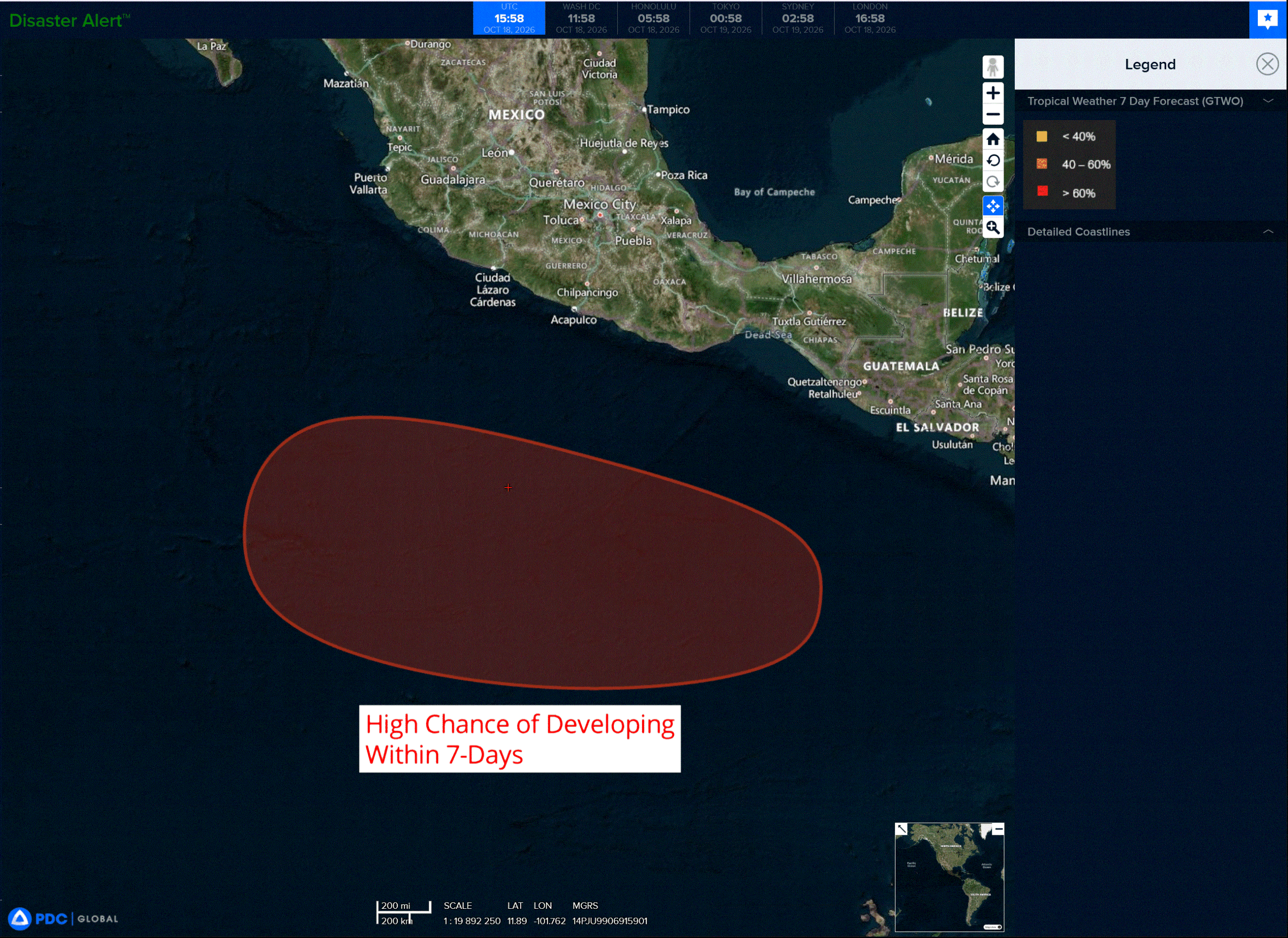
An area of low pressure is forecast to form well offshore of southern Mexico within a couple of days. Environmental conditions appear conducive for gradual development thereafter, and a tropical depression is likely to form around the middle of this week while it moves westward to west-northwestward, well south of Mexico.
* Formation chance through 48 hours…low…near 0 percent
* Formation chance through 7 days…high…80 percent
Central North Pacific: There are no Tropical Cyclones
Tropical cyclone formation is not expected during the next 7 days.
Western Pacific, Indian Ocean, and adjacent Seas:
Western Pacific
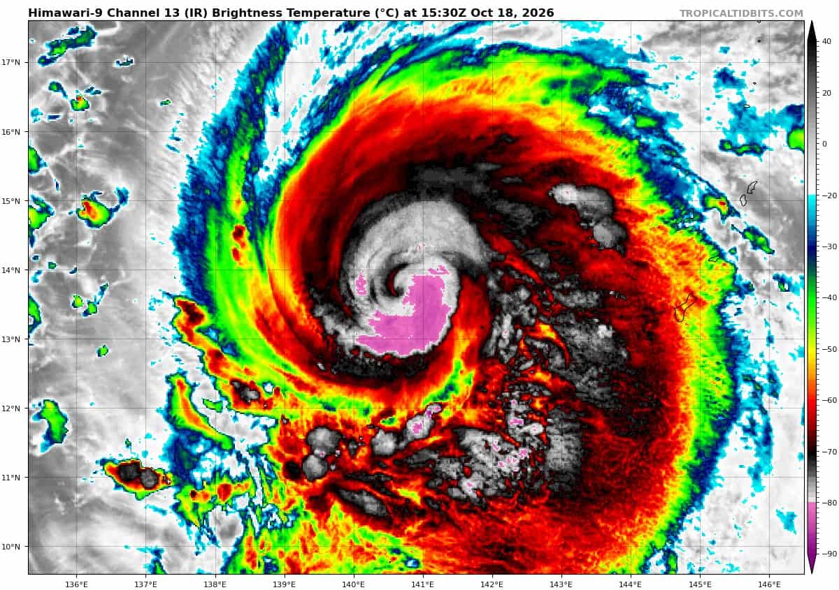
Tropical Cyclone 29W (Champi)
According to the JTWC warning number 13…sustained winds were 120 knots with gusts to 145 knots
Animated enhanced infrared (eir) satellite imagery depicts a compact inner core of deep convection, featuring rapidly developing vortical hot towers (vhts) deepening concentrically and initiating a new eye formation. The recent satellite changes have driven the cimss adt technique to change from uniform cdo to an active pinhole eye scheme, with raw t-numbers rapidly increasing to t6.5. There has been a lack of microwave imagery coverage of 29W since 180621z; consequently, the exact progression of the eyewall replacement cycle (erc) cannot be resolved beyond observations of cloud clearing within the central core. In the upper-levels, the anticyclone positioned to the northwest exhibits weakening and westward displacement, reducing the northerly shear that was influencing the system earlier.
Environmental conditions remain favorable, with low vws, very warm ssts, high ohc and robust radial outflow aloft.
The track of typhoon 29W has shifted west-northwestward over the past six hours, as the deep-layer ridge
extension draped across the northern pacific has pinched off into a discrete secondary anticyclone to the northeast. Smultaneously, the translation speed has decreased slightly as a localized col region develops north of the system, relaxing the steering gradient. This weakness will be suppressed by a eastward extension of the primary str (centered near Hong Kong) within 24 to 36 hours. This cell is projected to translate rapidly eastward north of 29W from 36 to 72 hours, reinforcing the northwestward trajectory and accelerating the cyclone to approximately 13 knots.
By 72 hours, a passing polar trough over the Korean Peninsula will weaken the ridge, opening a steering col across the East China Sea. The resultant relaxation of the steering gradient will induce gradual deceleration through the end of the forecast.
Regarding intensity, the erc appears to have completed, and the synoptic environment favors incipient re-intensification. The system will traverse an extensive pool of the warmest, highest ohc waters in the western pacific over the next 48 hours, providing robust thermodynamic energy to support sustained intensification. the primary limiting factor will be the high probability of additional periods of erc, the timing, duration and scale of which remain highly uncertain.
The cyclone is forecast to re-attain super typhoon intensity within the next 12 hours, peaking near 140 knots by 24 hours. depending on the ercs, the system could reach a higher peak intensity, and significant deviations below 140 knots are also possible. By 72 hours, increasing vertical wind shear and upwelling of
cold water amid the decelerating speed profile will truncate development, prompting a steady decay after 72 hours, as the system approaches Taiwan.
Southwest Pacific
Tropical Cyclone 01P (Wati)
According to the JTWC warning number 5…sustained winds were 65 knots with gusts to 80 knots
Animated enhanced infrared (eir) satellite imagery depicts a ball of roughly symmetrical convection with isolated overshooting tops. An 180450z ssmis 91ghz microwave image revealed an upper-level microwave eye-like feature, surrounded by curved convection. However, a close inspection of the microwave image suggests the system is in the early phases of vortex decoupling, with spiral band analysis suggesting the low level circulation center (llcc) is not aligned with the upper-level center. Analysis of hafs-a cross-sections supports this analysis.
Environmental conditions are marginally unfavorable, with rapidly increasing shear, decreasing ssts and strong poleward outflow aloft. Tropical cyclone 01P will track southeastward along the southwestern flank of the str for the duration of the forecast period.
Regarding intensity, the system has very likely begun the vortex decoupling process under gradually increasing vws. Hafs-a cross-sections and statistical guidance depict a sharp increase in vws commencing in the next 12 hours, Coincident with the system crossing poleward of the 26c isotherm. Full vortex decoupling should occur by 36 hours, as the system races southeastward.
01P commences extratropical transition (ett) by 24 hours, as it begins to interact with the strong jet stream to the south, and a 500mb major shortwave trough. Between 36 and 48 hours, 01P will move into phase with the 500mb trough, move under the jet stream and merge into the low-level baroclinic zone, and
transition to a strong gale-force low pressure area.
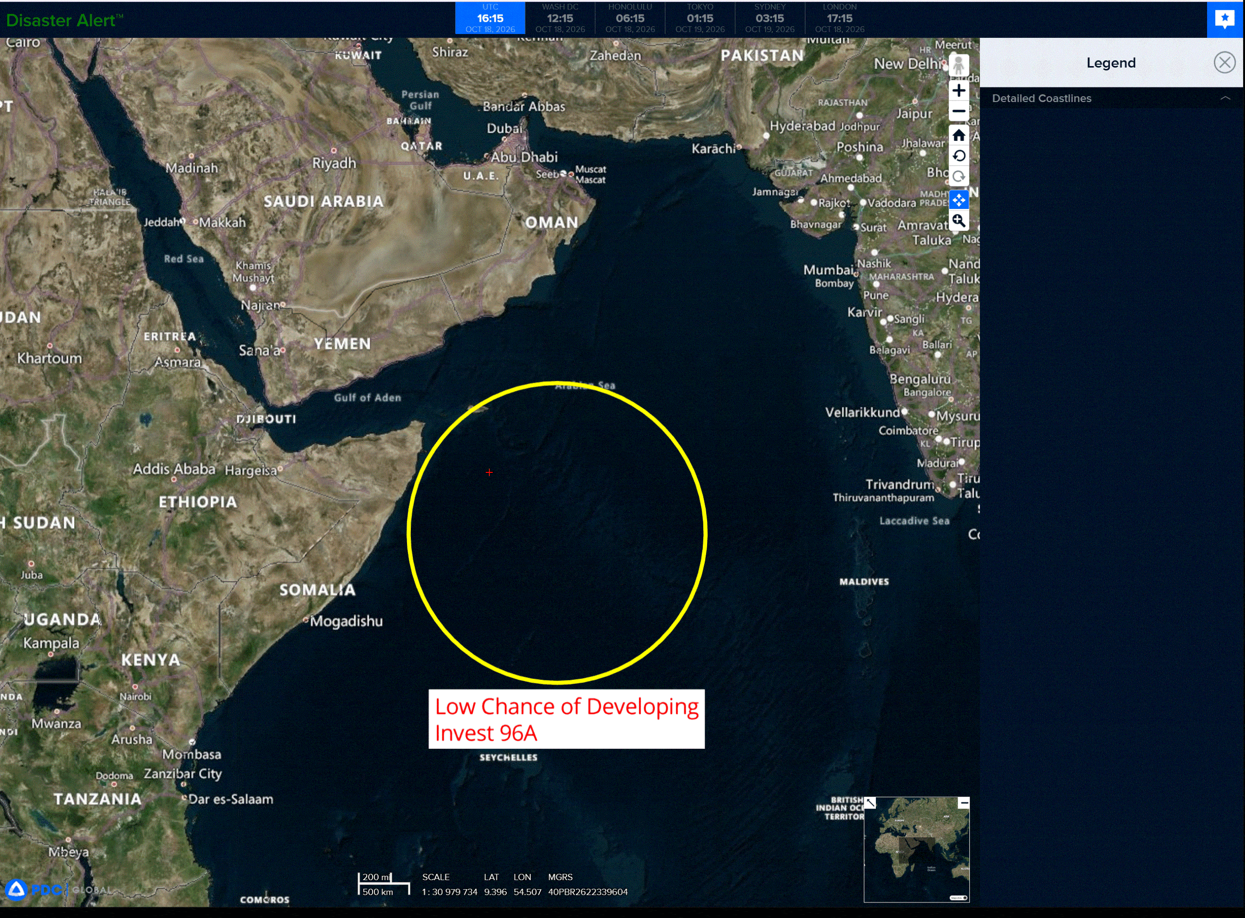
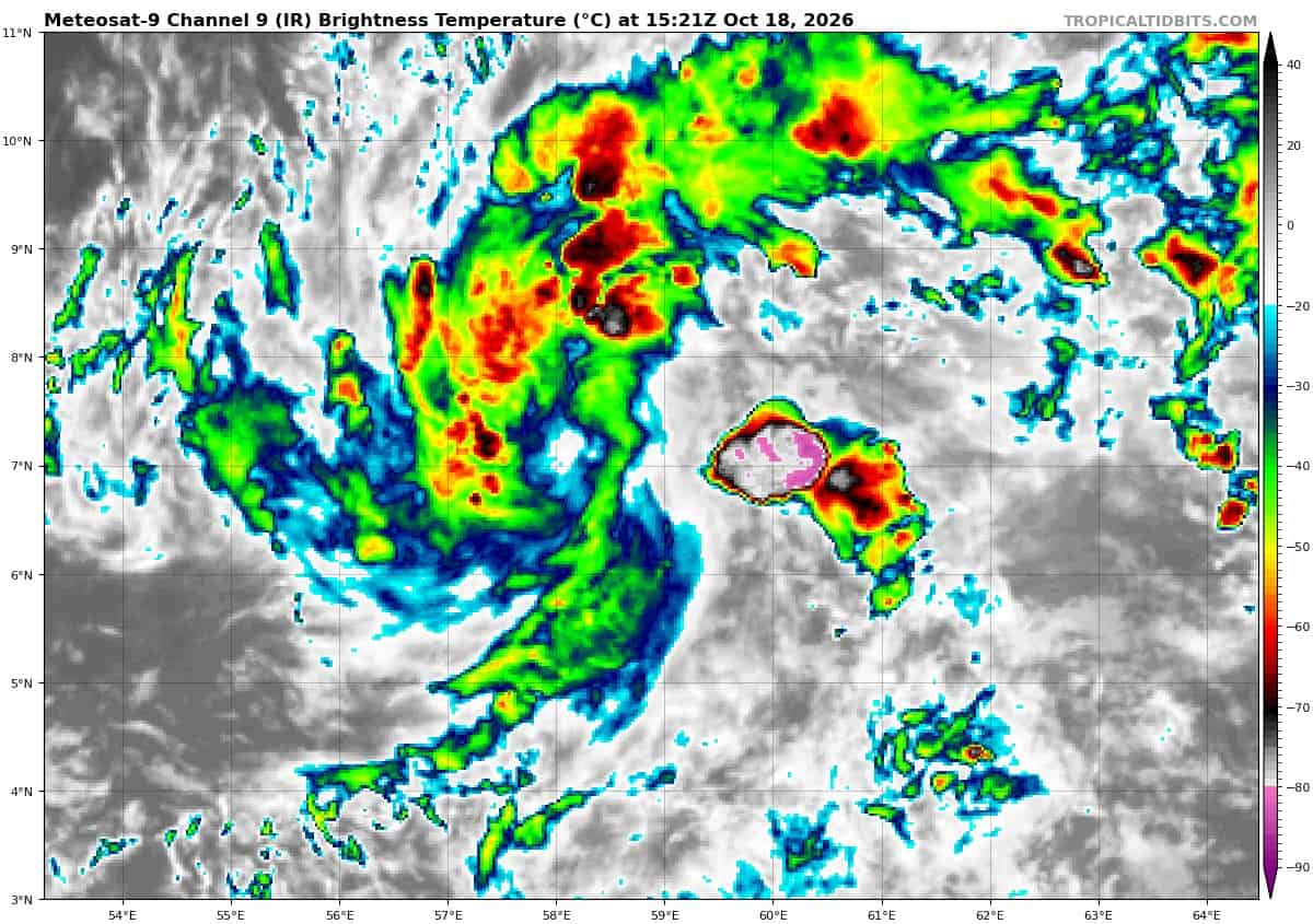
>>> There’s an area of disturbed weather being referred to as Invest 96A, which is located approximately 426 NM southeast of Socotra
Animated enhanced infrared satellite imagery depicts a disorganized area of convection with the hints of a more defined circulation beginning to form. A 180442z ascat-b pass shows a broad circulation with a swath of 25-30 kt winds to the south of the low level circulation center (llcc).
Environmental analysis reveals a favorable environment for development with strong upper level outflow, low to moderate wind shear (10-15 kts), and warm sea surface temperatures (29-30 c).
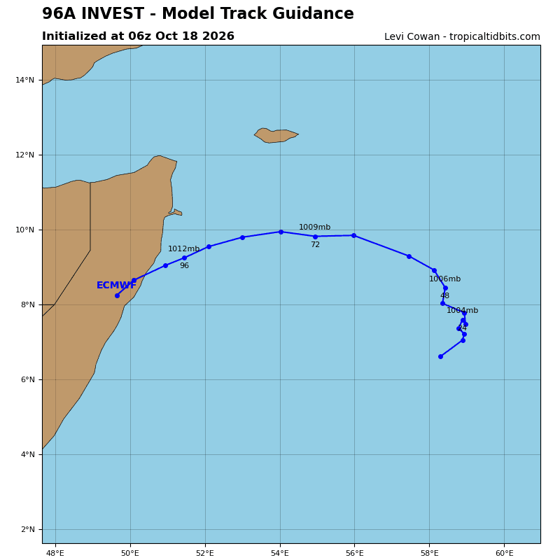
Global models are split on 96A, gefs, navgem, and gfs are the most aggressive out of the ensemble and deterministic models, both show 96A tracking eastward for the 24-36 hours before doubling back and tracking generally northwestward towards the Somali coast. Ecmwf loses interest in the system after about 48 hours and ecens has very few members depicting development.
Maximum sustained surface winds are estimated at 23 to 27 knots.
Minimum sea level pressure is estimated to be near 1009 mb.
The potential for the development of a significant tropical cyclone within the next 24 hours is low.