

Current Snapshot
For all the latest updates visit: DisasterAWARE
1800x1080e
trudy
191455_earliest_reasonable_toa_34
goes18_ir_21E_202610191535_lat19.6-lon-108.2
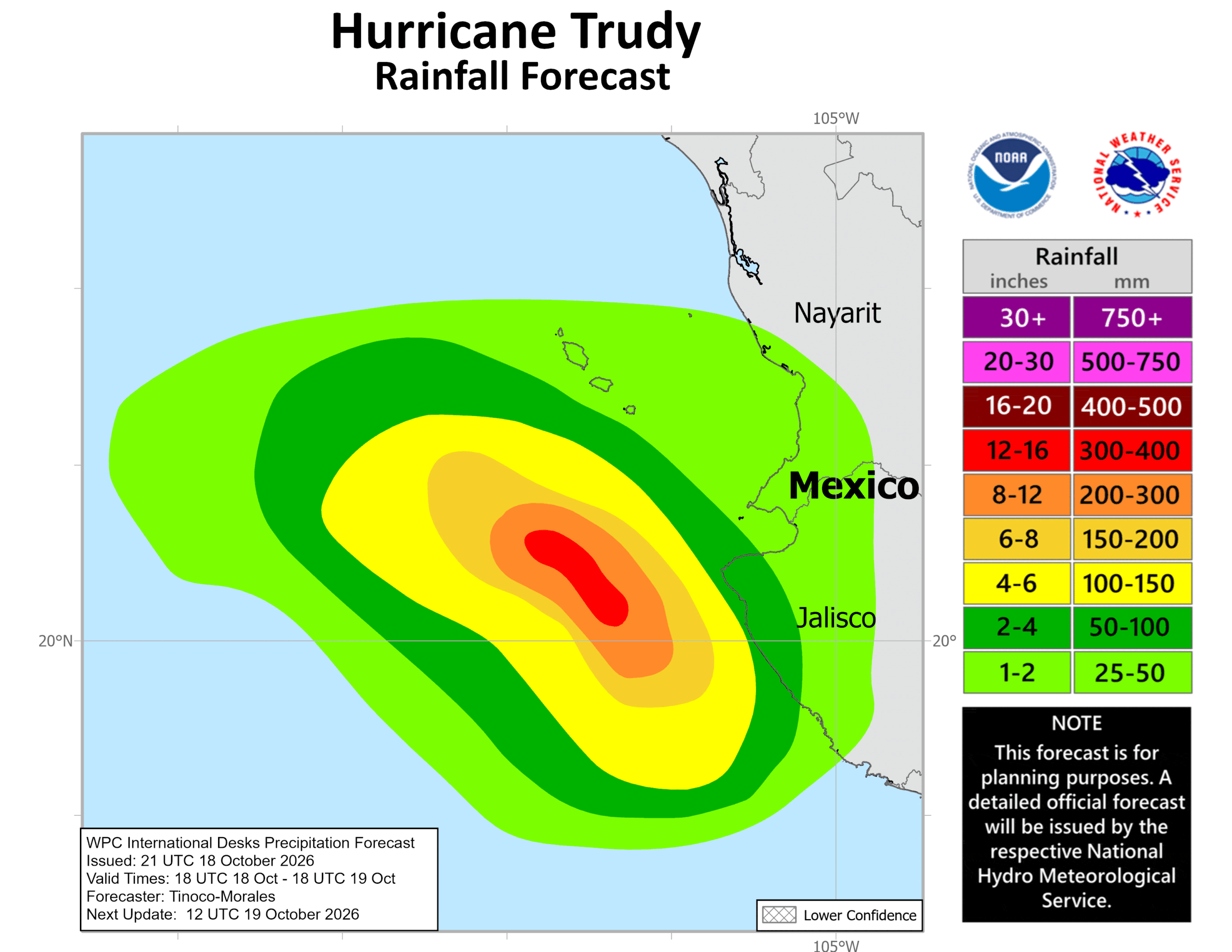
191455INTQPF_sm
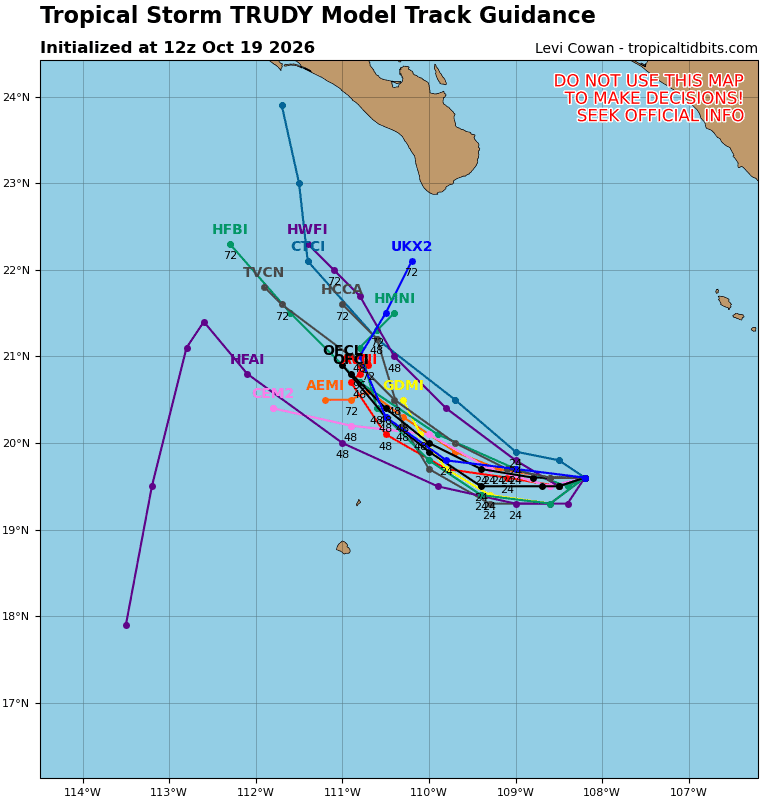
21E_tracks_latest
2
7

1800×1080
10
champi
29W_191200sair
himawari9_ir_29W_202610191530_lat14.8-lon137.6
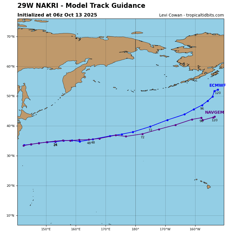
29W_tracks_latest
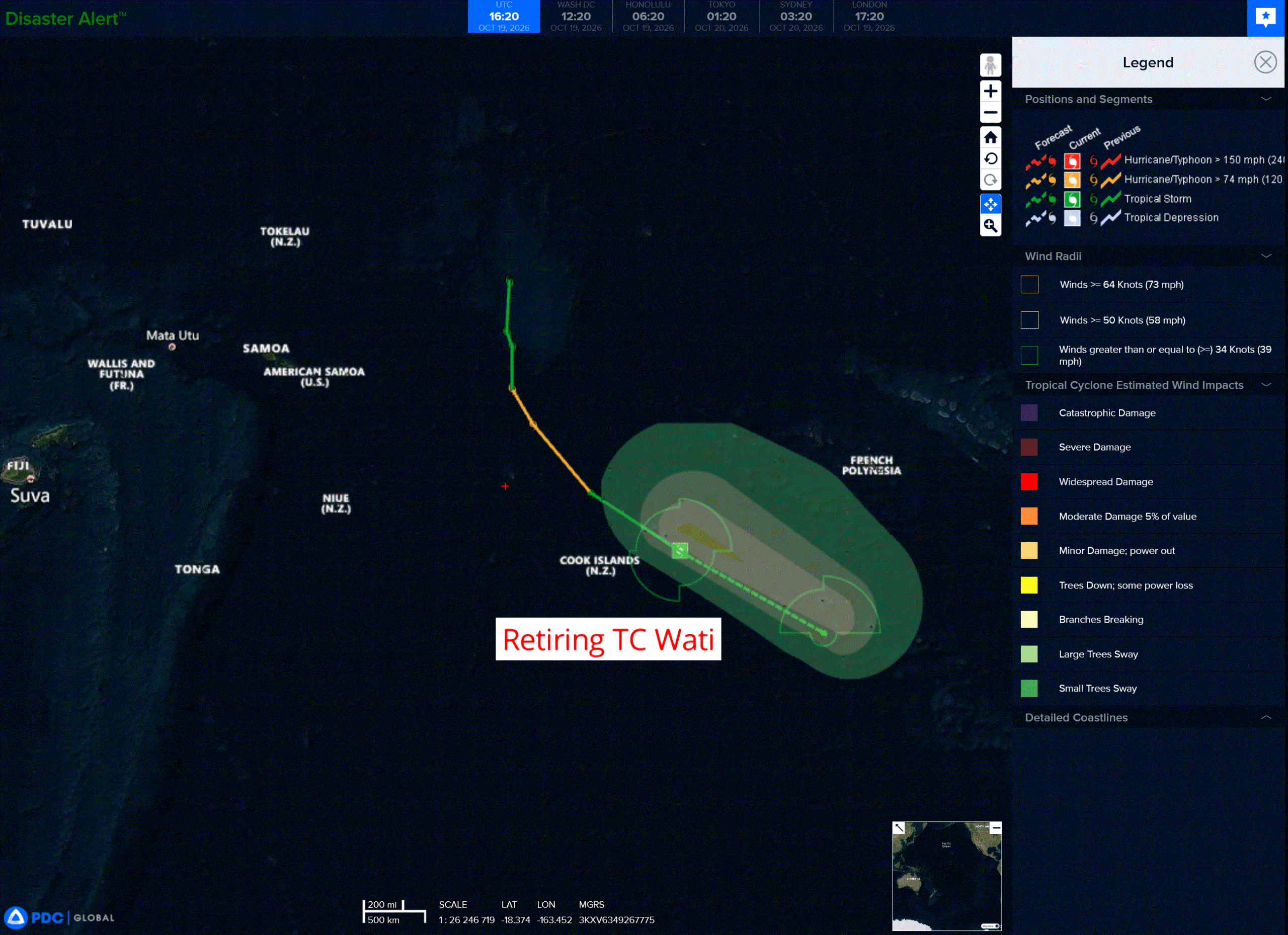
wati
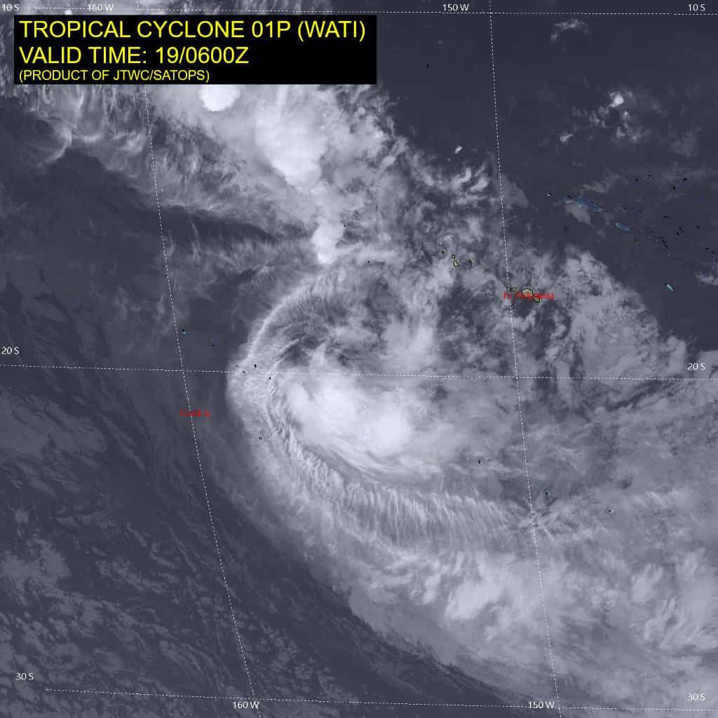
01P_190600sair
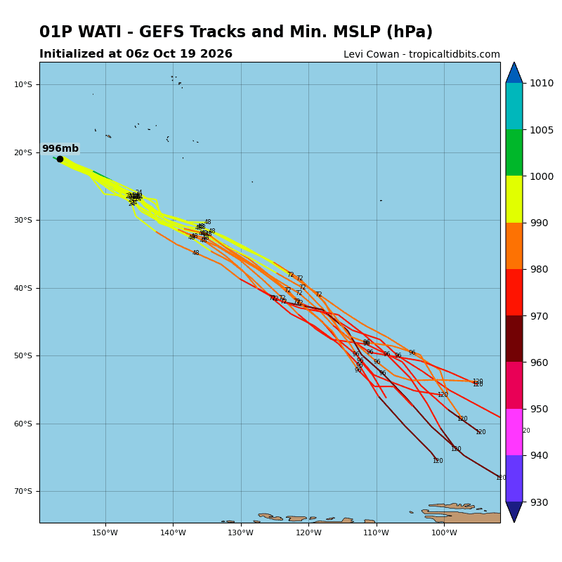
01P_gefs_latest
93s
meteosat9_ir_93S_202610191521_lat-4.0-lon55.9
93S_tracks_latest
By PDC’s Senior Weather
Specialist Glenn James

The Pacific Disaster Center’s (PDC Global) Monday, October 19, 2026, Tropical Cyclone Activity Report…for the Pacific Ocean, the Indian Ocean, and adjacent Seas.
Tropical Cyclones
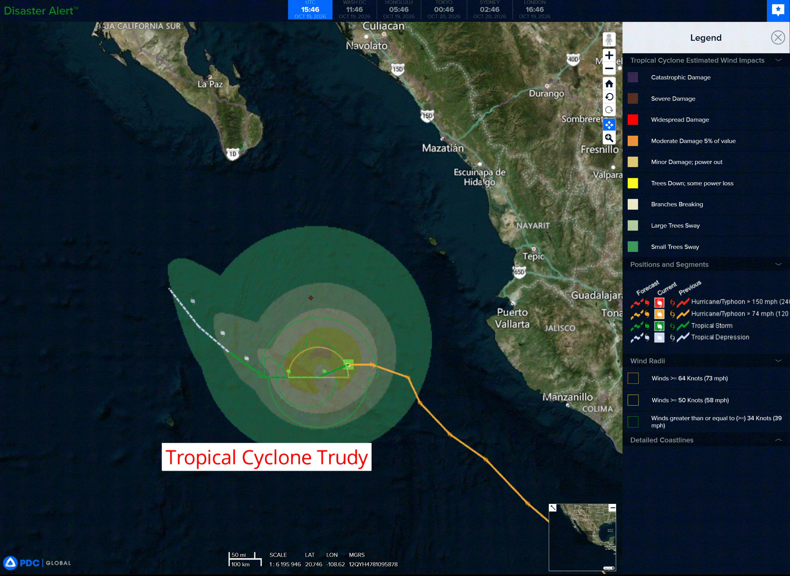
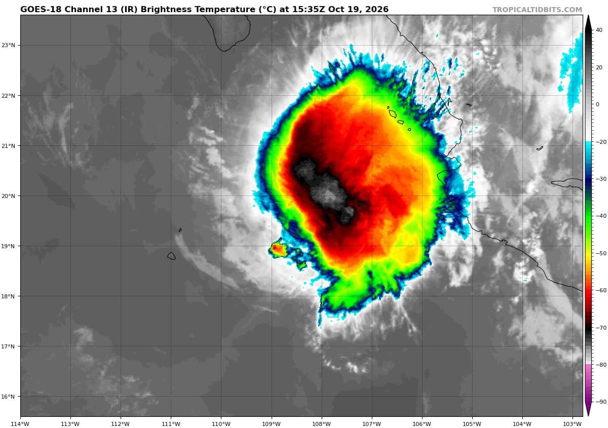
Tropical Cyclone 21E (Trudy) is located about 190 miles west-southwest of Cabo Corrientes, Mexico
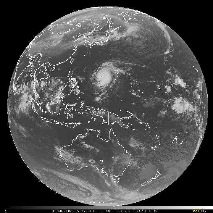
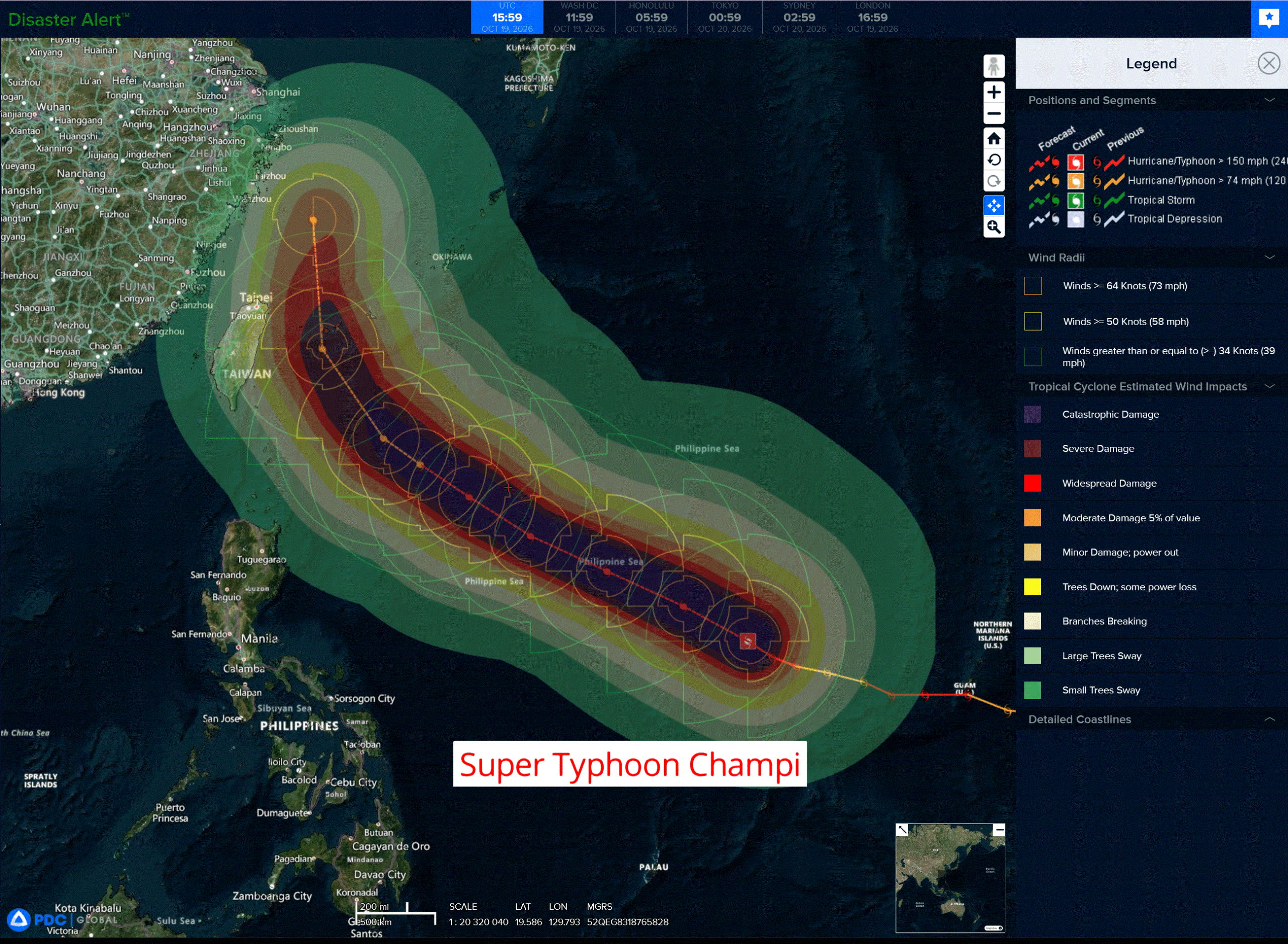
Tropical Cyclone 29W (Champi) is located approximately 319 NM north of Yap
Tropical Cyclone 01P (Wati) is located approximately 171 NM east of Rarotonga – Final Warning
Northeast Pacific:
Tropical cyclone 21E (Trudy)
TRUDY HOLDING STEADY OFF THE COAST OF WEST-CENTRAL MEXICO
According to the NHC advisory number 25
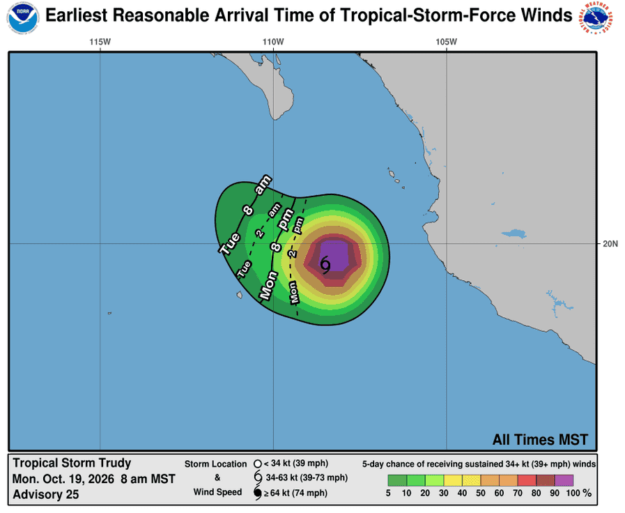
Trudy is moving toward the west-southwest near 7 mph (11 km/h). A westward to west-southwestward motion is expected through tonight, followed by a gradual turn toward the northwest on Tuesday. Maximum sustained winds are near 60 mph (95 km/h) with higher gusts. Weakening is expected over the next couple of days, and Trudy is forecast to degenerate to a post-tropical cyclone by early Tuesday. Tropical-storm-force winds extend outward up to 70 miles (110 km) from the center. The estimated minimum central pressure is 999 mb (29.50 inches).
HAZARDS AFFECTING LAND
SURF: Swells generated by Trudy will continue affecting portions of the coast of southwestern and west-central Mexico today. These swells are likely to cause life-threatening surf and rip current conditions.
>>> South of Southern Mexico:
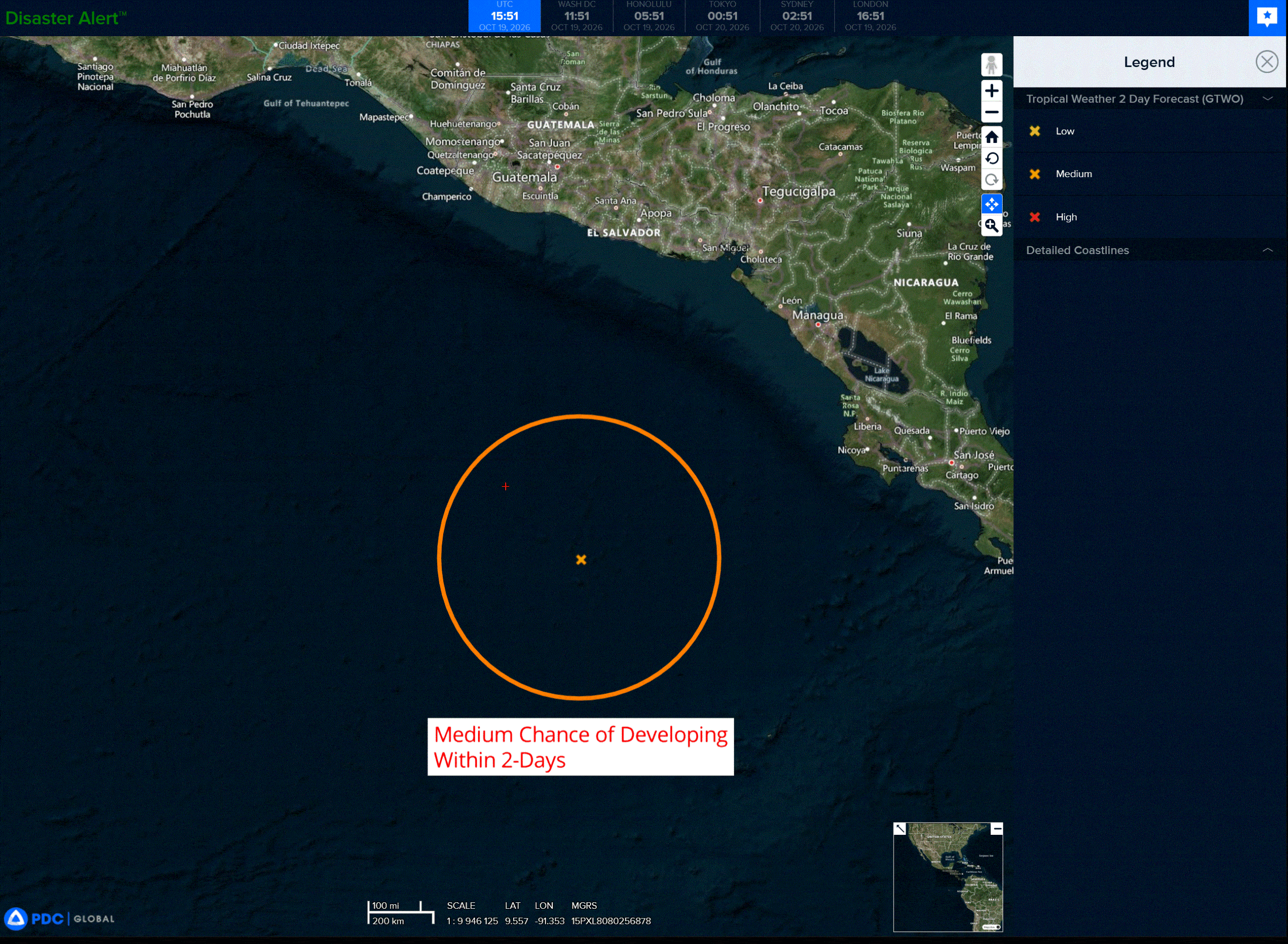
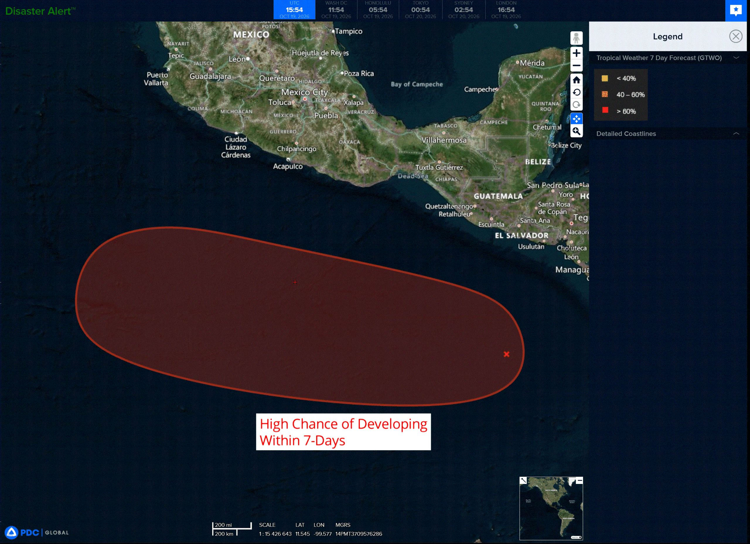
Showers and thunderstorms, associated with a trough of low pressure located several hundred miles south of Guatemala, remain disorganized. Environmental conditions appear conducive for development, and a tropical depression is expected to form around the middle of this week as the system moves westward to west-northwestward at around 10 mph, well to the south of the coast of southern Mexico.
* Formation chance through 48 hours…low…50 percent
* Formation chance through 7 days…high…90 percent
Central North Pacific: There are no Tropical Cyclones
Tropical cyclone formation is not expected during the next 7 days.
Western Pacific, Indian Ocean, and adjacent Seas:
Western Pacific
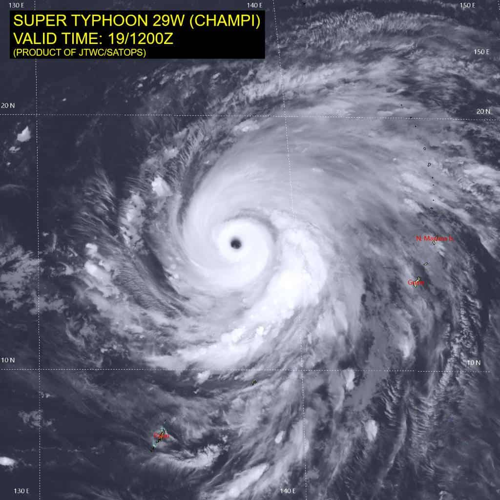
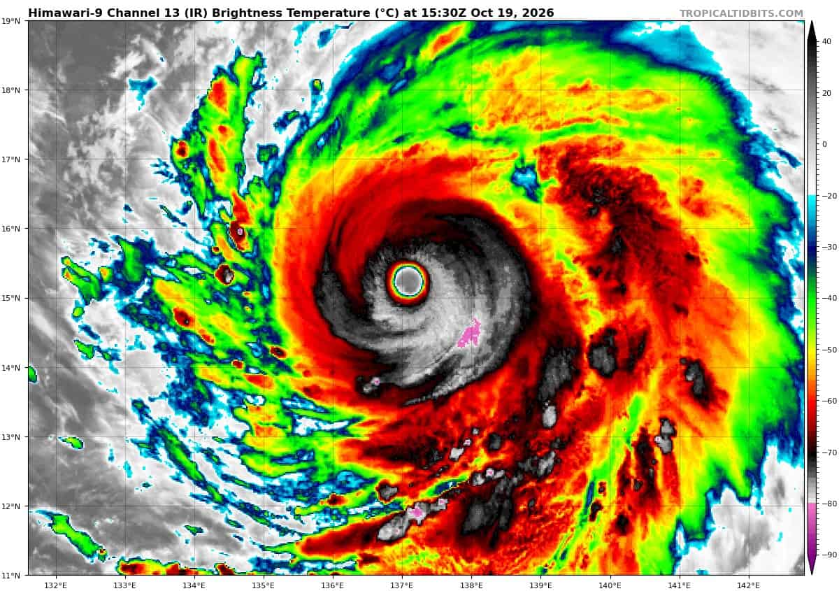
Tropical Cyclone 29W (Champi)
According to the JTWC warning number 21…sustained winds were 140 knots with gusts to 170 knots
Animated enhanced infrared (eir) satellite imagery depicts a compact inner core of deep convection surrounding a 25nm wide eye, with eye temperatures near 20c. The convective depth and symmetry of the
eyewall have degraded slightly over the past few hours in the eir depiction, and cloud-top temperatures have warmed by 1 to 2c. Animated water vapor imagery and atmospheric motion vectors (amv) depict cyclonic outflow up to 150mb, extending radially outward from the center to the edge of the central dense overcast (cdo), before turning anticyclonically into robust poleward and equatorward outflow channels. A 190808z ssmis 91ghz microwave image revealed a distinct inner eyewall, a well-defined moat, and a cohesive secondary eyewall approximately 30nm from the circulation center, providing definitive evidence of
secondary eyewall formation (sef) and the imminence of an eyewall replacement cycle (erc).
The initial intensity is held at 140 knots with high confidence, based on subjective dvorak current intensity
estimates of t7.0 and supported by cimss d-print and satcon objective estimates. Independent of the internal structural dynamics associated with the imminent erc, the synoptic environment remains highly conducive for development, characterized by low vertical wind shear (vws), elevated sea surface temperatures (ssts), high ocean heat content (ohc) (exceeding 125 kj per cm2), and strong dual-channel outflow aloft.
Super typhoon (sty) 29W is beginning to gradually accelerate as it transitions steering influence from the str to the northeast to the southern periphery of an extension of the str near Taiwan, which is building eastward south of Japan. As the ridge to the north continues to build over the next 12 to 24 hours, sty 29W will continue to accelerate to 13-14 knots from 12 to 36 hours. A deep mid-latitude trough will propagate across the Korean Peninsula around 36 hours, inducing a break in the subtropical ridge and resulting in the bifurcation of the str into two distinct ridge cells; one south of Honshu and the other over southeastern China, with a pronounced col region over the East China Sea (ecs).
The primary synoptic evolution expected after 48 hours is that the western ridge over southeastern China is forecast to retrograde toward the sino-Vietnam border region, while the eastern ridge south of Japan remains quasi-stationary. This evolution will broaden the barometric weakness to the north, which will be further eroded by the passage of a series of transient shortwave troughs over the course of the forecast period. After 48 hours, as sty 29W approaches the col region, it will decelerate to 7-8 knots due to the relaxation of the deep-layer steering gradient. By 72 hours, sty 29W will initiate a poleward recurvature into the ridge weakness, assisted by the amplification and reorientation of the western periphery of the eastern str into a meridional axis. While overall confidence in the primary forecast scenario is medium, an alternative scenario remains plausible, in which sty 29W maintains a continuous northwestward trajectory directly into Taiwan.
Regarding intensity, as the imminent erc progresses, sty 29W is expected to weaken by at least 10 knots, with potential for more pronounced short-term degradation. Assuming the erc completes within the next 12 hours, sty 29W should re-intensify rapidly, peaking at 145 knots by 24 hours as it traverses a pool of elevated ohc waters. Hafs-a and hwrf both explicitly depict subsequent erc initiation shortly after 24 hours; however, due to the expected deceleration of the system and consequent oceanic upwelling, that erc is unlikely to complete.
The combination of upwelling-induced sea surface cooling and increasing vertical wind shear will drive a steady weakening trend through 96 hours. as the system recurves into the ecs, it will encounter enhanced mid-latitude westerly shear and synoptic dry air entrainment, accelerating the weakening trend through the remainder of the forecast period.
Southwest Pacific
Tropical Cyclone 01P (Wati) – Final Warning
According to the JTWC warning number 7…sustained winds were 45 knots with gusts to 55 knots
Animated enhanced infrared (eir) satellite imagery depicts a rapidly decoupling system, with a partially exposed low level circulation center (llcc) displaced to the northwest of an area of deep convection and mid-level rotation that is being sheared to the southeast by strong northwest vertical wind shear (vws). A 090435z ssmis 89ghz microwave image revealed the exposed llcc and disorganized convection to the southeast.
01 will continue to accelerate southeastward along the southwestern flank of a subtropical ridge (str) to the northeast through the forecast period. Phase space diagrams and phase classification worksheets suggest the system is currently subtropical in nature, or has already begun extratropical transition (ett). Over the next 12 hours, the system will move into phase with a 500mb trough and move under the jet stream, and complete ett as a gale-force low pressure area.
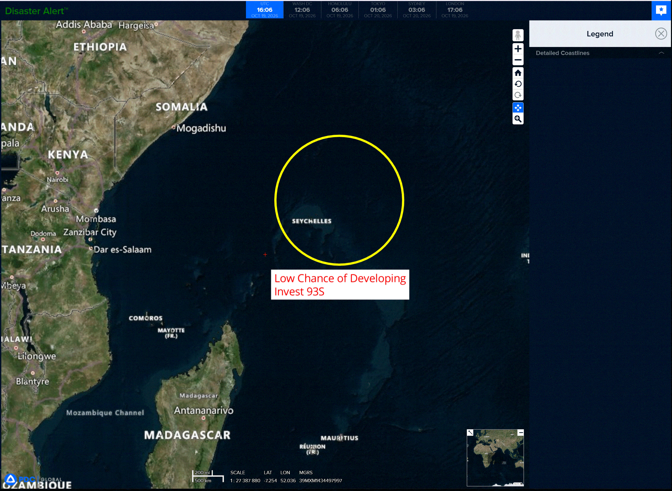
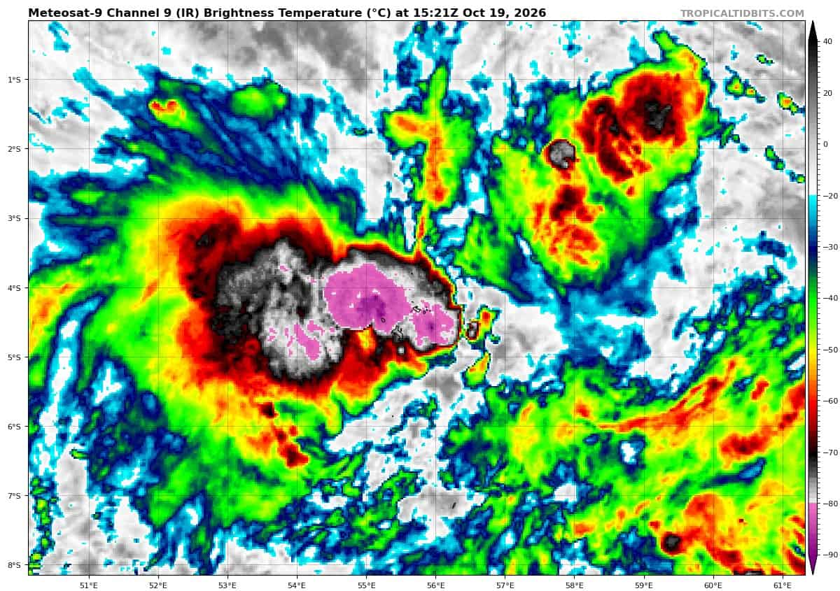
>>> There’s an area of disturbed weather being referred to as Invest 93S, which is located approximately 100 NM northeast of Seychelles
Animated enhanced infrared imagery (eir) depicts an area of partially exposed, broad turning on the northeastern side while the southwestern flank is obscured by flaring convection. An 181723z metop-b ascat pass depicts an area of elongated turning with enhanced winds on the northern and southern sides, somewhat displaced from the assessed center of turning. An 182117z amsr3 microwave pass depicts an elongated but consolidating low level circulation (llc).
Environmental analysis reveals low to moderate vertical wind shear (15-20kts), warm sea surface temperatures (28-29c), and moderate radial outflow aloft.
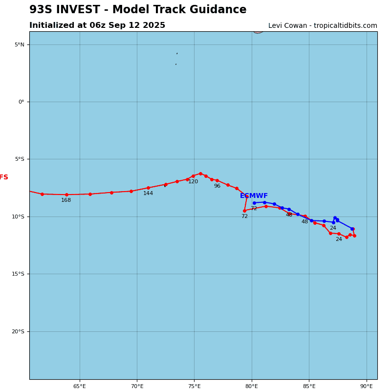
Global models are in agreement on 93S tracking southwestward.
Maximum sustained surface winds are estimated at 18 to 22 knots.
Minimum sea level pressure is estimated to be near 1010 mb.
The potential for the development of a significant tropical cyclone within the next 24 hours remains low.