

Current Snapshot
For all the latest updates visit: DisasterAWARE
1800x1080e
2e
goes18_ir_20E_202610161515_lat20.4-lon-109.2
161455INTQPF_sm
20E_tracks_latest
161455_earliest_reasonable_toa_34
goes19_ir_21E_202610161515_lat14.4-lon-102.4
t
21E_tracks_latest
7e
1800×1080
10
champi
29W_161200sair
29W_tracks_latest
01p
01P_160600sair

01P_tracks_latest
By PDC’s Senior Weather
Specialist Glenn James

The Pacific Disaster Center’s (PDC Global) Friday, October 16, 2026, Tropical Cyclone Activity Report…for the Pacific Ocean, the Indian Ocean, and adjacent Seas.
Tropical Cyclones
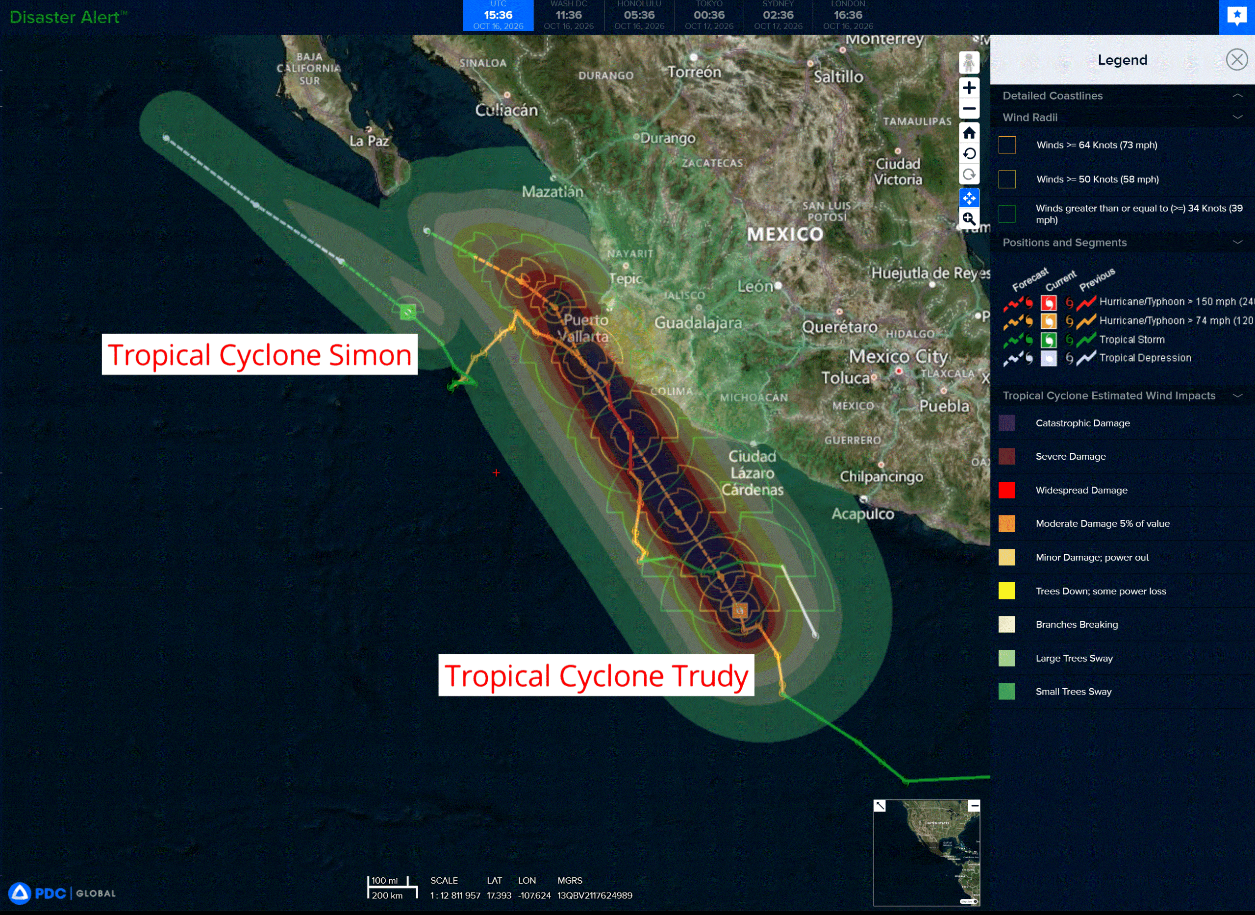
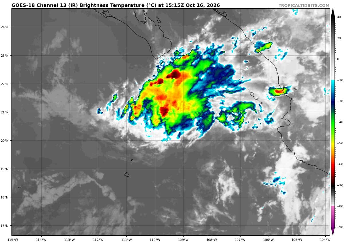
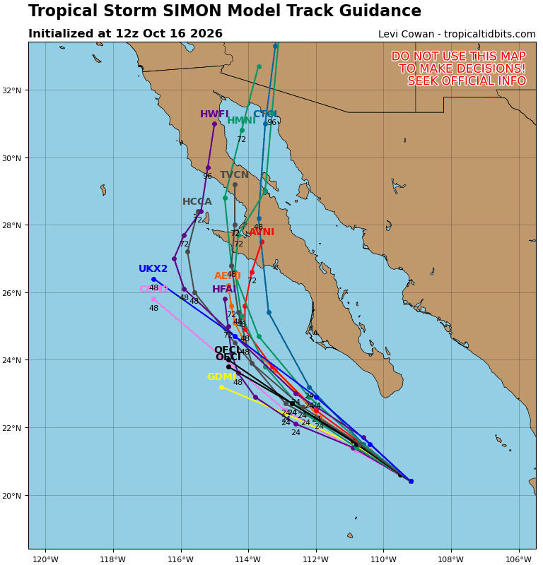
Tropical Cyclone 20E (Simon) is located about 245 miles west of Cabo Corrientes, Mexico
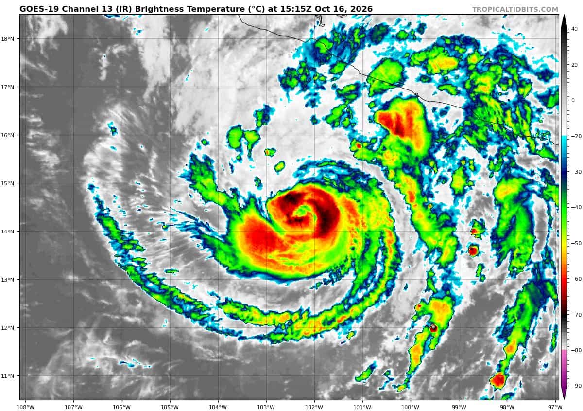
Tropical Cyclone 21E (Trudy) is located about 325 miles south-southeast of Manzanillo, Mexico
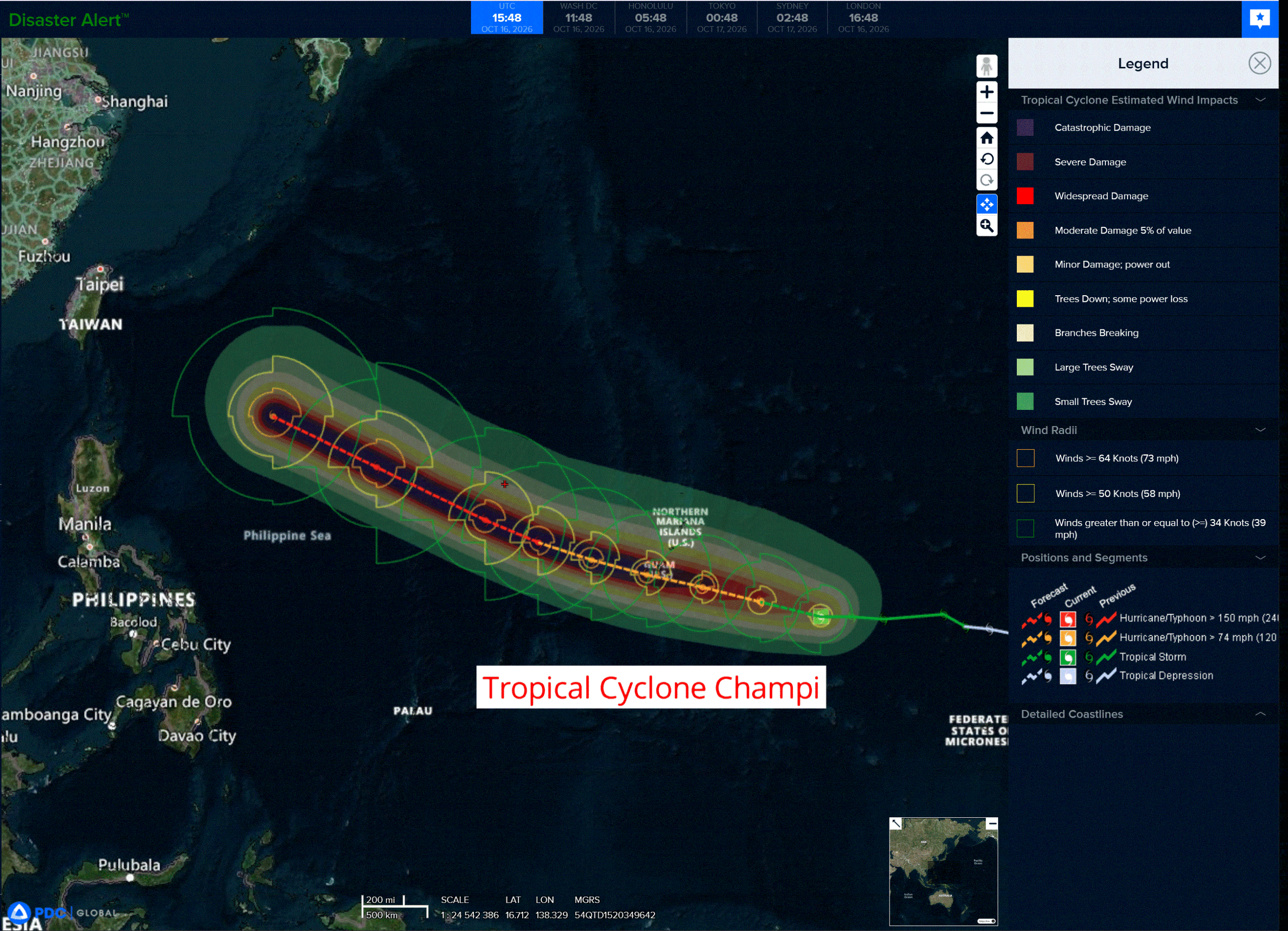
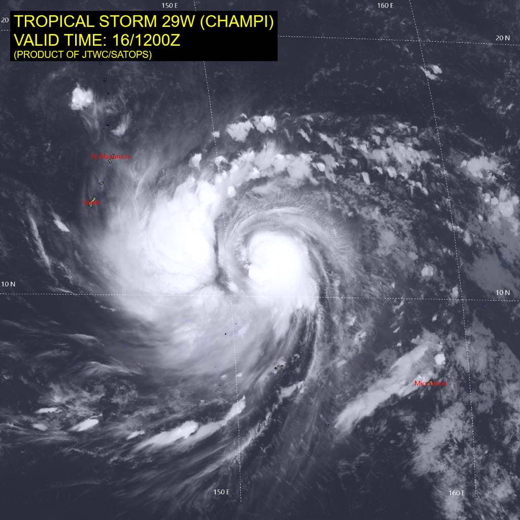
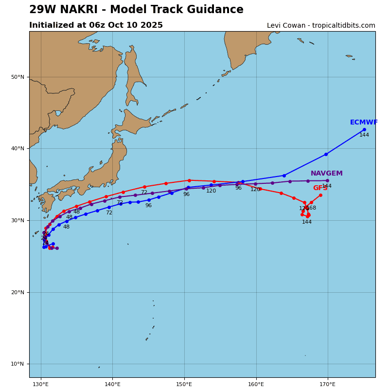
Tropical Cyclone 29W (Champi) is located approximately 405 NM east-southeast of Andersen AFB
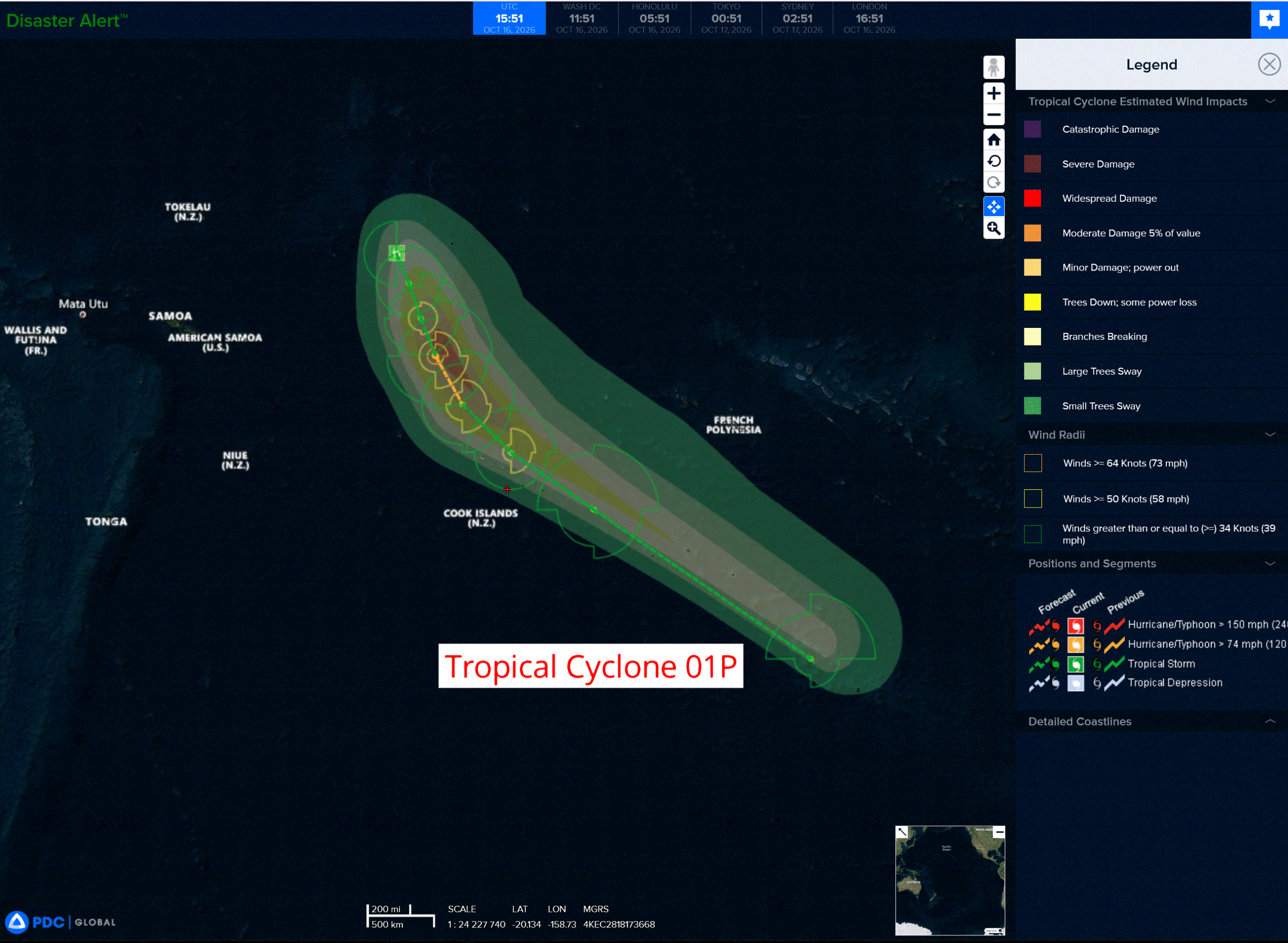
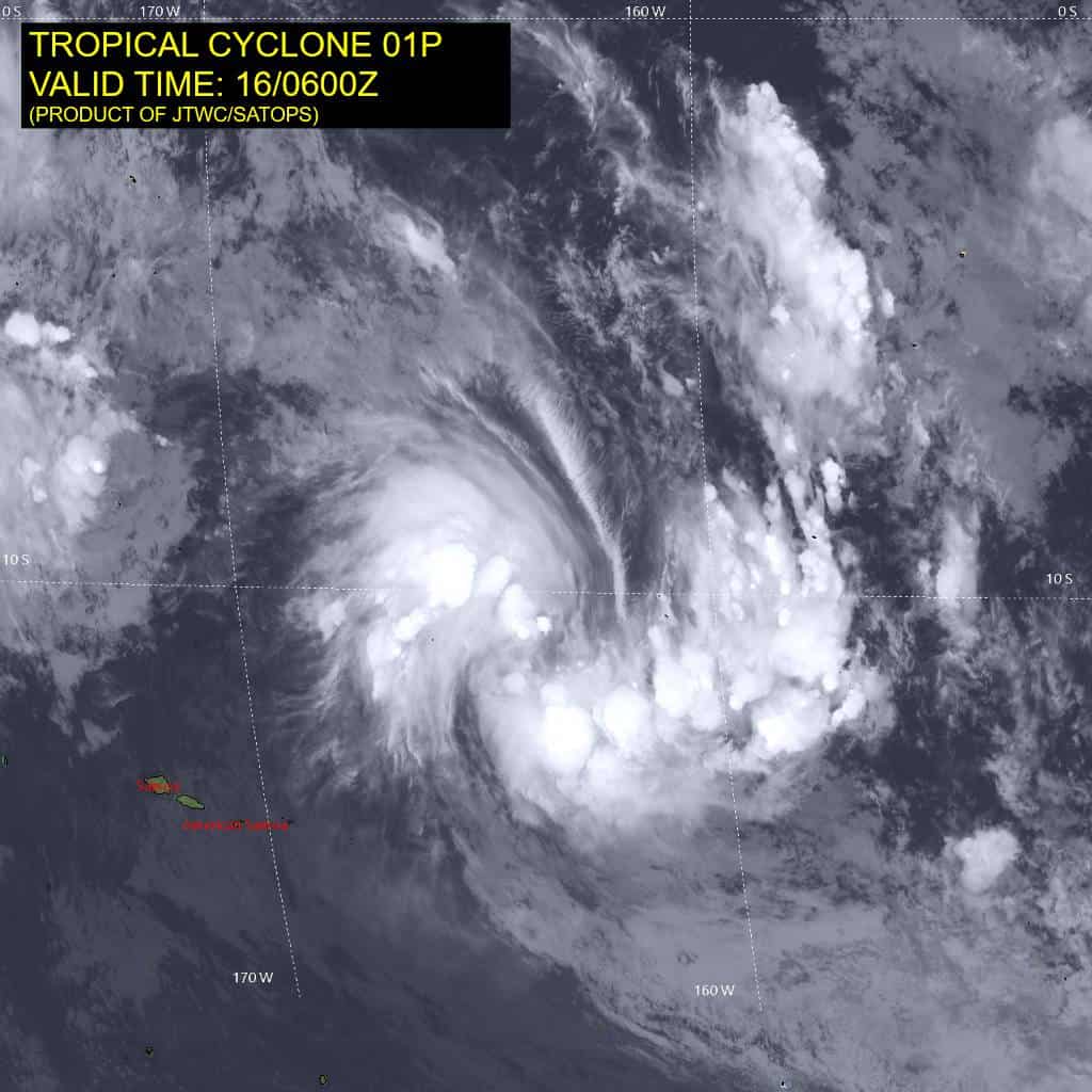
Tropical Cyclone 01P is located approximately 482 NM east-northeast of Pago Pago
Northeast Pacific:
Tropical cyclone 20E (Simon)
SIMON MOVING NORTHWESTWARD OFF THE COAST OF SOUTHERN BAJA CALIFORNIA
According to the NHC advisory number 37
Simon is moving toward the northwest near 9 mph (15 km/h) and this general motion is expected to prevail through the weekend.
Maximum sustained winds are near 40 mph (65 km/h) with higher gusts. Weakening is expected, and Simon is forecast to become a post-tropical remnant low on Saturday.
Tropical-storm-force winds extend outward up to 25 miles (35 km) from the center. The estimated minimum central pressure is 1002 mb (29.59 inches).
HAZARDS AFFECTING LAND
SURF: Swells generated by Simon could affect portions of the coast of west-central Mexico and Baja California Sur during the next day or so. These swells are likely to cause life-threatening surf and rip current conditions.
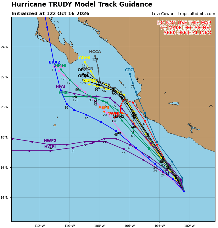
Tropical cyclone 21E (Trudy)
HURRICANE WARNING ISSUED FOR PORTIONS OF THE COAST OF MEXICO …TRUDY FORECAST TO APPROACH THE SOUTHWESTERN AND WEST-CENTRAL COAST OF MEXICO THIS WEEKEND
According to the NHC advisory number 13
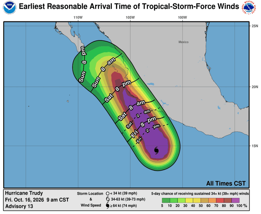
Trudy is moving toward the north-northwest near 5 mph (7 km/h). A north- northwestward to northwestward motion at a slightly faster forward speed is forecast during the next few days. On the forecast track, the center of Trudy will approach the coast of southwestern and west-central Mexico on Saturday and pass near the coast Saturday night into Sunday.
Maximum sustained winds are near 120 mph (195 km/h) with higher gusts. Trudy is a category 3 hurricane on the Saffir-Simpson Hurricane Wind Scale. Strengthening is expected through Saturday, and Trudy is forecast to remain a major hurricane when it makes its closest approach to Mexico. Weakening is predicted later this weekend and into early next week.
Hurricane-force winds extend outward up to 30 miles (45 km) from the center and tropical-storm-force winds extend outward up to 140 miles (220 km). The estimated minimum central pressure is 956 mb (28.23 inches).
HAZARDS AFFECTING LAND
WIND: Hurricane conditions are expected in the Hurricane Warning area by late Saturday or Saturday night, with tropical storm conditions spreading across the area on Saturday. Tropical storm conditions are expected within the Tropical Storm Warning area by late tonight or early Saturday. Hurricane conditions are possible in the Hurricane Watch area by late Saturday, with tropical storm conditions beginning on Saturday. Tropical storm conditions are possible in the Tropical Storm Watch area on Sunday.
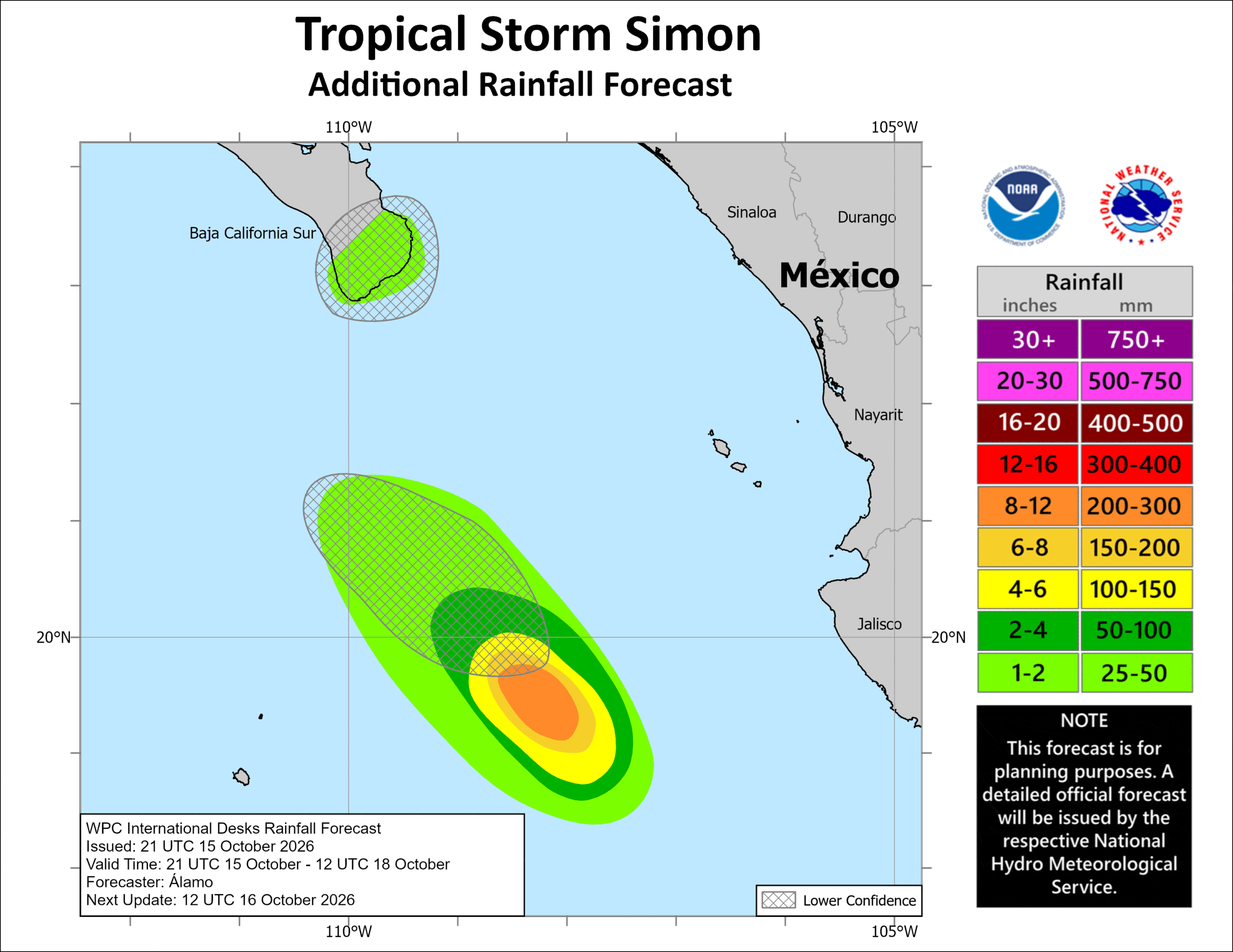
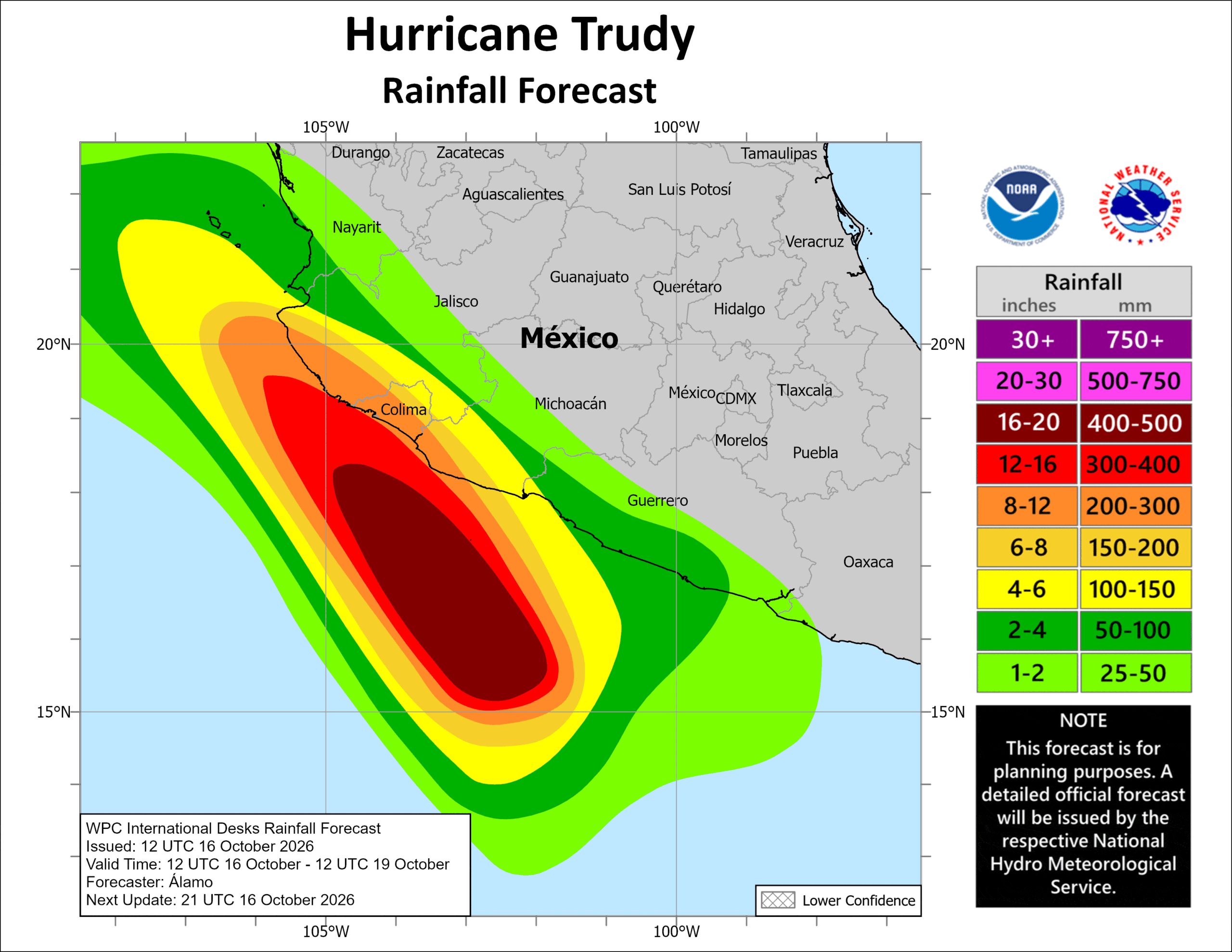
RAINFALL: Through the weekend, Trudy is expected to produce 4 to 8 inches with isolated higher totals around 15 inches along and near the southwest Mexican coast in Michoacán, Colima and Jalisco. This rainfall may produce life-threatening flooding and mudslides, especially in areas along steep terrain.
Elsewhere, Trudy’s outer bands are expected to produce 2 to 4 inch with isolated higher totals around 6 inches along the southwest Mexican coast in Guerrero. This rainfall may result in localized flash flooding through the weekend, especially in areas along steep terrain.
STORM SURGE: Coastal flooding from storm surge is possible in areas of onshore winds. Near the coast, the surge will be accompanied by large and destructive waves.
SURF: Swells generated by Trudy are affecting portions of the coast of southwestern Mexico and will spread northward toward west-central Mexico during the next few days. These swells are likely to cause life-threatening surf and rip current conditions.
>>> South of Southern Mexico:
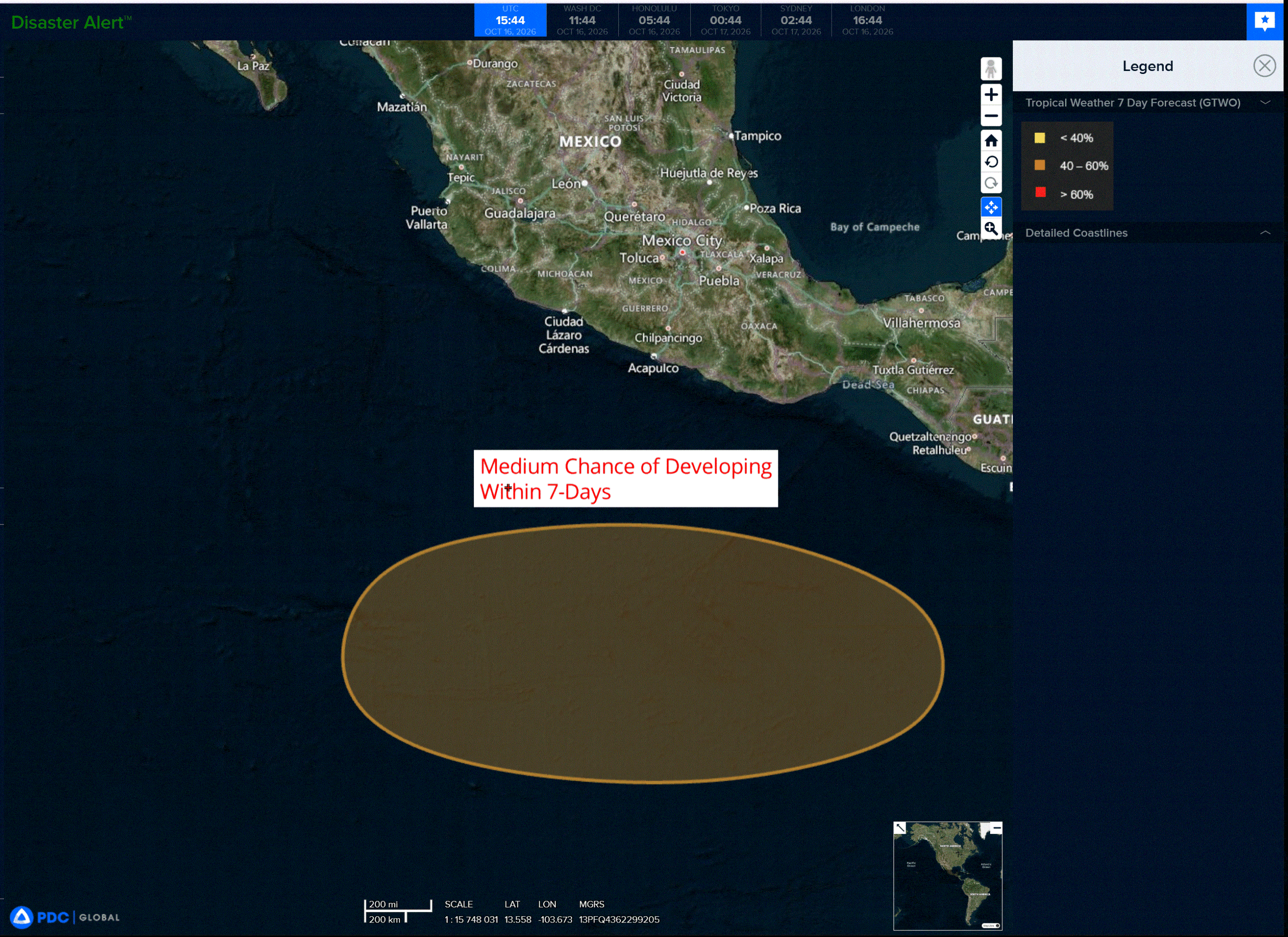
An area of low pressure is forecast to form offshore of southern Mexico during the early to middle part of next week.
Environmental conditions appear conducive for gradual development thereafter, and a tropical depression could form during the latter half of next week while it moves generally westward to west-northwestward over the eastern and central portions of the East Pacific.
* Formation chance through 48 hours…low…near 0 percent
* Formation chance through 7 days…medium…60 percent
Central North Pacific: There are no Tropical Cyclones
Tropical cyclone formation is not expected during the next 7 days.
Western Pacific, Indian Ocean, and adjacent Seas:
Western Pacific
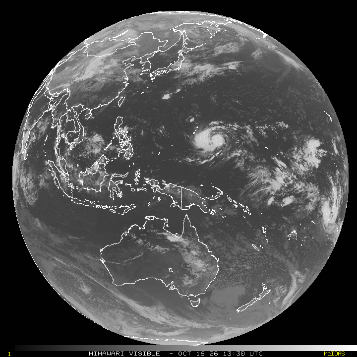
Tropical Cyclone 29W (Champi)
According to the JTWC warning number 9…sustained winds were 60 knots with gusts to 75 knots
Tropical storm 29W is poised to rapidly intensify and is approaching typhoon strength. following the compact cyan ring feature depicted in the 160611z gmi 37 ghz image, a transient warm spot briefly appeared in animated enhanced infrared (eir) satellite imagery. Since then, explosive convection has formed along the eastern periphery, obscuring the warm spot, while a large banding feature persists west of the storm center. A 161145z ascat-c pass reveals improved symmetry of the low-level circulation but likely
undersampled the maximum winds within the very compact inner core.
The system is located over warm sea surface temperatures (sst) of 29-30 degrees celsius and high ocean heat content (ohc) of near 100 kj per cm2. These factors, along with strong westward outflow and 10-15 kts of vertical wind shear (vws), are favorable for continued intensification.
TS 29W is being steered westward by a weakening str to the northeast. In the next 24 hours, a sharp trough approaching the Korean Peninsula will support the development of a new ridge over Honshu. The new str will quickly build eastward, maintaining a west to west-northwestward motion through 60 hours. Thereafter, the system will round the southwestern periphery of the ridge and turn northwestward.
The environment will remain favorable for the next few days, with TS 29W traversing sst of 29-30 degrees celsius under low to moderate vws. With a closed inner core now established, the system is likely entering a
prolonged episode of rapid intensification (ri). The forecast calls for TS 29W to attain typhoon strength shortly, followed by a passage over or very near Guam with maximum sustained winds near 100 kts. The strongest winds will remain confined to a small area near the center, while the gale-force wind radii extend northward to Tinian and Saipan.
After 60 hours, vws will ease to 5-10 kts as the system moves over even warmer sst of 30-31 degrees celsius and ohc values of 120-140 kj per cm2. However, by this time, difficult-to-predict internal tropical cyclone dynamics may cause the intensity to level off or weaken. The wind field will gradually expand as it passes the southern Mariana Islands.
Southwest Pacific
Tropical Cyclone 01P
According to the JTWC warning number 1…sustained winds were 35 knots with gusts to 45 knots
Animated enhanced infrared (eir) satellite imagery depicts deep convection wrapping around an obscured low-level circulation center (llcc). During the past six hours, the convective structure has improved, with enhanced radial outflow and particularly robust poleward outflow. A 160520z ssmis pass indicated extensive rainbands in all but the northeast quadrant, as well as a partial inner core.
The environment is conducive to further development, consisting of warm sea surface temperatures (sst) of 28-29 degrees celsius, very rich deep-layer moisture, and moderate upper-level divergence. Although the 800-250 mb vertically averaged wind field indicates low shear of 5-10 kts, the mid-level shear is elevated at
15-20 kts.
TC 01P will continue on a south-southeastward trajectory along the western periphery of a str through 36 hours. Thereafter, the system will round the southern periphery of the str and turn eastward, accelerating into the deep-layer westerly flow. Moderate mid-level shear will persist through 24 hours. However, warm
sst and a very moist atmosphere will support steady intensification to a peak of 65 kts by 36 hours. After 36 hours, ssts will decrease to below 26 degrees celsius, while vws will steadily increase to 40 kts by 60 hours.
Consequently, the forecast calls for steady weakening from 36 through 60 hours. Therefore, the forecast calls for steady weakening from 36 to 60 hours, followed by a slower rate of weakening as the system broadens out and undergoes extratropical transition (ett). TC 01P will enter the baroclinic zone by 72 hours and move beneath the jet stream. ETT will complete by 96 hours.