

Current Snapshot
For all the latest updates visit: DisasterAWARE

1800x1080e
2e
151442_earliest_reasonable_toa_34
goes18_ir_20E_202610151515_lat19.2-lon-108.0
151442INTQPF_sm
20E_tracks_latest
151457_earliest_reasonable_toa_34
goes19_ir_21E_202610151515_lat12.9-lon-101.6
151457INTQPF_sm
21E_tracks_latest
7e
1800x1080ec
10
2w
28W_150600sair
himawari9_ir_28W_202610151510_lat22.9-lon138.6
28W_tracks_latest
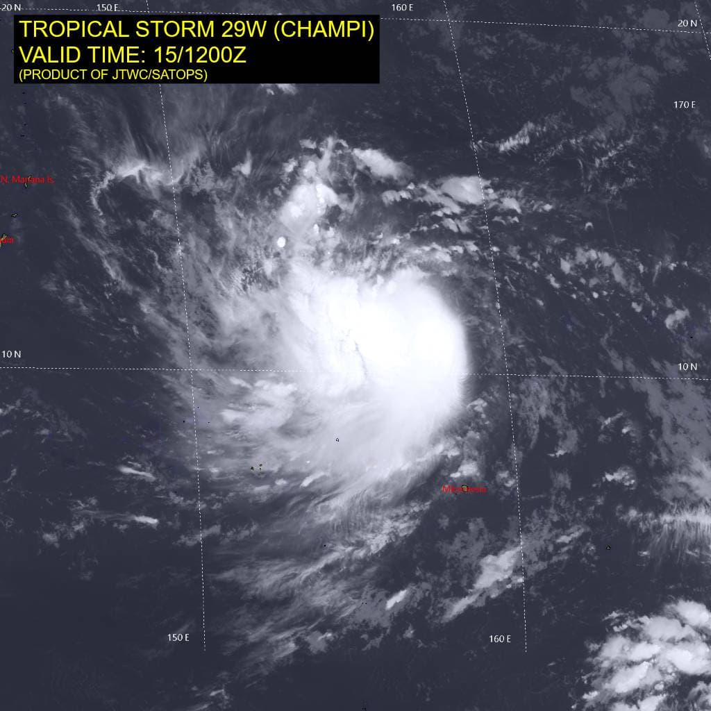
29W_151200sair
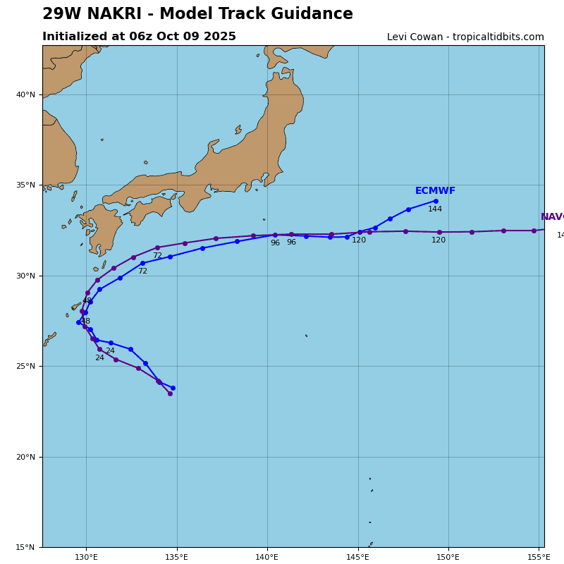
29W_tracks_latest
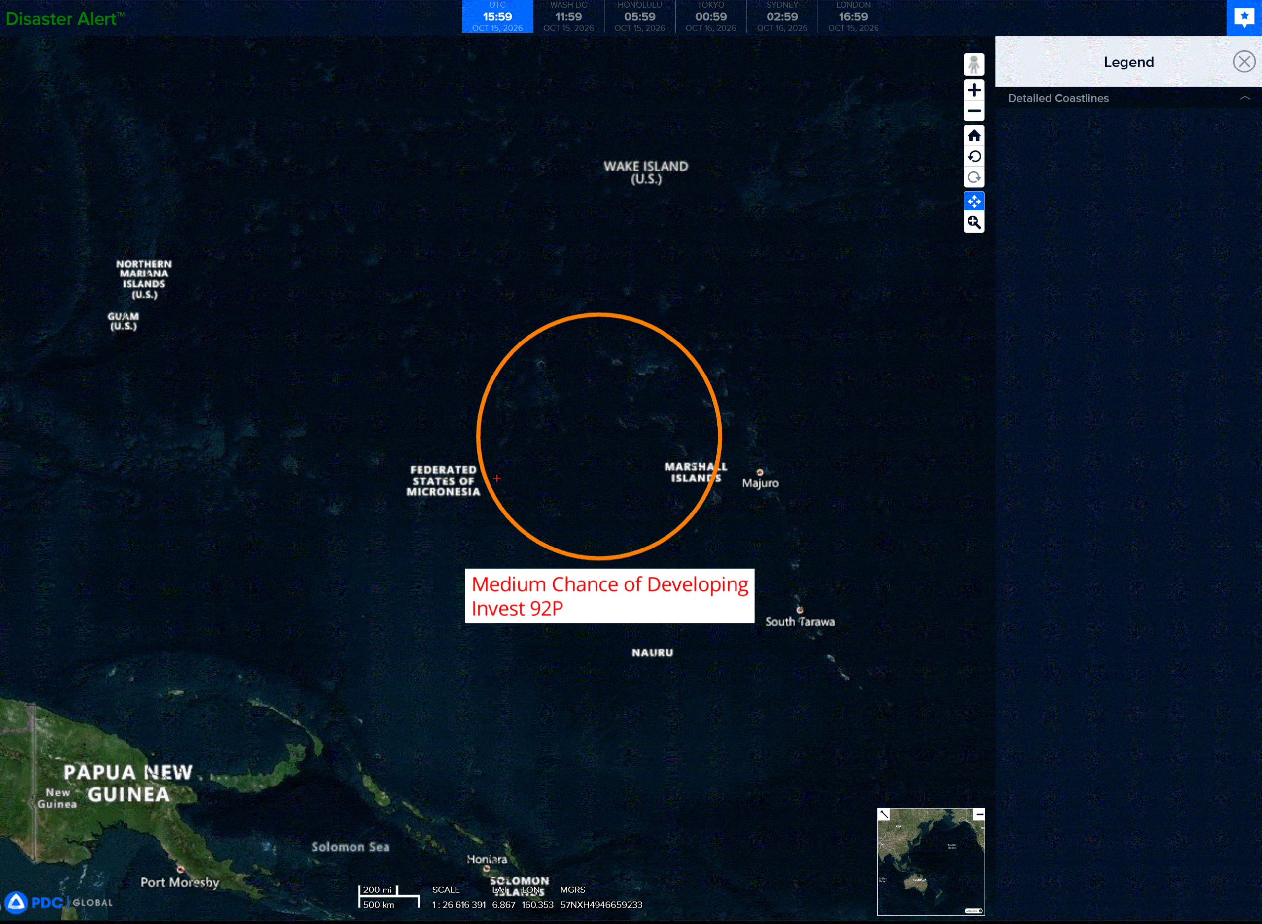
92p
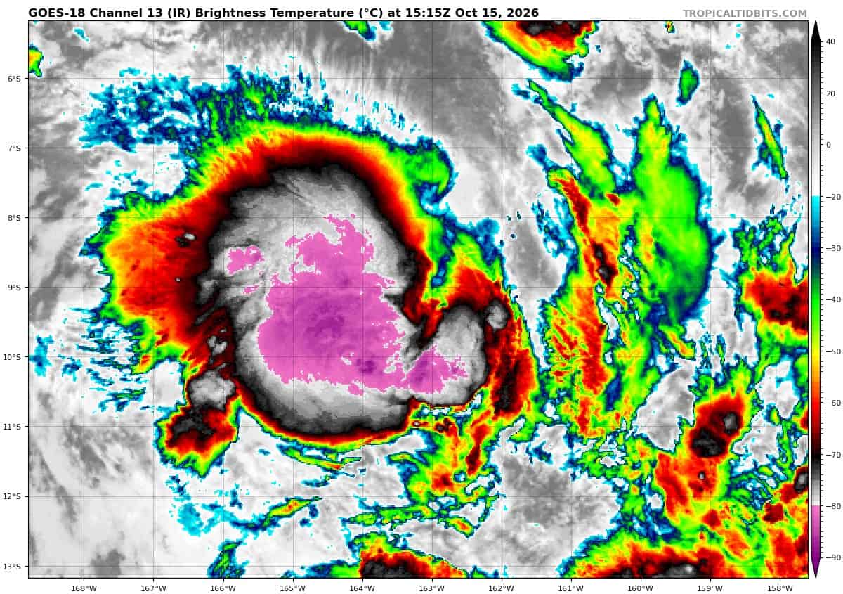
goes18_ir_92P_202610151515_lat-9.0-lon-163.5
92P_tracks_latest
By PDC’s Senior Weather
Specialist Glenn James

The Pacific Disaster Center’s (PDC Global) Thursday, October 15, 2026, Tropical Cyclone Activity Report…for the Pacific Ocean, the Indian Ocean, and adjacent Seas.
Tropical Cyclones
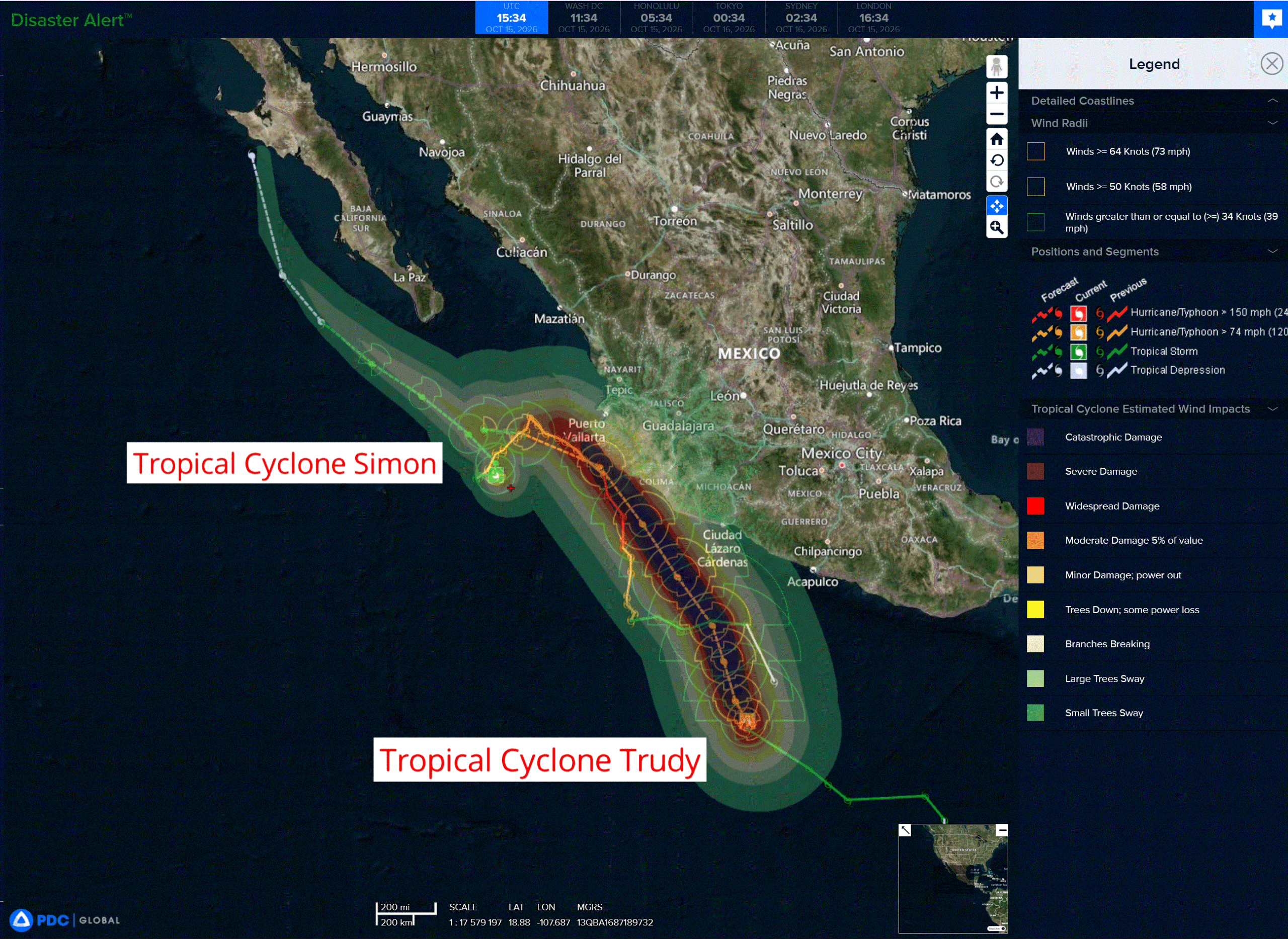
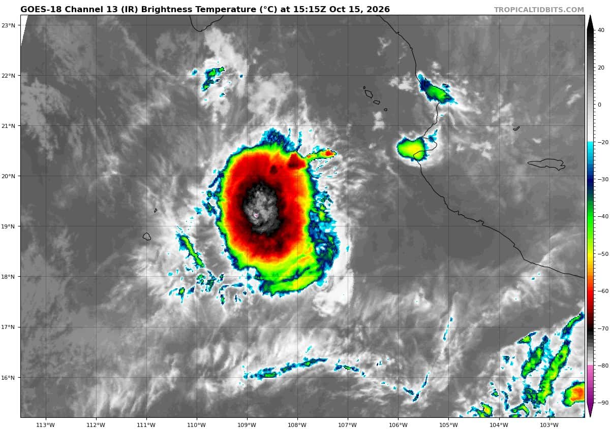
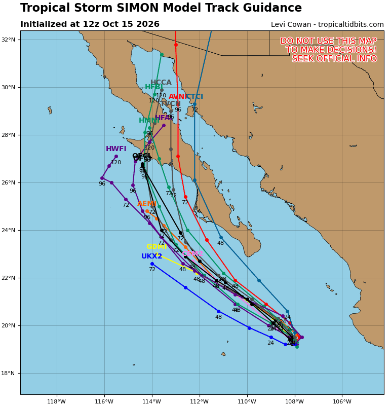
Tropical Cyclone 20E (Simon) is located about 175 miles west-southwest of Cabo Corrientes, Mexico
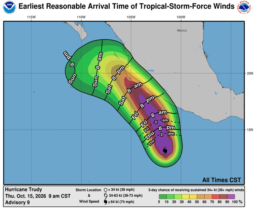
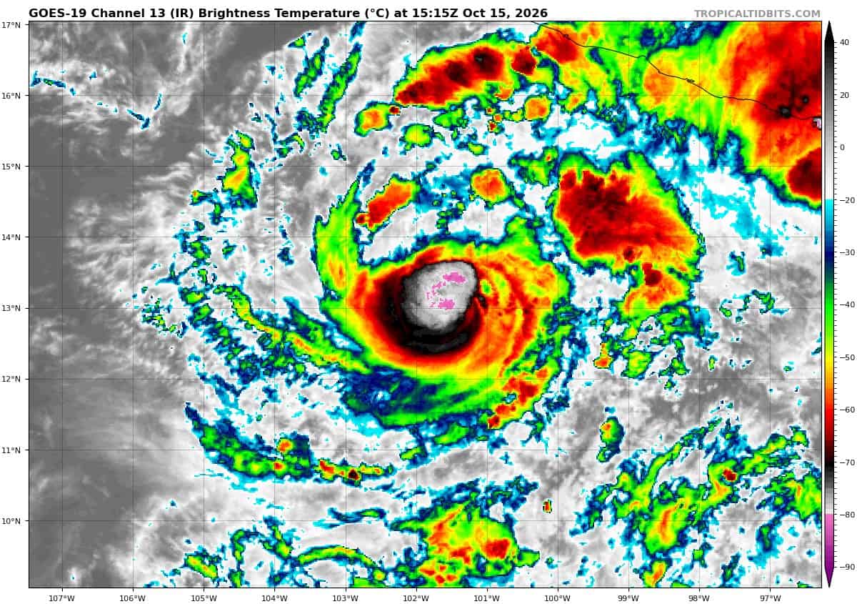
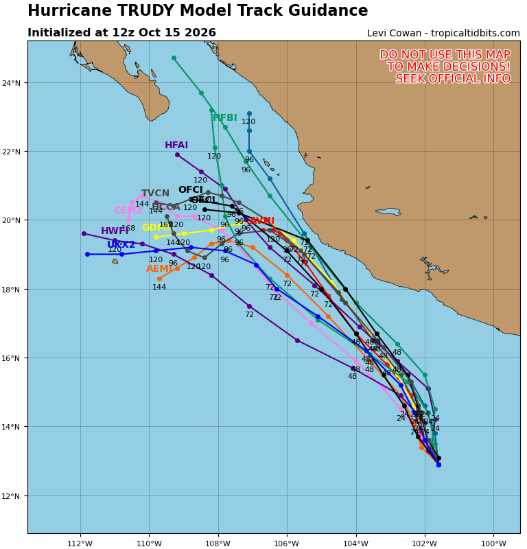
Tropical Cyclone 21E (Trudy) is located about 445 miles south-southeast of Manzanillo, Mexico
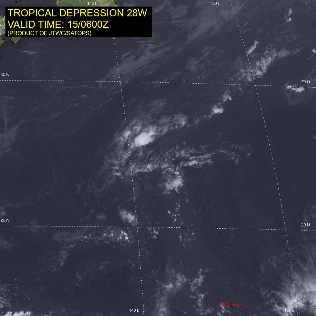
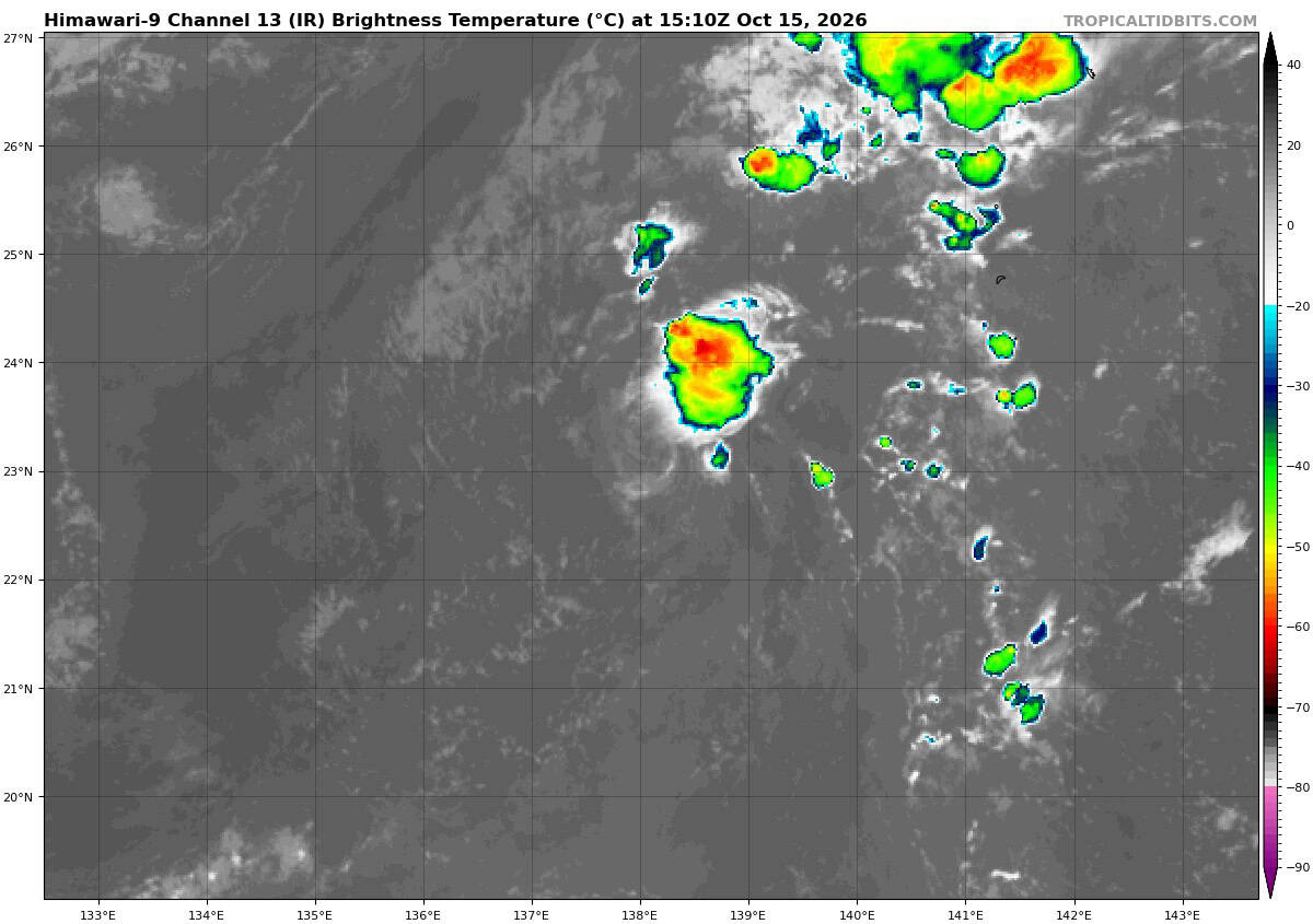
Tropical Cyclone 28W is located approximately 164 NM south-southwest of Iwo To – Final Warning
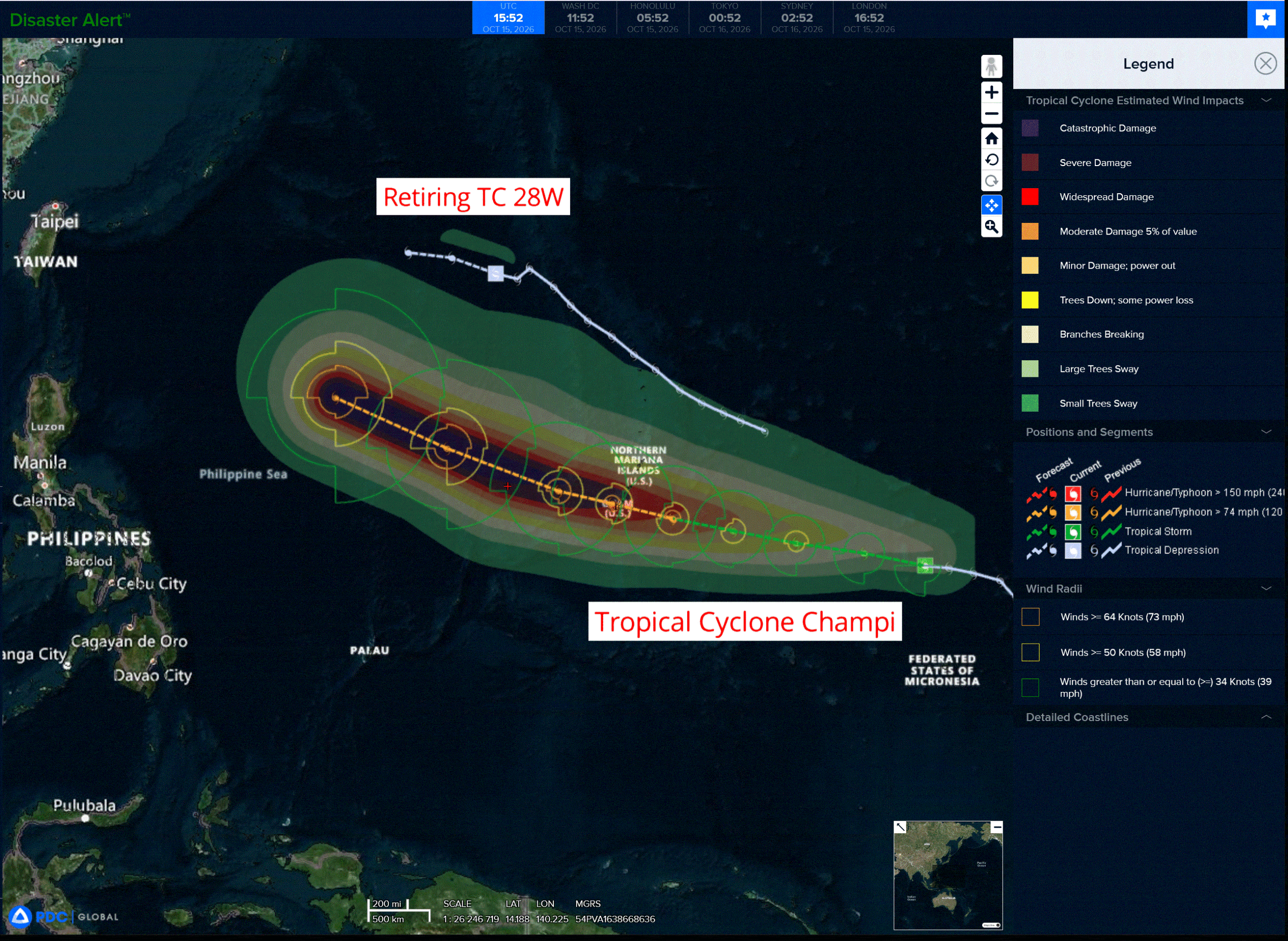
Tropical Cyclone 29W (Champi) is located approximately 750 NM east of Andersen AFB
Northeast Pacific:
Tropical cyclone 20E (Simon)
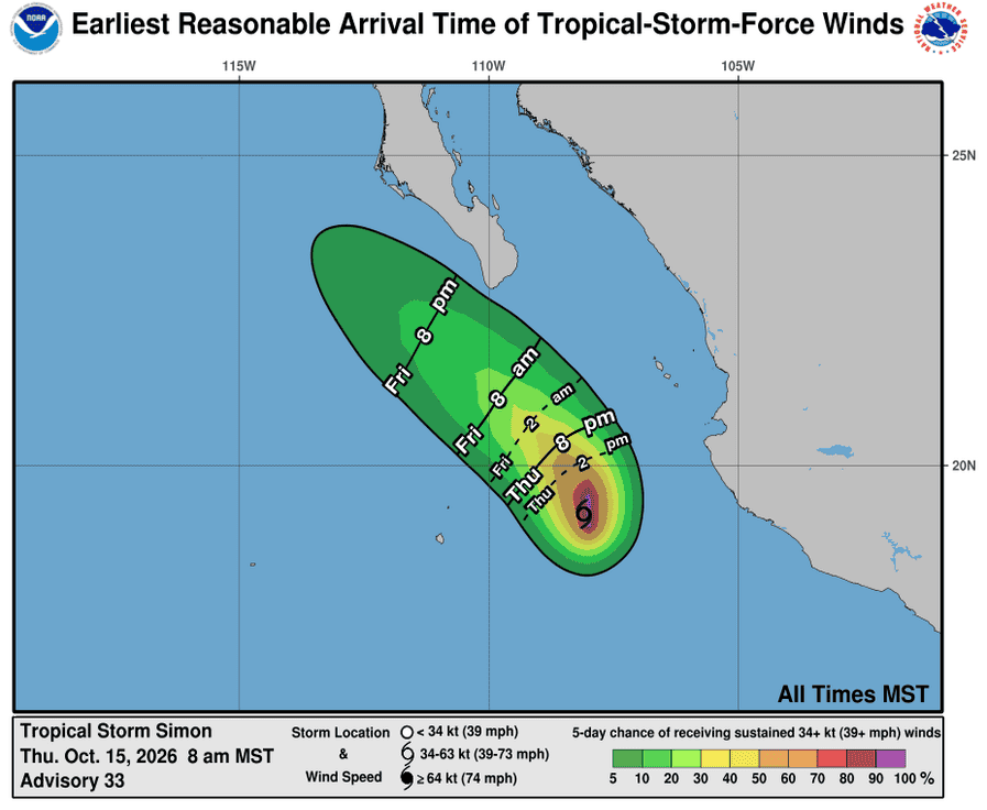
SIMON STILL NEARLY STATIONARY OFF OF THE COAST OF WESTERN MEXICO…INTERESTS IN BAJA CALIFORNIA SUR SHOULD CONTINUE TO MONITOR THE STORM
According to the NHC advisory number 33
Simon is nearly stationary and is likely to move slowly and erratically through tonight. A northwestward motion is forecast to begin by Friday and continue through the weekend.
Maximum sustained winds are near 60 mph (95 km/h) with higher gusts. Gradual weakening is expected during the next few days, and Simon is forecast to become a post-tropical remnant low by late this weekend.
Simon is a small tropical cyclone. Tropical-storm-force winds extend outward up to 35 miles (55 km) from the center. The estimated minimum central pressure is 996 mb (29.42 inches).
HAZARDS AFFECTING LAND
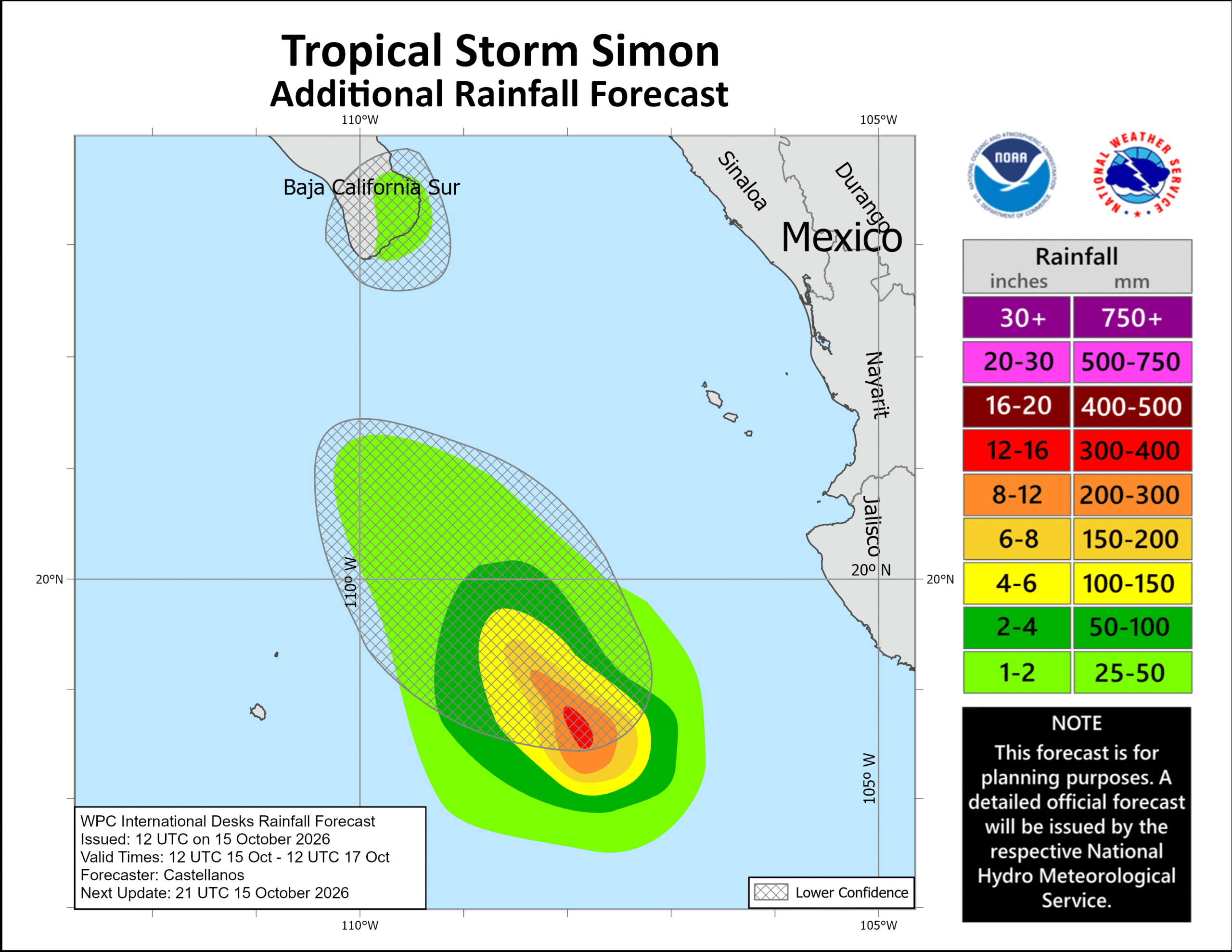
RAINFALL: Through early Saturday, Simon is expected to produce rainfall totals of 1 to 2 inches with isolated maximum amounts of 3 inches over portions of the state of Baja California Sur.
SURF: Swells generated by Simon will affect portions of the coast of west-central Mexico and Baja California Sur during the next couple of days. These swells are likely to cause life-threatening surf and rip current conditions.
Tropical cyclone 21E (Trudy)
TRUDY RAPIDLY INTENSIFYING…TROPICAL STORM WATCH ISSUED FOR A PORTION OF THE MEXICAN COAST
According to the NHC advisory number 9
Trudy is now moving toward the north-northwest near 6 mph (9 km/h). A continued motion toward the north-northwest is expected during the next day or so, followed by a turn back toward the northwest this weekend. On the forecast track, Trudy is expected to approach the coast of southwestern and west-central Mexico this weekend.
Maximum sustained winds have increased to near 90 mph (150 km/h) with higher gusts. Rapid intensification is forecast over the next day or so, and Trudy is forecast to become a major hurricane by Friday.
Hurricane-force winds extend outward up to 25 miles (35 km) from the center and tropical-storm-force winds extend outward up to 105 miles (165 km). The estimated minimum central pressure is 975 mb (28.80 inches).
HAZARDS AFFECTING LAND
WIND: Tropical storm conditions are possible within the watch area by early Saturday.
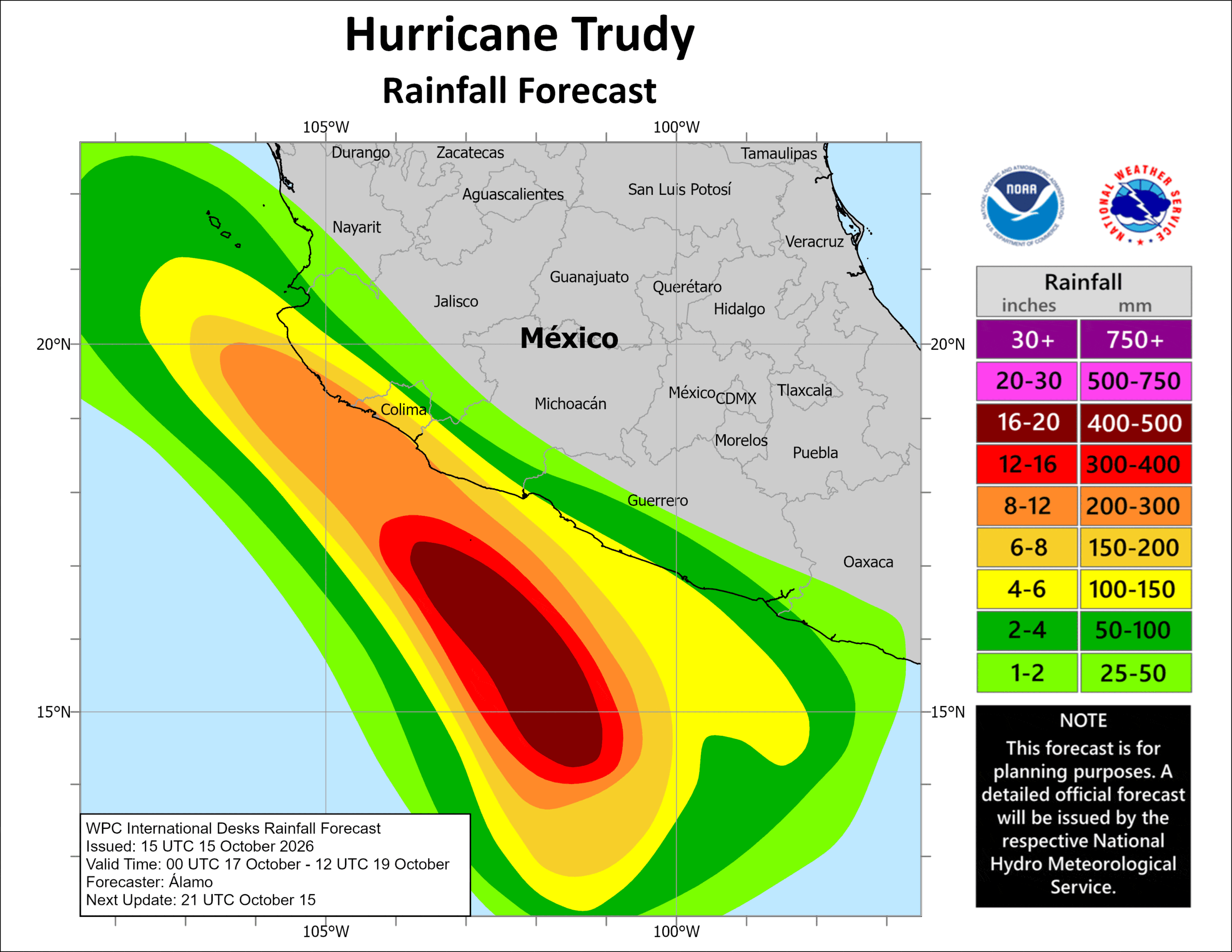
RAINFALL: Through the weekend, Trudy is expected to produce 4 to 8 inches with isolated higher totals around 12 inches through the weekend across Colima and Jalisco. This rainfall may produce life-threatening flooding and mudslides, especially in areas along steep terrain.
Elsewhere, Trudy’s outer bands are expected to produce 2 to 4 inch with isolated higher totals around 6 inches along the southwest Mexican coast between Guerrero and Michoacán. This rainfall may result in localized flash flooding through the weekend, especially in areas along steep terrain.
SURF: Swells generated by Trudy are expected to begin affecting portions of the coast of southwestern Mexico late this week and continue through the weekend. These swells are likely to cause life-threatening surf and rip current conditions.
>>> South of Southern Mexico:
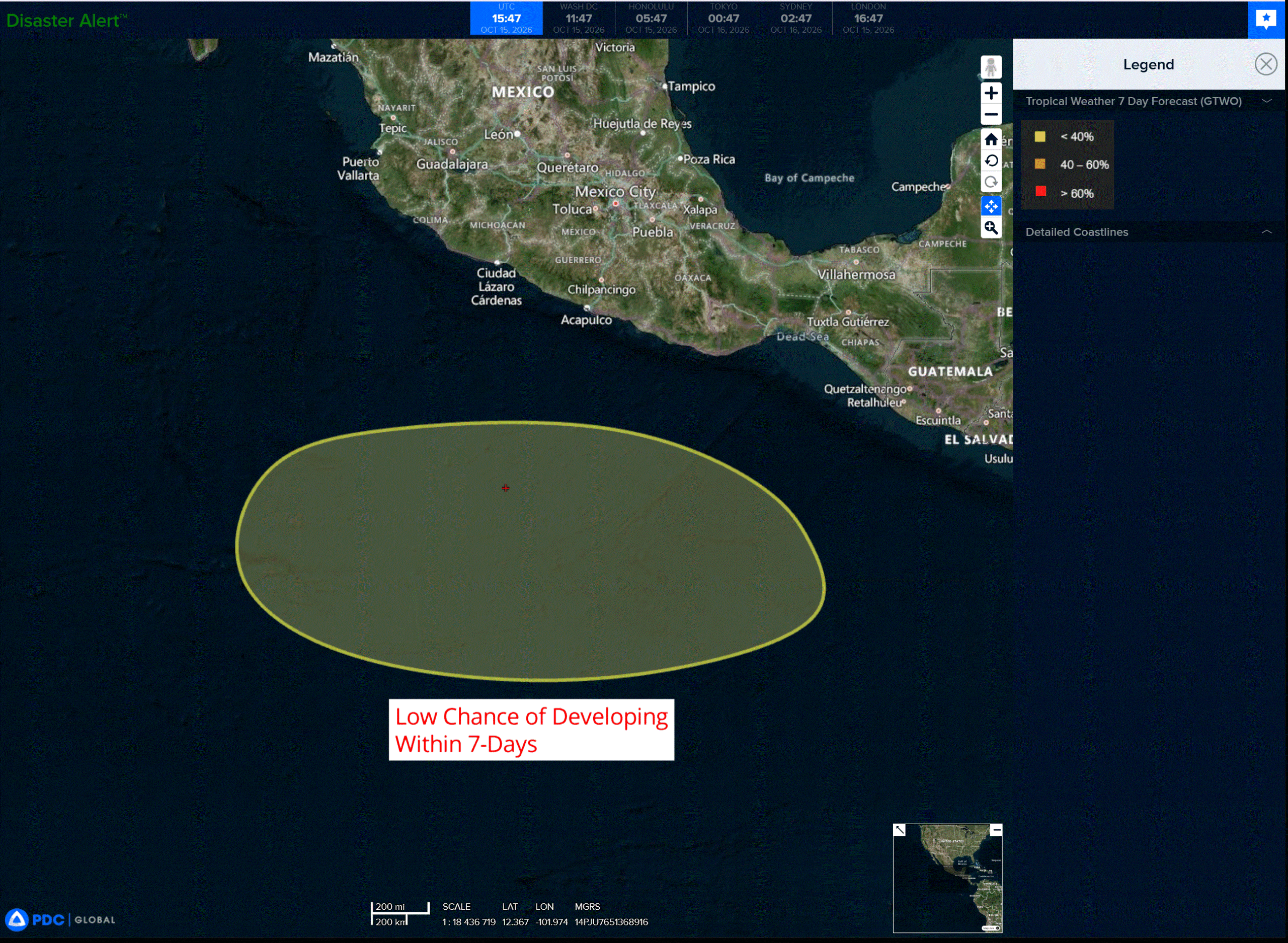
An area of low pressure is forecast to form offshore of southern Mexico during the early to middle part of next week.
Environmental conditions appear conducive for some gradual development thereafter while the system moves generally westward to west-northwestward over the east to central portion of the East Pacific.
* Formation chance through 48 hours…low…near 0 percent
* Formation chance through 7 days…low…30 percent
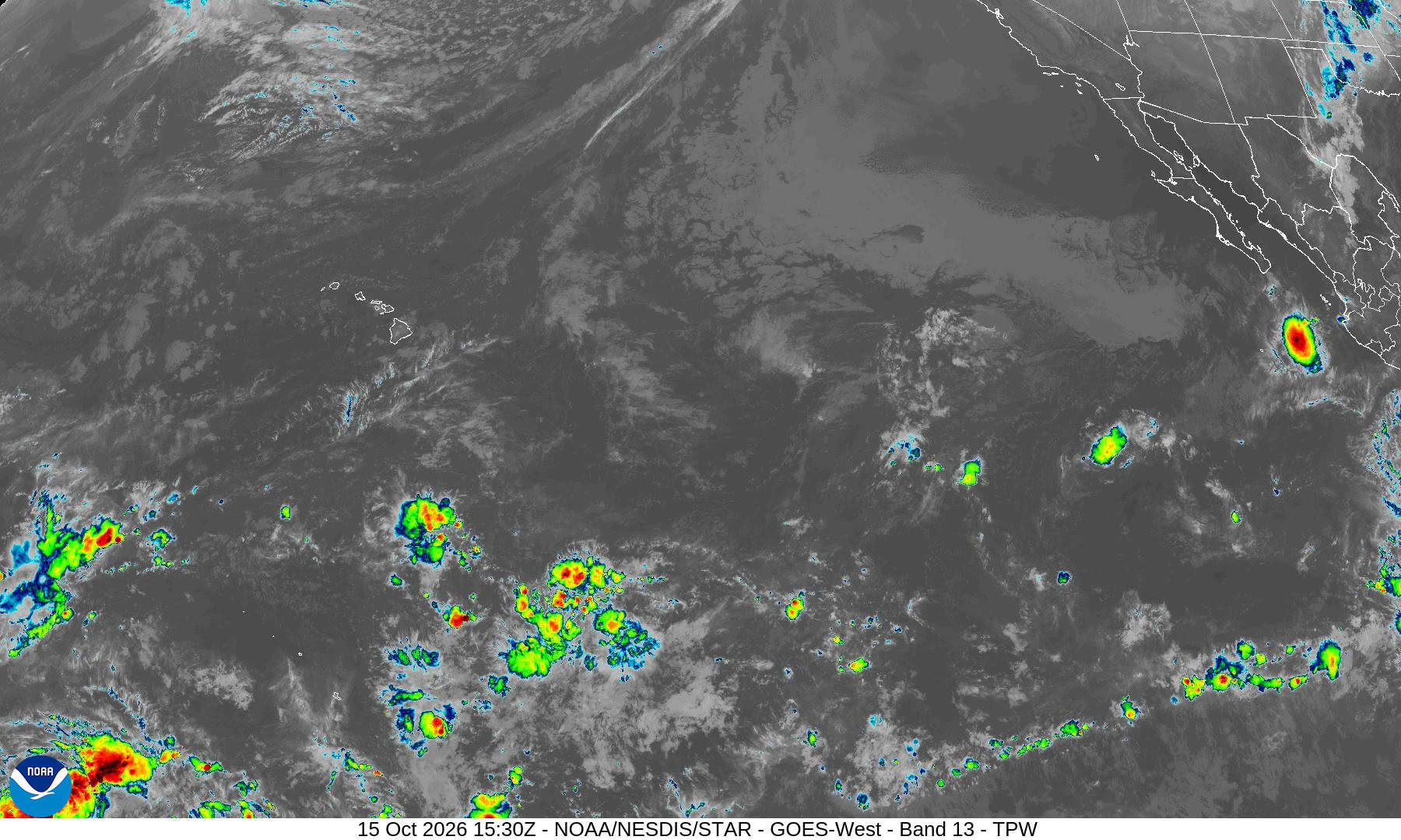
Central North Pacific: There are no Tropical Cyclones
Tropical cyclone formation is not expected during the next 7 days.
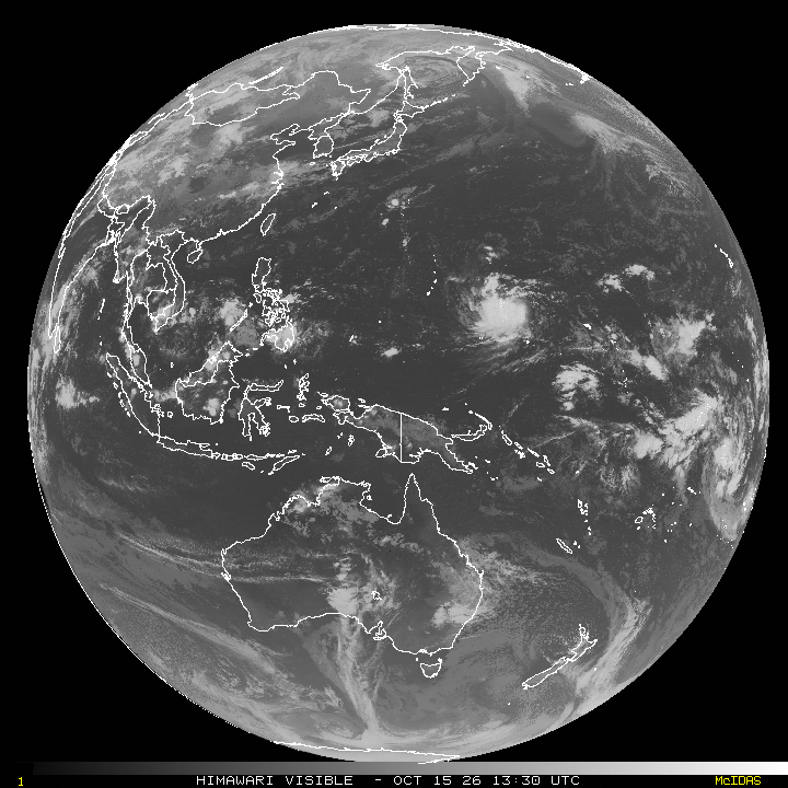
Western Pacific, Indian Ocean, and adjacent Seas:
Western Pacific
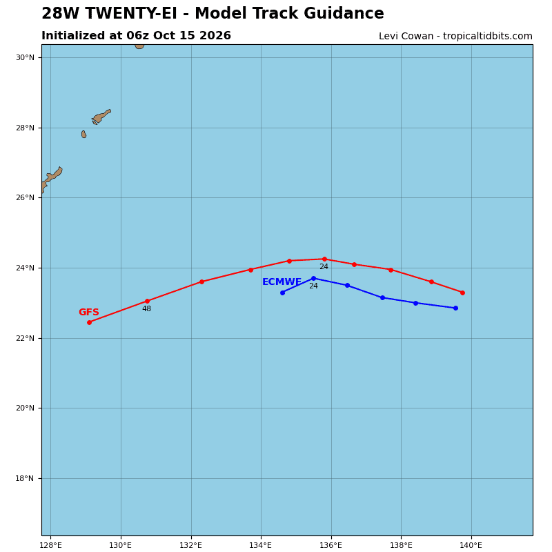
Tropical Cyclone 28W – Final Warning
According to the JTWC warning number 14…sustained winds were 20 knots with gusts to 30 knots
Scatterometer data reveals that maximum sustained winds have weakened into a 20-kt tropical disturbance. The system is interacting with a wall of dry air associated with a shear line to its west. This interaction will cause 28W to degenerate into a tropical wave within 24 hours, if not sooner, as it travels westward along
the low-level flow.
Tropical Cyclone 29W (Champi)
According to the JTWC warning number 5…sustained winds were 35 knots with gusts to 45 knots
Animated enhanced infrared (eir) satellite imagery depicts explosive deep convection persisting along the western side of the circulation with expanding upper-level outflow. The overshooting cloud tops have reached temperatures as cold as -97 degrees celsius. The system is likely still tilted southwestward with
height and battling moderate northeasterly vertical wind shear (vws). However, the system may be briefly overcoming the effects of vws as gravity waves emanate radially from the deep convection.
Most notably, the low-level circulation center (llcc) has become embedded in the nascent central dense overcast (cdo), with curved banding beginning to develop along the northern periphery. A 151025z ascat-c pass revealed an elongated llcc with gale-force winds confined to the southern semicircle. Based on these data and the improved convective structure, 29W has been upgraded to a 35-kt tropical storm (ts) with high confidence.
The environment is generally favorable for additional intensification, characterized by very warm sea surface temperatures (sst) of 29-30 degrees celsius, moderate upper-level divergence focused along the
western periphery, and plentiful deep-layer moisture.
TS 29W is moving west to west-northwestward along the southern periphery of the str. This ridge will erode from 24 to 48 hours as a trough passes well to the north. Meanwhile, a sharp mid-level trough approaching the Korean Peninsula will support the development of a new str over Honshu. This ridge will settle east of Honshu near 72 hours and become the primary steering mechanism for TS 29W, maintaining a west-northwestward trajectory through 120 hours.
The recent explosive convection and ongoing vortex consolidation may foreshadow significant intensification once axisymmetrization is achieved. VWSs will ease toward 60 hours, while TS 29W traverses very warm sst of 29-30 degrees celsius. The forecast calls for the system to become sufficiently organized to begin rapid intensification (ri) near 36 hours, reaching typhoon strength shortly thereafter and peaking at 125 kts at 96 hours.
Although the environment becomes even more favorable after 72 hours, characterized by warmer sst, higher ohc, and 5-10 kts of vws, the forecast conservatively levels off the intensity after 96 hours to
account for difficult-to-predict fluctuations in intensity caused by internal tropical cyclone dynamics.
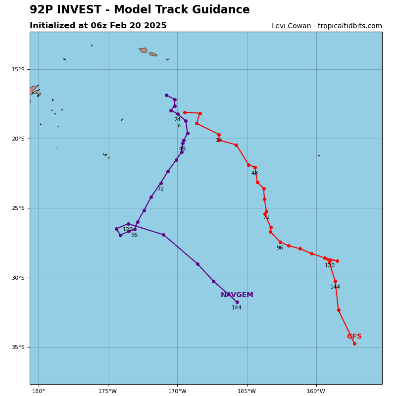
>>> There’s an area of disturbed weather being referred to as Invest 92P, which is located approximately 407 NM east-northeast of Swains Island
Animated multi-spectral satellite imagery and a 142041z 89 ghz microwave image depicts a partially
obscured lower-level circulation center with persistent deep convection around the periphery. A 142003z ascat pass emphasizes a broad and open circulation with elevated (20-25kt) winds along the western periphery, displaced approximately 30 NM from the center.
Environmental analysis reveals a favorable environment for development with strong upper level outflow, low to moderate vertical wind shear (15-20 kts), and warm sea surface temperatures (29-30 c). The current
main limiting factor for this system is the lack of organization.
Global models show 92P slowly drifting southward into a lower shear environment and consolidating over the next 36-48 hours.
Maximum sustained surface winds are estimated at 22-27 knots.
Minimum sea level pressure is estimated to be near 1003 mb.
The potential for the development of a significant tropical cyclone within the next 24 hours is medium.