

Current Snapshot
For all the latest updates visit: DisasterAWARE
1800x1080e
2e
131454_earliest_reasonable_toa_34s
goes18_ir_20E_202610131525_lat20.3-lon-107.2
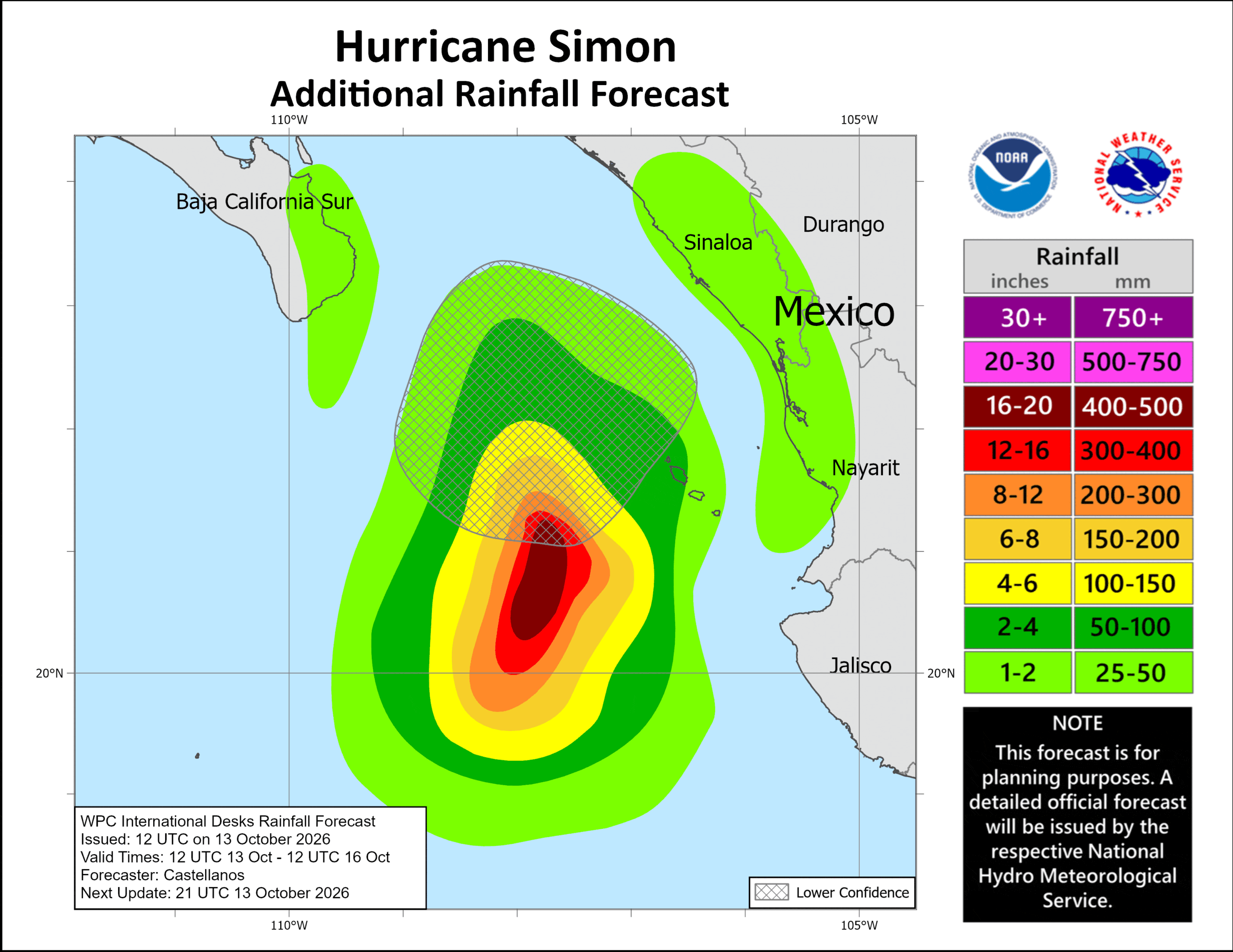
131454INTQPF_sm
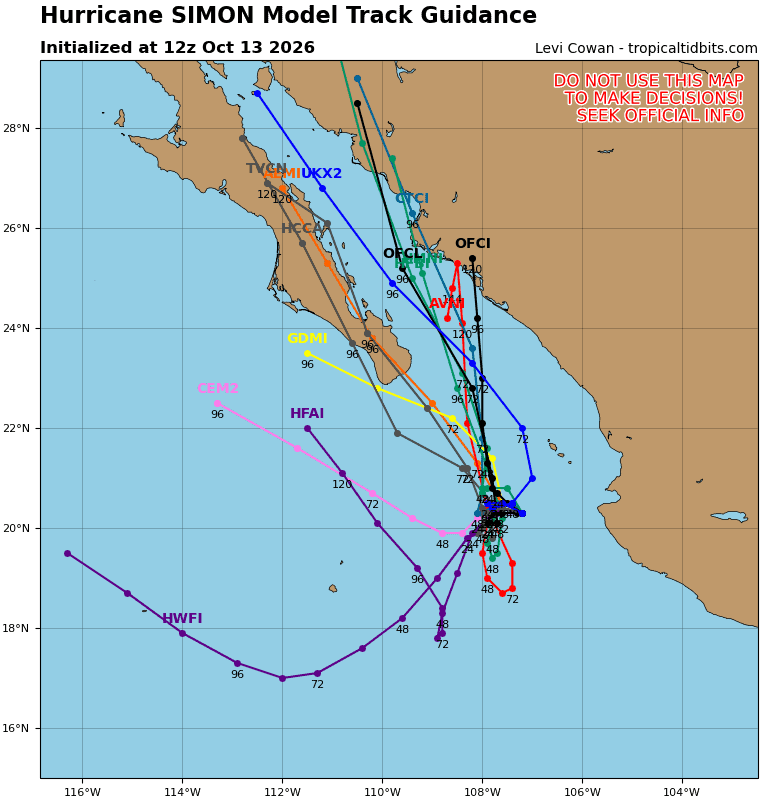
20E_tracks_latest
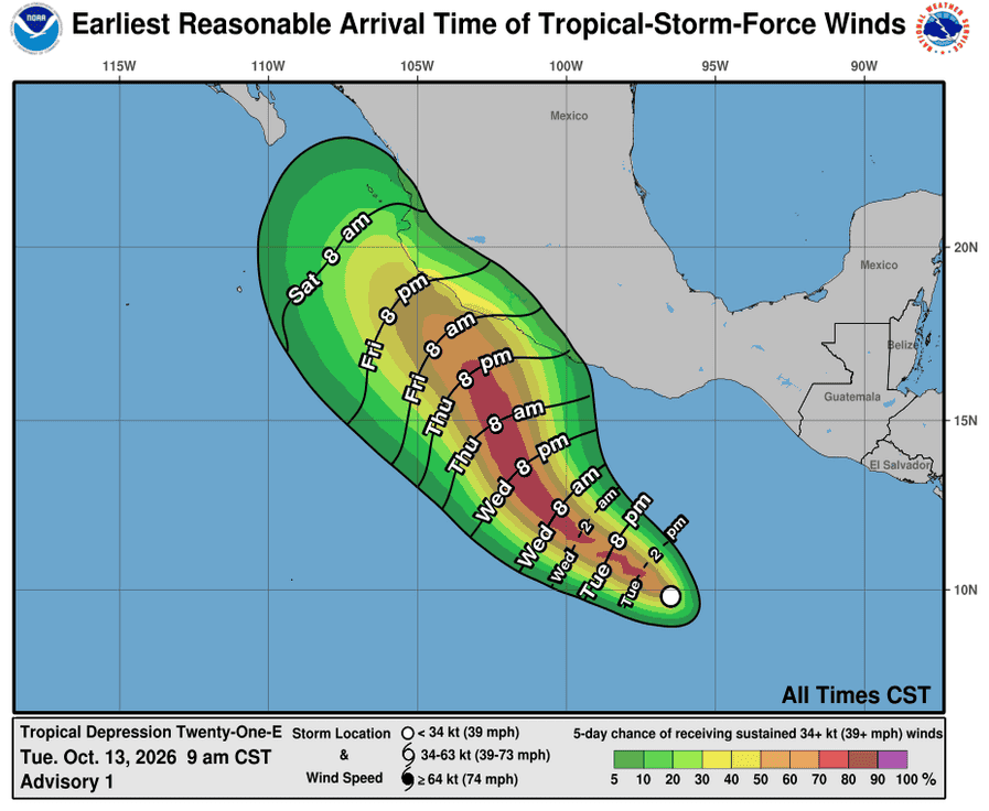
131449_earliest_reasonable_toa_34
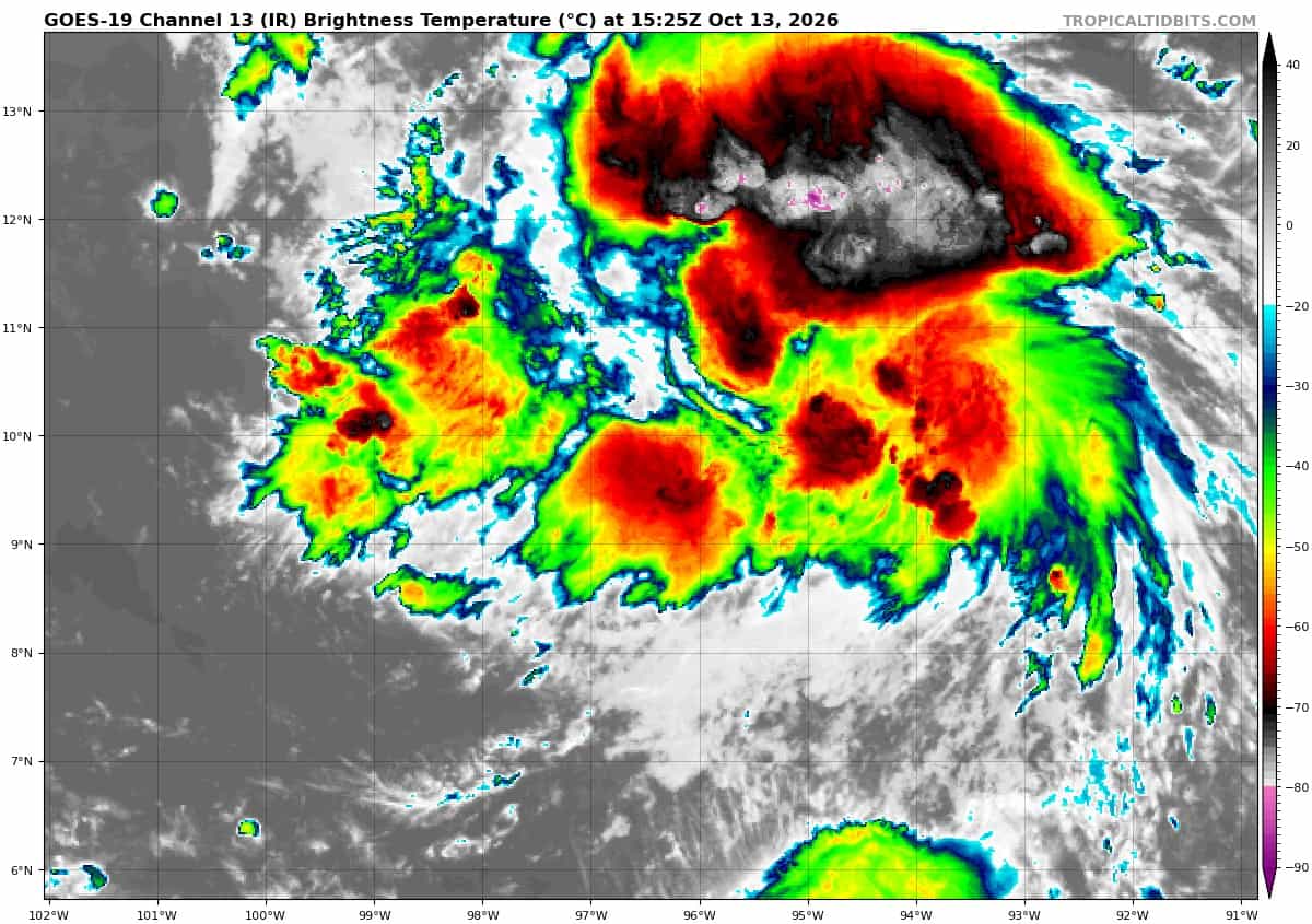
goes19_ir_21E_202610131525_lat9.5-lon-96.1
21E_tracks_latest
1800x1080ec
10
2w
27W_131200sair
himawari9_ir_27W_202610131520_lat36.8-lon155.5
27W_tracks_latest
28W_131200sair
himawari9_ir_28W_202610131520_lat19.4-lon145.4
28W_tracks_latest
96w
himawari9_ir_96W_202610131520_lat10.0-lon162.8
96W_tracks_latest
By PDC’s Senior Weather
Specialist Glenn James

The Pacific Disaster Center’s (PDC Global) Tuesday, October 13, 2026, Tropical Cyclone Activity Report…for the Pacific Ocean, the Indian Ocean, and adjacent Seas.
Tropical Cyclones
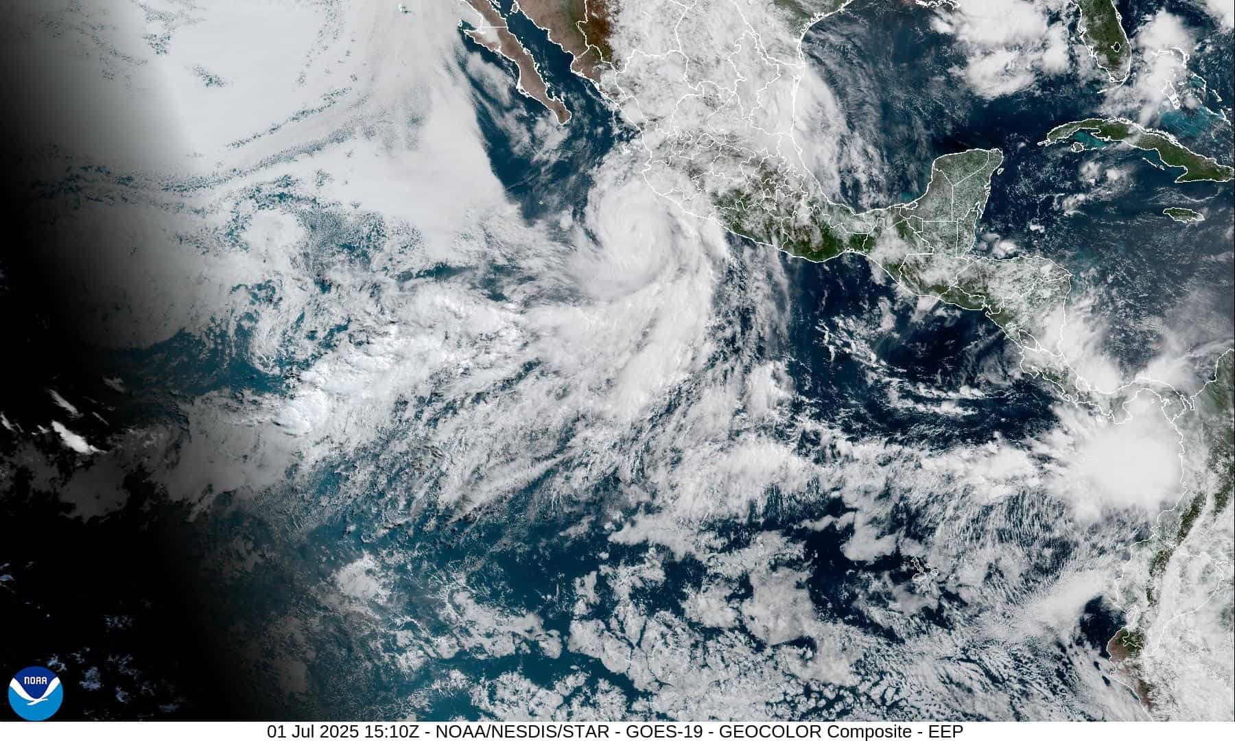
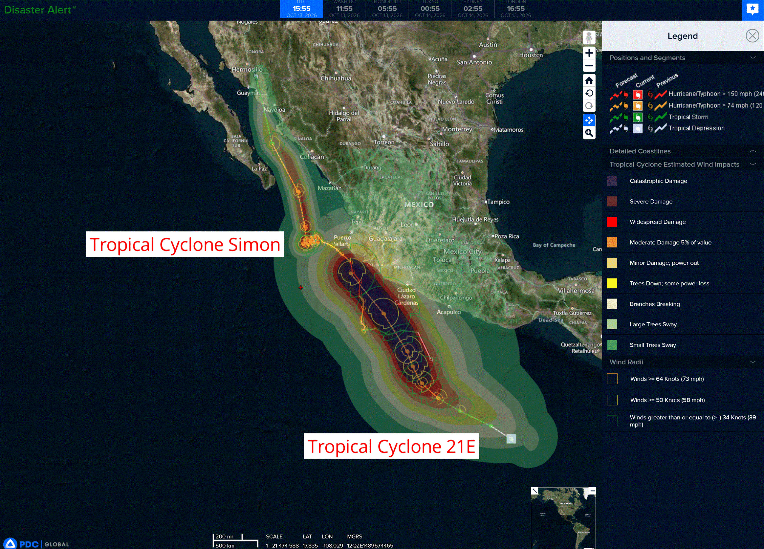
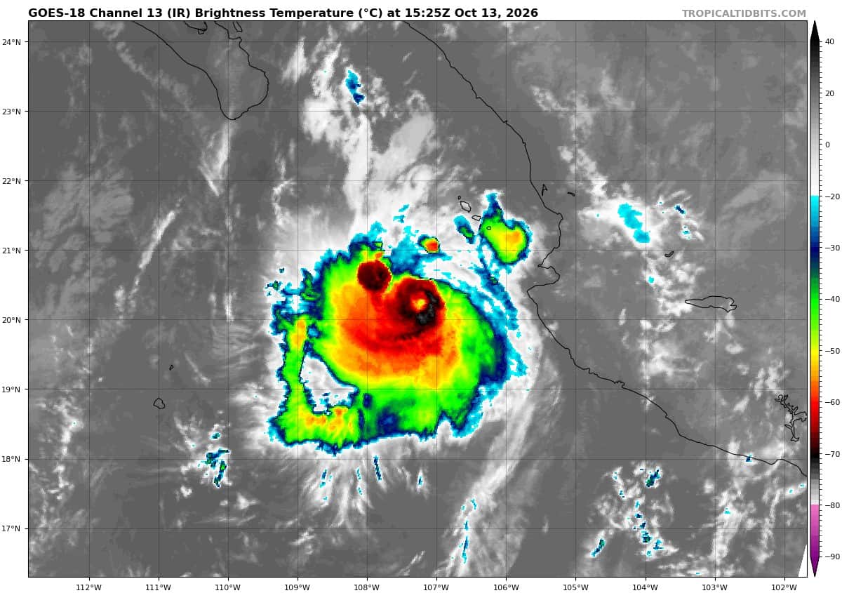
Tropical Cyclone 20E (Simon) is located about 210 miles south-southwest of Mazatlan, Mexico
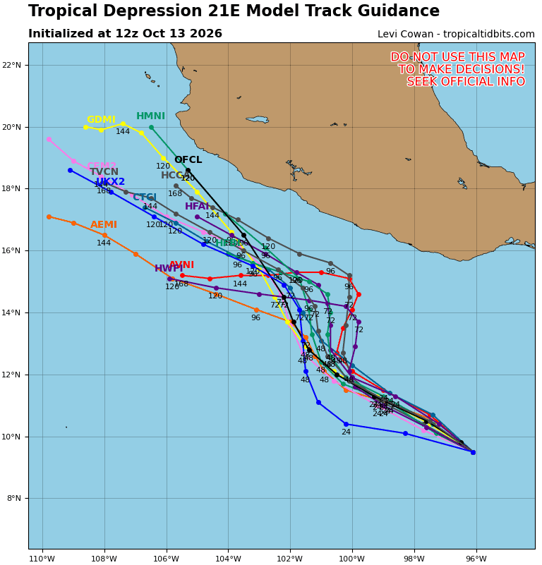
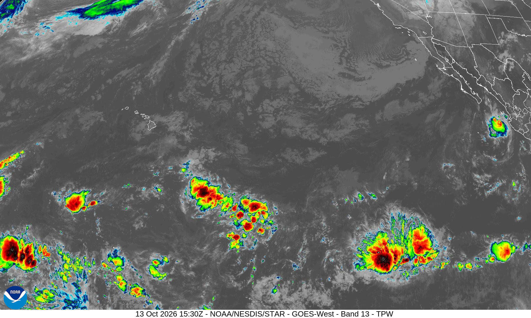
Tropical Cyclone 21E is located about 820 miles southeast of Manzanillo, Mexico
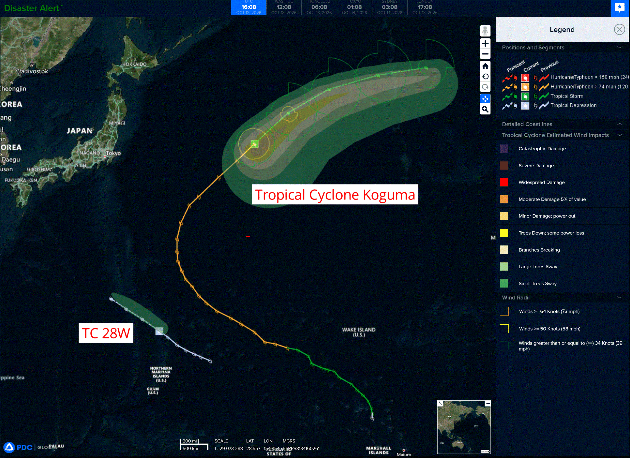
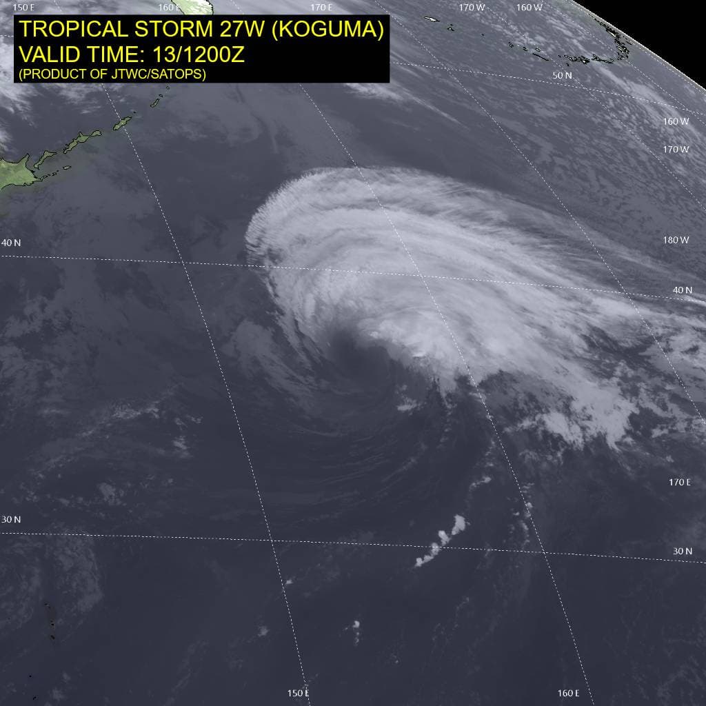
Tropical Cyclone 27W (Koguma) is located approximately 704 NM east-southeast of Misawa, Japan
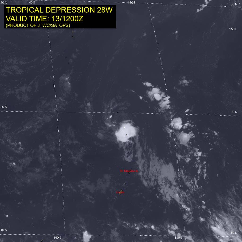
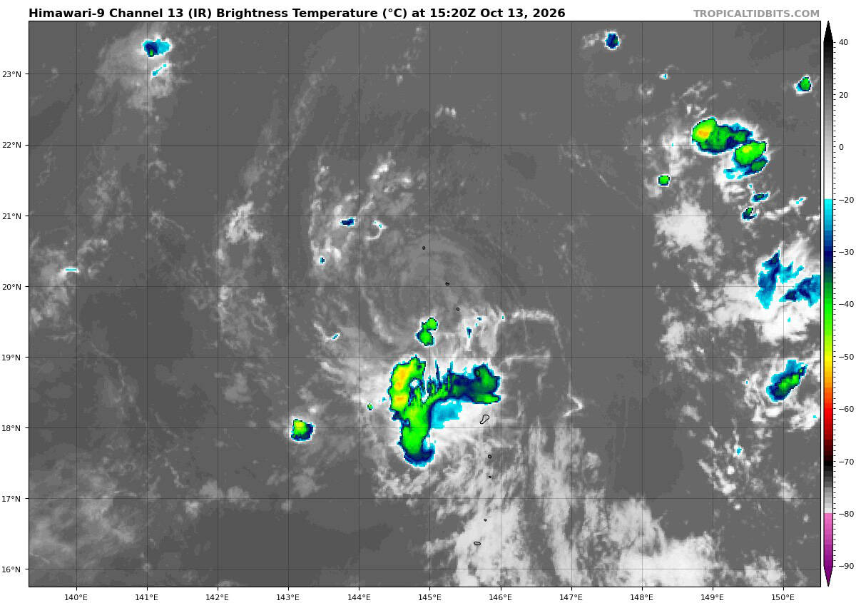
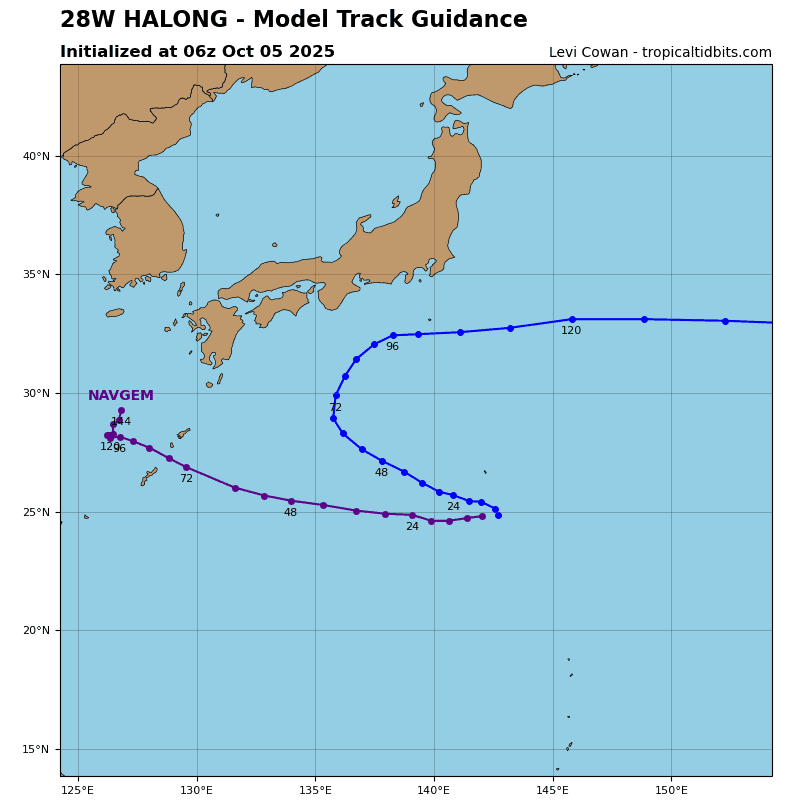
Tropical Cyclone 28W is located approximately 253 NM north of Saipan
Northeast Pacific:
Tropical cyclone 20E (Simon)
SMALL SIMON FORECAST TO MOVE SLOWLY OVER THE NEXT DAY OR TWO …INTERESTS IN WEST-CENTRAL MEXICO AND BAJA CALIFORNIA SUR SHOULD CONTINUE TO MONITOR FORECAST UPDATES
According to the NHC advisory number 25
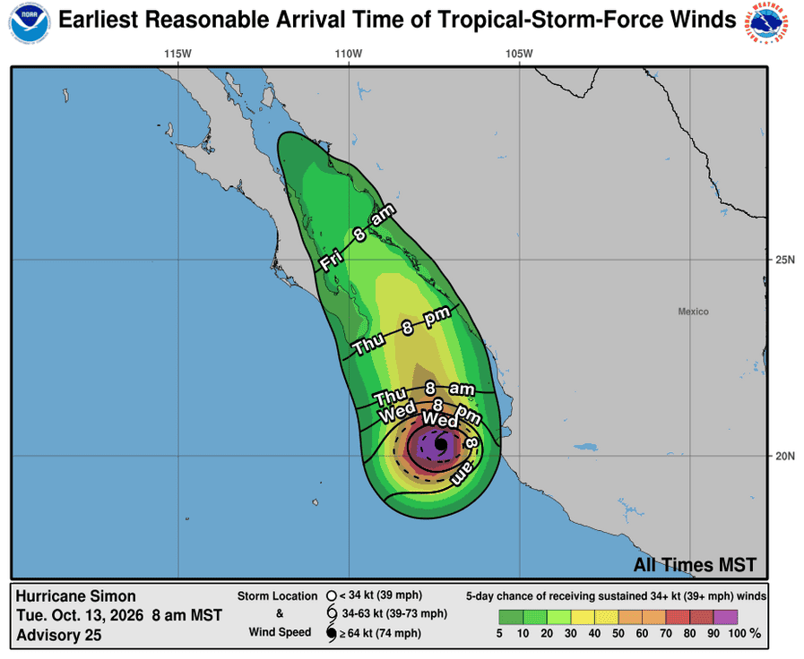
Simon is moving toward the west near 2 mph (4 km/h). The hurricane is forecast to move very slowly over the next couple of days, followed by an eventual turn to the north by late this week. Maximum sustained winds are near 90 mph (150 km/h) with higher gusts. Fluctuations in intensity are likely over the next few days, but Simon is forecast to remain a hurricane through midweek. Hurricane-force winds extend outward up to 10 miles (20 km) from the center and tropical-storm-force winds extend outward up to 45 miles (75 km). The estimated minimum central pressure is 977 mb (28.85 inches).
HAZARDS AFFECTING LAND
WIND: Hurricane conditions are possible within the hurricane watch area for Las Islas Marias on Wednesday, and for mainland Mexico on Thursday, with tropical storm conditions possible by Wednesday. Tropical storm conditions are possible within the tropical storm watch area today or Wednesday
RAINFALL: Simon is expected to produce rainfall totals of 1 to 2 inches with isolated maximum amounts of 3 inches over portions of the states of Baja California Sur, Nayarit, and Sinaloa by Friday.
STORM SURGE: A storm surge is possible near or east where Simon’s center eventually makes landfall along the Mexican coast.
SURF: Swells generated by Simon will affect portions of the coast of southwestern and west-central Mexico during the next few days. These swells are likely to cause life-threatening surf and rip current conditions.
Tropical cyclone 21E
TROPICAL DEPRESSION TWENTY-ONE-E FORMS OFF THE COAST OF SOUTHERN MEXICO …FORECAST TO RAPIDLY INTENSIFY TO A MAJOR HURRICANE OVER THE NEXT FEW DAYS
According to the NHC advisory number 1
The depression is moving toward the northwest near 10 mph (17 km/h). A motion between west-northwest and northwest should continue through Wednesday night. A turn toward the north-northwest and a decrease in forward speed is expected on Thursday. Maximum sustained winds are near 35 mph (55 km/h) with higher gusts. Rapid intensification is forecast during the next 3 days, and the cyclone is expected to become a hurricane by Wednesday night and a major hurricane by Friday. The estimated minimum central pressure is 1006 mb (29.71 inches).
Central North Pacific: There are no Tropical Cyclones
Tropical cyclone formation is not expected during the next 7 days.
Western Pacific, Indian Ocean, and adjacent Seas:
Western Pacific
Tropical Cyclone 27W (Koguma)
According to the JTWC warning number 35…sustained winds were 60 knots with gusts to 75 knots
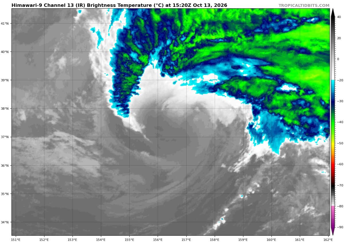
Animated enhanced infrared (eir) satellite imagery depicts a fully exposed low-level circulation center (llcc) undergoing rapid subtropical transition (stt). The mid-level circulation and associated deep convection seen earlier have completely collapsed and are no longer detectable in animated eir imagery. Based on the latest
model fields, thermal convection remains marginal, the system has yet to acquire definitive frontal characteristics, and it remains well equatorward of the polar front jet and associated baroclinic zone. Deep-layer vertical wind shear (vws) remains extremely high, and dry mid-level air now completely overlies the shallow vortex, which is confined below 700mb. Accordingly, the system is assessed as undergoing subtropical transition (stt).
Environmental conditions are highly unfavorable for tropical development, characterized by strong vws
exceeding 40 knots, cool ssts (24-25c), dry air entrainment, and vortex decoupling.
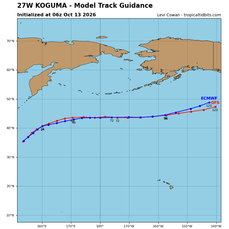
TS 27W continues its steady progression northeastward along the northwestern side of the str positioned to
the southeast. No significant track changes are expected; the system will gradually curve toward the east as it transits the poleward periphery of the str. Translation speed will remain stable at approximately 20 knots throughout the forecast window, as low- to mid-level ridging extending to the east blocks the typical
acceleration characteristic of cyclones leaving the subtropics.
Regarding intensity: 27W will continue to steadily weaken and gradually spin down as it transitions through stt and subsequent extratropical transition (ett) over the next 48 hours. As outlined above, 27W is currently assessed to be in stt mode, projected to complete within the next 12 hours. Aloft, the remnant vortex will pass beneath an upper-level ridge axis that displaces the polar jet stream far to the north over Kamchatka. in the lower levels, extensive high pressure extends poleward to the east of 27W toward
the Aleutian Islands, AK.
The lack of an active baroclinic zone will sustain a prolonged subtropical system structure. By 36 hours, the synoptic configuration is projected to shift as 27W enters the nose of an approaching polar jet maximum and phases with a 500mb shortwave trough. this interaction will trigger extratropical transition (ett), expected to be complete by 48 hours.
Tropical Cyclone 28W
According to the JTWC warning number 7…sustained winds were 25 knots with gusts to 35 knots
Animated enhanced infrared (eir) satellite imagery depicts a fully exposed low-level circulation center (llcc), with persistent convection confined along the southeastern convergent asymptote. While this deep convection has persisted in the southeastern quadrant for beyond six hours, it has been systematically unable to wrap inward toward the llcc. Transient, isolated convective bursts reside within the western inflow bands, but lack continuity and dissipate rapidly. A 131110z ascat-c pass resolves an asymmetric surface wind field, characterized by light, disorganized flow across the western semicircle and a 20-25 knot wind band along an arc extending from south of the llcc up the eastern flank.
Environmental conditions are unfavorable for tropical development. although deep-layer shear is minimal (0-5 kts), TD 28W resides directly beneath a weak upper-level low (ull) and inverted upper-level trough, heavily restricting upper-level outflow and introducing dry, subsident air directly over the vortex core. The 131200z Guam sounding (the nearest empirical rawinsonde station) confirms a strong subsidence inversion cap at 730mb, with deep dry air extending to 300mb. Tropical Depression 28W is forecast to continue tracking northwestward at approximately 10 knots along the southwestern periphery of the expansive str throughout the forecast period.
Regarding intensity, 28W remains in close proximity to the upstream ull and inverted trough. Over the forecast timeline, while the ull is projected to drift southwestward, the associated trough axis will remain coupled with the llcc. The resultant upper-level subsidence, persistent dry air entrainment, and the lack of a robust outflow mechanism will suppress intensification.
Mesoscale models continue to resolve a brief window of modest moisture improvement near 24 hours, which drives an incorrect model projected re-intensification. However, while transient convective cells may temporarily develop, persistence is unlikely due to the absence of an established upper-level exhaust mechanism. Accordingly, 28W will gradually weaken and decay, with dissipation below warning criteria projected by 36 hours.
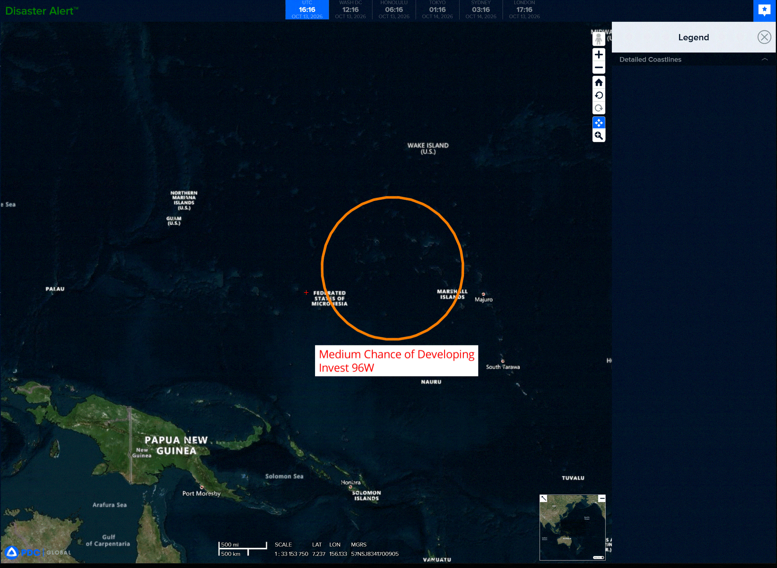
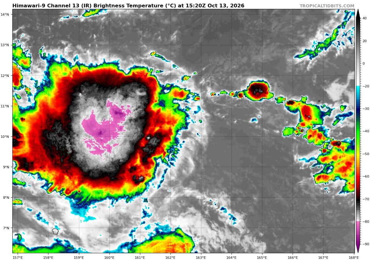
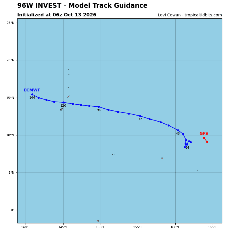
>>> There’s an area of disturbed weather being referred to as Invest 96W, which is located approximately 260 NM north-northeast of Kosrae
Animated multi-spectral satellite imagery depicts an exposed low-level circulation center (llcc) with collapsing convection in the western periphery. A 122222z ascat pass shows a broad outer rotation with a rmw of about 90nm, as well as a tight swath of 15 kt winds to the eastern semicircle of the smaller exposed
llcc.
Environmental analysis shows a favorable environment for development with fair upper-level outflow, low easterly vertical wind shear (10-15 kts), and warm sea surface temperatures (29-30c).
Global models show 96W tracking westward as it gradually consolidates and intensified. Both ensemble and deterministic models are in good agreement that 96W will develop, but the deterministic models are
generally more aggressive with the timeline, while the ensembles depict a slower development timeline.
Maximum sustained surface winds are estimated at 18-23 knots.
Minimum sea level pressure is estimated to be near 1008 mb.
The potential for the development of a significant tropical cyclone within the next 24 hours remains medium.