

Current Snapshot
For all the latest updates visit: DisasterAWARE
1800x1080e
2e
301455_earliest_reasonable_toa_34
goes18_ir_18E_202609301535_lat17.8-lon-107.7
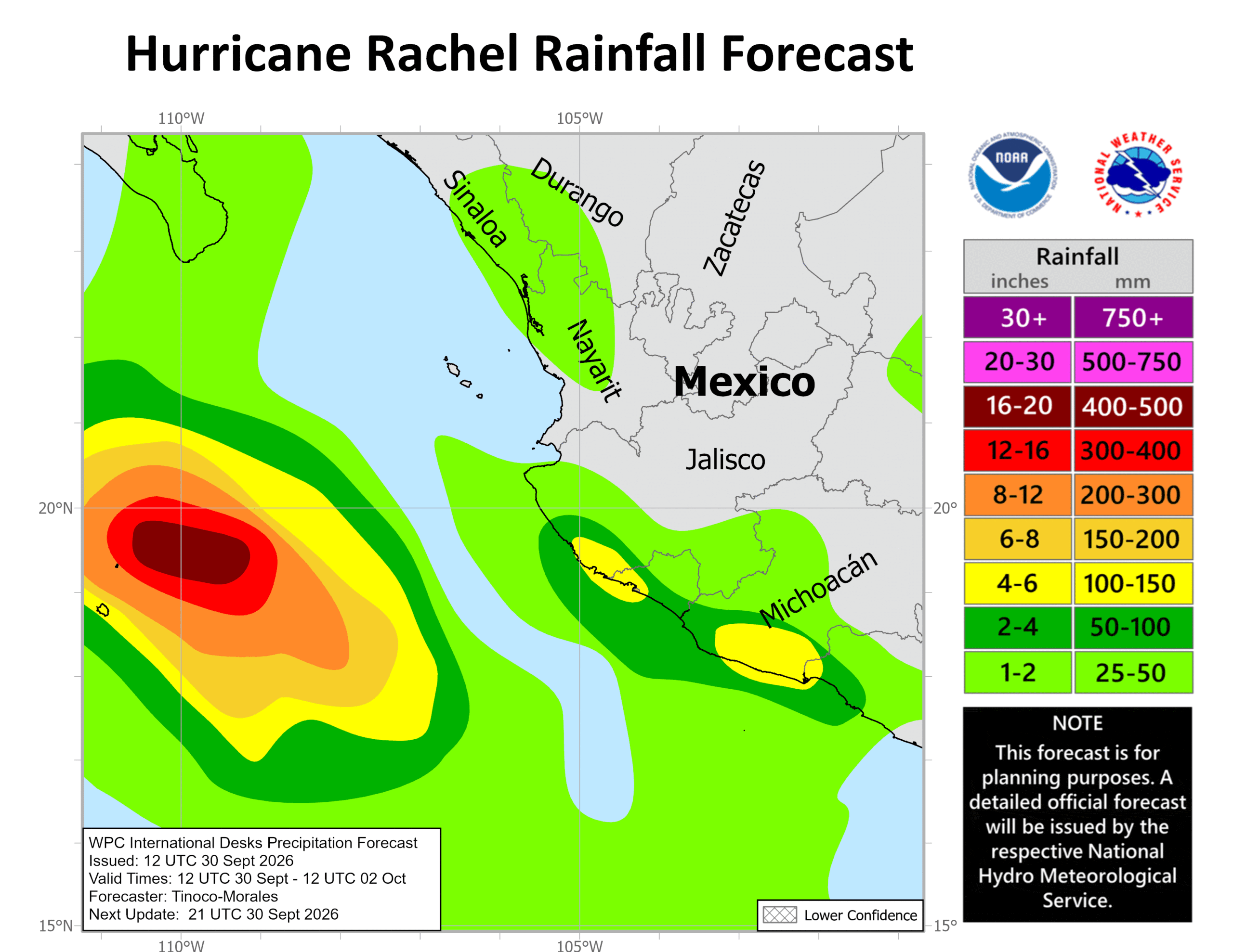
301455INTQPF_sm
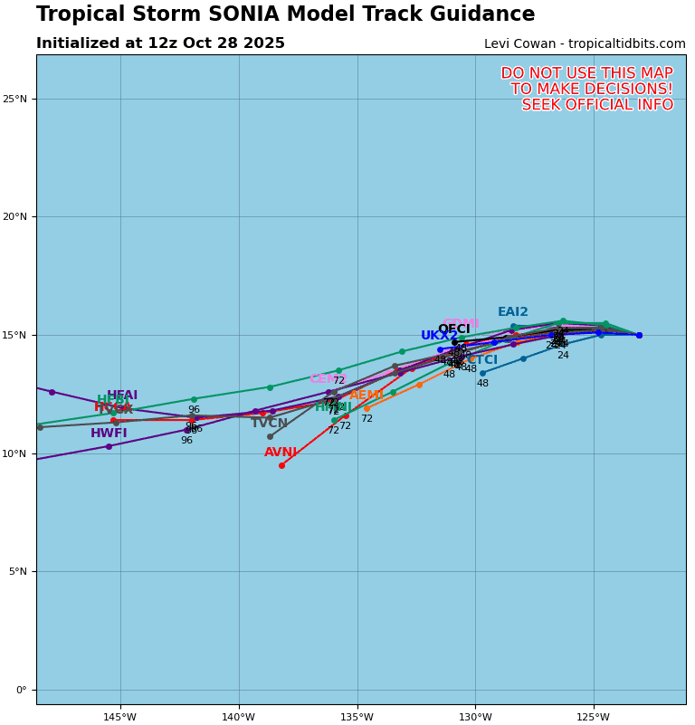
18E_tracks_latest
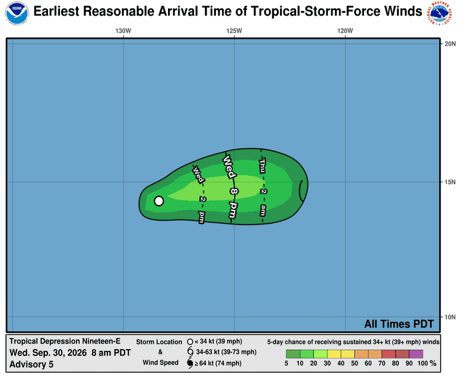
301446_earliest_reasonable_toa_34
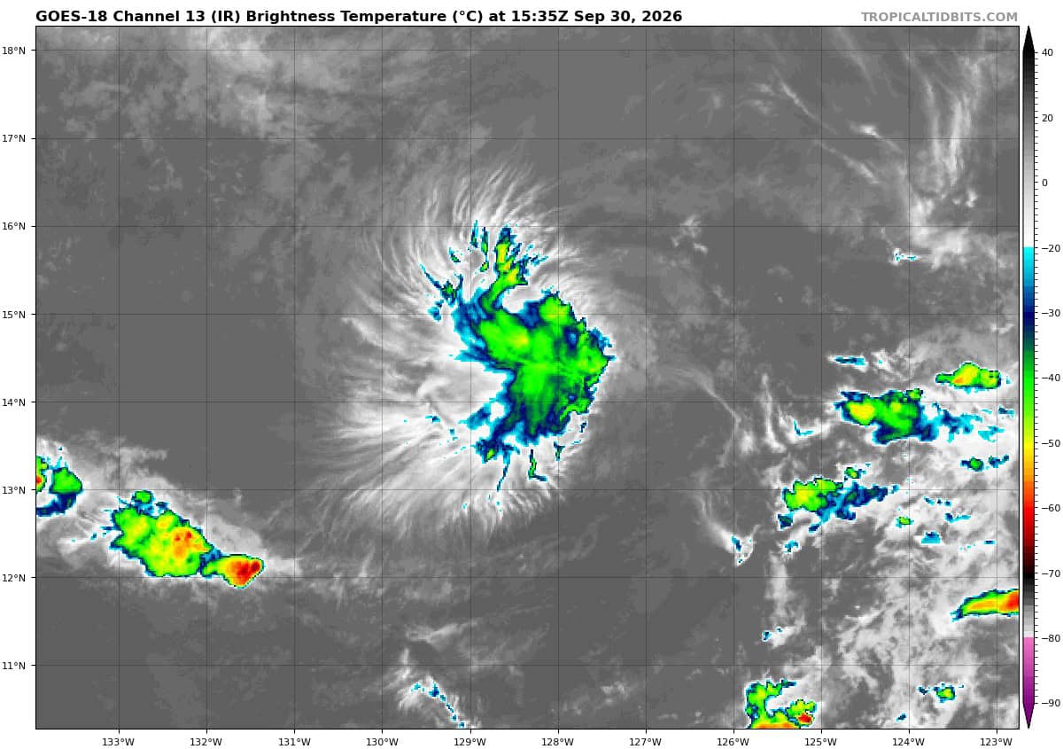
goes18_ir_19E_202609301535_lat14.2-lon-128.8
19E_tracks_latest
medium
nolo
301458_earliest_reasonable_toa_34
goes18_ir_15E_202609301535_lat22.2-lon-164.8
301458WPCQPF_sm
15E_eps_latest
2w
25W_301200sair
25W_tracks_latest
26W_301200sair
26W_tracks_latest
By PDC’s Senior Weather
Specialist Glenn James

The Pacific Disaster Center’s (PDC Global) Tuesday, September 29, 2026, Tropical Cyclone Activity Report…for the Pacific Ocean, the Indian Ocean, and adjacent Seas.
Tropical Cyclones
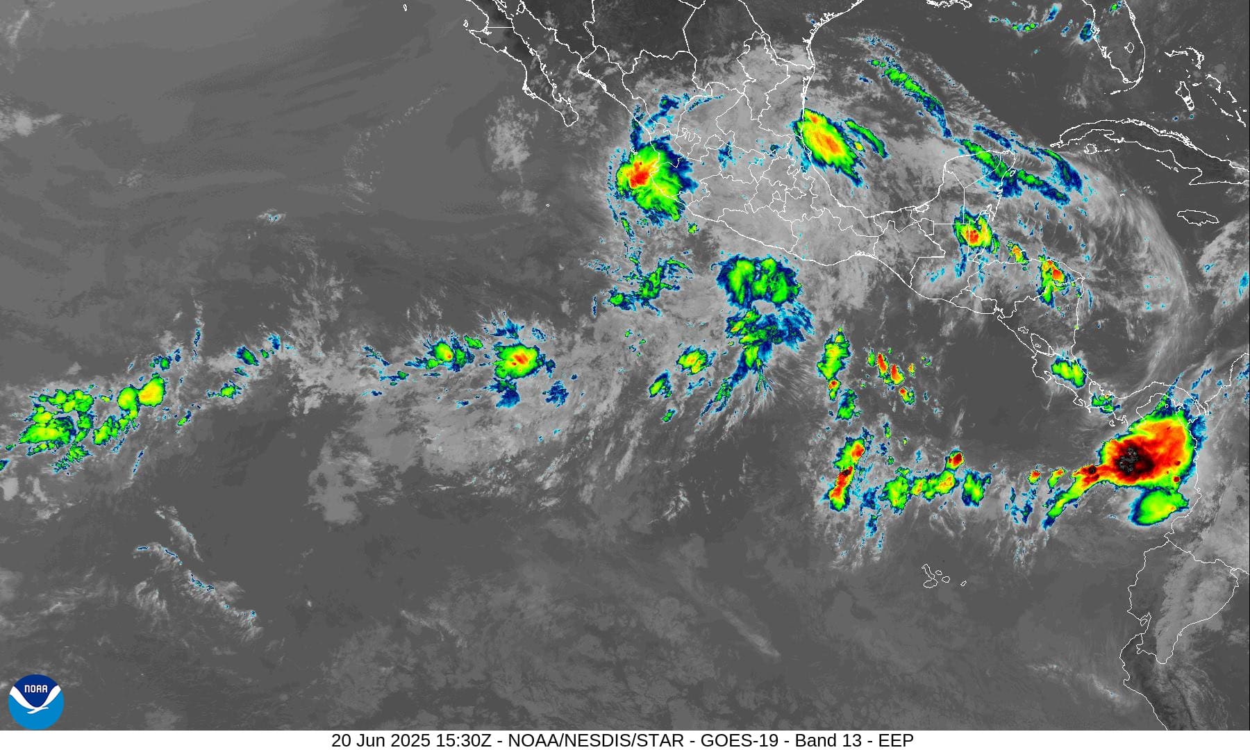
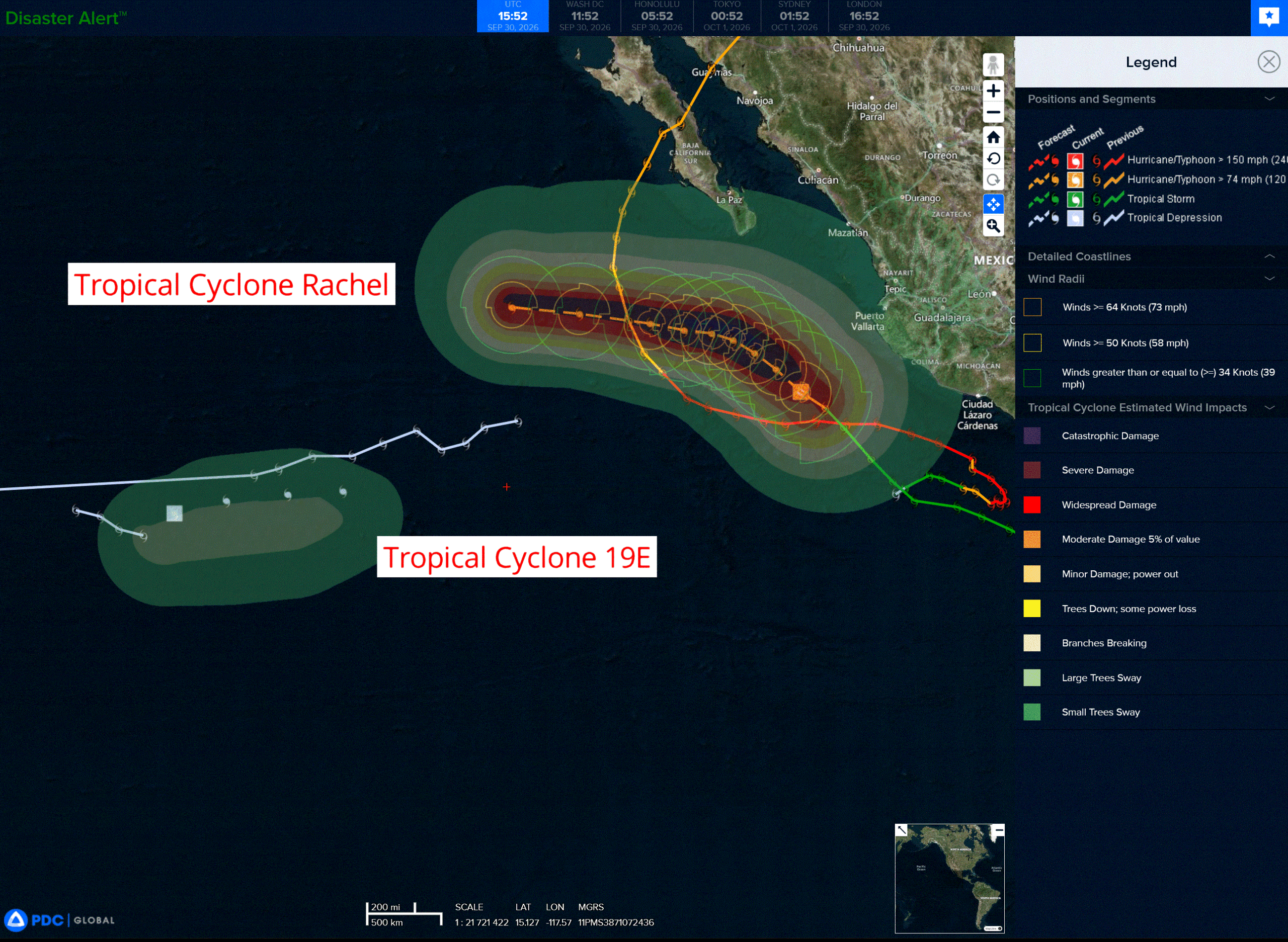
Tropical Cyclone 18E (Rachel) is located about 380 miles west of Lazaro Cardenas, Mexico
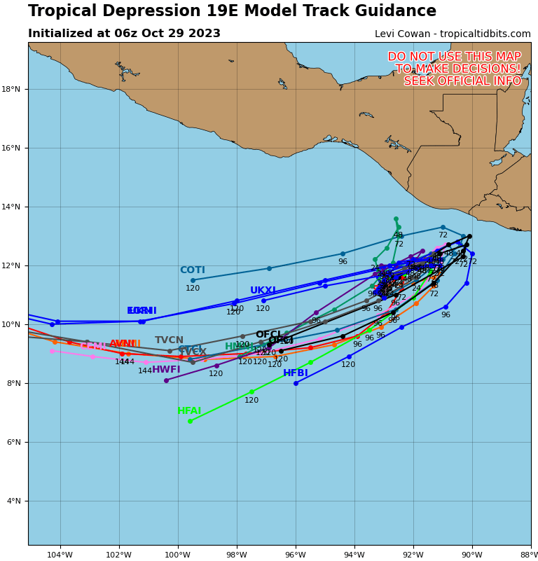
Tropical Cyclone 19E is located about 1345 miles west-southwest of the southern tip of Baja CA
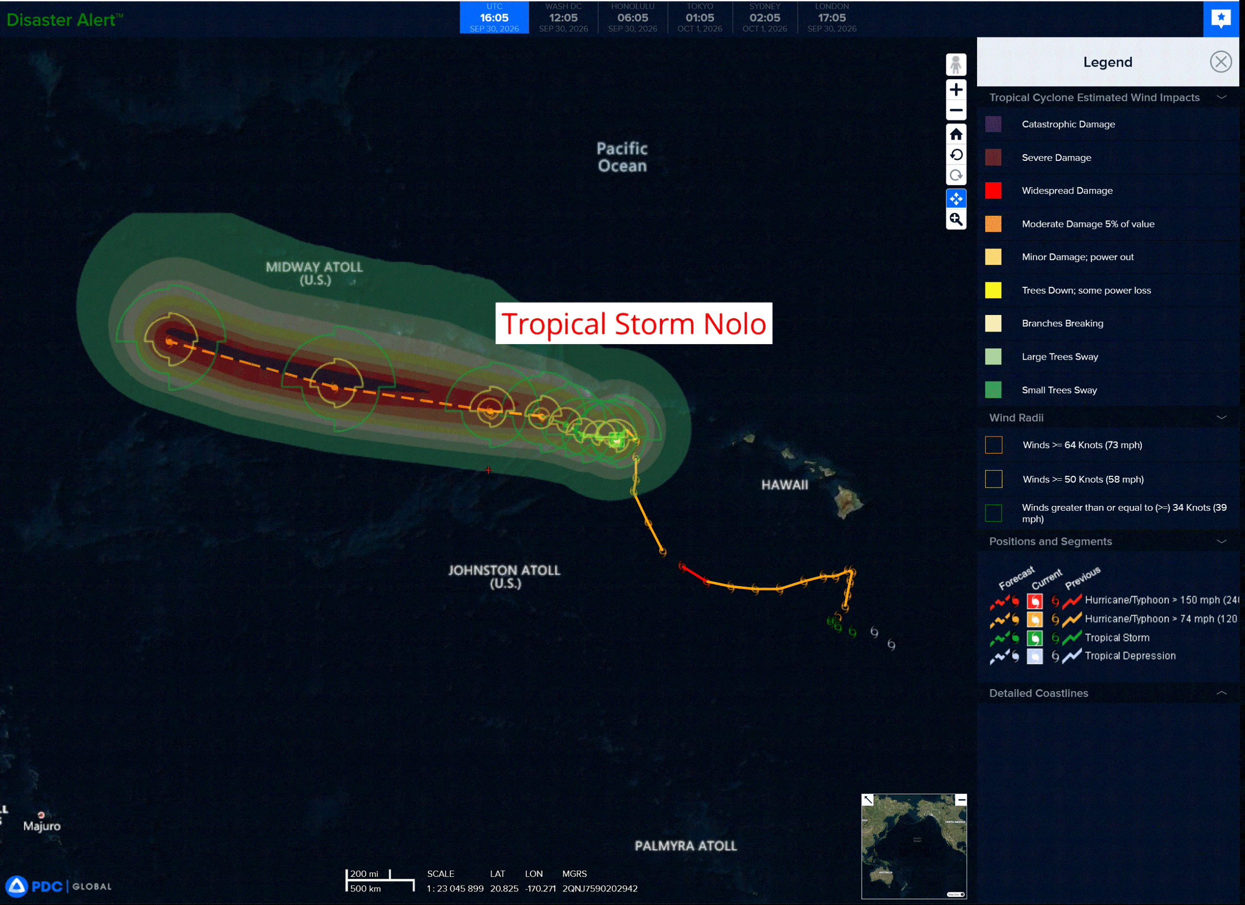
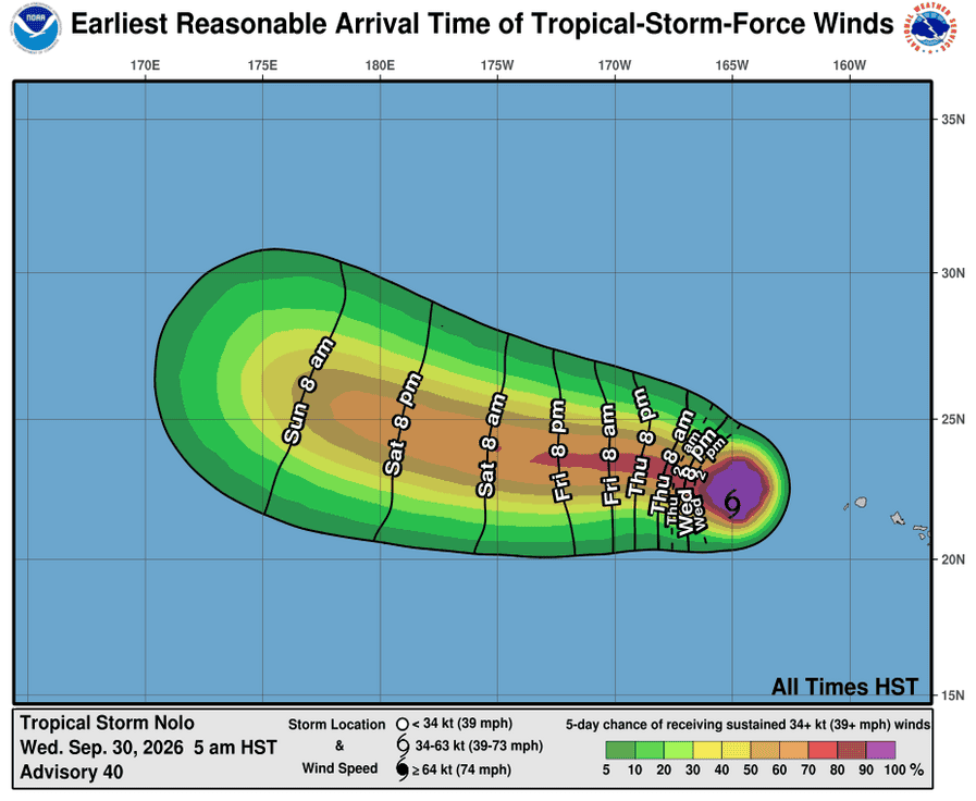
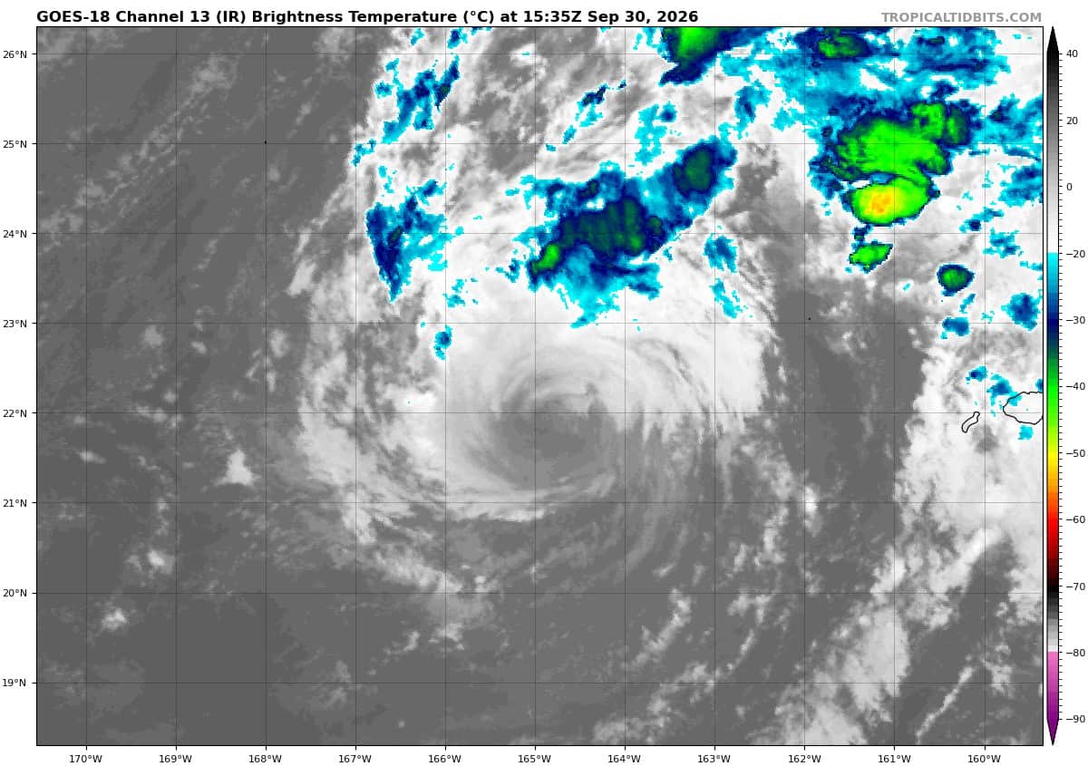
Tropical Cyclone 15E (Nolo) is located about 360 miles west of Lihue, Hawaii
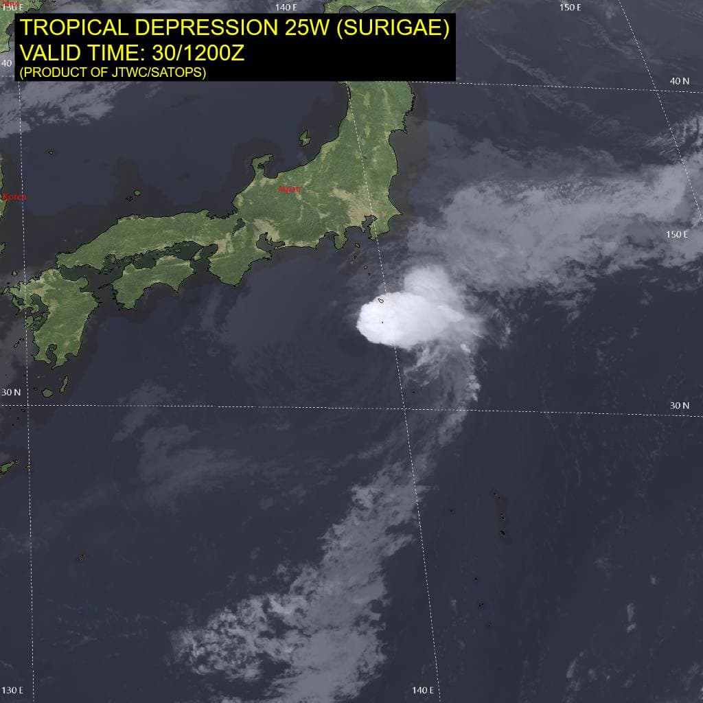
Tropical Cyclone 25W (Surigae) is located approximately 215 NM south-southwest of Yokosuka, Japan – Final Warning
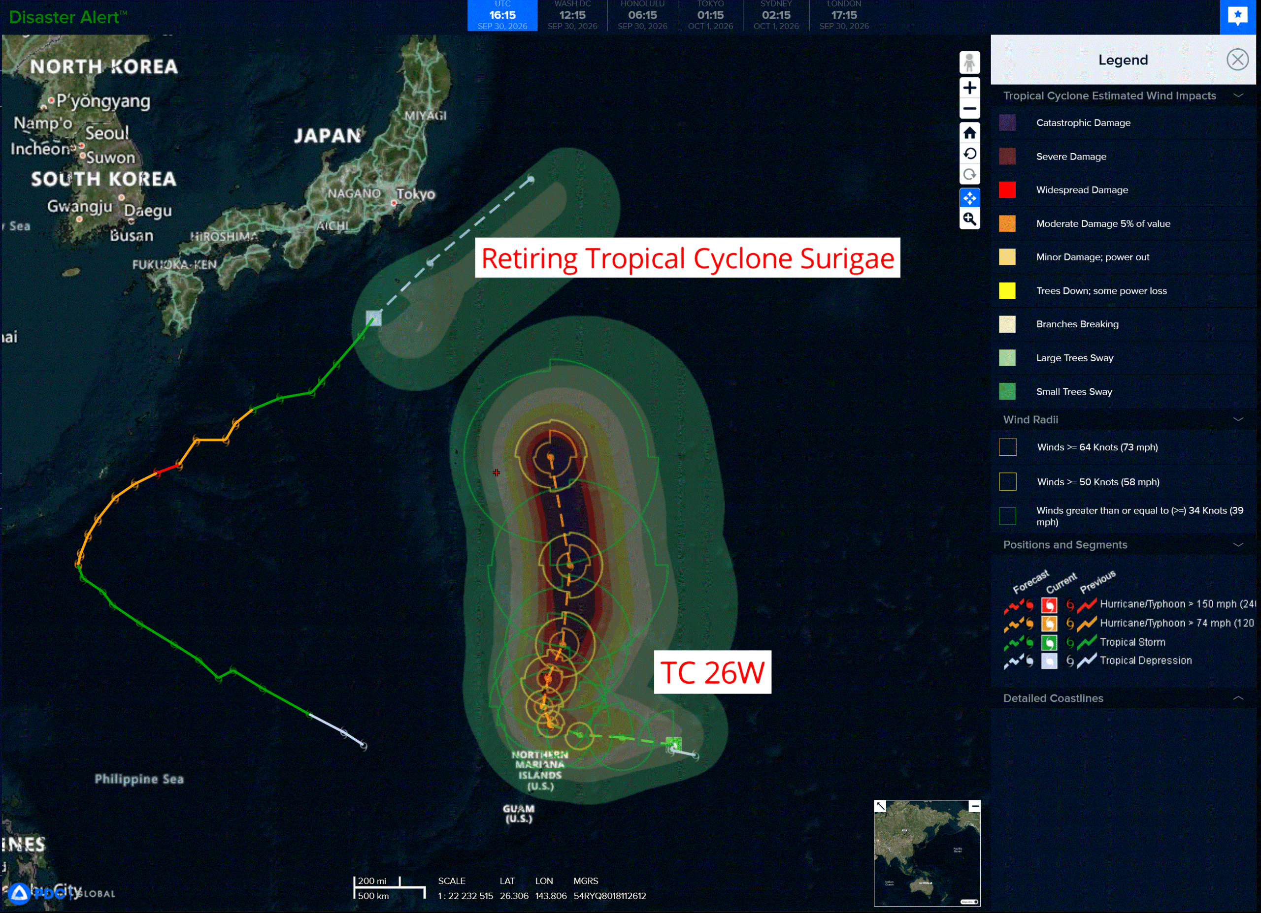
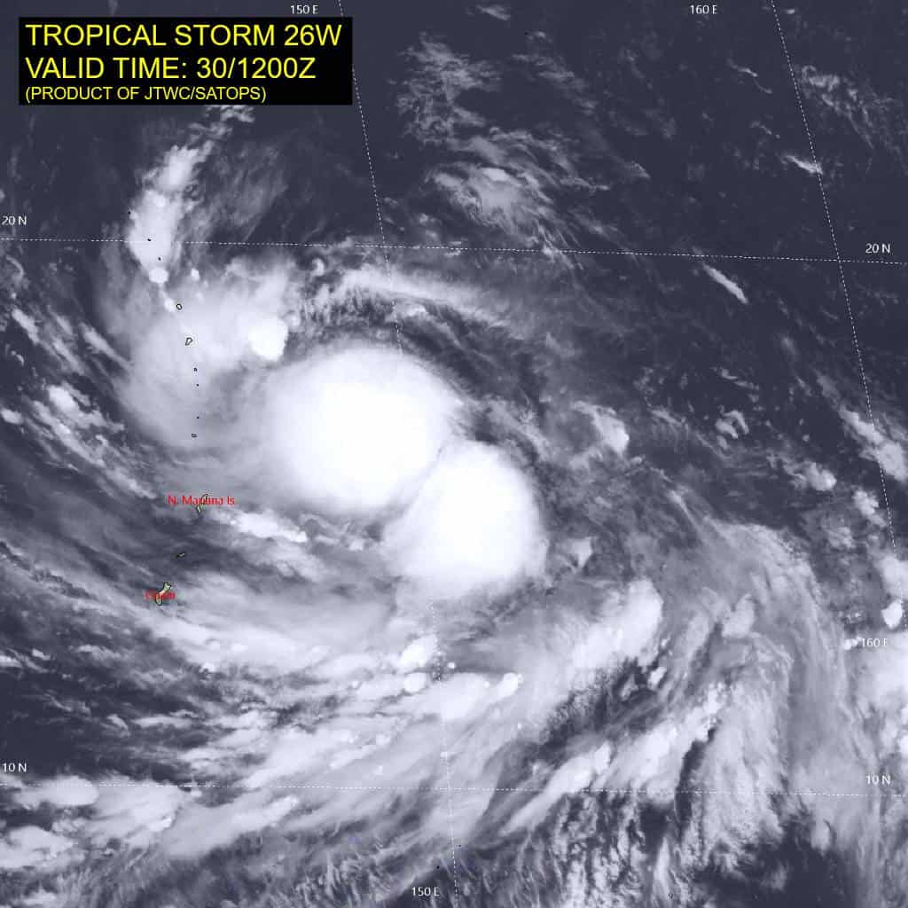
Tropical Cyclone 26W is located approximately 304 NM east of Saipan
Northeast Pacific:
Tropical cyclone 18E (Rachel)
RACHEL CONTINUES MOVING NORTHWESTWARD …WARNINGS AND WATCHES DISCONTINUED FOR THE COAST OF MEXICO
According to the NHC advisory number 14
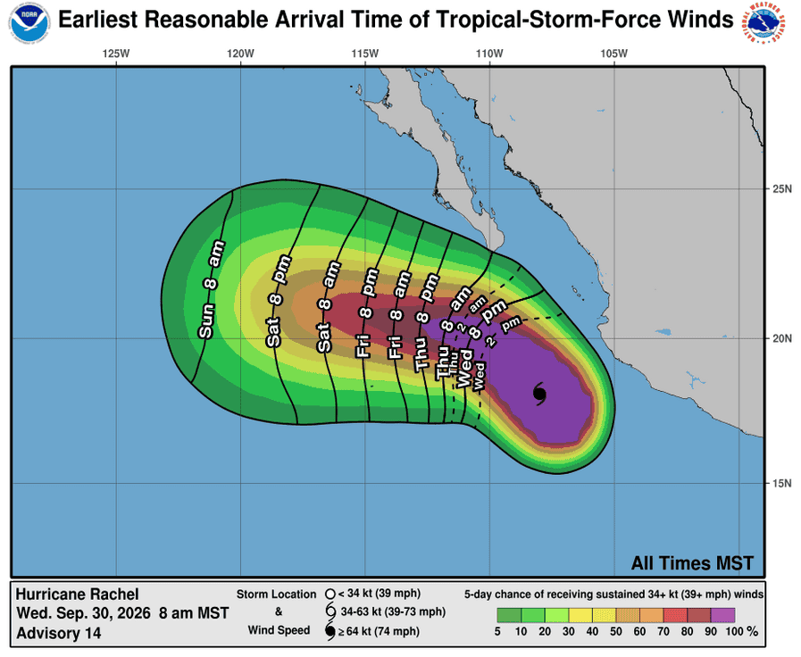
Rachel is moving toward the northwest near 9 mph (15 km/h). A northwestward motion at a slower forward speed is expected during the next day or two, followed by a turn toward the west-northwest and west later this week. On the forecast track, the center of Rachel is expected to move away from mainland Mexico and pass south of the Baja California Peninsula through Thursday.
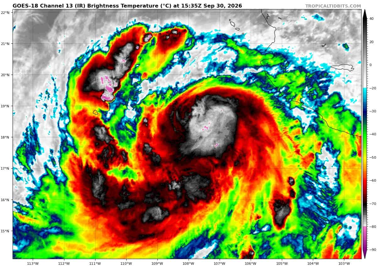
Maximum sustained winds are near 85 mph (140 km/h) with higher gusts. Rapid strengthening is expected today and tonight, and Rachel could become a major hurricane within the next day or so.
Hurricane-force winds extend outward up to 25 miles (35 km) from the center and tropical-storm-force winds extend outward up to 160 miles (260 km). The estimated minimum central pressure is 978 mb (28.88 inches).
HAZARDS AFFECTING LAND
WIND: Gusts to tropical-storm force are possible along portions of the coast of southwestern Mexico through tonight.
RAINFALL: RAINFALL: Rachel is expected to produce additional rainfall totals of 2 to 6 inches, with isolated maximum storm totals of 12 inches, across coastal portions of the Mexican states of Guerrero, Michoacán, Colima and Jalisco. This rainfall may produce life-threatening flooding and mudslides, especially in areas of steep terrain.
SURF: Swells generated by Rachel will affect the southwestern coast of Mexico during the next couple of days and spread northward along the coast of west-central Mexico and the Baja California Peninsula through the end of the week. These swells are likely to cause life-threatening surf and rip current conditions.
Tropical cyclone 19E
TROPICAL DEPRESSION NINETEEN-E A LITTLE STRONGER
According to the NHC advisory number 5
The depression is moving toward the east near 10 mph (17 km/h). An eastward to east-northeastward motion is expected over the next day or so.
Maximum sustained winds have increased to near 35 mph (55 km/h) with higher gusts. Little change in strength is forecast during the next day or so, and this system is expected to degenerate into a post-tropical remnant low by late Thursday.
The estimated minimum central pressure is 1002 mb (29.59 inches).
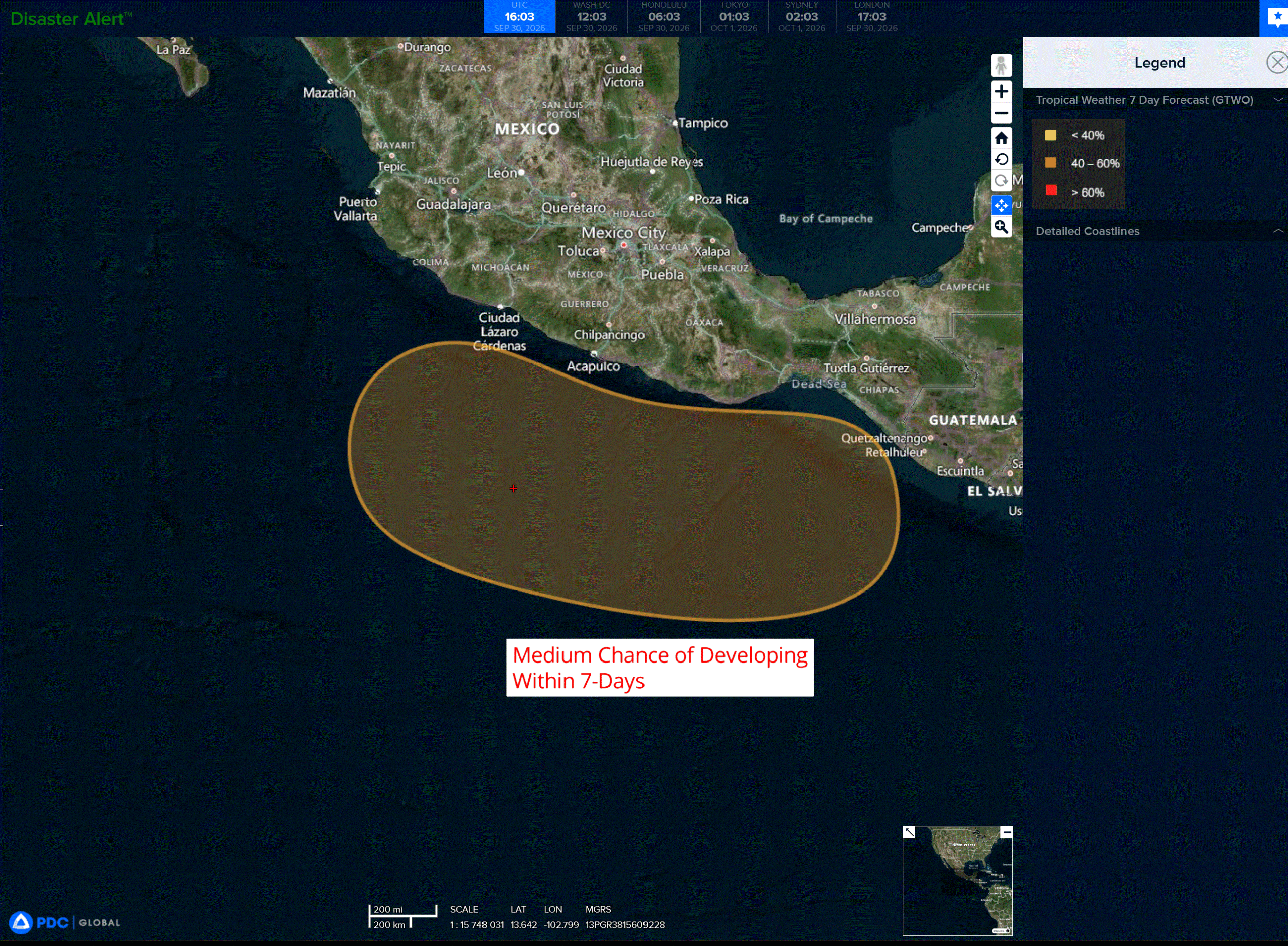
>>> South of Southern Mexico:
An area of low pressure could form late this weekend or early next week south of the southern coast of Mexico.
Thereafter, environmental conditions appear favorable for gradual development, and a tropical depression could form while the system moves slowly west-northwestward to northwestward.
* Formation chance through 48 hours…low…near 0 percent
* Formation chance through 7 days…medium…40 percent
Central North Pacific:
Tropical Cyclone 15E (Nolo)
NOLO CONTINUES TO BRING DANGEROUS CONDITIONS TO PORTIONS OF THE PAPAHANAUMOKUAKEA MARINE NATIONAL MONUMENT…TROPICAL STORM WARNING ISSUED FOR THE PAPAHANAUMOKUAKEA MARINE NATIONAL MONUMENT FROM FRENCH FRIGATE SHOALS TO MARO REEF
According to the NHC advisory number 40
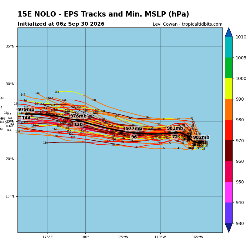
Nolo is moving toward the west-southwest near 6 mph (9 km/h) across the Papahanaumokuakea Marine National Monument. A westward to west-northwestward motion at a slower forward speed is expected over the next couple of days, followed by a faster motion by this weekend.
Maximum sustained winds are near 60 mph (95 km/h) with higher gusts. Little change in strength is expected over the next day or so, followed by re-intensification later this week.
Tropical-storm-force winds extend outward up to 125 miles (205 km) from the center. The estimated minimum central pressure is 991 mb (29.27 inches).
HAZARDS AFFECTING LAND WIND:
WIND: Tropical storm conditions are expected within the Tropical Storm Warning area from Nihoa to French Frigate Shoals today, with tropical storm conditions spreading westward from French Frigate Shoals to Maro Reef by Thursday.
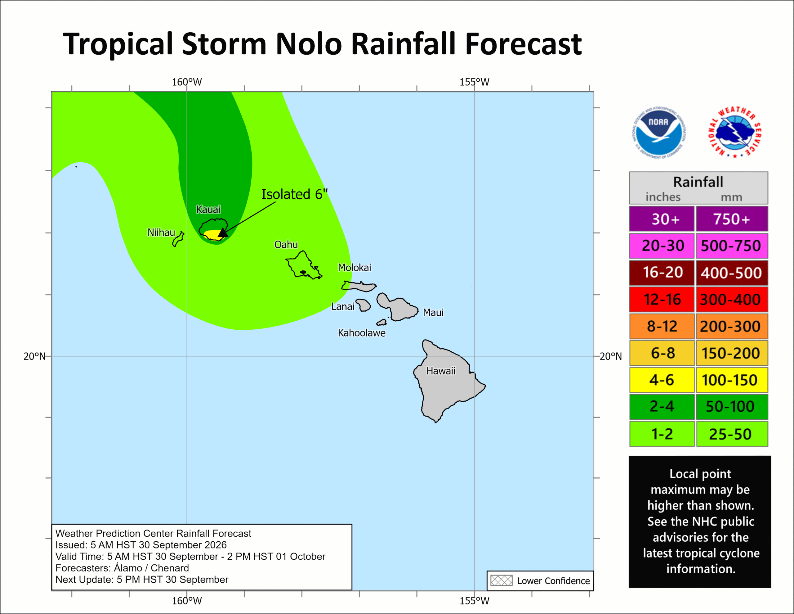
RAINFALL: Outer bands east of Nolo will produce an additional 2 to 6 inches of rain across Kauai and Niihau through Thursday, with maximum storm totals of 10 inches across Kauai. This rainfall could produce areas of flooding and mudslides, especially in areas of steep terrain.
SURF: Large surf associated with Nolo will continue to affect the Papahanaumokuakea Marine National Monument over the next several days. These large waves will likely inundate some of the low-lying atolls, especially from French Frigate Shoals to Nihoa.
Western Pacific, Indian Ocean, and adjacent Seas:
Western Pacific
Tropical Cyclone 25W (Surigae) – Final Warning
According to the JTWC warning number 30…sustained winds were 30 knots with gusts to 40 knots
Animated multi-spectral imagery depicts tropical depression 25W (Surigae) as a highly sheared, elongated, and poorly defined low-level circulation center that is completely inundated with dry air. The 301222z ascat
data confirms the center is stretched to the northeast.
Environmental analysis reveals a hostile environment characterized by high (35-40 kts) vertical wind shear and significant dry air induced by jet interaction, marginal (26-27 c) sea surface temperatures, and poor outflow.
25W is entering into the baroclinc zone and is exhibiting characteristics indicating it has begun extratropical transition, including moderate thermal advection and embedding under the upper-level westerlies.
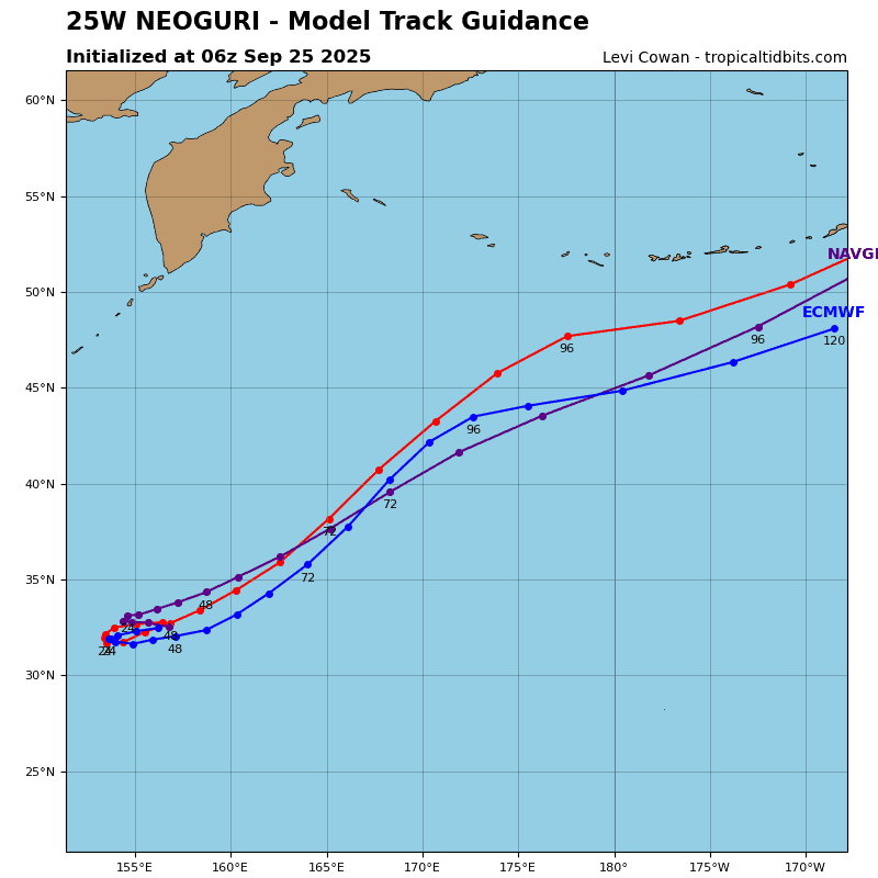
Deterministic model guidance is in strong agreement that 25W will complete extratropical transition no later than 12 hours.
Tropical Cyclone 26W
According to the JTWC warning number 3…sustained winds were 35 knots with gusts to 45 knots
Animated enhanced infrared (eir) satellite imagery depicts tropical storm 26W as a broad, but consolidating, system with two recently formed plumes of deep convection in the southwestern quadrant. The 301015z ascat pass reveals 26W has a vast wind field of 20-25 kt winds with a small pocket of 35 kts in the northwestern quadrant. The ascat also reveals the center remains asymmetric and elongated in the east-west direction.
Environmental analysis reveals a marginally favorable environment characterized by low to moderate (15-20 kts) vertical wind shear (vws), warm (29-30 c) sea surface temperatures (sst), and moderate radial outflow. The main inhibitor to intensification remain the storm’s poor organization and dry air introduced by mid-level wind shear.
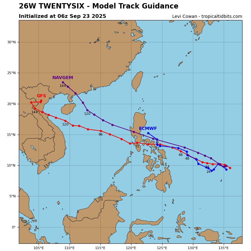
TS 26W is forecast to continue tracking westward while it remains on the southwestern periphery of the
steering ridge. At around 24-36 hours, a shortwave trough to the northwest will weaken the western extent of the ridge, causing 26W to turn northward. 26W will track generally northward from 36 hours through the end of the forecast period. 26W is expected to curve slightly to the northeast between 60-96 hours as the steering ridge rebuilds to the west following the passing of the trough.
Regarding intensity, 26W is forecast to gradually intensify until 48 hours. Following 48 hours, 26W is expected to steadily intensify at an increased rate until peaking at 96-120 hours. The environment is expected to improve after 48 hours, notably lower vws, improved poleward outflow after the trough passes, and improved consolidation of the storm structure, which will allow 26W to strengthen.