

Current Snapshot
For all the latest updates visit: DisasterAWARE
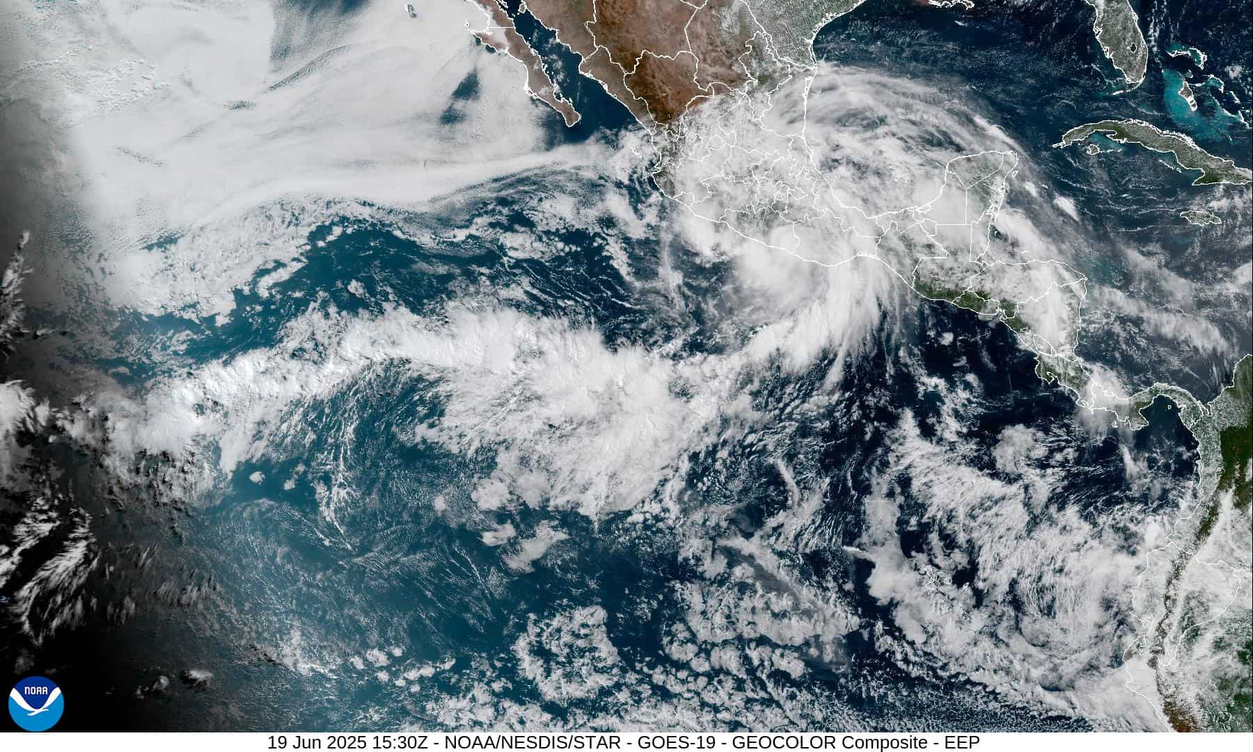
1800x1080e
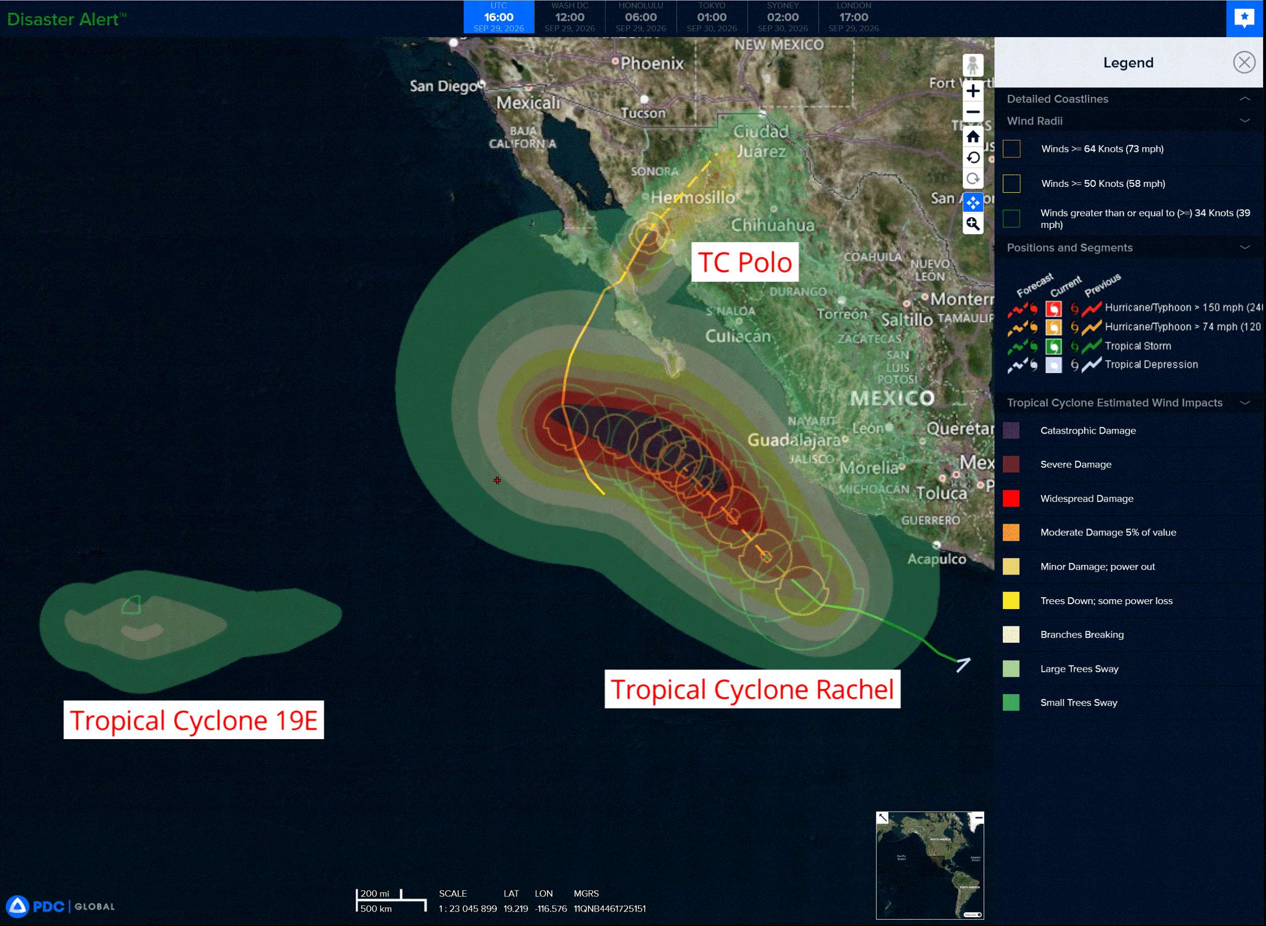
3e
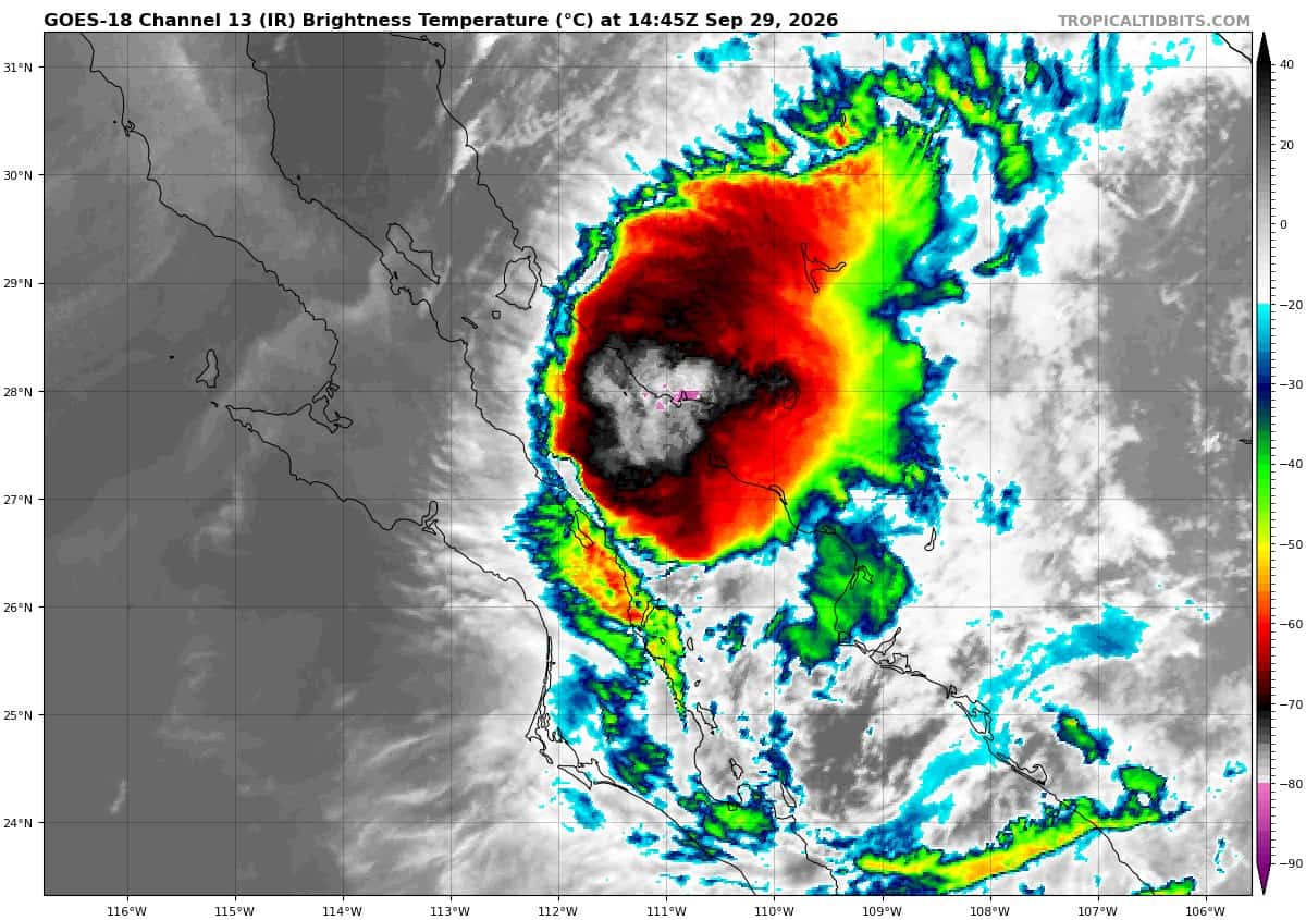
goes18_ir_17E_202609291445_lat26.9-lon-111.5P
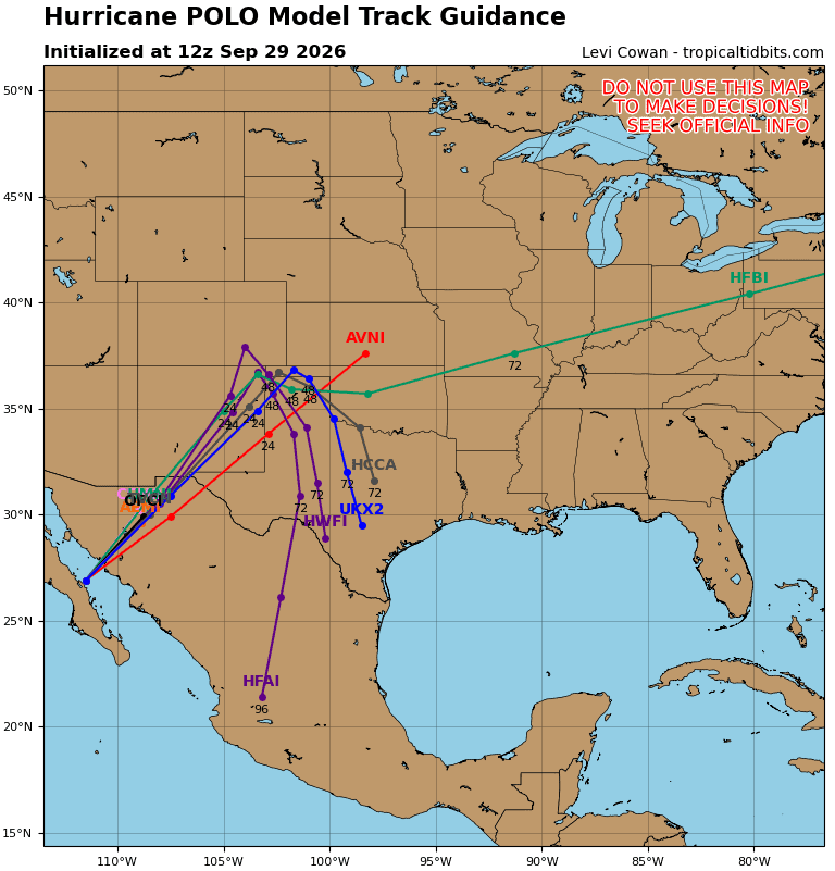
17E_tracks_latest
291450_earliest_reasonable_toa_34
291450INTQPF_sm
18E_tracks_latest
291449_earliest_reasonable_toa_34
goes18_ir_19E_202609291545_lat14.5-lon-132.1
19E_gefs_latest
nolo
291446_earliest_reasonable_toa_34N
goes18_ir_15E_202609291545_lat20.1-lon-164.2
291446WPCQPF_sm
15E_tracks_latest
sur
25W_291200sair
25W_tracks_latest
93w
himawari9_ir_93W_202609291550_lat15.9-lon153.0
93W_tracks_latest
By PDC’s Senior Weather
Specialist Glenn James

The Pacific Disaster Center’s (PDC Global) Tuesday, September 29, 2026, Tropical Cyclone Activity Report…for the Pacific Ocean, the Indian Ocean, and adjacent Seas.
Tropical Cyclones
Tropical Cyclone 17E (Polo) is located about 15 miles south of Guaymas, Mexico
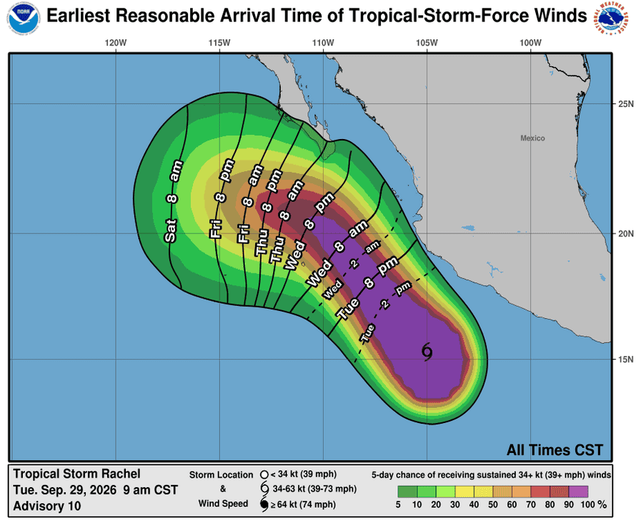
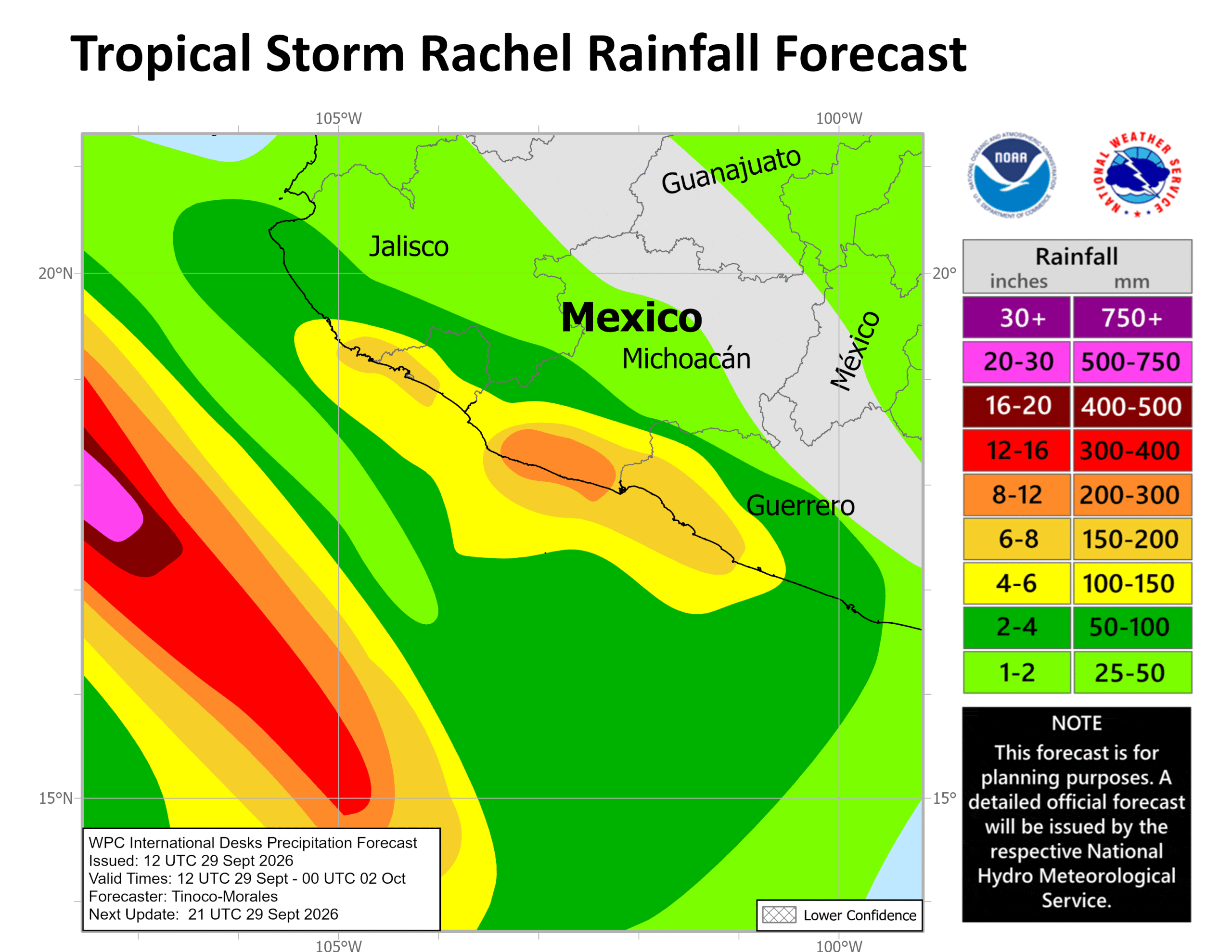
Tropical Cyclone 18E (Rachel) is located about 265 miles southwest of Lazaro Cardenas, Mexico
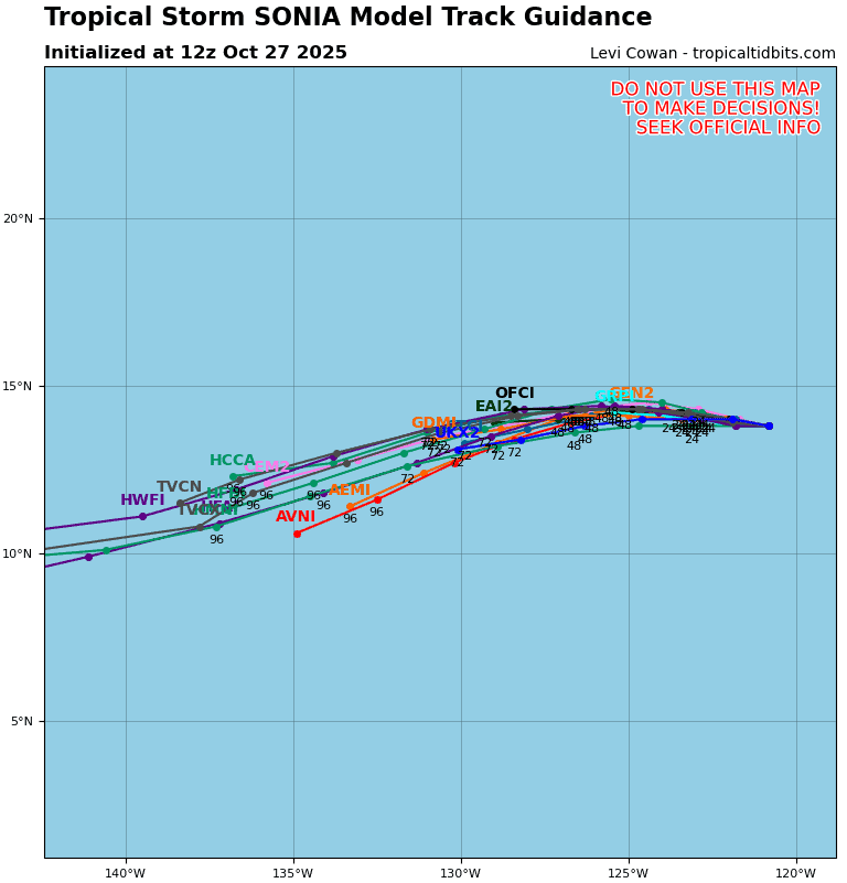
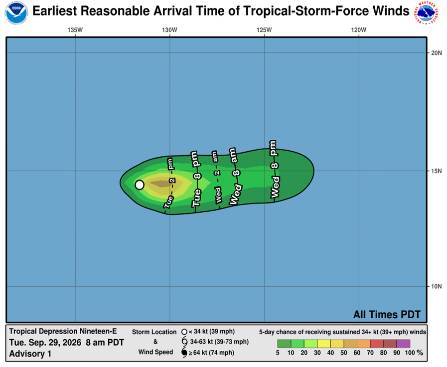
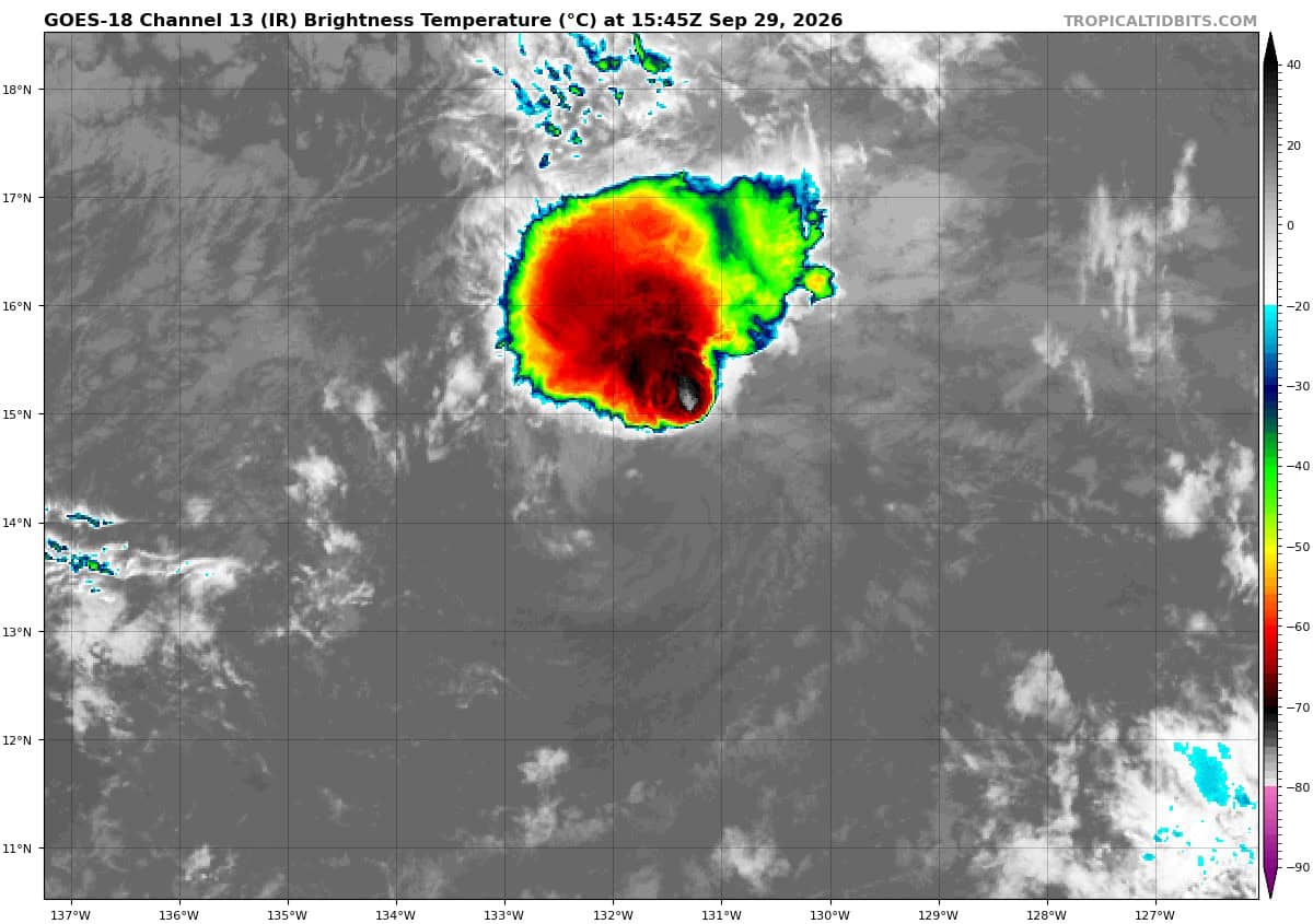
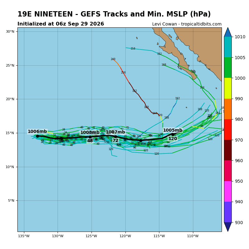
Tropical Cyclone 19E is located about 1535 miles west-southwest of the southern tip of Baja CA
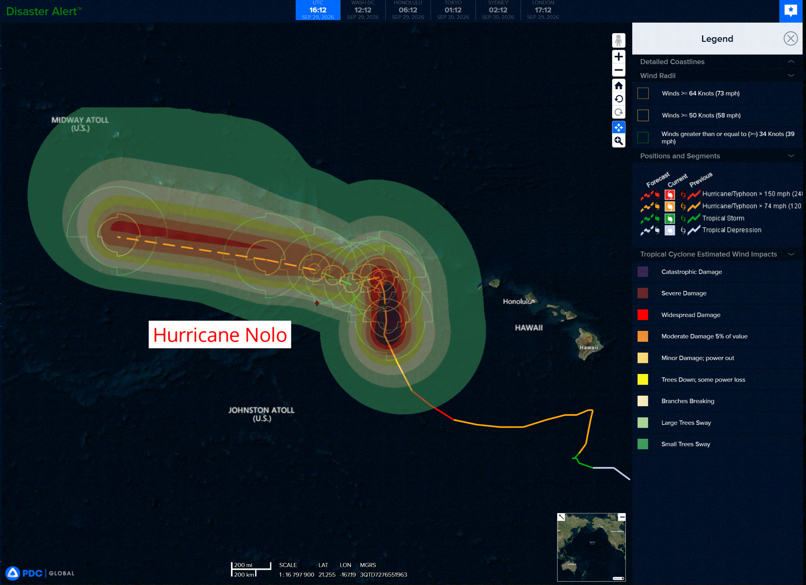
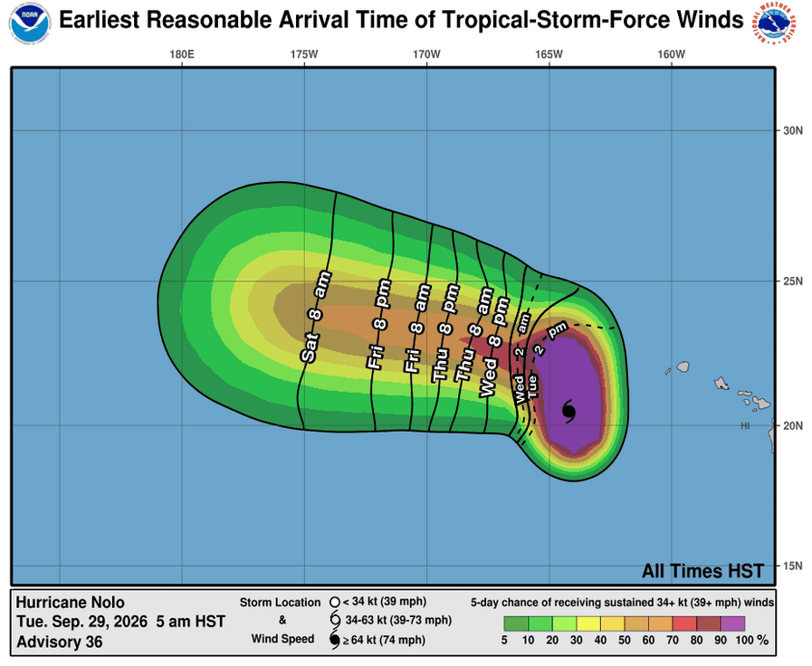
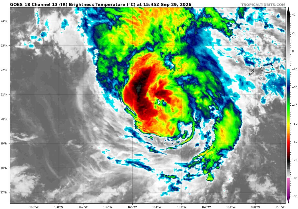
Tropical Cyclone 15E (Nolo) is located about 325 miles west-southwest of Lihue, Hawaii
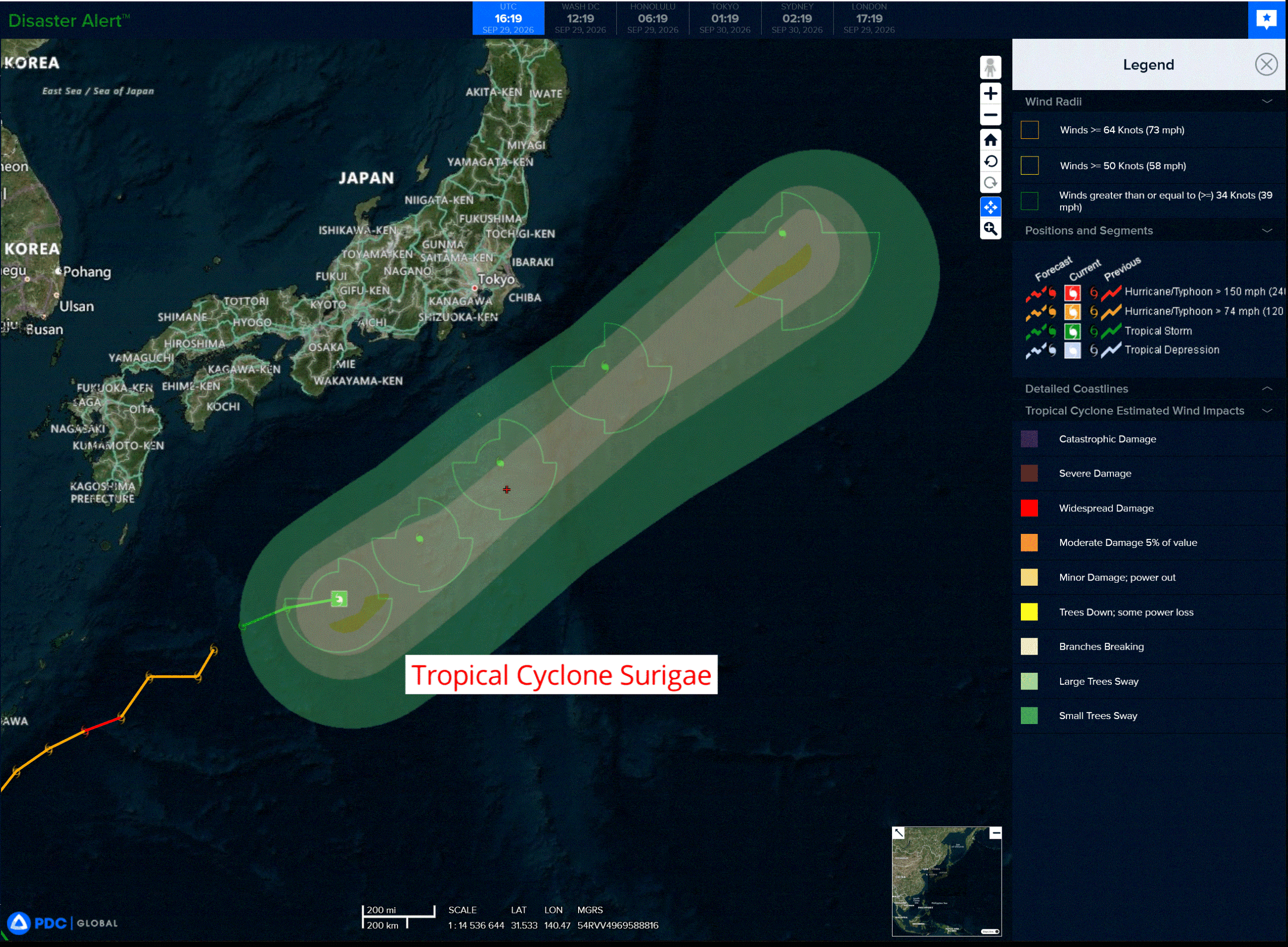
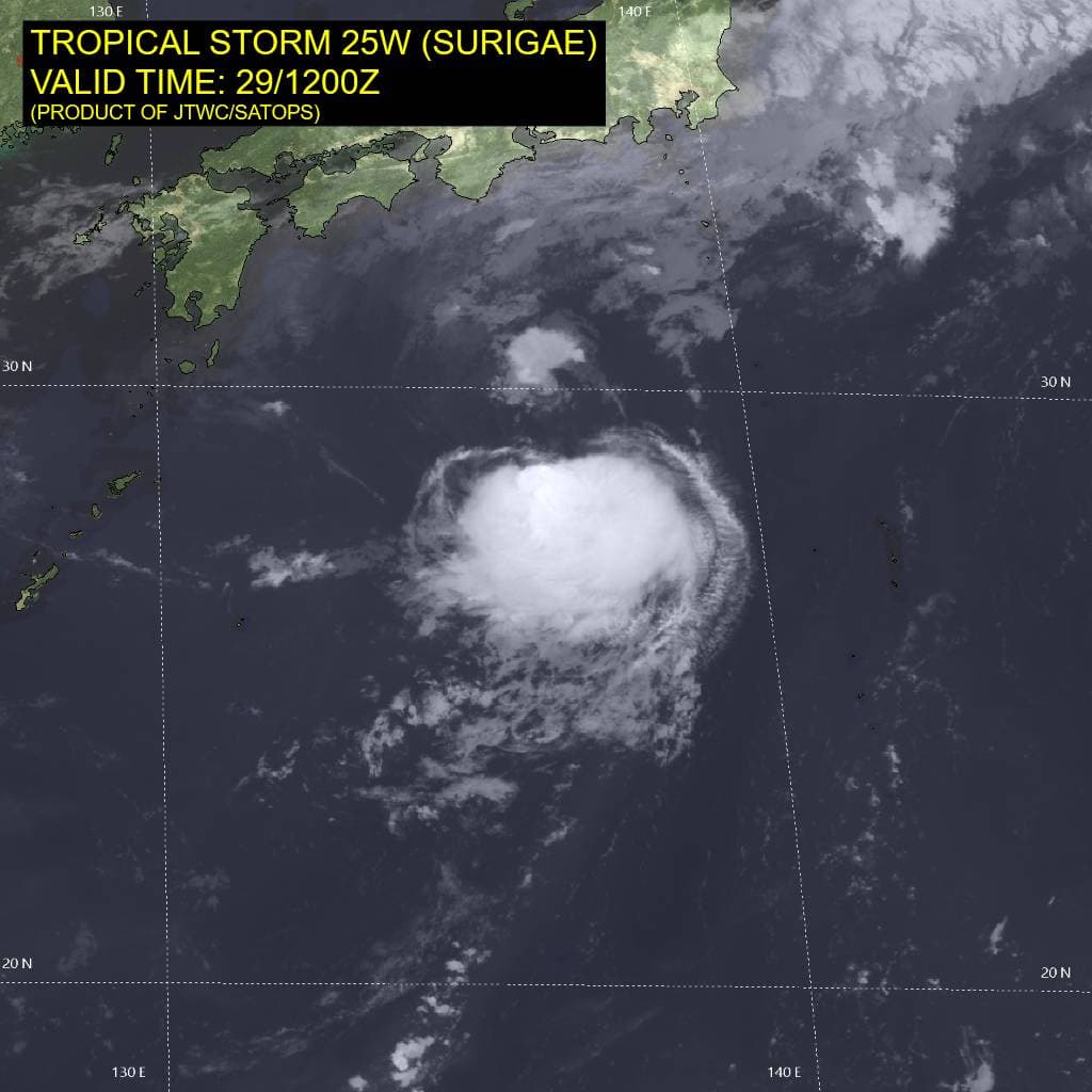
Tropical Cyclone 25W (Surigae) is located approximately 405 NM south-southwest of Yokosuka, Japan
Northeast Pacific:
Tropical cyclone 17E (Polo)
POLO ABOUT TO MAKE LANDFALL NEAR GUAYMAS MEXICO …CONDITIONS DETERIORATING IN THE LANDFALL AREA
According to the NHC advisory number 36
Polo is moving toward the northeast near 17 mph (28 km/h) and this motion is expected to continue with an increase in forward speed today. On the forecast track, the core of Polo will move inland over southern Sonora near Guaymas during the next few hours and cross portions of northwestern Mexico this afternoon.
Maximum sustained winds are near 75 mph (120 km/h) with higher gusts. Little change in strength is expected before landfall. Rapid weakening is expected after landfall as the center crosses northwestern Mexico.
Hurricane-force winds extend outward up to 30 miles (45 km) from the center and tropical-storm-force winds extend outward up to 90 miles (150 km). The Mexican Navy automated station in Guaymas recently reported a wind gust of 52 mph (84 km/h). The estimated minimum central pressure is 981 mb (28.97 inches).
HAZARDS AFFECTING LAND
WIND: Hurricane conditions are expected in the warning area and possible in the watch area during the next few hours. Hurricane and tropical storm conditions are expected over northwestern Mexico near the center of Polo this afternoon. A Wind Advisory is in effect for portions of southern New Mexico and far western Texas where strong gusty winds are possible late today and tonight in association with Polo’s remnants.
RAINFALL: Polo is expected to produce rainfall totals of 4 to 6 inches across southern and central portions of Sonora with isolated maximum totals of 8 inches. An additional 1 to 2 inches of rainfall is expected across Baja California Sur. This rainfall may produce life-threatening flooding and mudslides, especially in areas of steep terrain.
STORM SURGE: A storm surge is expected to produce significant coastal flooding in areas of onshore winds. Near the coast, the surge will be accompanied by large and destructive waves.
SURF: Swells generated by Polo will continue to affect portions of the coast of the Baja California peninsula and northwestern Mexico during the next day or so. These swells are likely to cause life-threatening surf, rip currents, and coastal flooding.
Tropical cyclone 18E (Rachel)
RACHEL SLIGHTLY STRONGER
According to the NHC advisory number 10
Rachel is moving toward the west-northwest near 13 mph (20 km/h). A general northwestward motion at a slower forward speed is expected during the next few days. On the forecast track, the center of Rachel is predicted to move parallel to, but stay offshore of, the coast of southwestern Mexico.
Maximum sustained winds are near 65 mph (100 km/h) with higher gusts. Gradual strengthening is expected during the next few days, and Rachel is forecast to become a hurricane later today.
Tropical-storm-force winds extend outward up to 160 miles (260 km) from the center. The estimated minimum central pressure is 987 mb (29.15 inches).
HAZARDS AFFECTING LAND
WIND: Tropical storm conditions are expected in the warning area later today or tonight. Tropical storm conditions are possible in the watch area by tonight or Wednesday.
RAINFALL: Rachel is expected to produce rainfall totals of 4 to 8 inches, with isolated maximum totals of 12 inches across coastal portions of the Mexican states of Guerrero, Michoacán, Colima and Jalisco. This rainfall may produce life-threatening flooding and mudslides, especially in areas of steep terrain.
SURF: Swells generated by Rachel will affect portions of the southwestern coast of Mexico during the next couple of days and spread northward through the end of the week. These swells are likely to cause life-threatening surf and rip current conditions.
Tropical cyclone 19E
NEW TROPICAL DEPRESSION EXPECTED TO BE SHORT-LIVED WELL OFFSHORE OF MEXICO
According to the NHC advisory number 1
The depression is moving toward the east near 9 mph (15 km/h) and this motion is expected to continue for the next few days.
Maximum sustained winds are near 35 mph (55 km/h) with higher gusts. The depression could become a tropical storm later today before weakening on Wednesday. The system is likely to degenerate into a post-tropical cyclone by late Thursday.
The estimated minimum central pressure is 1004 mb (29.65 inches).
Central North Pacific:
Tropical Cyclone 15E (Nolo)
NOLO IMPACTING THE PAPAHANAUMOKUAKEA MARINE NATIONAL MONUMENT
According to the NHC advisory number 36
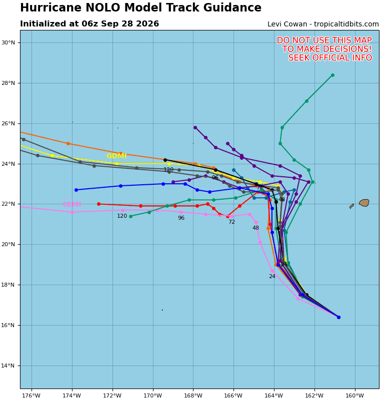
Nolo is moving toward the north near 9 mph (15 km/h). On the forecast track, the center of Nolo will remain well southwest and west of the main Hawaiian Islands. Nolo will continue to move northward across the Papahanaumokuakea Marine National Monument today. On Wednesday, Nolo will slow significantly, and turn toward the west, and continue generally westward through the latter part of the week.
Maximum sustained winds are near 110 mph (175 km/h) with higher gusts. Steady weakening is forecast over the next couple of days, followed by some re-intensification during the latter part of this week.
Hurricane-force winds extend outward up to 45 miles (75 km) from the center and tropical-storm-force winds extend outward up to 140 miles (220 km). The estimated minimum central pressure is 964 mb (28.47 inches).
HAZARDS AFFECTING LAND WIND:
WIND: Hurricane conditions are expected in the Hurricane Warning area in the Papahanaumokuakea Marine National Monument by Wednesday, with tropical storm conditions ongoing.
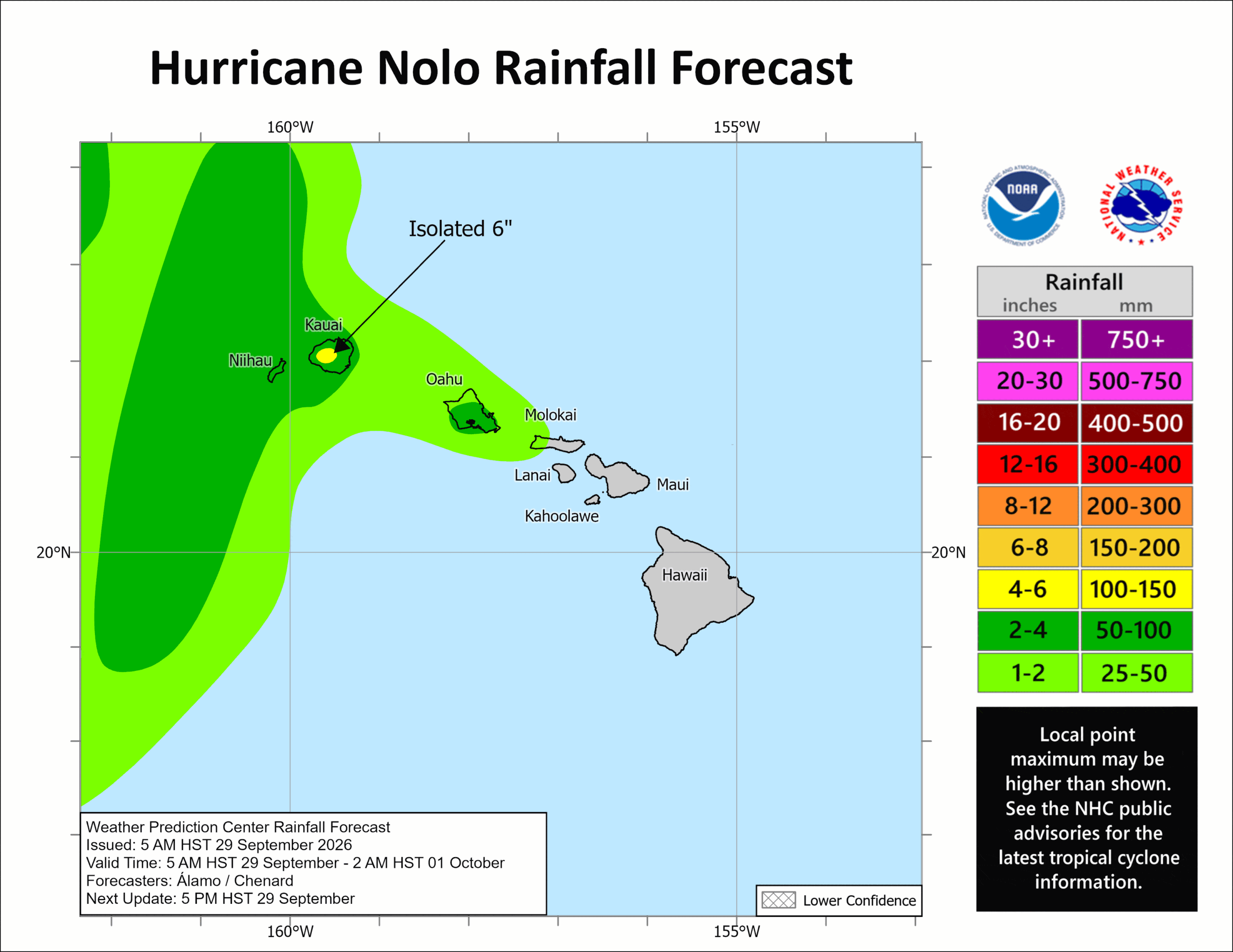
RAINFALL: Outer bands east of Nolo’s track will produce 3 to 6 inches of rain across Kauai and Niihau through Thursday. This rainfall could produce areas of flooding and mudslides, especially in areas of steep terrain.
SURF: Swells generated by Nolo will affect south- and west-facing shores of the main Hawaiian Islands for the next few days. These swells are likely to cause life-threatening surf and rip current conditions. Large surf associated with Nolo will continue to affect the Papahanaumokuakea Marine National Monument over the next several days. These large waves will likely inundate some of the low-lying atolls, especially from French Frigate Shoals to Nihoa.
Western Pacific, Indian Ocean, and adjacent Seas:
Western Pacific
Tropical Cyclone 25W (Surigae)
According to the JTWC warning number 26…sustained winds were 45 knots with gusts to 55 knots
Animated enhanced infrared (eir) and shortwave infrared (swir) satellite imagery depict a fully exposed, compact low-level circulation center (llcc). Deep convection persists along convergent low-level asymptotes in the southeastern semicircle, organizing into a cdo-like feature. However, the llcc remains fully decoupled from this down-shear convective canopy, which is displaced southeastward by moderate-to-high (20-25 kt) northwesterly vertical wind shear (vws).
Synoptically, the southwestern extent of a stationary frontal boundary lies approximately 120 nm north of the llcc. Aloft, a broad 200mb anticyclone is positioned south of Shanghai, while a southwesterly jet stream overlies mainland Japan and extends out over the Pacific northeast of Hokkaido. A 291007z ssmis 91ghz microwave pass clearly resolved the shallow low-level curved banding wrapping into the exposed center, with vigorous convective activity restricted entirely to the down-shear southeastern quadrant.
Environmental conditions are unfavorable, dominated by elevated northwesterly shear, marginal equatorward outflow, and mid-level dry air entrainment. nonetheless, continued transit over the warm waters of the kuroshio current (28-29c) provides sufficient surface heat flux to sustain persistent convective activity.
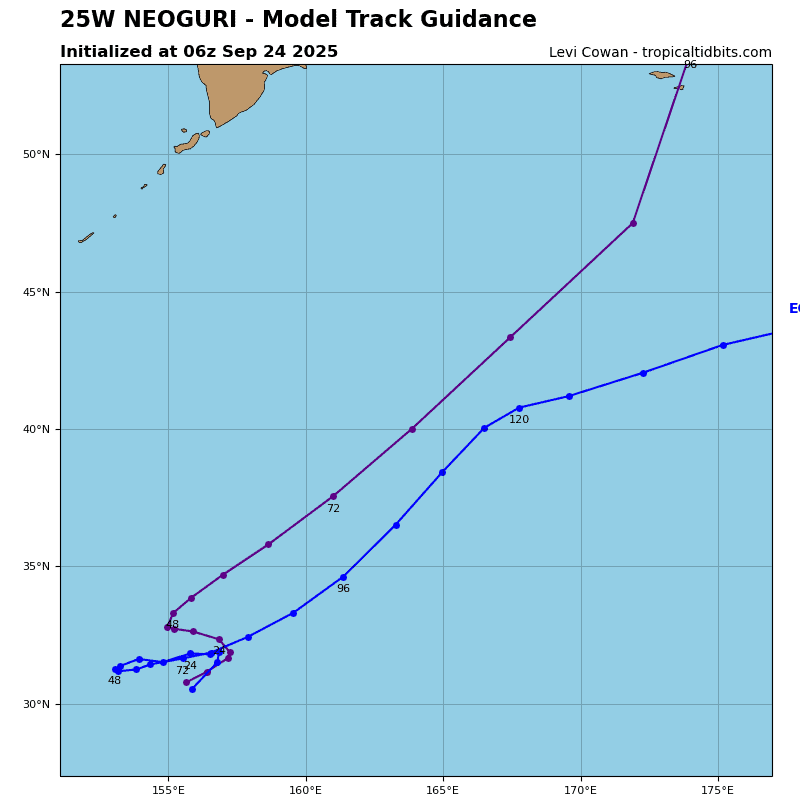
Tropical storm 25W is forecast to continue tracking northeastward along the northwestern periphery of the low- to mid-level str throughout the forecast period. 25W will remain in the warm sector south of the quasi-stationary coastal front through 24. By 36 hours 25W will interact directly with the coastal baroclinic zone, phase with a progressive 500mb shortwave trough, and move into the right-entrance quadrant of a 200mb upper-level jet streak, triggering extratropical transition (ett). Over the subsequent 12 hours, 25W will undergo rapid ett, structurally transforming into a cold-core, asymmetric extratropical low by 48 hours.
Regarding intensity: 25W will experience slight near-term weakening over the next 12 to 18 hours. However, persistent down-shear convective pulses driven by warm ssts within the Kuroshio Current will sustain borderline tropical storm force winds (35-40 kts) through 36 hours. As ett commences, strong baroclinic forcing coupled with upper-level divergent ventilation will arrest decay, prompting secondary post-transition re-intensification by 48 hours.
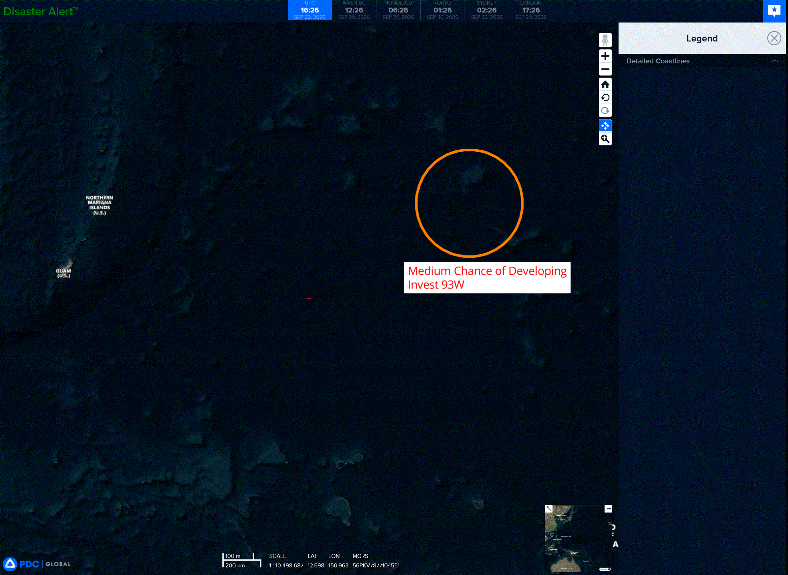
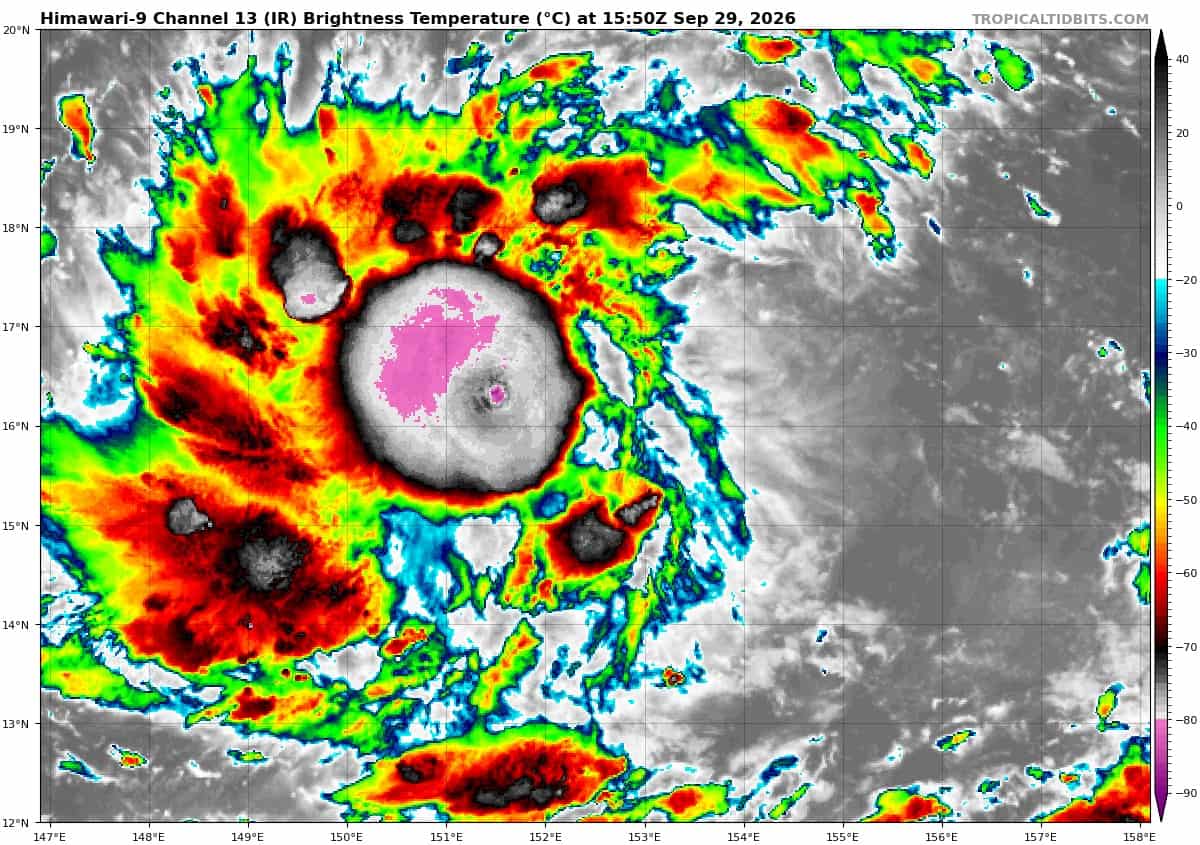
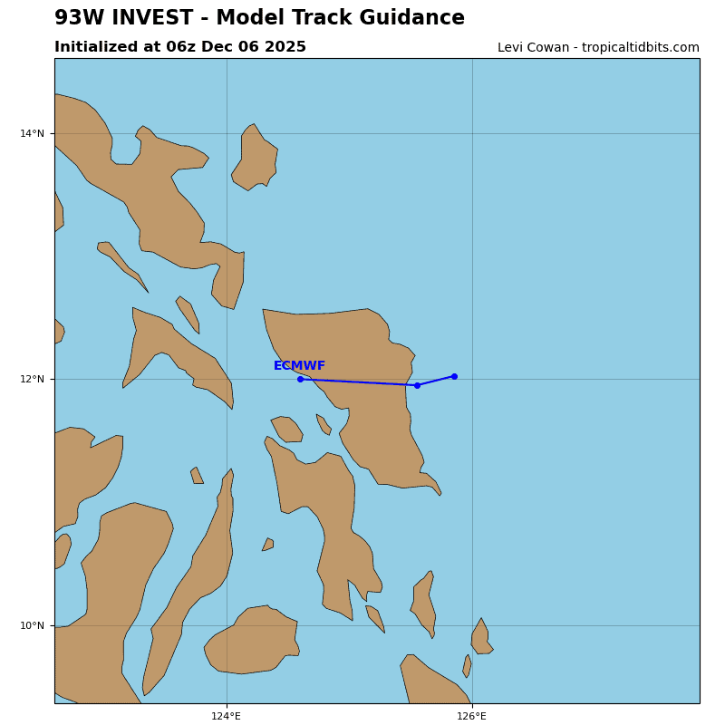
>>> There’s an area of disturbed weather that’s being referred to as Invest 93W, which is located approximately 607 NM east-northeast of Guam
Animated multi-spectral satellite imagery (msi) depicts a elongated low level circulation (llc) with persistent convection blooming along the western periphery.
Environmental analysis reveals favorable conditions for development with low (15 knots or less) vertical wind shear, good poleward outflow, and warm sea surface temperatures.
Global models depict 93W steadily, but rather slowly, consolidating over the next 24-48 hours, while traversing slowly west-northwestward.
Maximum sustained surface winds are estimated at 18 to 23 knots.
Minimum sea level pressure is estimated to be near 1008 mb.
The potential for the development of a significant tropical cyclone within the next 24 hours remains medium