

Current Snapshot
For all the latest updates visit: DisasterAWARE
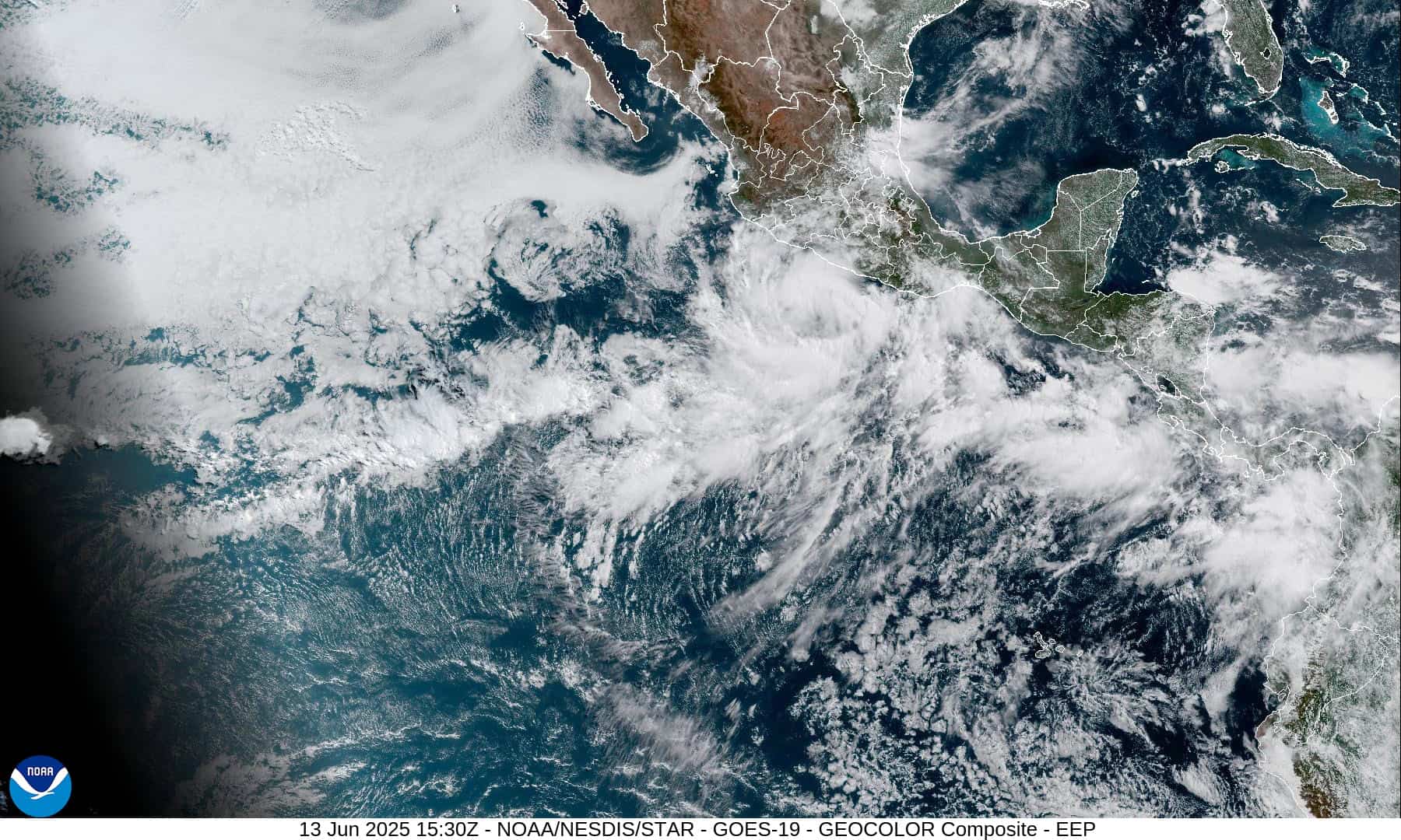
1800x1080e
2e
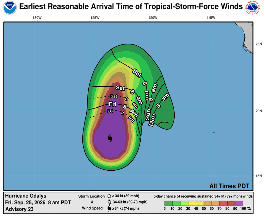
251446_earliest_reasonable_toa_34O
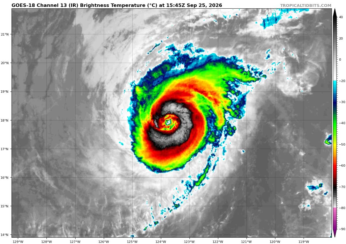
goes18_ir_16E_202609251545_lat17.7-lon-123.8O
16E_tracks_latest
251449_earliest_reasonable_toa_34P
goes18_ir_17E_202609251545_lat17.1-lon-108.0
17E_tracks_latest
2
7
1800x1080ec
nolo
251452_earliest_reasonable_toa_34
goes18_ir_15E_202609251545_lat15.8-lon-155.6
251452WPCQPF_sm
251452_peak_surge
15E_tracks_latest
2c
7c
surigae
25W_251200sair
himawari9_ir_25W_202609251540_lat21.4-lon128.2
25W_tracks_latest
By PDC’s Senior Weather
Specialist Glenn James

The Pacific Disaster Center’s (PDC Global) Friday, September 25, 2026, Tropical Cyclone Activity Report…for the Pacific Ocean, the Indian Ocean, and adjacent Seas.
Tropical Cyclones
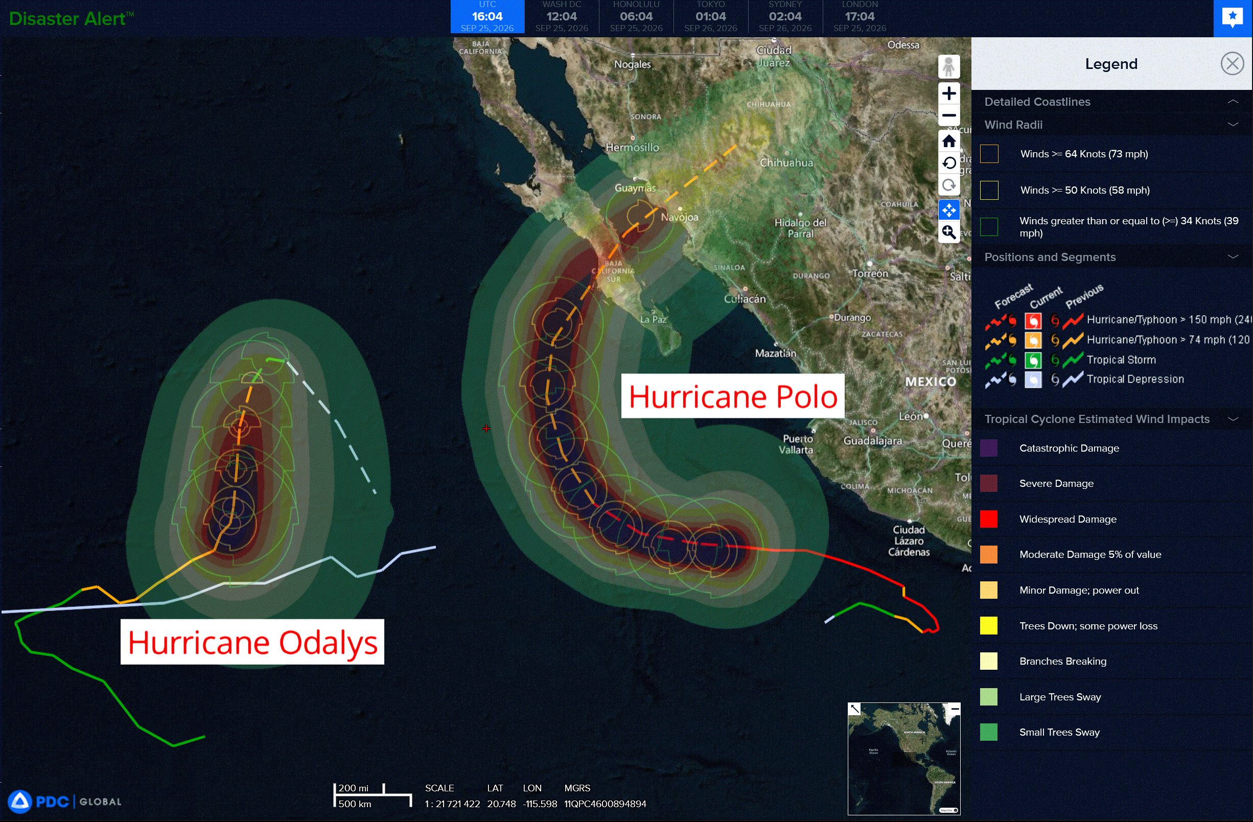
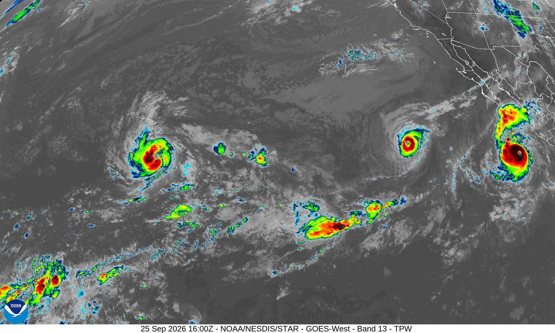
Tropical Cyclone 16E (Odalys) is located about 995 miles west-southwest of the southern tip of Baja California
Tropical Cyclone 17E (Polo) is located about 410 miles south-southeast of Cabo San Lucus, Mexico
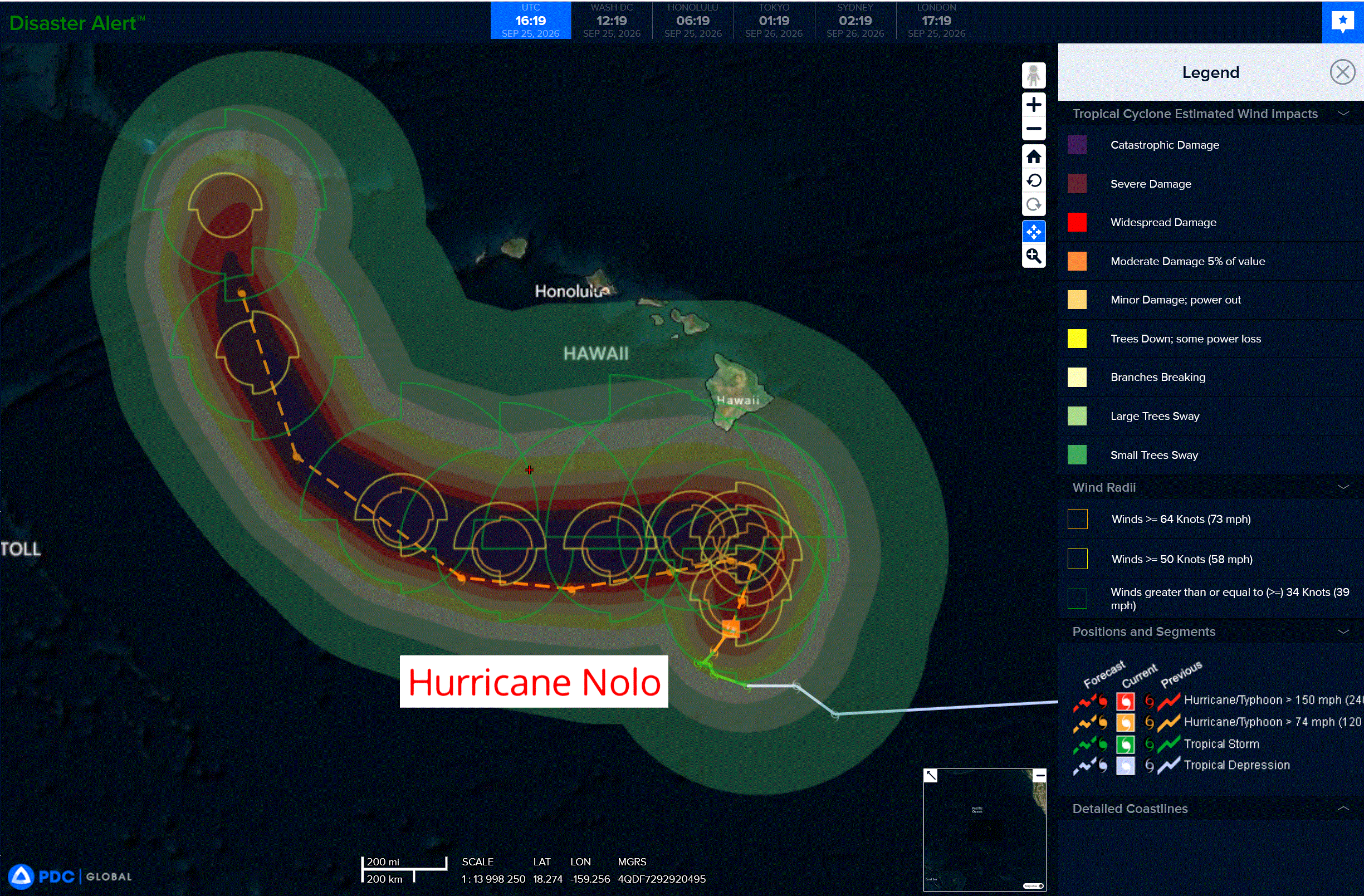
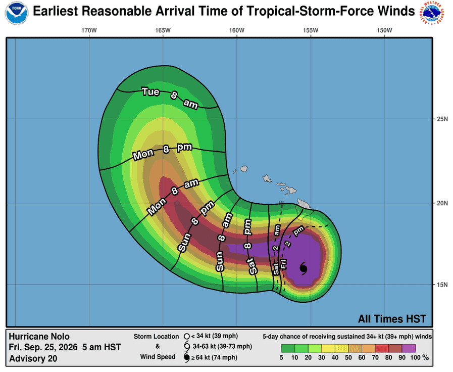
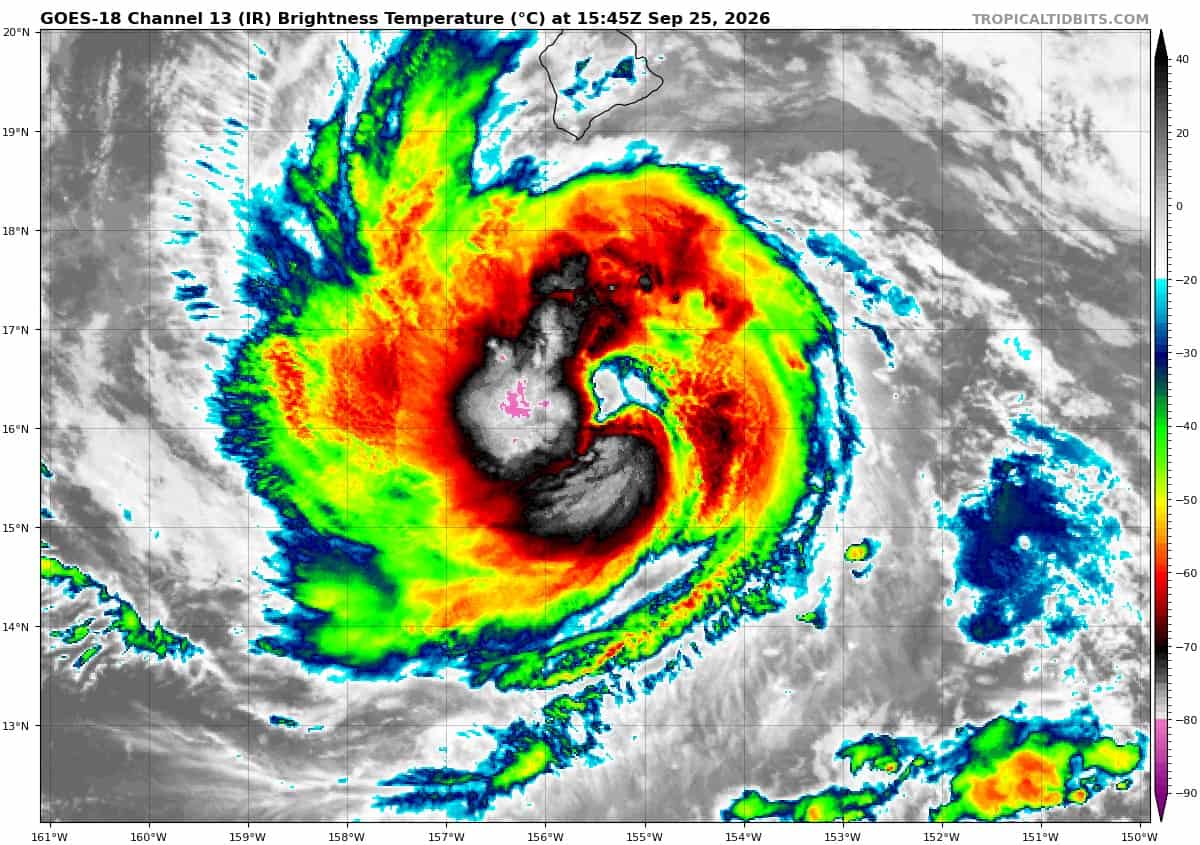
Tropical Cyclone 15E (Nolo) is located about 210 miles south of South Point, Hawaii
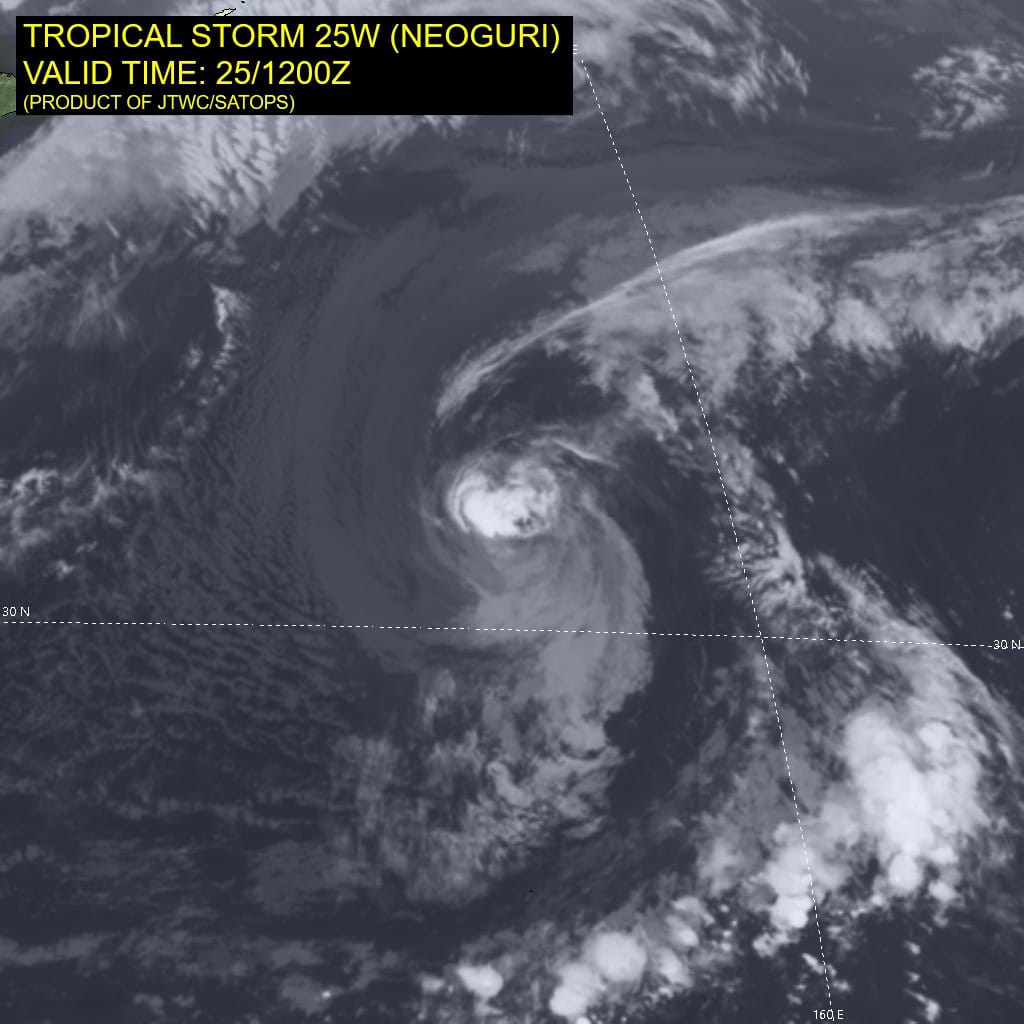
Tropical Cyclone 25W (Surigae) is located approximately 307 NM south of Kadena AB
Northeast Pacific:
Tropical cyclone 16E (Odalys)
CATEGORY 4 HURRICANE ODALYS HEADING NORTH-NORTHEASTWARD
According to the NHC advisory number 23
Odalys is moving toward the north-northeast near 6 mph (9 km/h), with a turn to the north expected to occur over the next couple of days. Maximum sustained winds are near 130 mph (215 km/h) with higher gusts. Odalys is a category 4 hurricane on the Saffir-Simpson Hurricane Wind Scale. Some intensity fluctuations are possible through this evening. A gradual weakening trend is forecast to commence over the weekend. Hurricane-force winds extend outward up to 25 miles (35 km) from the center and tropical-storm-force winds extend outward up to 150 miles (240 km). The estimated minimum central pressure is 946 mb (27.94 inches).
Tropical cyclone 17E (Polo)
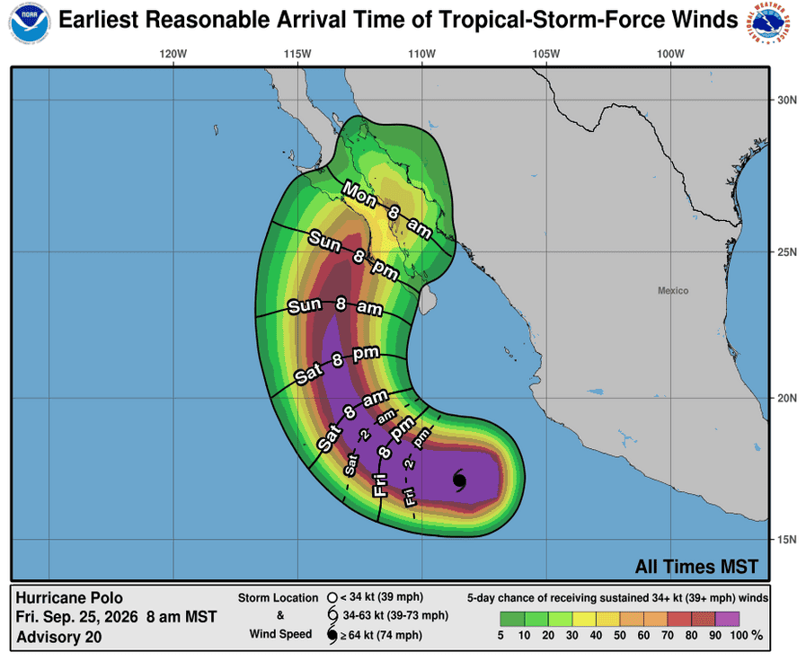
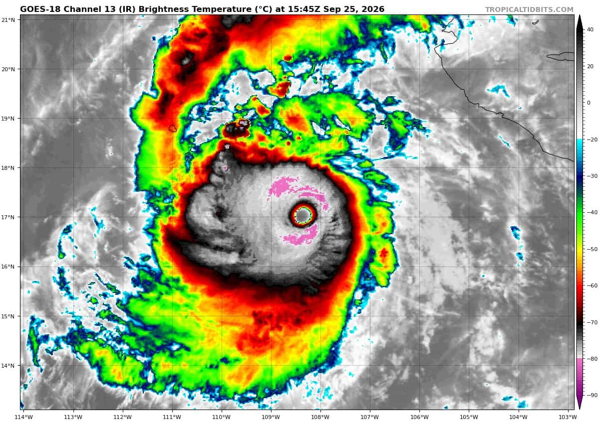
POLO IS AN EXTREMELY POWERFUL CATEGORY 5 HURRICANE …INTERESTS IN BAJA CALIFORNIA SUR SHOULD MONITOR ITS PROGRESS
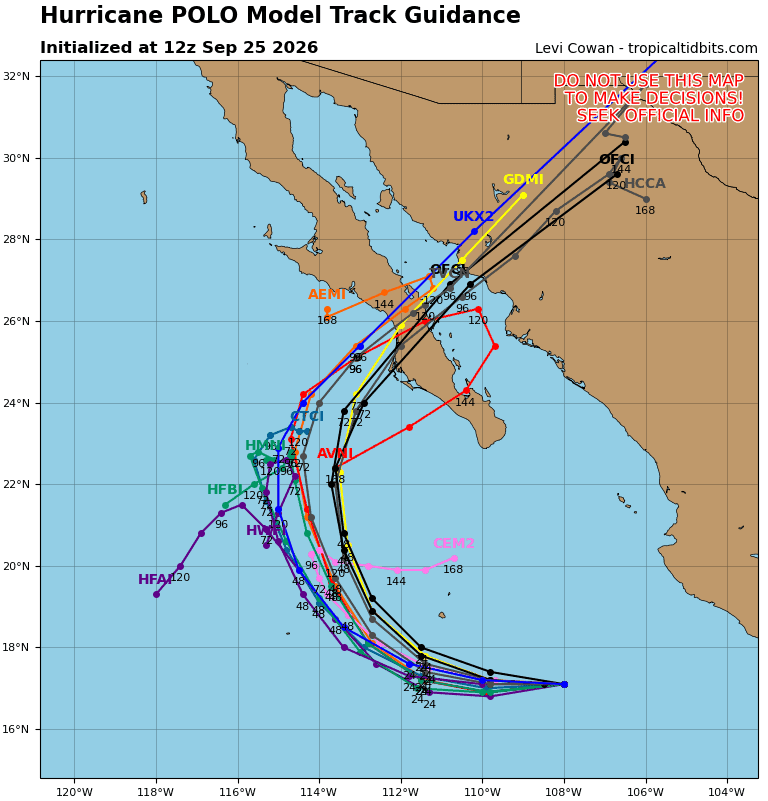
According to the NHC advisory number 20
Polo is moving toward the west near 12 mph (19 km/h), and this motion is expected to continue through today. A gradual turn to the northwest and north is forecast on Saturday and Sunday, followed by a northeastward motion on Monday. On the forecast track, Polo is expected to approach Baja California Sur early next week. Maximum sustained winds are near 180 mph (285 km/h) with higher gusts. Polo is a category 5 hurricane on the Saffir-Simpson Hurricane Wind Scale. Fluctuations in intensity are possible today, but some weakening is expected over the weekend. Polo is forecast to approach Baja California Sur as a strong hurricane early next week. Hurricane-force winds extend outward up to 40 miles (65 km) from the center and tropical-storm-force winds extend outward up to 115 miles (185 km). The estimated minimum central pressure is 900 mb (26.58 inches).
HAZARDS AFFECTING LAND
RAINFALL: Polo is expected to produce rainfall totals of 4 to 8 inches with maximum amounts of 10 inches across portions of Baja California Sur. This rainfall may produce life-threatening flooding and mudslides, especially in areas of steep terrain.
SURF: Swells generated by Polo will continue affecting the coast of southwestern Mexico during the next couple of days. Swells will spread northward along the coast of west-central Mexico and the Baja California Peninsula through the weekend. These swells are likely to cause life-threatening surf, rip currents, and coastal flooding.
>>> South of the Gulf of Tehuantepec:
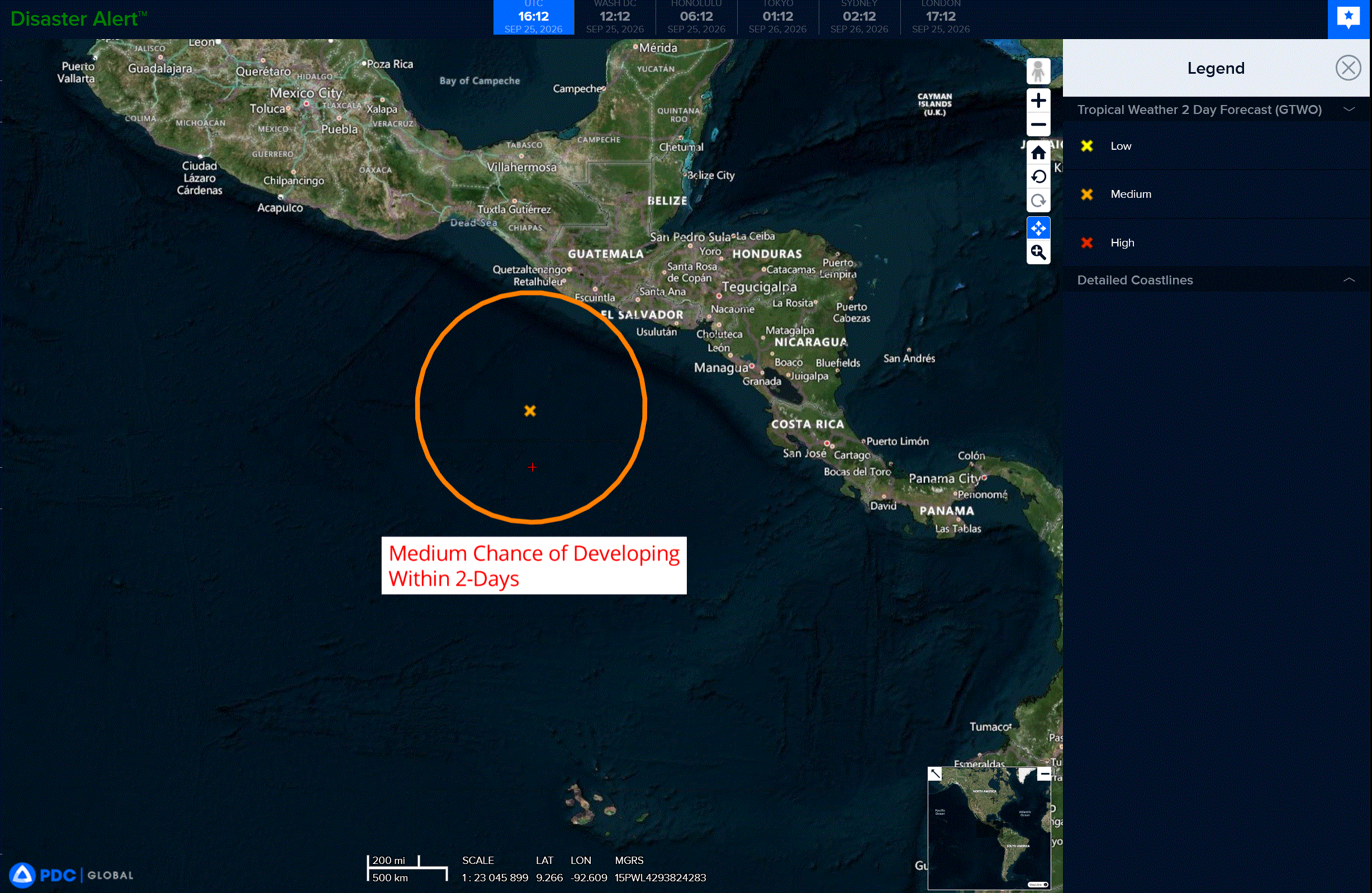
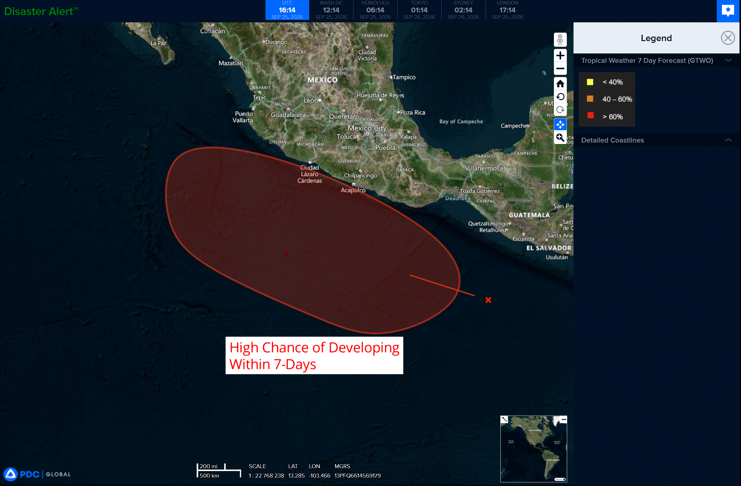
An area of low pressure is expected to form within the next day or two to the south of the Gulf of Tehuantepec. Afterward, environmental conditions appear favorable for gradual development, and a tropical depression is expected to form late this weekend or early next week while the system moves slowly west-northwestward to northwestward, parallel to the coast of southern and southwestern Mexico.
* Formation chance through 48 hours…low..40 percent
* Formation chance through 7 days…high…90 percent
Central North Pacific:
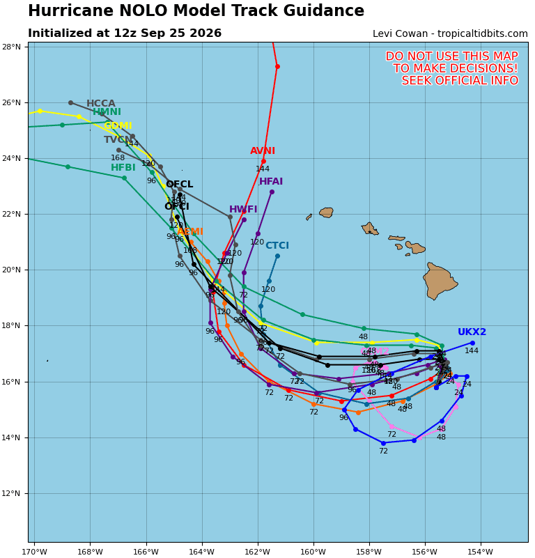
Tropical Cyclone 15E (Nolo)
TROPICAL STORM NOLO HOLDING STEADY AND IS EXPECTED TO TURN NORTHWARD TONIGHT…HURRICANE WATCH REMAINS IN EFFECT FOR HAWAII COUNTY
According to the NHC advisory number 16
Nolo is moving toward the west-northwest near 6 mph. A sharp turn to the north and north-northeast is expected late tonight, with this motion continuing through the end of the week. On the forecast track, the system is expected to approach the Big Island of Hawaii on Friday and Saturday. Maximum sustained winds are near 45 mph with higher gusts. Nolo is forecast to become a hurricane by Thursday night and could become a major hurricane by the weekend. Tropical-storm-force winds extend outward up to 80 miles from the center. The estimated minimum central pressure is 1002 mb (29.59 inches).
HAZARDS AFFECTING LAND WIND:
WIND: Hurricane conditions are possible in the watch area starting as early as Friday night.
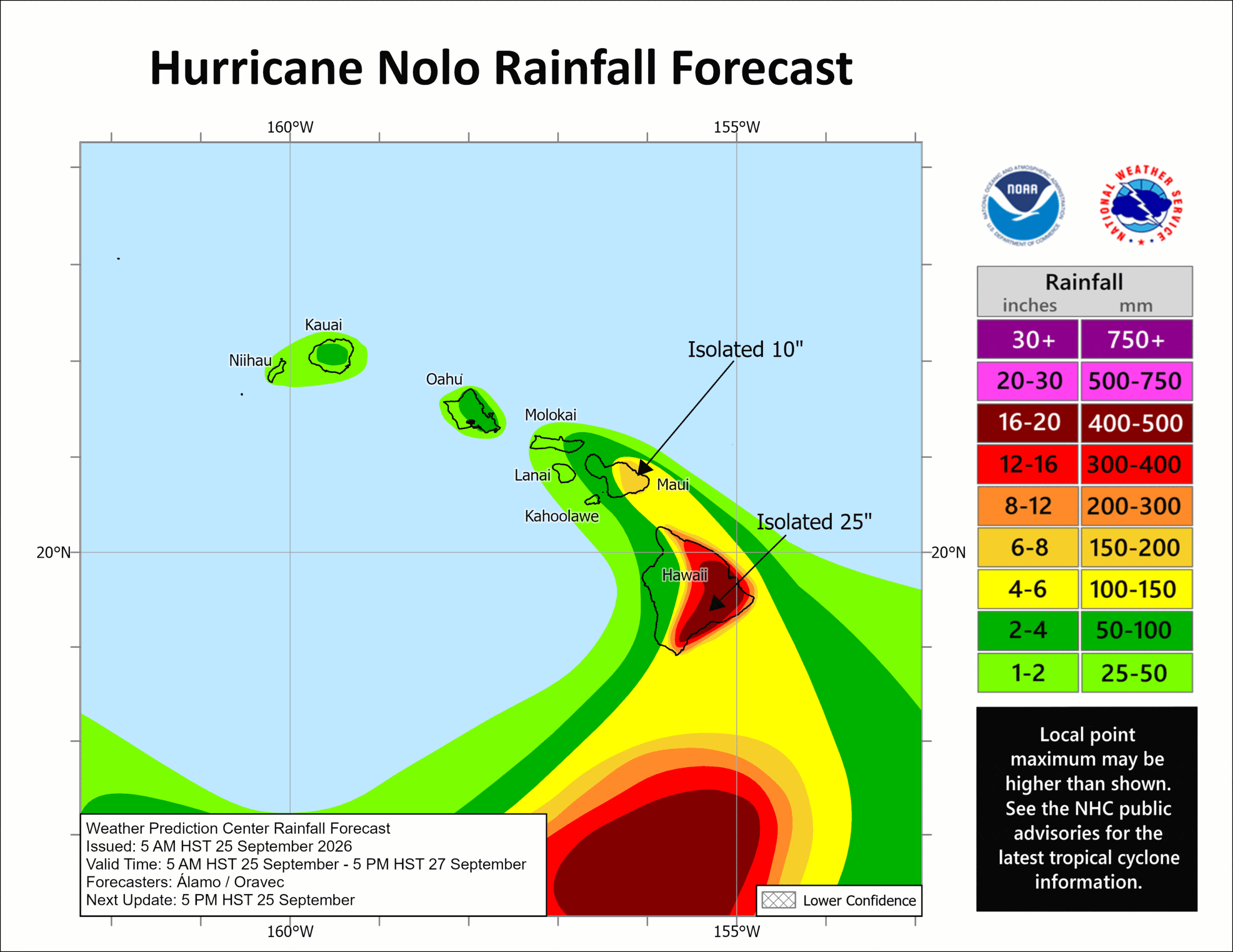
RAINFALL: For the Big Island, Nolo will produce rainfall totals of 15 to 20 inches with maximum amounts of 35 inches. This rainfall could produce catastrophic life-threatening flooding and mudslides, especially in areas of steep terrain.
For Maui, rainfall totals of 5 to 10 inches with maximum amounts of 20 inches are expected. Life-threatening flooding and mudslides are possible, especially in areas of high terrain. Across the remainder of the Hawaiian Islands, rainfall totals of 1 to 3 inches with maximum amounts of 6 inches are expected with isolated flooding possible.
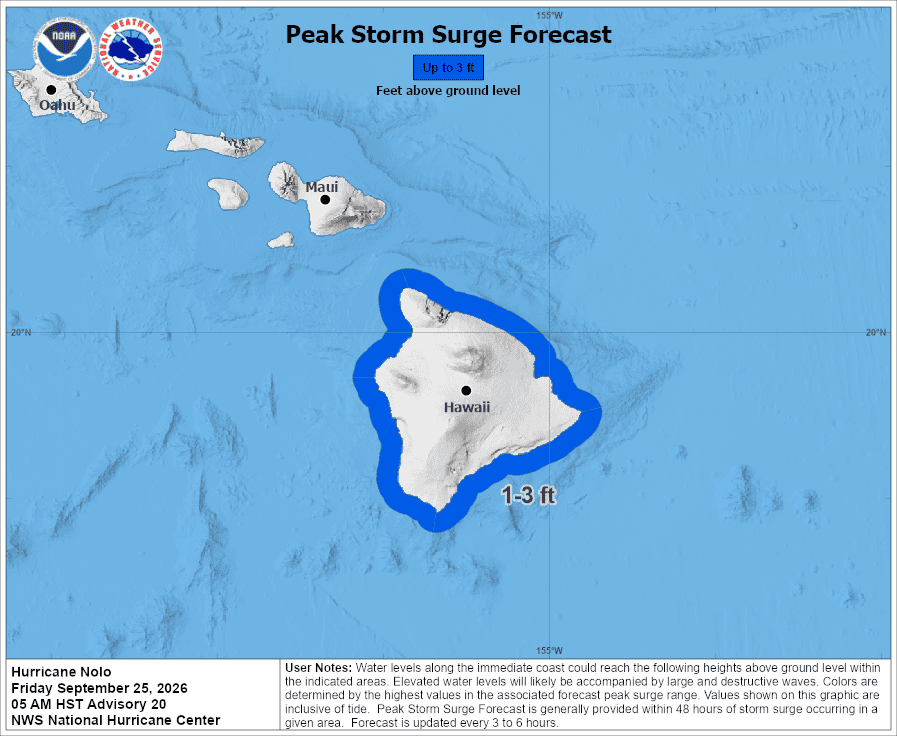
STORM SURGE: The combination of a dangerous storm surge and the tide will cause normally dry areas near the coast to be flooded by rising waters moving inland from the shoreline. The water could reach the following heights above ground somewhere in the indicated areas if the peak surge occurs at the time of high tide…
Hawaii County…1 to 3 ft
The deepest water will occur along the immediate coast near and to the right of the landfall location, where the surge will be accompanied by large and dangerous waves. Surge-related flooding depends on the relative timing of the surge and the tidal cycle, and can vary greatly over short distances.
SURF: Swells generated by Nolo are expected to reach exposed east and south-facing shores of the Big Island by Friday, spreading westward and building through the weekend. These swells are likely to cause life-threatening surf and rip current conditions.
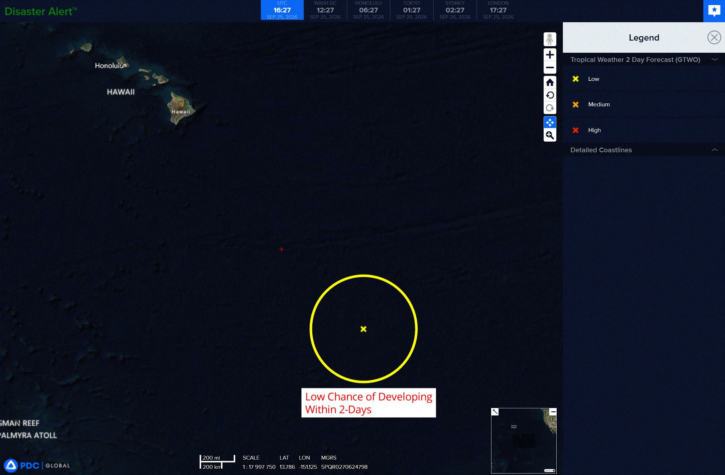
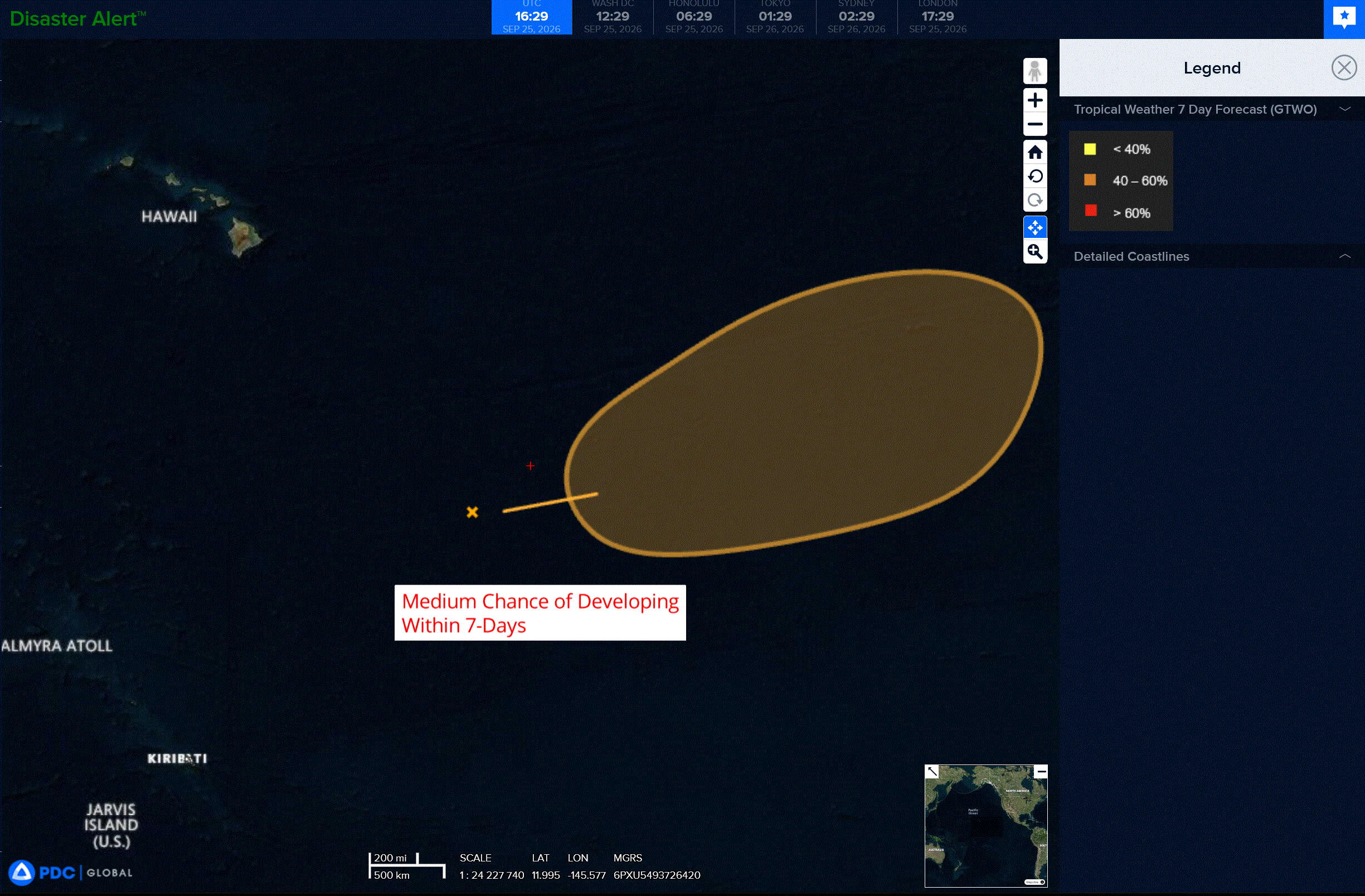
>>> Well East-Southeast of the Hawaiian Islands:
A broad area of low pressure is forecast to form about 1000 miles east-southeast of the Hawaiian Islands over the weekend. Environmental conditions appear favorable for gradual development of this system, and a tropical depression could form late this weekend or early next week. The system is forecast to move generally northeastward, remaining well east-southeast of the Hawaiian Islands.
* Formation chance through 48 hours…low…20 percent
* Formation chance through 7 days…medium…50 percent
Western Pacific, Indian Ocean, and adjacent Seas:
Western Pacific
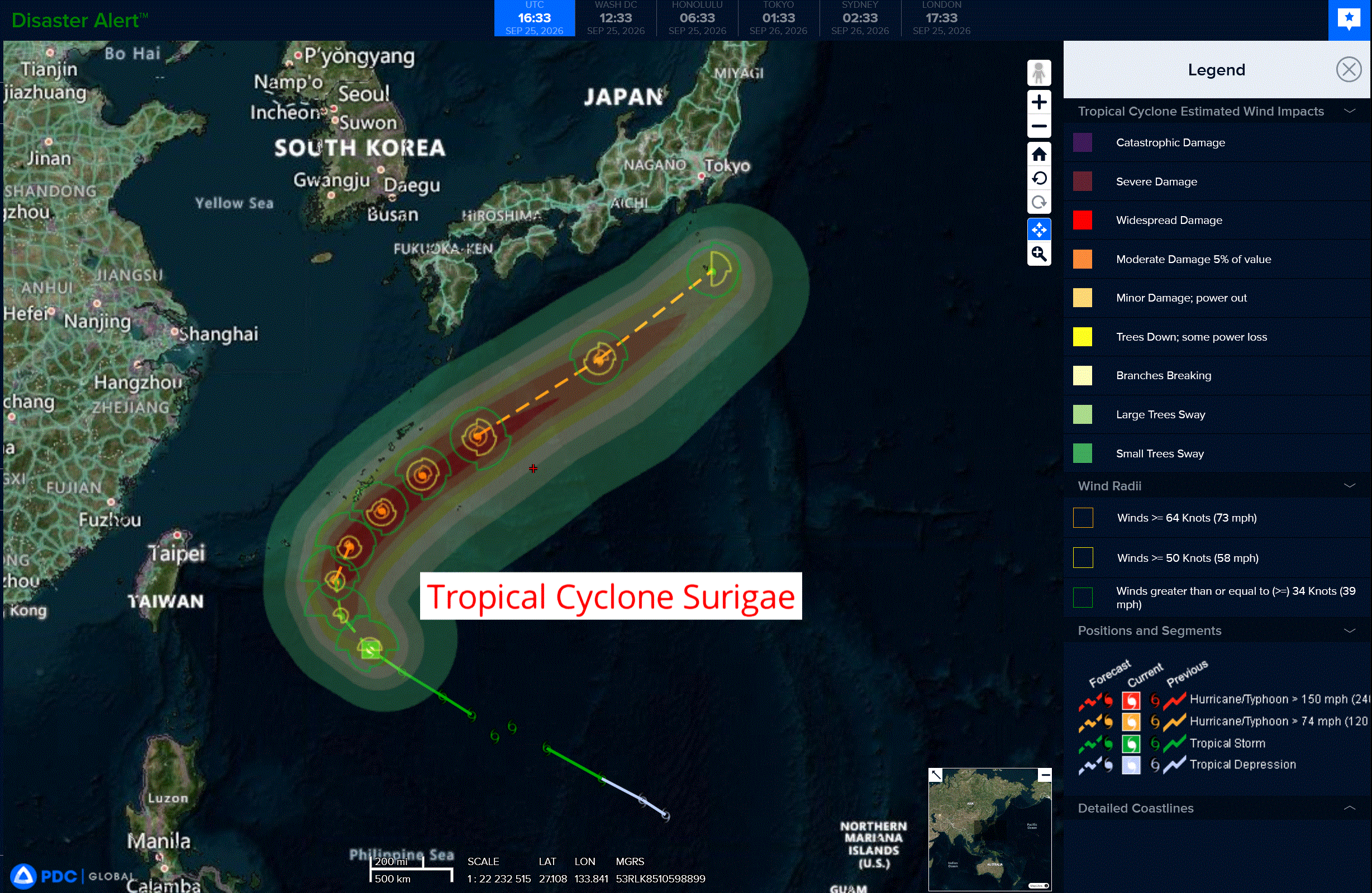
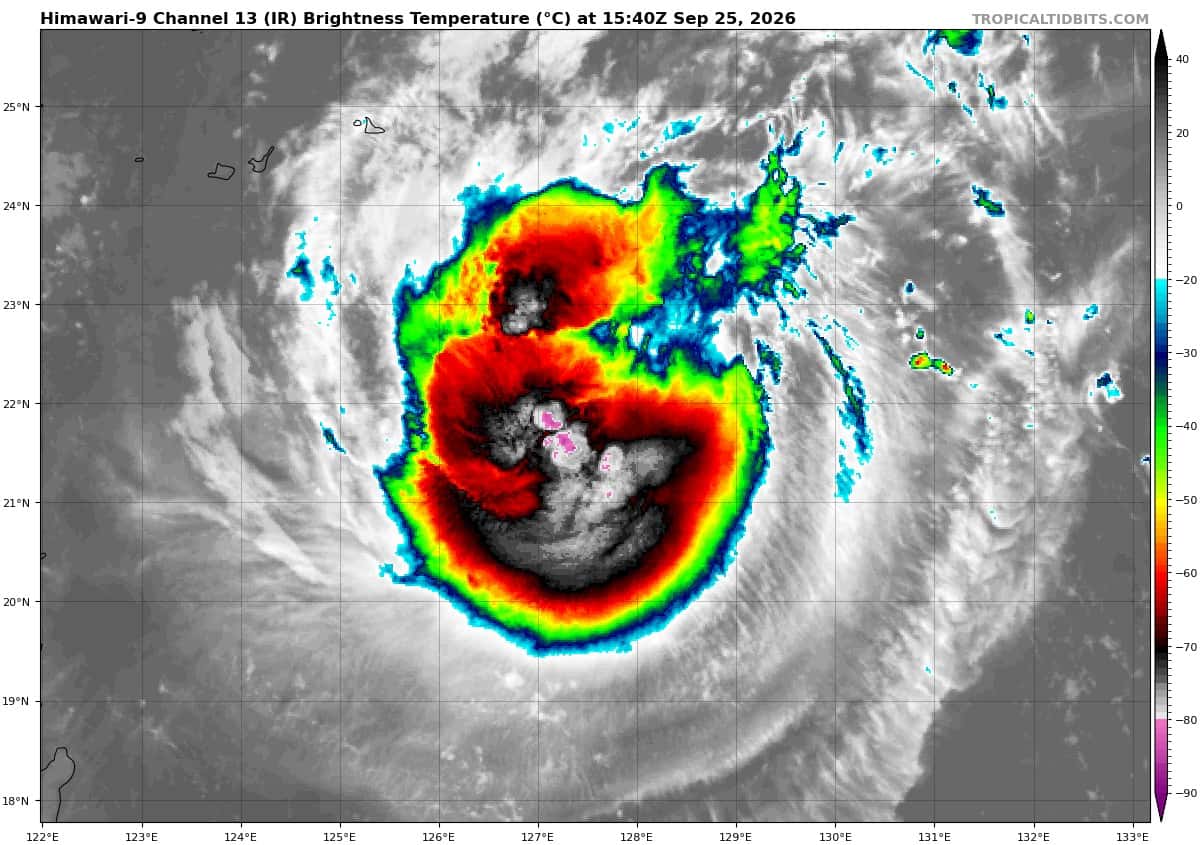
Tropical Cyclone 25W (Surigae)
According to the JTWC warning number 10…sustained winds were 50 knots with gusts to 65 knots
Animated enhanced infrared (eir) and proxy visible (proxyvis) satellite imagery indicates that tropical storm 25W is undergoing steady convective consolidation and maturation. Deep convection continues to pulse, but has demonstrated persistence despite moderate southerly vertical wind shear (vws) over the past six hours, characterized by persistent overshooting tops concentrated near the inner core.
Animated water vapor imagery as well as cimss and cira atmospheric motion vectors (amvs) indicate a split in the outflow-level environmental flow around the core and associated vortex. This configuration suggests significantly reduced local vertical shear directly over the vortex core, although satellite observations are restricted to outflow levels and numerical soundings
continue to depict moderate, albeit relaxing, mid-level shear.
A 250853z wsf-m 37ghz image provided initial confirmation of a compact low-level circulation center (llcc) embedded beneath deep convection, and approaching vertical alignment. A 251224z ascat-c pass revealed a small but well-organized llcc with strengthening winds and an
expanding wind field; however, a slight tilt persists, with convective bursting confined primarily to the upshear-left quadrant relative to the surface circulation.
Environmental conditions are favorable, with decreasing shear, high ssts (29-30c), elevated ocean heat content (ohc), and moderate to strong poleward outflow aloft.
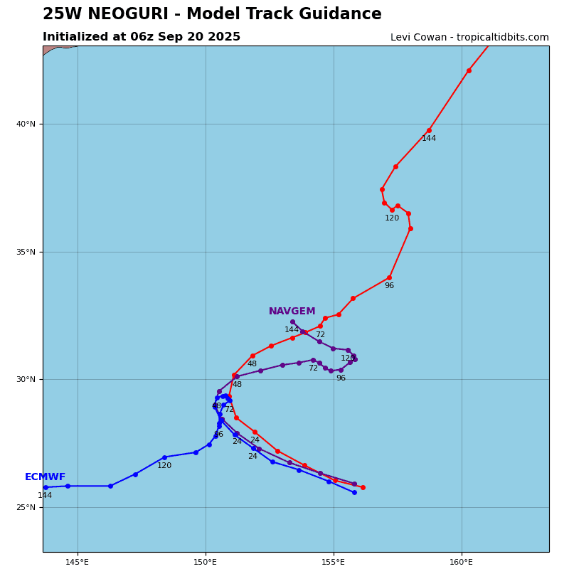
TS 25W has tracked northwestward at a steady 12-13 knots over the past six hours along the southwestern flank of the large str to the south of Japan. Over the next 12 hours, 25W will begin to decelerate and turn gradually northward as it enters a col region/weakness in the ridge. From 12 to 36 hours, 25W will gradually cross the ridge axis, maintaining a reduced translation speed of 5-6 knots as it passes east of Miyakojima and the southern
Ryukyus.
By 48 hours, 25W will reach its closest point of approach (cpa) to Okinawa and begin to accelerate as the str drifts southwestward and elongates along a southwest-northeast axis. A
passing mid-latitude trough to the north should exert sufficient forcing and extend far enough equatorward to capture 25W as it tracks past the northern Ryukyus, promoting further acceleration from 72 hours through the end of the forecast. By 120 hours, 25W will be positioned south of Tokyo and commence extratropical transition (ett).
Regarding intensity: given imminent vertical axisymmetrization and an increasingly favorable environment, 25W is projected to maintain a steady intensification rate within the next 12 hours. The forecast stops just shy of explicitly predicting rapid intensification (ri); however, due to its compact core, 25W may outpace consensus guidance and attain a higher rate of intensification through 48 hours.
After passing Okinawa, 25W will encounter increasing environmental shear, initiating a gradual weakening trend. the rate of weakening will accelerate after 72 hours as northwesterly shear increases sharply, ssts cool, and 25W begins ett. Track guidance remains polarized into two distinct regimes. The alternative scenario reflected in select dynamical guidance (galwem, navgem, gfs, hafs-a, and ctcx) continues to depict recurvature arrested by a quasi-stationary meander near Okinawa within the str col region. Gefs and mogreps partially exhibit this tendency, whereas the full suite of AI guidance alongside deterministic ecmwf consistently depicts a progressive recurvature scenario, which the JTWC forecast continues to favor.