

Current Snapshot
For all the latest updates visit: DisasterAWARE
1800x1080e
2e
261442_earliest_reasonable_toa_34O
goes18_ir_16E_202609261415_lat19.5-lon-123.7
16E_tracks_latest
261450_earliest_reasonable_toa_34P
goes18_ir_17E_202609261415_lat17.7-lon-111.4
17E_tracks_latest
high1
high2
goes19_ir_90E_202609261415_lat11.9-lon-98.3
90E_tracks_latest
nolo
261456_earliest_reasonable_toa_34N
20262690740-20262691530-GOES18-ABI-HI-13-600×600
261456WPCQPF_sm
261456_peak_surge
15E_tracks_latest
c2
highc
surigae
25W_261200sair

25W_tracks_latest
By PDC’s Senior Weather
Specialist Glenn James

The Pacific Disaster Center’s (PDC Global) Saturday, September 26, 2026, Tropical Cyclone Activity Report…for the Pacific Ocean, the Indian Ocean, and adjacent Seas.
Tropical Cyclones
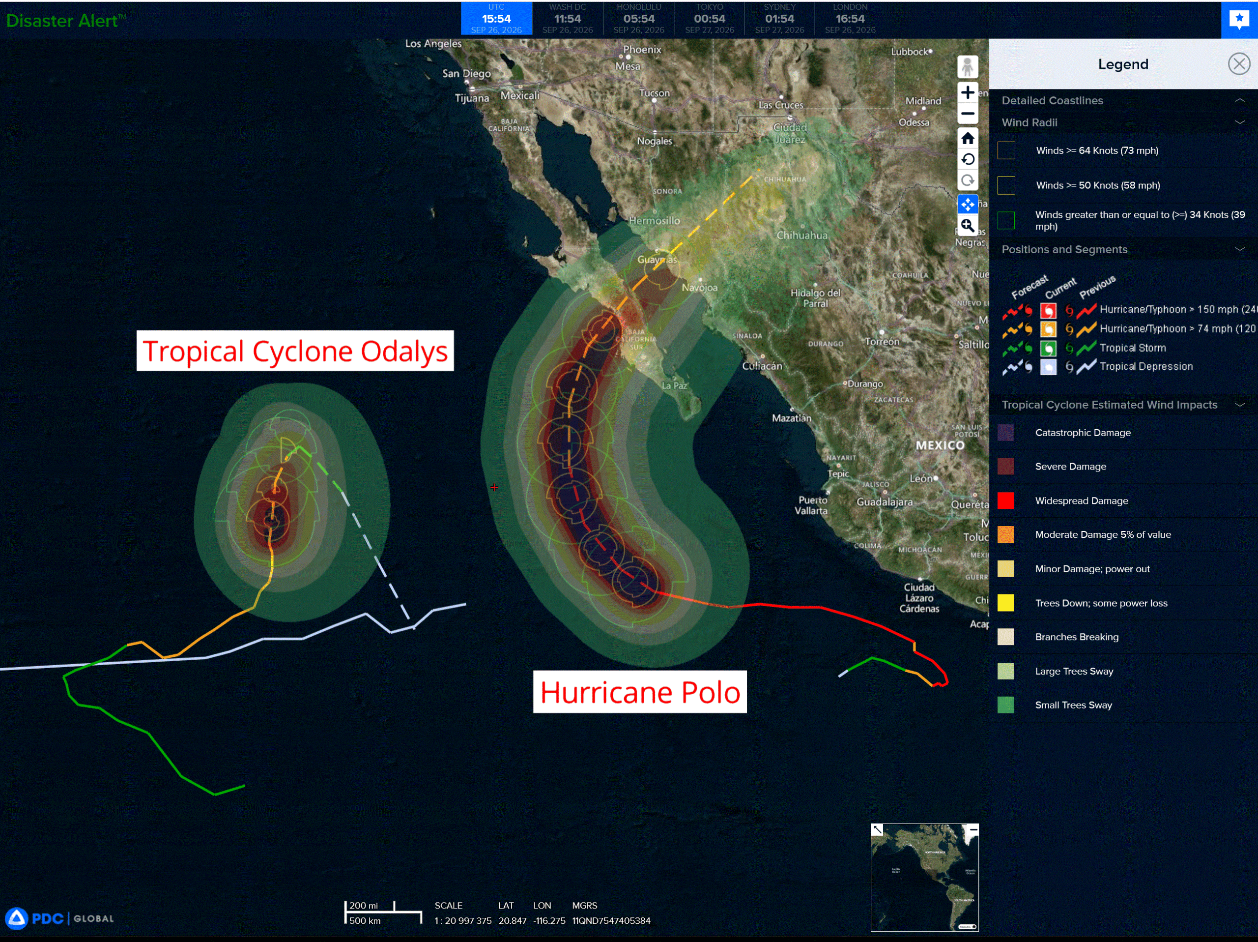
Tropical Cyclone 16E (Odalys) is located about 910 miles west of the southern tip of Baja California
Tropical Cyclone 17E (Polo) is located about 365 miles south-southwest of Cabo San Lucus, Mexico
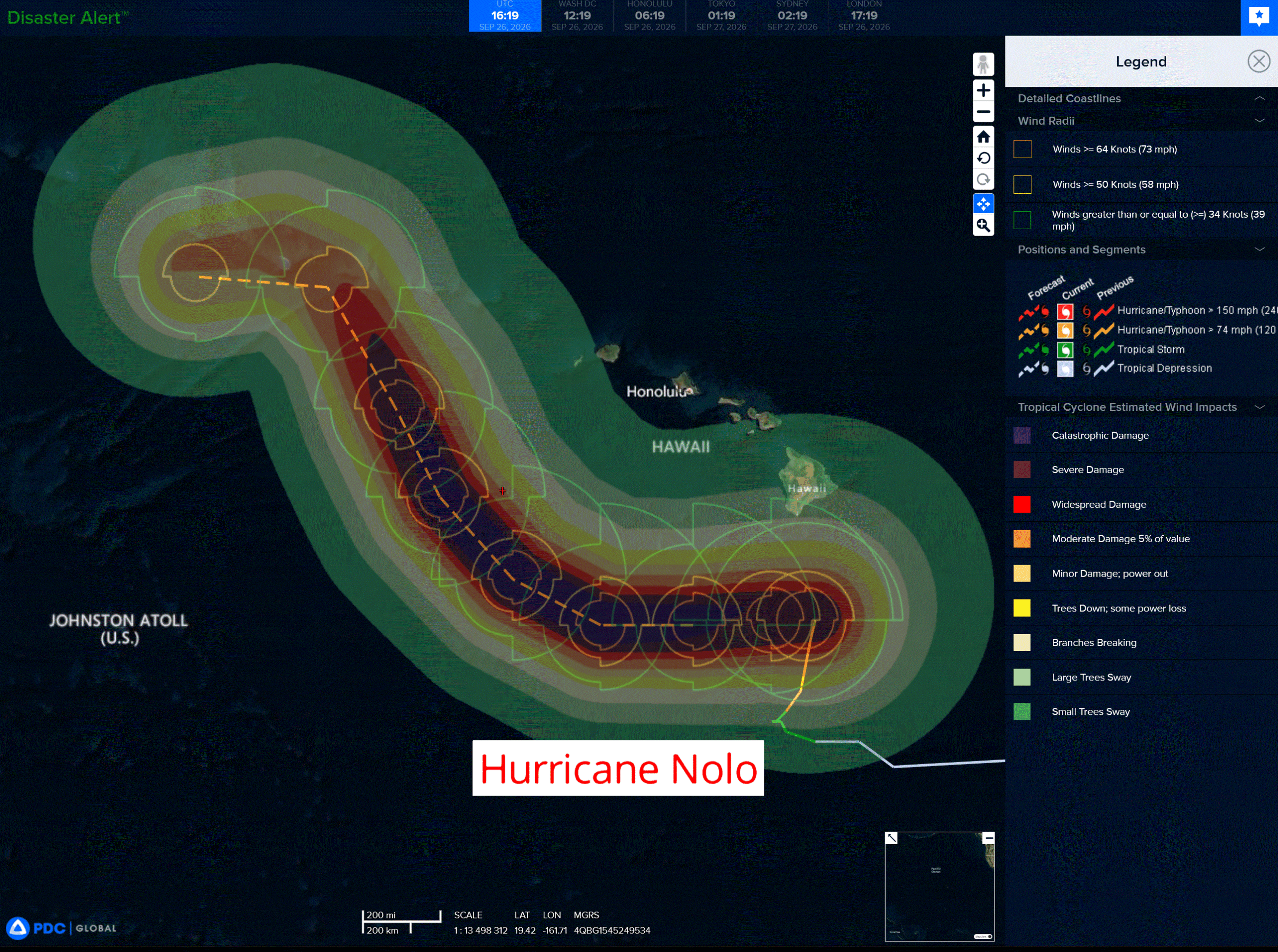
Tropical Cyclone 15E (Nolo) is located about 145 miles south of South Point, Hawaii
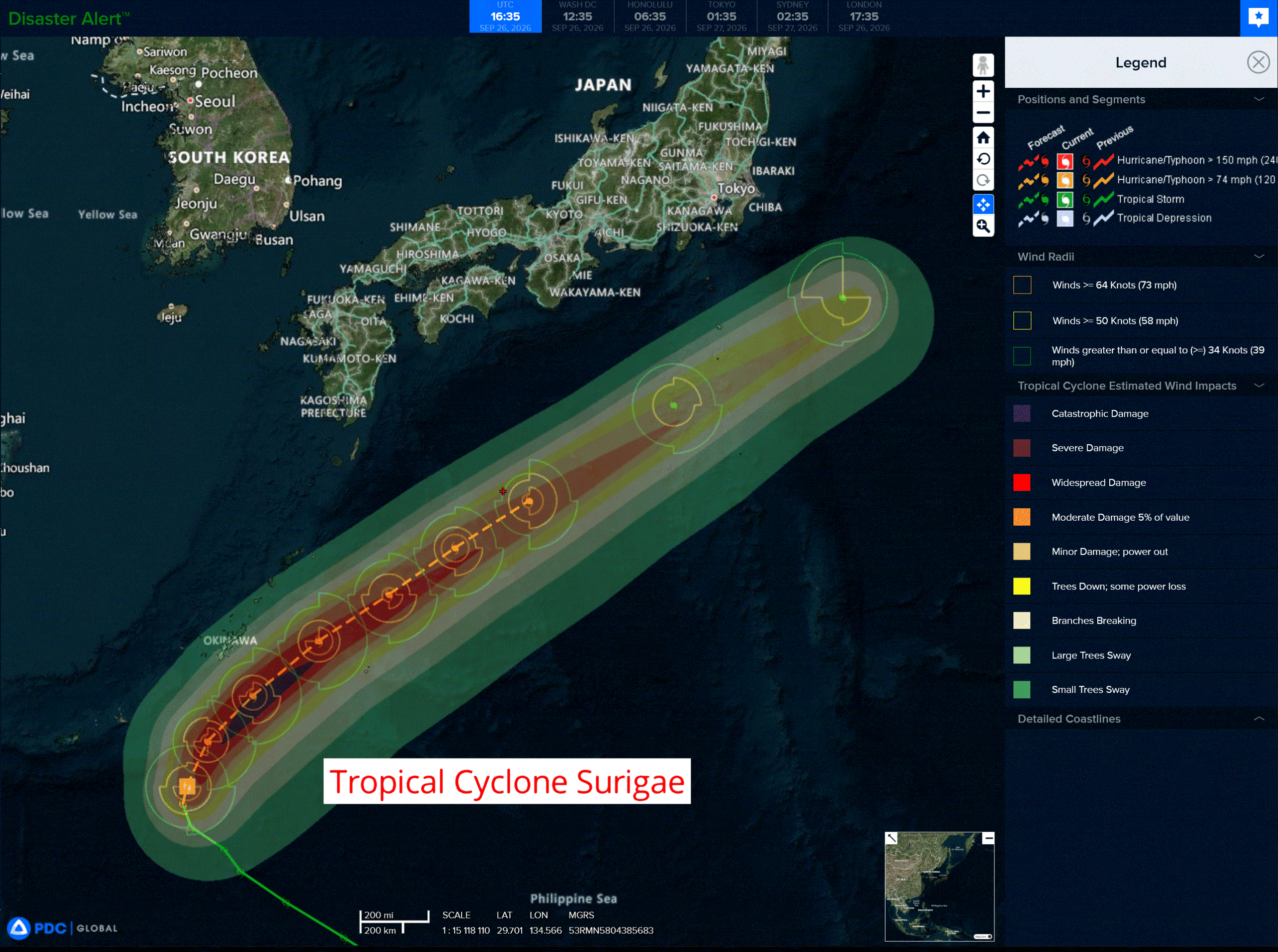
Tropical Cyclone 25W (Surigae) is located approximately 198 NM south-southwest of Kadena AB
Northeast Pacific:
Tropical cyclone 16E (Odalys)
ODALYS EXPECTED TO RAPIDLY WEAKEN OVER THE OPEN EAST PACIFIC
According to the NHC advisory number 27
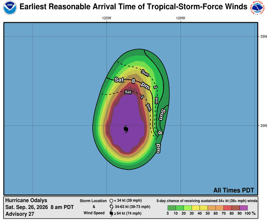
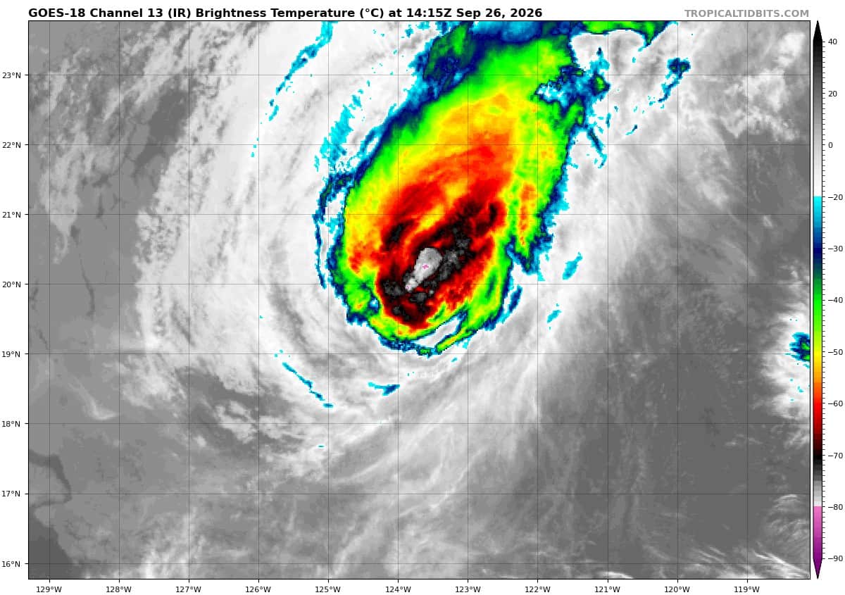
Odalys is moving toward the north near 7 mph (11 km/h), and this motion is expected to continue through today, followed by a sharp turn toward the east and then south-southeast by early next. Maximum sustained winds have decreased to near 105 mph (165 km/h) with higher gusts. Rapid weakening is forecast over the next several days, and Odalys is anticipated to become a post-tropical cyclone by early next week. Hurricane-force winds extend outward up to 25 miles (35 km) from the center and tropical-storm-force winds extend outward up to 125 miles (205 km). The estimated minimum central pressure is 965 mb (28.50 inches).
Tropical cyclone 17E (Polo)
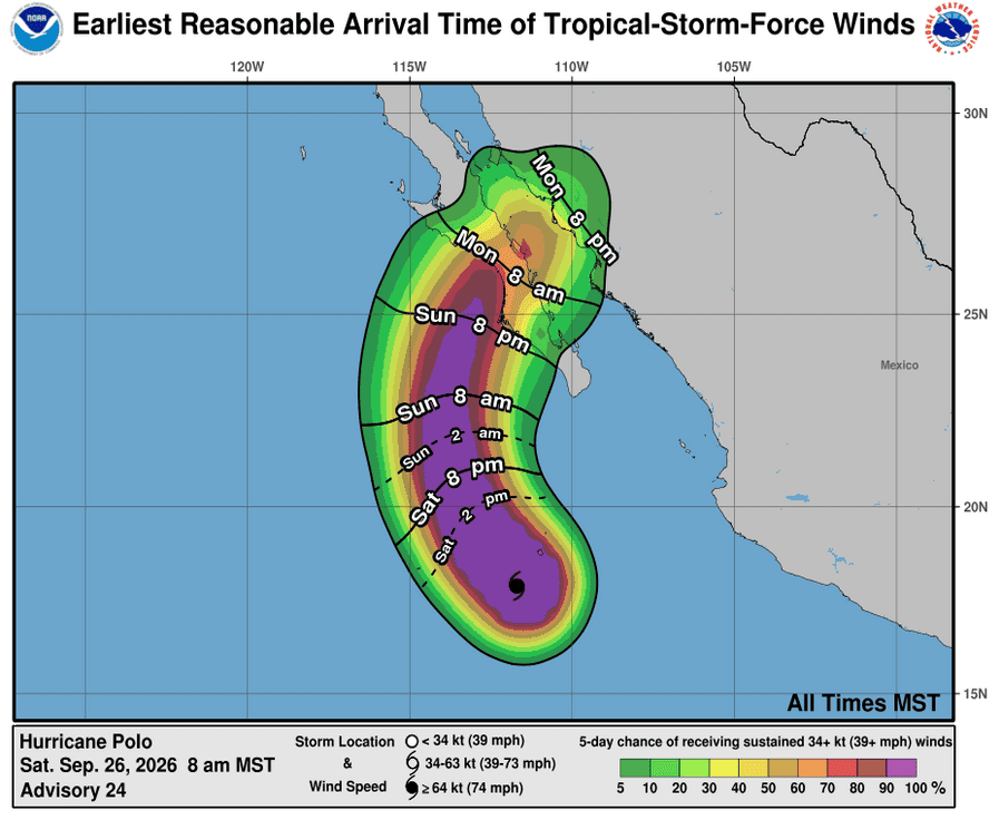
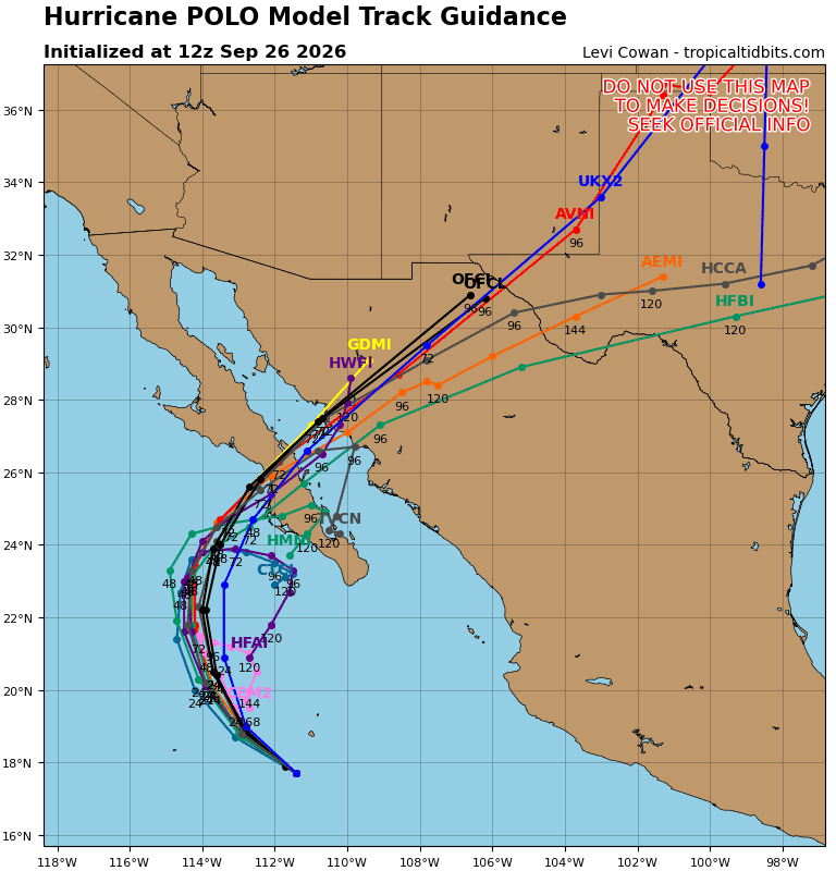
POLO REMAINS A POWERFUL HURRICANE… …EXPECTED TO MAKE LANDFALL IN BAJA CALIFORNIA SUR ON MONDAY AS A STRONG HURRICANE
According to the NHC advisory number 24
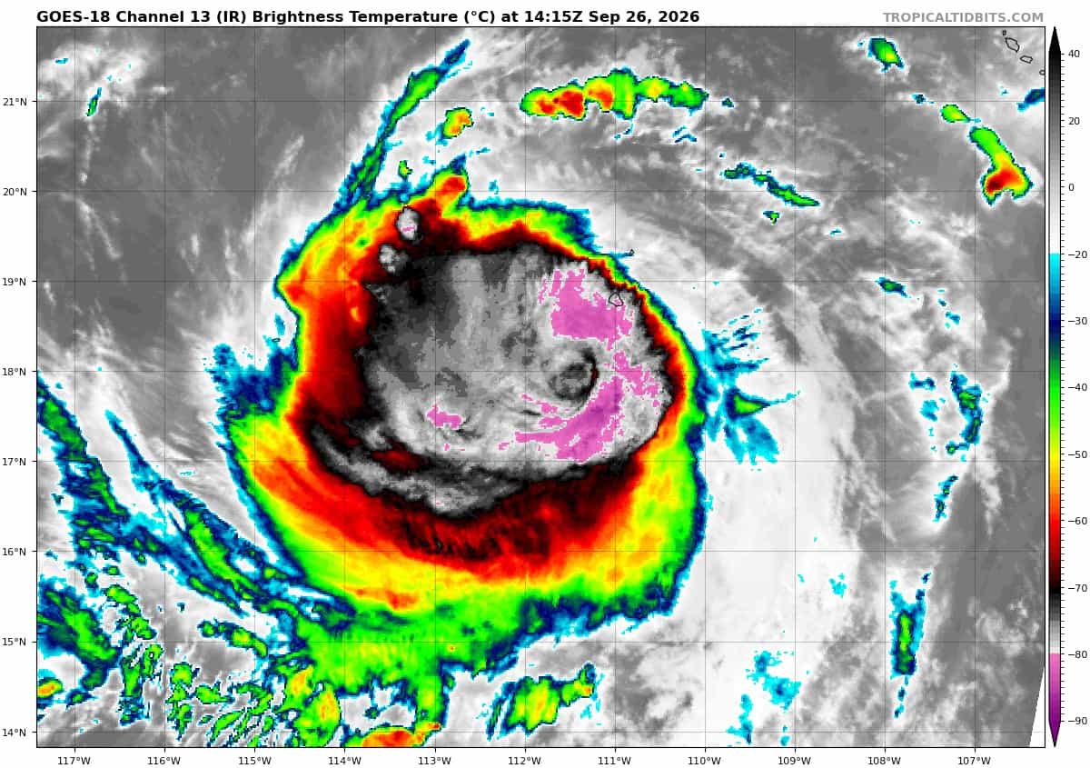
Polo is moving toward the west-northwest near 9 mph (15 km/h). A turn toward the northwest is expected today, followed by a northward motion on Sunday. By Monday, Polo is expected to turn northeastward and approach Baja California Sur. Maximum sustained winds are near 155 mph (250 km/h) with higher gusts. Polo is a category 4 hurricane on the Saffir-Simpson Hurricane Wind Scale. Gradual weakening is forecast during the next couple of days, however Polo is expected to be a strong hurricane when it approaches Baja California Sur on Monday. Hurricane-force winds extend outward up to 35 miles (55 km) from the center and tropical-storm-force winds extend outward up to 125 miles (205 km). A weather station on Socorro Island recently reported a sustained wind of 40 mph (65 km/h) and a gust of 58 mph (93 km/h). The estimated minimum central pressure is 928 mb (27.41 inches).
HAZARDS AFFECTING LAND
WIND: Hurricane conditions are possible within the watch area by Monday afternoon, with tropical storm conditions possible in the southern portion of the watch area by Sunday night into early Monday. These conditions are expected to spread northward during the day on Monday.
RAINFALL: Polo is expected to produce rainfall totals of 4 to 8 inches with maximum amounts of 10 inches across portions of Baja California Sur. This rainfall may produce life-threatening flooding and mudslides, especially in areas of steep terrain.
STORM SURGE: A storm surge could produce significant coastal flooding in areas of onshore winds. Near the coast, the surge will be accompanied by large and destructive waves.
SURF: Swells generated by Polo will continue affecting the coast of southwestern Mexico during the next day or two. Swells will also spread northward along the coast of west-central Mexico and the Baja California Peninsula through the weekend. These swells are likely to cause life-threatening surf, rip currents, and coastal flooding.
>>> South of the Gulf of Tehuantepec:
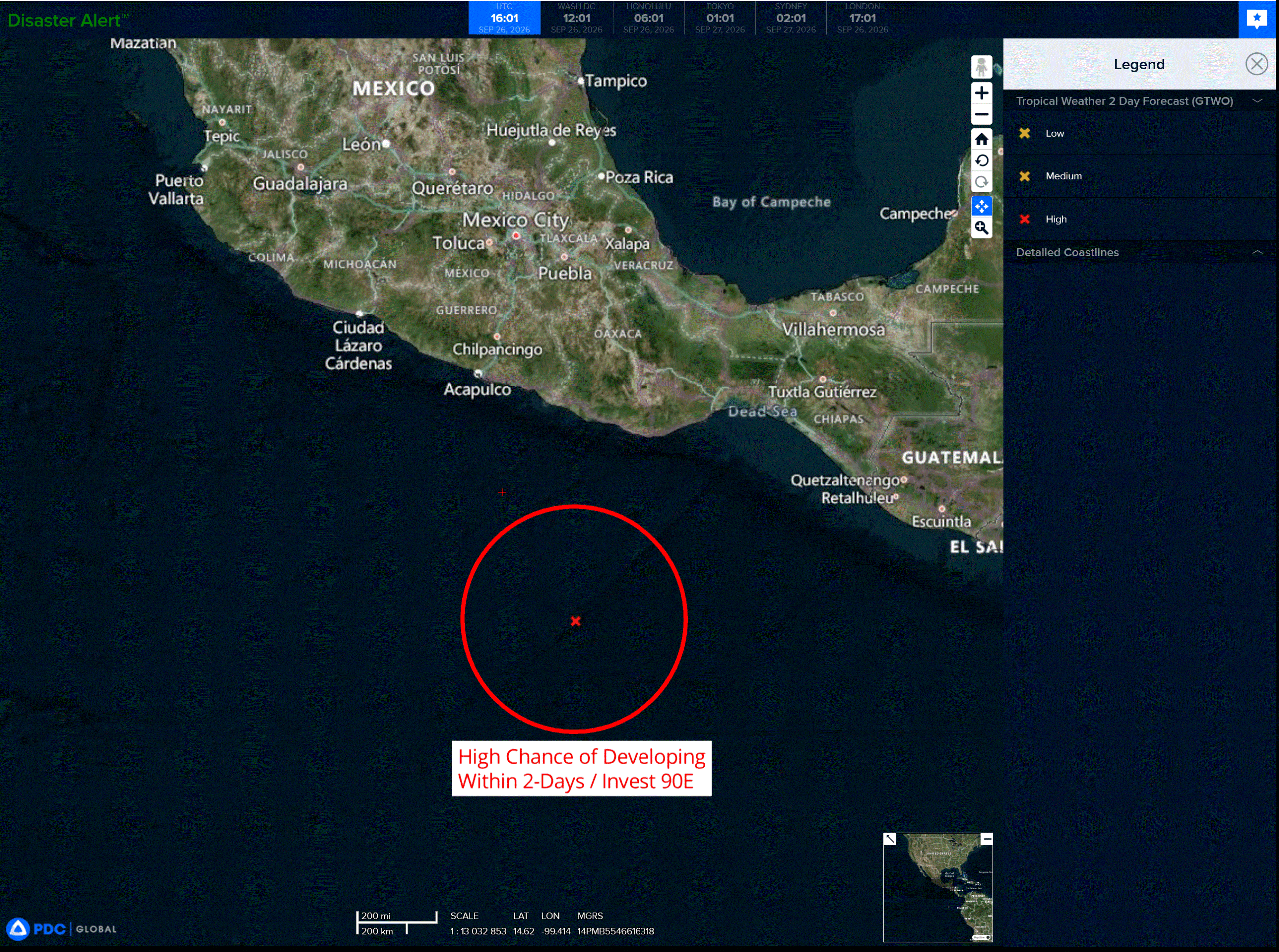
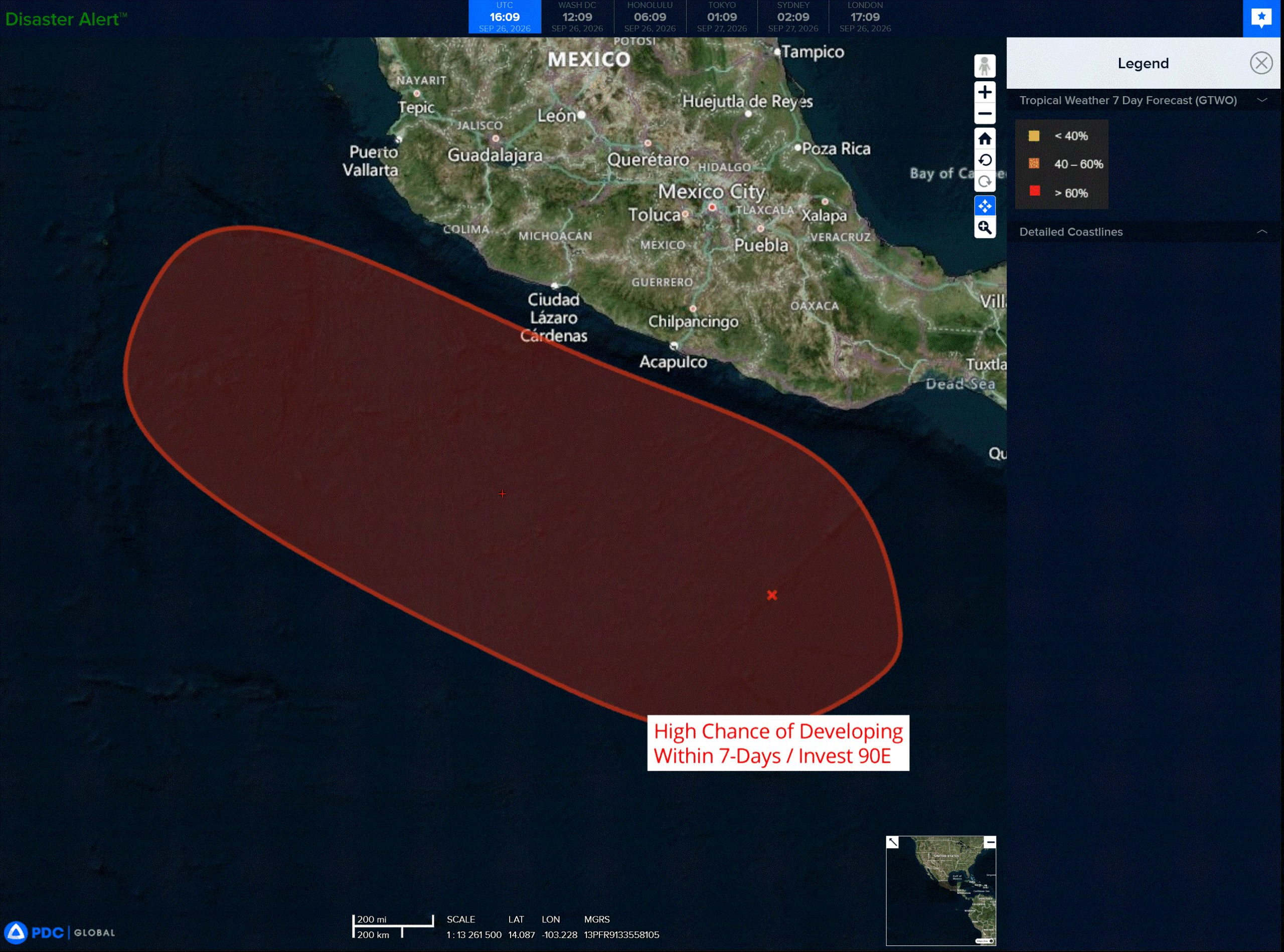
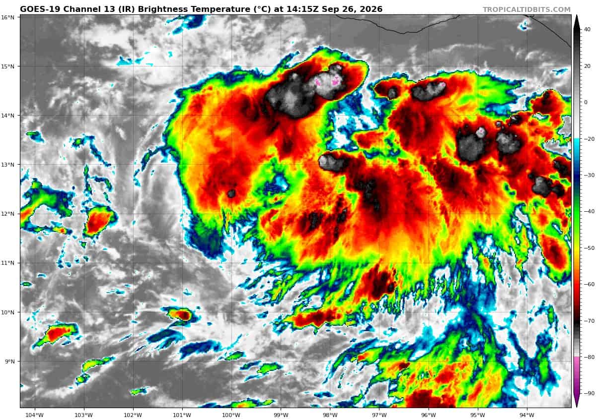
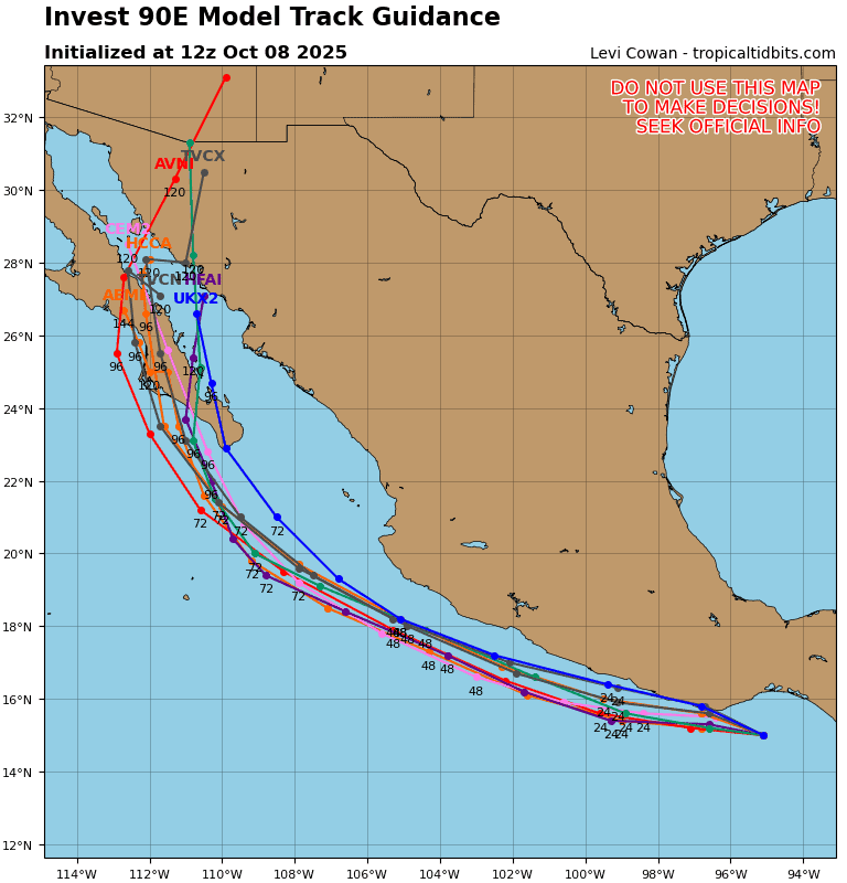
Invest 90E
An area of low pressure south of the Gulf of Tehuantepec continues to become better organized as shower and thunderstorm activity increases. Environmental conditions are conducive for development, and a tropical depression is expected to form in the next day or two as the system continues to move slowly to the west-northwest or northwest. This motion should keep it parallel to the coast of southern and southwestern Mexico.
* Formation chance through 48 hours…high..90 percent
* Formation chance through 7 days…high…90 percent
Central North Pacific:
Tropical Cyclone 15E (Nolo)
NOLO STILL MEANDERING SOUTH OF THE BIG ISLAND OF HAWAII…ADDITIONAL HEAVY RAINFALL, GUSTY WINDS, AND LARGE WAVES EXPECTED FOR PORTIONS OF THE HAWAIIAN ISLANDS
According to the NHC advisory number 24
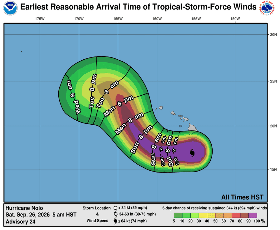
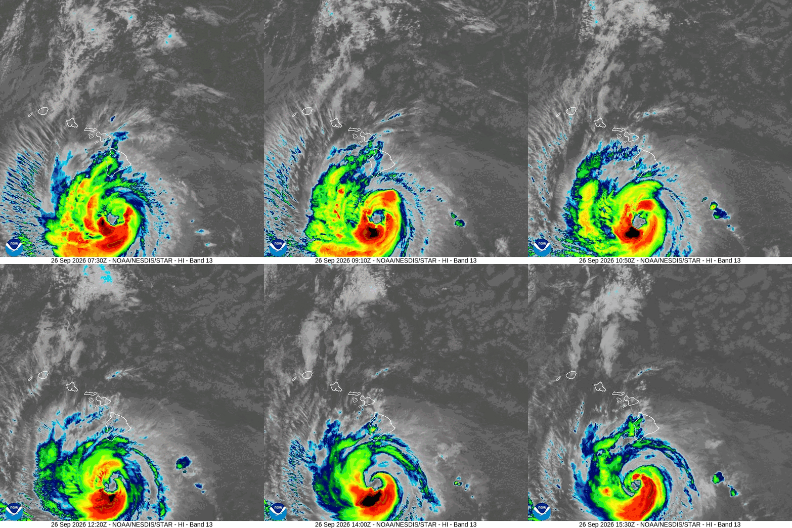
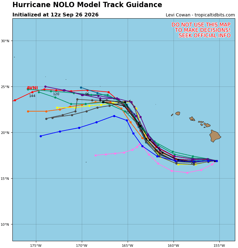
Nolo is nearly stationary. A westward motion with increasing forward speed is forecast later today and Sunday. A turn toward the northwest and north-northwest is expected on Monday and Tuesday. On the forecast track, the center of Nolo will remain well south and southwest of the main Hawaiian Islands. Maximum sustained winds are near 105 mph (165 km/h) with higher gusts. Nolo is forecast to strengthen into a major hurricane tonight or early Sunday and peak in intensity by early Monday. Thereafter, some weakening is expected. Hurricane-force winds extend outward up to 45 miles (75 km) from the center and tropical-storm-force winds extend outward up to 140 miles (220 km). The minimum central pressure based on aircraft data is 976 mb (28.82 inches).
HAZARDS AFFECTING LAND WIND:
WIND: Tropical storm conditions are occurring and hurricane-force gusts are possible in portions of the warning area in areas of steep terrain. Tropical storm conditions are possible in the tropical storm watch area beginning today. Gusts to tropical storm force are occurring in Maui County in areas of steep terrain. Regardless of the exact track of Nolo, strong and gusty winds are possible for all of the Hawaiian Islands through the weekend.
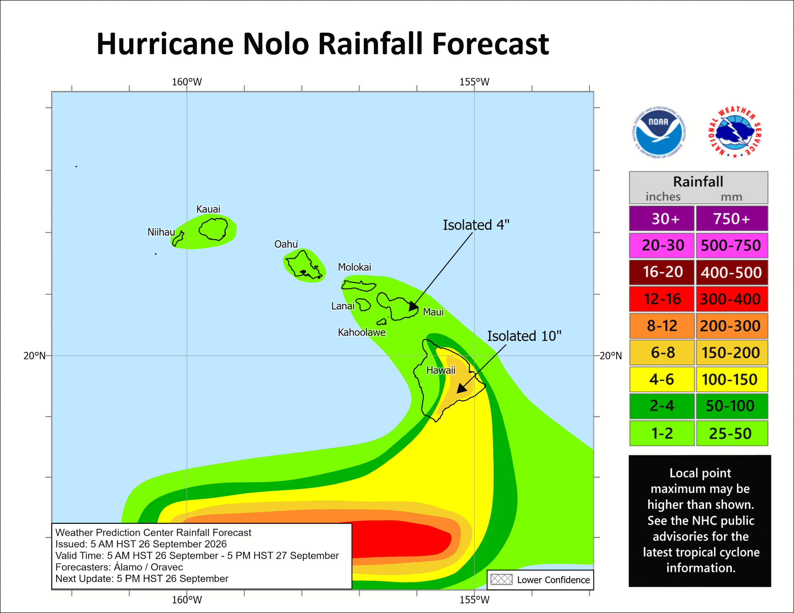
RAINFALL: For the eastern and southern portions of the Big Island, Nolo will produce additional rainfall totals 4 to 8 inches with isolated totals of 10 inches, bringing storm totals to 10 to 20 inches with maximum amounts of 25 inches. This rainfall could produce significant, life-threatening flooding and mudslides, especially in areas of steep terrain.
For the western portions of the Big Island, rainfall totals of 1 to 3 inches are expected. For eastern Maui, additional rainfall totals of 1 to 2 inches are expected, bringing storm totals to 4 to 8 inches with maximum amounts of 10 inches. Life-threatening flooding and mudslides are possible, especially in areas of high terrain.
Across the remainder of the Hawaiian Islands, maximum storm total rainfall amounts of 1 to 3 inches are expected.
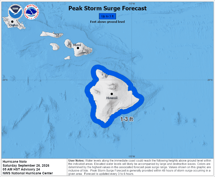
STORM SURGE: The combination of a dangerous storm surge and the tide will cause normally dry areas near the coast to be flooded by rising waters moving inland from the shoreline. The water could reach the following heights above ground somewhere in the indicated areas if the peak surge occurs at the time of high tide…
Hawaii County…1 to 3 ft
The deepest water will occur along the immediate coast near and to the right of the landfall location, where the surge will be accompanied by large and dangerous waves. Surge-related flooding depends on the relative timing of the surge and the tidal cycle, and can vary greatly over short distances.
SURF: Swells generated by Nolo are affecting exposed east- and south-facing shores of the Big Island and are expected to spread westward and build through the weekend. These swells are likely to cause life-threatening surf and rip current conditions.
>>> Well East-Southeast of the Hawaiian Islands:
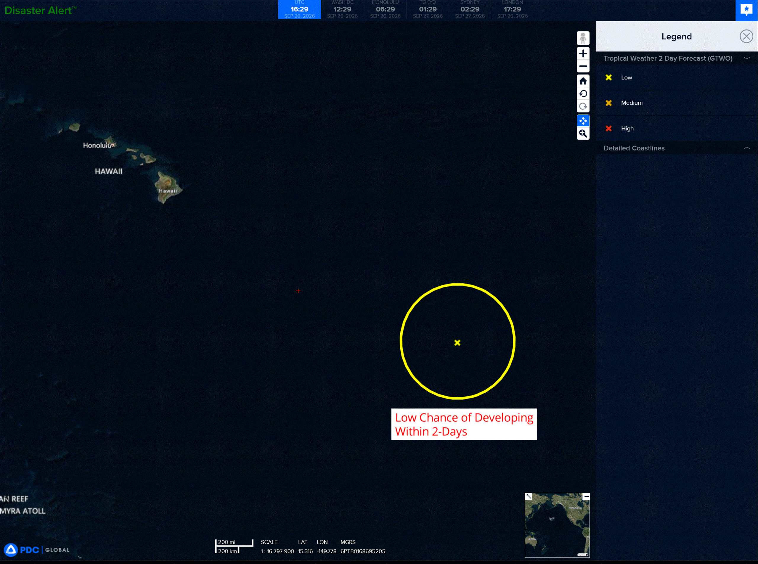
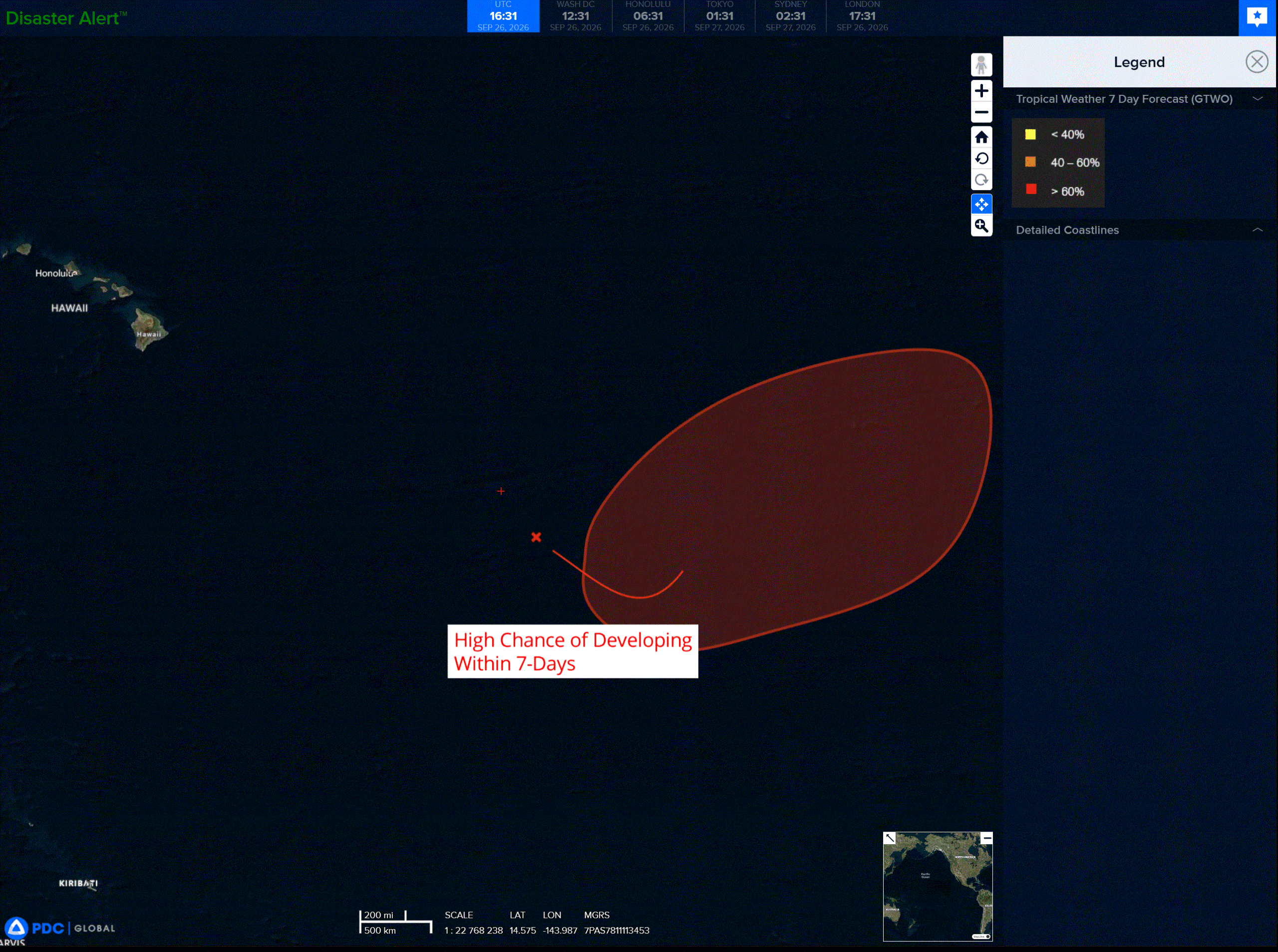
A broad area of low pressure is expected to form within the next day or so about 1000 miles to the east-southeast of the Hawaiian Islands. Environmental conditions are expected to be conducive for development of the system, and a tropical depression is likely to form during the early to middle part of next week. The system is expected to move generally northeastward, and remain well east-southeast of the Hawaiian Islands.
* Formation chance through 48 hours…low…20 percent
* Formation chance through 7 days…high…70 percent
Western Pacific, Indian Ocean, and adjacent Seas:
Western Pacific
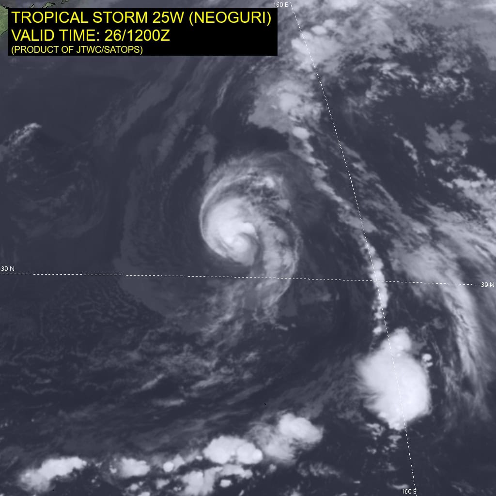
Tropical Cyclone 25W (Surigae)
According to the JTWC warning number 14…sustained winds were 70 knots with gusts to 85 knots
Animated enhanced infrared (eir) satellite imagery depicts a slow-moving system, attempting to clear out an eye feature, though as of yet, not succeeding in this endeavor.Tthe most recent frames of eir however, at 1320z show a nascent pinhole eye, but whether this will be another in a string of failed attempts, or the real deal, is yet to be determined. The system has slowed to 4 knots; trochoidal wobbling of the inner core has resulted in erratic short-term track motion as convective organization proceeds. A 261141z ascat-b pass demonstrates that while the central dense overcast (cdo) and convective canopy remain asymmetric, the underlying low-level circulation is highly symmetric and well defined.
Maximum sampled scatterometer winds were 55 knots; however, given the extremely compact inner core and typical ascat rain attenuation/resolution limitations at higher wind speeds, operational surface winds are assessed to be 10-15 knots stronger. The inner core remains beyond jma radar coverage, though the northern arc of the developing eyewall remains detectable.
Persistence among subjective and objective fixes over the past six hours suggests the system has entered a temporary plateau in intensification pending stable eyewall development. environmental
conditions remain highly favorable, characterized by minimal deep-layer shear, high ssts (29-30c), high ohc, strong dual-channel outflow, and a very low ventilation index of 0.004.
Typhoon 25W resides entirely within a large col region between an expansive subtropical ridge (str) to the east and a broad continental ridge centered over southwestern China. Having entered this weak steering environment approximately six hours ago, the system has decelerated markedly, drifting slowly
northward at 4 knots. The str to the east is forecast to weaken and recede southwestward over the next 12 to 24 hours, allowing TY 25W to round the ridge axis, exit the col, and initiate recurvature to the northeast under the influence of a progressive, relatively weak mid-latitude shortwave trough. beyond 36 hours, the str to the southeast remains weakened while mid-latitude flow to the north becomes predominantly zonal; TY 25W will translate northeastward along this relaxed steering gradient at 9-10 knots through 120 hours.
Regarding intensity: the system appears poised to complete eye formation; retention of an eye will be the pivotal factor governing near-term intensification. Thermodynamic conditions strongly favor intensification, including a moderate probability of rapid intensification (ri) over the next 24 hours. Beyond 24 hours,
increasing vws will be partially counterbalanced by vigorous poleward outflow, leading to a gradual weakening trend through 72 hours.
In the extended forecast, 25W will weaken more rapidly due to lower ssts, elevated shear, dry air entrainment, and the onset of extratropical transition (ett). the synoptic philosophy remains unchanged, with the bifurcated alternative scenario still viable. The gfs and hafs-a persist as the primary outliers advancing this alternative, contributing to elevated forecast uncertainty. The gfs sustains 25W as a more intense cyclone for an extended period, while simultaneously accelerating cyclogenesis of a secondary disturbance near the Marianas.
In the gfs solution, these combined systems reinforce development of a strong ridge to the north and east of 25W, effectively blocking poleward progression. Additionally, the gfs depicts a weaker, less dynamic trough that fails to extend sufficiently equatorward to induce recurvature.