

Current Snapshot
For all the latest updates visit: DisasterAWARE
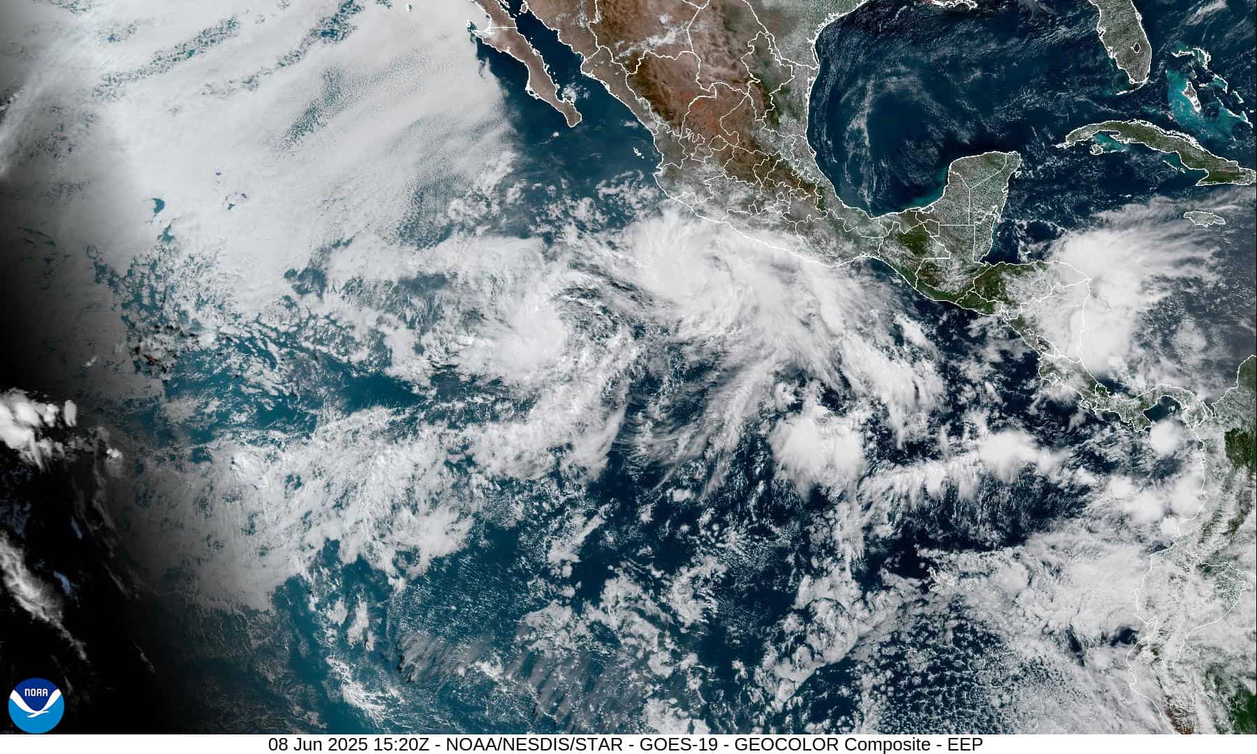
1800x1080e
2e
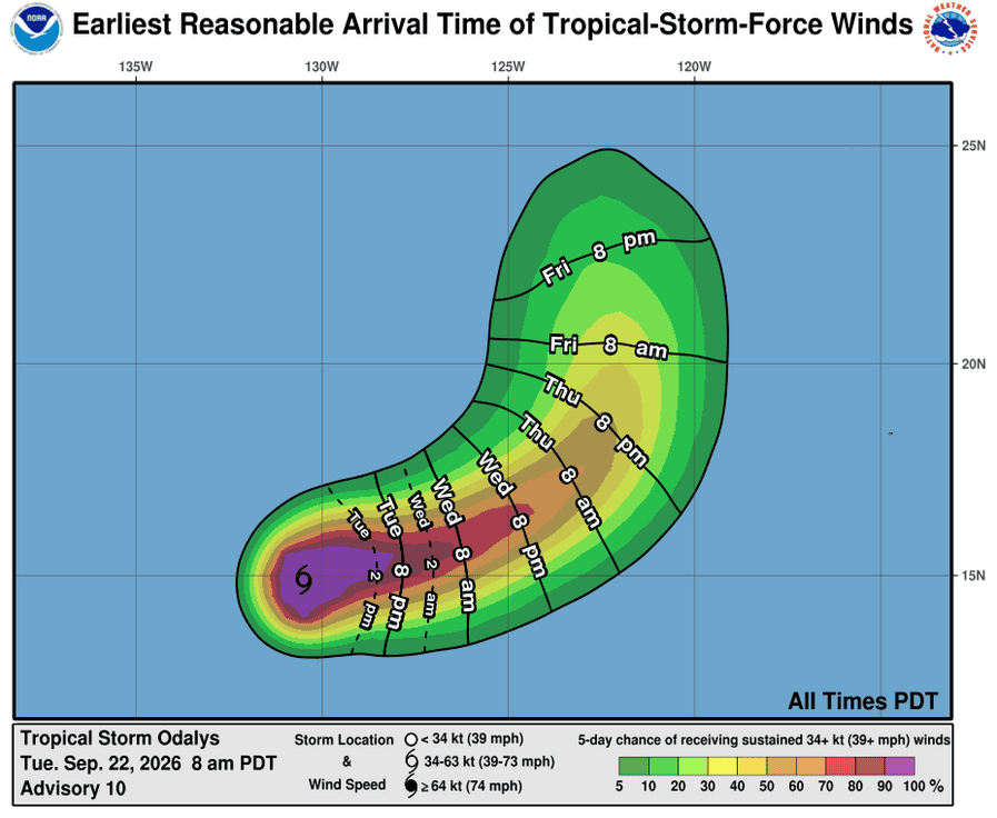
221444_earliest_reasonable_toa_34O
16E_tracks_latest
221454_earliest_reasonable_toa_34P
goes19_ir_17E_202609221415_lat14.7-lon-101.6
221454INTQPF_sm
17E_tracks_latest
7
1800x1080ec
2c
7c
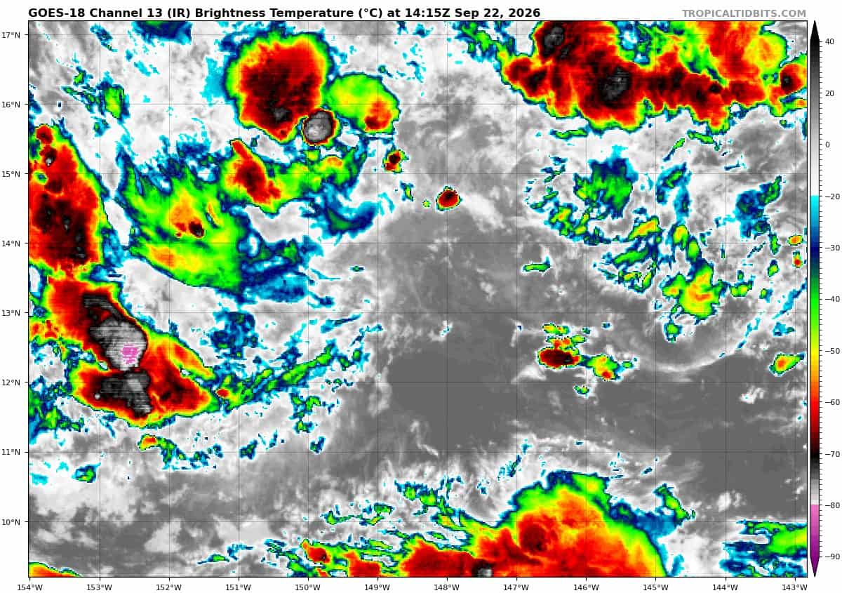
goes18_ir_15E_202609221415_lat13.2-lon-148.1
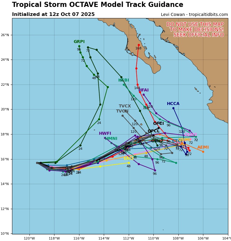
15E_tracks_latest
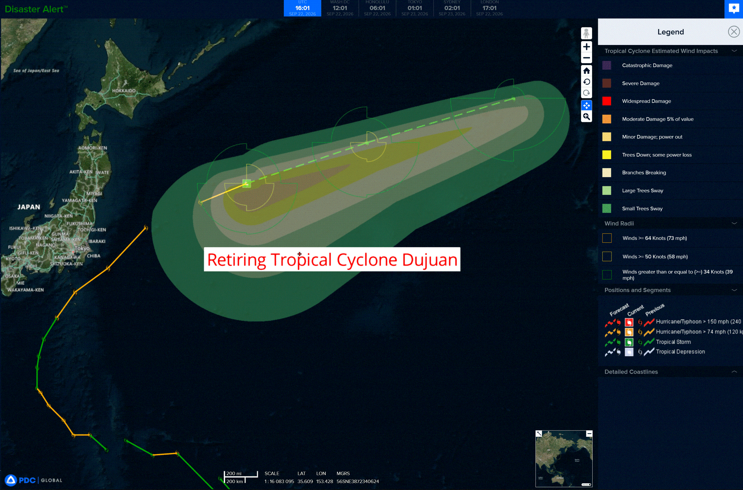
dujuan
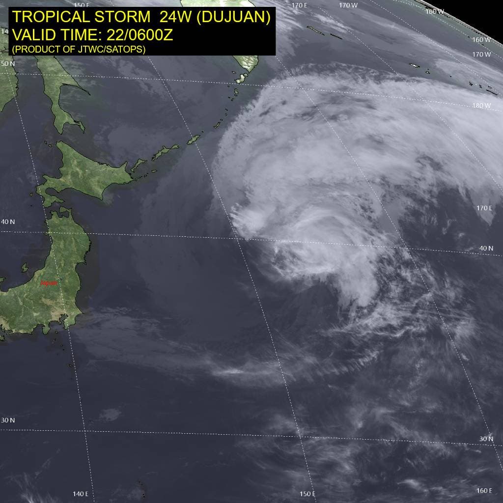
24W_220600sair
91w
himawari9_ir_91W_202609221410_lat14.5-lon140.7

91W_tracks_latest
95B
95B_tracks_latest
By PDC’s Senior Weather
Specialist Glenn James

The Pacific Disaster Center’s (PDC Global) Tuesday, September 22, 2026, Tropical Cyclone Activity Report…for the Pacific Ocean, the Indian Ocean, and adjacent Seas.
Tropical Cyclones
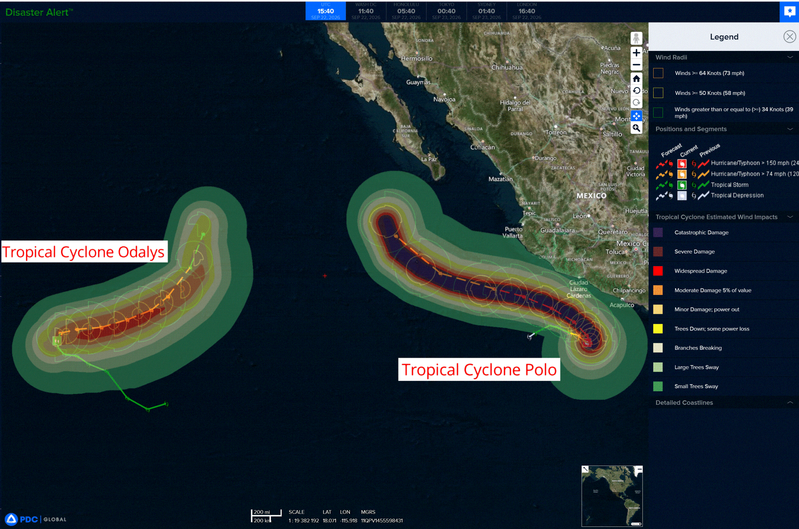
Tropical Cyclone 16E (Odalys) is located about 1455 miles west-southwest of the southern tip of Baja California
Tropical Cyclone 17E (Polo) is located about 345 miles south-southeast of Manzanillo, Mexico
Tropical Cyclone 24W (Dujuan) is located approximately 424 NM east of Misawa, Japan – Final Warning
Northeast Pacific:
Tropical cyclone 16E (Odalys)
ODALYS MAINTAINS INTENSITY AS IT MOVES OVER THE OPEN EASTERN PACIFIC OCEAN
According to the NHC advisory number 10
Odalys is moving toward the north near 5 mph (7 km/h). A turn toward the northeast and then east-northeast is expected to occur over the next day or so. An east-northeast to eastward motion is expected through the end of the week.
Maximum sustained winds are near 65 mph (100 km/h) with higher gusts. Additional strengthening is forecast, and Odalys could become a hurricane later today or tonight.
Tropical-storm-force winds extend outward up to 90 miles (150 km) from the center. The estimated minimum central pressure is 998 mb (29.47 inches).
Tropical cyclone 17E (Polo)
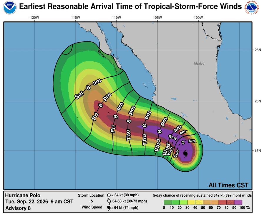
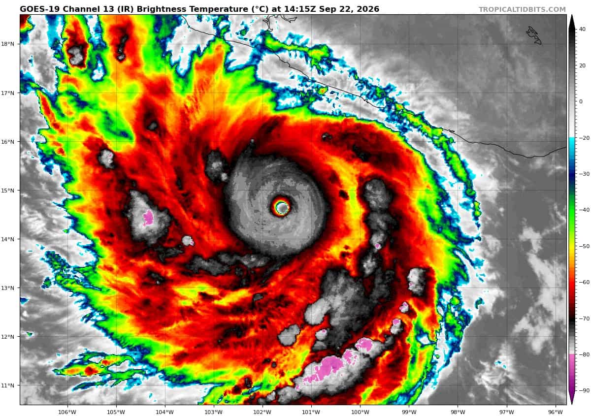
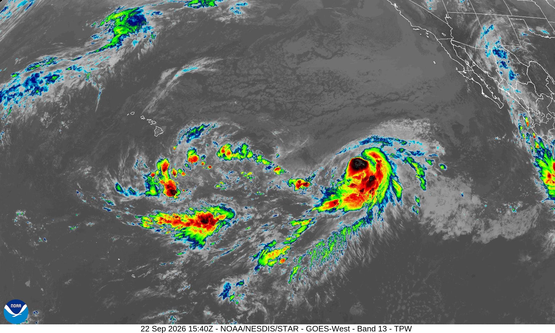
POLO IS AN EXTREMELY DANGEROUS CATEGORY 5 HURRICANE …EXPECTED TO MOVE SLOWLY OFF THE COAST OF MEXICO DURING THE NEXT COUPLE OF DAYS
According to the NHC advisory number 8
Polo is drifting toward the north near 2 mph. A turn toward the northwest and west-northwest is expected tonight and Wednesday. On the forecast track, the core of Polo is expected to be near the coast of southwestern Mexico during the next few days, although forecast to remain offshore.
Maximum sustained winds have increased to near 165 mph with higher gusts. Polo is a category 5 hurricane on the Saffir-Simpson Hurricane Wind Scale. Some additional strengthening is likely through tonight, with fluctuations in strength possible Wednesday and Wednesday night.
A NOAA Hurricane Hunter aircraft is currently enroute to investigate Polo. Hurricane-force winds extend outward up to 35 miles from the center and tropical-storm-force winds extend outward up to 90 miles (150 km).
HAZARDS AFFECTING LAND
WIND: Tropical storm conditions are expected within the warning area along the coast of Mexico by early Wednesday. Tropical storm conditions are possible within the watch area along the coast of Mexico by Thursday.
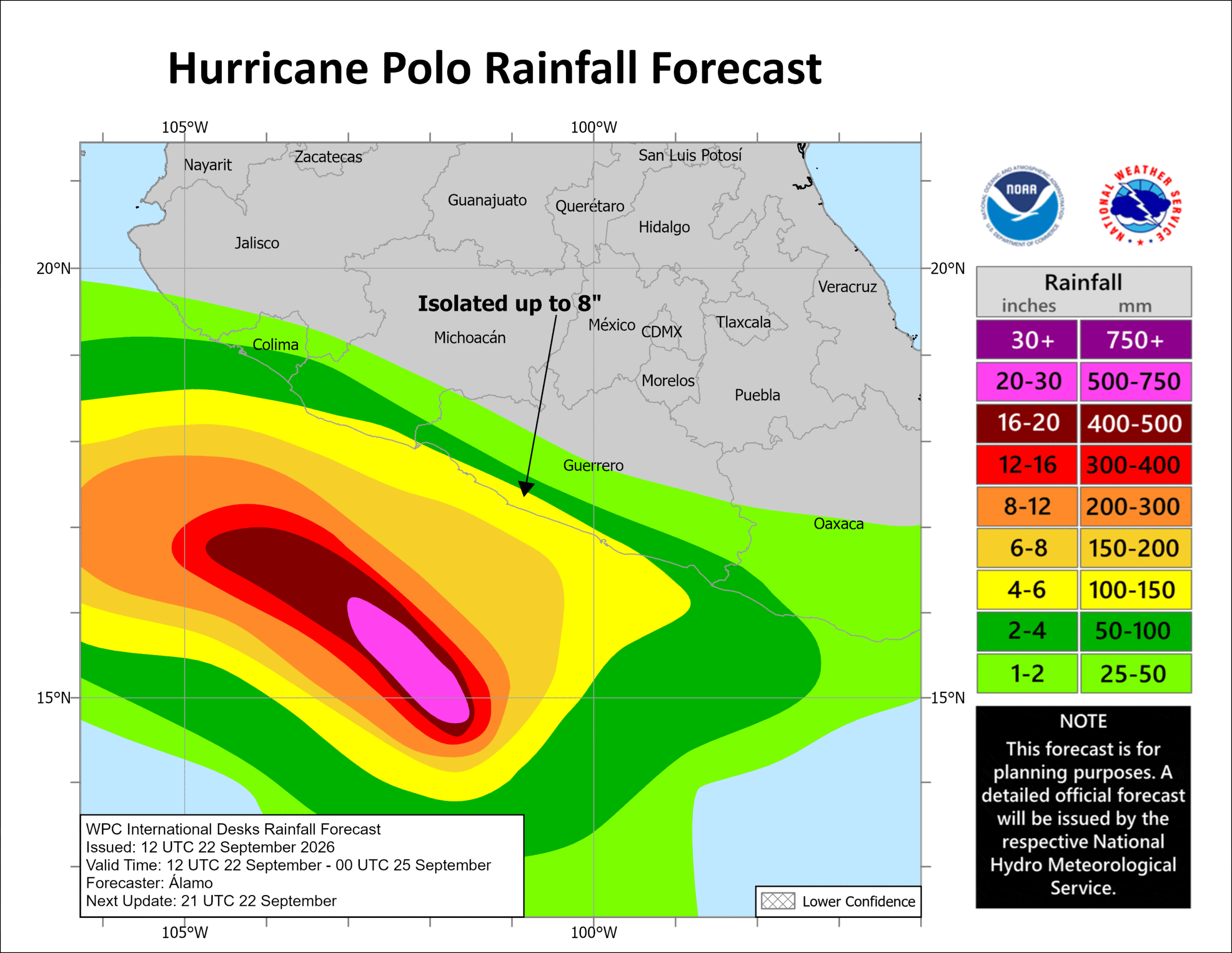
RAINFALL: Polo is expected to produce rainfall totals of 3 to 6 inches, with isolated maximum totals up to 8 inches across coastal portions of the Mexican states of Guerrero and Michoacán through Thursday. This rainfall may produce life-threatening flooding and mudslides, especially in areas of steep terrain. Rainfall of 2 to 4 inches is possible in coastal portions of Oaxaca, Colima, and Jalisco through Thursday.
SURF: Swells generated by Polo are expected to affect portions of the coast of southwestern Mexico during the next few days. These swells are likely to cause life-threatening surf and rip current conditions.
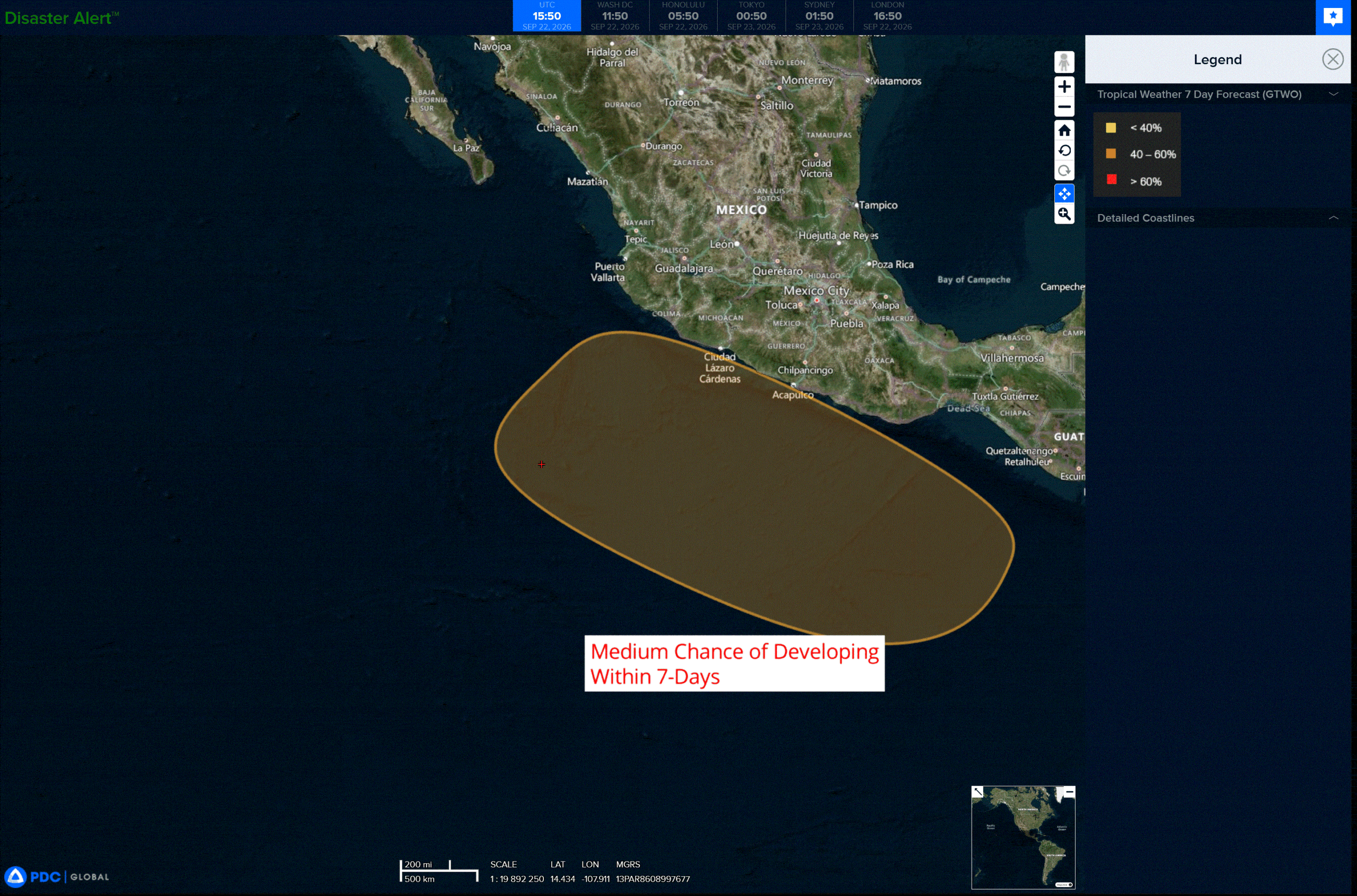
>>> South of the Gulf of Tehuantepec:
An area of low pressure is expected to form in the next few days to the south of the Gulf of Tehuantepec. Afterwards, environmental conditions should be favorable for gradual development, and a tropical depression could form late this week or this weekend as the system moves slowly west-northwestward to northwestward. This motion should keep it parallel to the coast of southern and southwestern Mexico.
* Formation chance through 48 hours…low…near 0 percent
* Formation chance through 7 days…medium…60 percent
Central North Pacific: There are no Tropical Cyclones
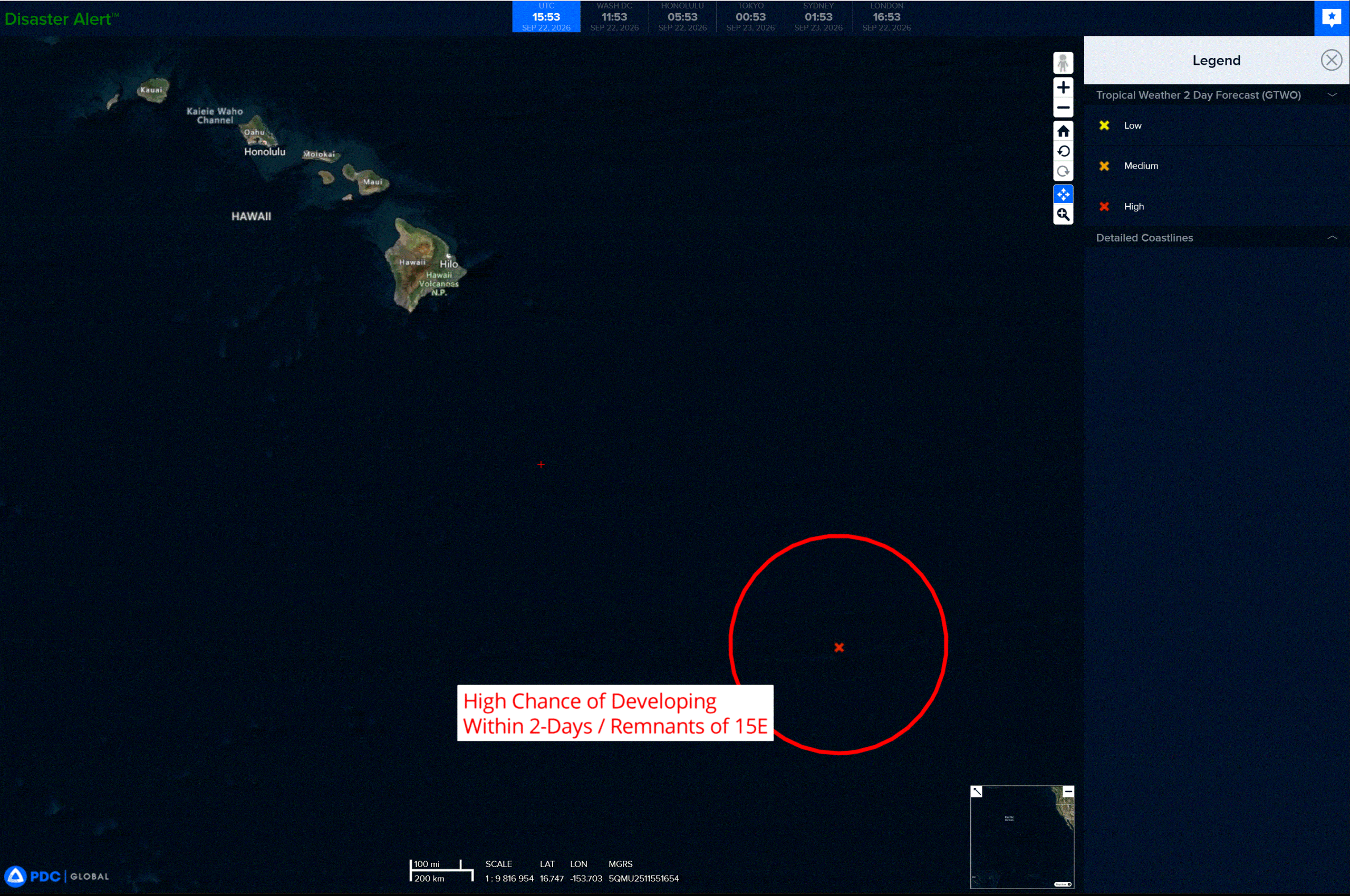
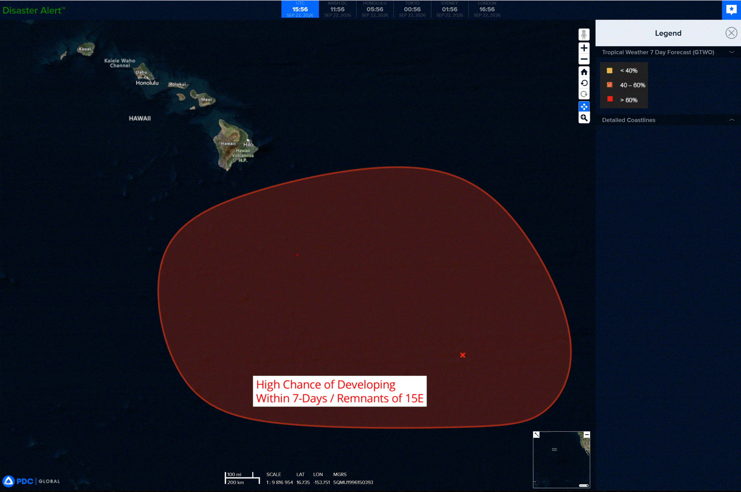
>>> Southeast of the Hawaiian Islands:
(Former TD 15E)
The remnants of Tropical Depression 15E, located several hundred miles southeast of the Hawaiian Islands, has produced an increase in showers and thunderstorms over the last few hours. The environmental conditions are still expected to be conducive for further development, and a tropical depression is likely to form during the next day or two while the system moves slowly west-northwestward or northwestward. Interests in the Hawaiian Islands should continue to monitor the progress of this system.
* Formation chance through 48 hours…high…70 percent
* Formation chance through 7 days…high…90 percent
Western Pacific, Indian Ocean, and adjacent Seas:
Western Pacific
Tropical Cyclone 24W (Dujuan) – Final Warning
According to the JTWC warning number 28…sustained winds were 60 knots with gusts to 75 knots
Animated multi-spectral imagery depicts tropical storm 24W (Dujuan) with a very broad, elongated, and fully exposed low-level circulation center. Convection is highly sheared to the northeast as the system further embeds itself under the upper level jet.
Environmental analysis reveals a hostile environment characterized by cold (23-24 c) sea surface temperatures, extreme (60-65 kts) vertical wind shear, extensive dry air entrainment. 24W is assessed to be currently undergoing extratropical transition (ett), exhibiting moderate temperature advection induced by interaction with the jet.
Global deterministic models are in strong agreement that 24W will complete ett within 12 hours and continue tracking poleward through the remainder of the forecast period.
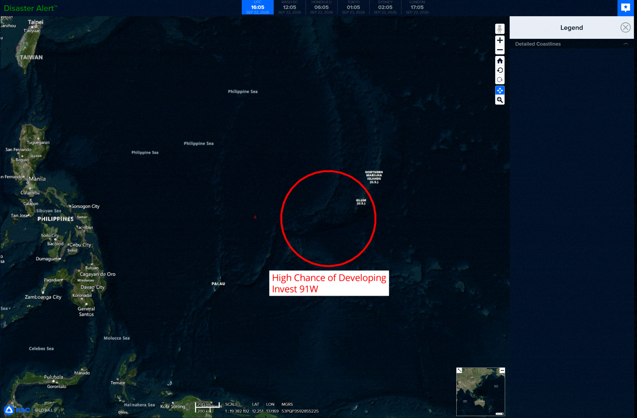
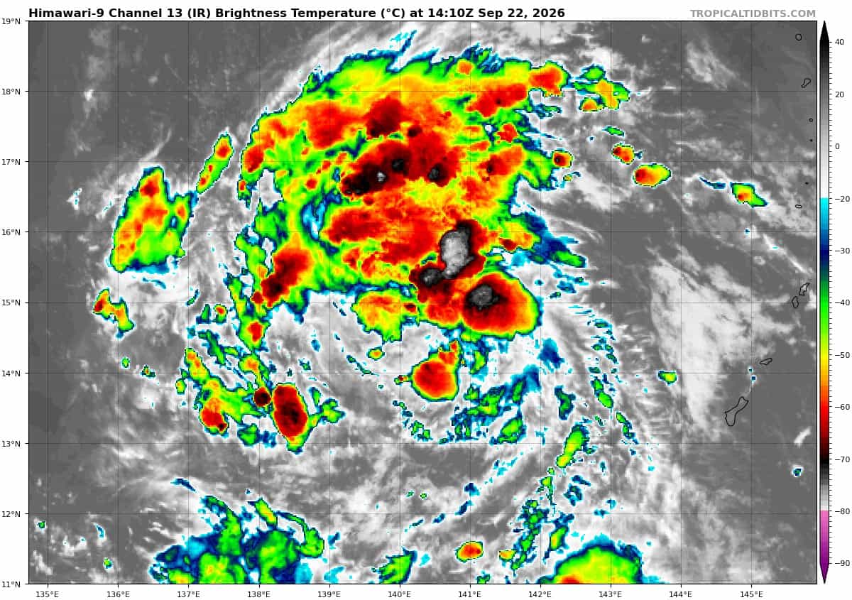
>>> There’s an area of disturbed weather that’s being referred to as Invest 91W, which is located approximately 173 NM west-southwest of Guam
Multi-spectral satellite imagery (msi) and a 220035z metop-c ascat pass depict a consolidating low level circulation center (llcc) obscured by flaring, patchy convection.
Environmental analysis indicates a favorable area for development with low vertical wind shear (10-15kts), good equatorward outflow, and a warm sea surface temperature (29-30c).
Global deterministic and ensemble models depict formation of a tropical depression within 24 to 48 hours as the system tracks northwestward.
Maximum sustained surface winds are estimated at 18 to 23 knots.
Minimum sea level pressure is estimated to be near 1006 mb.
The potential for the development of a significant tropical cyclone within the next 24 hours remains high.
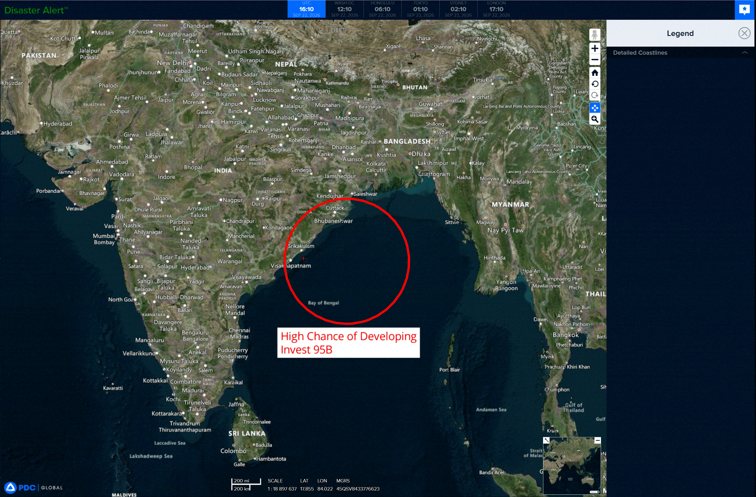
>>> There’s an area of disturbed weather that’s being referred to as Invest 95B, which is located approximately 169 NM east of Visakhapatnam, India
Animated multi-spectral satellite imagery (msi) satellite imagery depicts a consolidating low-level circulation center (llcc) with flaring deep convection to the on the western periphery of the circulation.
Environmental analysis indicates a favorable area for development with low vertical wind shear (10-15 kts), moderate equatorward outflow aloft, warm sea surface temperatures (29-30c), and robust amounts of moisture within the area.
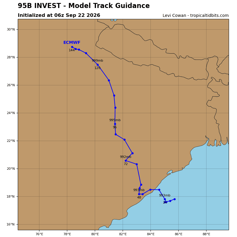
Global deterministic and ensemble models are in agreement of gradual development within the next 24-36 hours while slowly drifting towards the coast of eastern India.
Maximum sustained surface winds are estimated at 28 to 33 knots.
Minimum sea level pressure is estimated to be near 998 mb.
The potential for the development of a significant tropical cyclone within the next 24 hours is upgraded to high.