

Current Snapshot
For all the latest updates visit: DisasterAWARE
1800x1080e
rachel
051514_earliest_reasonable_toa_34
goes18_ir_18E_202610051535_lat20.4-lon-115.8
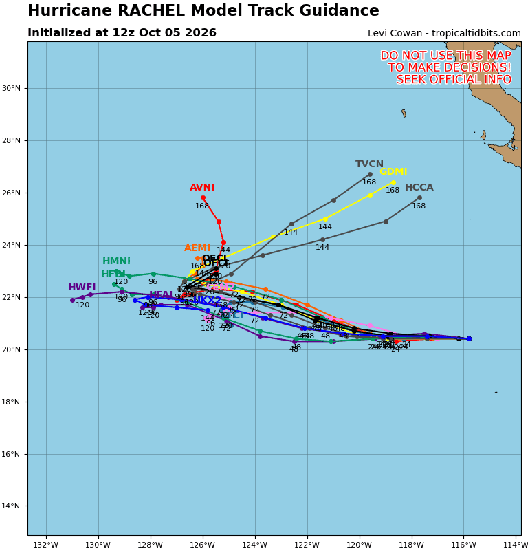
18E_tracks_latest
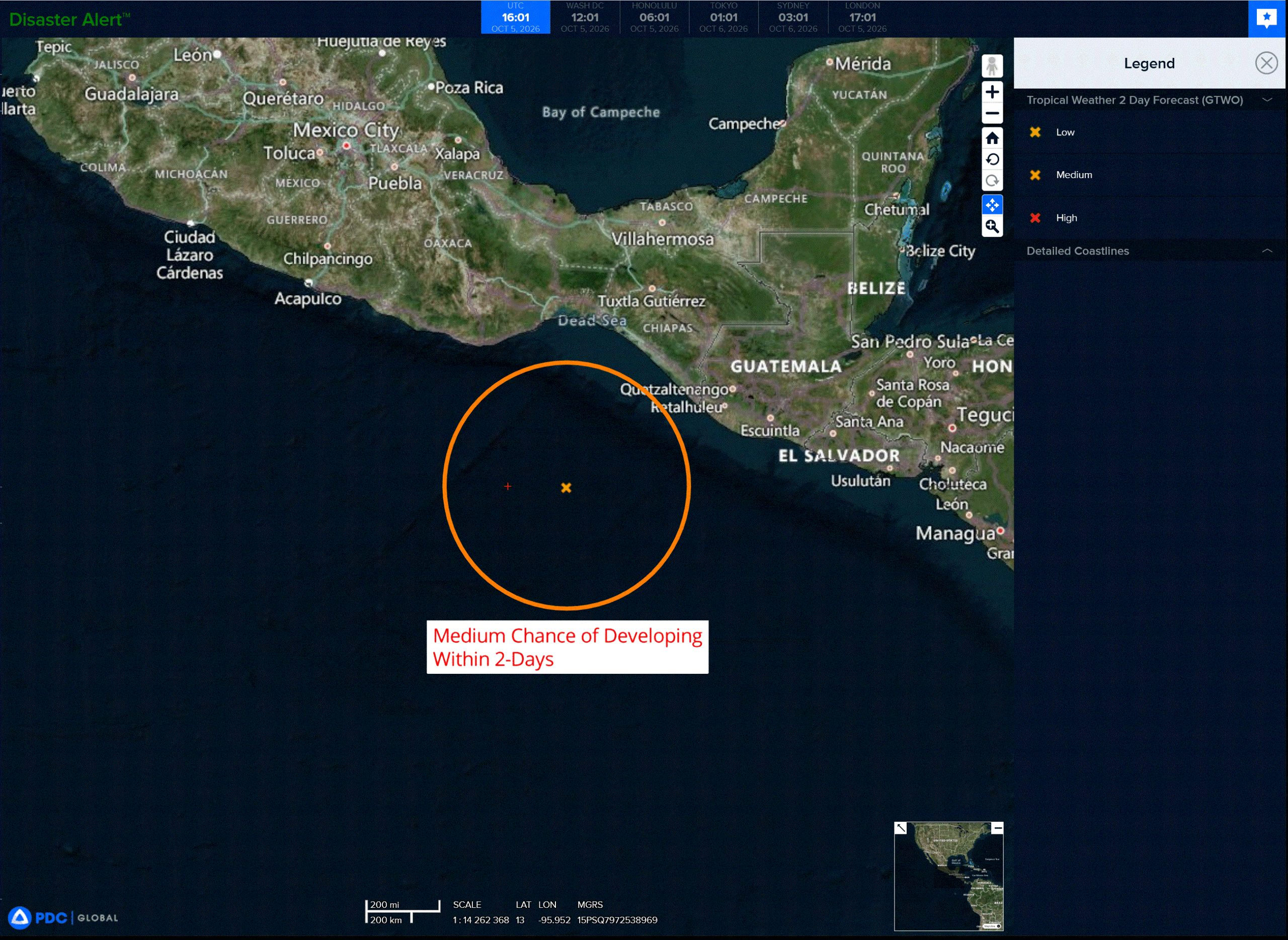
med
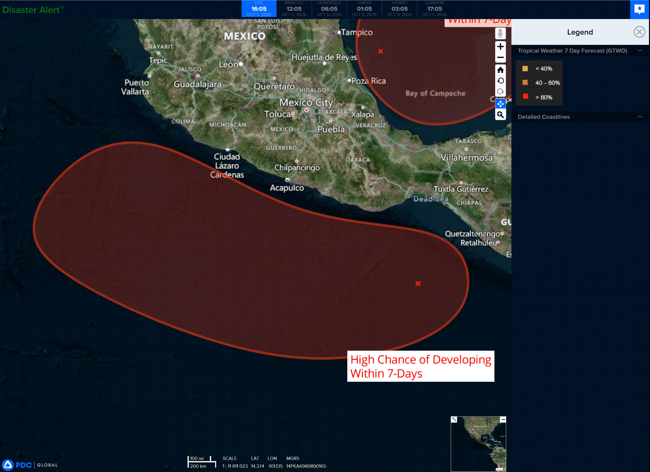
high

1800×1080
10
3w
15E_051200sair
goes18_ir_15E_202610051535_lat25.6-lon176.2
15E_tracks_latest
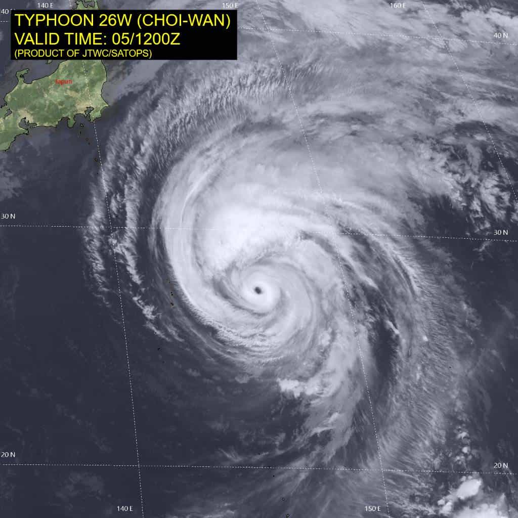
26W_051200sair
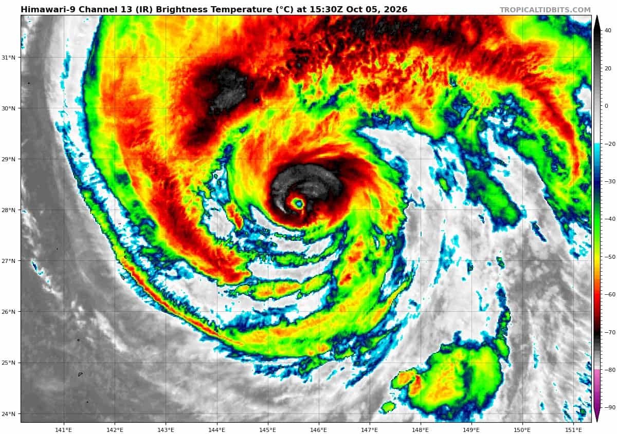
himawari9_ir_26W_202610051530_lat27.3-lon145.9
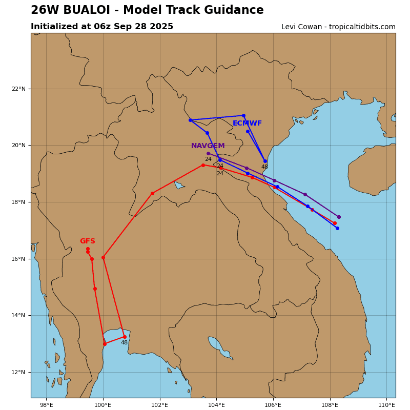
26W_tracks_latest
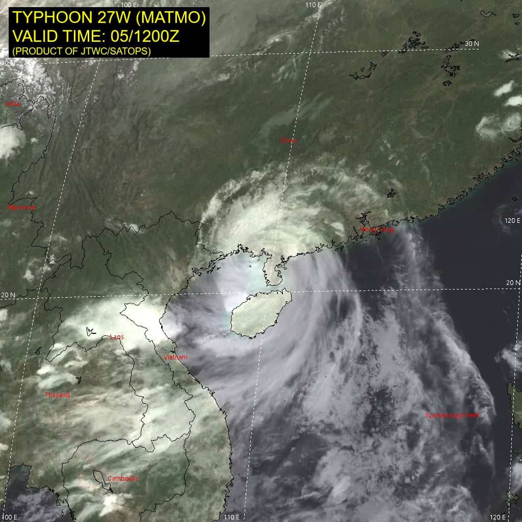
27W_051200sair
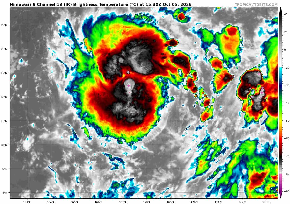
himawari9_ir_27W_202610051530_lat11.5-lon167.9
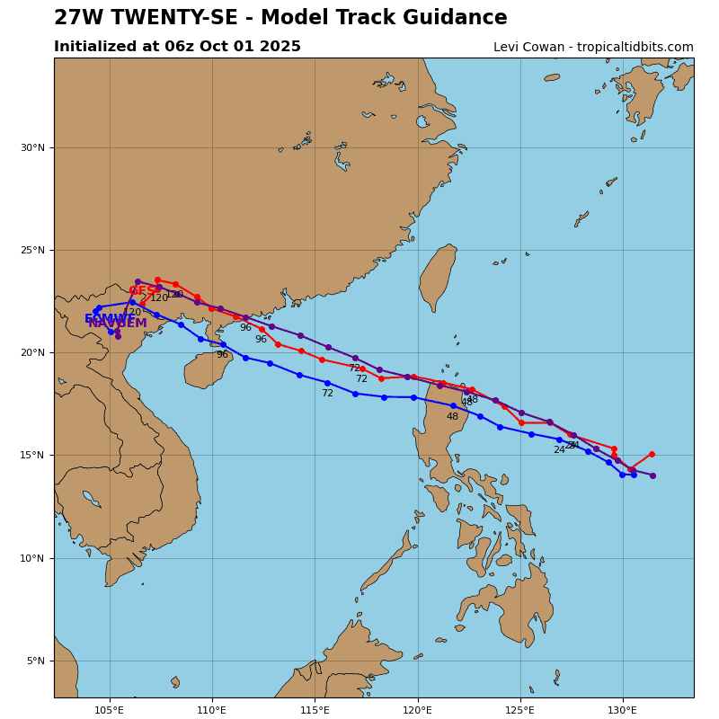
27W_tracks_latest
By PDC’s Senior Weather
Specialist Glenn James

The Pacific Disaster Center’s (PDC Global) Monday, October 5, 2026, Tropical Cyclone Activity Report…for the Pacific Ocean, the Indian Ocean, and adjacent Seas.
Tropical Cyclones
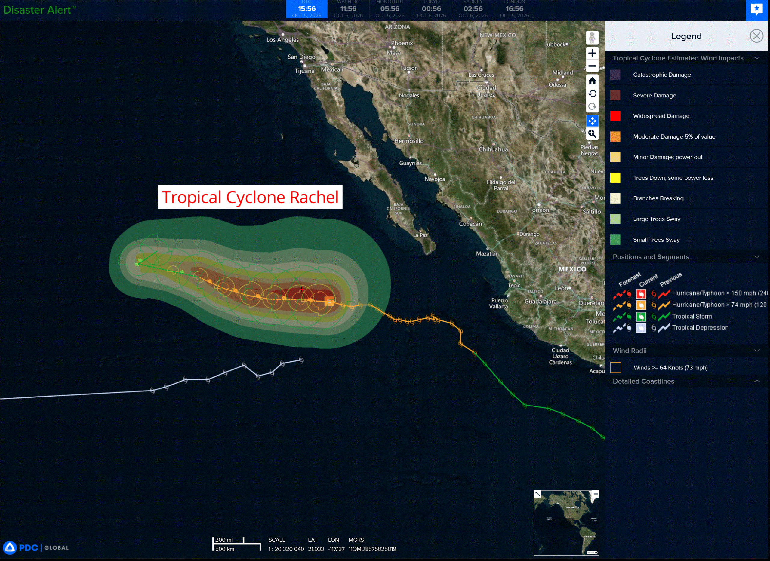
Tropical Cyclone 18E (Rachel) is located about 440 miles west-southwest of the southern tip of Baja CA
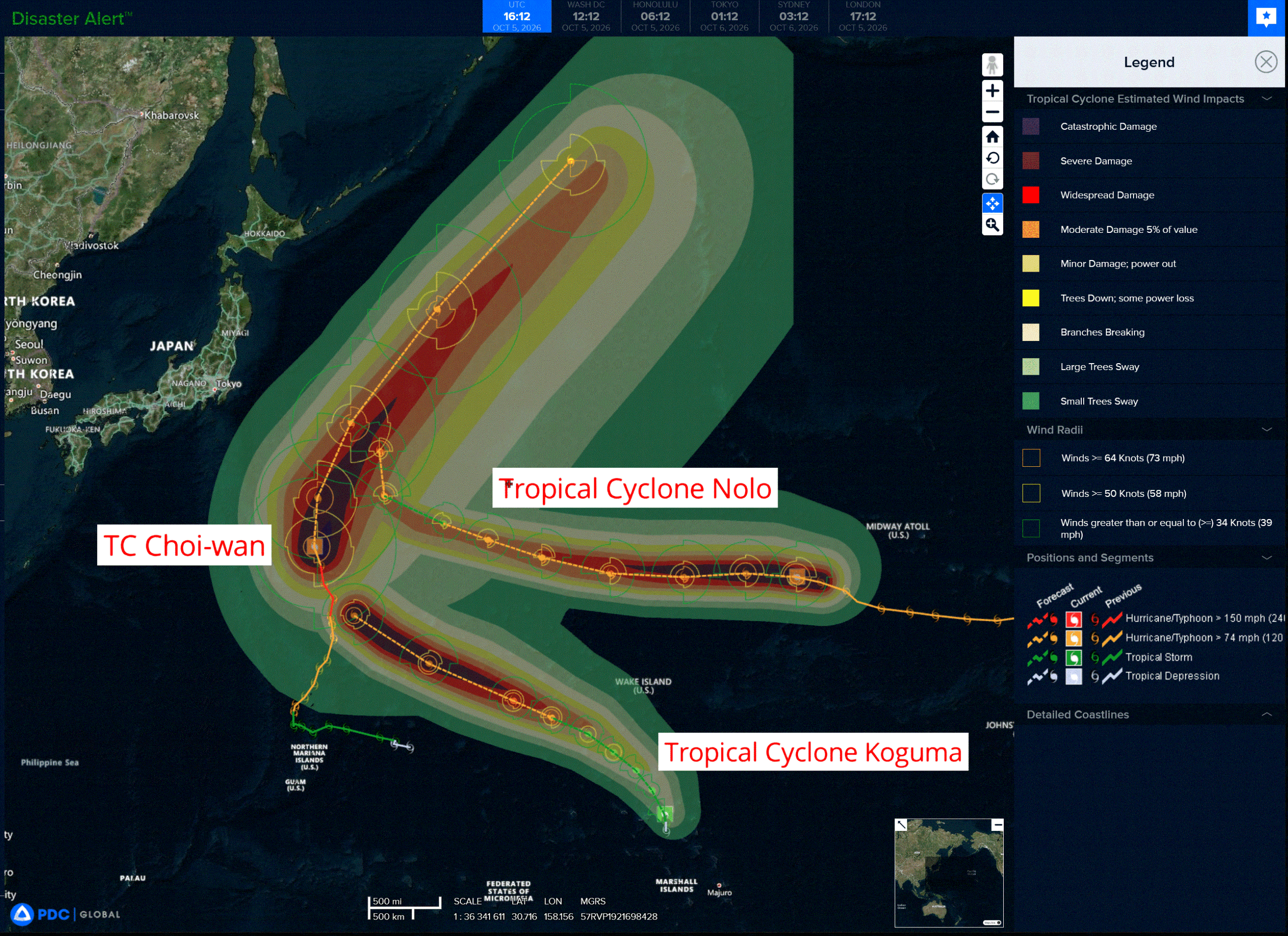
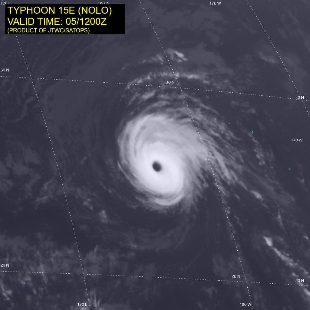
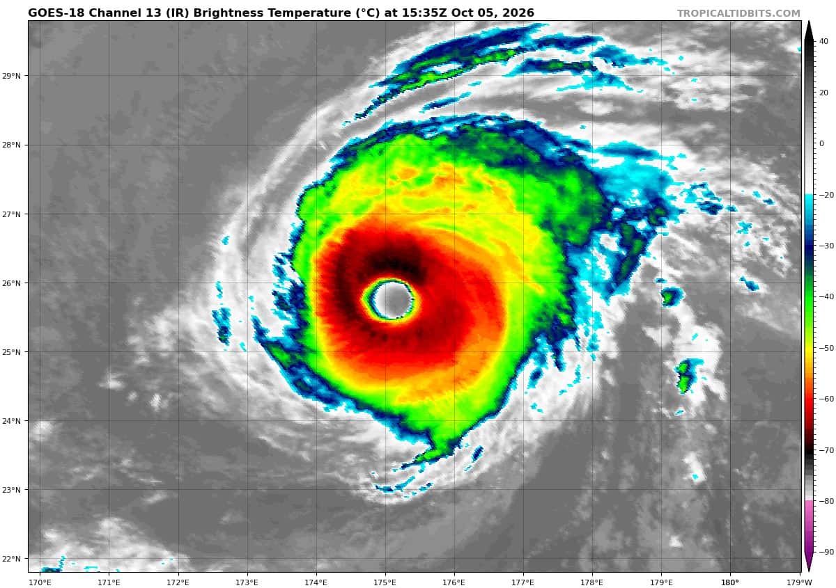
Tropical Cyclone 15E (Nolo) is located about 961 miles west-northwest of Johnston Island
Tropical Cyclone 26W (Choi-Wan) is located approximately 290 NM east-northeast of Iwo To
Tropical Cyclone 27W (Koguma) is located approximately 168 NM north of Kwjalein
Northeast Pacific:
Tropical cyclone 18E (Rachel)
RACHEL SLIGHTLY WEAKENS AND CONTINUES WESTWARD
According to the NHC advisory number 34
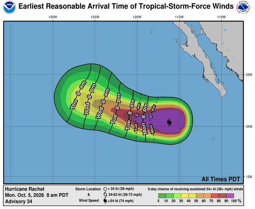
Rachel is moving toward the west near 7 mph (11 km/h) and a continued westward to west-northwestward motion is expected for the next several days.
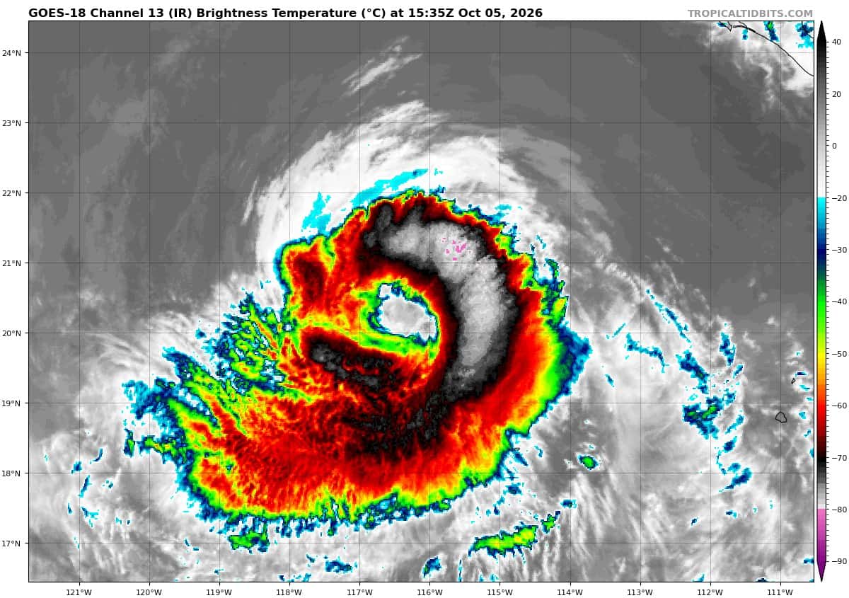
Maximum sustained winds are near 85 mph (140 km/h) with higher gusts. Fluctuations in strength are possible over the next few days, with gradual weakening beginning by the mid part of the week.
Hurricane-force winds extend outward up to 40 miles (65 km) from the center and tropical-storm-force winds extend outward up to 140 miles (220 km). The estimated minimum central pressure is 976 mb (28.82 inches).
HAZARDS AFFECTING LAND
SURF: Swells generated by Rachel will continue to affect the coast of the Baja California Peninsula for the next couple of days. These swells are likely to cause life-threatening surf and rip current conditions.
>>> South of Southern Mexico:
A broad area of low pressure located just to the south of the Gulf of Tehuantepec is producing disorganized showers and thunderstorms.
Environmental conditions appear favorable for gradual development, and a tropical depression is expected to form during the middle to latter portion of the week while the system moves slowly west-northwestward to northwestward, just offshore of the southern to southwestern coast of Mexico.
* Formation chance through 48 hours…medium…50 percent
* Formation chance through 7 days…high…90 percent
Central North Pacific: There are no Tropical Cyclones
Tropical cyclone formation is not expected during the next 7 days.
Western Pacific, Indian Ocean, and adjacent Seas:
Western Pacific
Tropical Cyclone 15E (Nolo)
According to the JTWC warning number 60…sustained winds were 105 knots with gusts to 130 knots
Animated enhanced infrared (eir) satellite imagery depicts typhoon 15E (Nolo) with a large, symmetrical eye measuring approximately 35nm in diameter. Additionally, cloud tops are warming slightly, particularly along the western flank where dry air is entraining into the core. The 050855z ascat data reveals an asymmetric wind field, with a thin band of storm- and typhoon-force winds along the southwestern semicircle contrasted with an expansive range of elevated winds within the northeast semicircle.
Environmental analysis reveals a marginally favorable environment characterized by low to moderate (15-20 kts) vertical wind shear (vws), warm (28-29 c) sea surface temperatures (sst), and moderate
poleward outflow, offset by dry air entrainment from the west.
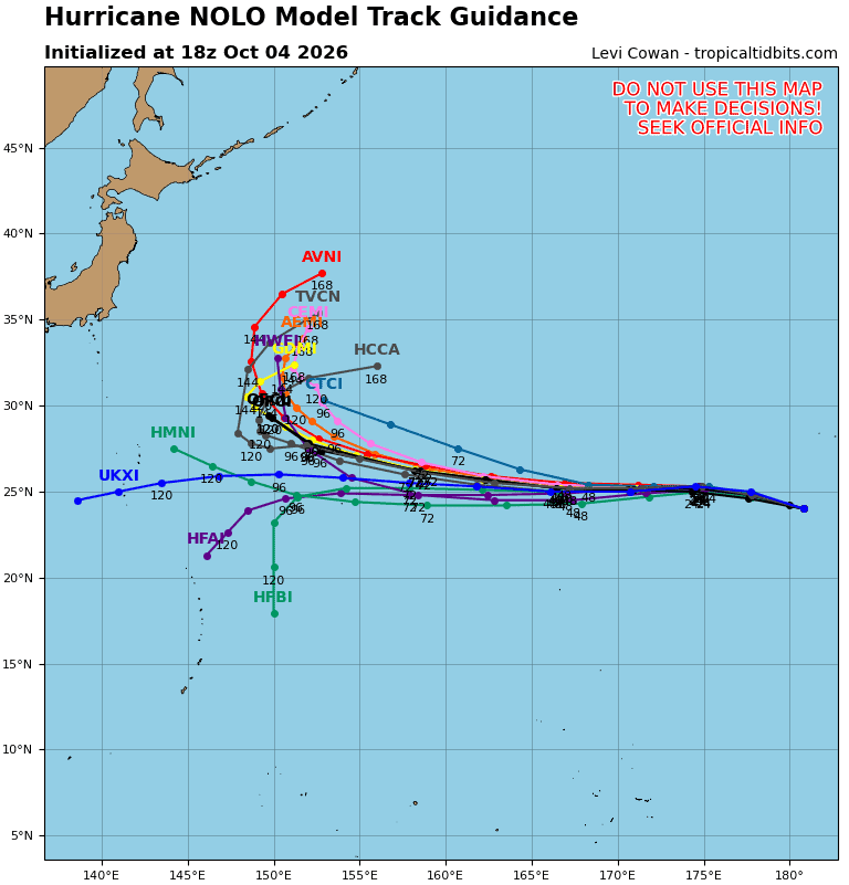
TY 15E is forecast to continue tracking generally west-northwestward to westward while it remains on the
southern periphery of the steering str. Beginning around 96 hours, 15E will begin to round the periphery of the ridge and turn poleward into a break between the steering ridge and a building low- to mid-layer ridge centered over Japan. 15E will track poleward through 120 hours.
Regarding intensity, 15E is forecast to gradually weaken over the next 72 hours as the environment gets
progressively more unfavorable, with decreasing outflow, increasing vws, and increasing dry air entrainment through 72 hours. Around 72-96 hours, the vws is expected to abate slightly and the outflow is expected to marginally improve, allowing 15E to briefly re-intensify through 120 hours.
Tropical Cyclone 26W (Choi-wan)
According to the JTWC warning number 23…sustained winds were 110 knots with gusts to 135 knots
Animated enhanced infrared (eir) satellite imagery depicts typhoon 26W (Choi-wan) with a steadily degrading structure. cloud tops have continued to warm over the past 6 hours and the central dense
overcast has started to become irregular, particularly in the western semicircle. The dry slot that was evident 6 hours ago has now entirely encircled the inner-core.
Environmental analysis indicates that 26W is now in a marginal environment characterized by strong
poleward outflow aloft, low (5-10 kts) vertical wind shear, and warm (28-29 c) sea surface temperatures greatly offset by significant dry air entrainment.
TY 26W is forecast to continue tracking generally northward, along the western periphery of the str to the
east through 12 hours. Near 12 hours, 26W will approach the steering ridge axis and begin turning northeastward. Track speeds will significantly increase starting around 24 hours as an incoming long wave trough picks up 26W and ushers it quickly northeastward. Extratropical transition is forecast to begin at 36 hours and complete at 48 hours as the system becomes embedded underneath the jet south of the Kamchatka Peninsula.
Regarding intensity, 26W is forecast to steadily weaken through 36 hours due to dry air entrainment and cooling sea surface temperatures. Following 36 hours, westerly shear will drastically increase, causing the system to further weaken. However, 26W will tap into an extreme poleward outflow channel, supported by a very strong jet max to the north. This will allow for the system to maintain an intensity near typhoon strength
as it undergoes extratropical transition and becomes a potent cold-core low.
Tropical Cyclone 27W (Koguma)
According to the JTWC warning number 3…sustained winds were 35 knots with gusts to 45 knots
Animated enhanced infrared (eir) satellite imagery depicts tropical storm 27W (Koguma) with a mostly obscured low-level circulation center (llcc) that has tucked underneath building convection over the center. Southerly vertical wind shear continues to impact the system, leaving the southern portion of the llcc slightly exposed. A 051032z metop-c ascat pass revealed a compact circulation with gale-force winds limited to the northwestern quadrant.
Environmental analysis indicates that 27W remains placed within a marginally favorable environment characterized by moderate poleward outflow aloft, moderate (15-20 kts) southerly shear, and warm (29-30 c) sea surface temperatures.
TS 27W is forecast to track generally northward under the influence of the ner to the southeast through 12 hours. Around 12 hours, 27W will begin to feel the effects of the subtropical ridge (str) to the north, which will then become the primary steering mechanism. This will result in a northwestward trajectory through 96 hours as the system tracks along the southern periphery of the str. Near 96 hours, the system will approach the southwestern extent of the steering ridge and begin to turn slightly more poleward through 120 hours.
Regarding intensity, 27W is forecast to gradually intensify through 60 hours to 70 kts as the environment remains marginally favorable. The primary hindrance is expected to be easterly shear, which is anticipated to increase starting around 24 hours. Shear is forecast to decrease after 60 hours, allowing for a quicker rate of intensification. Additionally, poleward outflow will begin to increase at 72 hours, further supporting the intensification trend. Right around 120 hours, southwesterly shear will begin to increase, stunting further
intensification.
It is worth noting that 27W is expected to be quite compact throughout the forecast period, and will be highly
susceptible to changes in the surrounding environment. For example, if shear ends up being stronger than expected, less development could occur than is currently forecast.