

Current Snapshot
For all the latest updates visit: DisasterAWARE
1800x1080e
11
031435_earliest_reasonable_toa_34
goes18_ir_18E_202610031515_lat19.5-lon-111.9
18E_tracks_latest
7
1800x1080ec
nolo
031436_earliest_reasonable_toa_34N
goes18_ir_15E_202610031515_lat23.2-lon-170.5
15E_tracks_latest
10
2
26W_031200sair
26W_tracks_latest
94w
himawari9_ir_94W_202610031510_lat8.3-lon167.4
94W_tracks_latest
By PDC’s Senior Weather
Specialist Glenn James

The Pacific Disaster Center’s (PDC Global) Saturday, October 3, 2026, Tropical Cyclone Activity Report…for the Pacific Ocean, the Indian Ocean, and adjacent Seas.
Tropical Cyclones
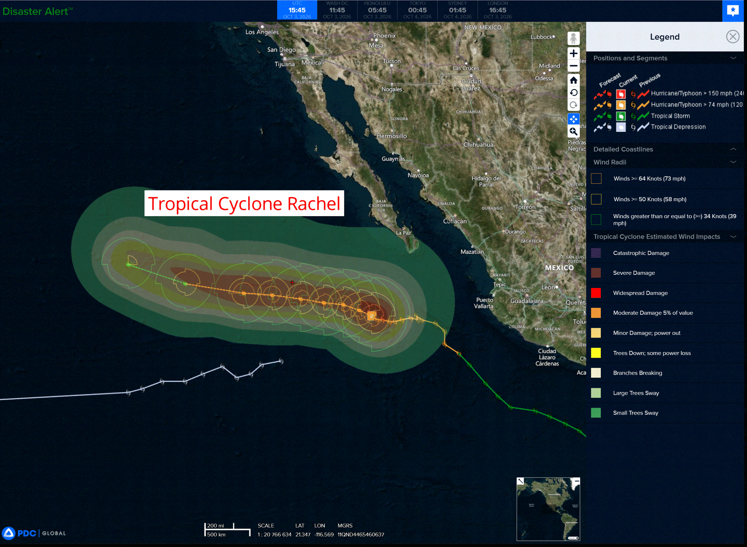
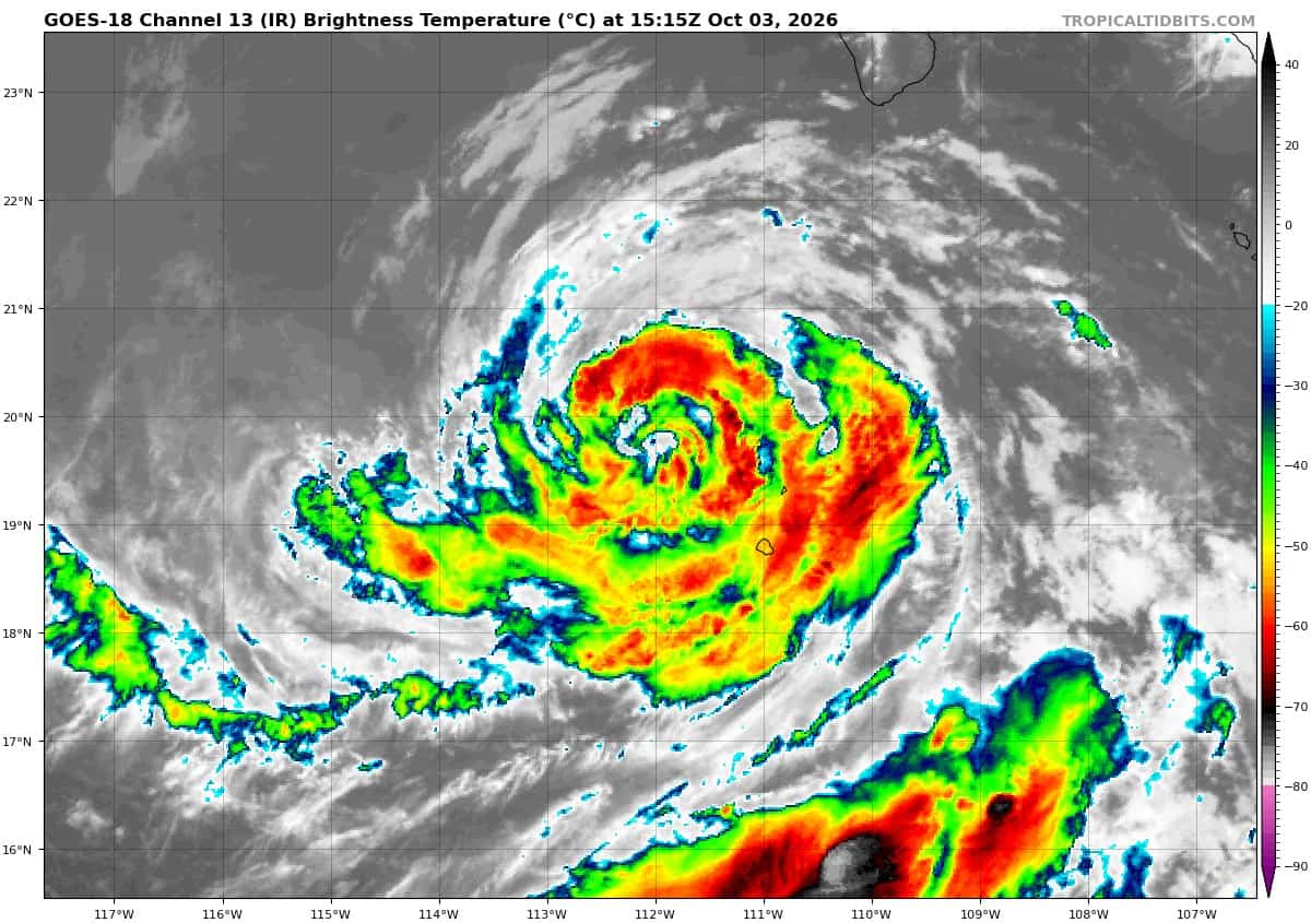
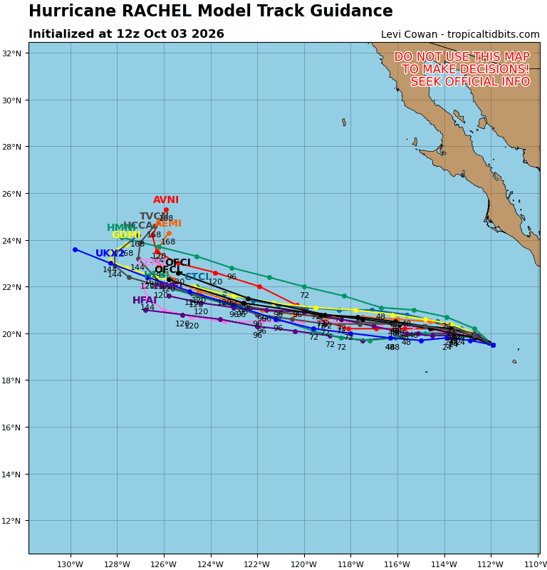
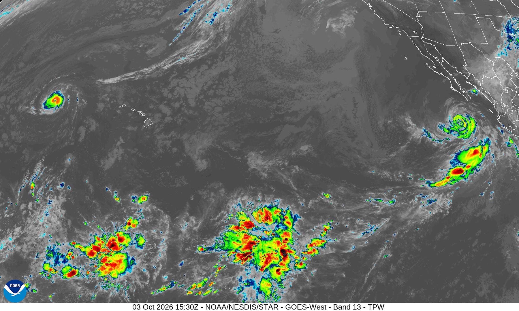
Tropical Cyclone 18E (Rachel) is located about 270 miles south-southwest of the southern tip of Baja CA
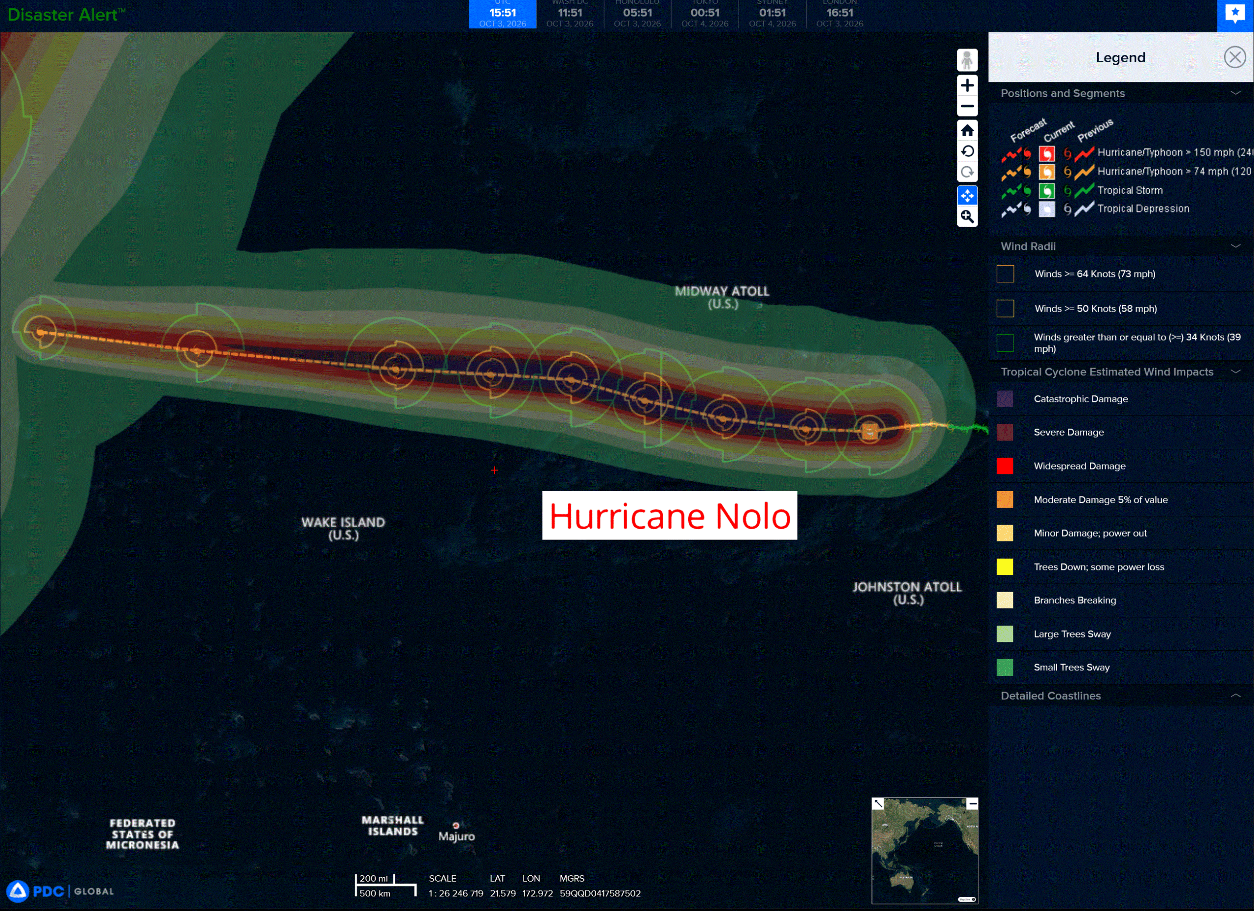
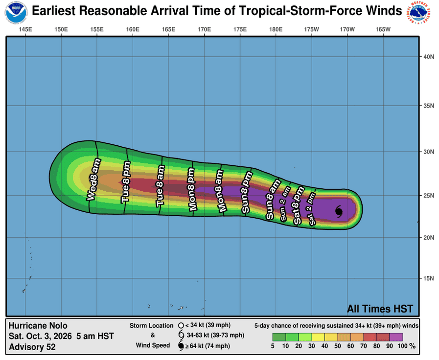
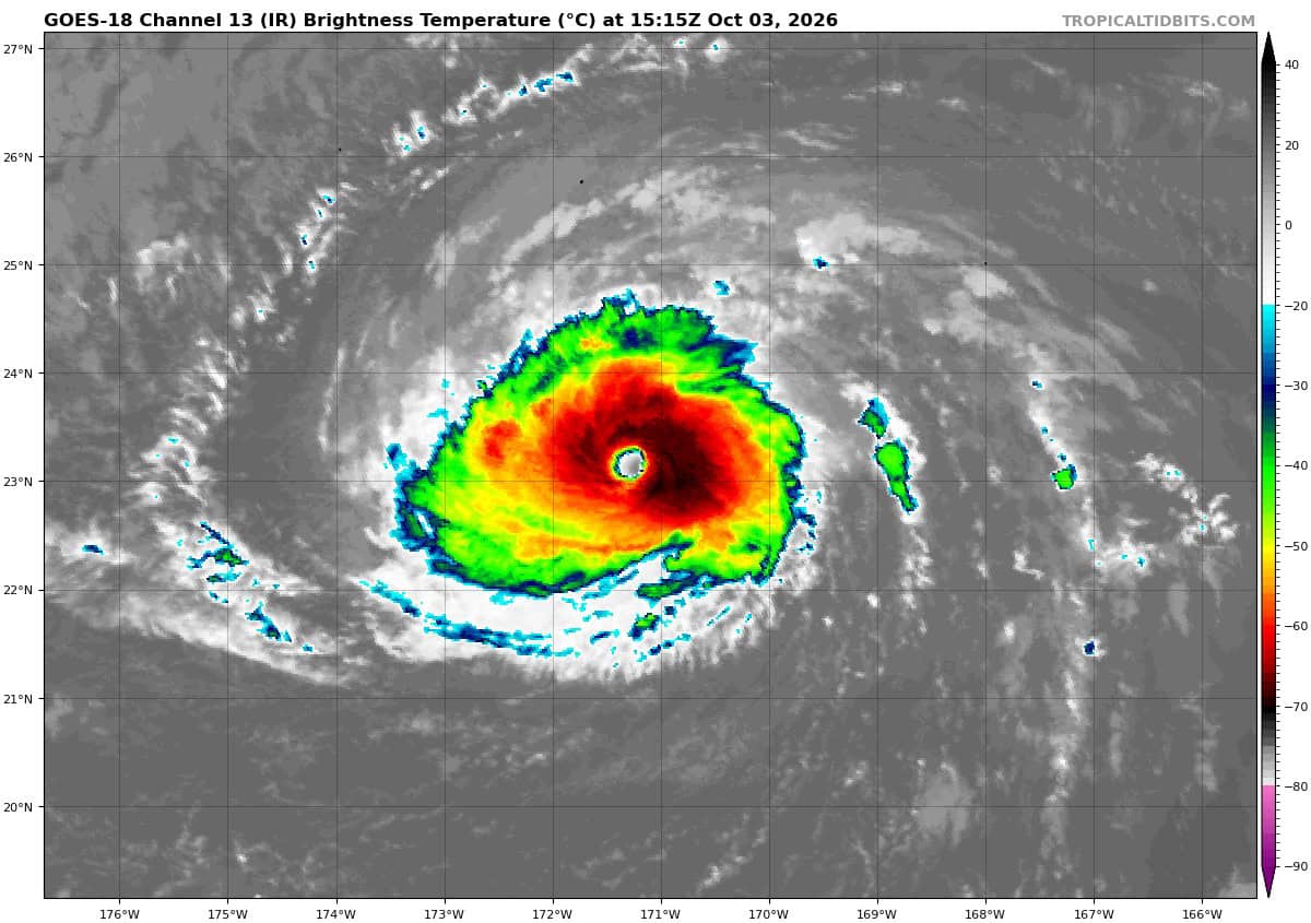
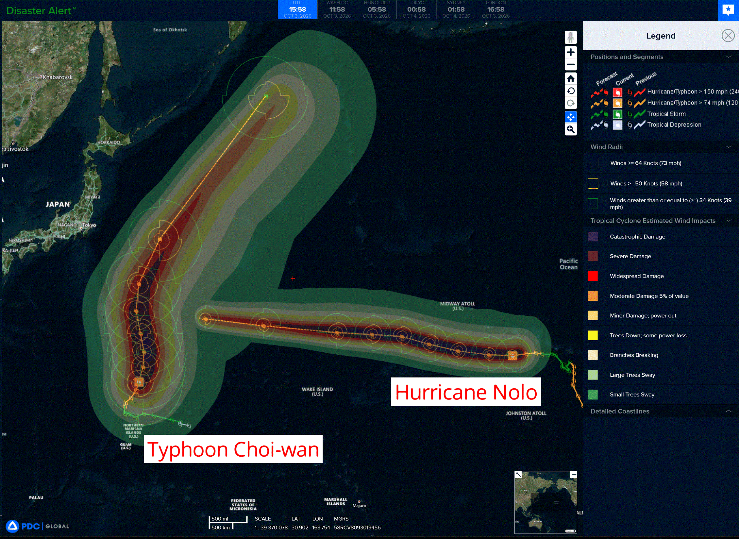
Tropical Cyclone 15E (Nolo) is located about 160 miles south-southwest of Maro Reef
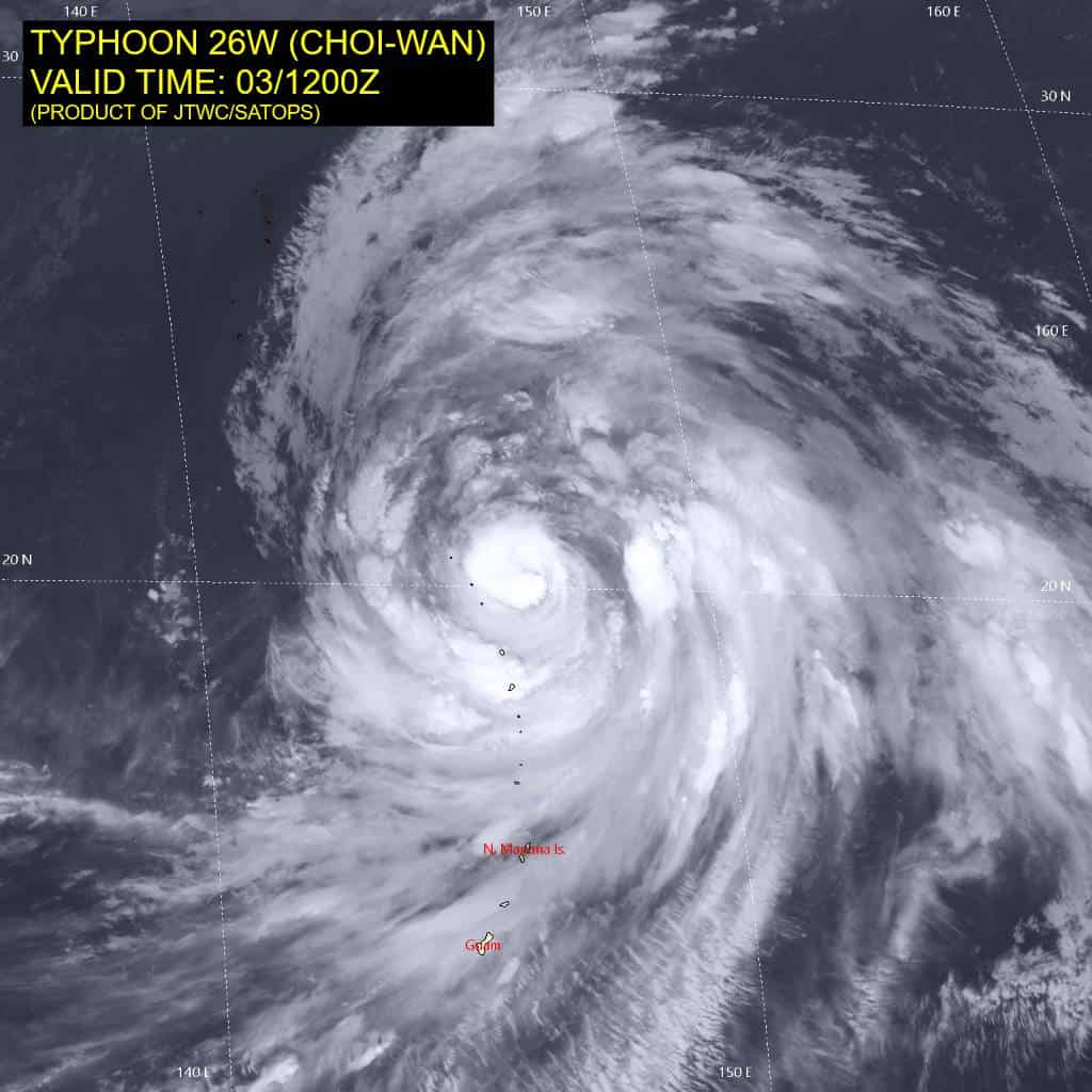
Tropical Cyclone 26W (Choi-Wan) is located approximately 307 NM north of Saipan
Northeast Pacific:
Tropical cyclone 18E (Rachel)
RACHEL MOVING SLOWLY WEST-NORTHWESTWARD
According to the NHC advisory number 26
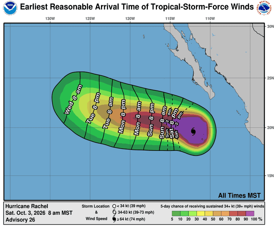
Rachel is moving toward the west-northwest near 3 mph (6 km/h), and this slow motion is expected to continue through tonight. A west to west-northwest motion is then expected Sunday through the middle of next week, with a gradual increase in forward speed.
Maximum sustained winds have decreased to near 85 mph (140 km/h) with higher gusts. Some weakening is forecast during the next day or so, with some slight restrengthening possible on Monday. Rachel is forecast to remain a hurricane for the next few days.
Hurricane-force winds extend outward up to 45 miles (75 km) from the center and tropical-storm-force winds extend outward up to 150 miles (240 km). The estimated minimum central pressure is 973 mb (28.74 inches).
HAZARDS AFFECTING LAND
SURF: Swells generated by Rachel will continue to affect the coast of west-central Mexico through the weekend and the Baja California Peninsula through Monday. These swells are likely to cause life-threatening surf and rip current conditions.
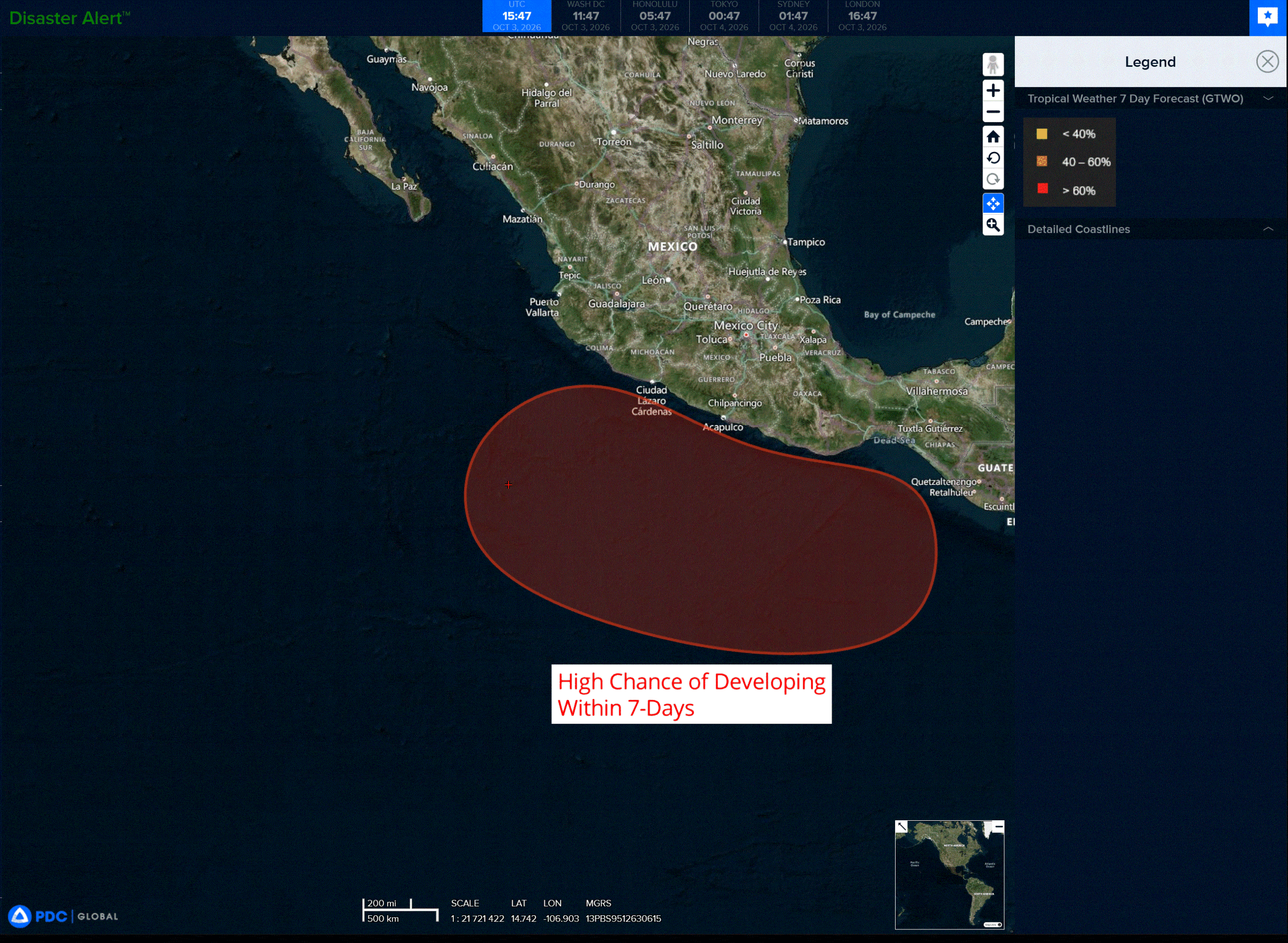
>>> South of Southern Mexico:
An area of low pressure is forecast to form late this weekend or early next week south of the southern coast of Mexico.
Thereafter, environmental conditions appear favorable for gradual development, and a tropical depression is likely to form during the middle to latter portion of next week while the system moves slowly west-northwestward to northwestward.
* Formation chance through 48 hours…low…near 0 percent
* Formation chance through 7 days…high…80 percent
Central North Pacific:
Tropical Cyclone 15E (Nolo)
NOLO EXPECTED TO BECOME A MAJOR HURRICANE LATER TODAY
According to the NHC advisory number 52
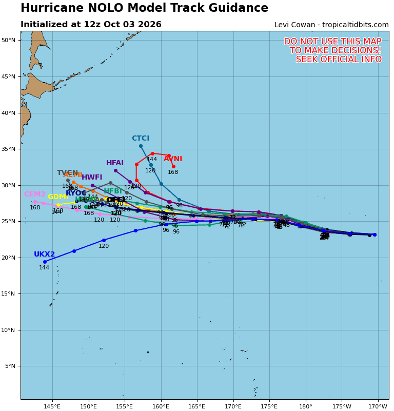
A mainly westward motion with an additional increase in forward speed is expected during the next few days. On the forecast track, the center of Nolo will continue to move through the Papahanaumokuakea Marine National Monument but remain just south of the Northwestern Hawaiian Islands west of Maro Reef. Nolo is expected to cross the International Date Line by Sunday midday Hawaiian Time.
Maximum sustained winds are near 110 mph (175 km/h) with higher gusts. Strengthening is forecast during the next day or two, and Nolo is expected to become a major hurricane later today. Gradual weakening is likely to begin on Monday.
Hurricane-force winds extend outward up to 30 miles (45 km) from the center and tropical-storm-force winds extend outward up to 150 miles (240 km). The estimated minimum central pressure is 963 mb (28.44 inches).
HAZARDS AFFECTING LAND WIND:
WIND: Tropical storm conditions will continue within the Tropical Storm Warning area from Maro Reef to Lisianski Island through today.
SURF: Large waves associated with Nolo will continue to affect the Papahanaumokuakea Marine National Monument over the next several days. The surf will likely inundate some of the low-lying atolls from Maro Reef to Lisianski Island.
Western Pacific, Indian Ocean, and adjacent Seas:
Western Pacific
Tropical Cyclone 26W (Choi-wan)
According to the JTWC warning number 15…sustained winds were 90 knots with gusts to 110 knots
Animated enhanced infrared (eir) satellite imagery depicts typhoon 26W (Choi-wan) with a compact inner-core and an intermittent eye that has been cycling over the past 6 hours. Cloud tops have noticeably cooled following 031200z, indicative of continuing intensification. A 030909z f16 ssmis 37 ghz microwave image
revealed a defined low emissivity region, which lined up with the upper-level center in the 91 ghz image. This alignment suggests that the system has minimal vortex tilt with height.
A partial 031117z metop-c ascat pass revealed the compact inner-core, however, it also showed that 26W has expansive 34-knot wind radii. This is especially true for the southeastern quadrant of the system. which is measured to be about 300 NM.
TY 26W is forecast to track generally northward through 60 hours as it traverses the western periphery of
the str to the northeast. After 60 hours, the system will accelerate northeastward as it rounds the ridge axis and begins to interact with the strong upper-level flow. Extratropical transition is expected to be complete no later than 96 hours, once the system becomes embedded underneath the jet south of the Kamchatka Peninsula.
In terms of intensity, 26W is forecast to intensify over the next 24 hours to a peak intensity of around 110 kts as the environment remains favorable with low shear, very warm sst, and robust outflow. The peak intensity could potentially be even higher if 26W is able to maintain its compact core and stave off the dry air to the west. After 24 hours, ocean heat content will start to drop and equatorward outflow will become restricted, causing 26W to gradually weaken through 72 hours.
Following 72 hours, the system will tap into an extreme poleward outflow channel, supported by a strong jet max to the north. This will somewhat offset the cool sst and very high southwesterly vertical wind shear, allowing for 26W to maintain an intensity near typhoon-strength through the initial stages of frontogenesis.
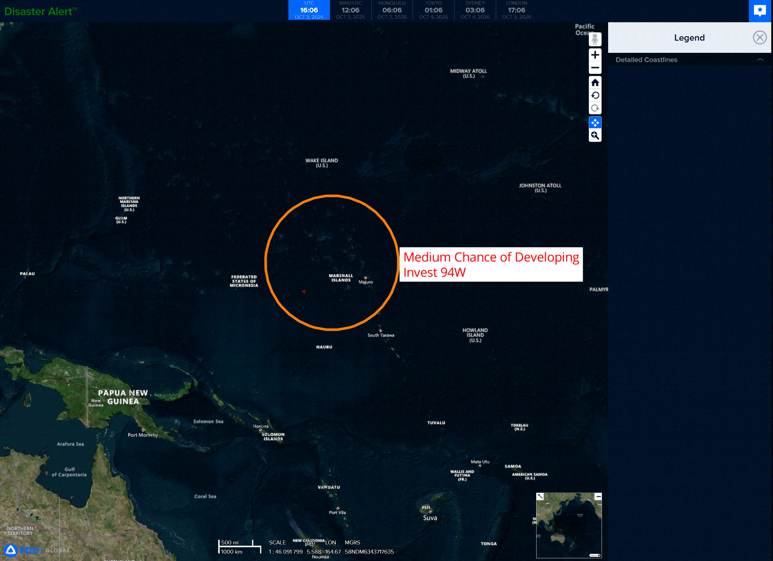
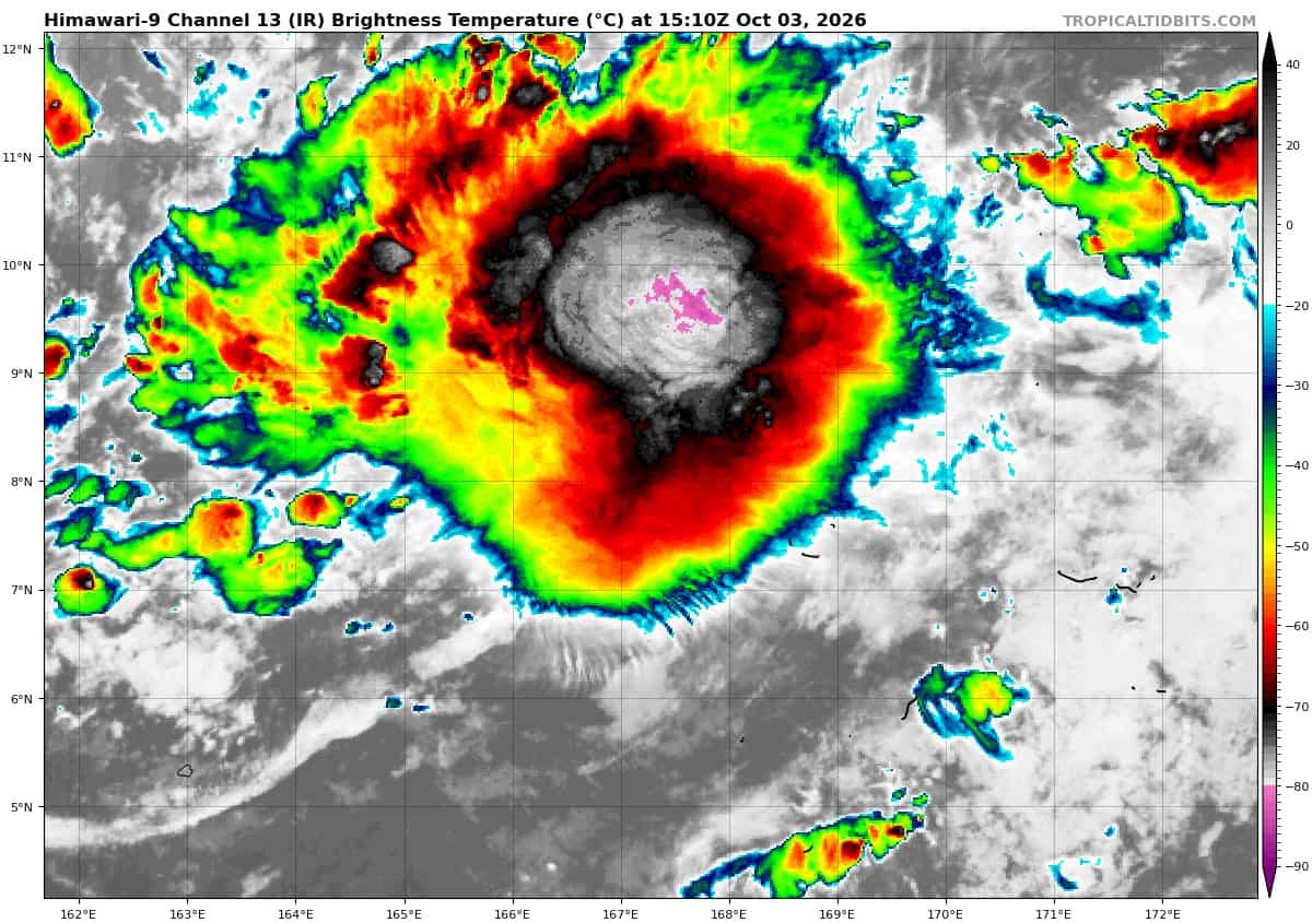
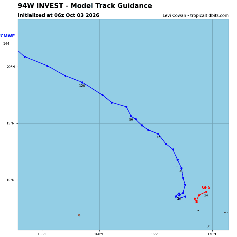
>>> There’s an area of disturbed weather being referred to as Invest 94W, which is located approximately 47 NM southwest of Kwajalein
Animated enhanced infrared (eir) satellite imagery depicts 94W with a consolidating low-level circulation center that has tucked underneath the southeastern quadrant of persistent convection. A 030910z ascat-b pass revealed a band of 15-20 knot winds wrapping around the northen periphery of the circulation.
Environmental analysis reveals marginally favorable conditions for development with low to moderate vertical wind shear (15-20 kts), weak equatorward outflow aloft, and warm (29-30 c) sea surface temperatures.
Global models are in fair agreement that 94W will be quasi-stationary over the next 24 hours as it continues to consolidate.
Maximum sustained surface winds are estimated at 18 to 23 knots.
minimum sea level pressure is estimated to be near 1008 mb.
The potential for the development of a significant tropical cyclone within the next 24 hours is upgraded to medium.