

Current Snapshot
For all the latest updates visit: DisasterAWARE

1800×1080
rachel
091455_earliest_reasonable_toa_34
goes18_ir_18E_202610091505_lat22.6-lon-124.9
091455WPCQPF_sm
091455WPCERO_sm
18E_tracks_latest
simon
091446_earliest_reasonable_toa_34
goes19_ir_20E_202610091505_lat15.9-lon-104.5
091446INTQPF_sm
20E_tracks_latest
7e
1800x1080ec
10
2w
15E_091200sair
15E_eps_latest
27W_091200sair
himawari9_ir_27W_202610091450_lat20.1-lon154.1
27W_tracks_latest
95w
himawari9_ir_95W_202610091450_lat13.6-lon144.7
95W_tracks_latest
By PDC’s Senior Weather
Specialist Glenn James

The Pacific Disaster Center’s (PDC Global) Friday, October 9, 2026, Tropical Cyclone Activity Report…for the Pacific Ocean, the Indian Ocean, and adjacent Seas.
Tropical Cyclones
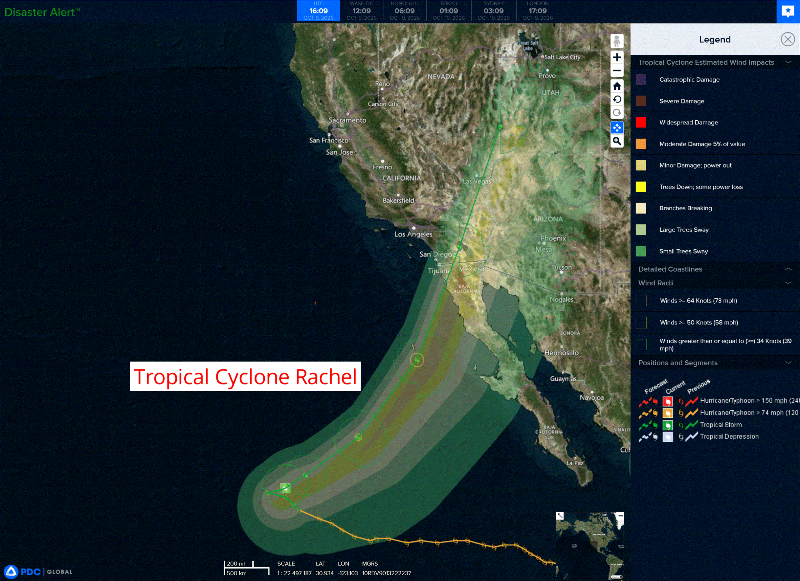
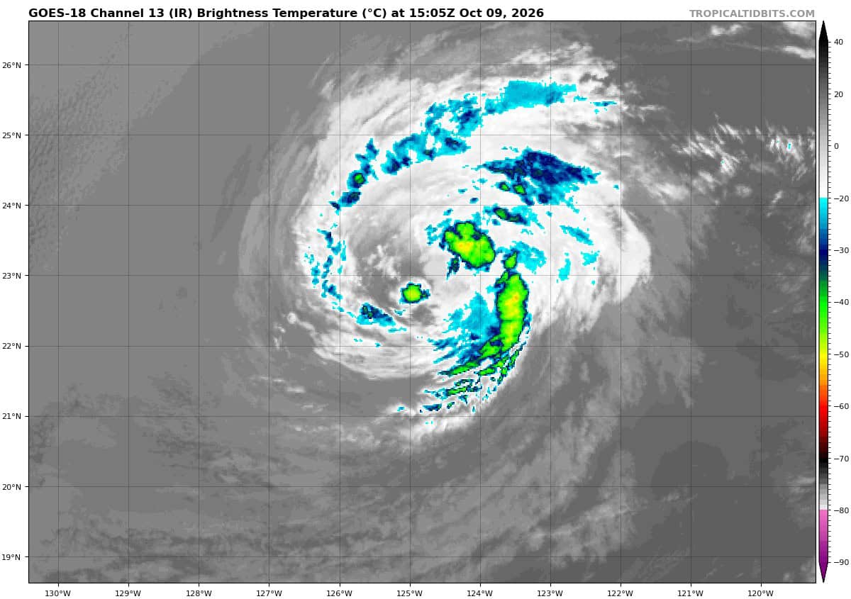
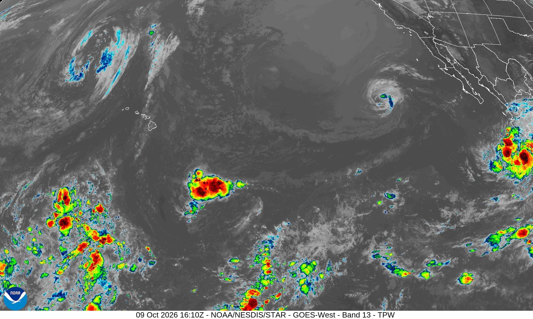
Tropical Cyclone 18E (Rachel) is located about 935 miles west of the southern tip of Baja CA
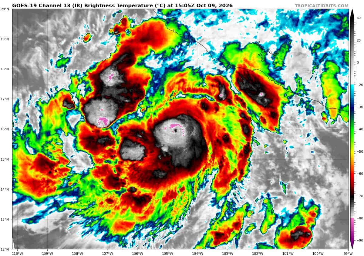
Tropical Cyclone 20E (Simon) is located about 210 miles south of Manzanillo, Mexico
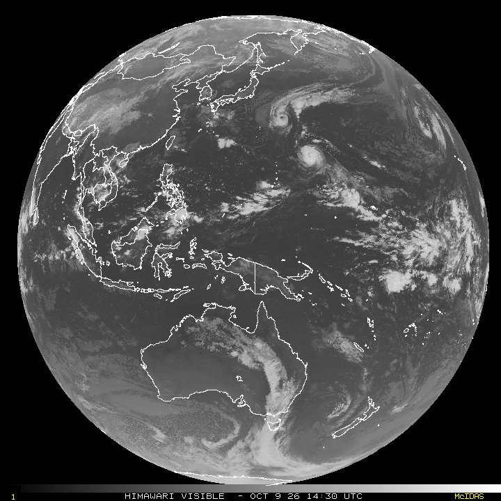
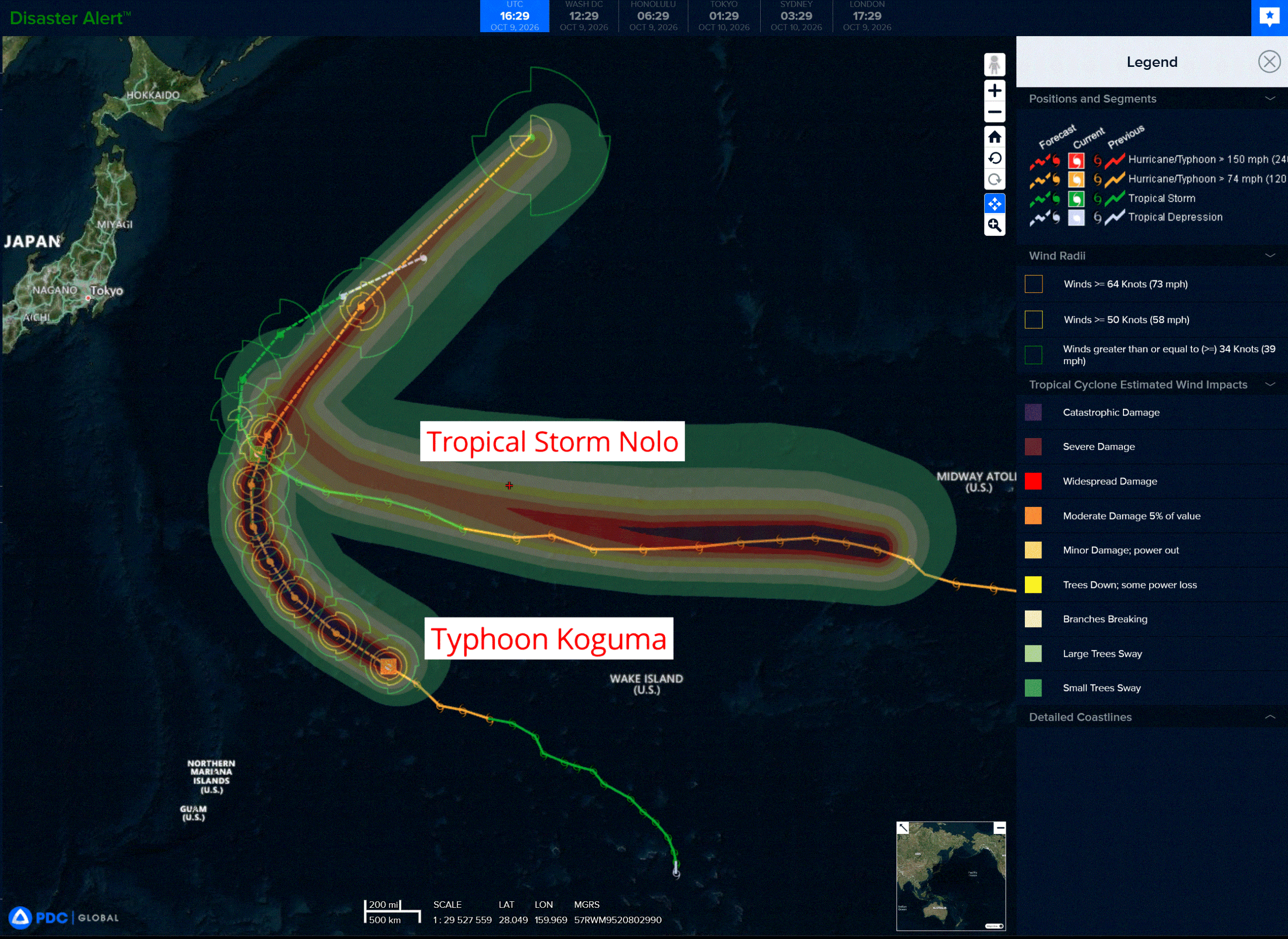
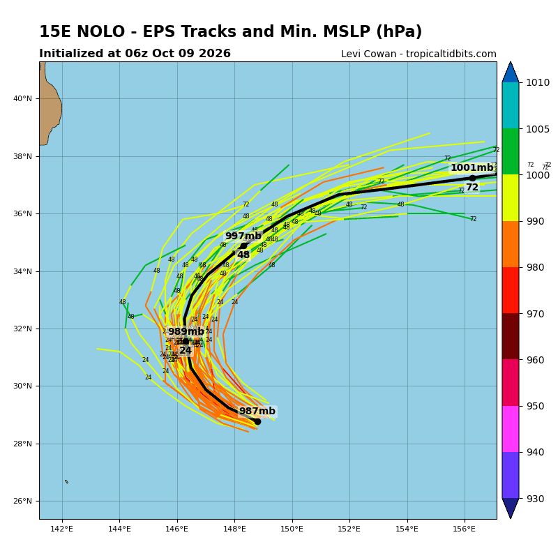
Tropical Cyclone 15E (Nolo) is located about 552 NM southeast of Tokyo, Japan
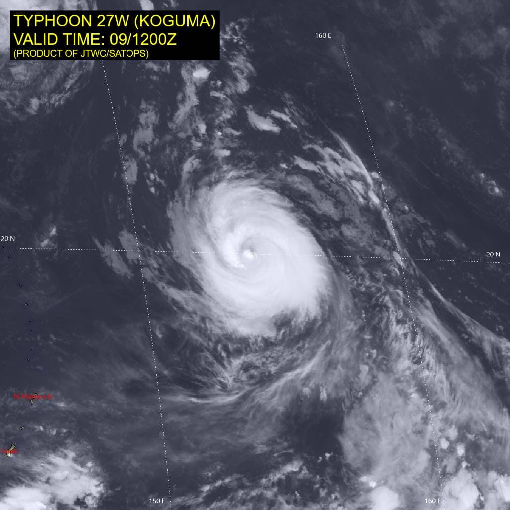
Tropical Cyclone 27W (Koguma) is located approximately 558 NM east-northeast of Saipan
Northeast Pacific:
Tropical cyclone 18E (Rachel)
TROPICAL STORM WATCHES ISSUED FOR SOUTHERN CALIFORNIA AND BAJA CALIFORNIA
According to the NHC advisory number 50
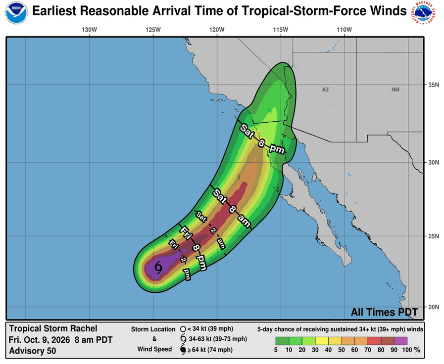
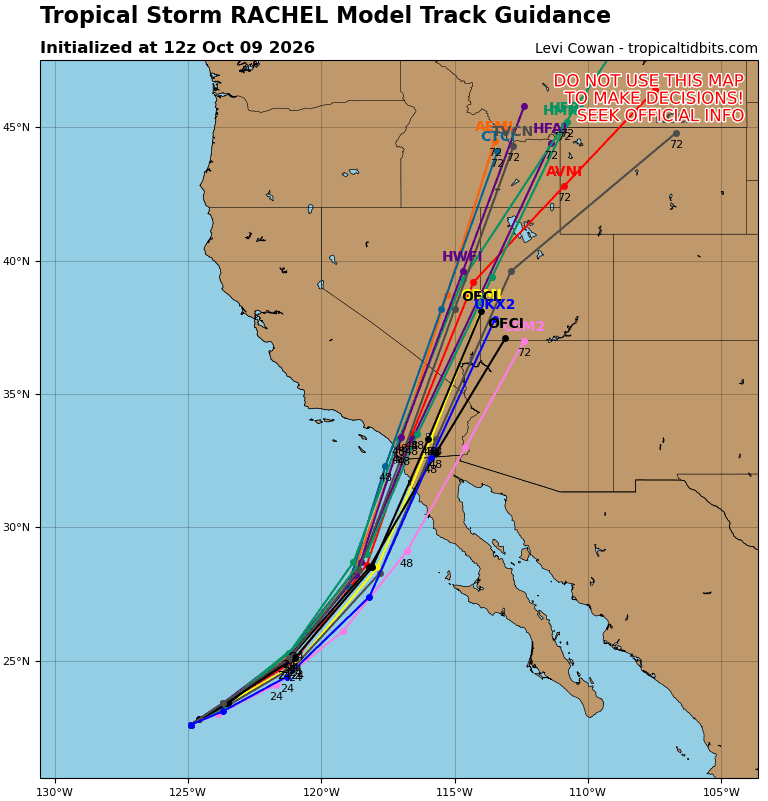
Rachel is moving toward the northeast near 5 mph (7 km/h). A general northeast to north-northeast motion, with a significant increase in forward speed is expected over the next couple of days. On the forecast track, the center of Rachel is expected to approach the northern Baja California Peninsula or southern California late Saturday or early Sunday.
Maximum sustained winds are near 50 mph (85 km/h) with higher gusts. Some strengthening is possible the next day or two, with rapid weakening forecast after the storm moves inland over the southwestern United States on Sunday.
Tropical-storm-force winds extend outward up to 80 miles (130 km) from the center. The estimated minimum central pressure is 994 mb (29.36 inches).
HAZARDS AFFECTING LAND
WIND: Tropical storm conditions are possible within the watch area in Baja California, and southern California by Saturday night or early Sunday. Strong gusty winds associated with the system are expected to spread over interior portions of the Southwest United States, especially in areas of higher terrain, from this weekend into early next week.
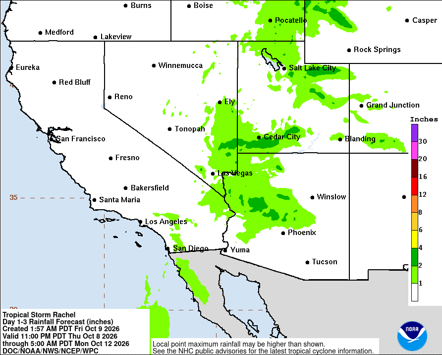
RAINFALL: Rachel will bring 1 to 3 inches of rain to portions of Baja California this weekend.
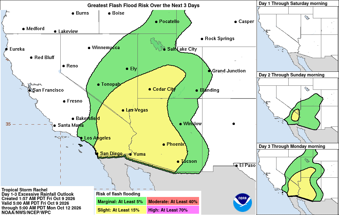
Rachel and associated moisture of the system will also bring rainfall of 1 to 3 inches, with maximum amounts locally up to 5 inches in portions of the Southwest United States this weekend. This will lead to increasing coverage of rainfall and potential for flash and urban flooding.
SURF: Swells partly generated by Rachel will build along the coast of Southern California and northern Baja California through the weekend. These swells are likely to cause life-threatening surf and rip current conditions, as well as moderate to isolated major coastal flooding, through early next week.
Tropical cyclone 20E (Simon)
SIMON FORECAST TO RAPIDLY INTENSIFY AND APPROACH THE COAST OF MEXICO AS A DANGEROUS MAJOR HURRICANE THIS WEEKEND …PREPARATIONS SHOULD BE RUSHED TO COMPLETION TODAY
According to the NHC advisory number 9
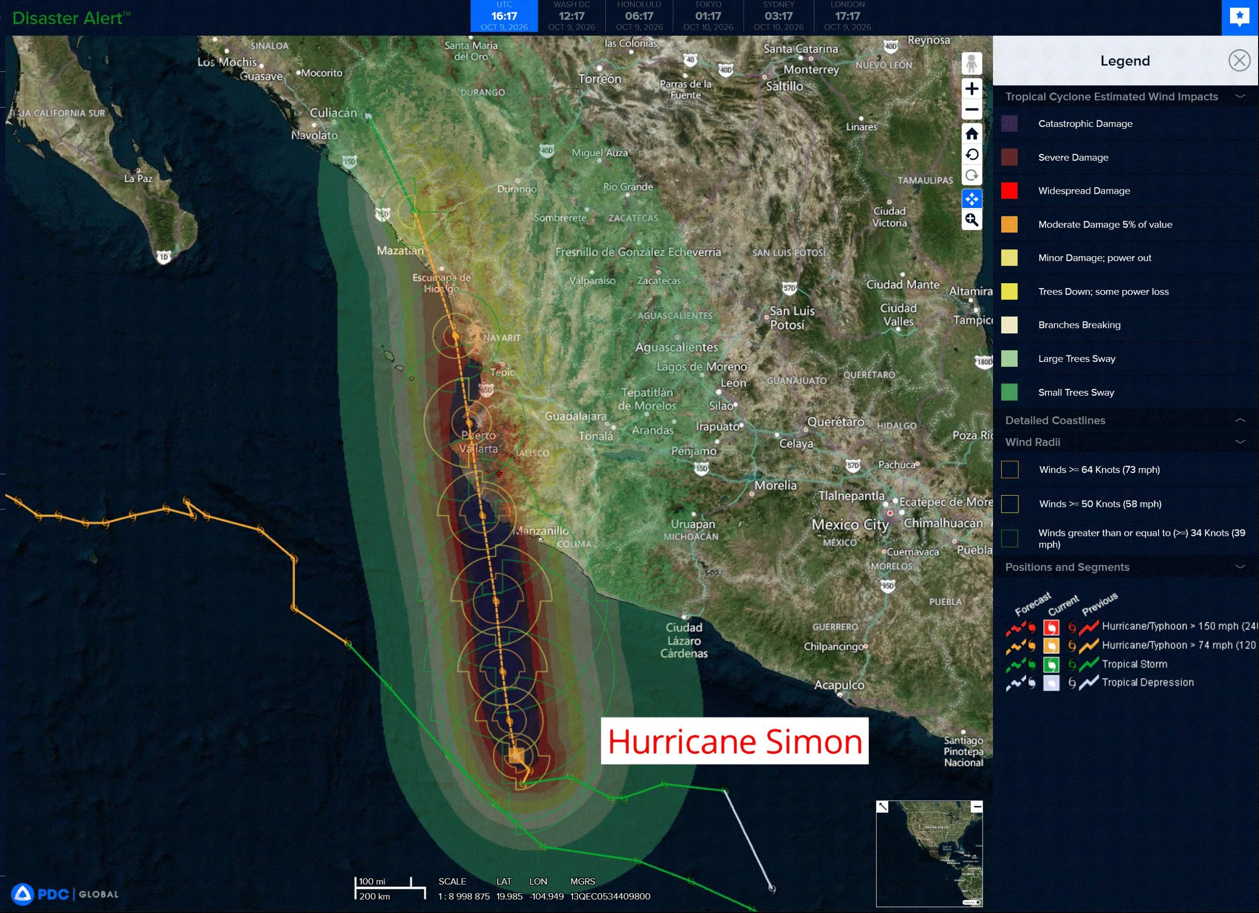
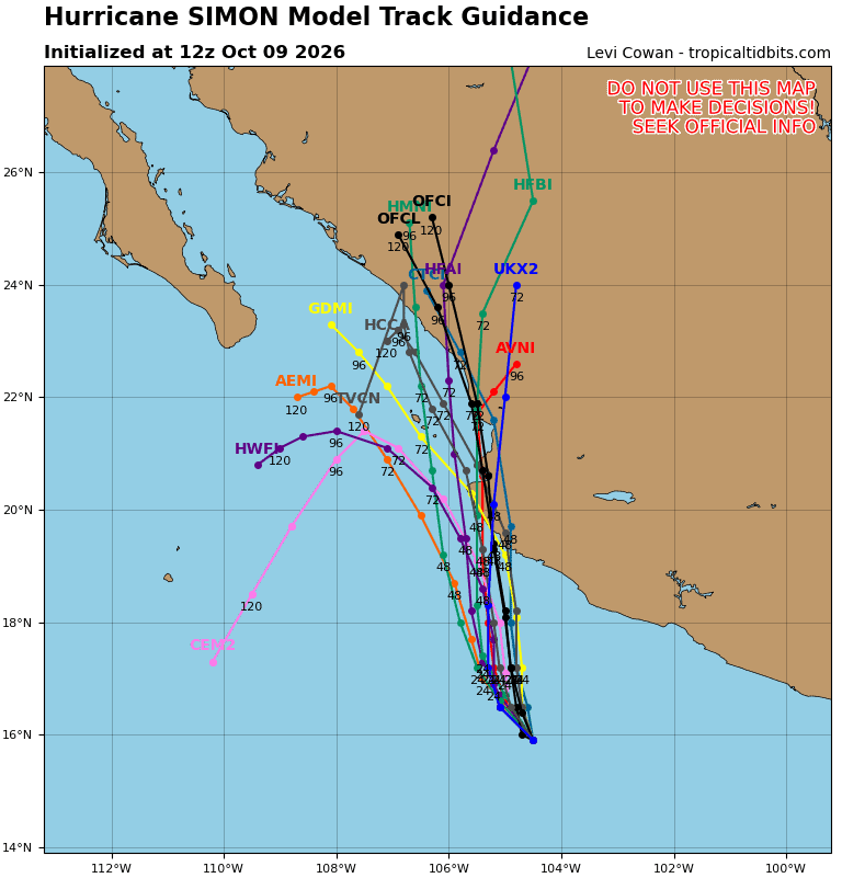
Simon is moving toward the northwest near 3 mph (6 km/h). A slow turn toward the north is expected today and tonight. Simon is then forecast to move generally northward, with the center passing very near or over the west-central coast of Mexico on Sunday.
Maximum sustained winds have increased to near 100 mph (155 km/h) with higher gusts. Continued rapid strengthening is expected during the next day or so. Simon is forecast to become a major hurricane by this evening and strengthen further on Saturday.
Hurricane-force winds extend outward up to 15 miles (30 km) from the center and tropical-storm-force winds extend outward up to 80 miles (130 km). The estimated minimum central pressure is 973 mb (28.74 inches).
HAZARDS AFFECTING LAND
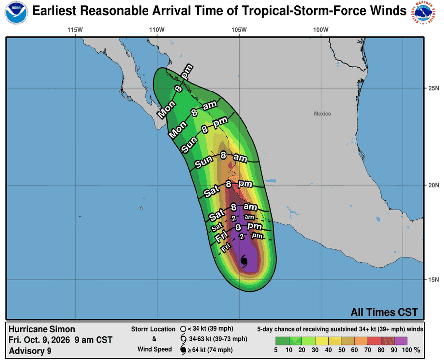
WIND: Hurricane conditions are expected in the warning area Saturday evening or Sunday, with tropical storm conditions expected Saturday morning. Tropical storm conditions are possible within the Tropical Storm Watch area beginning tonight or early Saturday.
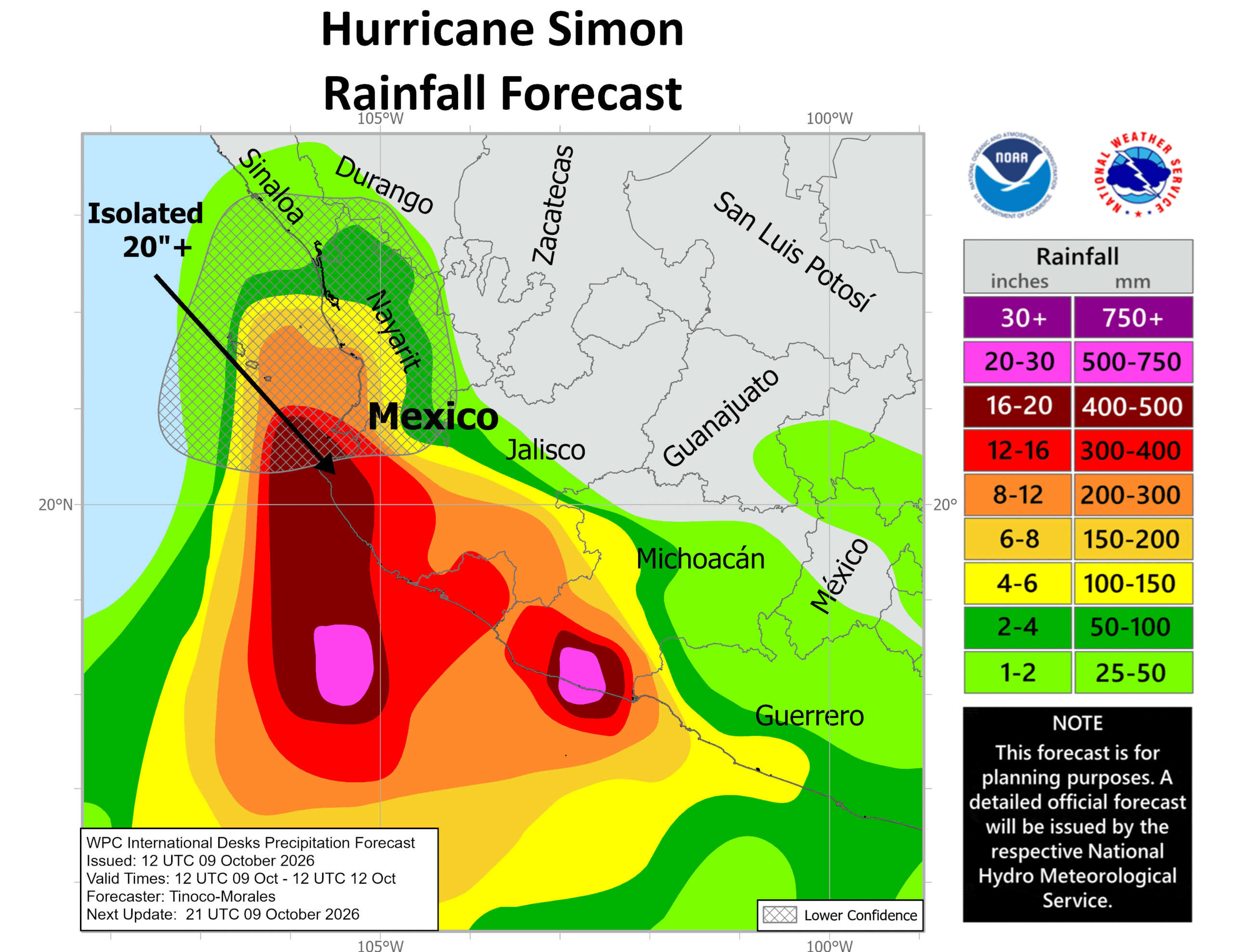
RAINFALL: Simon is expected to produce rainfall totals of 8 to 15 inches over portions of southwestern Mexico, with isolated maximum totals of 25 inches possible across portions of Michoacan, Colima, Jalisco and Nayarit through Sunday. This rainfall may produce life-threatening flooding and mudslides, especially in areas of steep terrain.
STORM SURGE: A dangerous storm surge is likely along the immediate coast near and to the east of where the center makes landfall. Near the coast, the surge will be accompanied by large and destructive waves.
SURF: Swells generated by Simon will affect portions of the coast of southwestern and west-central Mexico during the next few days. These swells are likely to cause life-threatening surf and rip current conditions.
>>> South of Guatemala:
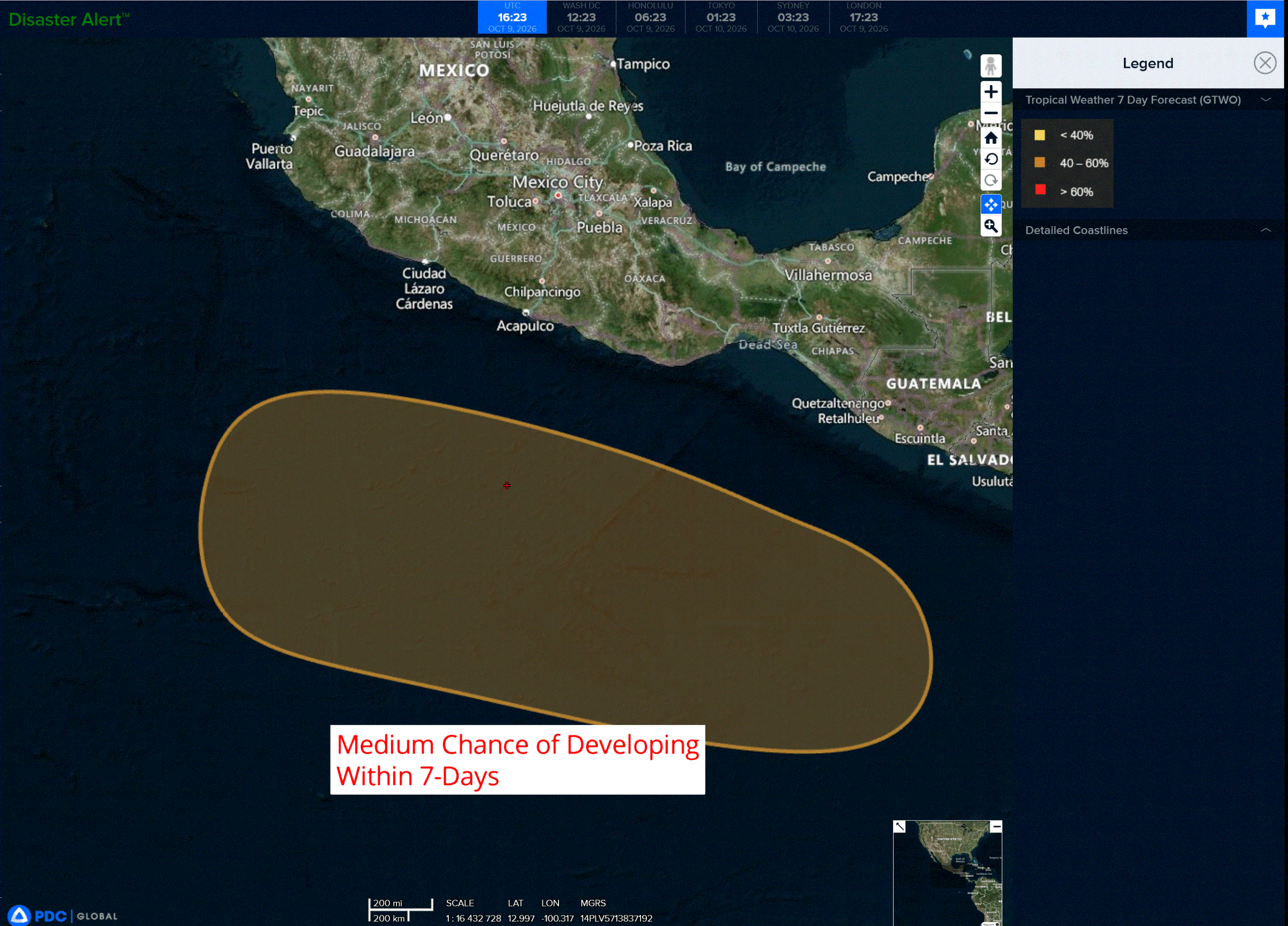
An area of low pressure is forecast to form south of the coast of Guatemala early next week. Environmental conditions are expected to be conducive for some gradual development thereafter, and a tropical depression could form as the system moves generally west-northwestward at around 10 mph.
* Formation chance through 48 hours…near…0 percent
* Formation chance through 7 days…medium…60 percent
Central North Pacific: There are no Tropical Cyclones
Tropical cyclone formation is not expected during the next 7 days.
Western Pacific, Indian Ocean, and adjacent Seas:
Western Pacific
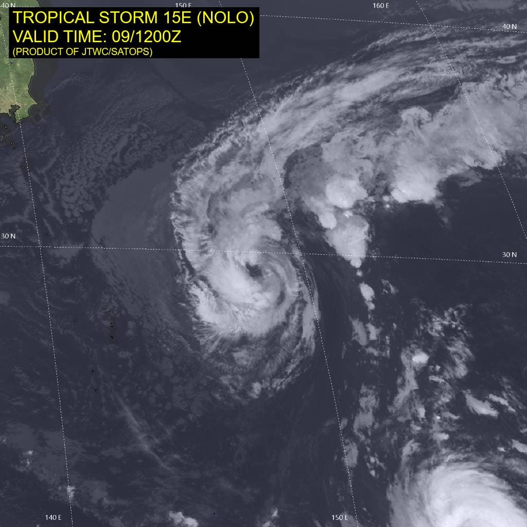
Tropical Cyclone 15E (Nolo)
According to the JTWC warning number 76…sustained winds were 50 knots with gusts to 65 knots
Animated enhanced infrared (eir) satellite imagery depicts tropical storm 15E (Nolo) with a shallow band of convection wrapping around the western and southern portions of a mostly exposed, yet well-defined low-level circulation center (llcc). A field of dry air to the west continues to impact the vortex, limiting convective
activity. A 091055z metop-c ascat pass revealed a symmetric core of 40-45 knot winds and gale-force winds weighted more on the northern semicircle.
Environmental analysis indicates a marginal environment characterized by strong poleward outflow aloft, low to moderate (15-20 kts) vertical wind shear, and borderline (26-27 c) sea surface temperatures greatly offset by the significant dry air entrainment.
TS 15E is forecast to continue tracking northwestward, along the southwestern periphery of the str, for only another 12 hours. Near 12 hours, 15E will begin to turn northward as it rounds the western extent of the str. Track speeds will start to increase near 36 hours as the system turns northeastward and traverses the poleward side of the ridge. Extratropical transition is forecast to begin at 48 hours and complete no later than 60 hours, once the system becomes embedded underneath the strong upper-level jet.
In terms of intensity, 15E is forecast to maintain its current intensity of 50 kts through 12 hours, primarily due to the strong poleward outflow channel. After 12 hours, 15E is forecast to weaken through 60 hours as westerly shear quickly increases and sea surface temperatures drop. Some models, particularly the gfs, actually show 15E dissipating before fully rounding the ridge and completing extratropical transition. This is
currently analyzed to be less likely due to the current solid structure of the llcc.
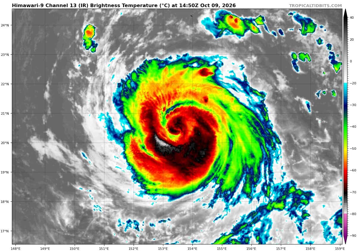
Tropical Cyclone 27W (Koguma)
According to the JTWC warning number 19…sustained winds were 100 knots with gusts to 125 knots
Animated enhanced infrared (eir) satellite imagery depicts typhoon 27W (Koguma), surprisingly, undergoing an eyewall replacement cycle (erc) with an expanding central dense overcast (cdo) and a generally broadening appearance. The erc was captured by 090731z wsfm 89 ghz and 090759z gmi 89 ghz microwave images. The images show the degrading extremely compact inner-core surrounded by a
stronger, outer eyewall.
Additionally, a 090752z rcm-3 sar pass revealed dual wind maximums, further supporting the assessment of an ongoing erc. the sar measured a vmax of 104 kts within the northeastern quadrant of the inner eyewall. cloud tops also started warming at 091000z, though the system appears to be reorganizing right around 091200z with a warming eye and improving symmetry.
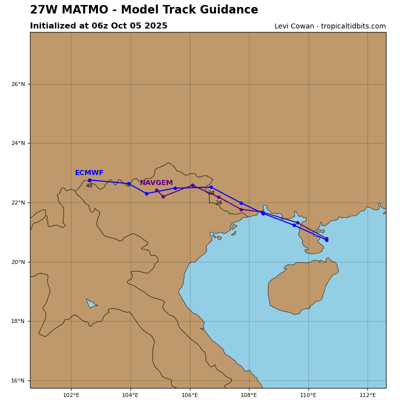
TY 27W is forecast to continue tracking northwestward, along the southwestern periphery of the str through
48 hours. 27W will then approach the ridge axis, causing the trajectory to become generally northward through 72 hours. Following 72 hours, track speeds will start to increase as the system traverses the northwestern extent of the str and accelerates northeastward through 120 hours. Extratropical transition is forecast to begin at 120 hours with completion occurring just outside of the 5-day forecast period.
In terms of intensity, 27W is forecast to recover from the erc and continue intensifying through 24 hours to a peak of around 120 kts. A outflow channel and sea surface temperatures will start to drop, causing the intensification trend to come to a halt. As a result, 27W is forecast to maintain or slightly weaken from 24 to 48 hours. Around 60 hours, southwesterly shear will start to increase, initiating a steady weakening trend that will persist through the remainder of the forecast period.
By 96 hours, shear will increase to over 50 kts and dry air will begin greatly impacting the system. However, 27W will tap into an extreme poleward outflow channel, supported by a strong jet maximum to the northeast, which is expected to allow the system to maintain typhoon strength through 96 despite the otherwise highly unfavorable environment.
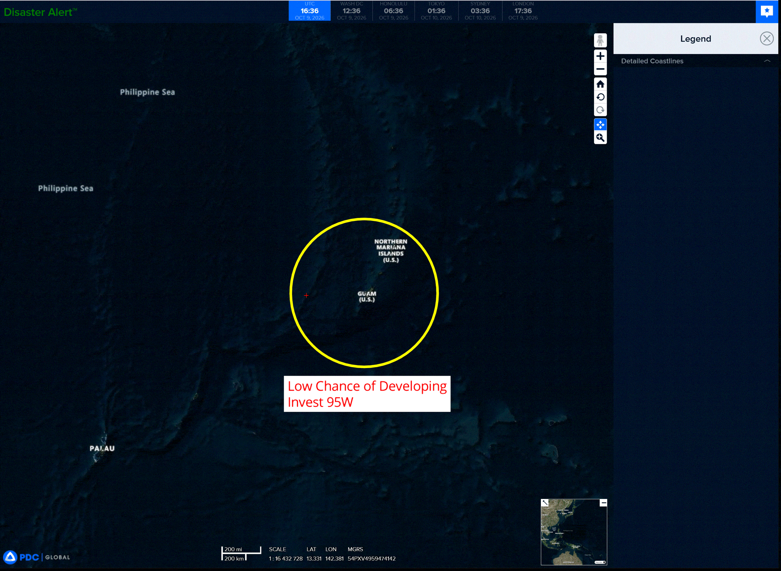
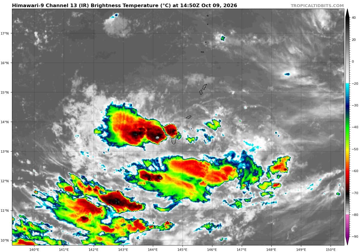
>>> There’s an area of disturbed weather being referred to as Invest 95W, which is located approximately 12 NM west-northwest of Guam.
Animated enhanced infrared satellite imagery (eir) depicts 95W with a poorly disorganized low level circulation center (llcc) and flaring convection along the southern periphery.
Environmental analysis reveals marginal conditions for development with weak outflow aloft, low to moderate (15 to 20 knots) easterly vertical wind shear, and warm (29-30 c) sea surface temperatures.
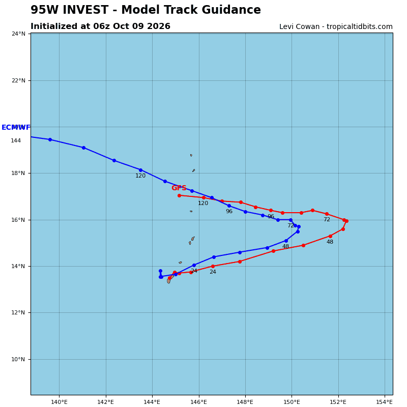
Ensemble models are showing marginal development for 95W as it tracks east-northeastward over the
next 24-48 hours.
Global deterministic models show little to no development of the system.
Maximum sustained surface winds are estimated at 13 to 18 knots.
Minimum sea level pressure is estimated to be near 1007 mb.
The potential for the development of a significant tropical cyclone within the next 24 hours is low.