

Current Snapshot
For all the latest updates visit: DisasterAWARE
1800x1080e
rachel
101452_earliest_reasonable_toa_34
goes18_ir_18E_202610101505_lat24.7-lon-120.5
101452WPCQPF_sm
101452WPCERO_sm
18E_tracks_latest
simon
101454_earliest_reasonable_toa_34S
goes19_ir_20E_202610101505_lat17.3-lon-104.8
101454INTQPF_sm
20E_tracks_latest
7

1800×1080
10
2w
15E_101200sair
15E_gefs_latest
27W_101200sair
27W_tracks_latest
95W
himawari9_ir_95W_202610091750_lat14.0-lon146.7
95W_tracks_latest
By PDC’s Senior Weather
Specialist Glenn James

The Pacific Disaster Center’s (PDC Global) Saturday, October 10, 2026, Tropical Cyclone Activity Report…for the Pacific Ocean, the Indian Ocean, and adjacent Seas.
Tropical Cyclones
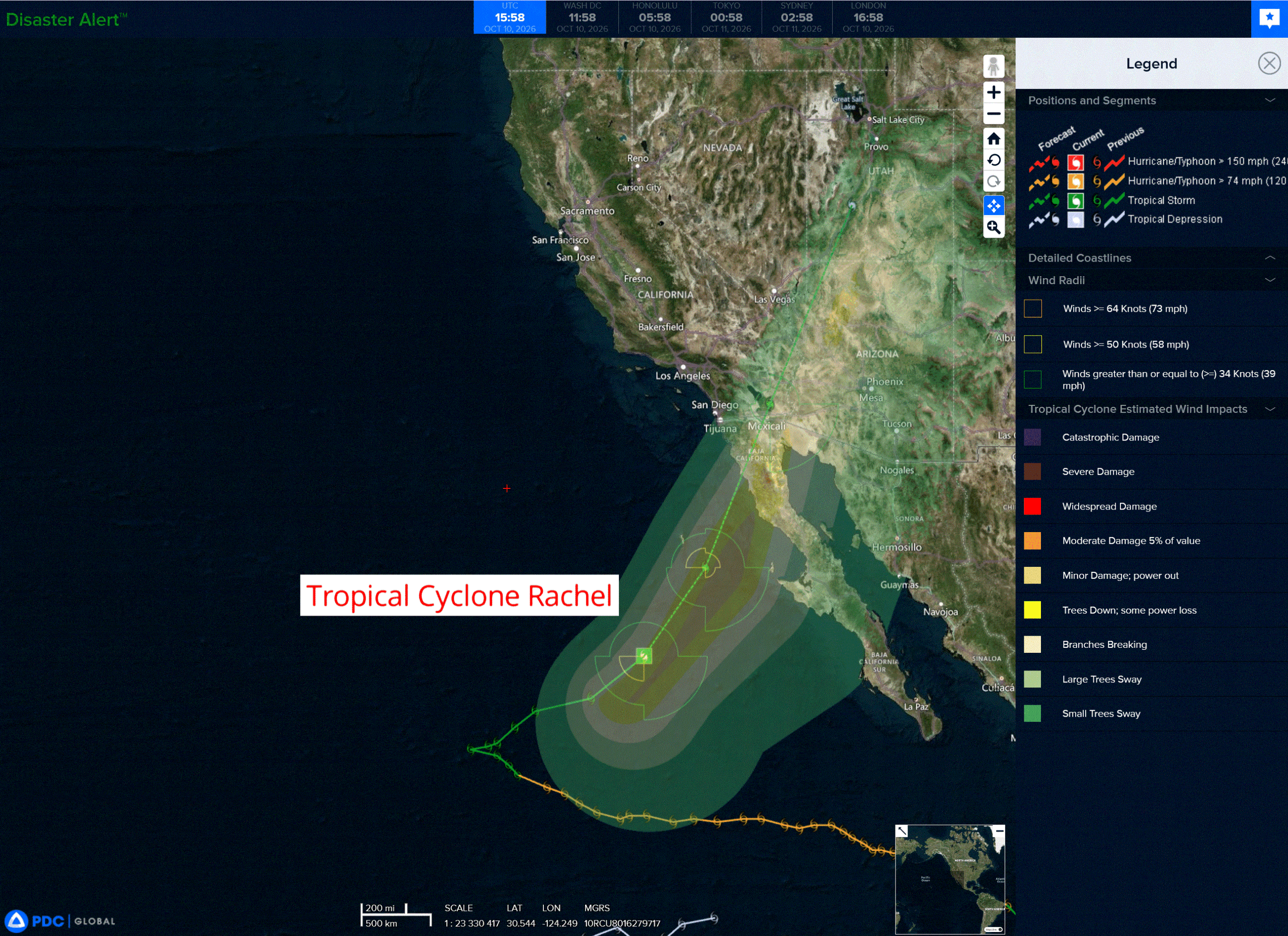
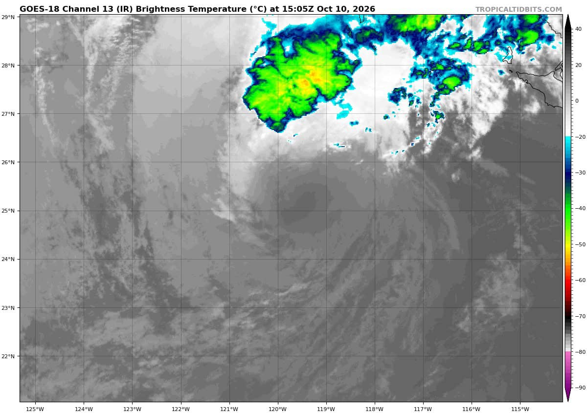
Tropical Cyclone 18E (Rachel) is located about 520 miles south-southwest of San Diego, CA
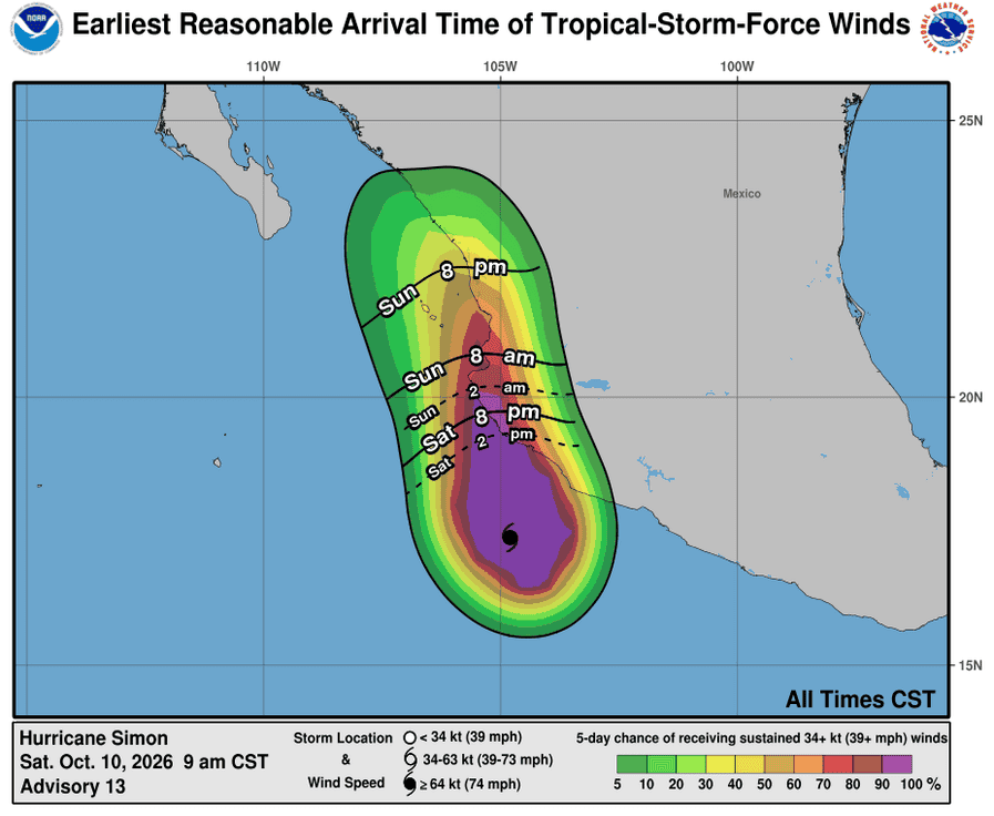
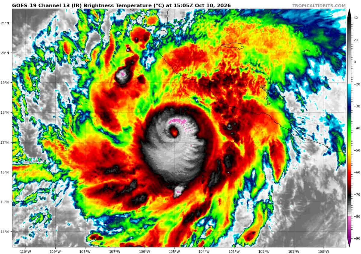
Tropical Cyclone 20E (Simon) is located about 115 miles south-southwest of Manzanillo, Mexico
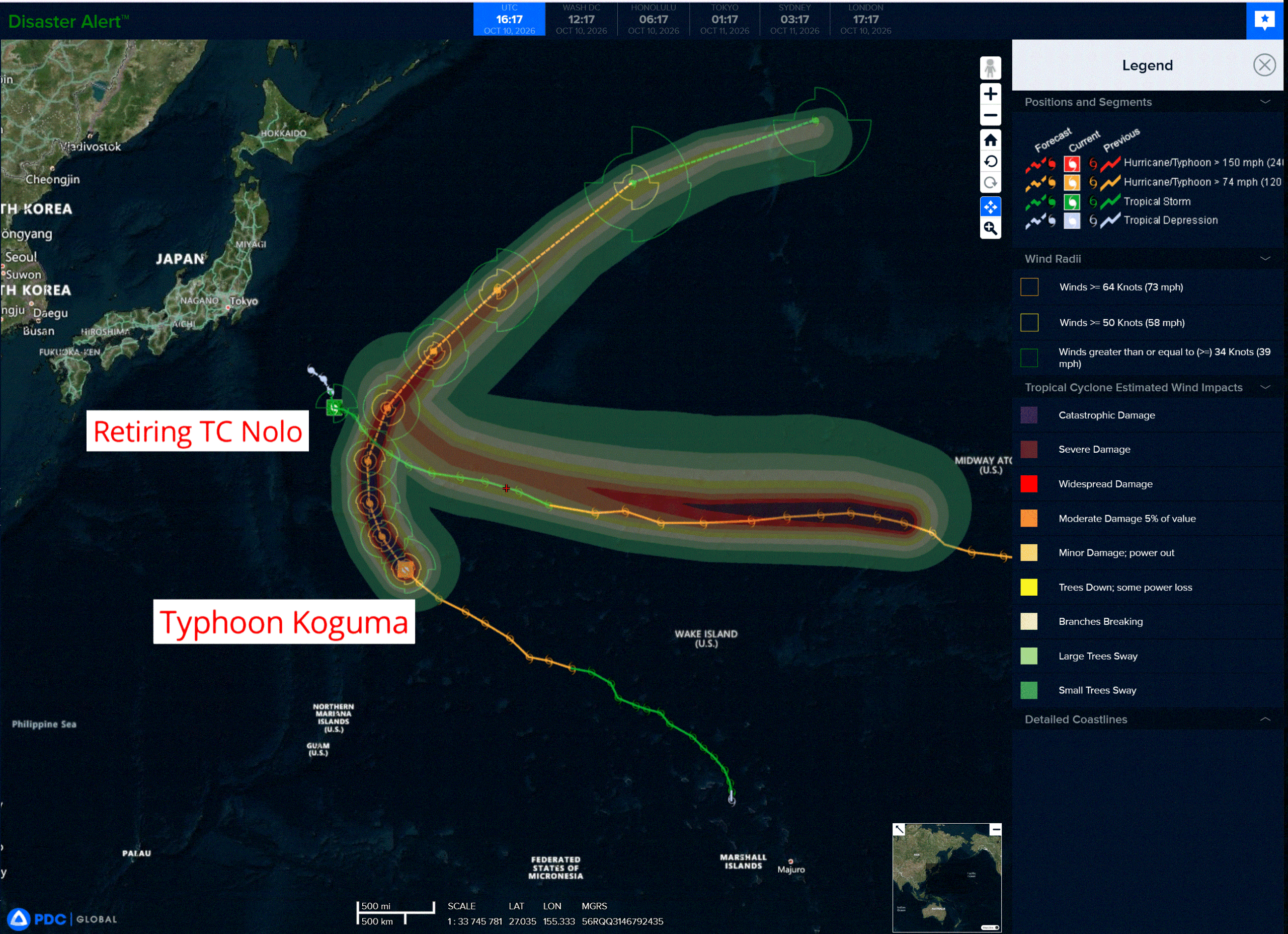
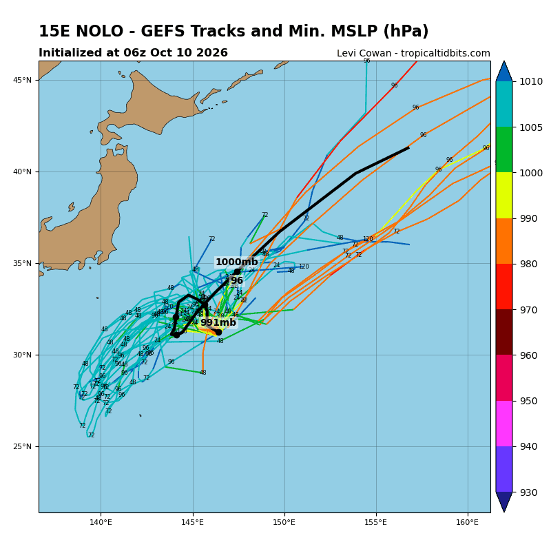
Tropical Cyclone 15E (Nolo) is located about 393 NM southeast of Yokosuka, Japan – Final Warning
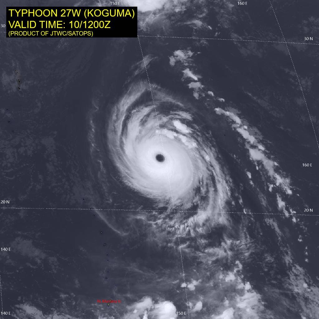
Tropical Cyclone 27W (Koguma) is located approximately 510 NM north-northeast of Saipan
Northeast Pacific:
Tropical cyclone 18E (Rachel)
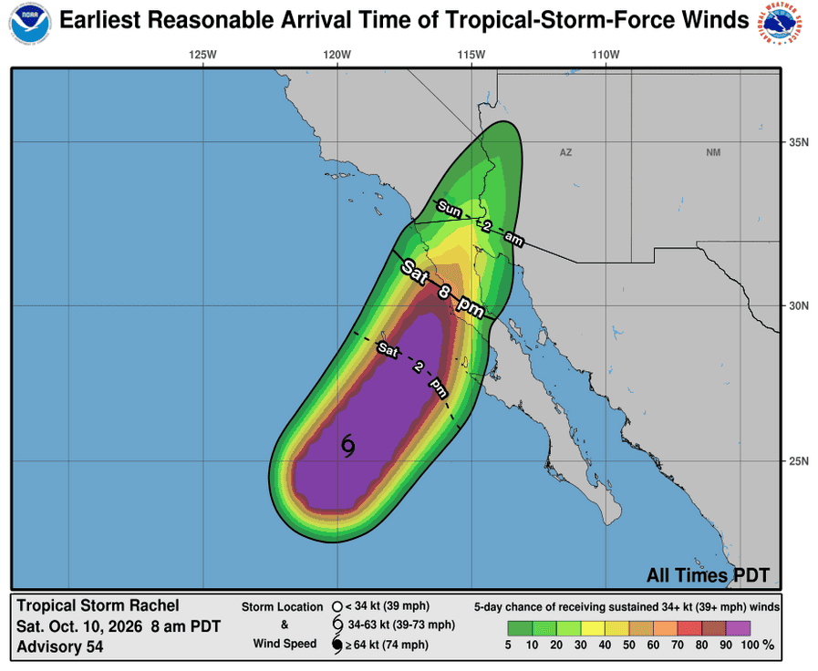
TROPICAL STORM CONDITIONS EXPECTED TO BEGIN ON THE WEST COAST OF THE BAJA CALIFORNIA PENINSULA BY THIS EVENING
According to the NHC advisory number 54
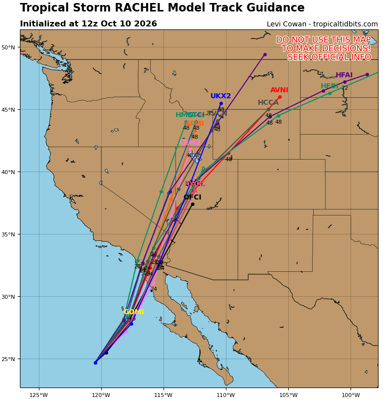
Rachel is moving toward the northeast near 22 mph (35 km/h). A northeastward to north-northeastward motion with an increase in forward speed is expected through Sunday. On the forecast track, the center of Rachel is expected to approach northern Baja California today and move onshore tonight. Rachel’s post-tropical remnants will then move across the southwestern United States on Sunday.
Maximum sustained winds are near 60 mph (95 km/h) with higher gusts. Some strengthening is possible through tonight, but rapid weakening is expected after Rachel moves inland over Baja California and the southwestern United States on Sunday. Rachel is likely to become post-tropical by Sunday morning.
Tropical-storm-force winds extend outward up to 150 miles (240 km) from the center. The estimated minimum central pressure is 992 mb (29.30 inches).
HAZARDS AFFECTING LAND
WIND: Tropical storm conditions are expected to reach portions of the Baja California Peninsula within the Tropical Storm Warning area beginning this evening and continuing into Sunday morning. Tropical storm conditions are also possible within the Tropical Storm Watch area in extreme Southern California, eastern Baja California, and portions of northwest Mexico beginning tonight or early Sunday. Strong gusty winds associated with the system are expected to spread over interior portions of the Southwest United States, especially in areas of higher terrain, tonight through early next week.
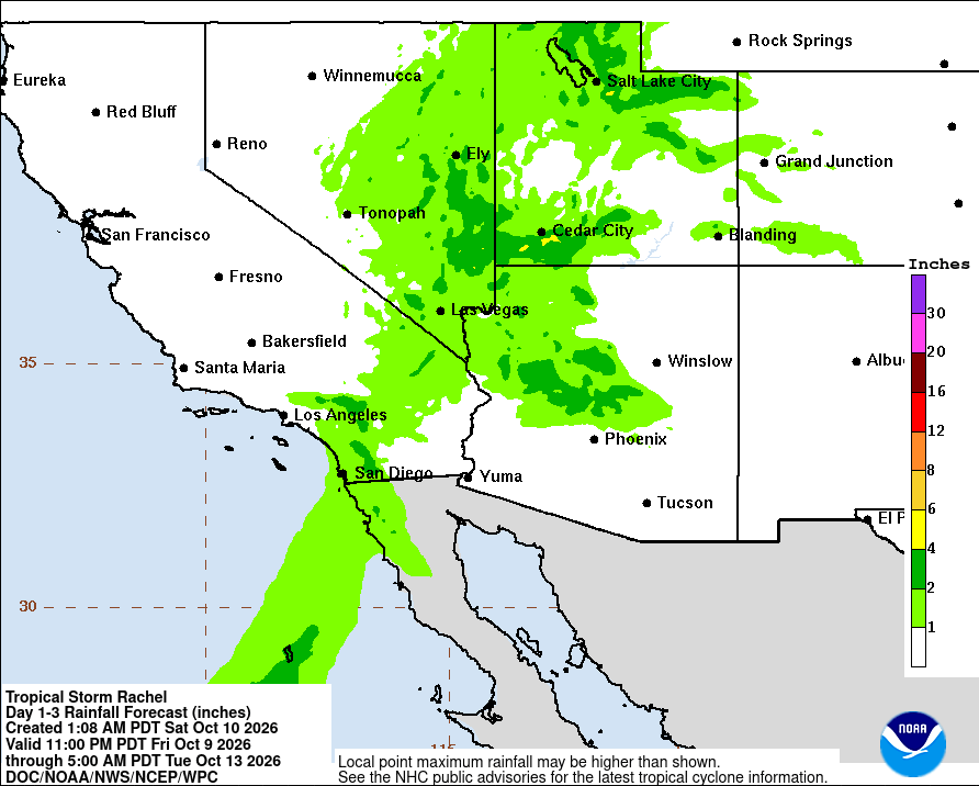
RAINFALL: Rachel will bring 1 to 3 inches of rain to portions of Baja California this weekend.
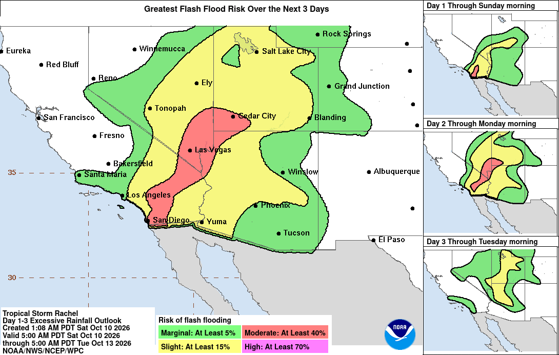
Rachel and its associated moisture will also bring rainfall of 1 to 3 inches, with maximum amounts locally up to 5 inches in portions of the Southwest United States this weekend. This will lead to increasing coverage of rainfall and potential for significant flash and urban flooding.
SURF: Waves generated by Rachel will continue to build along the coasts of Southern California and northern Baja California today. These waves, combined with an incoming long-period southerly swell, will cause life-threatening surf and rip current conditions. Coastal flooding and erosion are expected to worsen tonight into Sunday morning as the highest waves coincide with the high tides and water levels that are already running well above predicted levels. Moderate to major coastal flooding is expected, with hazardous coastal conditions continuing into early next week.
Tropical cyclone 20E (Simon)
SIMON A DANGEROUS CATEGORY 4 HURRICANE WITH 150-MPH WINDS …PREPARATIONS TO PROTECT LIFE AND PROPERTY SHOULD BE RUSHED TO COMPLETION SHORTLY IN THE HURRICANE WARNING AREA
According to the NHC advisory number 13
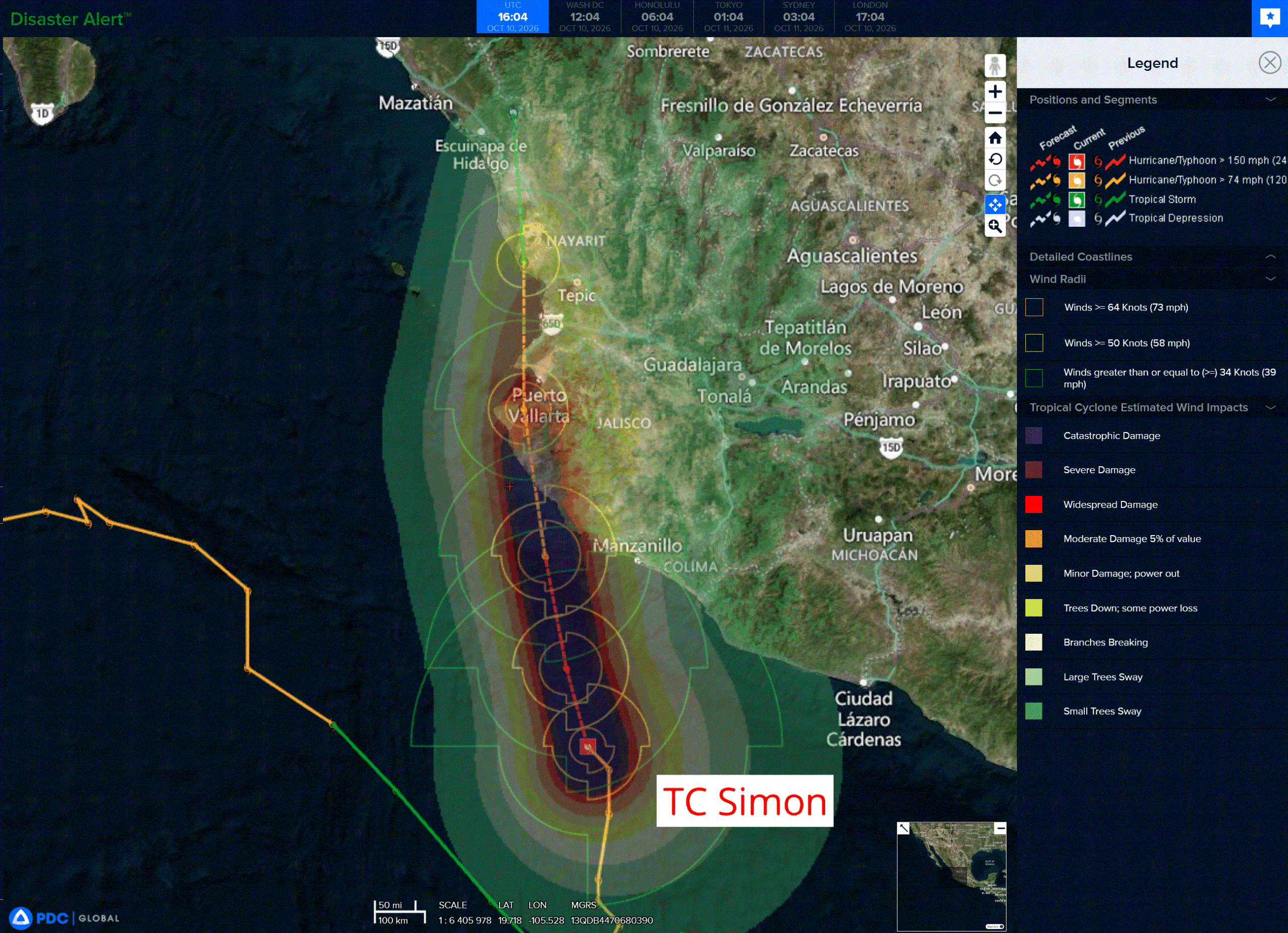
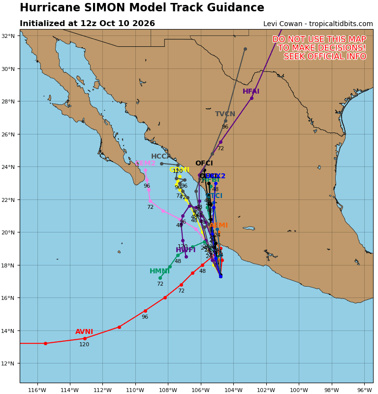
Simon is moving toward the north near 5 mph (7 km/h), and this general motion is forecast to continue through the weekend. On the forecast track, Simon is expected to be near or just inland of the west-central coast of Mexico on Sunday.
Maximum sustained winds are near 150 mph (240 km/h) with higher gusts. Simon is a category 4 hurricane on the Saffir-Simpson Hurricane Wind Scale. Some additional strengthening remains possible today, and Simon is forecast to approach the coast of west-central Mexico as a major hurricane tonight or early Sunday.
An Air Force Reconnaissance aircraft is scheduled to investigate the hurricane later today. Hurricane-force winds extend outward up to 15 miles (30 km) from the center and tropical-storm-force winds extend outward up to 125 miles (205 km). The estimated minimum central pressure is 938 mb (27.70 inches).
HAZARDS AFFECTING LAND
WIND: Hurricane conditions are expected in the southern part of the Hurricane Warning area beginning early Sunday, with tropical storm conditions expected as soon as this afternoon, with these winds spreading northward thereafter. Tropical storm conditions are possible within the Tropical Storm Watch area beginning this afternoon.
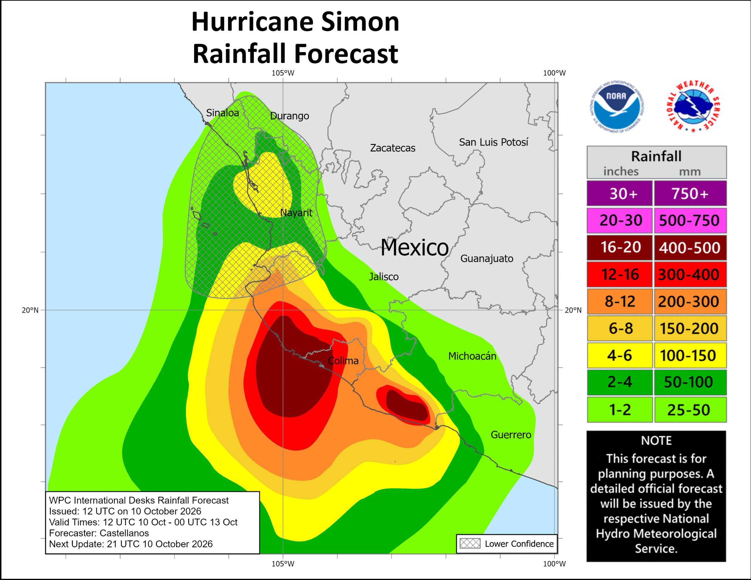
RAINFALL: Simon is expected to produce rainfall totals of 10 to 20 inches over portions of southwestern Mexico, with isolated maximum totals of 30 inches possible across portions of Michoacan, Colima, and Jalisco through Sunday. This rainfall will produce life-threatening flooding and mudslides, especially in areas of steep terrain.
STORM SURGE: A dangerous storm surge is expected along the immediate coast near and to the east of where the center makes landfall. Near the coast, the surge will be accompanied by large and destructive waves.
SURF: Swells generated by Simon will affect portions of the coast of southwestern and west-central Mexico during the next few days. These swells are likely to cause life-threatening surf and rip current conditions.
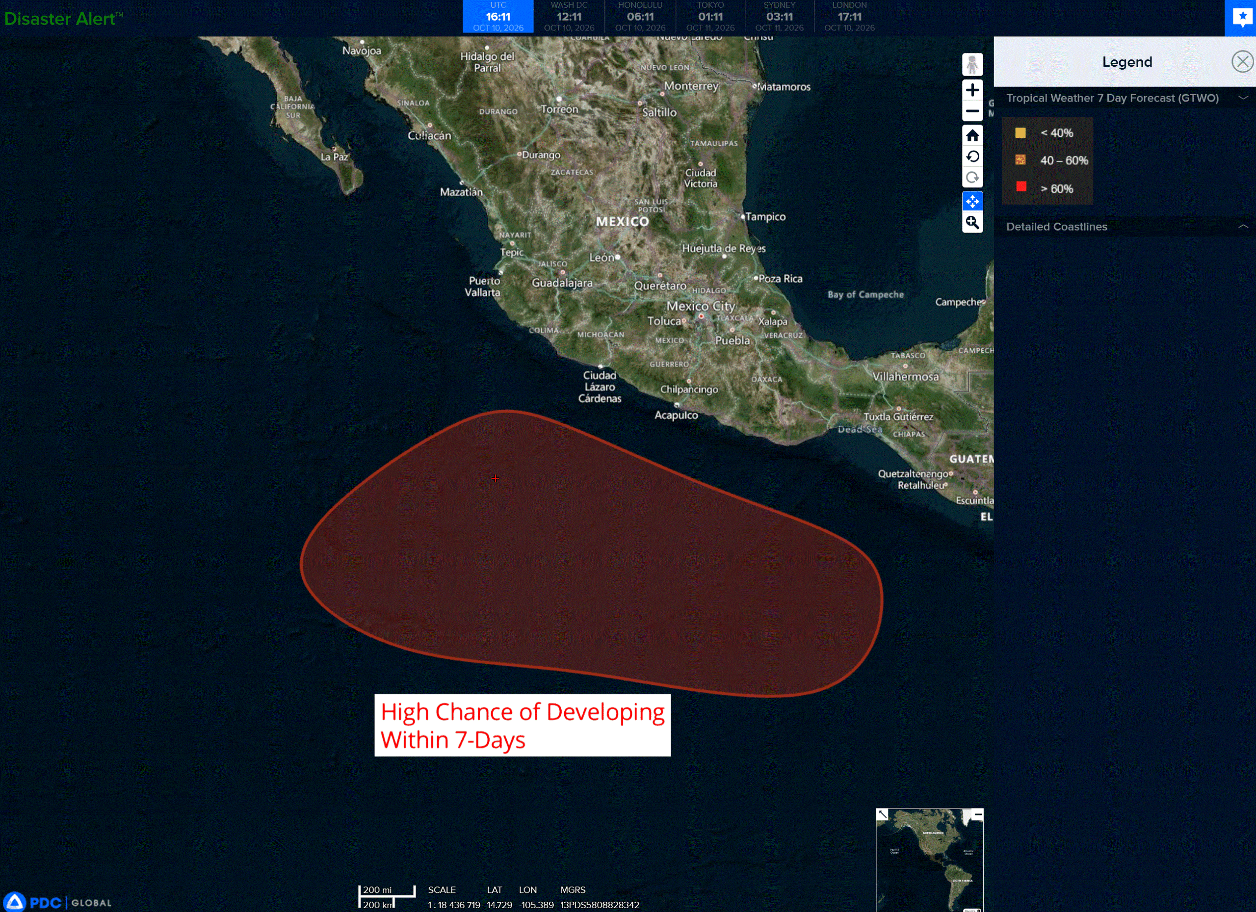
>>> South of southwestern Mexico:
An area of low pressure is forecast to develop south or southwest of the coast of Mexico by early next week. Environmental conditions are expected to be conducive for gradual development thereafter, and a tropical depression is likely to form by the middle or latter half of next week as the system moves generally west-northwestward at around 10 mph.
* Formation chance through 48 hours…near…0 percent
* Formation chance through 7 days…high…70 percent
Central North Pacific: There are no Tropical Cyclones
Tropical cyclone formation is not expected during the next 7 days.
Western Pacific, Indian Ocean, and adjacent Seas:
Western Pacific
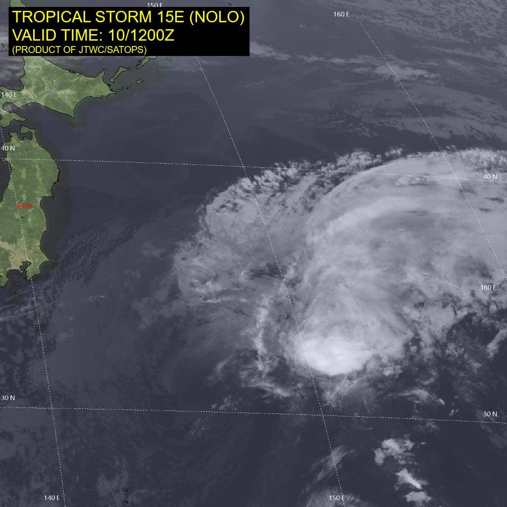
Tropical Cyclone 15E (Nolo) – Final Warning
According to the JTWC warning number 80…sustained winds were 35 knots with gusts to 45 knots
TS 15E has turned westward, against the previously forecast recurve toward the northeast. The system has weakened quickly and become shallow, now driven by low-level flow. TS 15E is acquiring hybrid characteristics as it straddles the 26 degree celsius isotherm and pulls colder air into its circulation, becoming a subtropical depression by 12 hours.
Over the next 24-36 hours, the hybrid system will gradually weaken, opening into a trough as the vertical wind shear increases to 40-60 kts. a large area of 25-30 kt northeasterly winds will move over the waters off the coast of central Honshu at the end of the forecast period.
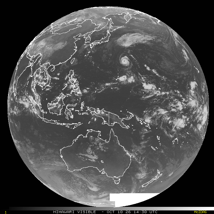
Tropical Cyclone 27W (Koguma)
According to the JTWC warning number 23…sustained winds were 120 knots with gusts to 145 knots
Typhoon 27W maintains an impressive satellite presentation, with a well-defined, circular eye measuring 25 nm in diameter embedded in a nearly symmetric central dense overcast (cdo). The eye temperature has risen to 21 degrees celsius, its warmest observed value, and the cdo cloud top temperatures remain uniformly between -60 and -70 degrees celsius. Upper-level outflow has expanded over the past six hours. Coincident sar passes at approximately 100800z from sentinel-1c and rcm-3 estimated peak sustained winds of approximately 115-125 kts, Though the rcm-3 pass included a peak value of 135 kts. with the satellite presentation improved over the past six hours.
The environment is favorable, characterized by low vertical wind shear (vws), warm sea surface temperatures (sst) of 28-29 degrees celsius, and moderate divergence aloft.
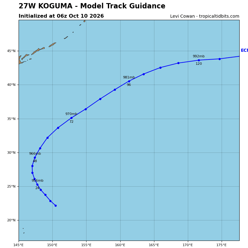
TY 27W will travel northwestward at 10 kts along the southwestern periphery of a str. The system will
gradually turn poleward as it reaches the western periphery of the ridge, cross the str axis after 24 hours, and accelerate northeastward thereafter, becoming increasingly embedded in deep-layer mid-latitude westerly flow.
TY 27W is likely at or near peak intensity, though slight additional intensification is possible through 12 hours. While vws will remain low at 5-10 kts through 36 hours, the system has about 12 hours remaining over a sufficiently warm subsurface water layer with ocean heat content (ohc) of 30 kj per cm2. After 12 hours, the circulation will traverse the cold wakes left behind by former TY 26W and TS 15E. These less
favorable ocean conditions, combined with relatively slow forward motion, will support the onset of weakening near 24 hours.
VWS will begin to increase after 36 hours as the system gains latitude and approaches the southern periphery of an upper-level jet stream, reaching 40-50 kts by 72 hours. the combination of cooler waters and stronger shear will lead to a more pronounced weakening trend. The storm will begin extratropical transition (ett) by 96 hours as it enters a stronger baroclinic environment and complete ett by 120 hours.
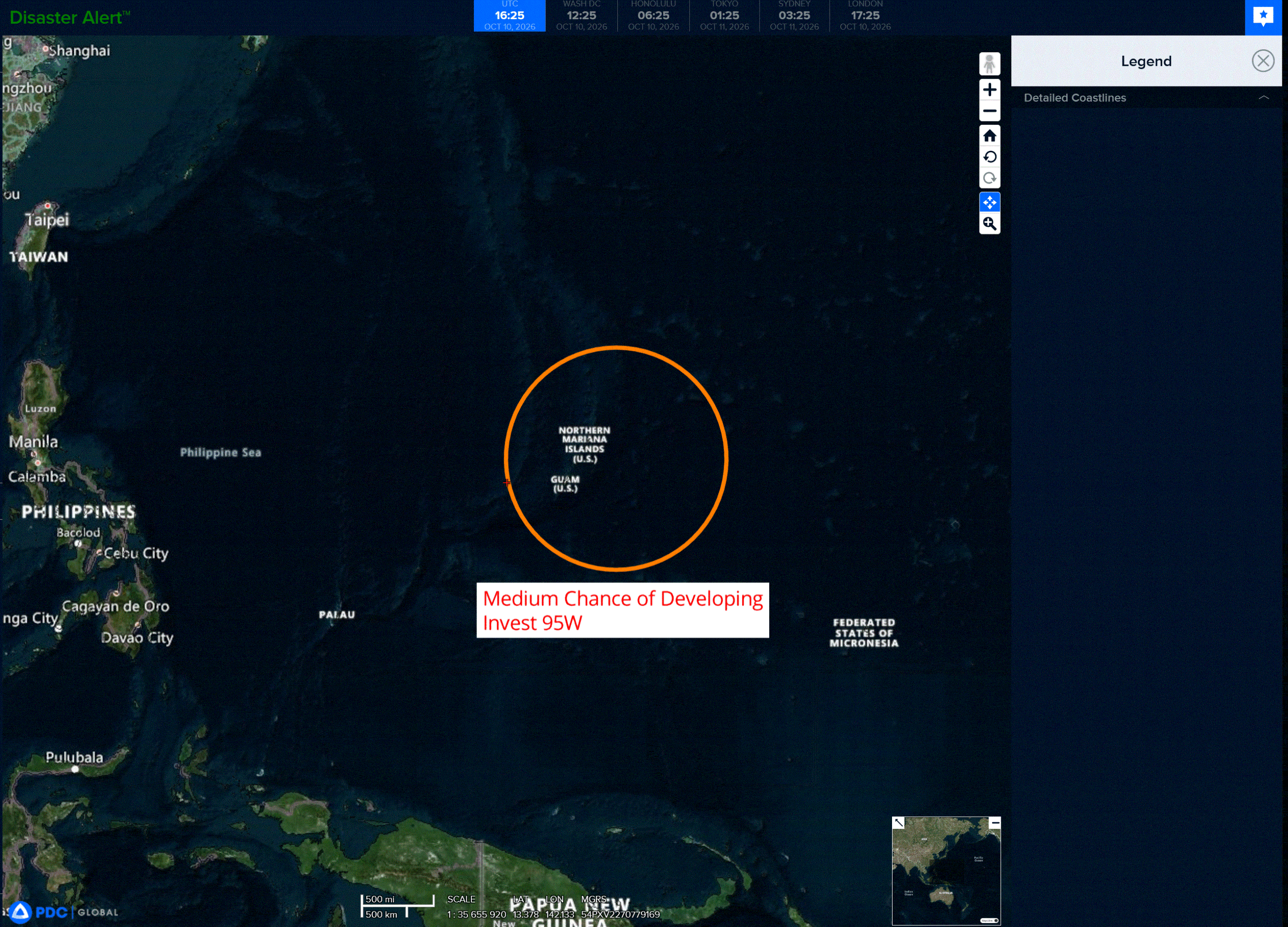
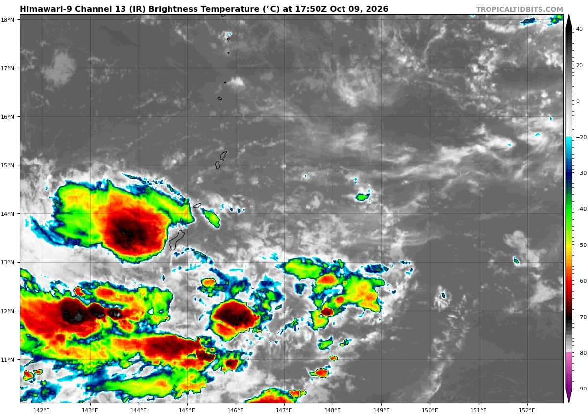
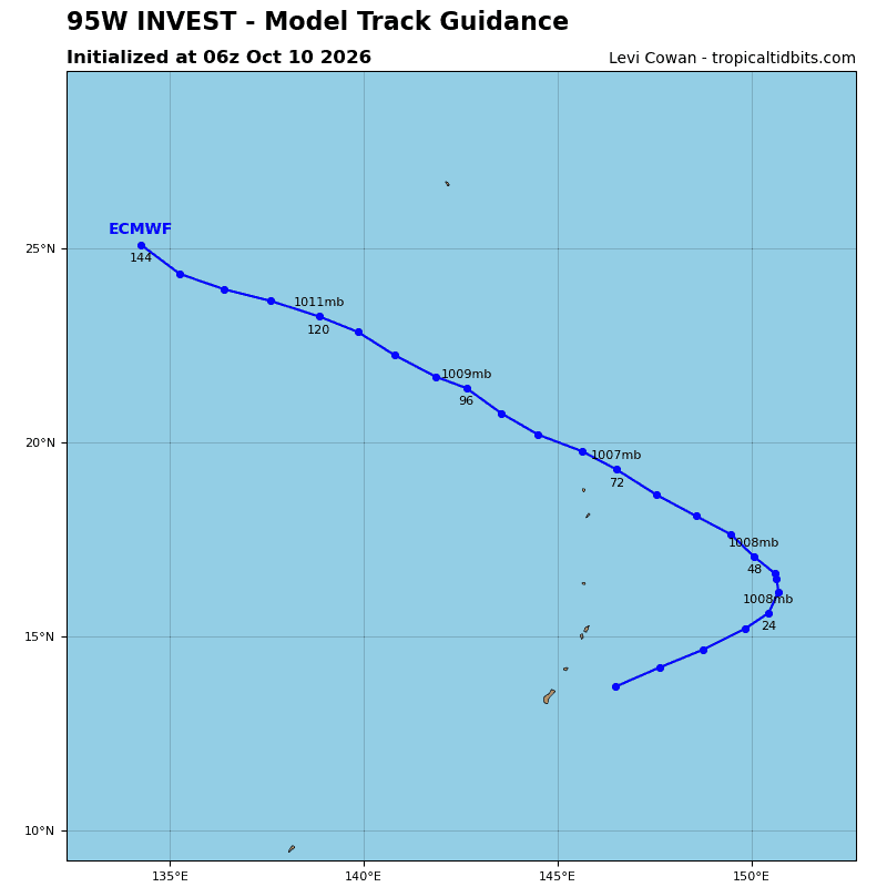
>>> There’s an area of disturbed weather being referred to as Invest 95W, which is located approximately 73 NM east-northeast of Guam.
Animated enhanced infrared (eir) satellite imagery depicts a slowly consolidating low level circulation with
flaring convection to the south and east. Analysis of the low-level cloud bands indicate that 95W likely does not have a closed circulation and resembles a trough. Recent scatterometer data indicated 25 kt winds in the southeast quadrant.
Environmental analysis indicates a favorable area for development with moderate vertical wind shear (15-20kts), good westward outflow, and very warm sea surface temperatures (29-30c).
Global deterministic and ensemble models agree on a slow development trend, and the system could become a tropical depression outside of 24 hours but within 48 hours as it tracks northeastward for the next 24-36 hours before curving sharply northwestward.
Maximum sustained surface winds are estimated at 23-28 knots.
Minimum sea level pressure is estimated to be near 1007 mb.
The potential for the development of a significant tropical cyclone within the next 24 hours is upgraded to medium.