

Current Snapshot
For all the latest updates visit: DisasterAWARE
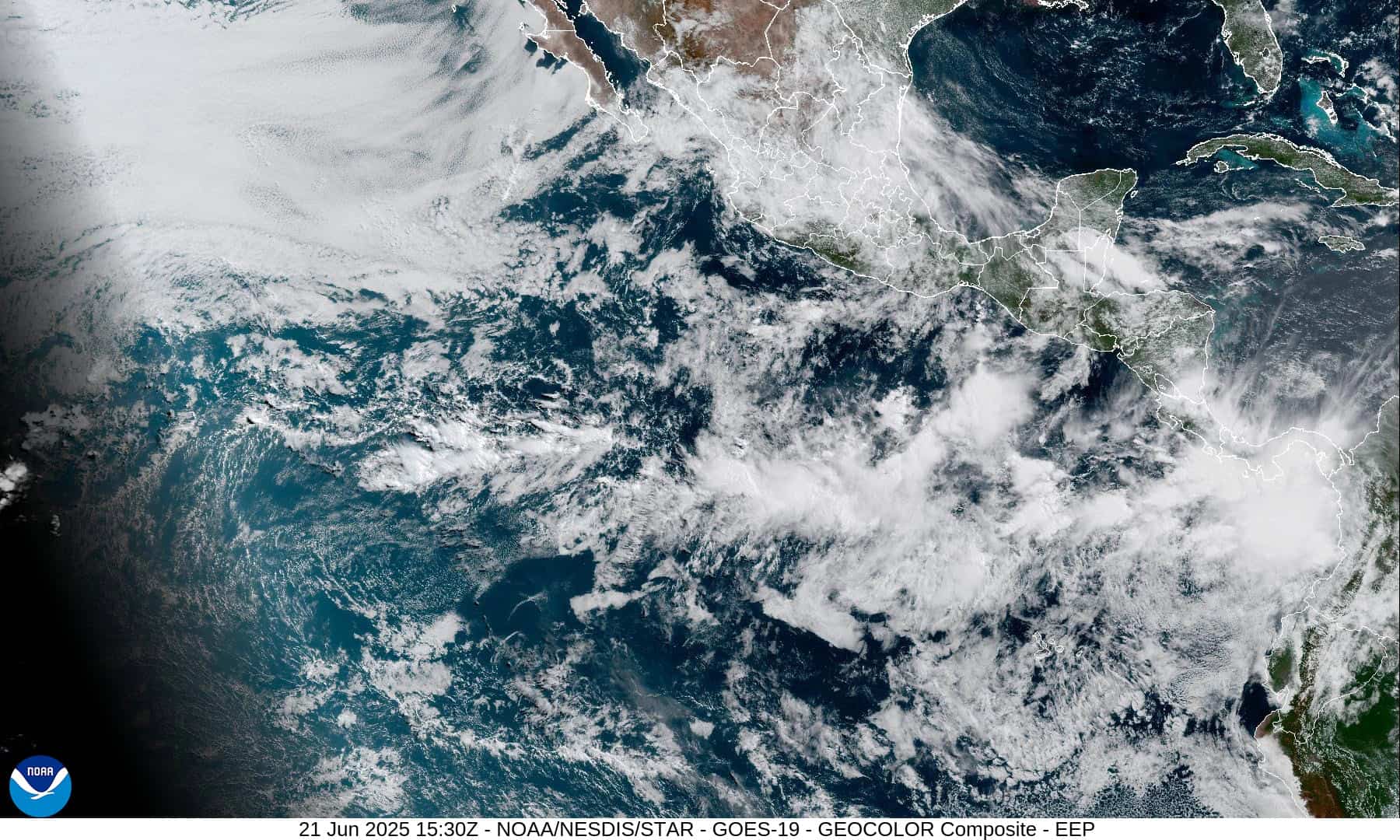
1800x1080e
2eeee
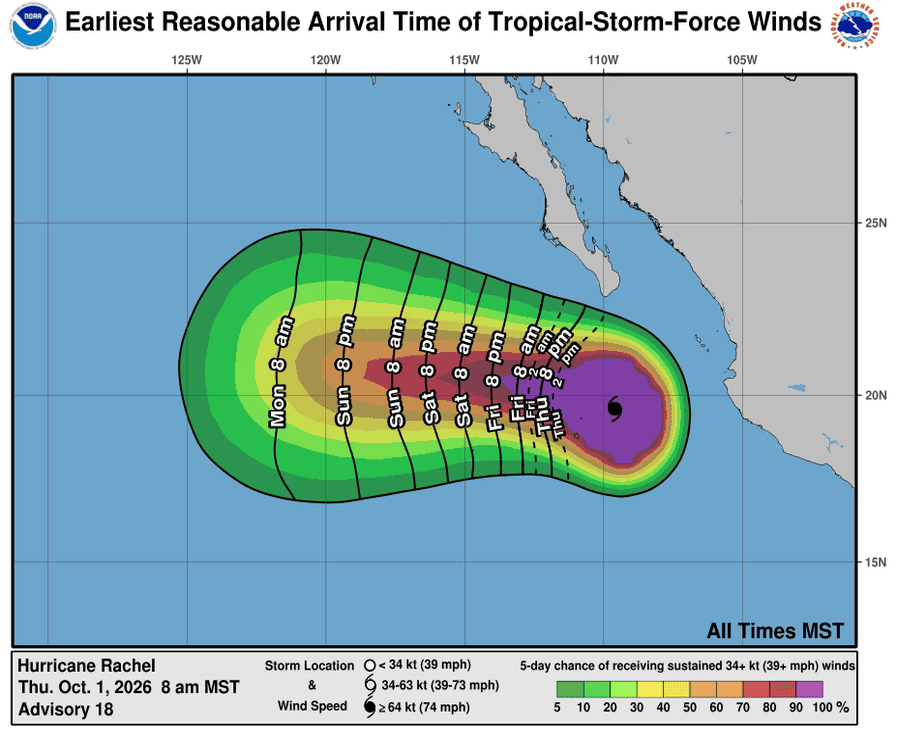
011447_earliest_reasonable_toa_34R
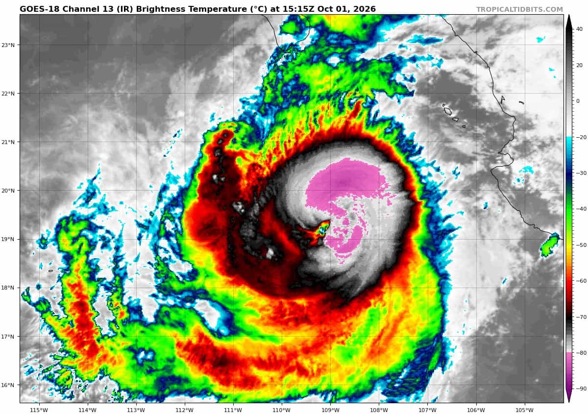
goes18_ir_18E_202610011515_lat19.5-lon-109.5
011447INTQPF_sm
18E_tracks_latest
goes18_ir_19E_202610011515_lat15.2-lon-124.0
19E_tracks_latest
7

1800×1080
nolo
goes18_ir_15E_202610011535_lat21.8-lon-165.3
011449WPCQPF_sm
15E_eps_latest
choi-wan
26W_011200sair
26W_tracks_latest
By PDC’s Senior Weather
Specialist Glenn James

The Pacific Disaster Center’s (PDC Global) Thursday, October 1, 2026, Tropical Cyclone Activity Report…for the Pacific Ocean, the Indian Ocean, and adjacent Seas.
Tropical Cyclones
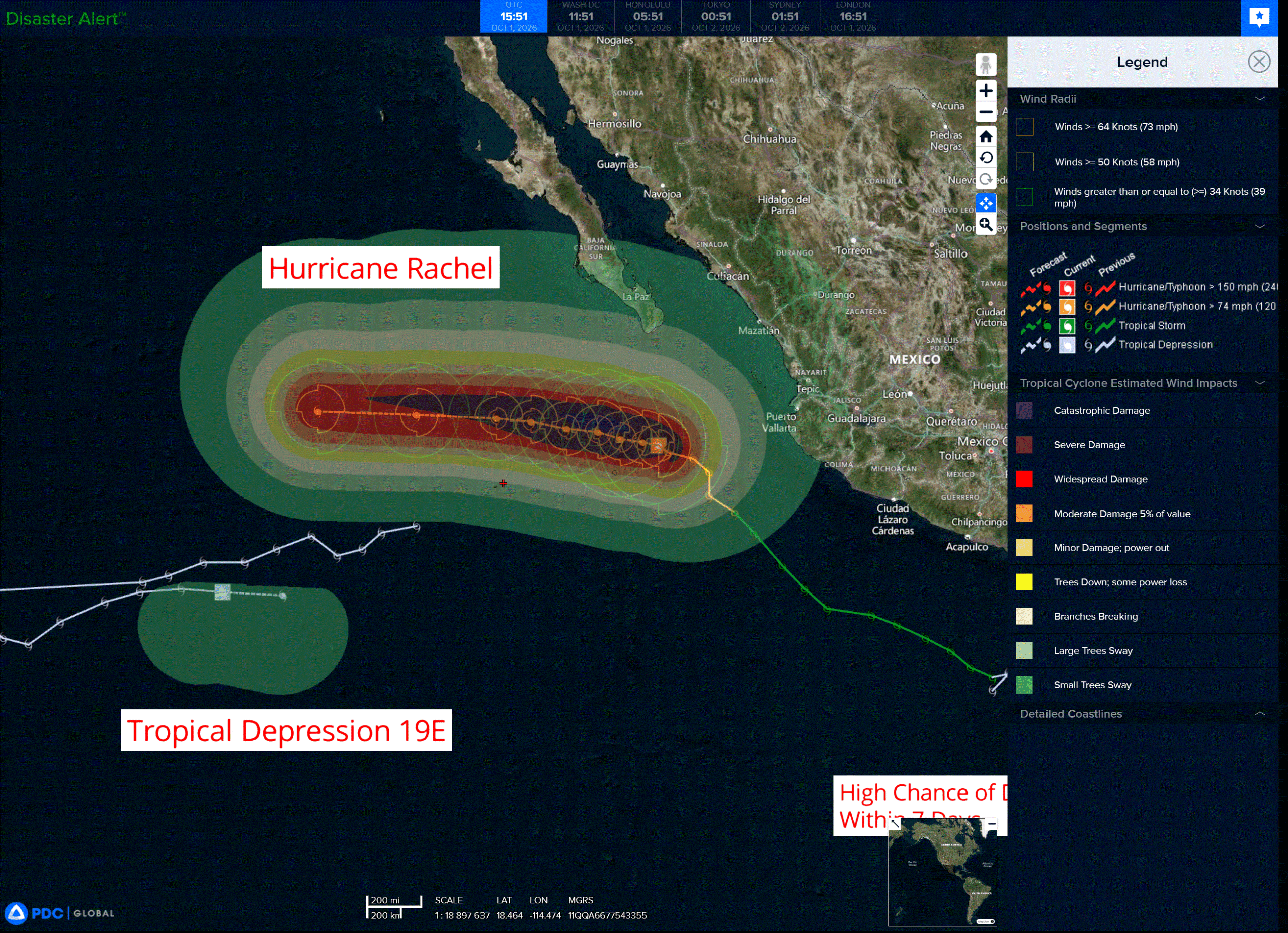
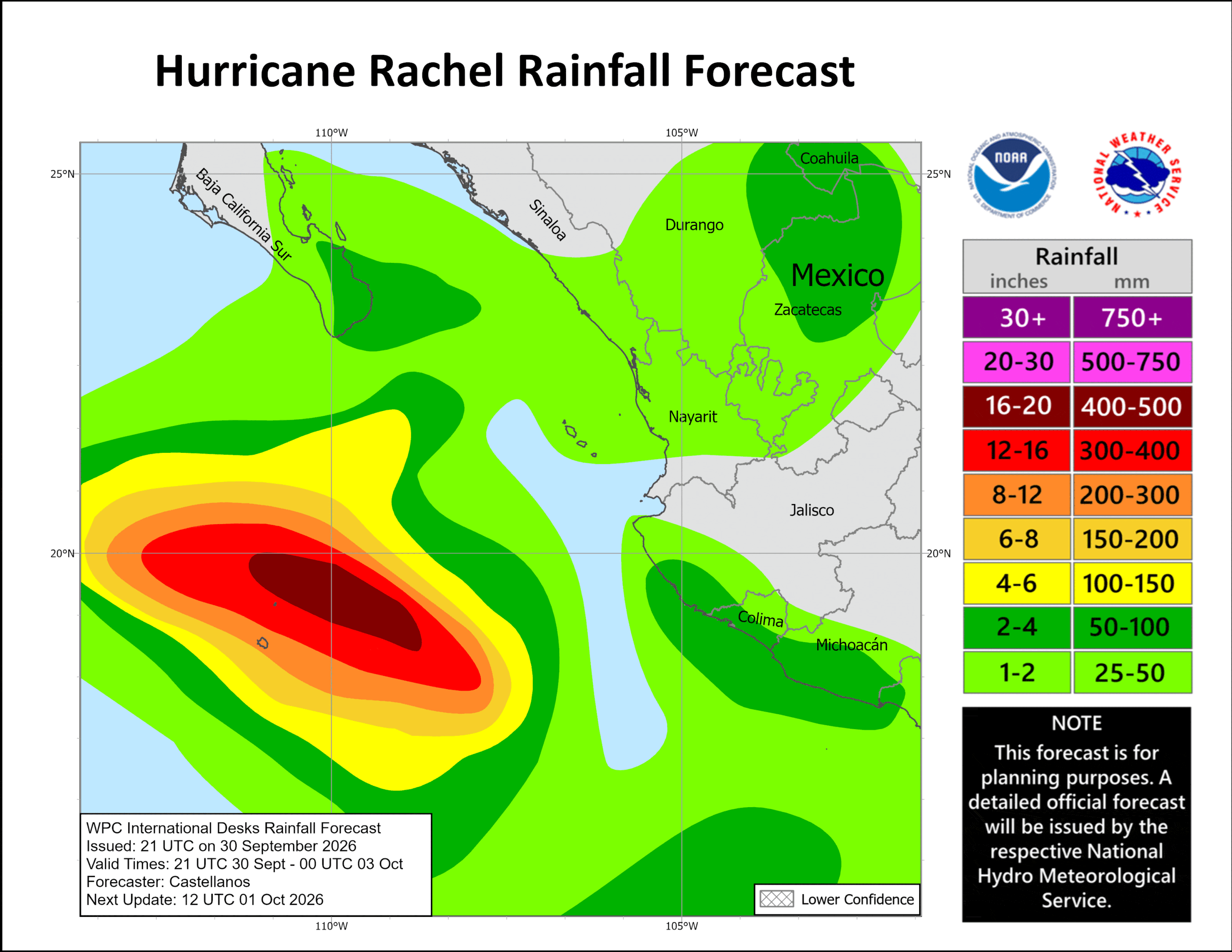
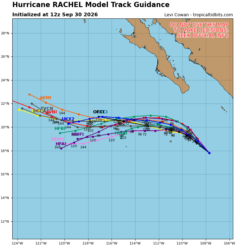
Tropical Cyclone 18E (Rachel) is located about 230 miles south of the southern tip of Baja CA
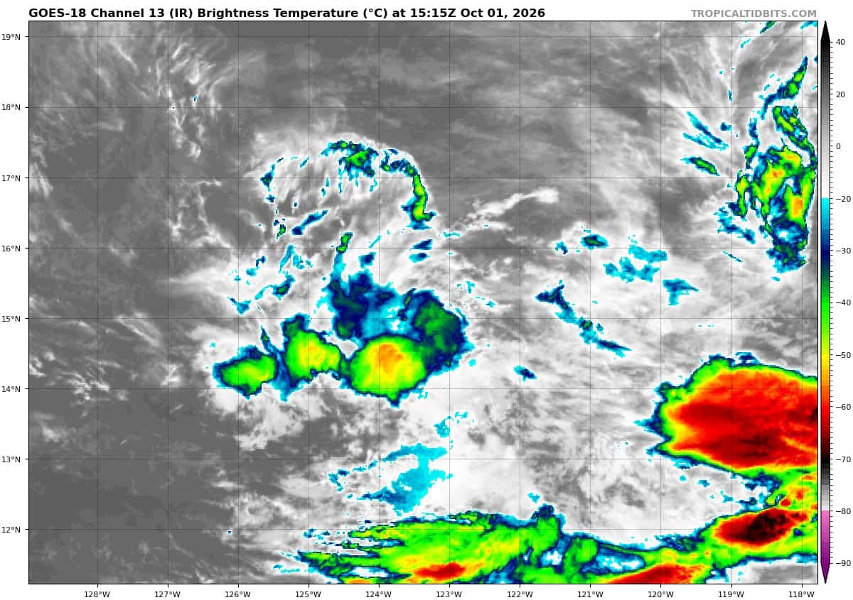
Tropical Cyclone 19E is located about 1025 miles west-southwest of the southern tip of Baja CA
Tropical Cyclone 15E (Nolo) is located about 390 miles west of Lihue, Hawaii
Tropical Cyclone 26W (Choi-Wan) is located approximately 304 NM north of Tinian
Northeast Pacific:
Tropical cyclone 18E (Rachel)
RACHEL STRENGTHENS
According to the NHC advisory number 18
Rachel is moving toward the west-northwest near 6 mph (9 km/h), and this west-northwest to west motion at a slightly slower forward speed is expected the next couple of days.
Maximum sustained winds have increased to near 105 mph (165 km/h) with higher gusts. Some additional strengthening is possible during the next couple of days.
Hurricane-force winds extend outward up to 35 miles (55 km) from the center and tropical-storm-force winds extend outward up to 150 miles (240 km).
The estimated minimum central pressure is 964 mb (28.47 inches).
HAZARDS AFFECTING LAND
SURF: Swells generated by Rachel will affect the coast of west-central Mexico and the Baja California Peninsula through the end of the week. These swells are likely to cause life-threatening surf and rip current conditions.
Tropical cyclone 19E
DEPRESSION MOVES FARTHER EASTWARD
According to the NHC advisory number 9
The depression is moving toward the east near 16 mph (26 km/h) and this motion is expected to continue for another day or so.
Maximum sustained winds are near 30 mph (45 km/h) with higher gusts. The depression should become a remnant low later today before dissipating by tomorrow.
The estimated minimum central pressure is 1006 mb (29.71 inches).
>>> South of Southern Mexico:
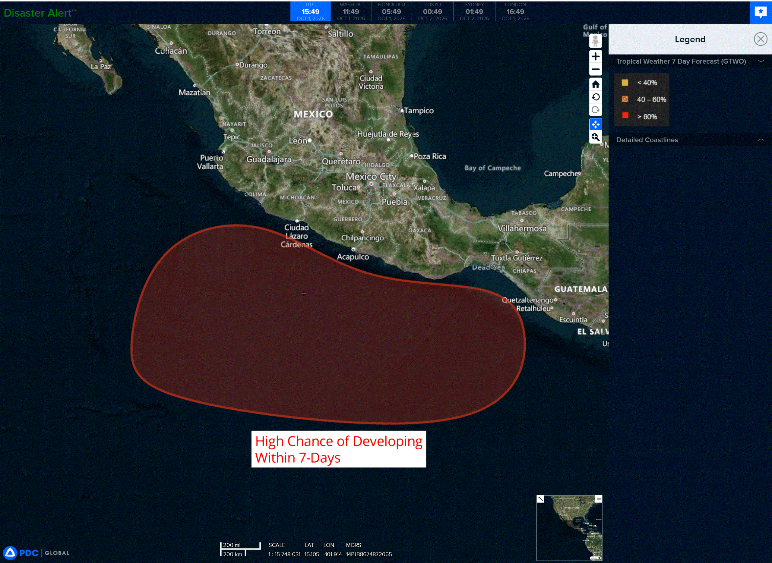
An area of low pressure could form late this weekend or early next week south of the southern coast of Mexico.
Thereafter, environmental conditions appear favorable for gradual development, and a tropical depression is likely form while the system moves slowly west-northwestward to northwestward.
* Formation chance through 48 hours…low…near 0 percent
* Formation chance through 7 days…high…70 percent
Central North Pacific:
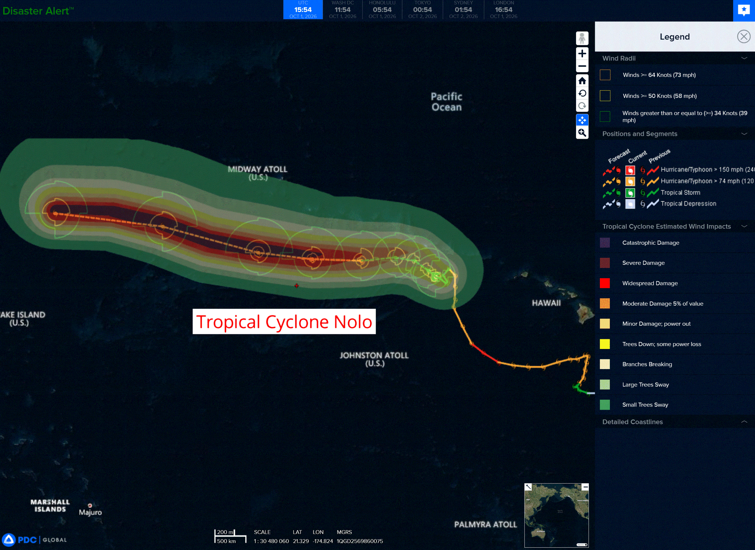
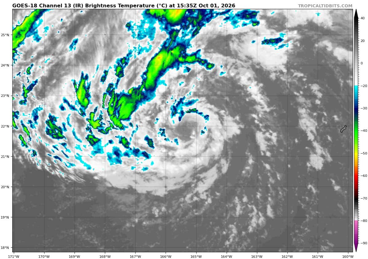
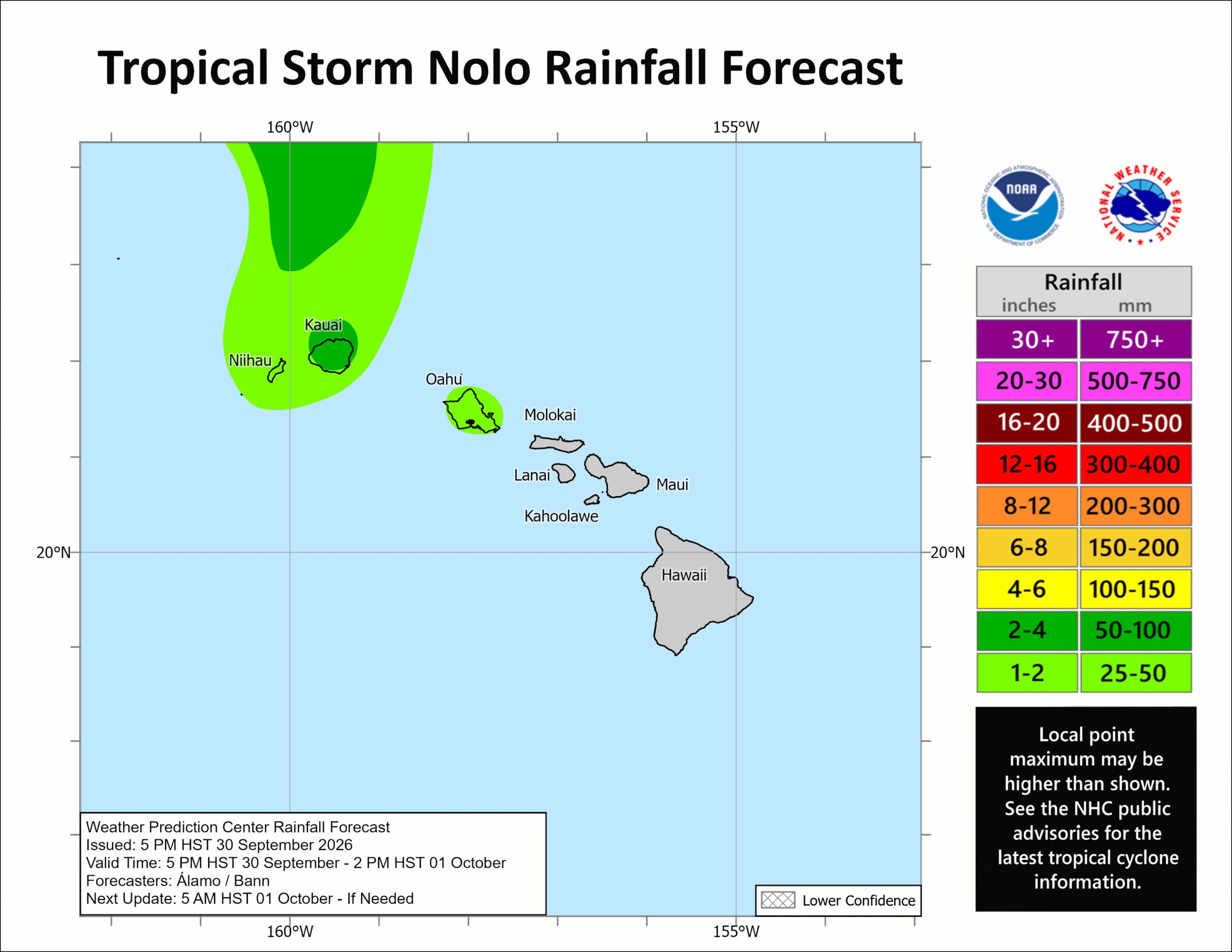
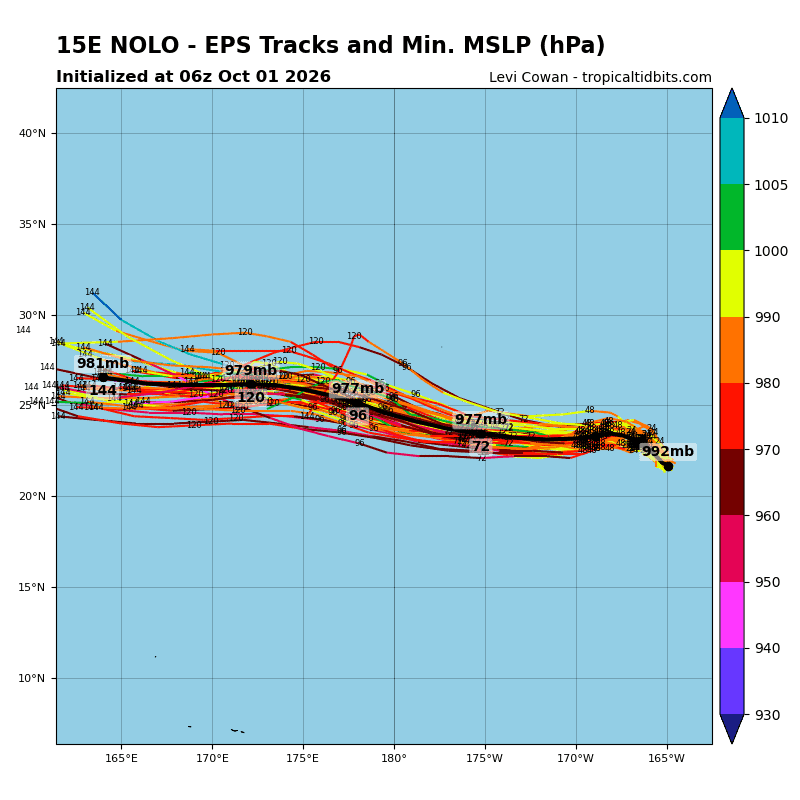
Tropical Cyclone 15E (Nolo)
NEW TROPICAL STORM WATCH ISSUED FOR NOLO IN PORTIONS OF THE PAPAHANAUMOKUAKEA MARINE NATIONAL MONUMENT
According to the NHC advisory number 44
Nolo is moving toward the west-northwest near 5 mph (7 km/h). A west-northwest to northwest track is expected today, followed by a westward turn with a large increase in forward speed by the weekend. On the forecast track, Nolo should remain south of the main atolls of the Papahanaumokuakea Marine National Monument.
Maximum sustained winds are near 60 mph (95 km/h) with higher gusts. Gradual strengthening is expected for the next day or so, and Nolo could become a hurricane by the weekend.
Tropical-storm-force winds extend outward up to 105 miles (165 km) from the center.
The estimated minimum central pressure is 993 mb (29.33 inches).
HAZARDS AFFECTING LAND WIND:
WIND: Tropical storm conditions are expected within the Tropical Storm Warning area from Nihoa to French Frigate Shoals today, with tropical storm conditions spreading westward from French Frigate Shoals to Maro Reef later today. Tropical storm conditions are possible from west of Maro Reef to Lisianski Island starting Saturday morning.
SURF: Large surf associated with Nolo will continue to affect the Papahanaumokuakea Marine National Monument over the next several days. These large waves will likely inundate some of the low-lying atolls, especially from French Frigate Shoals to Maro Reef.
Western Pacific, Indian Ocean, and adjacent Seas:
Western Pacific
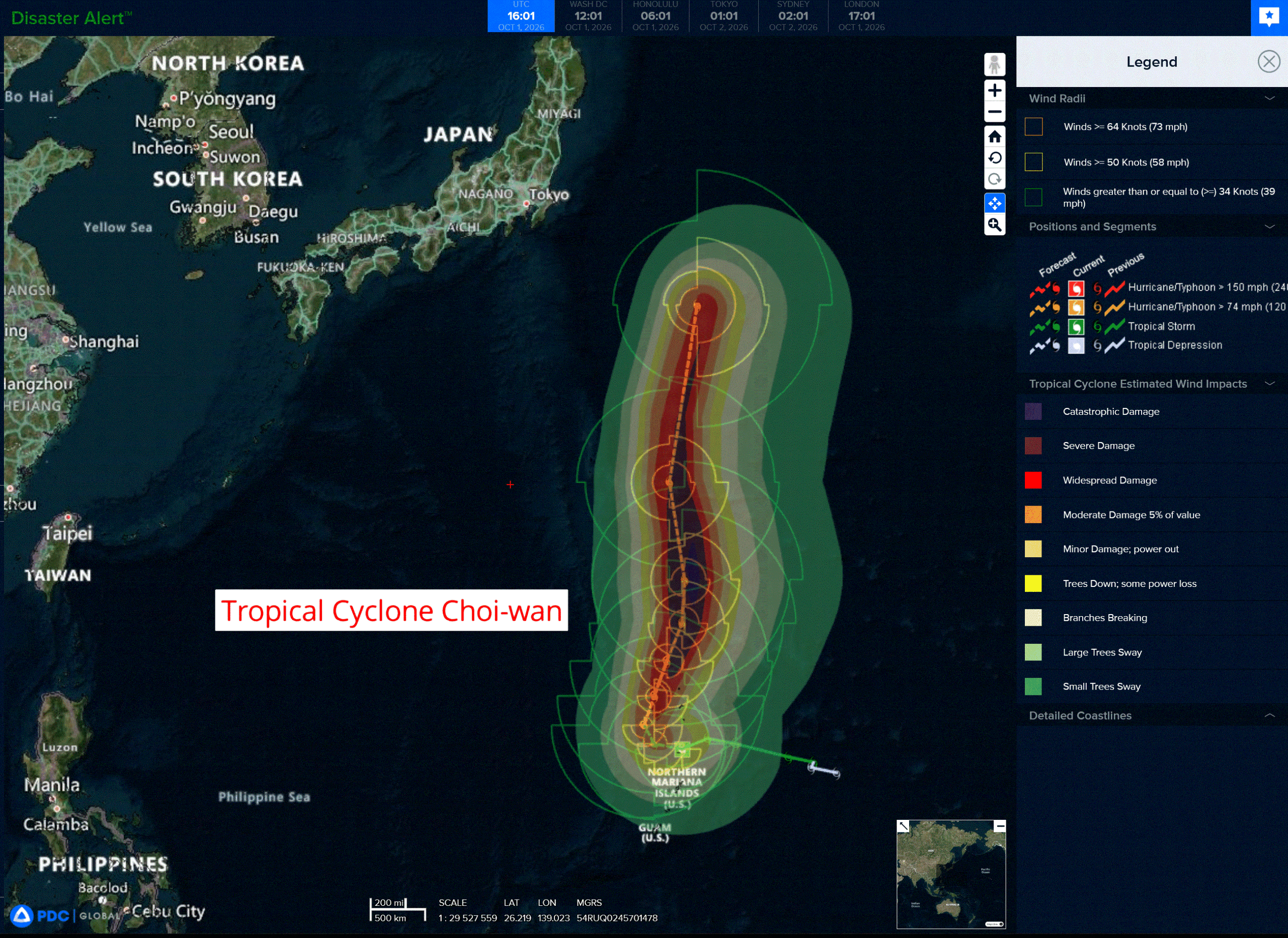
Tropical Cyclone 26W (Choi-wan)
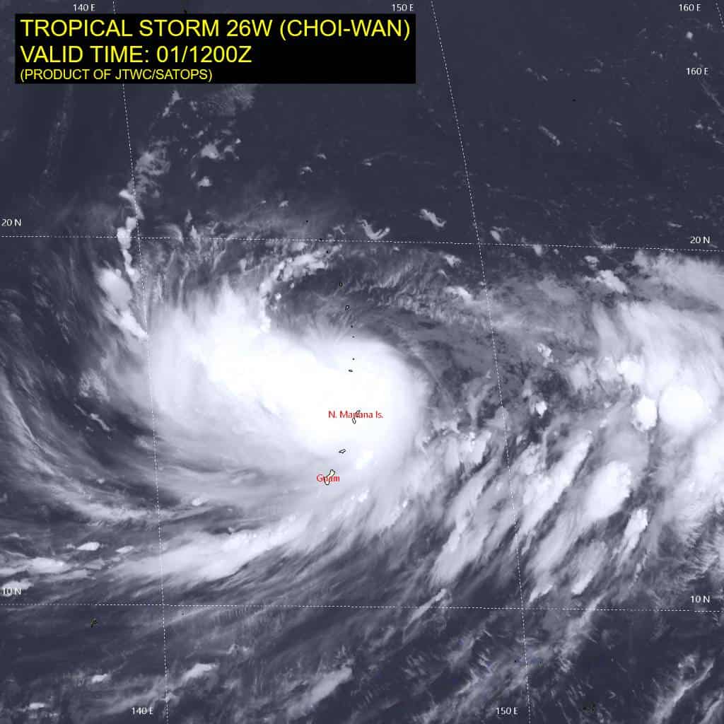
According to the JTWC warning number 7…sustained winds were 50 knots with gusts to 65 knots
Animated enhanced infrared (eir) satellite imagery depicts tropical storm 26W beginning to tuck under the central deep convection and reducing the vertical tilt. The upper-level convection has begun to fight the vertical wind shear and is attempting to expand upshear. Additionally, the partially exposed lower-level cloud
banding has become tighter and noticeably more symmetrical. The 011158z ascat data reveals a tight, slightly oblong inner core surrounded by a vast wind field. A 011358z surface observation from Saipan recorded 32 kts sustained winds with gusts up to 50 kts.
Environmental analysis reveals a favorable environment, characterized by moderate to high (20-25 kts) vertical wind shear (vws), moderate equatorward outflow, warm (30-31 c) sea surface temperatures, and high (125-150 kj per cm squared) ocean heat content (ohc).
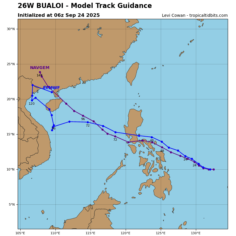
TS 26W (Choi-wan) is forecast to continue tracking west-northwestward for the next 12 hours while it remains on the southwestern periphery of the steering str. Around 12 hours, a shortwave trough to the north will pass, eroding the western flank of the ridge. In response, 26W will slowly curve poleward into the weak steering environment created as the ridge retreats eastward. 26W will track northward to north-northeastward from 24-60 hours with a near equatorial ridge centered to the southeast providing the
northeastward steering influence. Beginning around 60 hours, the now re-oriented steering ridge will build back westward, causing 26W to briefly curve northwestward before assuming a generally northward track from 96-120 hours.
Regarding intensity, 26W is forecast to steadily intensify through 72 hours. At around 24 hours, the environment will become more favorable, including reduced vws of 10-15 kts, an enhanced poleward outflow channel provided by the retreating str, and high (125-150 kj per cm squared) ocean heat content (ohc). due to the improved environment between 24-72 hours, an increased rate of intensification may be observed, including the potential for rapid intensification and a peak intensity higher than 110 kts.
By 72 hours, 26W is forecast to enter into a region of lower ohc (50-75 kj per cm squared), which is expected to induce a weakening trend from 72-120 hours. Choi-wan is expected to maintain an expansive wind field through the duration of the forecast.