

Current Snapshot
For all the latest updates visit: DisasterAWARE
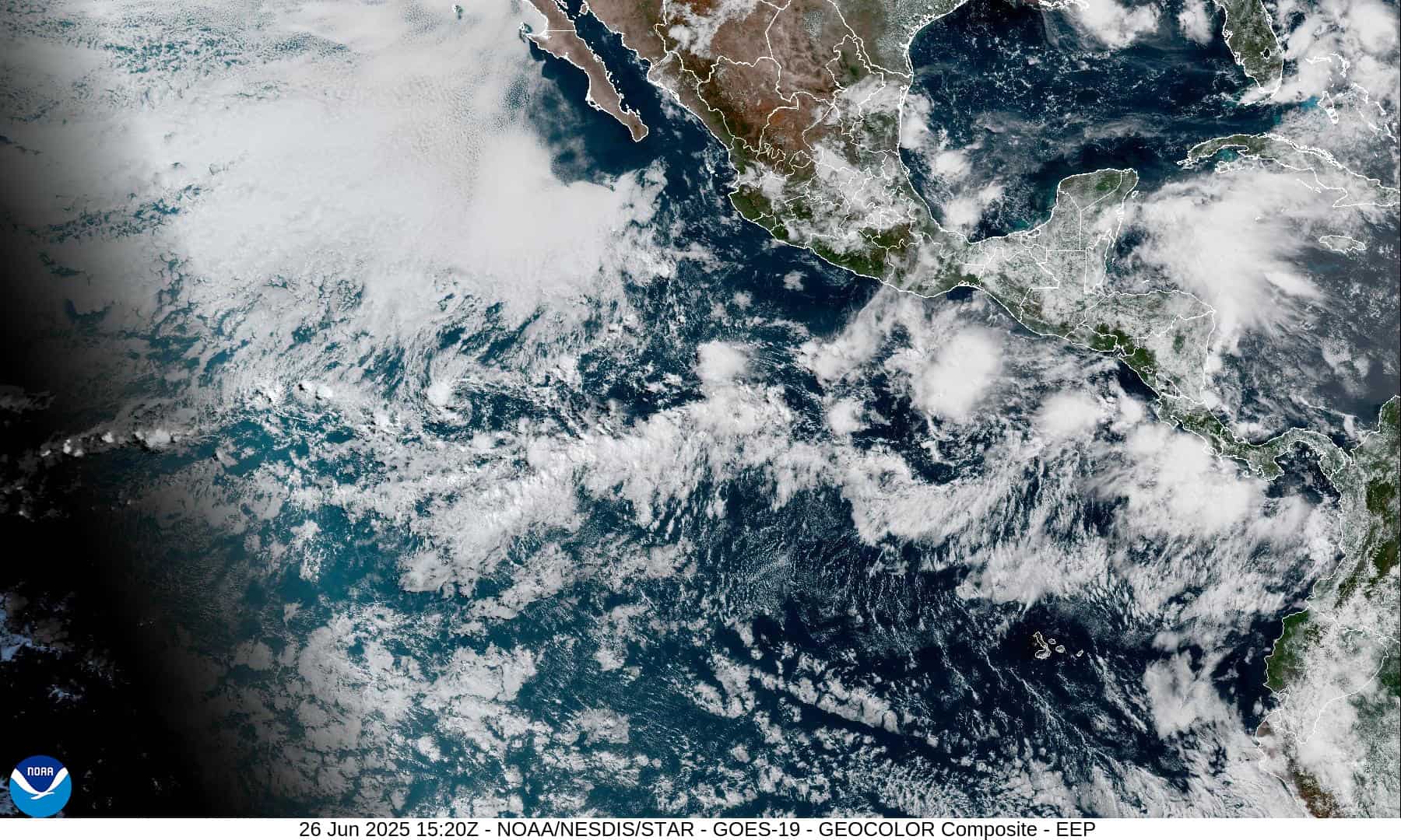
1800x1080e
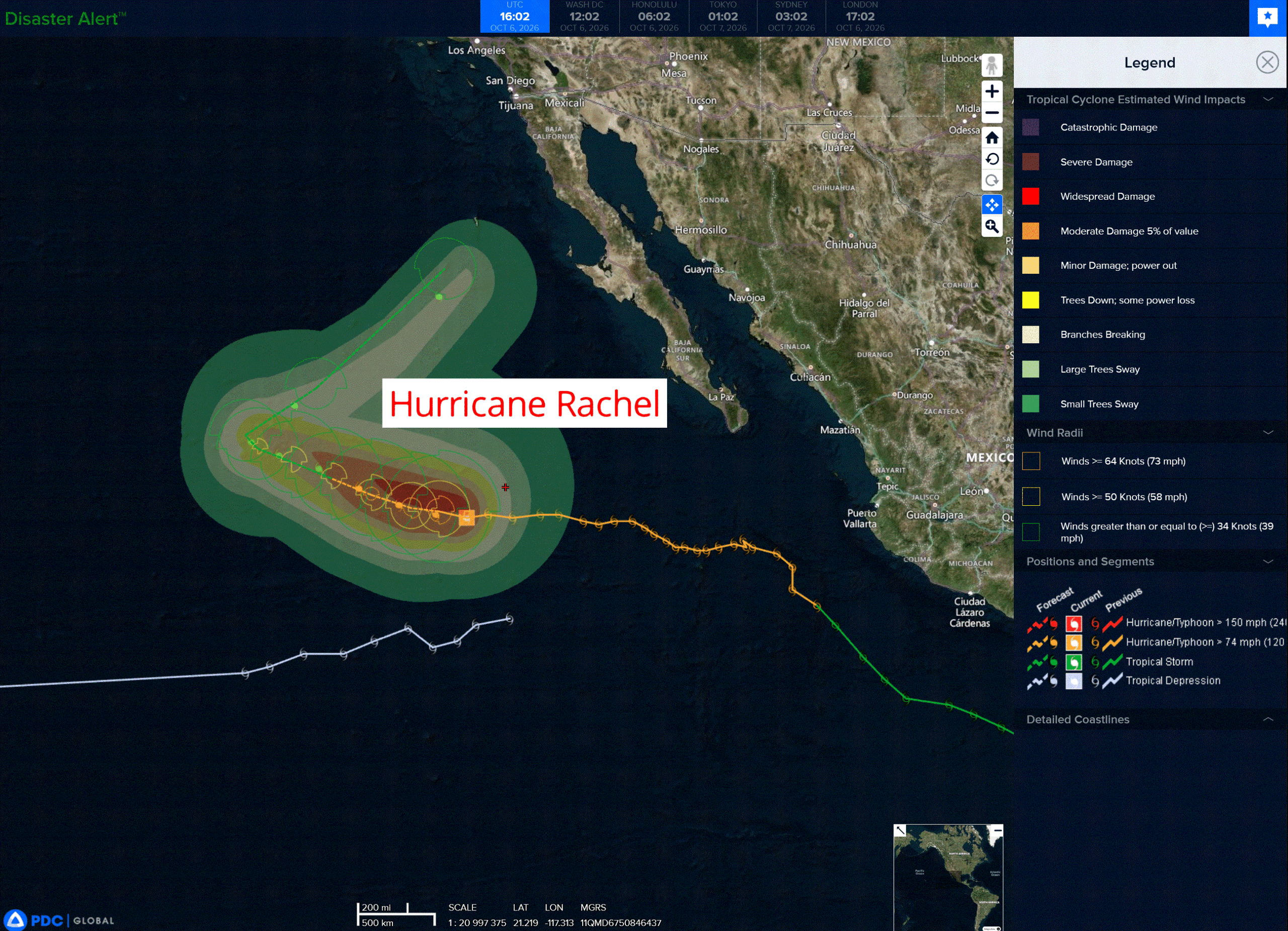
rachel
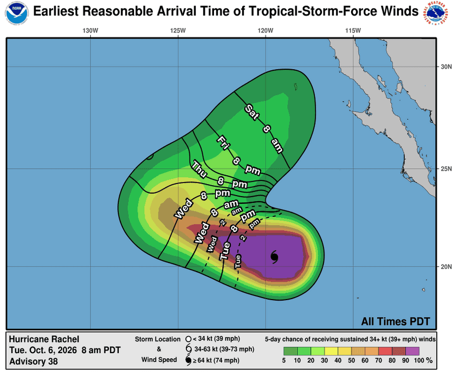
061445_earliest_reasonable_toa_34
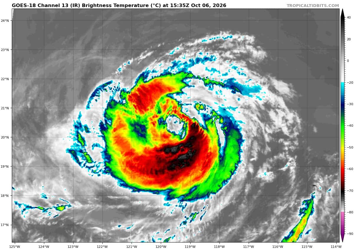
goes18_ir_18E_202610061535_lat20.4-lon-119.1
18E_tracks_latest
92E
2e
goes19_ir_92E_202610061615_lat12.8-lon-98.2

92E_tracks_latest
1800x1080ec
10
3w
15E_061200sair
goes18_ir_15E_202610061535_lat25.4-lon169.1
15E_tracks_latest
26W_061200sair
himawari9_ir_26W_202610061530_lat33.7-lon147.6
26W_tracks_latest
27W_061200sair
himawari9_ir_27W_202610061530_lat14.0-lon165.8
27W_tracks_latest
By PDC’s Senior Weather
Specialist Glenn James

The Pacific Disaster Center’s (PDC Global) Tuesday, October 6, 2026, Tropical Cyclone Activity Report…for the Pacific Ocean, the Indian Ocean, and adjacent Seas.
Tropical Cyclones
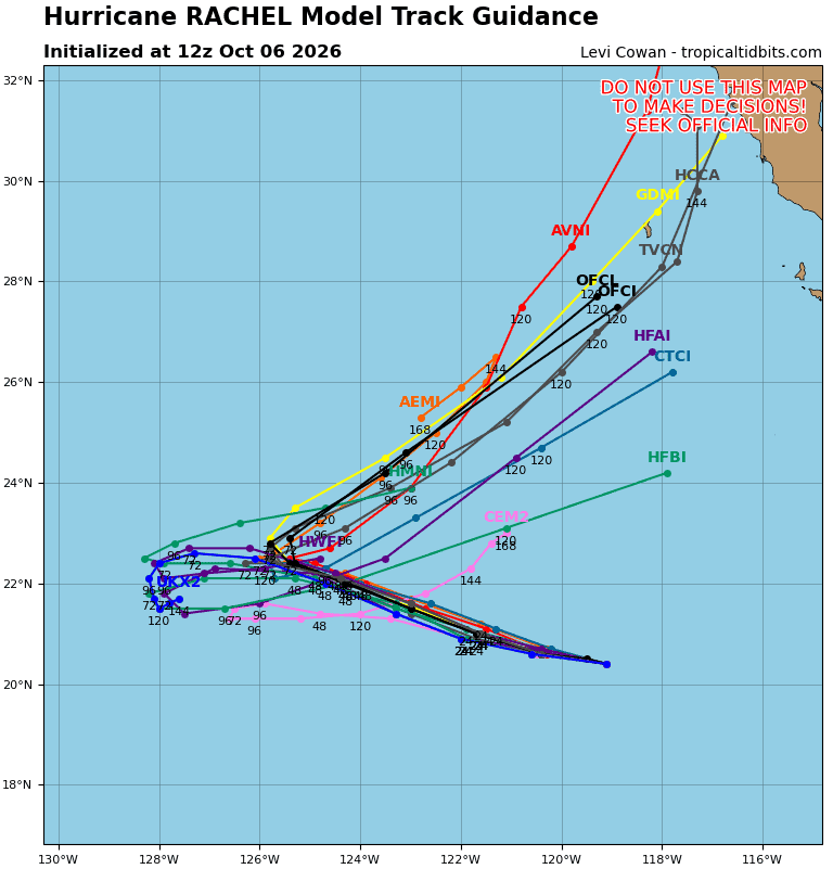
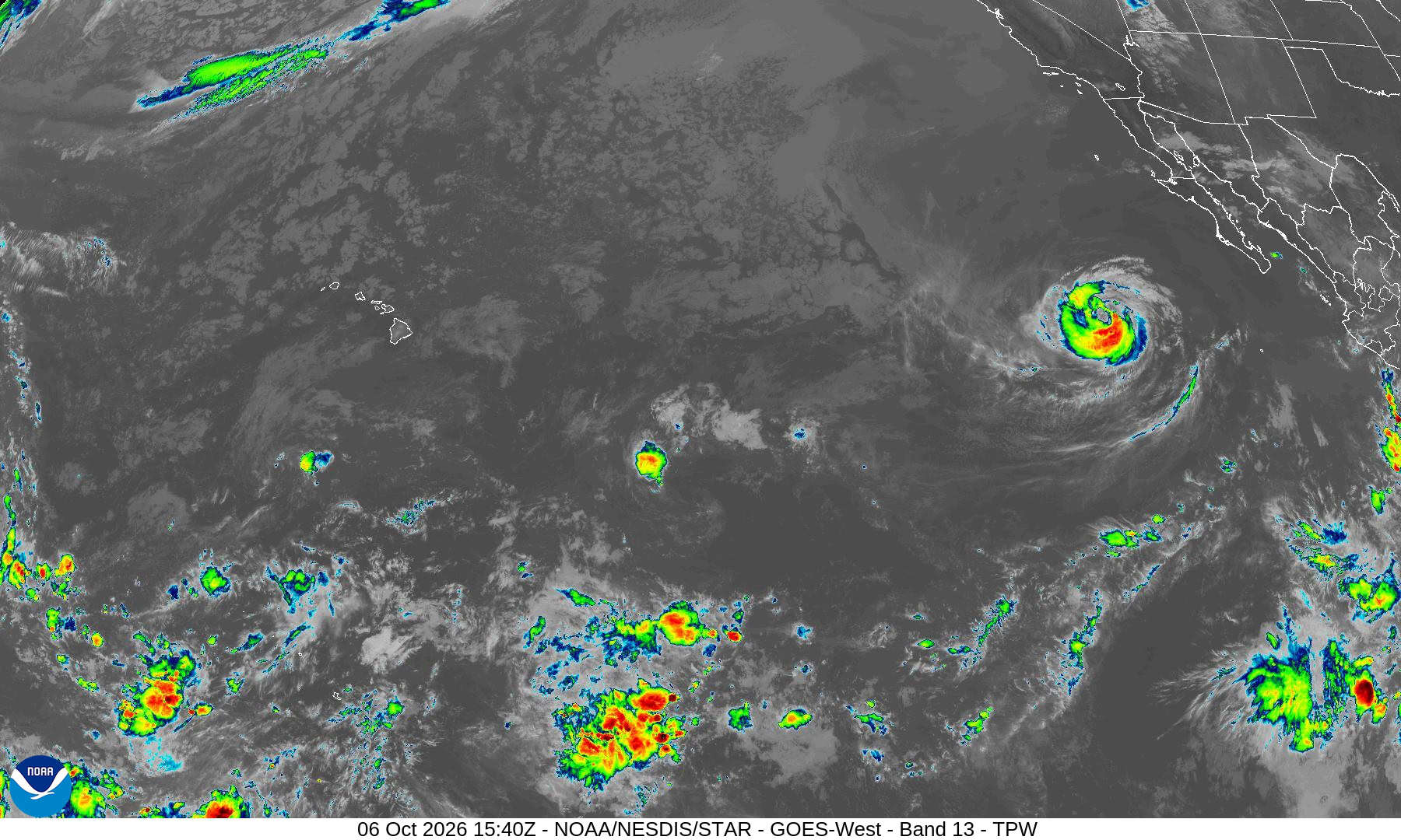
Tropical Cyclone 18E (Rachel) is located about 640 miles west-southwest of the southern tip of Baja CA
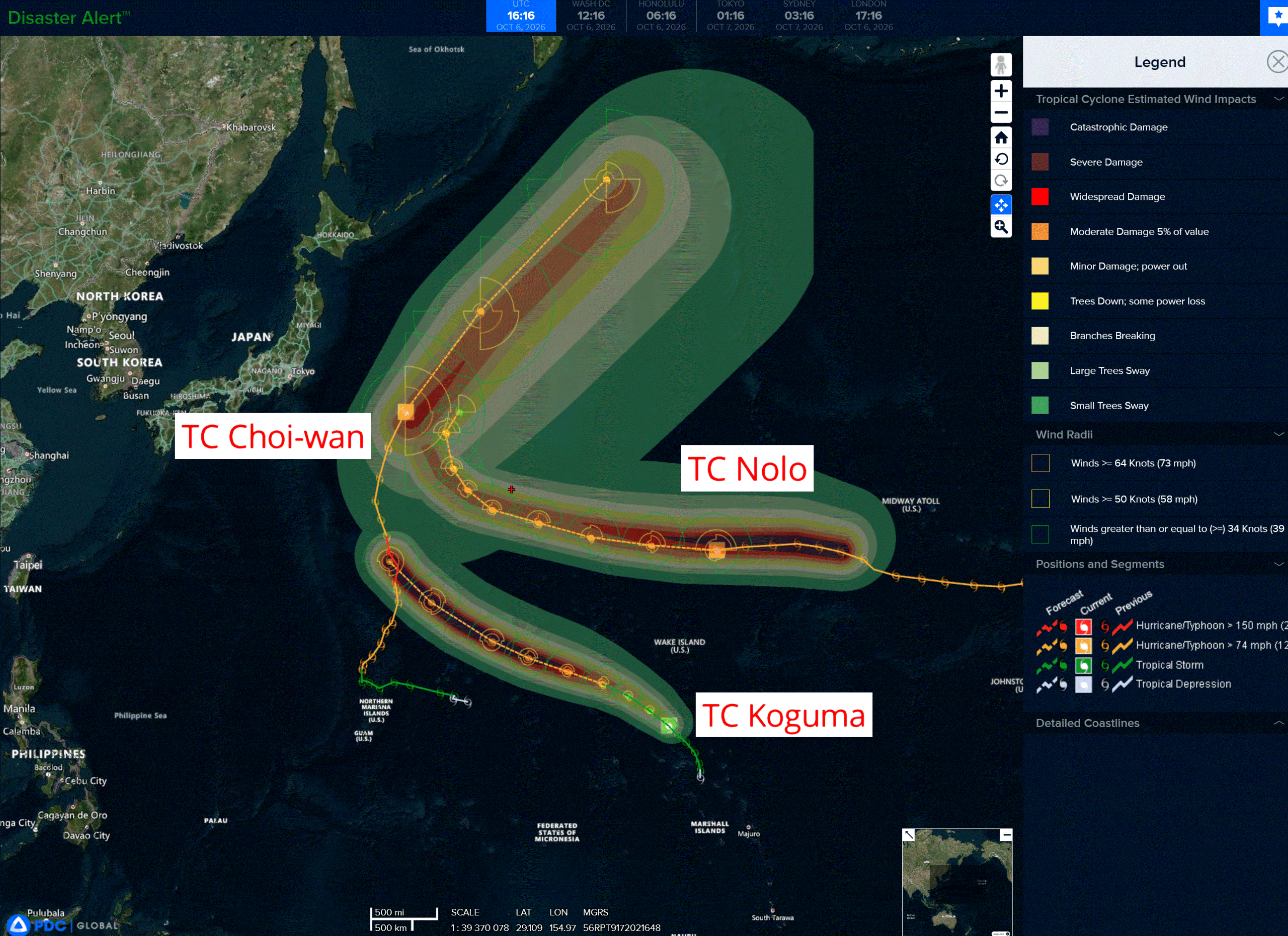
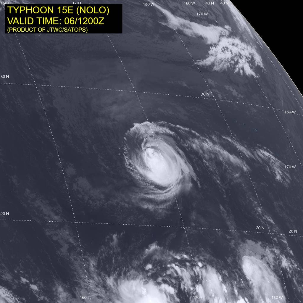
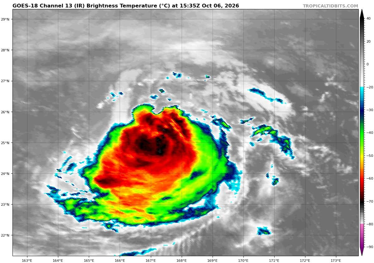
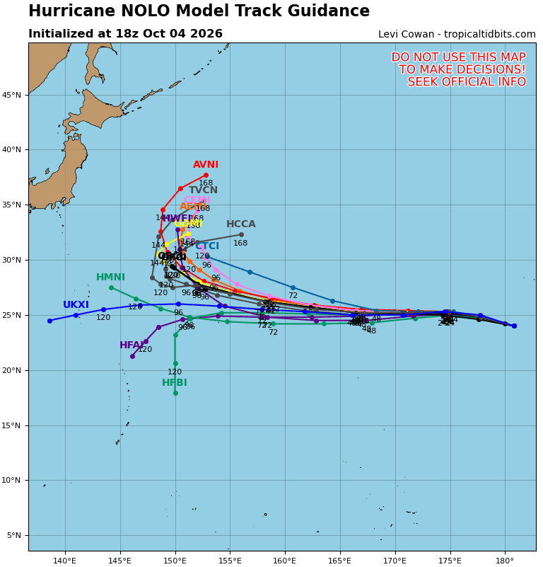
Tropical Cyclone 15E (Nolo) is located about 391 miles north-northeast of Wake Island
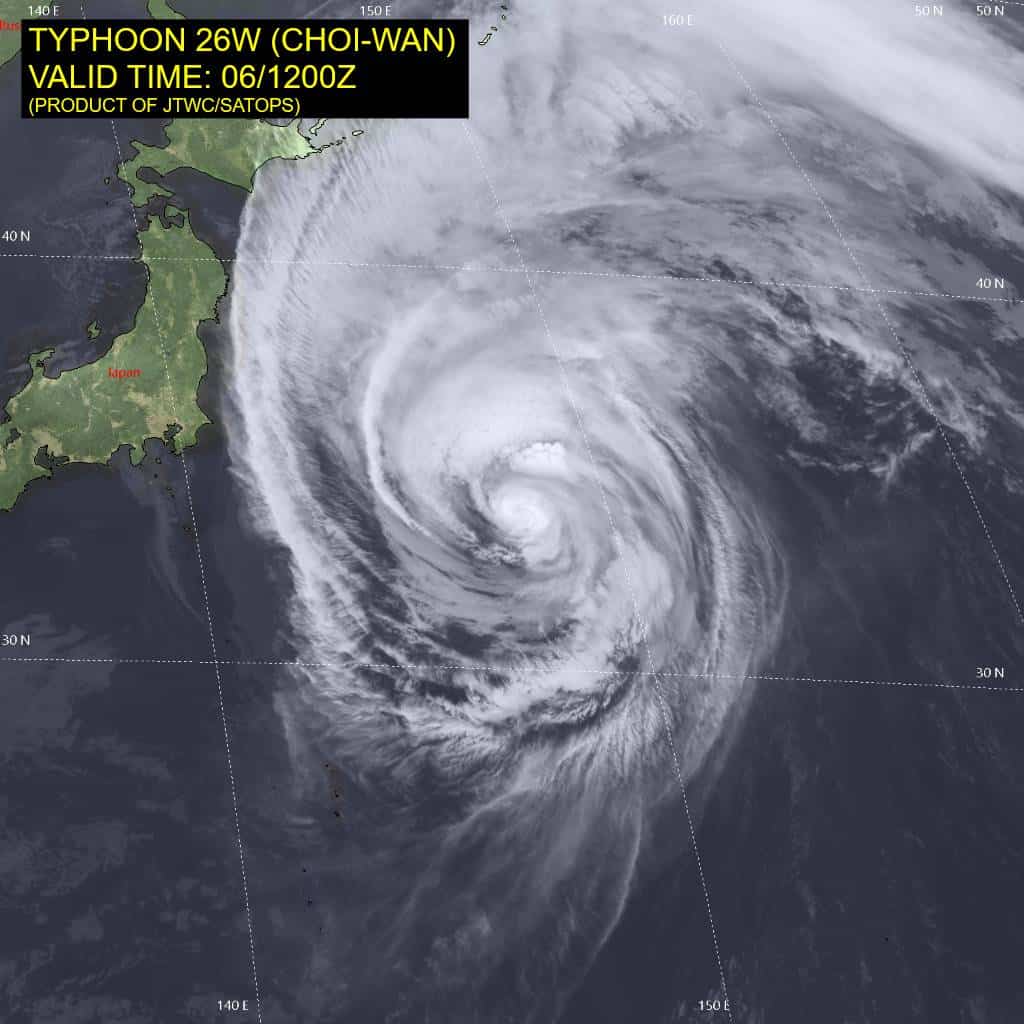
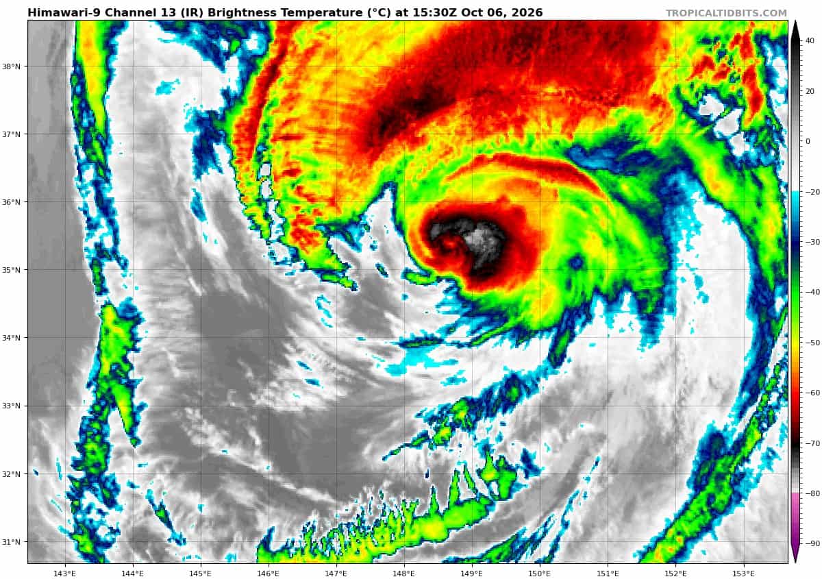
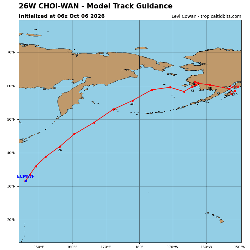
Tropical Cyclone 26W (Choi-Wan) is located approximately 402 NM east-southeast of Yokosuka, Japan
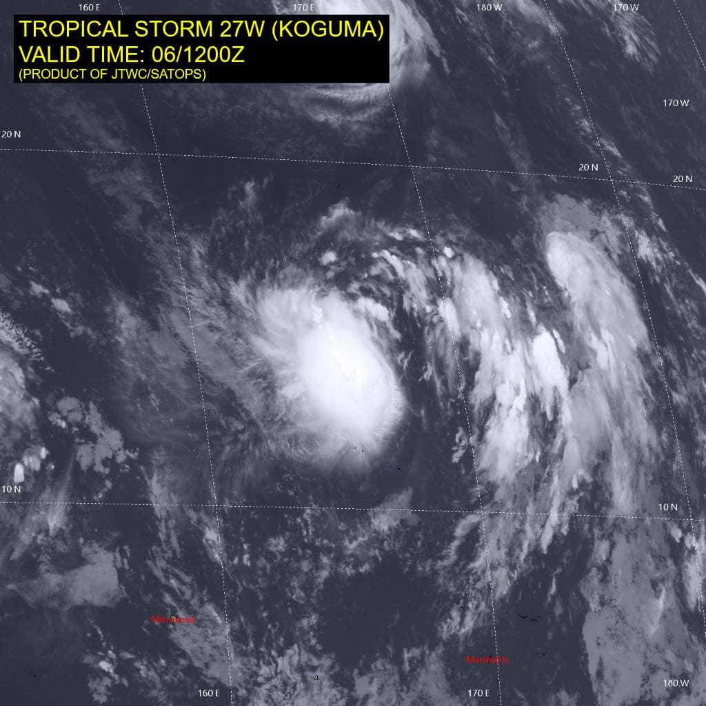
Tropical Cyclone 27W (Koguma) is located approximately 321 NM south of Wake Island
Northeast Pacific:
Tropical cyclone 18E (Rachel)
RACHEL CONTINUES TO MOVE WESTWARD
According to the NHC advisory number 38
Rachel is moving toward the west near 8 mph (13 km/h). A westward to west-northwestward motion is expected during the next few days, with a sharp northeastward turn late this week.
Maximum sustained winds are near 85 mph (140 km/h) with higher gusts. Some fluctuations in intensity are possible the next day or so, with gradual weakening is forecast the rest of the week.
Hurricane-force winds extend outward up to 35 miles (55 km) from the center and tropical-storm-force winds extend outward up to 140 miles (220 km). The estimated minimum central pressure is 977 mb (28.85 inches).
HAZARDS AFFECTING LAND
SURF: Swells generated by Rachel will continue to affect the coast of the Baja California Peninsula and portions of southern California for the next several days. These swells are likely to cause life-threatening surf and rip current conditions.
>>> South of Southern Mexico:
Invest 92E
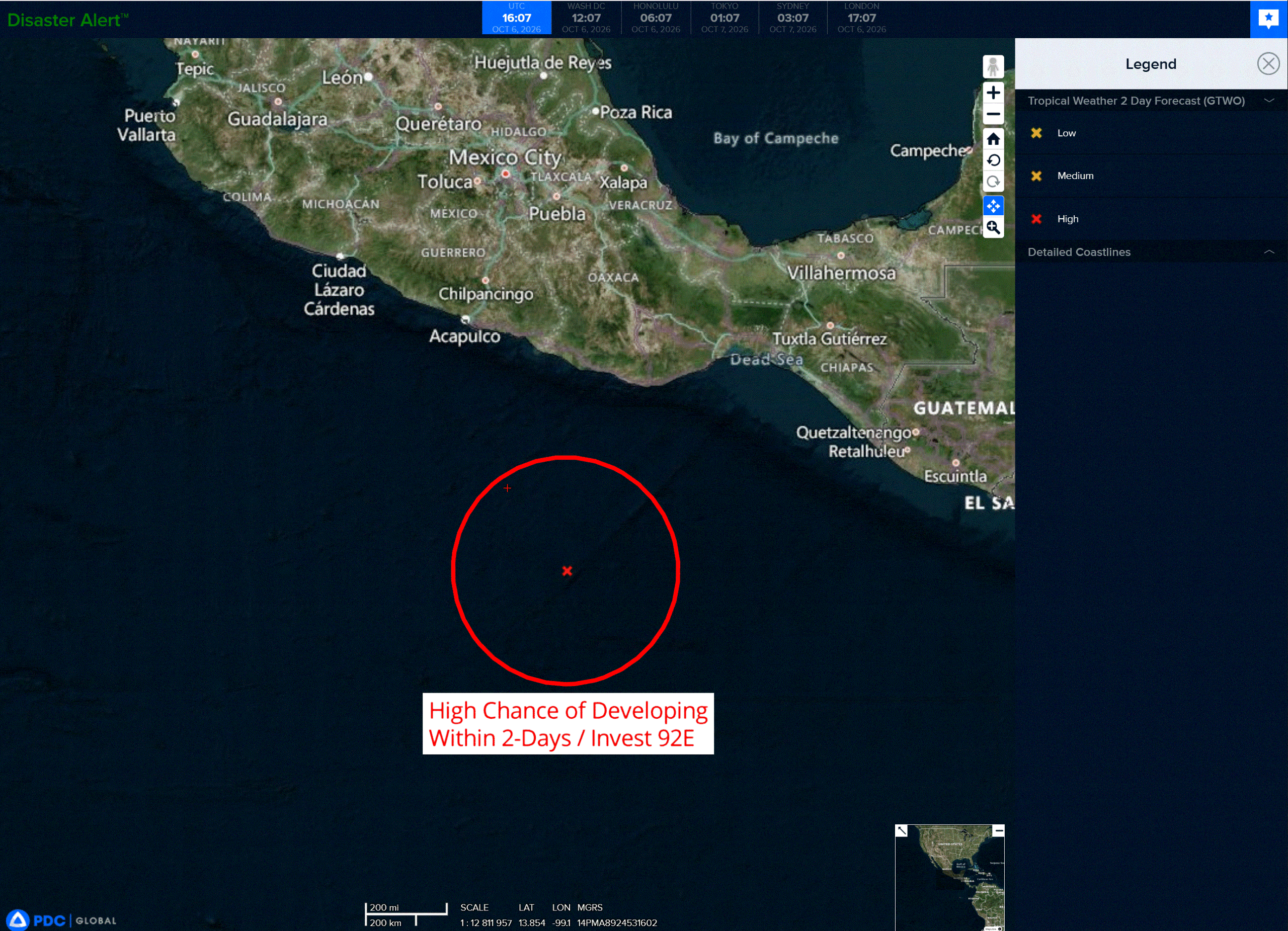
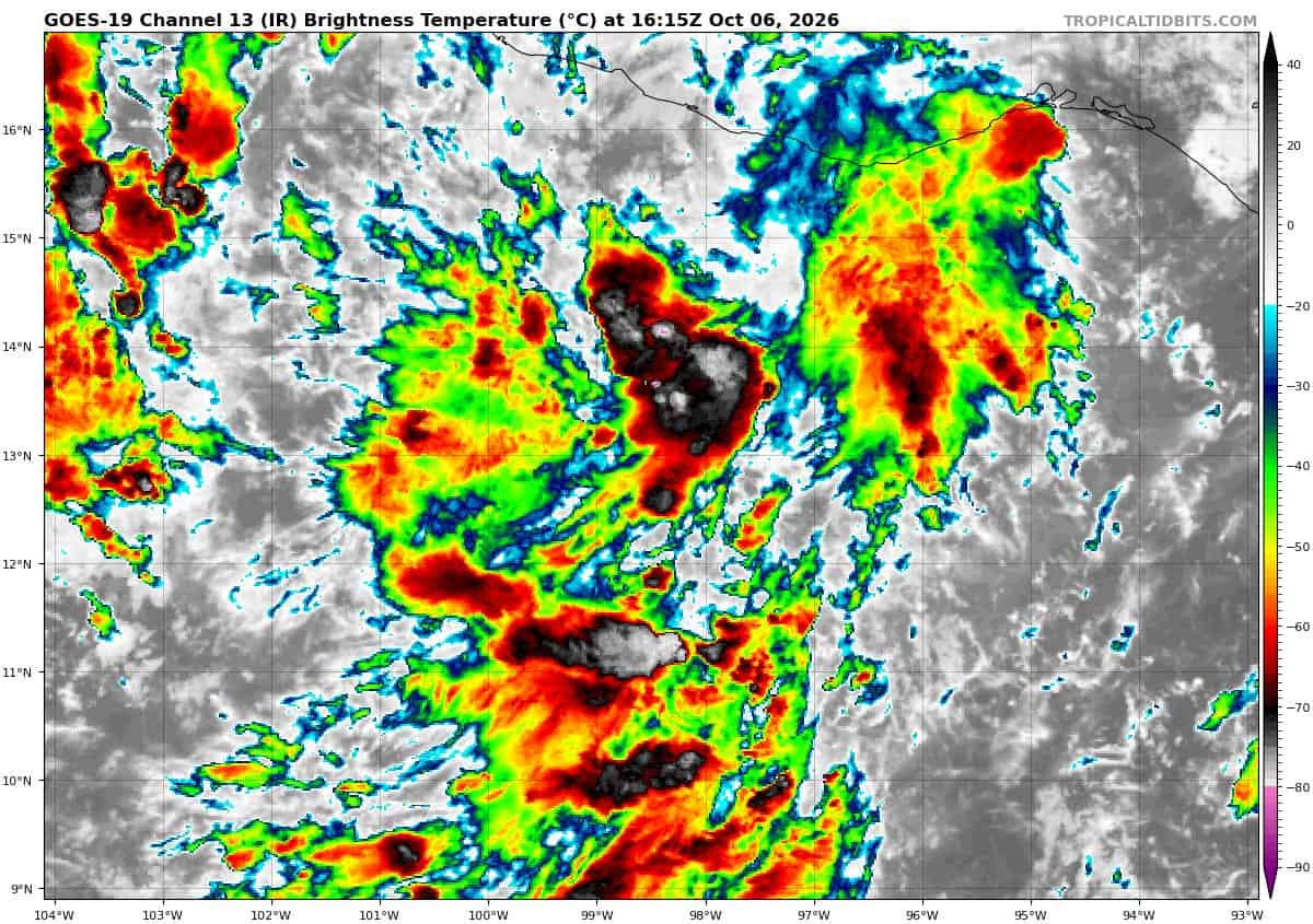
Shower and thunderstorm coverage has been increasing in association with a broad area of low pressure located offshore of southern Mexico.
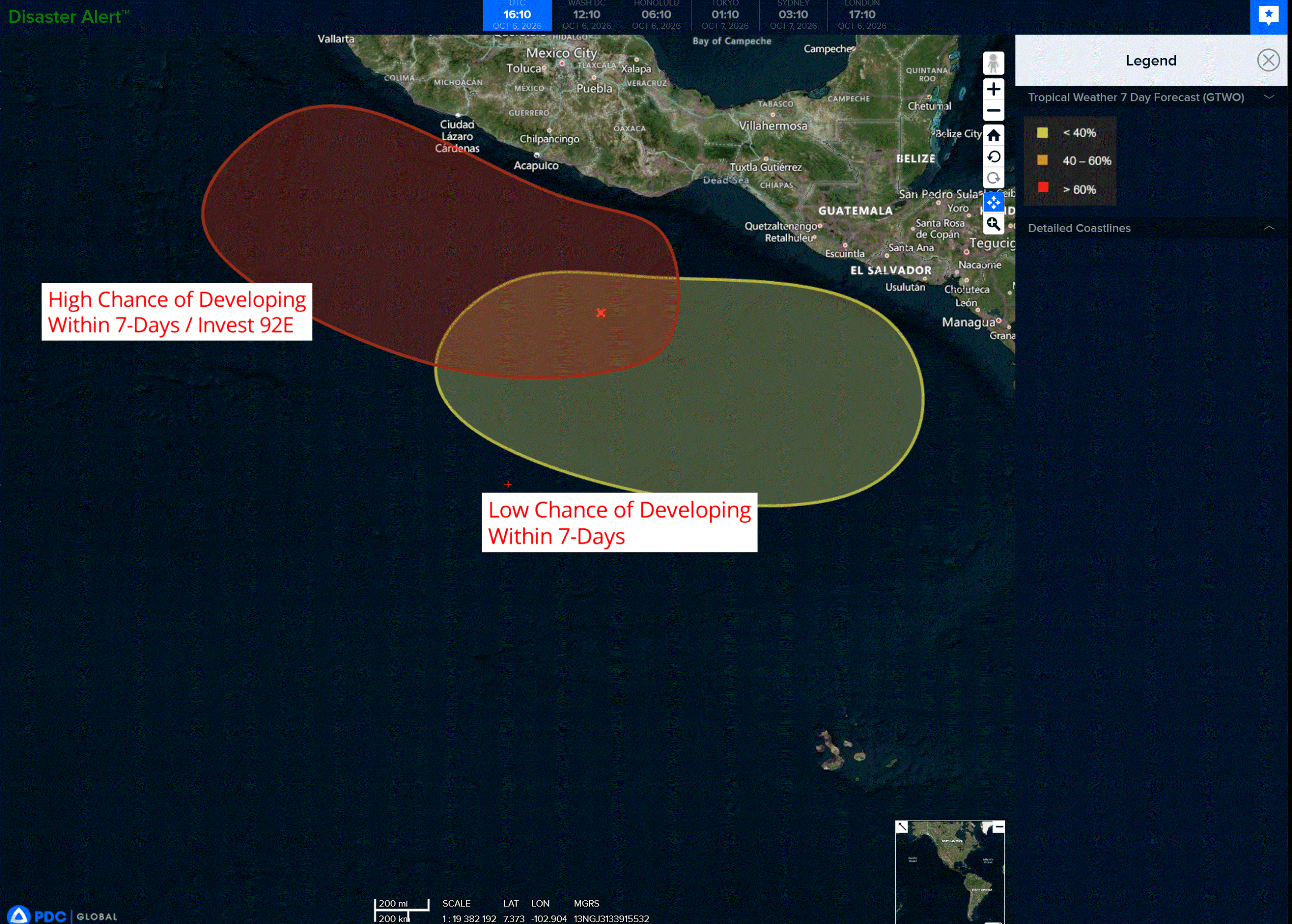
Environmental conditions appear favorable for gradual development, and a tropical depression is likely to form within the next day or two while the system moves slowly west-northwestward to northwestward.
Regardless of development, heavy rainfall is expected across portions of southern and southwestern Mexico over the next few days. Interests along the coast of southwestern Mexico should monitor the progress of this system.
* Formation chance through 48 hours…high…90 percent
* Formation chance through 7 days…high…90 percent
>>> South of Guatemala:
An area of low pressure is expected to form south of the coast of Guatemala early next week. Environmental conditions appear conducive for some gradual development of this system thereafter while it moves generally west-northwestward around 10 mph.
* Formation chance through 48 hours…near…0 percent
* Formation chance through 7 days…low…20 percent
Central North Pacific: There are no Tropical Cyclones
Tropical cyclone formation is not expected during the next 7 days.
Western Pacific, Indian Ocean, and adjacent Seas:
Western Pacific
Tropical Cyclone 15E (Nolo)
According to the JTWC warning number 64…sustained winds were 100 knots with gusts to 125 knots
Animated enhanced infrared (eir) satellite imagery depicted the sudden and dramatic collapse of typhoon 15E’s central eye just a few hours ago. Additionally, the poleward outflow channel is completely suppressed by the moderate to high (20-25 kts) northerly vertical wind shear (vws). The equatorward outflow channel remains available, but increasingly weak. The 061015z ascat data reveals a tight inner core with an asymmetric wind field. A thin band of storm- and typhoon-force winds is present along the southwestern
semicircle, contrasted by the expansive range of elevated winds within the northeast semicircle.
Environmental analysis reveals a marginally unfavorable environment, characterized by moderate to high vws, significant dry air entrainment, marginal (0-20 kj per cm squared) ocean heat content (ohc), and poor outflow, offset slightly by warm (27-28 c) sea surface temperatures (sst).
TY 15E (Nolo) is forecast to continue tracking westward to west-northwestward while it remains on the equatorward periphery of the str centered to the northeast. Beginning around 48 hours, 15E will turn poleward into a weak steering environment created by a break between the robust steering str and a building low- to mid-level ridge centered over Japan. During this period, 15E is forecast to slow its translational speed. Ultimately, 15E is forecast to drift poleward and recurve about the steering ridge
through the remainder of the forecast period. Transition into an extratropical cyclone will begin no later than 120 hours.
Regarding intensity, 15E is forecast to steadily weaken through 36-48 hours as the environment remains marginally unfavorable. By about 48 hours, vws is expected to abate slightly, concurrent with the poleward outflow channel strengthening as the storm enters the weakness between ridges. As a result, 15E is anticipated to re-intensify slightly between 60-72 hours. After 72 hours, vws is expected to increase, stifling the poleward outflow channel and forcing excessive amounts of dry air into the core.
The environment will continue to deteriorate as Nolo tracks poleward, along with the weak outflow, vws, and dry air, it is expected to cross the 26c isotherm around 96 hours. between 96-120 hours, 15E is forecast to begin interaction with the upper-level westerlies and enter the baroclinic zone, thus beginning extratropical
transition.
Tropical Cyclone 26W (Choi-wan)
According to the JTWC warning number 27…sustained winds were 80 knots with gusts to 100 knots
Animated enhanced infrared (eir) satellite imagery depicts a gradually degrading convective structure associated with Typhoon 26W. While the central dense overcast (cdo) and cloud-filled eye remain evident, cloud top temperatures surrounding the core continue to warm, and the convective structure over the southwest quadrant is beginning to erode. A 061010z gmi pass revealed anintact lower-level eyewall, while indicating weakening in the southern portion of the upper-level eyewall.
The environment is largely unfavorable as the system crosses the 26-degree celsiusisotherm into progressively cooler waters and encounters high vertical wind shear (vws). These detrimental conditions outweigh the favorable influence of strong poleward outflow aloft.
TY 26W is now racing northeastward at 23 kts along the northwestern periphery of the str. The system will
continue to accelerate northeastward through 24 hours as it becomes increasingly embedded in strong deep-layer westerly flow. The environment will become increasingly hostile to the tropical cyclone, with vws increasing to 40-50 kts and sst decreasing to 14-16 degrees celsius by 24 hours. These factors will continue to erode the inner core, resulting in steady weakening.
Baroclinic forcing will also increase as TY 26W interacts with a mid-level trough ejecting eastward from Honshu and becomes coupled with the jet stream to the north. Therefore, TY 26W will rapidly complete
extratropical transition by 24 hours while maintaining typhoon-force winds. The expansive, potent wind field will produce very high seas.
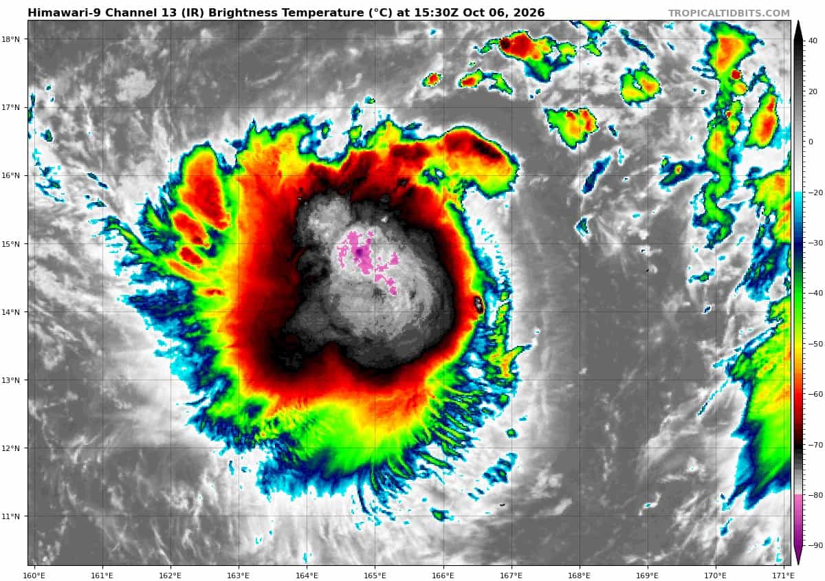
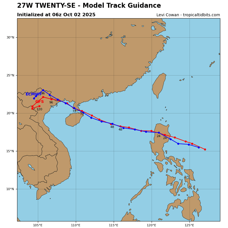
Tropical Cyclone 27W (Koguma)
According to the JTWC warning number 7…sustained winds were 45 knots with gusts to 55 knots
Animated enhanced infrared (eir) satellite imagery depicts a small central cold cover (ccc) completely obscuring the low-level circulation center (llcc). The burst of convection has persisted for at least six hours, and cloud top temperatures have been ascold as -92 degrees celsius. The ccc pattern is consistent with
arrested development, supporting the assessment that the intensity has remained nearly steady while the pattern persists. A 060649z wsf-m mwi pass indicated a vertically tilted vortex and a lack of a coherent inner core.
Despite traversing very warm sea surface temperatures (sst) near 30 degrees celsius and high ocean heat
content (ohc), TS 27W continues to contend with dry air wrapping into the circulation from the southwest and moderate vertical wind shear (vws) of near 20 kts.
TS 27W will continue on a northwestward trajectory through 12 hours, steered by the southern extension of the str. Thereafter, the system will turn west-northwestward as the mid-level ridge builds westward. Toward the end of the forecast period, a trough traveling eastward from Honshu will interact with typhoon 15E to create a weakness in the str, allowing TS 27W to turn northwestward on a more poleward track.
The evolution of the trough, TY 15E, and the str introduces significant uncertainty regarding the degree of the poleward turn late in the forecast period. The forecast calls for limited development through 12 hours
due to the ongoing ccc pattern, vws, and dry air entrainment.
Despite traversing very warm sst and high ohc, the system will intensify slowly through 36 hours as moderate vws persists. After 36 hours, easing shear will allow TS 27W to rapidly intensify to a peak of 110 kts by 72 hours. By 120 hours, the system will weaken slightly due to lower ohc. TS 27W has a compact circulation and is prone to significant fluctuations in intensity. If the vws eases sooner and TS 27W develops a coherent inner core more quickly, then rapid intensification (ri) could commence earlier and lead to a higher peak intensity than forecast.