Central north Pacific: There are no Tropical Cyclones



By PDC’s Senior Weather
Specialist Glenn James

The Pacific Disaster Center’s (PDC Global) Saturday, August 8, 2026, Tropical Cyclone Activity Report…for the Pacific Ocean, the Indian Ocean, and adjacent Seas
Current Tropical Cyclones:
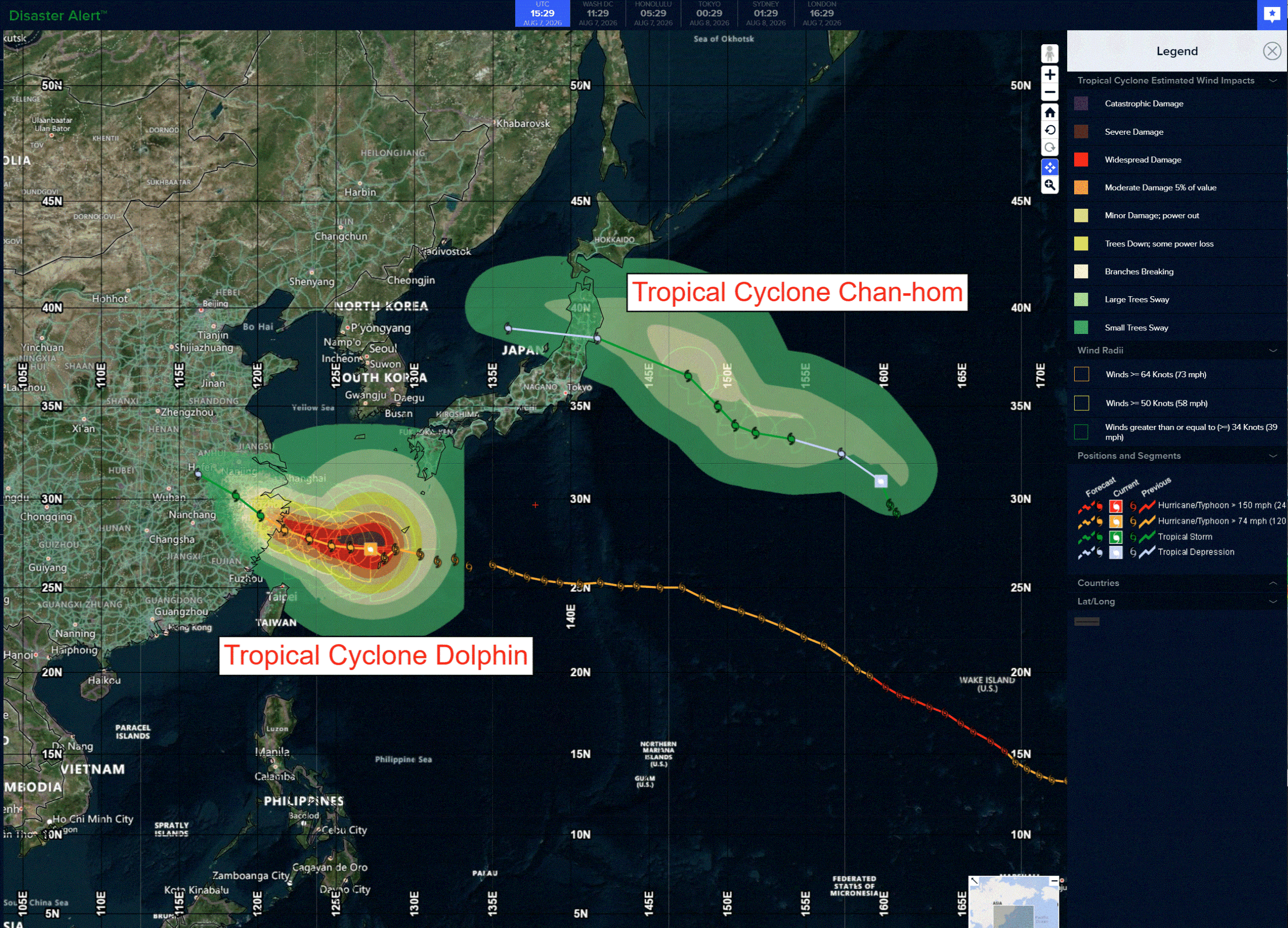
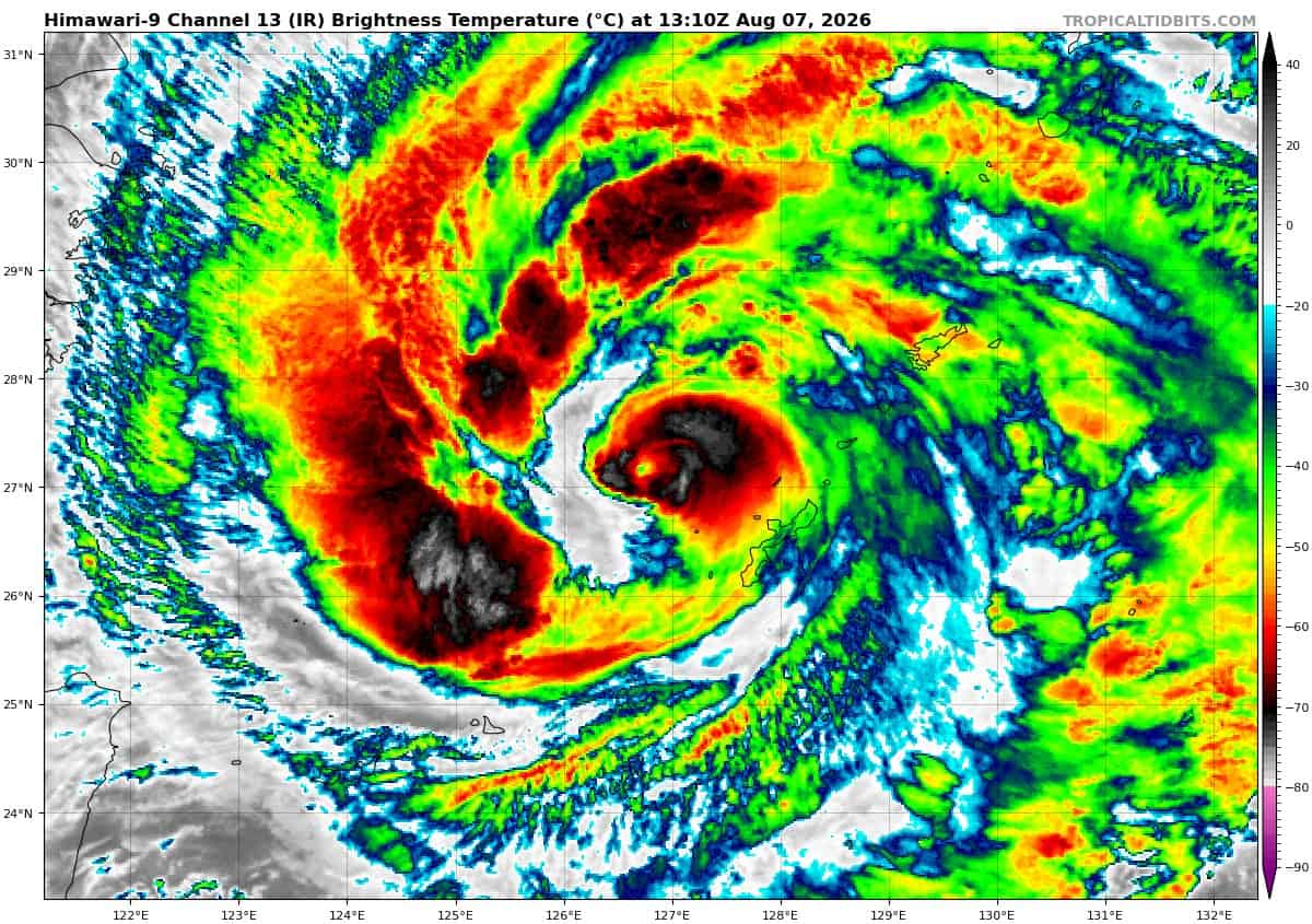
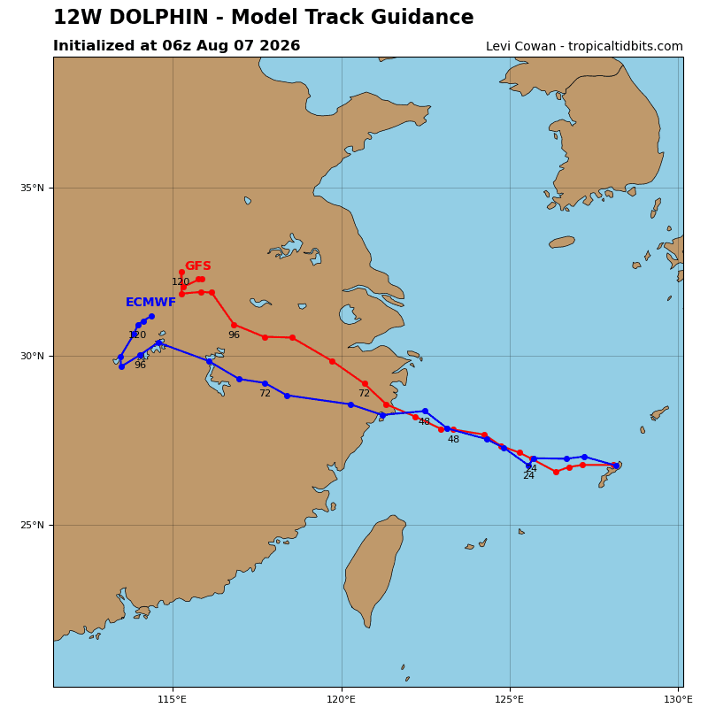
Tropical cyclone 12W (Dolphin)…is located approximately 101 NM west-northwest of Kadena AB
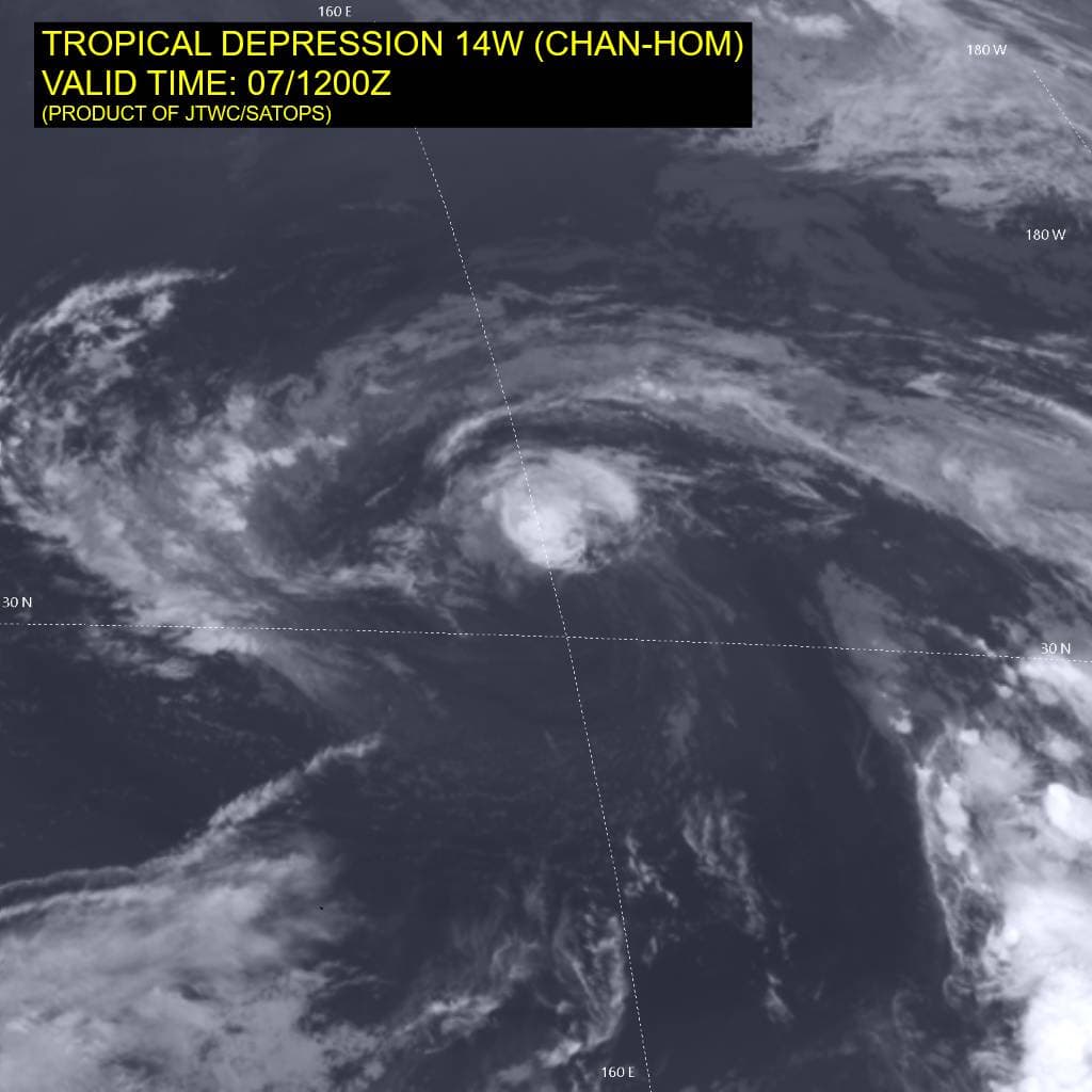
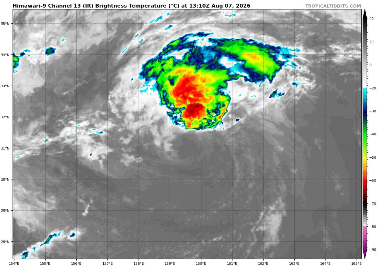
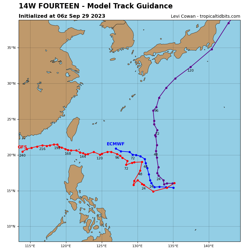
Tropical cyclone 14W (Chan-hom)…is located approximately 584 NM east of Yokosuka, Japan
Northeast Pacific: There are no Tropical Cyclones
>>> Western East Pacific and Central Pacific:
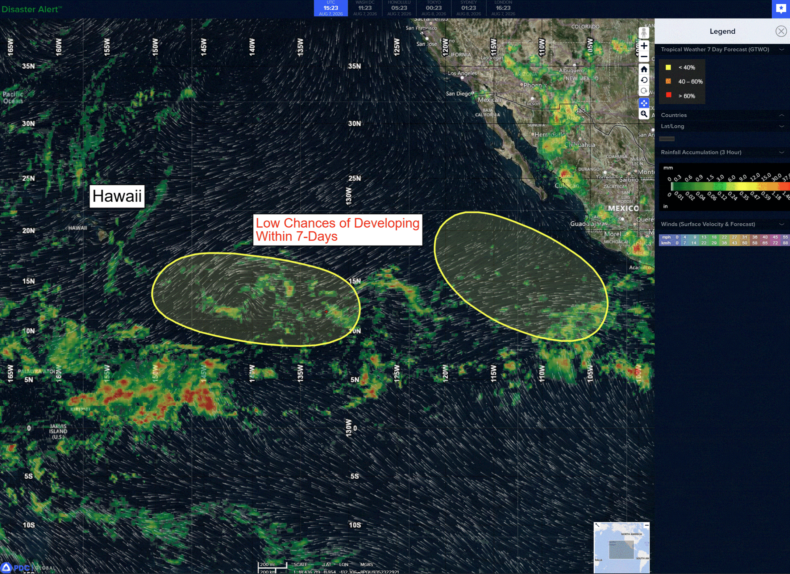
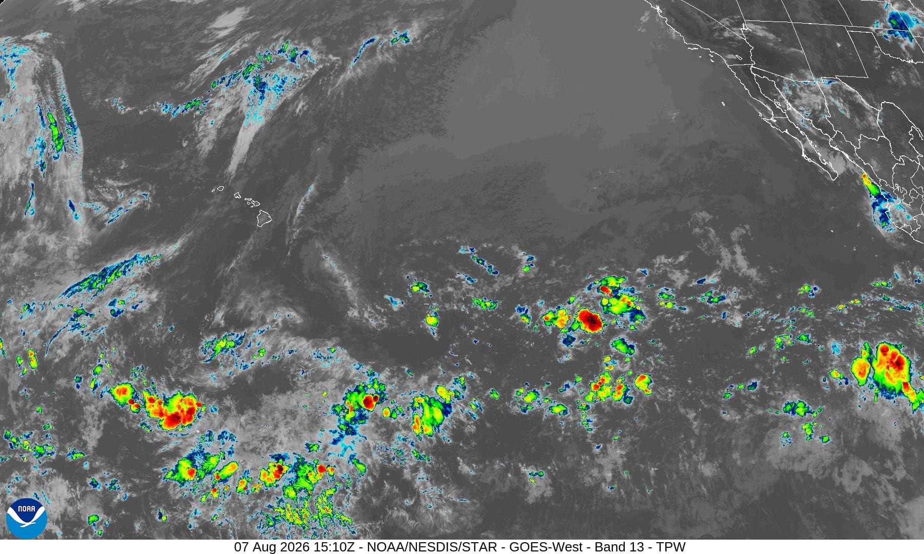
Showers and thunderstorms associated with a series of tropical waves were located over the western portion of the east Pacific. Environmental conditions appear conducive for gradual development of these showers and storms, and a tropical depression could form early next week as this system moves westward toward the central Pacific.
*Formation chance through 48 hours…low…near 0 percent
*Formation chance through 7 days…medium…40 percent
>>> Southwest of Mexico:
An area of low pressure could form well offshore of the southwestern coast of Mexico early or into the middle of next week. Some gradual development of this system is possible thereafter as it moves generally west-northwestward.
*Formation chance through 48 hours…low…near 0 percent
*Formation chance through 7 days…low…20 percent
Central north Pacific: There are no Tropical Cyclones
Western Pacific, Indian Ocean, and adjacent Seas:
Western Pacific
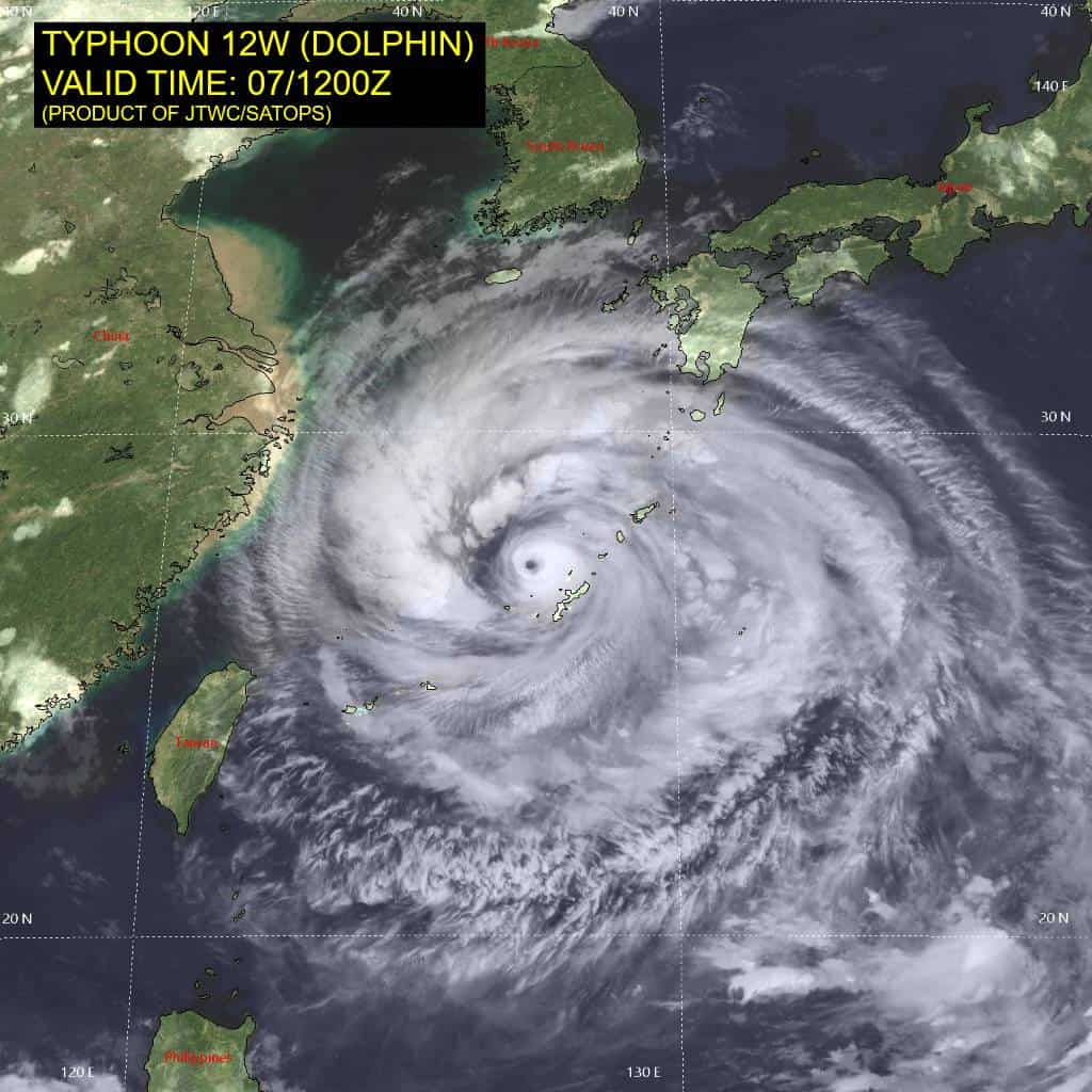
Tropical Cyclone 12W (Dolphin)
According to the JTWC warning number 49, sustained winds were 80 knots…with gusts to 100 knots
Animated enhanced infrared (eir) satellite imagery depicts typhoon (ty) 12W (Dolphin) with a ragged and filling eye. A prominent dry slot has formed along the western edge of the eyewall, eroding it along the western flank. The 070939z rcm-2 sar pass revealed the dry slot in animated satellite imagery is correlated to a region of significantly lower wind speeds. The sar data also confirmed that there is a band of 75-85 kt winds displaced about 80 NM north of the center, in addition to winds of comparable strength tightly surrounding the inner core.
The environment remains favorable, characterized by low (0-5 kts) vertical wind shear (vws), warm (29-30 kts) sea surface temperatures (sst), and good outflow aloft.
TY 12W (Dolphin) is forecast to continue tracking generally westward to north-northward while it remains under the influence of the str centered over the Sea of Japan. The trough currently eroding the str is expected to pass by around 24 hours, allowing the now shallow str to reorient and build in the mid-levels to the northeast of the system, driving a gentle northwestward curve beginning around 24 hours. Landfall in China isexpected around 48 hours.
Regarding intensity, 12W has maintained intensity while it remains over the warm pool of relatively higher ocean heat content (ohc) associated with the Kuroshio Current. Dolphin is expected to maintain this intensity approximately for the next 12 hours and exit the warmer ohc values around 24 hours. The lowering ohc values will contribute to slight weakening leading up to landfall. Dolphin is forecast to rapidly weaken over land and fully dissipate by 96 hours.
Tropical Cyclone 14W (Chan-hom)
According to the JTWC warning number 5, sustained winds were 35 knots…with gusts to 45 knots
Animated enhanced infrared (eir) satellite imagery depicts tropical depression (td) 14W (Chan-hom) as a bare and fully exposed low-level circulation center (llcc) completely devoid of convection save for a pitiful plume of central convection weakly rising from the llcc. Dry air continues to envelop the system, wrapping into the core from the south.
The 071058z ascat data reveals the system has weakened unexpectedly and the elevated winds that once wrapped around the western periphery of the system have dissipated. Tthe wind field remains highly asymmetric, with a vast swath of 25-30 kt winds extending the entirety of the northeastern semicircle. The southwestern semicircle is significantly weaker, with a large patch of 5-10 kts extending southwestward from the center.
Environmental analysis reveals an unfavorable environment characterized by moderate to high (20-25 kts) vertical wind shear (vws), marginally favorable (26-27 c) sea surface temperatures (sst), and weak poleward outflow.
TS 14W is forecast to continue tracking northwestward while it remains under the steering influence of the weak str centered to its northeast. Between 24-36 hours, a deep trough will weaken the ridge and induce a weaker steering environment. 14W is forecast to slow track speeds and turn poleward into the weakness in the ridge between 36-60 hours. Following the passage of the trough around 72 hours, the str will rebuild and drive 14W westward through 120 hours. Towards the end of the forecast period, a shallow str over the Sea of Japan will build and cause 14W to track due westward again between 96-120 hours.
Regarding intensity, 14W is expected to gradually intensify through 72 hours as the environment slowly becomes more favorable. VWS is expected to ease slightly by 24 hours and allow for slight intensification. However, by around 72 hours, ssts are expected to become unfavorable and induce weakening through the remainder of the forecast period. Dry air entrainment is anticipated to be persistent inhibitor to intensification throughout the forecast.
Additionally, 14W is expected to remain positioned in close proximity to an upper-level low through 120 hours. 14W is forecast to begin subtropical transition no later than 96 hours and be complete by 120 hours.
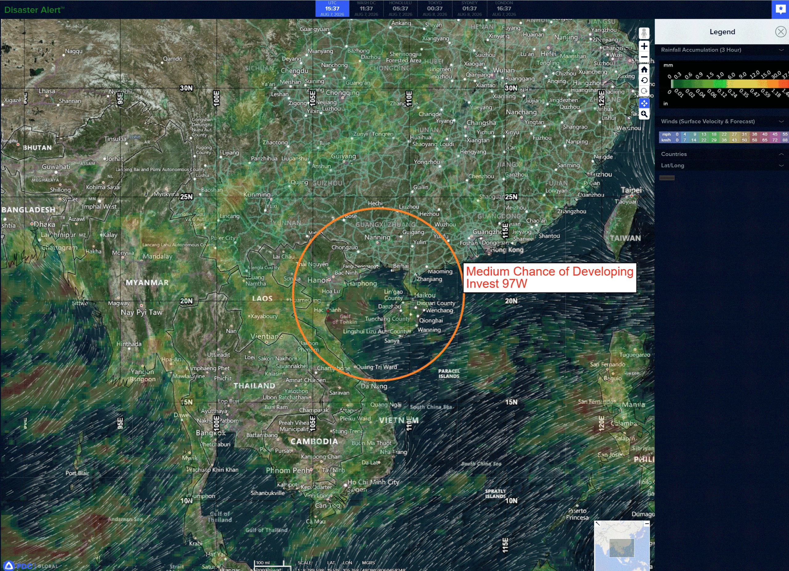
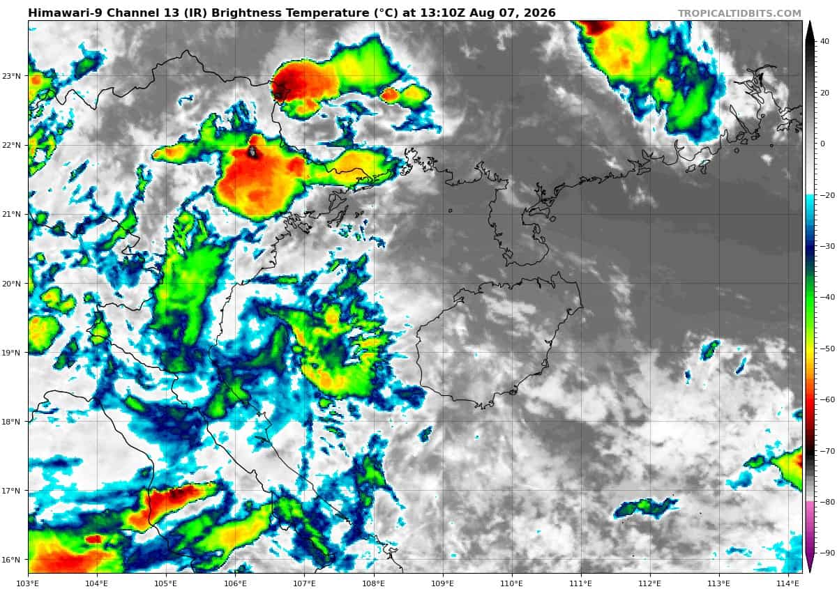
>>> There’s an area of disturbed weather that’s being referred to as Invest 97W, which is located approximately 34 NM east-southeast of Bach Longvi
Animated enhanced multi-spectral satellite imagery (msi) depicts persistent convection building over a low-level circulation center (llcc). a 061430z ascat-c image reveals a closed circulation with 15-20 knot winds along the northwest periphery. Only a slight improvement in structure would necessitate
the initiation of warnings.
The environmental analysis for the area indicates favorable conditions for development with low vertical wind shear (5-10 kts), good equatorward outflow aloft, and warm sea surface temperature aloft (29-30c).
While global deterministic models are not in support of development, global ensemble models show slight development over the next 6 hours.
Maximum sustained surface winds are estimated at 12 to 18 knots.
The potential for the development of a significant tropical cyclone within the next 24 hours remains medium
>>> There’s a second area of disturbed weather that’s being referred to as the Remnants of 13W which is located approximately 231 NM southwest of Iwo To
Animated multi-spectral satellite imagery (msi) depicts the remnants of 13W as a tropical wave placed within the southeastern periphery of the wind field of the much larger TY 12W (Dolphin). The low-level circulation center (llcc) is currently not well-defined at the surface and the convection is primarily located within the southern semicircle.
The environment is analyzed to be marginal with strong eastward outflow aloft, moderate to high (20-25 kts) northwesterly vertical wind shear, and warm (29-30 c) sea surface temperatures.
Numerical model guidance shows the remnant vorticity of 13W regenerating over the next 24-48 hours as it tracks eastward. The belt of strong low-level westerly winds to the south of the llcc will likely aid in the redevelopment of the circulation. There remains a chance that the system is unable to form a closed circulation and remains as a wave
feature as it tracks eastward.
Maximum sustained surface winds are estimated at 18 to 25 knots.
The potential for the development of a significant tropical cyclone within the next 24 hours is low.