Retiring Tropical Cyclone 02C (Moke) – Last Advisory
MOKE IS NO LONGER A TROPICAL CYCLONE
According to the NHC advisory number 20…





By PDC’s Senior Weather
Specialist Glenn James

The Pacific Disaster Center’s (PDC Global) Tuesday, August 25, 2026, Tropical Cyclone Activity Report…for the Pacific Ocean, the Indian Ocean, and adjacent Seas.
Tropical Cyclones
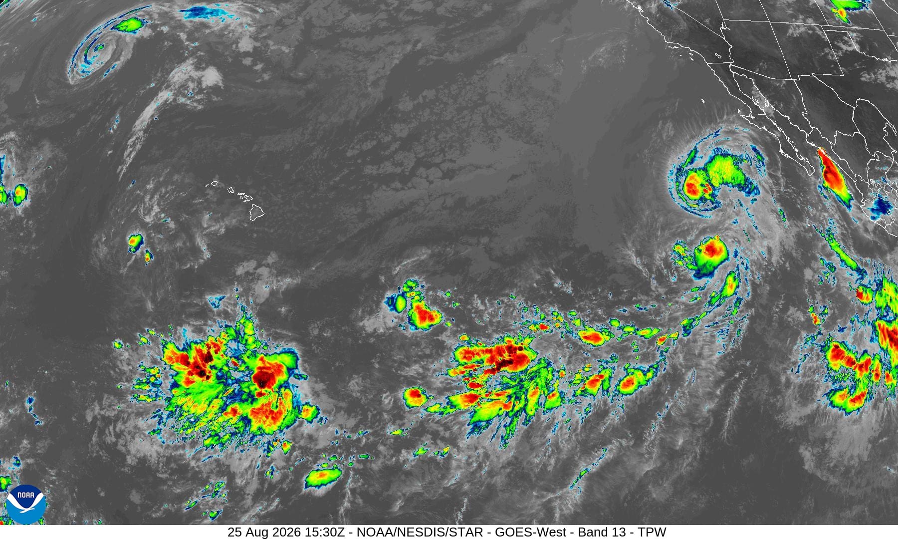
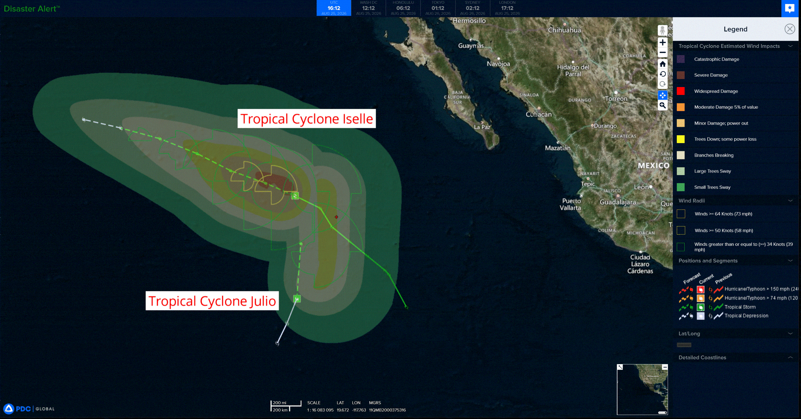
Tropical Cyclone 09E (Iselle) is located about 730 miles west of the southern tip of Baja California
Tropical Cyclone 10E (Julio) is located about 675 miles west-southwest of the southern tip of Baja California
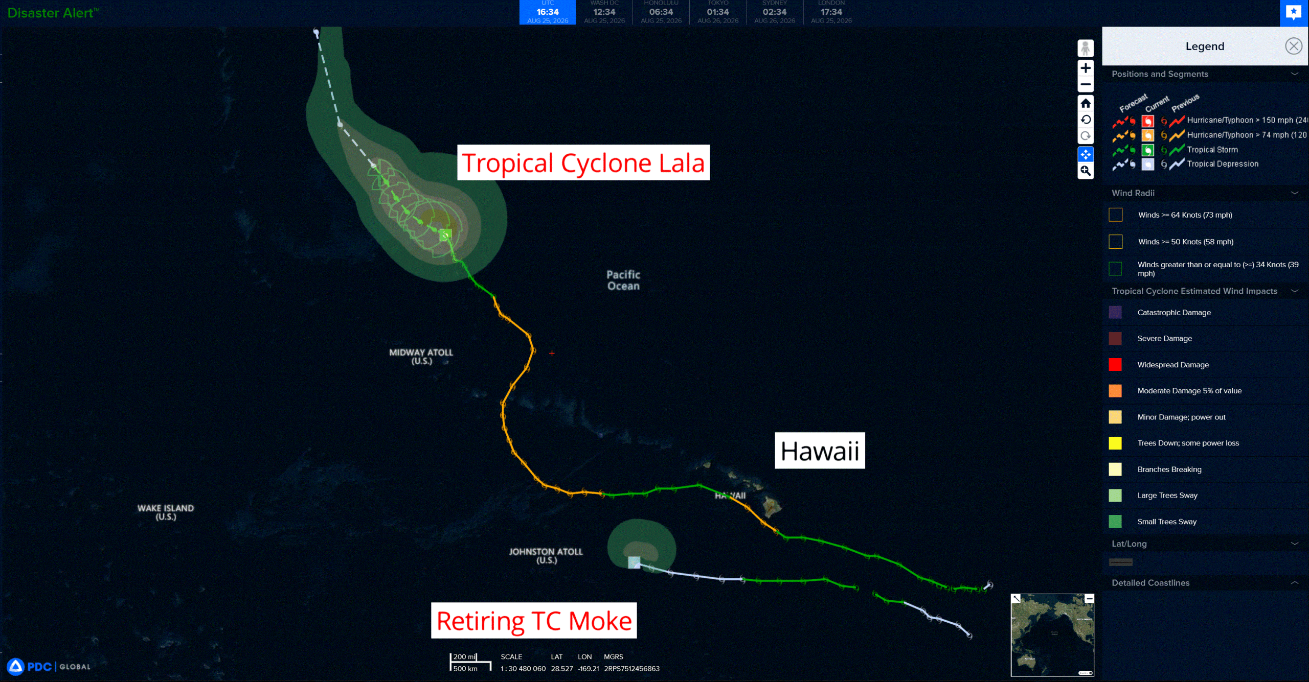
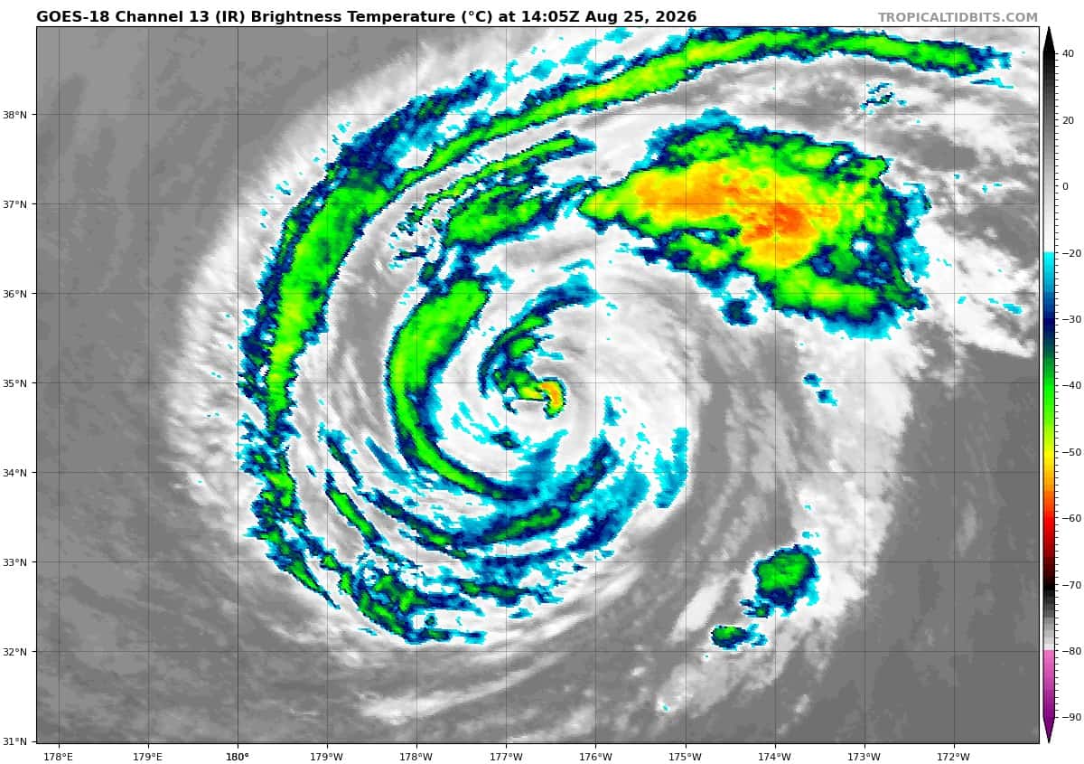
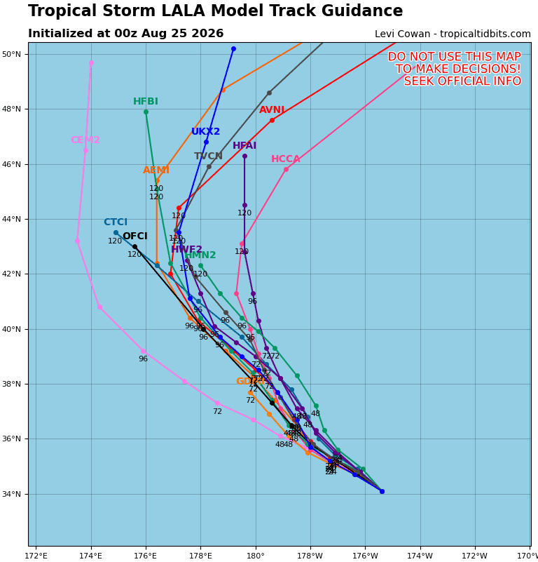
Tropical Cyclone 01C (Lala) is located about 460 miles north of Kure Atoll
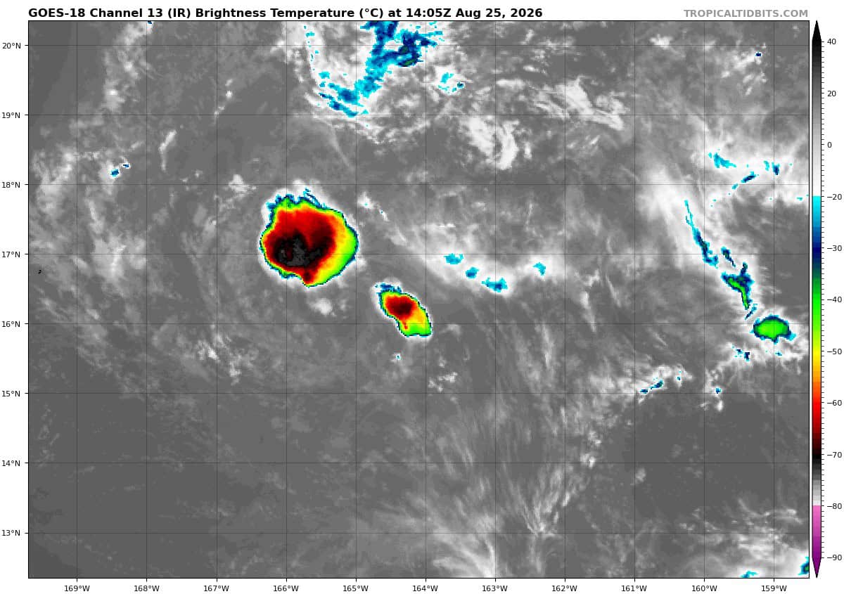
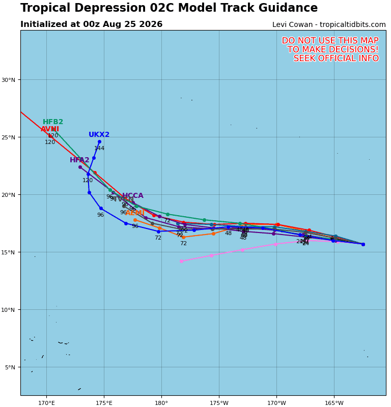
Retiring Tropical Cyclone 02C (Moke) is located about 360 miles east of Johnston Island – Last Advisory
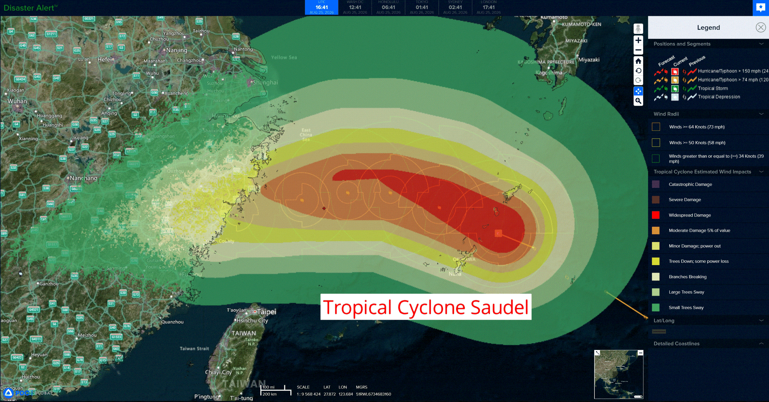
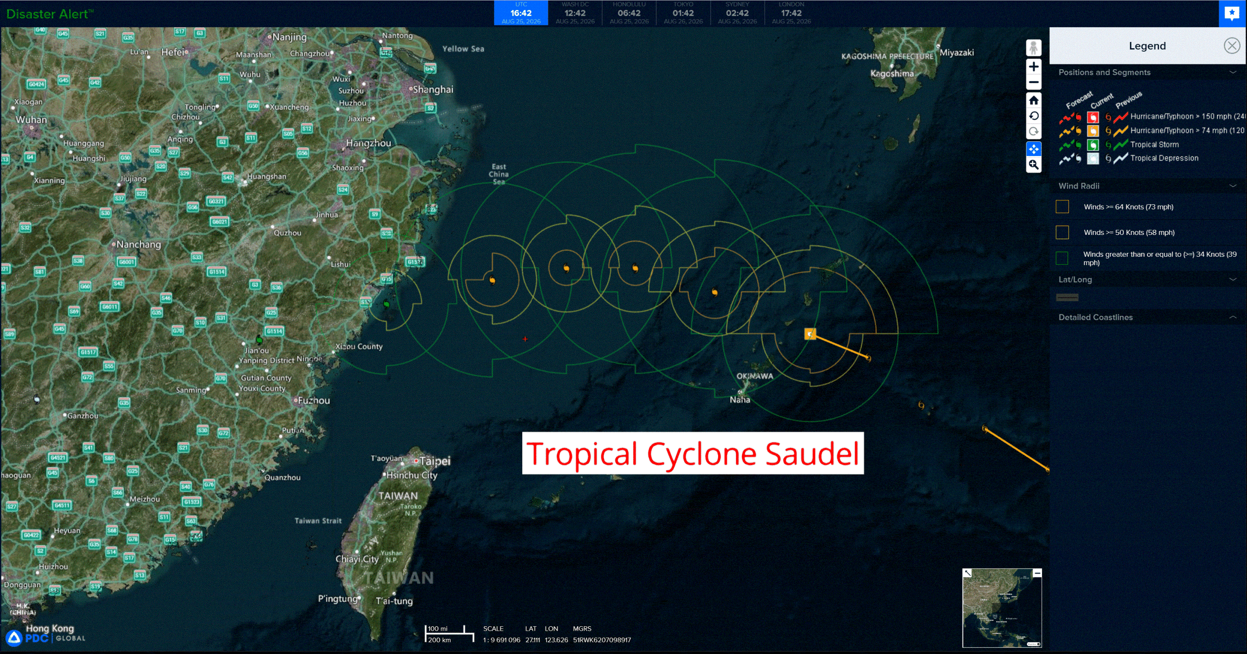
Tropical Cyclone 17W (Saudel)…is located approximately 77 NM east-southeast of Kadena AB
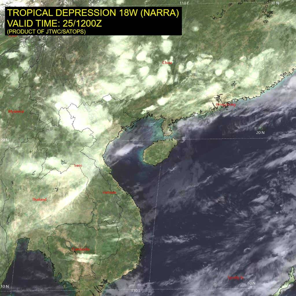
Tropical Cyclone 18W (Narra)…is located approximately 191 NM east-southeast of Hanoi, Vietnam
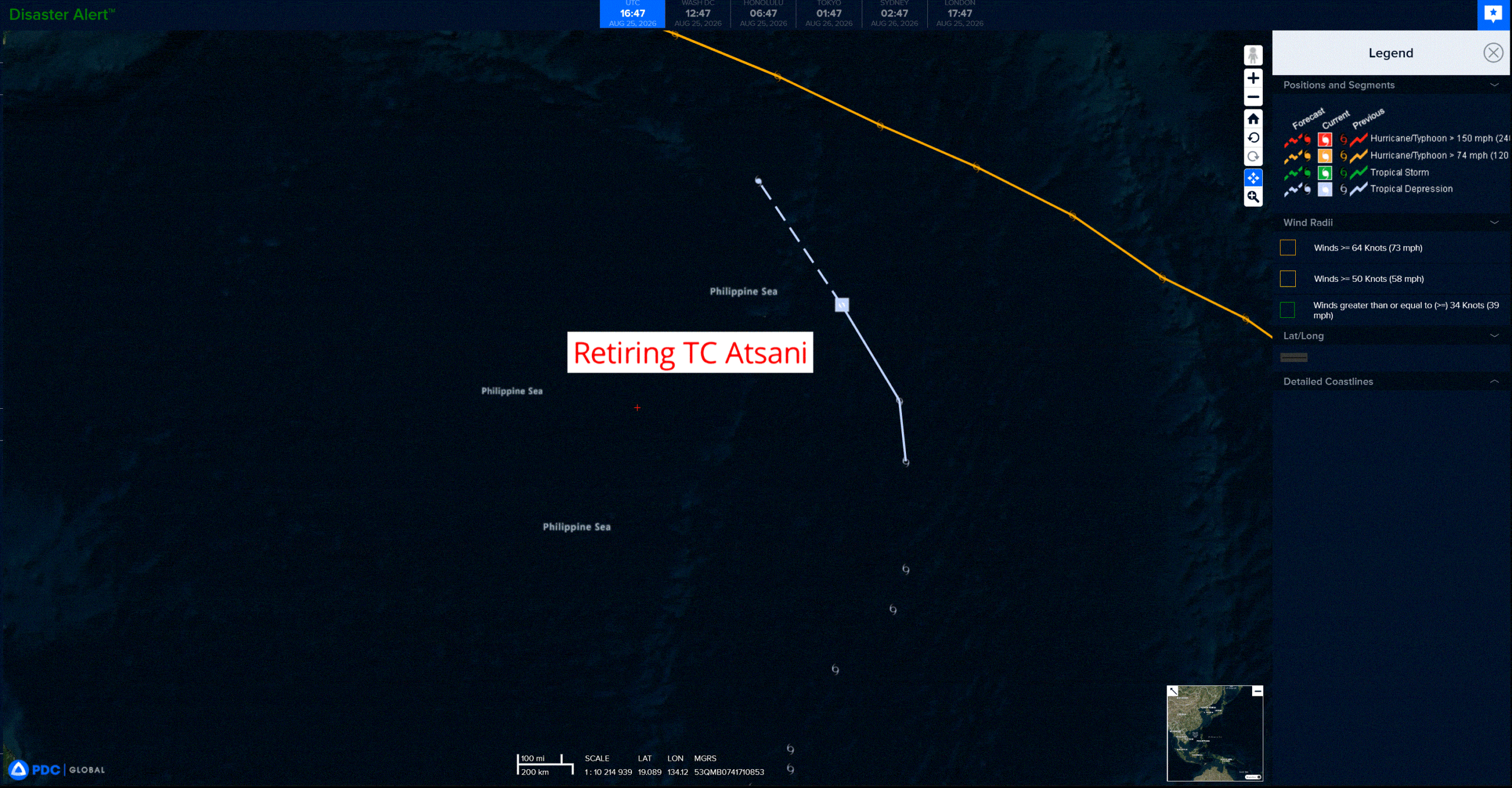
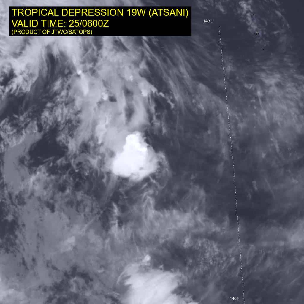
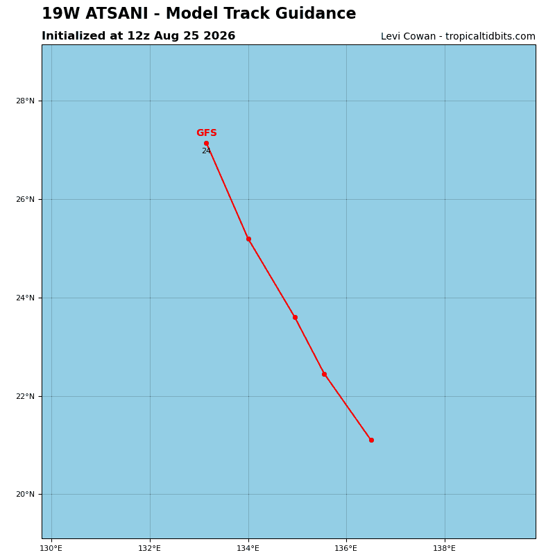
Retiring Tropical Cyclone 19W (Atsani)…is located approximately 335 NM southwest of Iwo-to – Final Warning
Northeast Pacific:
Tropical Cyclone 09E (Iselle)
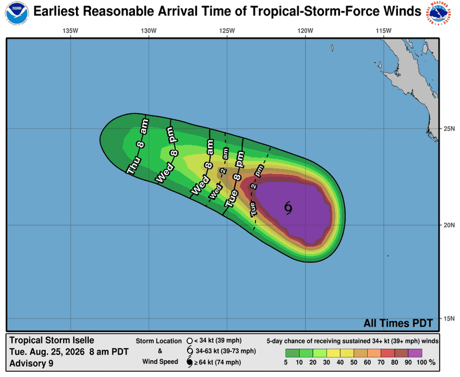
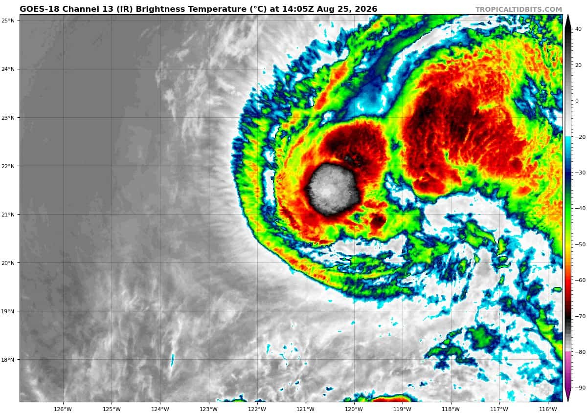
LARGE ISELLE FORECAST TO SLOWLY WEAKEN DURING THE NEXT FEW DAYS
According to the NHC advisory number 9…
Iselle is moving toward the west-northwest near 10 mph (17 km/h), and this general motion is expected for the next couple of days, with a turn towards the west possible on Thursday. Maximum sustained winds remain near 70 mph (110 km/h) with higher gusts. Slow weakening is forecast during the next few days. Tropical-storm-force winds extend outward up to 205 miles (335 km) from the center. The estimated minimum central pressure is 988 mb (29.18 inches).
HAZARDS AFFECTING LAND
SURF: Swells generated by Iselle are affecting the west coast of the Baja California Peninsula, and will continue for a couple more days. These swells are likely to cause life-threatening surf and rip current conditions.
Tropical Cyclone 10E (Julio)
JULIO A LITTLE STRONGER BUT SHOULD BECOME ABSORBED BY ISELLE LATER TODAY
According to the NHC advisory number 4…
Julio is moving toward the north-northeast near 22 mph (35 km/h). This general motion is expected to continue today. Maximum sustained winds are near 50 mph (85 km/h) with higher gusts. Little change in strength is forecast before Julio becomes absorbed by Tropical Storm Iselle later today. Tropical-storm-force winds extend outward up to 175 miles (280 km) from the center. The estimated minimum central pressure is 1001 mb (29.56 inches).
>>> Central East Pacific:
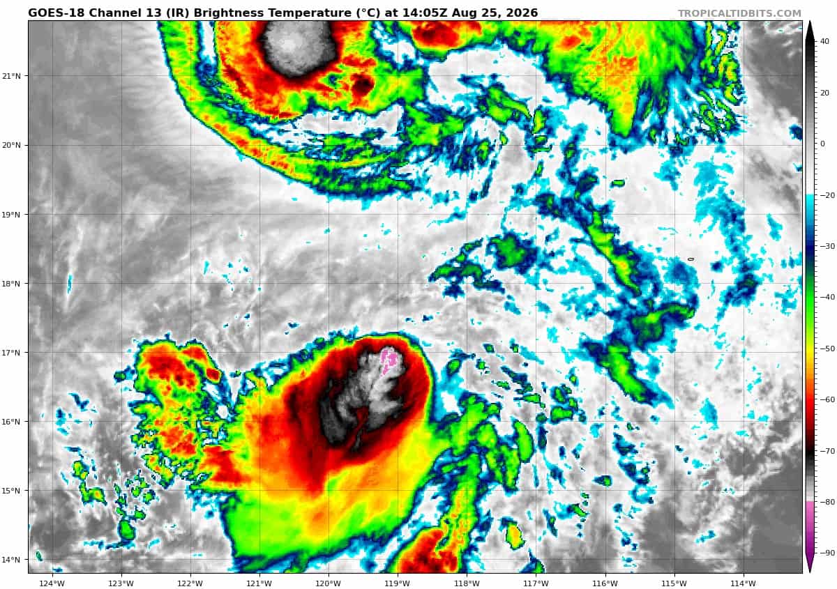
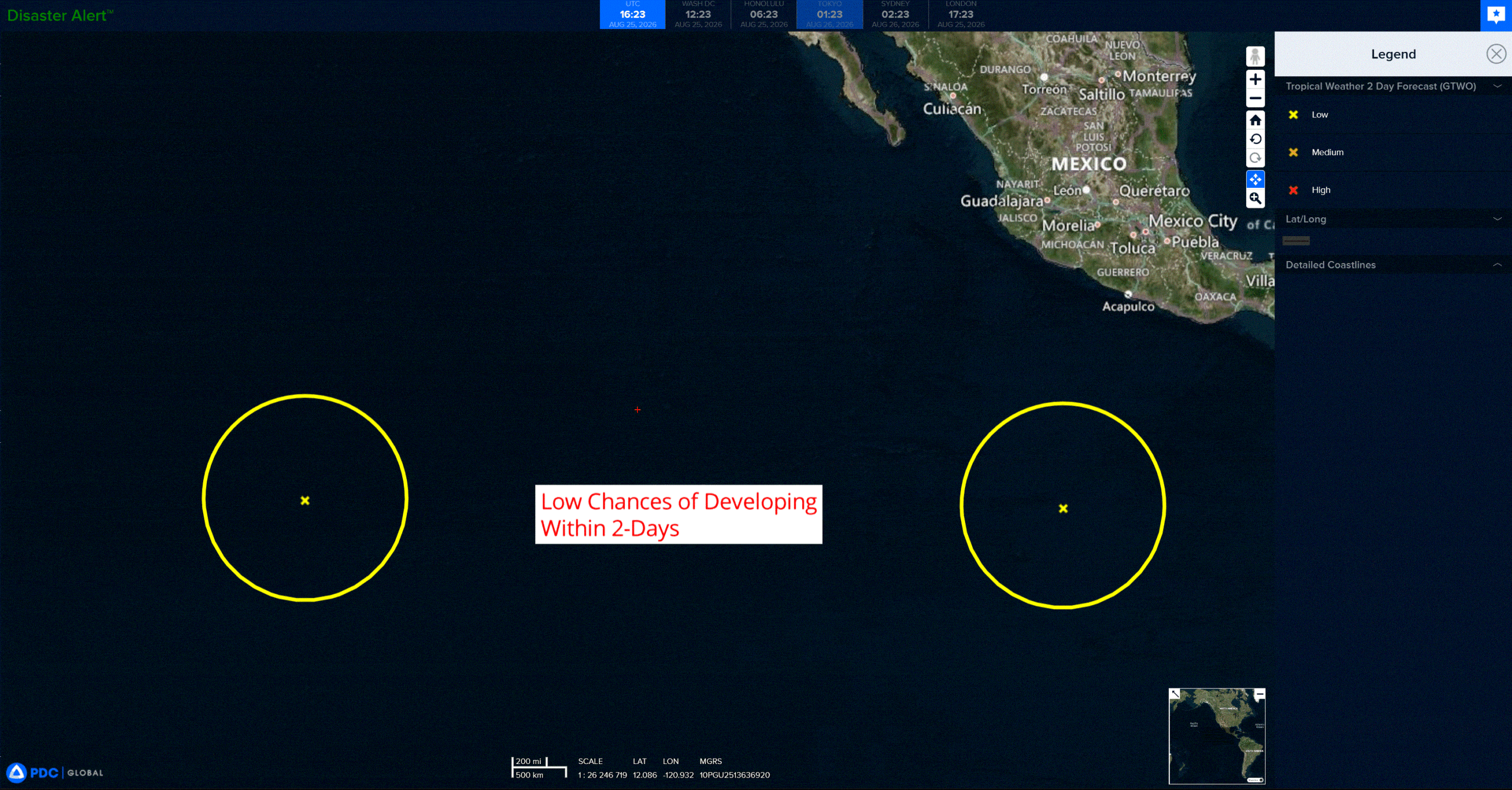
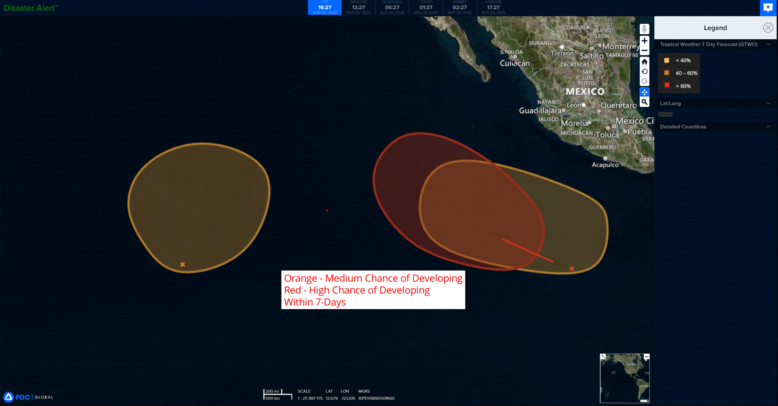
A tropical wave located well to the south of southern Mexico is producing a large area of disorganized showers and thunderstorms. Environmental conditions appear favorable for development of this system, and a tropical depression is expected to form in a few days while it moves generally west-northwestward at 10 to 15 mph, well offshore of Mexico.
* Formation chance through 48 hours…low…30 percent
* Formation chance through 7 days…high…90 percent
>>> Western East Pacific:
A trough of low pressure located well to the east-southeast of the Hawaiian Islands is producing some disorganized showers and thunderstorms. An area of low pressure is forecast to form along the trough during the next couple of days, and environmental conditions appear conducive for some gradual development thereafter. A tropical depression could form during the latter part of the week or early this weekend while the system drifts generally north-northeastward.
* Formation chance through 48 hours…low…30 percent
* Formation chance through 7 days…medium…60 percent
>>> Well offshore of Southern Mexico:
An area of low pressure could form well offshore of Central America late this week or this weekend. Environmental conditions could support some gradual development of this system, and a tropical depression could form late this weekend or early next week while it moves westward to west-northwestward at 10 to 15 mph well offshore of southern Mexico.
* Formation chance through 48 hours…low…near 0 percent
* Formation chance through 7 days…medium…40 percent
Central north Pacific:
Tropical Cyclone 01C (Lala)
LALA SHOWING LITTLE CHANGE
According to the NHC advisory number 53…
Lala is moving toward the west-northwest near 6 mph (9 km/h), and a slow west-northwestward to northwestward motion is expected for the next few days. Maximum sustained winds are near 50 mph (85 km/h) with higher gusts. Gradual weakening is expected during the next couple of days, and Lala is forecast to become a post-tropical cyclone on Thursday. Tropical-storm-force winds extend outward up to 125 miles (205 km) from the center. The estimated minimum central pressure is 994 mb (29.36 inches).
Retiring Tropical Cyclone 02C (Moke) – Last Advisory
MOKE IS NO LONGER A TROPICAL CYCLONE
According to the NHC advisory number 20…
The remnants are moving toward the west near 14 mph (22 km/h), and this motion is expected to continue today. Maximum sustained winds are near 35 mph (55 km/h) with higher gusts. The estimated minimum central pressure is 1006 mb (29.71 inches).
Western Pacific, Indian Ocean, and adjacent Seas:
Western Pacific
Tropical Cyclone 17W (Saudel)
According to the JTWC warning number 29…Sustained winds were 85 knots with gusts to 105 knots
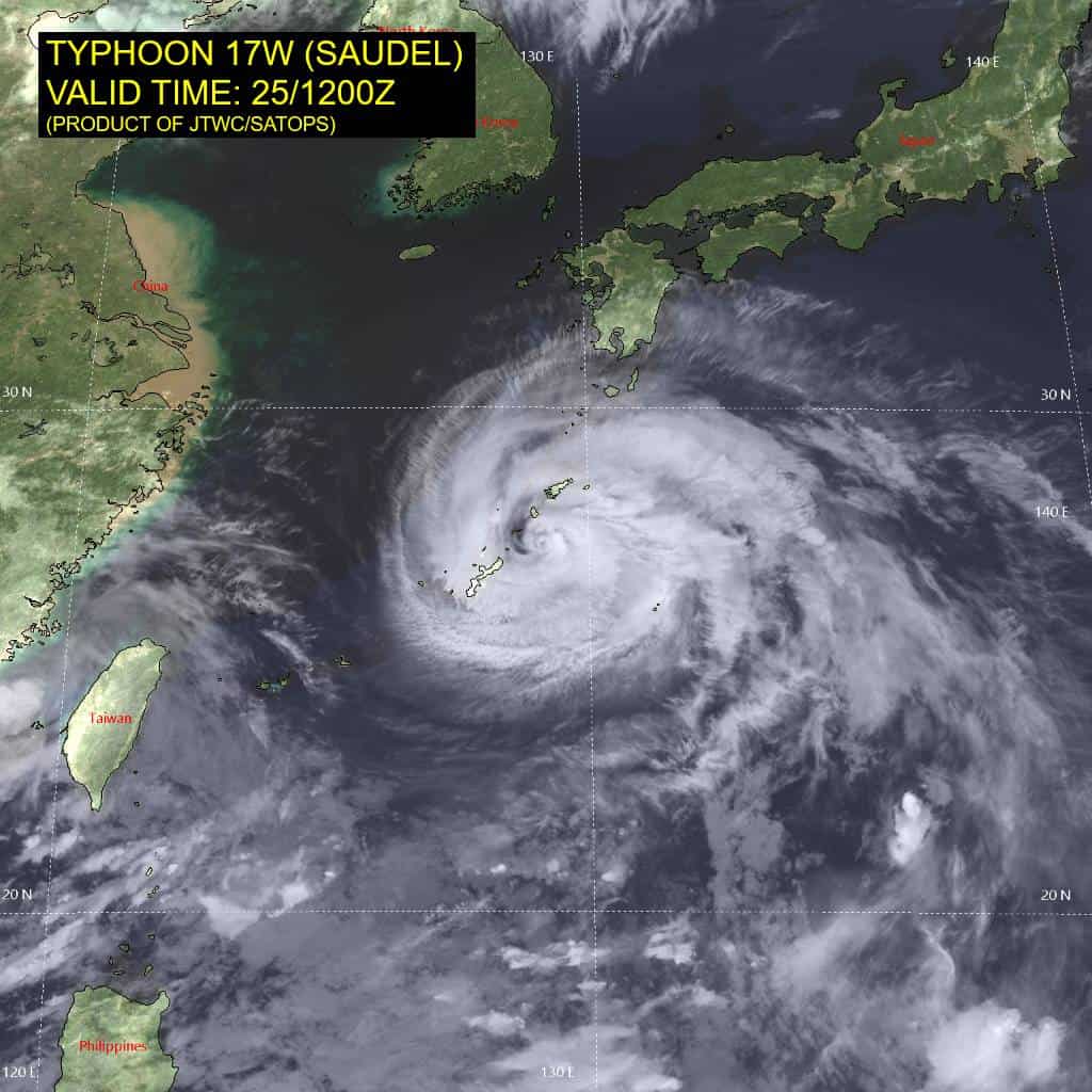
Typhoon (ty) 17w is currently making landfall over the Japanese Island of Okinoerabujima, where the sea level pressure has dropped to 965 mb at 251200z, accompanied by a sustained wind of 60 kts and a gust of 85 kts. It is probable that the maximum sustained winds are occurring within the channel between Okinoerabujima and
Tokunoshima.
Animated enhanced infrared (eir) satellite imagery depicts little change in structure, consisting of a compact central dense overcast flanked by extensive spiral bands. a persistent dry slot is wedged into the western semicircle as a result of 20-25 kts of northwesterly vertical wind shear (vws), entraining dry air into the vortex in the 500-300 mb layer. A 250914z wsf-m mwi 37 ghz image confirms this structural degradation, revealing that the
inner core is open on the southwestern side. This shear is offsetting any development potential offered by the warm sea surface temperatures (sst) of 28-29 degrees celsius.
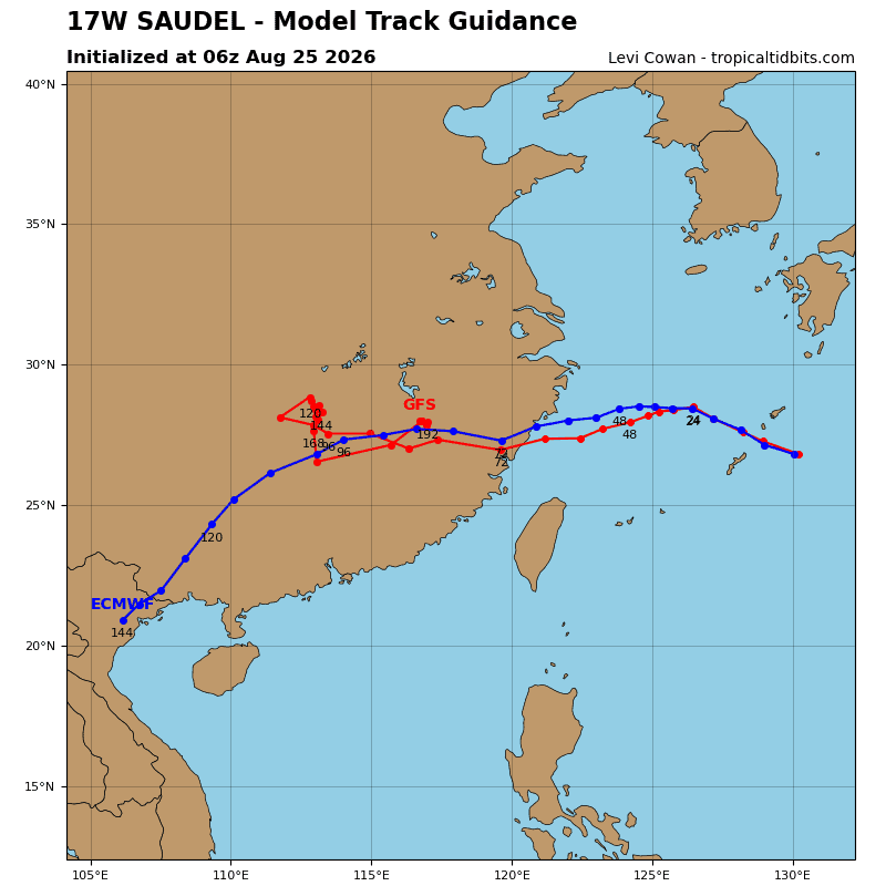
The westward migration of the str east of ty 17w will cease in the next 12 hours. This will allow the western
extension of the ridge to become the dominant steering mechanism, causing ty 17w to turn westward and decelerate from 11 kts to approximately 06 kts over the next 36 hours. From 36 to 96 hours, an anticyclone over the interior of China will take control, guiding the system on a west-southwestward trajectory with a faster motion toward landfall.
While warm ocean waters remain ahead of the storm, gradual weakening will take place through 24 hours. This will be driven by persistent, moderate-to-high vws, which is actively entraining dry air into the circulation. A brief reprieve in the shear between 24 and 36 hours will allow the intensity to level off. However, after this window, moderate-to-high vws will return. This, combined with increasing land interaction, will lead to a faster weakening trend. The system will rapidly deteriorate once over land, dissipating by 96 hours.
Tropical Cyclone 18W (Narra)
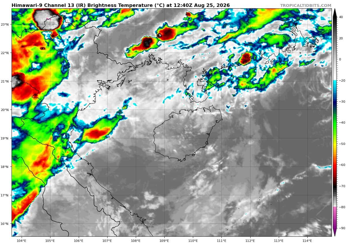
According to the JTWC warning number 20…Sustained winds were 30 knots with gusts to 40 knots
The fully exposed low-level circulation center (llcc) is rapidly unraveling as it makes landfall over Hainan. Prior to making landfall, a 251053z wsf-m mwi 37 ghz image detected a very compact lower-level core, which supported the 250600z intensity of 40 kts. Since then, the circulation has been devoid of convection and has been spinning down. The environment is hostile due to 30-35 kts of northeasterly vertical wind shear (vws).
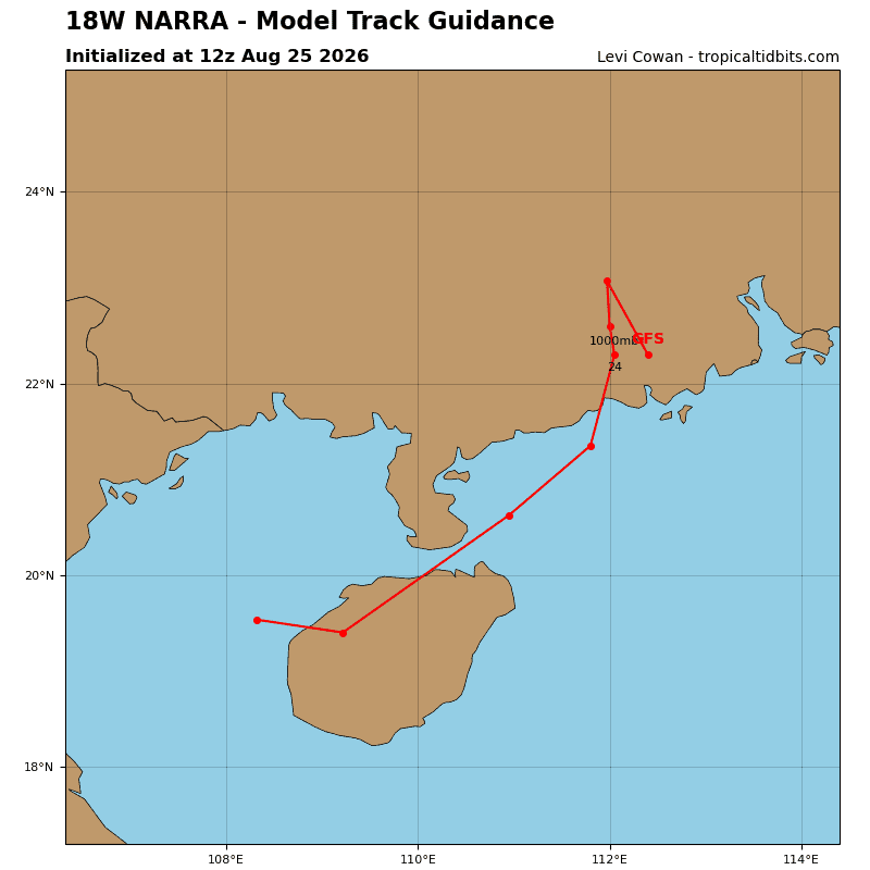
18w is embedded within low- to mid-level southwesterly flow, which will steer the circulation toward the northeast. A poleward turn will commence at 12 hours as the shallow southwesterly winds orient south-southwesterly on the southern side of a monsoon trough over southern China.
With the lack of convection, continued land interaction, and strong vws, td 18w will continue to weaken. While the forecast goes out to 36 hours, it is quite possible that the circulation will dissipate sooner. The hostile shear will persist for the next 24 hours, after which time the system will have progressed inland and therefore will be unable to tap into the more favorable environmental conditions.
Tropical Cyclone 19W (Atsani) – Final Warning
According to the JTWC warning number 12…Sustained winds were 25 knots with gusts to 35 knots
Animated multi-spectral satellite imagery (msi) depicts a heavily sheared and asymmetric system with a fully exposed low-level circulation center (llcc). Fragile and short-lived convective flare-ups can be seen to the west, however, persistent dry air entrainment and high (25-30 kts) northeasterly vertical wind shear (vws) are driving the terminal decay of tropical depression (td) 19w.
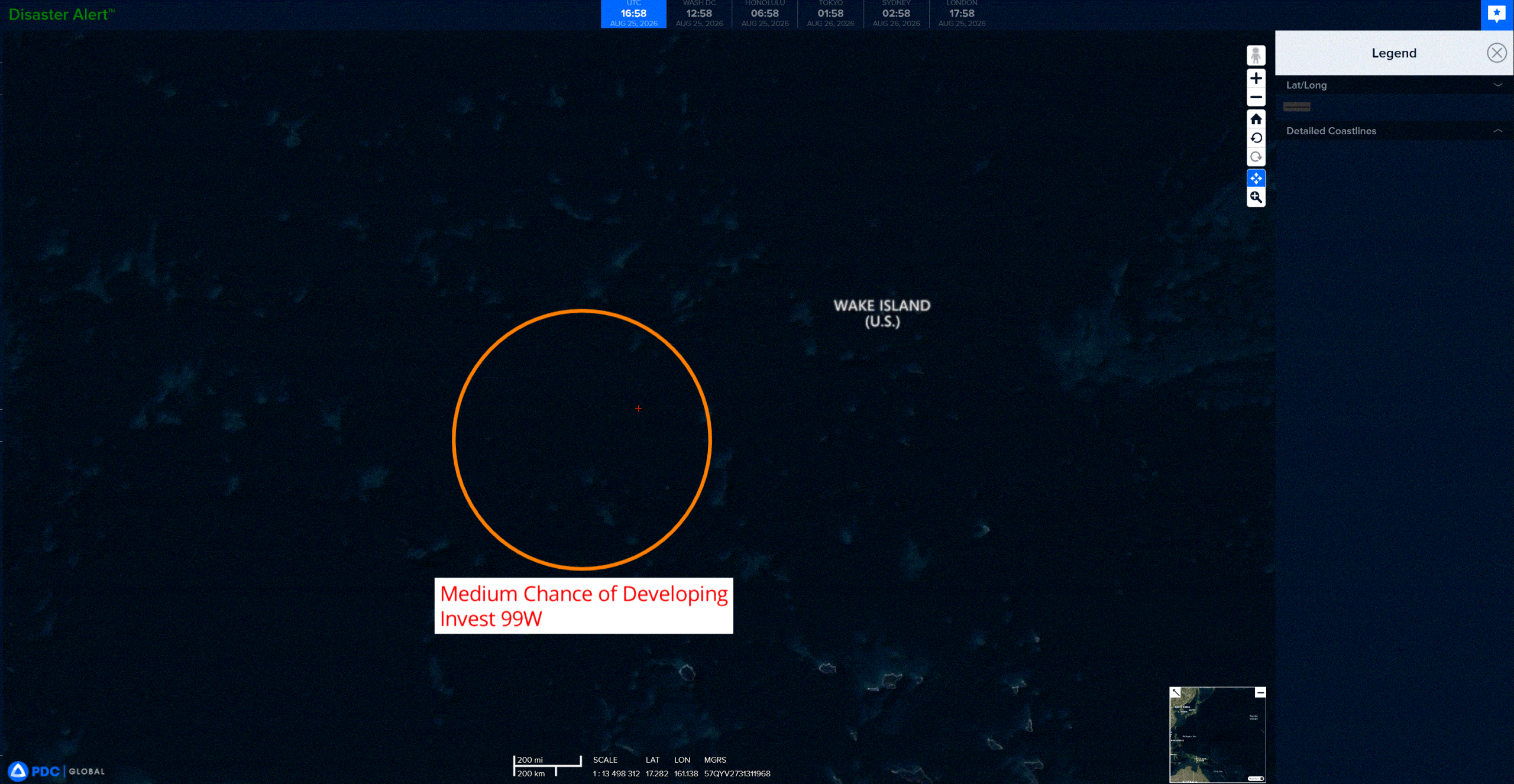
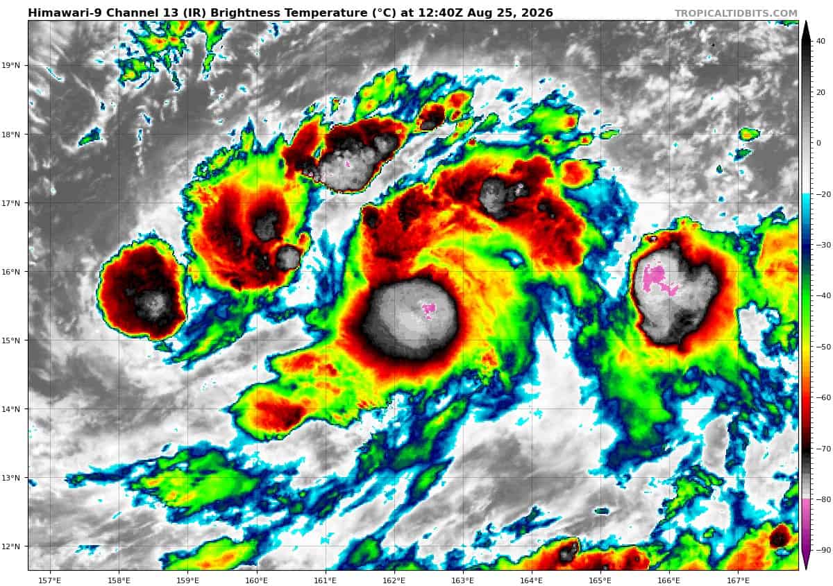
>>> There’s an area of disturbed weather being referred to as Invest 99W, which is located approximately 343 southwest of Wake Island
Animated enhanced infrared imagery (eir) depicts persistent convection exhibiting weak banding and obscuring a loosely defined low-level circulation center. A 250918z metop-b ascat partial pass reveals 20 kt winds along the eastern periphery. A 250720z 37 ghz gmi pass depicts broad and weak curvature within the lower-level cloud structure.
Environmental analysis is conducive for development with low vertical wind shear (10-15 kts), warm sea surface temperatures (29-30 c), abundant deep-layer moisture, and strong radial outflow aloft.
Global deterministic and ensemble models illustrate gradual to steady development over the next 24-36 hours as the system transits generally northward.
Maximum sustained surface winds are estimated at 18 to 23 knots.
minimum sea level pressure is estimated to be near 1007 mb.
The potential for the development of a significant tropical cyclone within the next 24 hours is medium.