
")
Current Snapshot
For all the latest updates visit: DisasterAWARE
e
c
bavi
close
09W_041200sair
09W_tracks_latest
may
10W_041200sair
himawari9_ir_10W_202607041510_lat21.3-lon107.8
10W_tracks_latest
By PDC’s Senior Weather
Specialist Glenn James

The Pacific Disaster Center’s (PDC Global) Saturday, July 4, 2026, Tropical Cyclone Activity Report…for the Pacific Ocean, the Indian Ocean, and adjacent Seas
Current Tropical Cyclones:
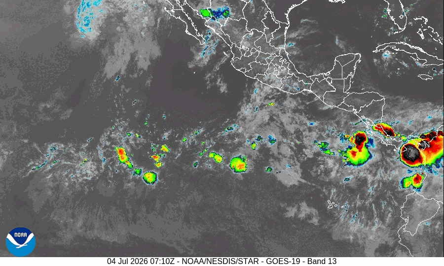
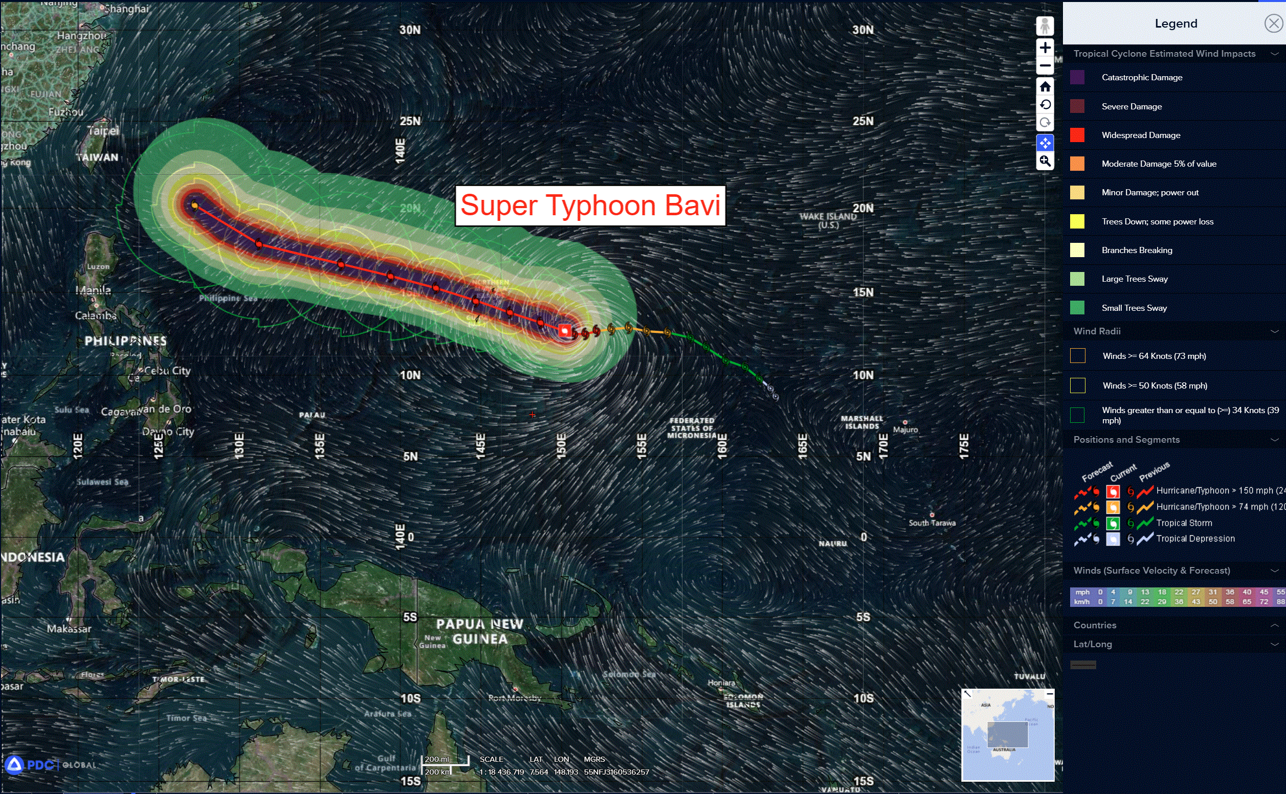
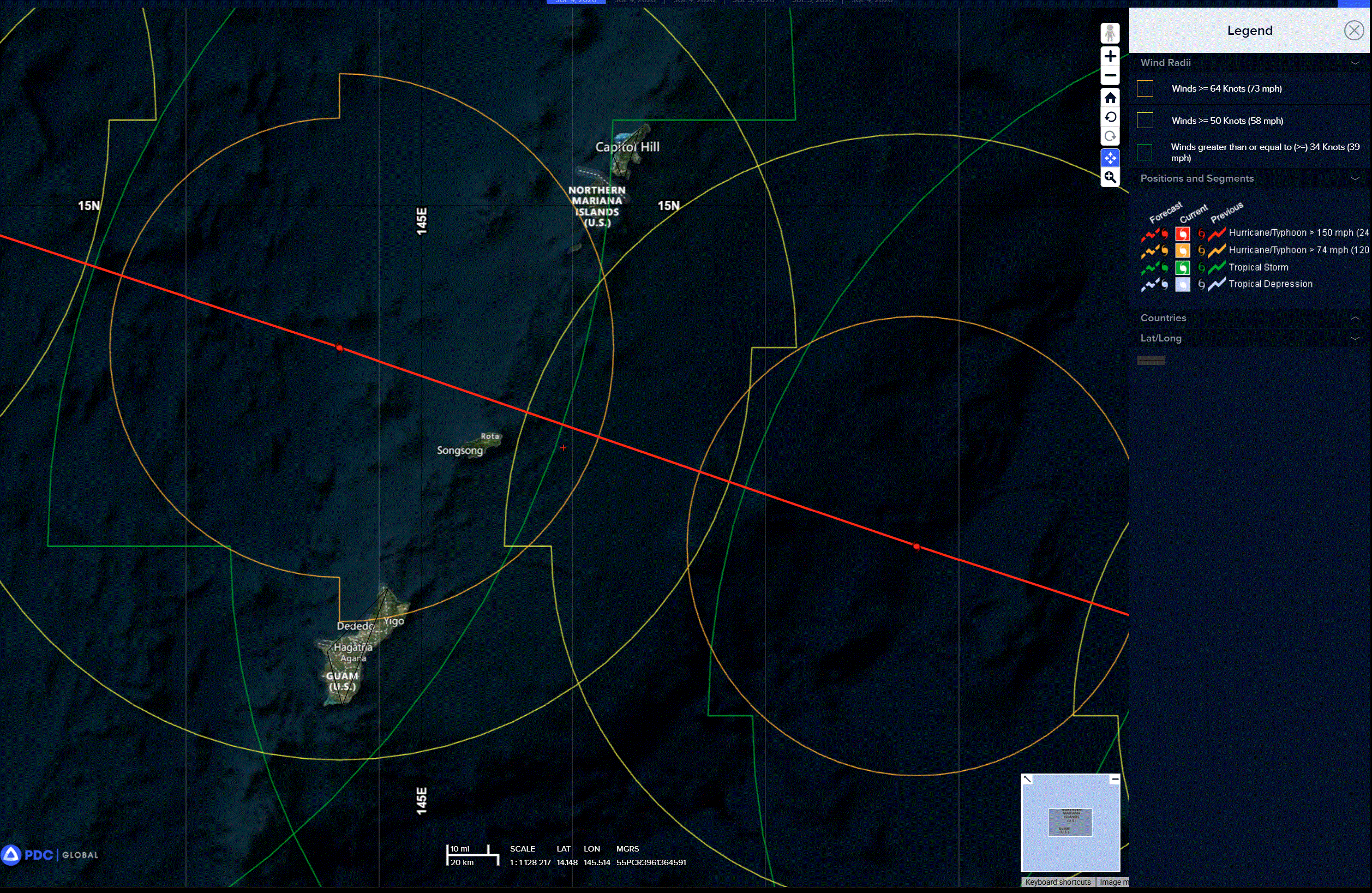
Tropical Cyclone 09W (Bavi) is located approximately 253 NM east of Navsta Guam
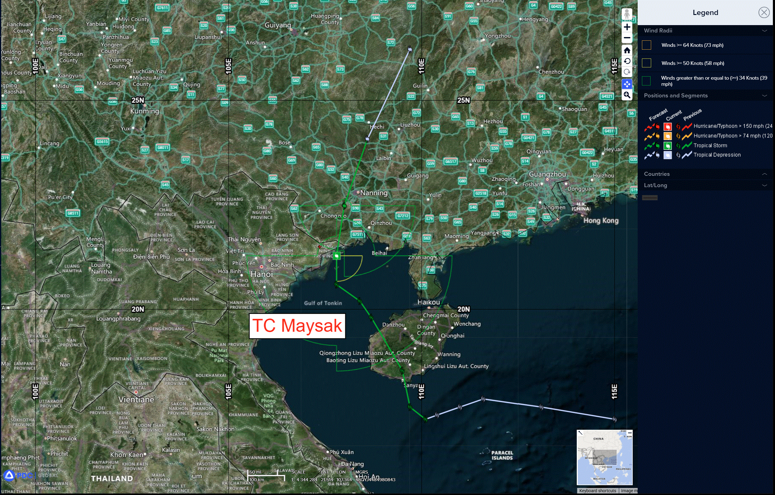
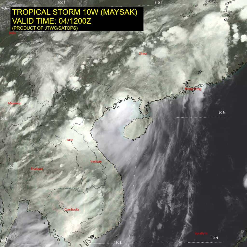
Tropical Cyclone 10W (Maysak) is located approximately 117 NM east-northeast of Hanoi, Vietnam – Final Warning
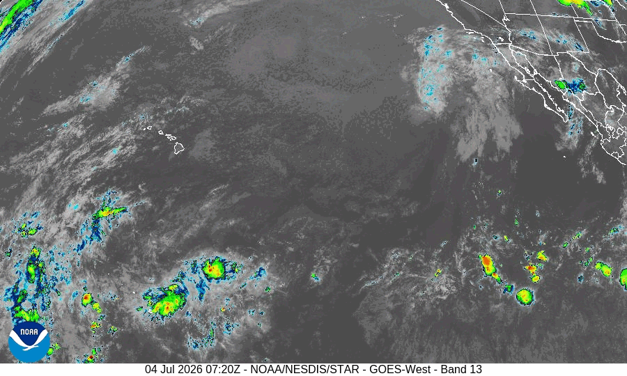
Northeast Pacific Ocean:
Western East Pacific: There are no Tropical Cyclones
>>> A tropical wave located several hundred miles to the southwest of the coast of southwestern Mexico is producing disorganized shower activity.
Development of this system appears unlikely as it moves westward across the central and western portions of the East Pacific basin during the next several days.
* Formation chance through 48 hours…low…near 0 percent
* Formation chance through 7 days…low…near 0 percent
Central Pacific Ocean: There are no Tropical Cyclones
Western Pacific, Indian Ocean, and adjacent Seas:
Western Pacific
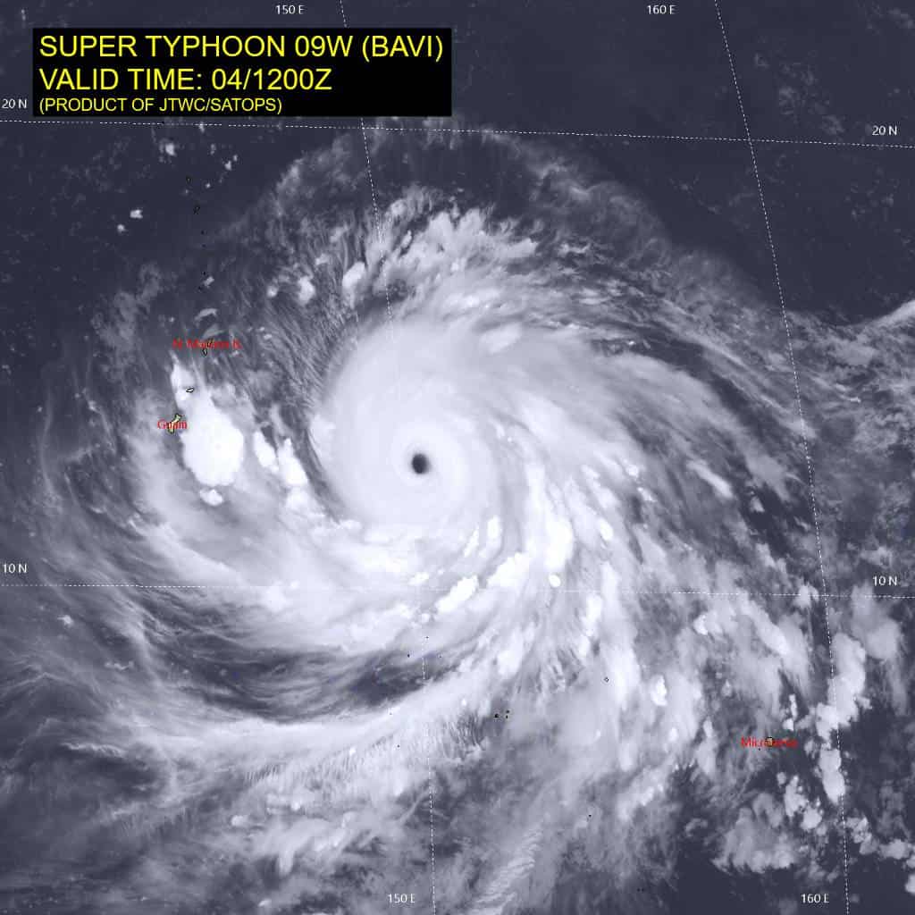
Super Typhoon 09W (Bavi)
According to the JTWC Warning Number 17, sustained winds are 135 knots with gusts to 165 knots
Animated enhanced infrared (eir) satellite imagery depicts a powerful super typhoon (sty) approaching the Mariana Islands. The central dense overcast and eye have degraded in the past six hours, with warming convective cloud top temperatures and a slightly cooler eye. The upper-level outflow remains robust and radial. a 040806z wsf-m mwi pass reveals a very thick inner core and a less circular upper-level eye. The 37 ghz image notably depicts multiple, incomplete lower-level rings surrounding the eye, which isindicative of a partial eyewall replacement cycle (erc). This observation is supported by the mperc algorithm from cimss, which gives a 68 percent probability of erc onset.
The environment continues to be highly favorable for maintaining a high-end storm, characterized by low vertical wind shear (vws), high ocean heat content exceeding 125 kj per square cm, and abundant deep-layer
moisture.
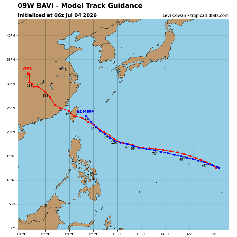
The forward motion of super typhoon 09W has veered slightly north of due west. The system will commence a
west-northwestward trajectory through the entirety of the forecast period, driven by a deep-layer str to the north. As sty Bavi escapes the grasp of a near-equatorial ridge, it will gain speed and reach 12-15 kts by 48 hours. The near-term intensity forecast has become more complex.
The environment will become even more favorable between 12 and 36 hours because an upper-level ridge will build eastward from the Ryukyu Islands and significantly enhance upper-level divergence on the western periphery of the vortex. The complication will come from the partial erc presented in the aforementioned microwave pass, which is a transient, unstable process, and two possible outcomes arise. Either the partial outer band will successfully wrap around the center and lead to a collapse of the inner eye, or the inner core will hold until the outer ring dissipates. Both scenarios will lead to weakening, which is reflected in the forecast at 12 hours.
The process will complete in the next 12-24 hours, and re-intensification will commence thereafter. Given the exceptional upstream environment and past over-performance of Bavi’s intensification phase in the past few days, the forecast calls for a new peak of 150 kts at 48 hours. An even higher peak closer to 160 kts is not out of the question.
Slow to gradual weakening will occur towards the latter part of the forecast period due to increasing vws. STY 09W will gradually expand in size, becoming an extremely massive circulation with gale-force winds extending out to 300 nm from the center by 120 hours. impacts will extend far from the center.
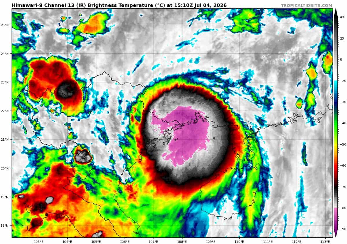
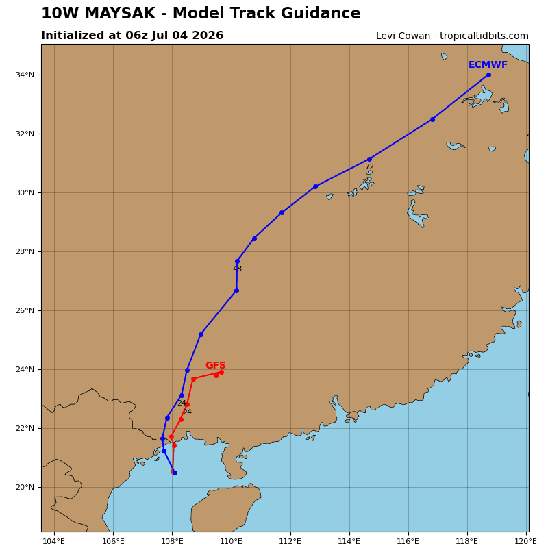
Tropical Cyclone 10W (Maysak) – Final Warning
According to the JTWC Warning Number 13, sustained winds are 50 knots with gusts to 65 knots
The low-level circulation center has been analyzed over land. Warm (29-30 c) sea surface temperatures in the Gulf of Tonkin and an overall favorable environment initially resulted in increased convection over water. However, as the system moves northeastward and further inland, the frictional effects of land interaction will result in the beginning of a decay phase. TS 10W is expected to fully dissipate within the next 24-36 hours.