

Current Snapshot
For all the latest updates visit: DisasterAWARE
e
c
bavi
close
09W_051200sair
09W_tracks_latest
By PDC’s Senior Weather
Specialist Glenn James

The Pacific Disaster Center’s (PDC Global) Sunday, July 5, 2026, Tropical Cyclone Activity Report…for the Pacific Ocean, the Indian Ocean, and adjacent Seas
Current Tropical Cyclones:
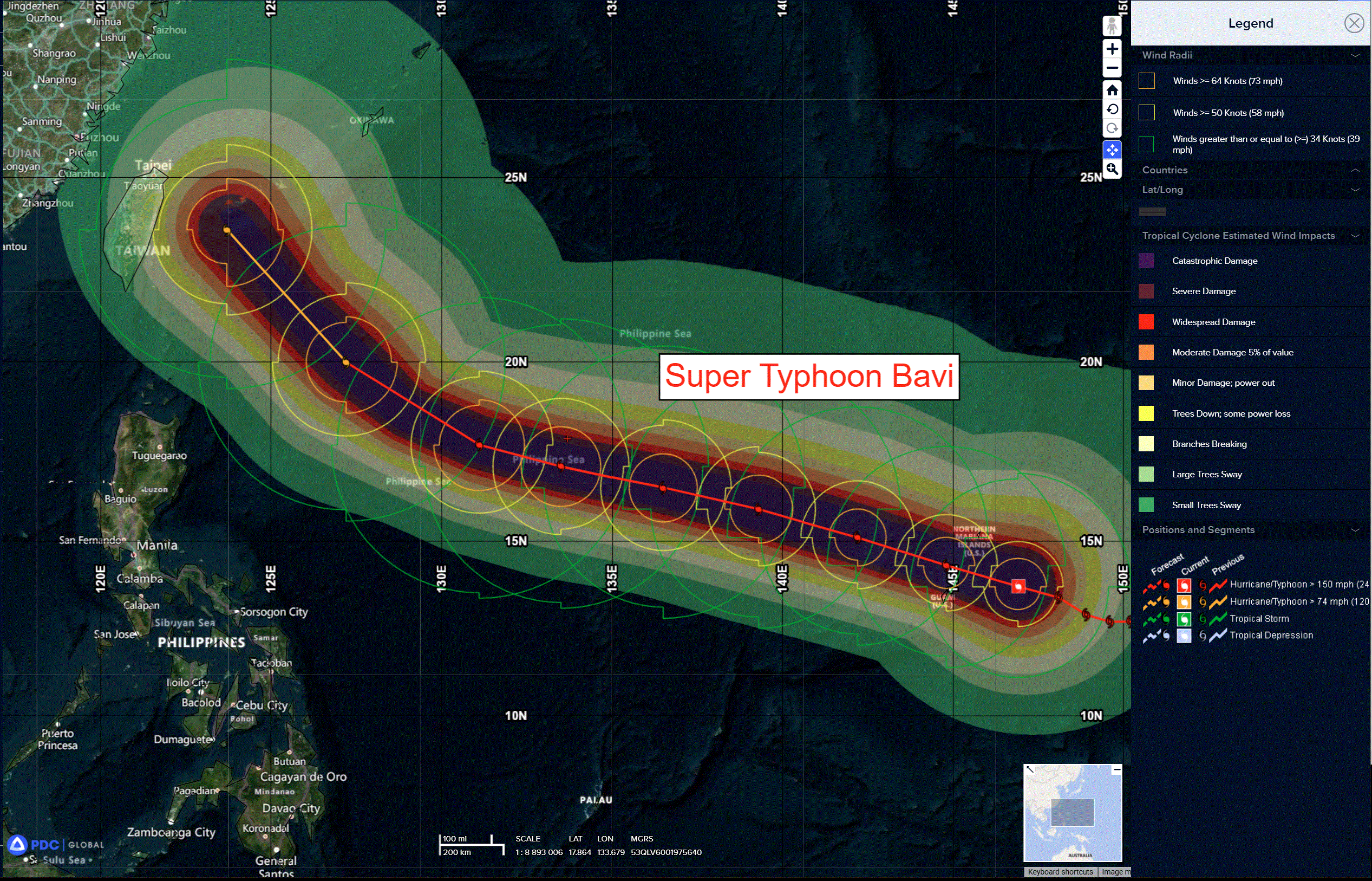
Tropical Cyclone 09W (Bavi) is located approximately 1211 NM southeast of Kadena AB
Northeast Pacific Ocean: There are no Tropical Cyclones
Central Pacific Ocean: There are no Tropical Cyclones
Western Pacific, Indian Ocean, and adjacent Seas:
Western Pacific
Super Typhoon 09W (Bavi)
According to the JTWC Warning Number 19, sustained winds are 155 knots with gusts to 190 knots
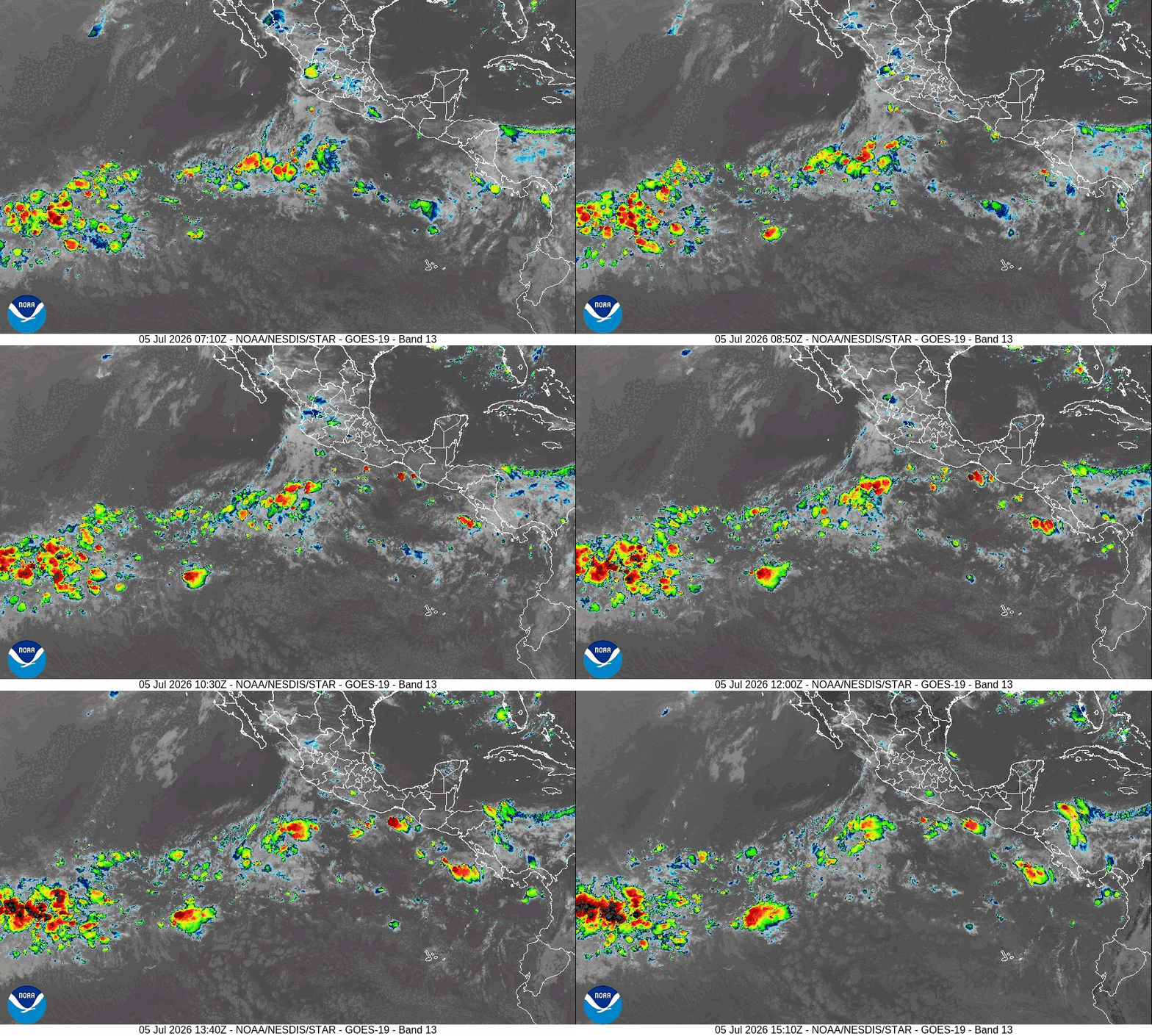
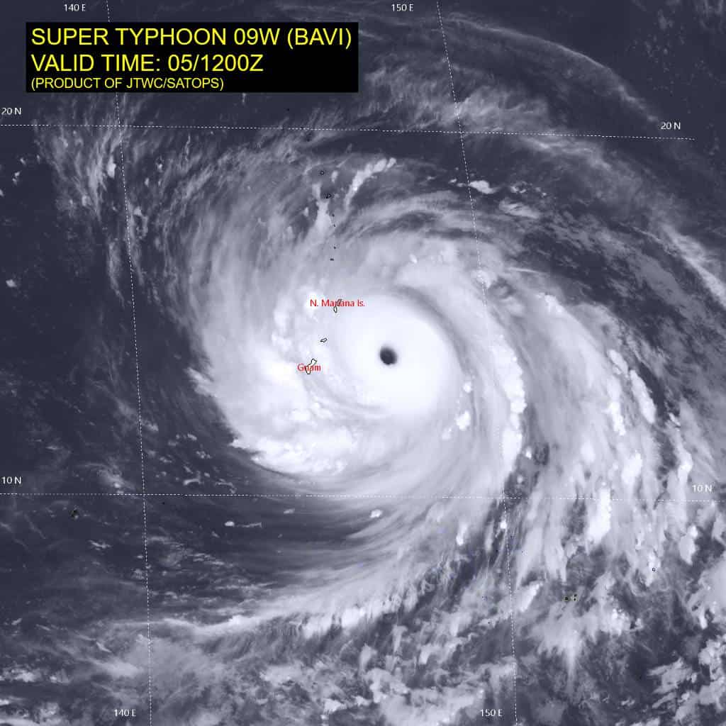
Super typhoon 09W has the classic appearance of an extremely powerful tropical cyclone. Over the past three hours, the system has taken a menacing turn westward toward Rota. Animated enhanced infrared (eir) satellite imagery depicts a perfectly circular, 25 nm-wide eye embedded in a symmetric central dense overcast (cdo), surrounded by dense convective banding features. Cloud top temperatures have continued to cool to -80 degrees celsius, with a solid ring of the cmg shade encircling the eye on animated infrared imagery enhanced via the bd curve. Concurrently, the eye temperature has warmed to 20 degrees celsius.
This robust structure is supported by exceptional radial outflow, enabling efficient ventilation in all quadrants and sustaining the intense coreconvection. A 050746z wsf-m mwi pass revealed an intense eyewall surrounded by multiple rainbands, though this structure does not yet signify an imminent eyewall replacement cycle (erc), as these banding features have not fully consolidated into a closed concentric ring.
Data from the pgua wsr-88d radar reveals heavy rainbands sweeping over the southern Mariana Islands, with inbound winds greater than 150 kts at 16,000 ft as the eyewall comes into sharper focus. Ground observations from Saipan International Airport indicate that typhoon-force gusts of 66 kts have arrived. The vortex is now traversing very warm sea surface temperatures (sst) of 30-31 degrees celsius and very high ocean heat content (ohc) of 150 kj per square cm in an environment of low vertical wind shear (vws) and rich deep-layer moisture. These factors are exceptionally favorable for supporting a high-end storm.
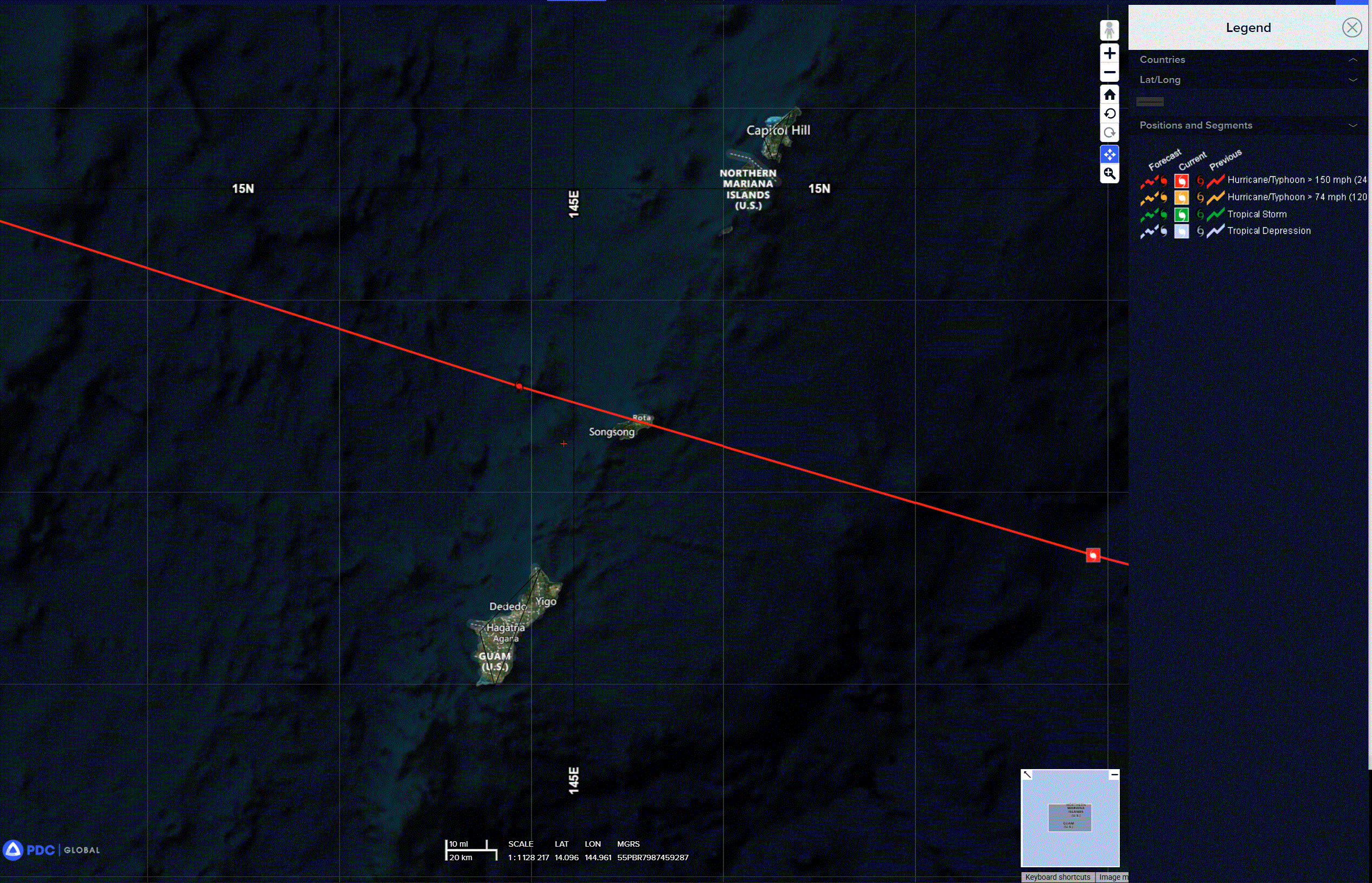
A recent shift in storm motion due west has increased the potential for a direct landfall on or very near Rota.
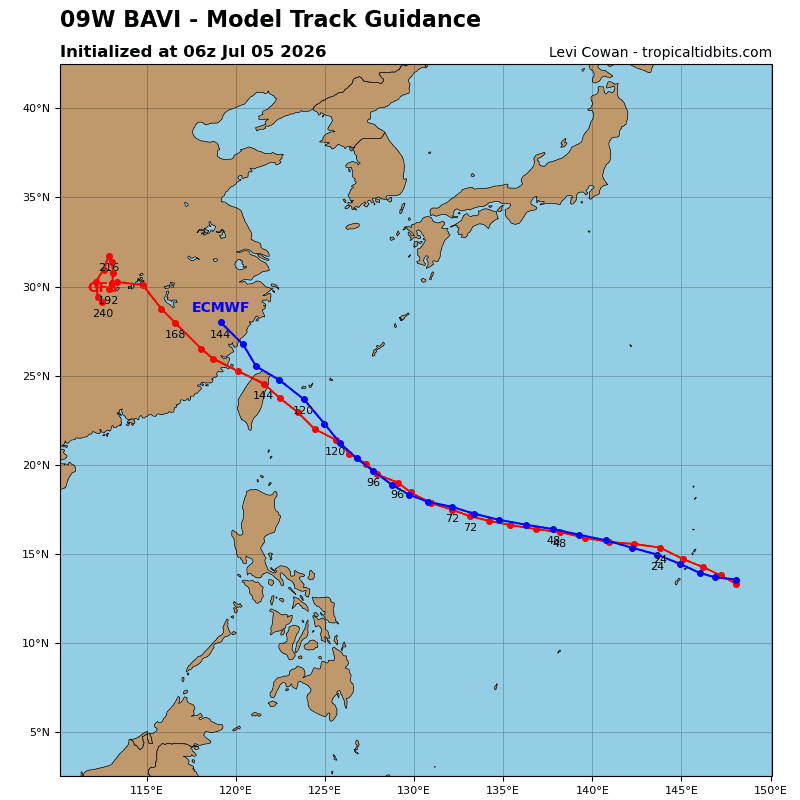
Consequently, the forecast track at 12 and 24 hours has been shifted southward by 20 nm, bringing the center directly over the island. While these short-term deviations are difficult to predict, the system will resume a west-northwestward trajectory shortly, steered by a deep-layer str anchored to the north. By 72 hours, STY 09W will turn northwestward as it rounds the southwestern periphery of the ridge.
STY 09W is at or very near peak intensity, and it will remain a powerful tropical cyclone through the forecast
period. Exceptionally favorable conditions persist, characterized by very high ohc, low vws, strong divergence aloft, and abundant moisture. Slight weakening will begin by 24 hours as the system travels over lower ohc. The weakening will accelerate after 36 hours due to increasing vws and the likelihood of structural disruptions
from erc. By 72 hours, an upper-level ridge building south of Honshu will impart 20-25 kts of easterly shear on the system.
Normally, this amount of shear would result in more rapid weakening, but sty Bavi will undergo massive expansion in size, with gale-force winds extending nearly 300 nm outward from the center. This substantial
footprint of the vortex will insulate the core, mitigating the detrimental effects of vws.