

Current Snapshot
For all the latest updates visit: DisasterAWARE
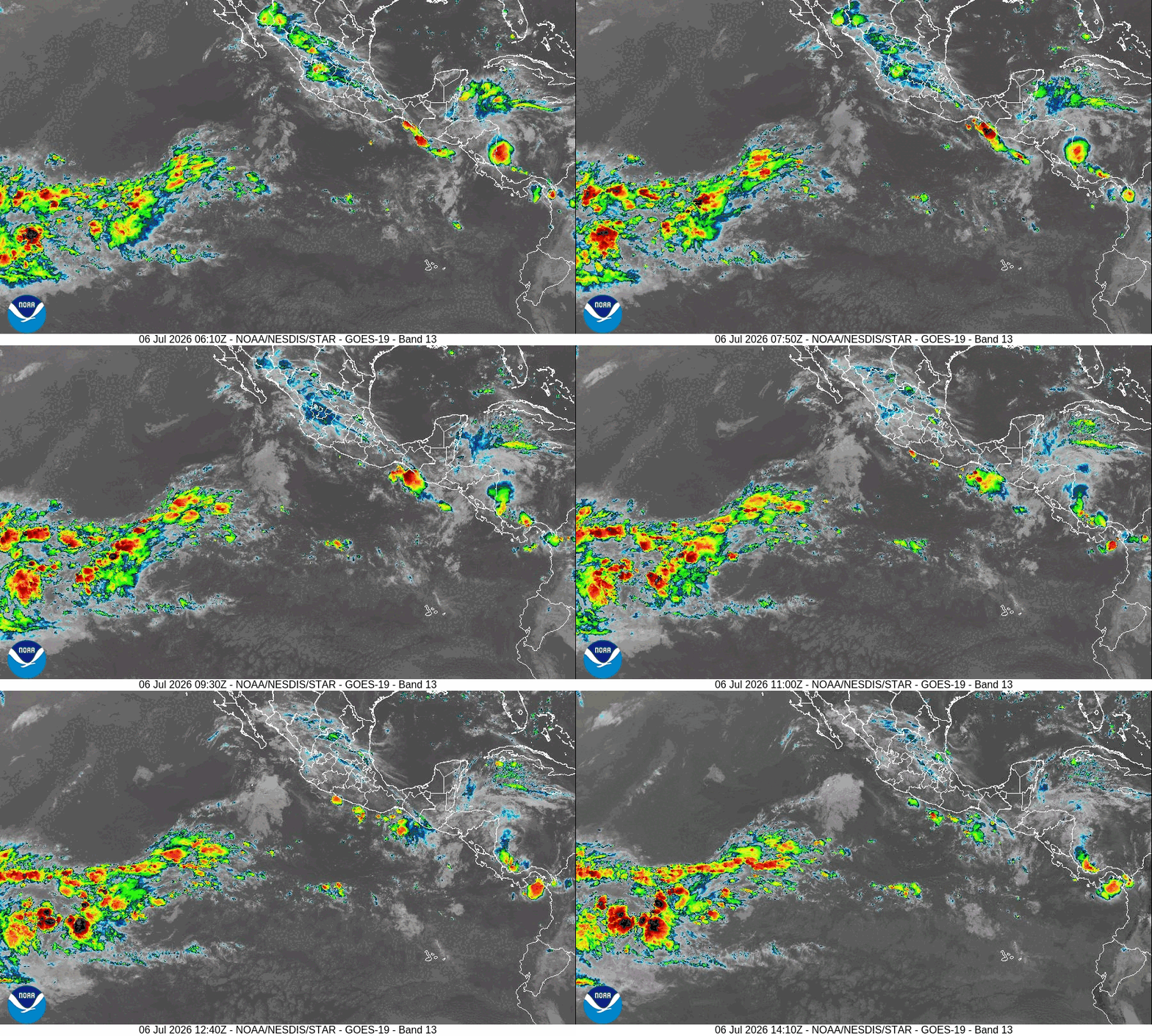
e
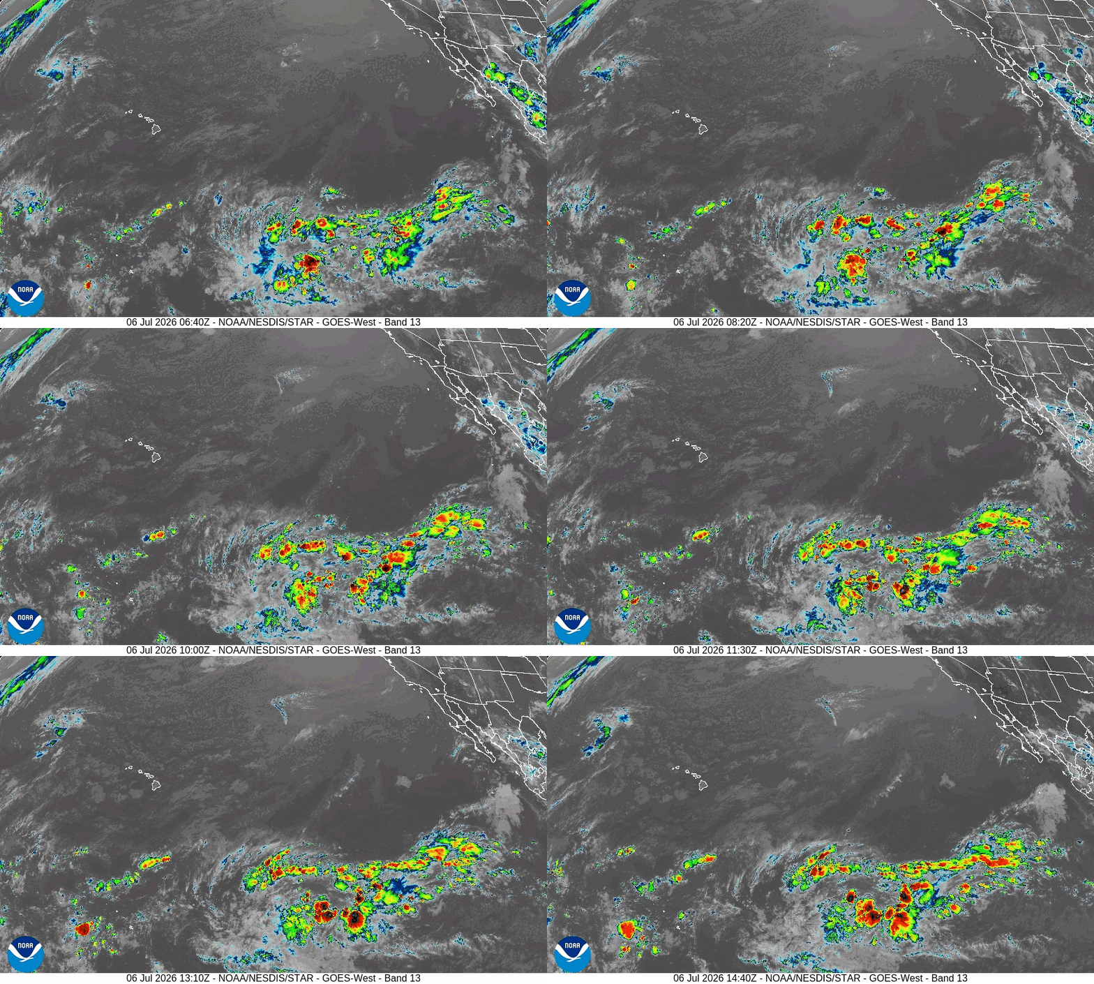
c
b
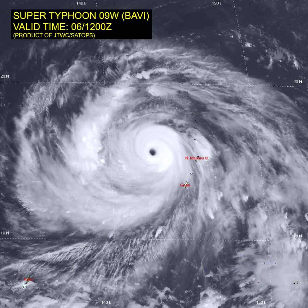
09W_061200sair
himawari9_ir_09W_202607061510_lat15.4-lon142.7
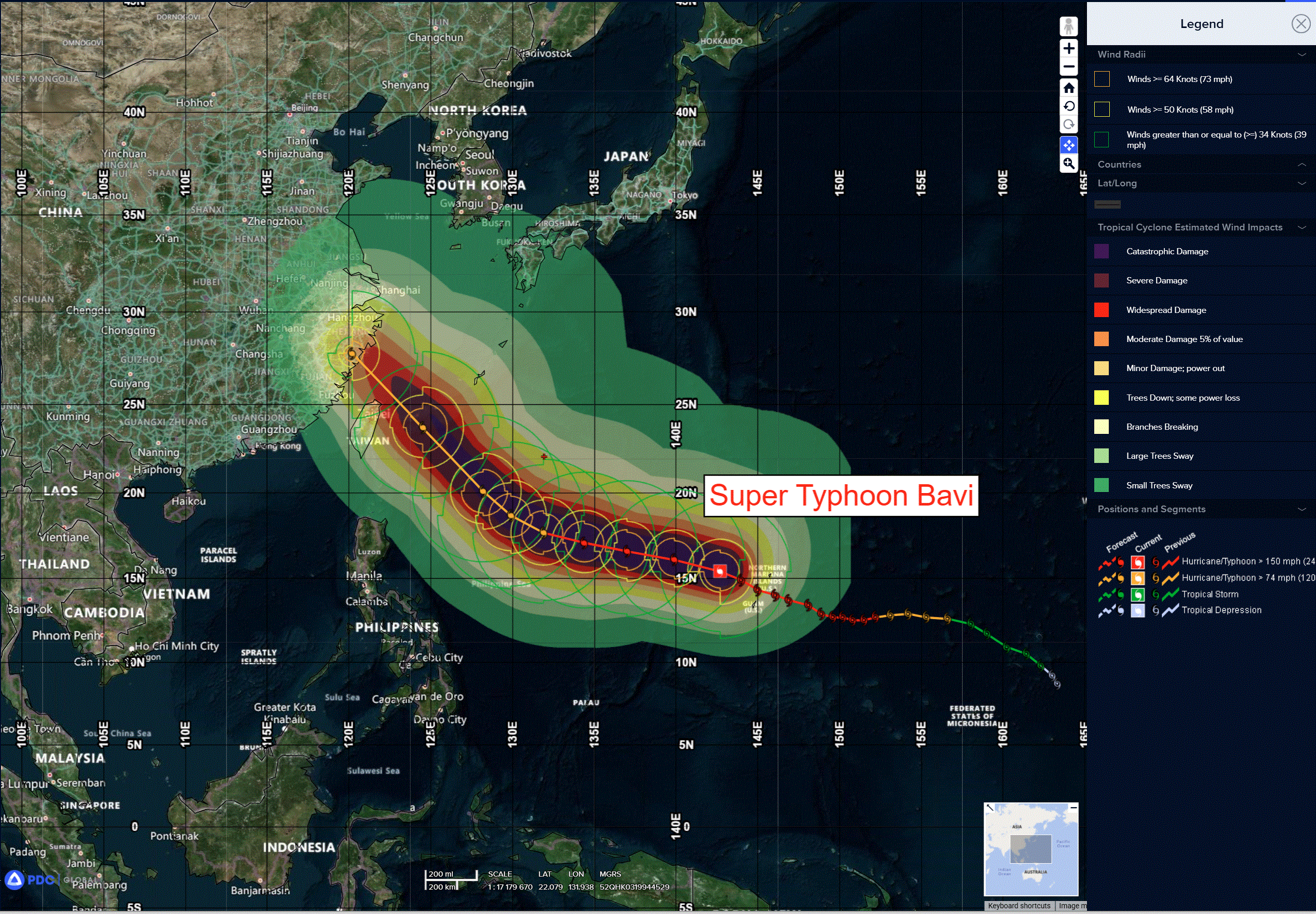
09W_tracks_latest
By PDC’s Senior Weather
Specialist Glenn James

The Pacific Disaster Center’s (PDC Global) Monday, July 6, 2026, Tropical Cyclone Activity Report…for the Pacific Ocean, the Indian Ocean, and adjacent Seas
Current Tropical Cyclones:
Tropical Cyclone 09W (Bavi) is located approximately 915 NM southeast of Kadena AB
Northeast Pacific Ocean: There are no Tropical Cyclones
>>> Offshore of Southwestern Mexico:
A low pressure system is expected to form late this weekend or early next week several hundred miles south of the coast of southwestern Mexico. Gradual development is possible after that time as the system moves west-northwestward.
* Formation chance through 48 hours…low…near 0 percent
* Formation chance through 7 days…low…20 percent
Central Pacific Ocean: There are no Tropical Cyclones
An area of low pressure could form in a few days over the central Pacific basin well south of the Hawaiian Islands. Some slow development of this system is possible late this week and through the weekend while it moves westward across the central Pacific.
* Formation chance through 48 hours…low…near 0 percent
* Formation chance through 7 days…low…20 percent
Western Pacific, Indian Ocean, and adjacent Seas:
Western Pacific
Typhoon 09W (Bavi)
According to the JTWC Warning Number 25, sustained winds are 125 knots with gusts to 150 knots
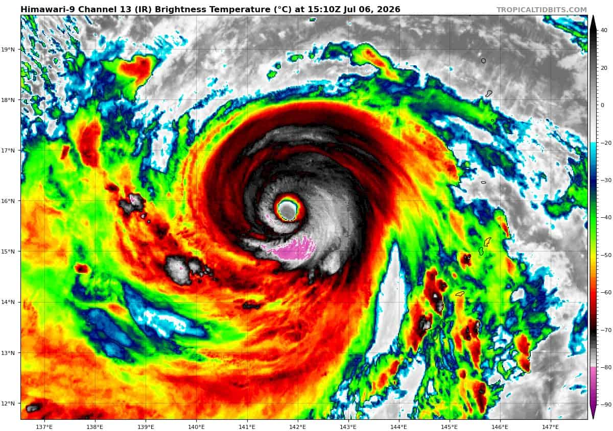
Animated enhanced infrared (eir) satellite imagery depicts a 20 nm-wide eye embedded within a more ragged central dense overcast (cdo). On infrared imagery enhanced via the bd curve, the spatial extent of the white shade has significantly diminished over the past several hours, which correlates with the decreasing dvorak final t-numbers. However, deep convection with very cold tops measuring -81 degrees celsius has flared up over the eastern semicircle of the cdo and is actively wrapping around the eyewall. While the upper-level outflow remains restricted on the eastward flank due to low to moderate easterly vertical wind shear (vws), the ventilation is robust on the western side,
Enhanced by an upper-level trough passing over the Philippines. recent passes by low-earth orbiting satellites provided critical data on the storm’s structural evolution. A 060800z ssmis pass depicts a robust inner eyewall nearly encircled by an outer ring of deep convection. This partial eyewall replacement cycle (erc) is likely responsible for the recent degradation of the cdo and the overall weakening of the system. Additionally, data from a 060832z rcm-2 sar pass and a 061131z ascat-b pass indicate that the extent of storm-force winds has significantly expanded, reflecting the massive size of the wind field.
The environment is still favorable for the maintenance of super typhoon (sty) bavi. The ocean features very warm sea surface temperatures (sst) and high ocean heat content (ohc), while the troposphere supports moderate divergence aloft and abundant deep-layer moisture.
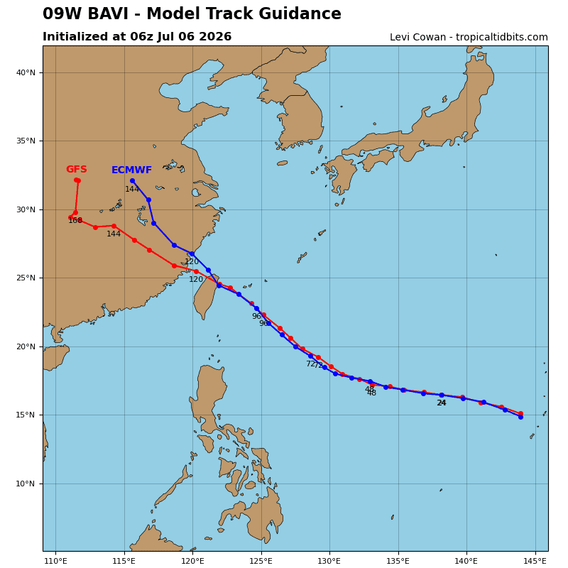
STY Bavi will maintain a west-northwestward trajectory with a steady forward motion of 14 kts under the steering influence of the str for the next 48 hours. By 60 hours, the system will decelerate slightly and veer towards the northwest as it reaches the southwestern periphery of the steering ridge. Subsequently, the str will build to the east, causing the system to accelerate along its northwestern track. On this trajectory, the storm center will pass near the northeastern tip of Taiwan before making landfall over central China.
The environment will support the storm’s intensity in the near term, with low to moderate vws persisting for the next 12 hours. However, an upper-level ridge will build to the north and induce stronger easterly shear. Although the typhoon will continue to travel over warm sst and high ohc, this increased shear will trigger a gradual weakening trend through 96 hours. Furthermore, potential erc events, as depicted by hafs-a, introduce complexity and reduce overall confidence in the intensity forecast.
Between 96 and 120 hours, the mountainous terrain of northern Taiwan will severely disrupt the storm’s expansive circulation, leading to rapid weakening up to and through landfall at 120 hours. STY Bavi will maintain a very large wind field until its demise, and gale-force winds will completely envelope both Taiwan and Okinawa during its passage.