

Current Snapshot
For all the latest updates visit: DisasterAWARE
7e
e
2c
7c
c
bavi
09W_091200sair
himawari9_ir_09W_202607091520_lat19.2-lon128.8
09W_tracks_latest
By PDC’s Senior Weather
Specialist Glenn James

The Pacific Disaster Center’s (PDC Global) Thursday, July 9, 2026, Tropical Cyclone Activity Report…for the Pacific Ocean, the Indian Ocean, and adjacent Seas
Current Tropical Cyclones:
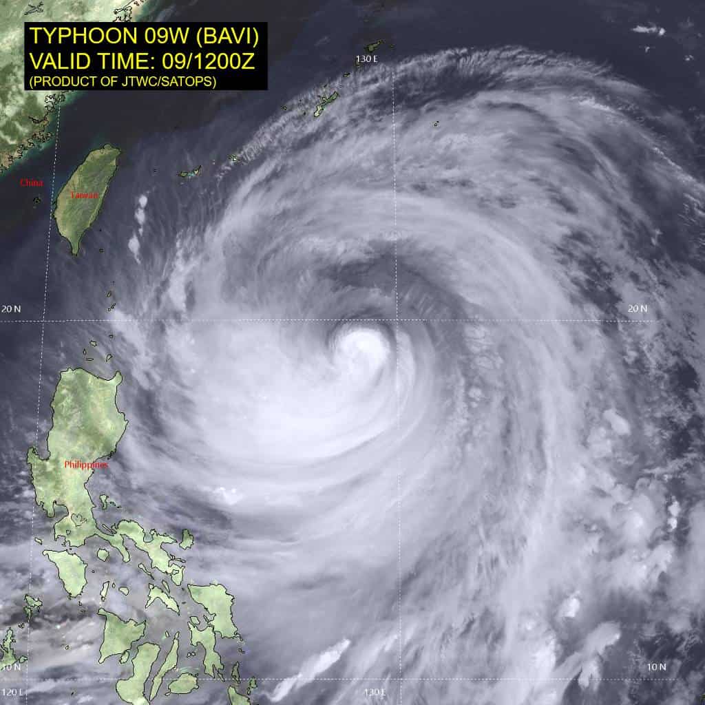
Tropical Cyclone 09W (Bavi) is located approximately 441 NM south of Kadena AB
Northeast Pacific Ocean: There are no Tropical Cyclones
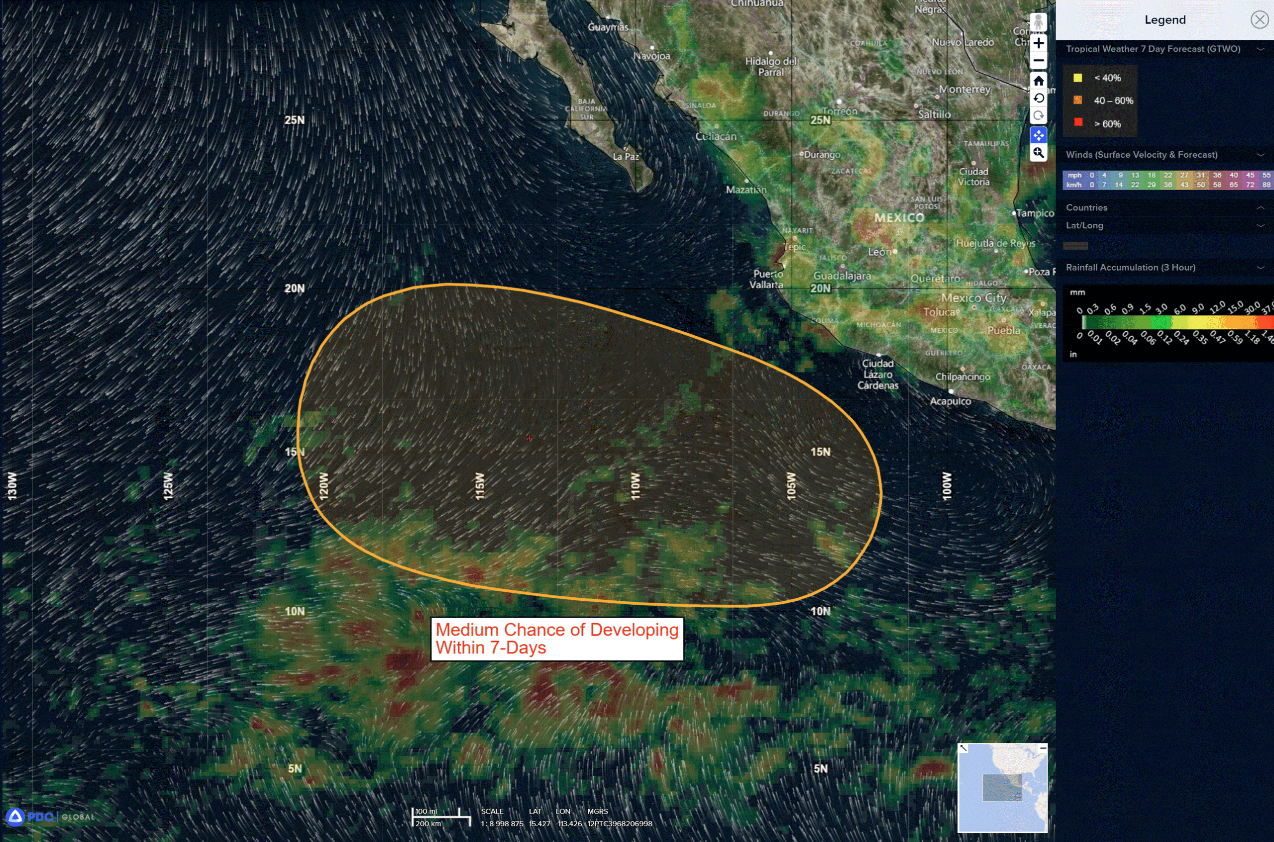
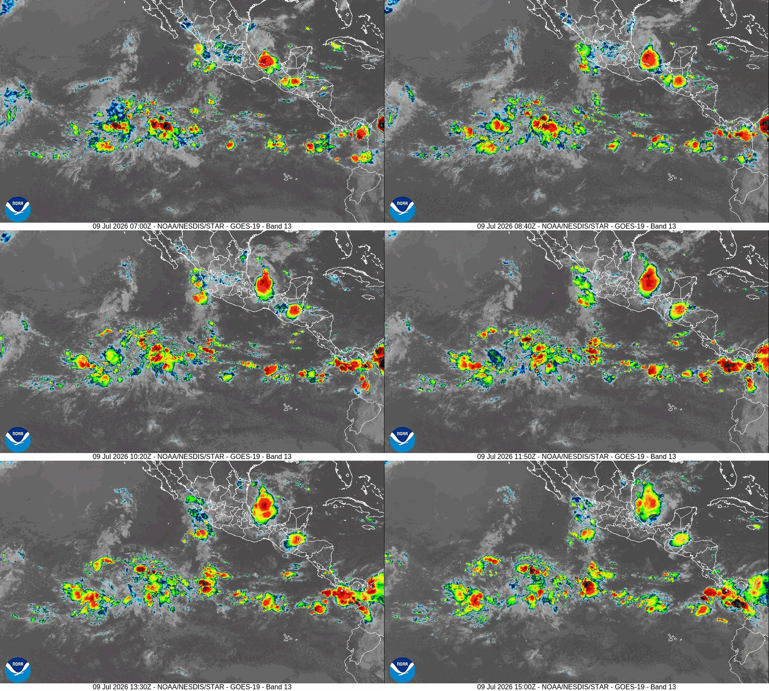
>>> Offshore of Southwestern Mexico:
An area of low pressure is expected to form late this weekend or early next week several hundred miles south-southwest of the coast of southwestern Mexico. Environmental conditions appear favorable for gradual development thereafter, and a tropical depression could form next week while the system moves generally west-northwestward.
* Formation chance through 48 hours…low…near 0 percent
* Formation chance through 7 days…medium…60 percent
Central Pacific Ocean: There are no Tropical Cyclones
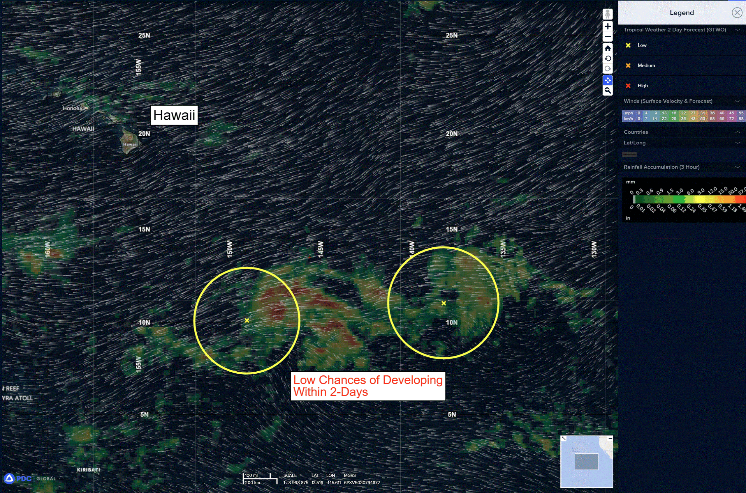
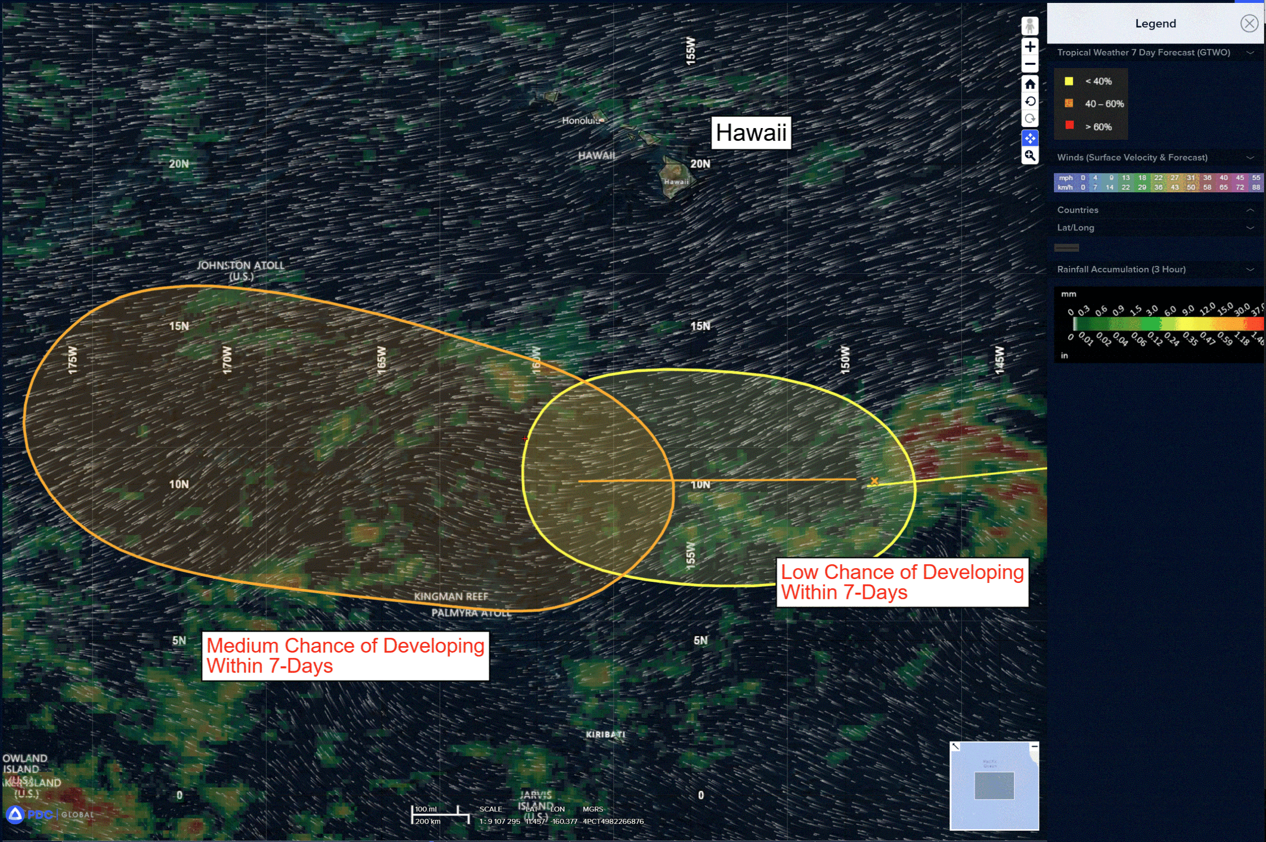
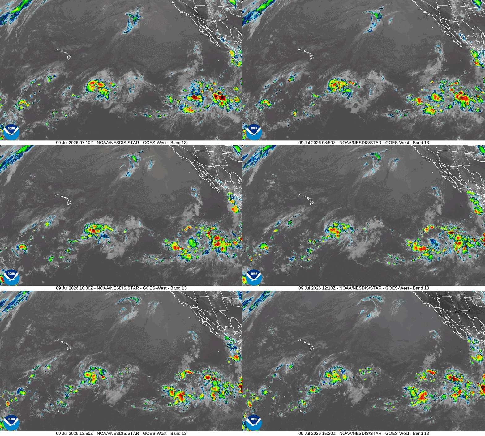
Disorganized showers and thunderstorms have increased since yesterday near a trough of low pressure located several hundred miles southeast of the Hawaiian Islands. Environmental conditions appear conducive for gradual development of this system later this week into early next week, and a tropical depression could form as the system moves westward to west-northwestward across the central Pacific, remaining well south of the Hawaiian Islands.
* Formation chance through 48 hours…low…20 percent
* Formation chance through 7 days…medium…60 percent
>>> Well Southeast of the Hawaiian Islands:
Another area of showers and thunderstorms is associated with a trough of low pressure located more than 1000 miles east-southeast of the Hawaiian Islands. Environmental conditions appear favorable for slow development of this system this weekend into early next week as it moves westward or west-southwestward into the central Pacific, remaining well south of the Hawaiian Islands.
* Formation chance through 48 hours…low…near 0 percent
* Formation chance through 7 days…low…30 percent
Western Pacific, Indian Ocean, and adjacent Seas:
Western Pacific
Typhoon 09W (Bavi)
According to the JTWC Warning Number 35, sustained winds are 100 knots with gusts to 125 knots
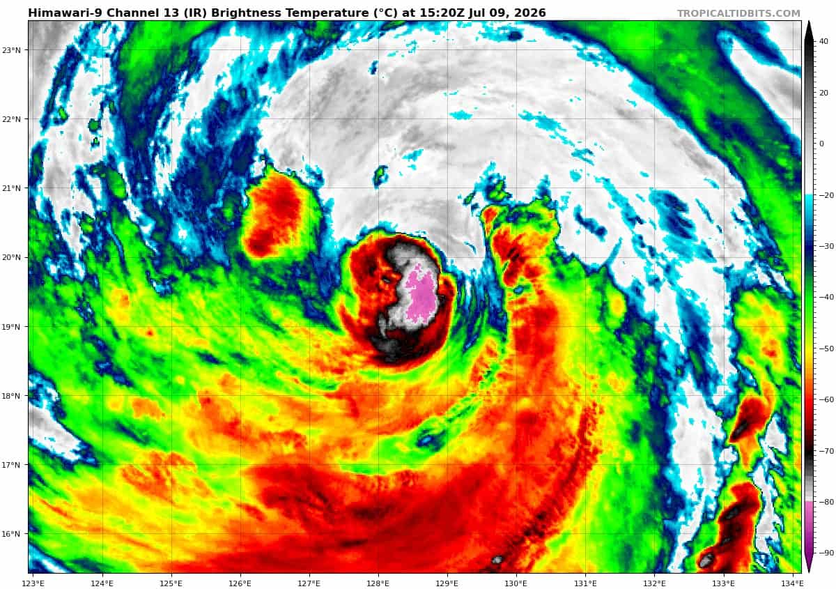
Animated enhanced infrared (eir) satellite imagery depicts typhoon 09W (Bavi) with an increasingly asymmetrical convective structure, as the system is confronted by hostile deep-layer northeasterly vertical wind shear (vws) of 25 kts, which has tilted and disrupted the vertical axis of the storm. Additionally, the vortex has experienced structural vertical decoupling and steering layer compression. This has severed typhoon (ty) 09W (Bavi) from the rapid, deep-layer steering flow, leaving the llcc governed by shallower, significantly slower lower-tropospheric steering mechanism, manifested by a deceleration in translational velocity from 10 kts to 5 kts.
This reduced translation speed is conducive to localized self-induced upwelling, driving sea surface cooling along the track and limiting any near-term thermodynamic intensity recovery. Furthermore, the hostile 25 kts vws regime has likely arrested the completion of the ongoing erc by inducing severe convective asymmetry and preventing the outer wrapping eyewall from consolidating or closing symmetrically, as revealed by a 090900z f17 ssmis 91 ghz microwave pass showing a nearly fully eroded inner eyewall and an incomplete wrapping of the secondary eyewall.
While vigorous upper-level equatorward and westward outflow and elevated sea surface temperatures (sst) of 29-30 c are present, the system is unable to exploit this due to structural corruption. based on the obscured, cloud-filled low-level circulation center (llcc) and the low-level cloud tracing over the northern semicircle.
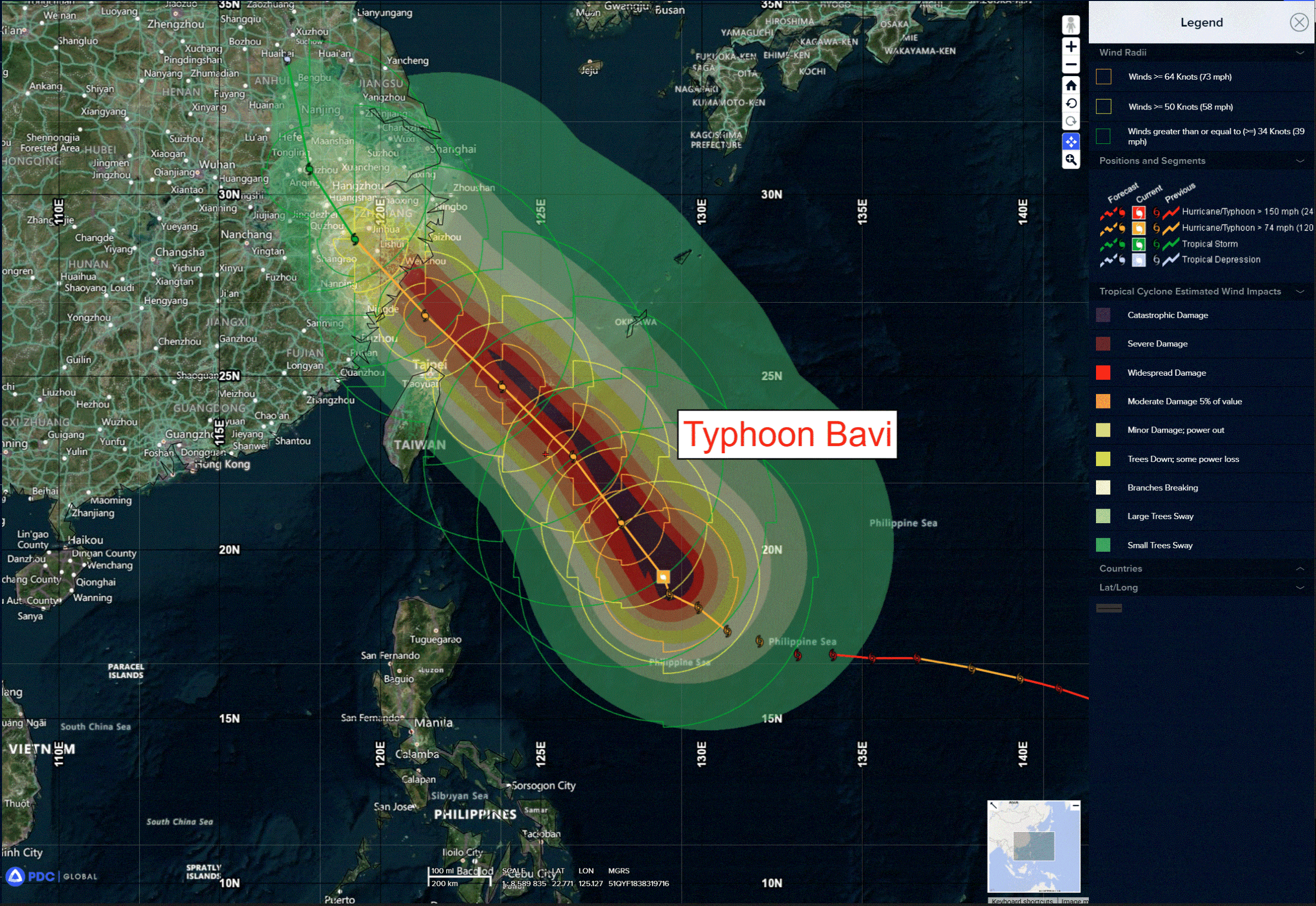
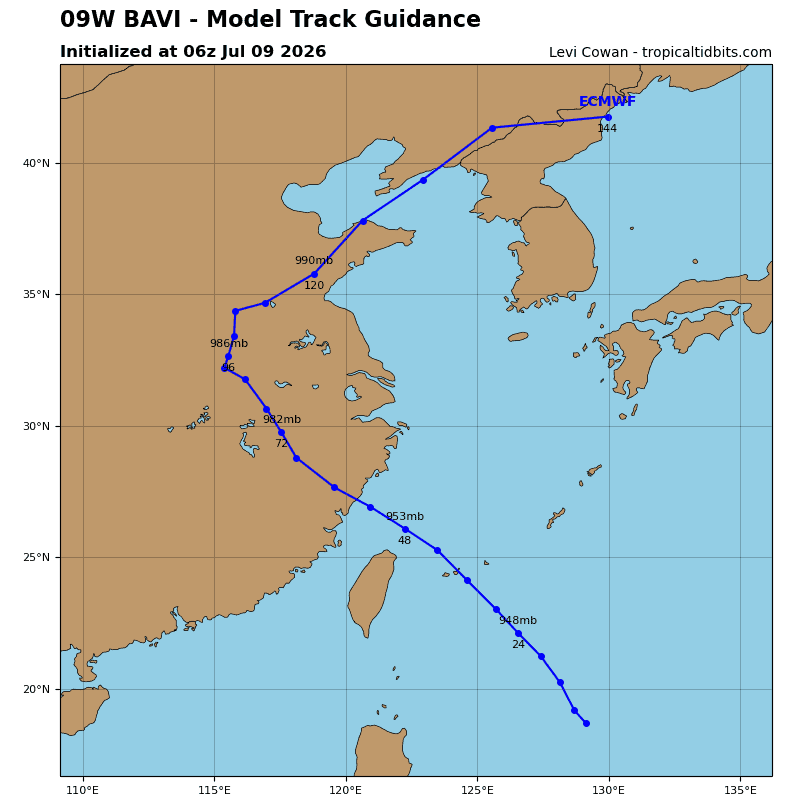
Overall steering dynamics for ty 09W remain governed by an elongating and consolidating northeastern str, which will sustain a generally northwestward translational vector throughlandfall. Along this trajectory, ty 09W is forecast to transit the immediate proximity of Ishigakijima just prior to 36 hours. Subsequent to this maritime passage and soon after 48 hours, the system will execute landfall over the eastern Chinese seaboard. notwithstanding central core kinematics, an expansive gale-force wind radii field will encompass a massive geographic footprint
stretching from Taiwan through the Ryukyu arc to Okinawa.
Thermodynamically, intensity fluctuations are highly probable over the initial 36 hours due to inherent predictive uncertainties governing the ongoing erc and fluctuations in vws. A transient relaxation in vws near 12 hours presents a window were degradation incurred during the erc may stabilize, allowing for minor intensification or sustainment of maximum sustained speeds for an ensuing 12-hour period. Advancing beyond 24 hours, however, a renewed escalation in vws coupled with cyclone displacement away from the highly efficient equatorward outflow channel will arrest
development. Concurrently, ty Bavi will transit out of robust ocean heat content regime along its path, beginning a terminal decay phase near 36 hours.
Terrestrial friction induced by the post 48 hour landfall will catalyze a rapid weakening trend. Once situated inland over the Asian continent, land interaction and engagement with deep-layer baroclinicity will force the remnant vortex to deflect northward and subsequently northeastward, while ultimately completing dissipation.