

Current Snapshot
For all the latest updates visit: DisasterAWARE
77
e
2
7
c
bavi
09W_071500sair
09W_tracks_latest
By PDC’s Senior Weather
Specialist Glenn James

The Pacific Disaster Center’s (PDC Global) Tuesday, July 7, 2026, Tropical Cyclone Activity Report…for the Pacific Ocean, the Indian Ocean, and adjacent Seas
Current Tropical Cyclones:
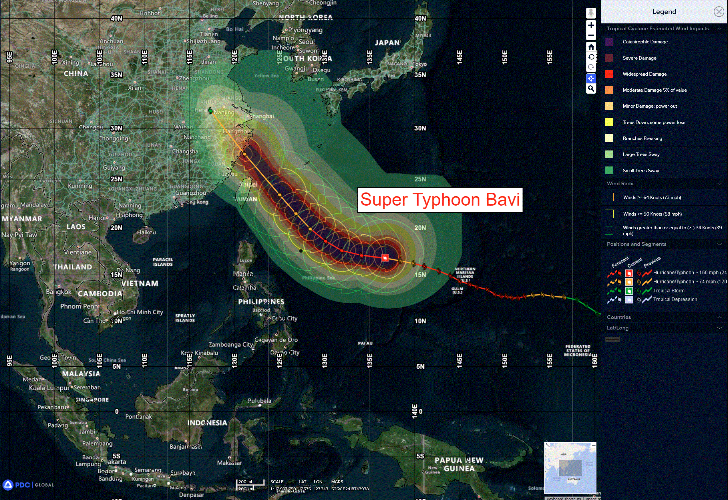
Tropical Cyclone 09W (Bavi) is located approximately 674 NM south-southeast of Kadena AB
Northeast Pacific Ocean: There are no Tropical Cyclones
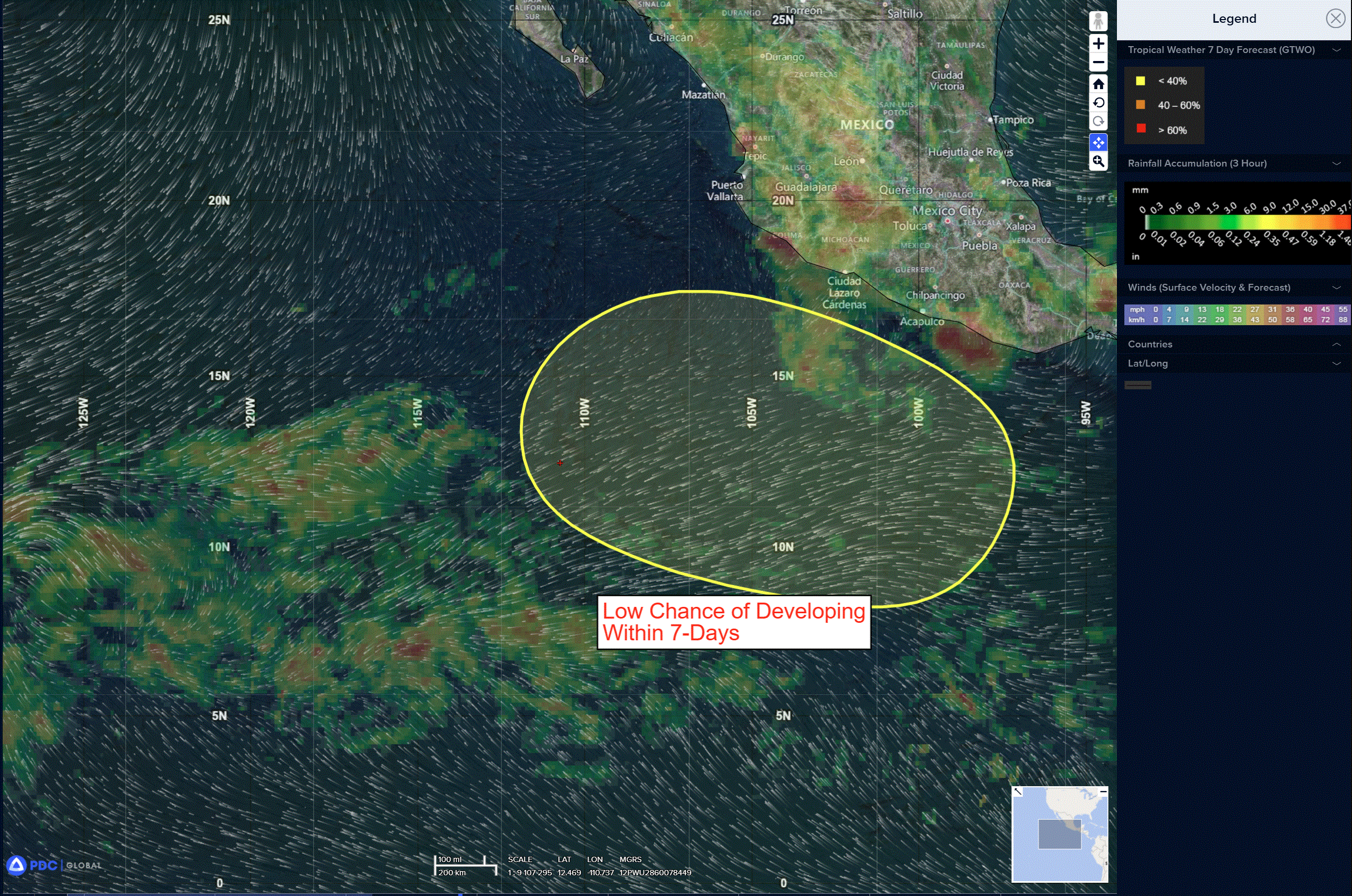
>>> Offshore of Southwestern Mexico:
An area of low pressure is expected to form late this weekend or early next week several hundred miles south of the coast of southwestern Mexico. Environmental conditions appear favorable for gradual development thereafter, and a tropical depression could form as the system moves generally west-northwestward.
* Formation chance through 48 hours…low…near 0 percent
* Formation chance through 7 days…medium…40 percent
Central Pacific Ocean: There are no Tropical Cyclones
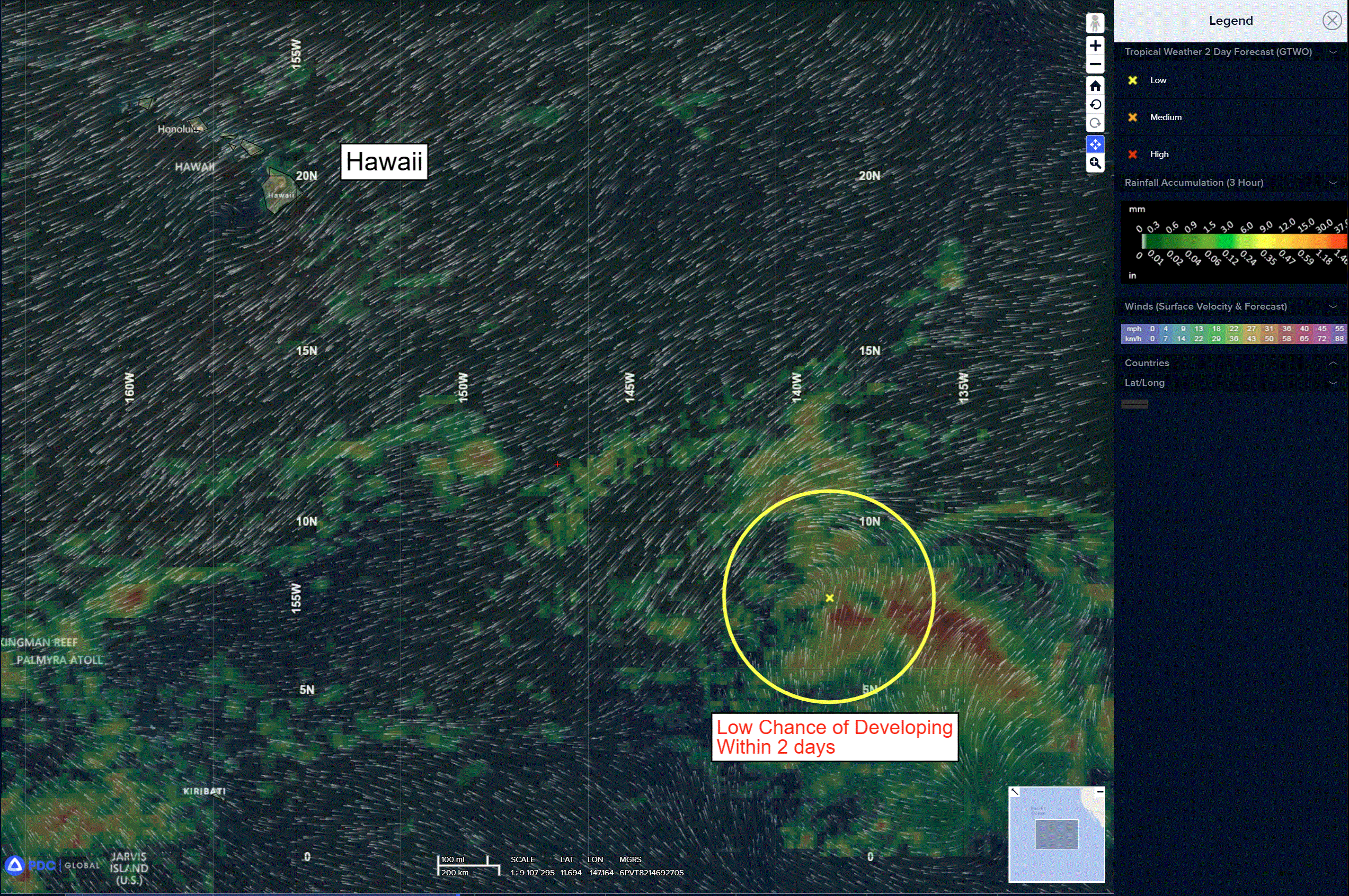
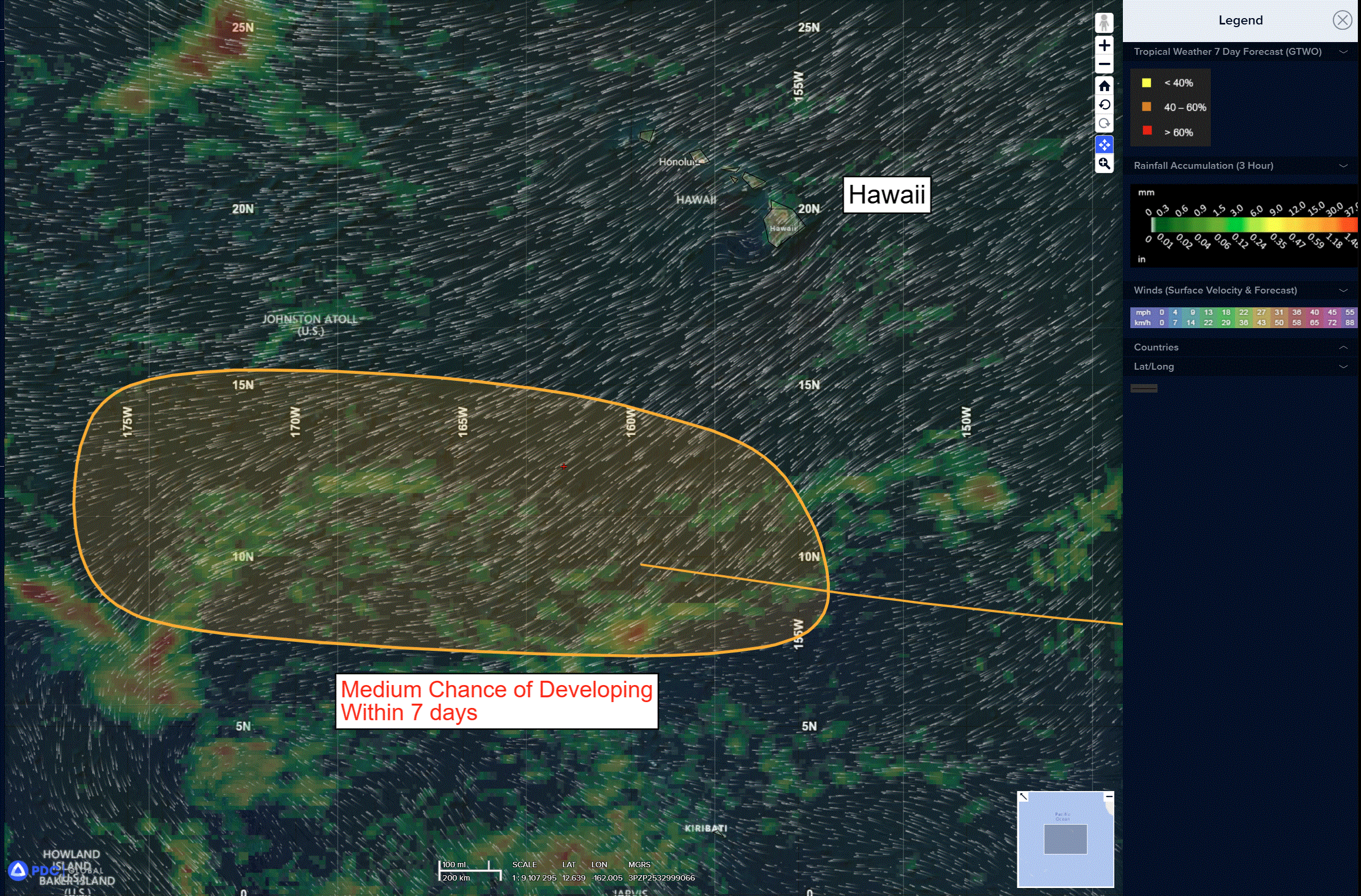
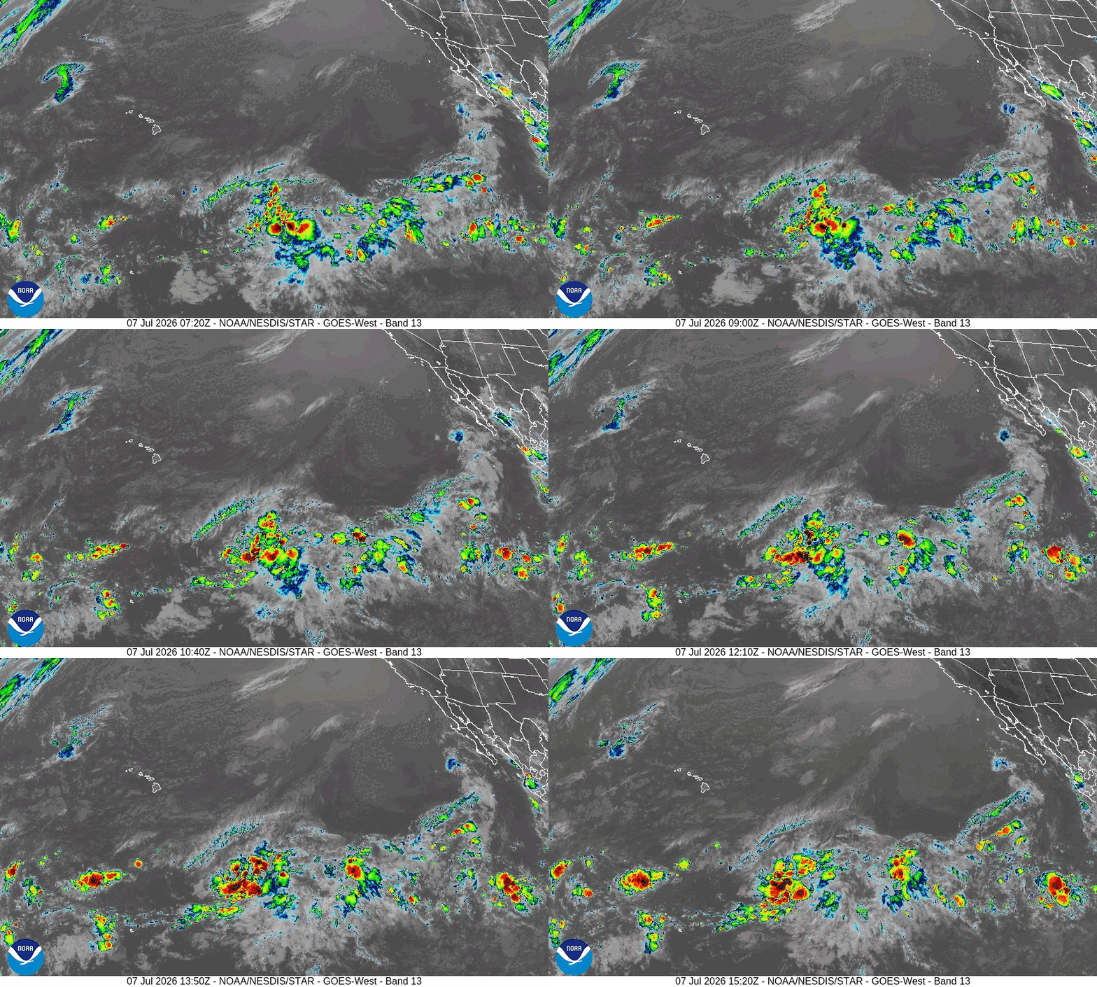
A trough of low pressure located well southeast of the Hawaiian Islands is producing disorganized showers and thunderstorms. Environmental conditions appear favorable for gradual development of this system later this week and into this weekend, and a tropical depression could form as the system moves westward to west-northwestward across the central Pacific, remaining well south of the Hawaiian Islands.
* Formation chance through 48 hours…low…10 percent
* Formation chance through 7 days…medium…60 percent
Western Pacific, Indian Ocean, and adjacent Seas:
Western Pacific
Super Typhoon 09W (Bavi)
According to the JTWC Warning Number 29, sustained winds are 135 knots with gusts to 165 knots
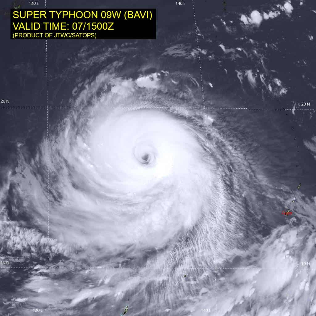
Animated enhanced infrared (eir) satellite imagery depicts super typhoon 09w (Bavi) with an expansive ring of cold cloud tops surrounding a 30 nm eye. On the bd curve ir satellite loop, the black shade now measures a thickness of greater than 100 nm in all directions, showing how large the system has become. Overall, the central dense overcast has significantly cooled and is now much larger compared to 6 hours ago. However, the eye itself has simultaneously become a bit more cloud-filled. There also appears to be some pressure on the system from the northeast, evident by
the upper-level cloud elements and associated outflow being restricted in that quadrant.
Environmental analysis indicates that 09W is in a marginally favorable environment characterized by strong outflow aloft and warm (29-30 c) sea surface temperatures offset by the moderate to high (20-25 kts) northeasterly vertical wind shear.
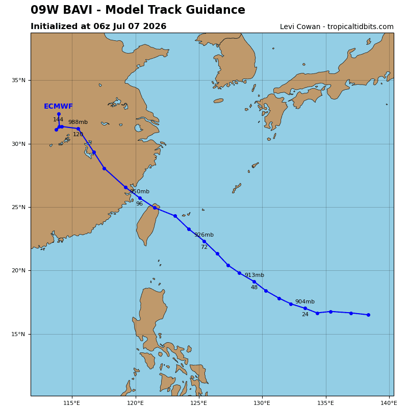
Super typhoon 09W is forecast to continue tracking west-northwestward through 24 hours. After 24 hours, the str that is currently centered over Okinawa is expected to propagate eastward and merge with the steering complex that is currently situated to the east-northeast of 09W. The resulting str will guide 09W in a more northwestward direction through the remainder of the forecast period. A track very close to Ishigakijima is forecast to occur just after 72 hours as the system heads toward the eastern coast of China. A final landfall is currently forecast to take place well south of Shanghai right around 96 hours.
In terms of intensity, 09W is forecast to slightly intensify over the next 12 hours as the system fends off the elevated northeasterly shear and
recovers from the eyewall replacement cycle that concluded some 10-12 hours ago. After 12 hours, the shear is expected to begin gradually degrading the vortex through 36 hours. After 36 hours, the ocean heat content (ohc) will begin to markedly drop, further supporting a weakening trend. By 72 hours, the ohc will drop to unfavorable levels, causing 09W to weaken as it approaches the eastern coast of China. After landfall, terrain interaction will cause the system to rapidly weaken through the remainder of the forecast period.