

Current Snapshot
For all the latest updates visit: DisasterAWARE
e7
e
2c
c7
c
bavi
09W_101200sair
09W_tracks_latest
By PDC’s Senior Weather
Specialist Glenn James

The Pacific Disaster Center’s (PDC Global) Friday, July 10, 2026, Tropical Cyclone Activity Report…for the Pacific Ocean, the Indian Ocean, and adjacent Seas
Current Tropical Cyclones:
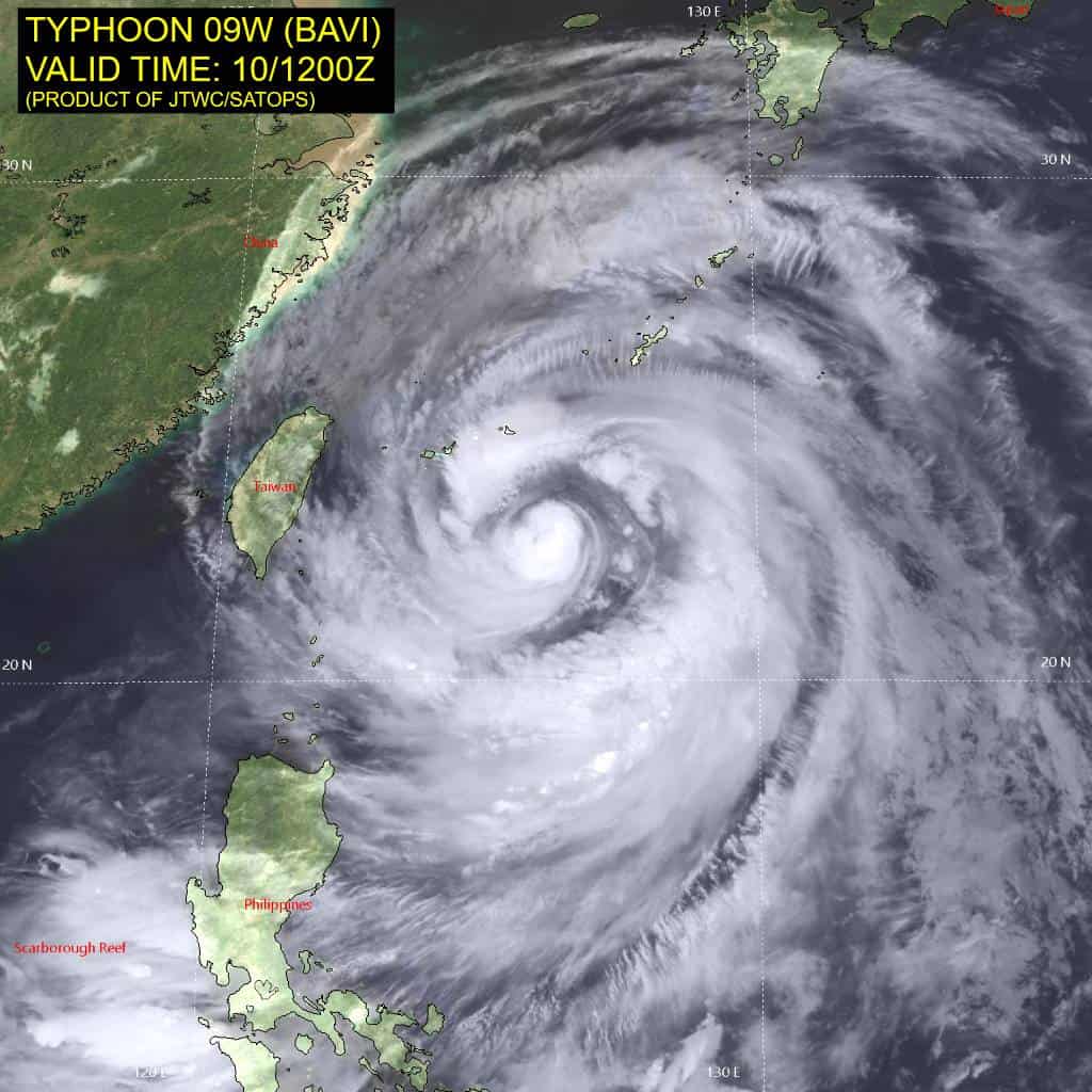
Tropical Cyclone 09W (Bavi) is located approximately 248 NM south-southwest of Kadena AB
Northeast Pacific Ocean: There are no Tropical Cyclones
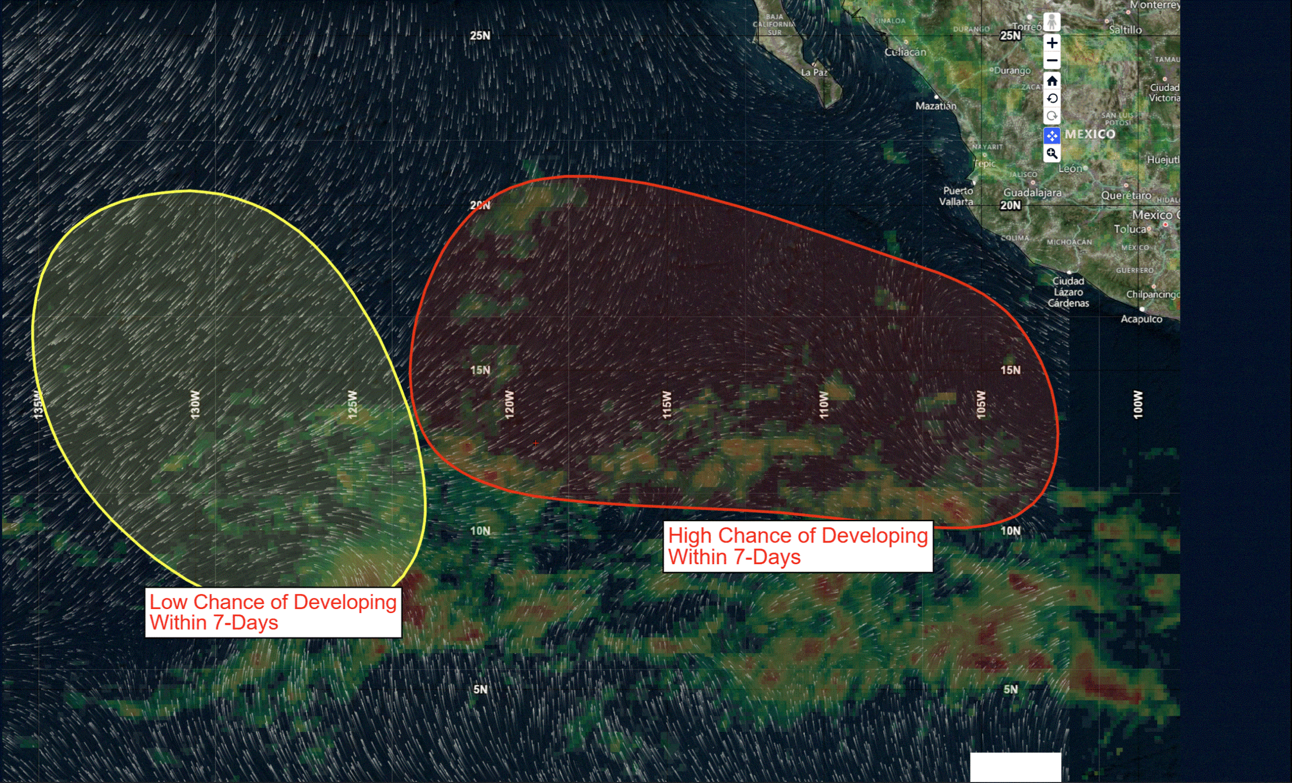
>>> Offshore of Southwestern Mexico:
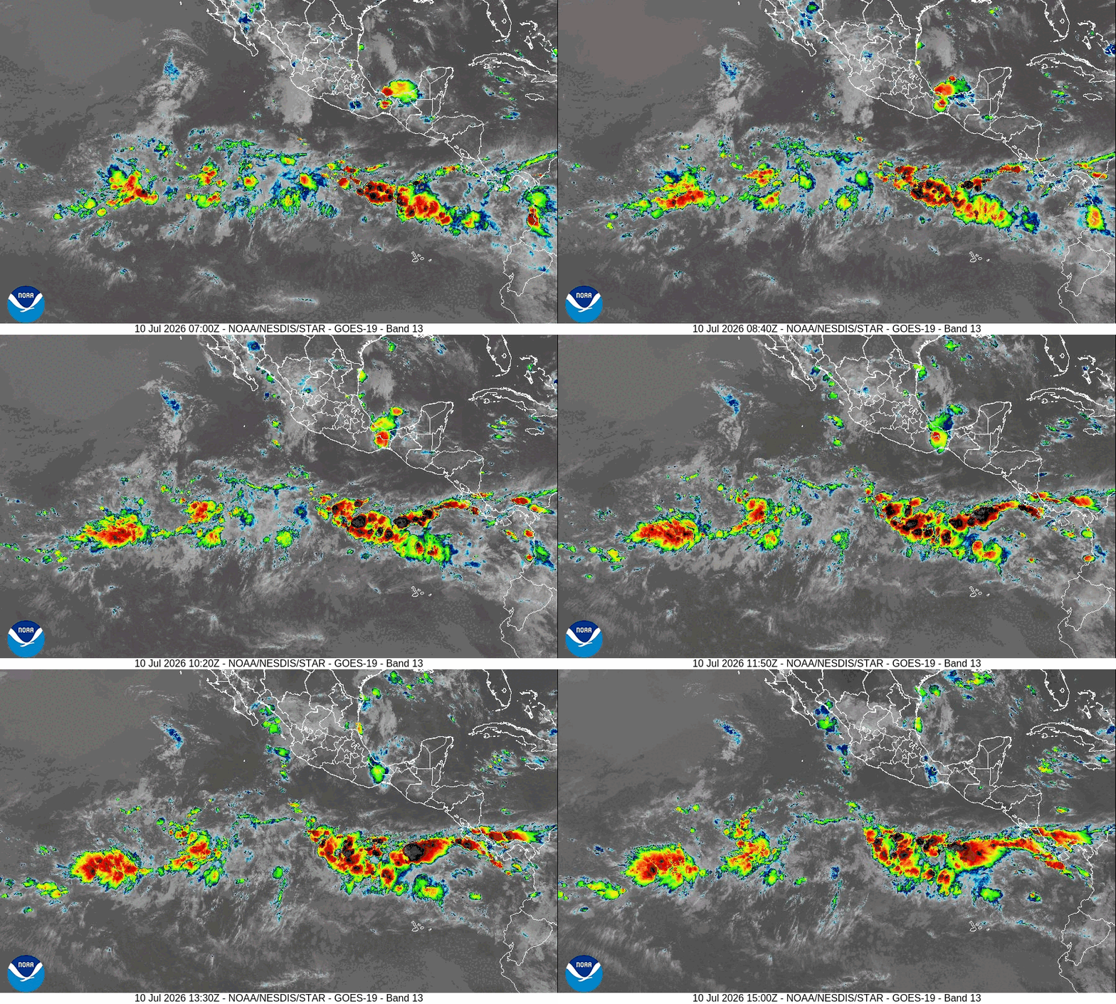
An area of low pressure is expected to form late this weekend or early next week several hundred miles south-southwest of the coast of southwestern Mexico. Environmental conditions appear favorable for gradual development thereafter, and a tropical depression is likely to form next week while the system moves generally west-northwestward.
* Formation chance through 48 hours…low…near 0 percent
* Formation chance through 7 days…high…70 percent
>>> Central and Western East Pacific:
Another area of low pressure could form by early next week well southwest of the Baja California peninsula. Some slow development of this system is possible next week while it moves slowly northwestward.
* Formation chance through 48 hours…low…near 0 percent
* Formation chance through 7 days…low…20 percent
Central Pacific Ocean: There are no Tropical Cyclones
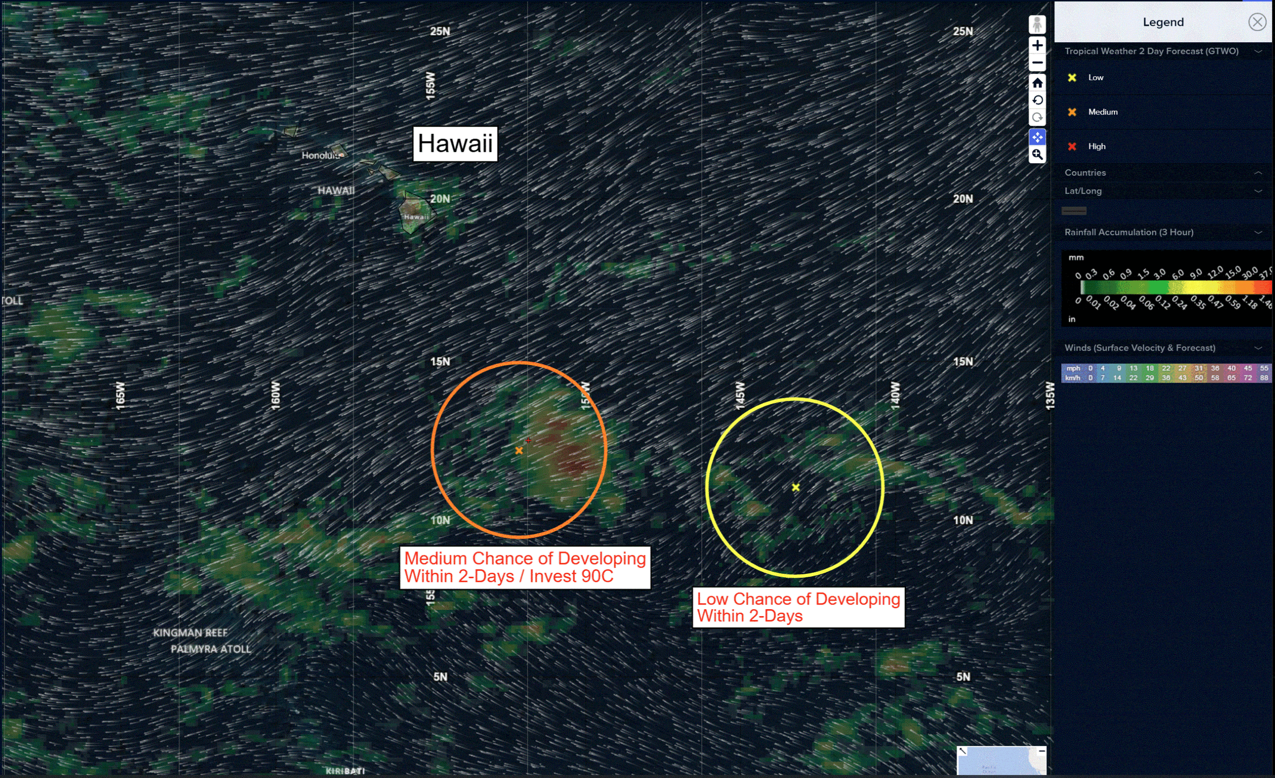
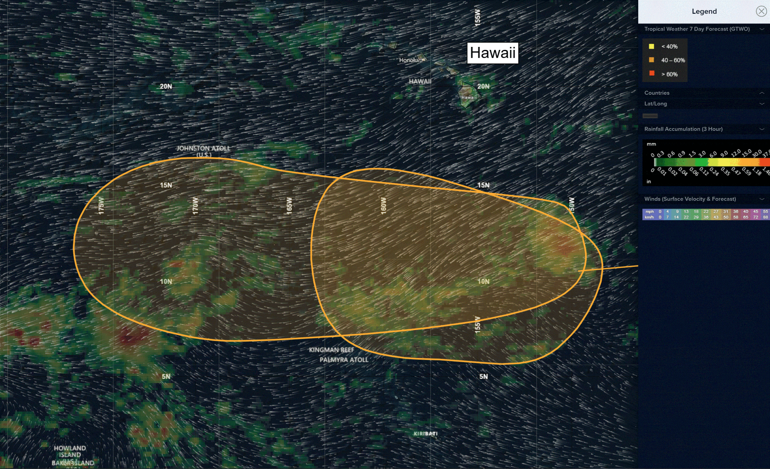
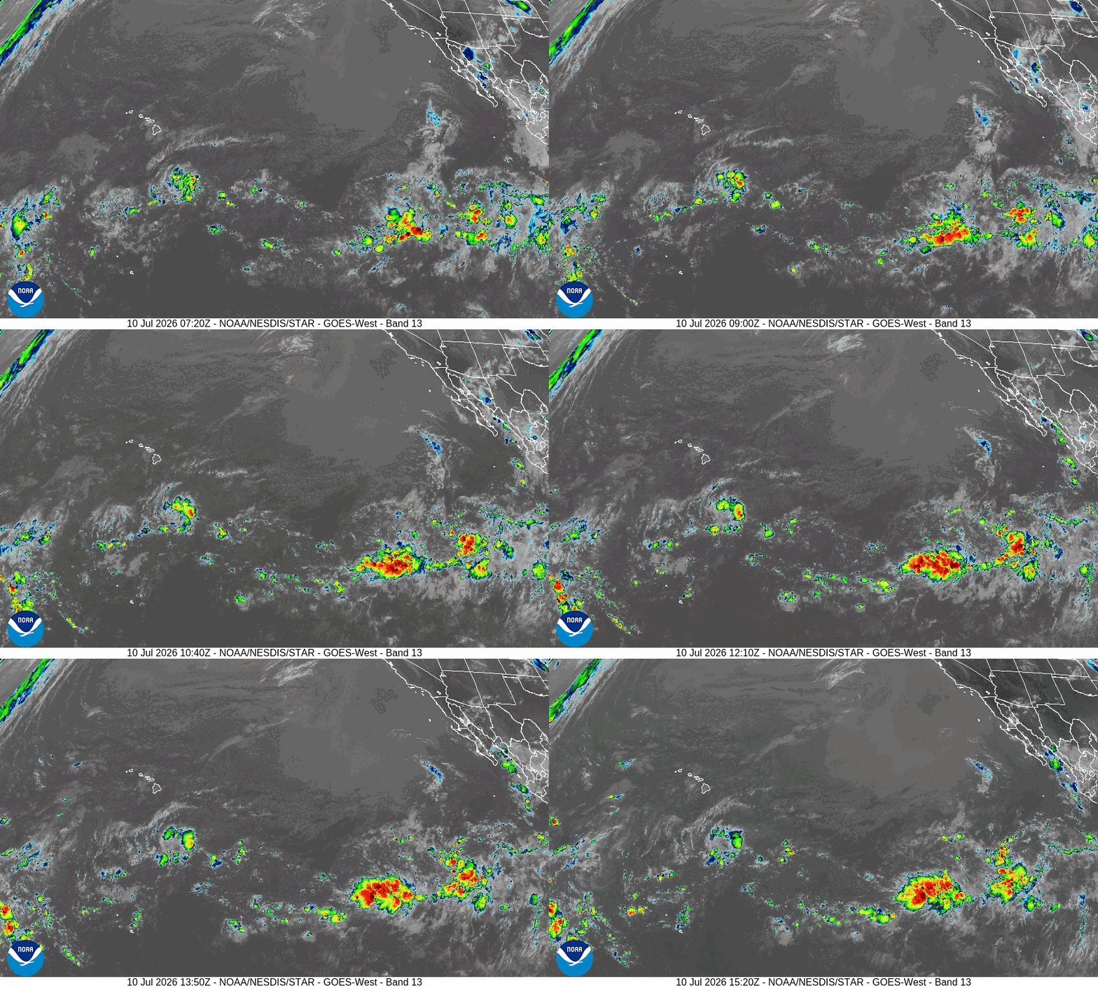
>>> South-Southeast of the Hawaiian Islands
Invest 90C
Recent satellite-derived wind data indicate that the area of disturbed weather located several hundred miles south-southeast of the Hawaiian Islands does not have a closed surface wind circulation. Environmental conditions appear conducive for gradual development of this system through early next week, and a tropical depression could form while the system moves generally westward across the central Pacific, remaining well south of the Hawaiian Islands.
* Formation chance through 48 hours…medium…40 percent
* Formation chance through 7 days…medium…50 percent
>>> Well Southeast of the Hawaiian Islands:
Another area of showers and thunderstorms is associated with a trough of low pressure located about 1000 miles southeast of the Hawaiian Islands. Environmental conditions appear favorable for some slow development of this system, and a tropical depression could form next week as it moves mainly westward over the central Pacific, remaining well south of the Hawaiian Islands.
* Formation chance through 48 hours…low…near 0 percent
* Formation chance through 7 days…medium…40 percent
Western Pacific, Indian Ocean, and adjacent Seas:
Western Pacific
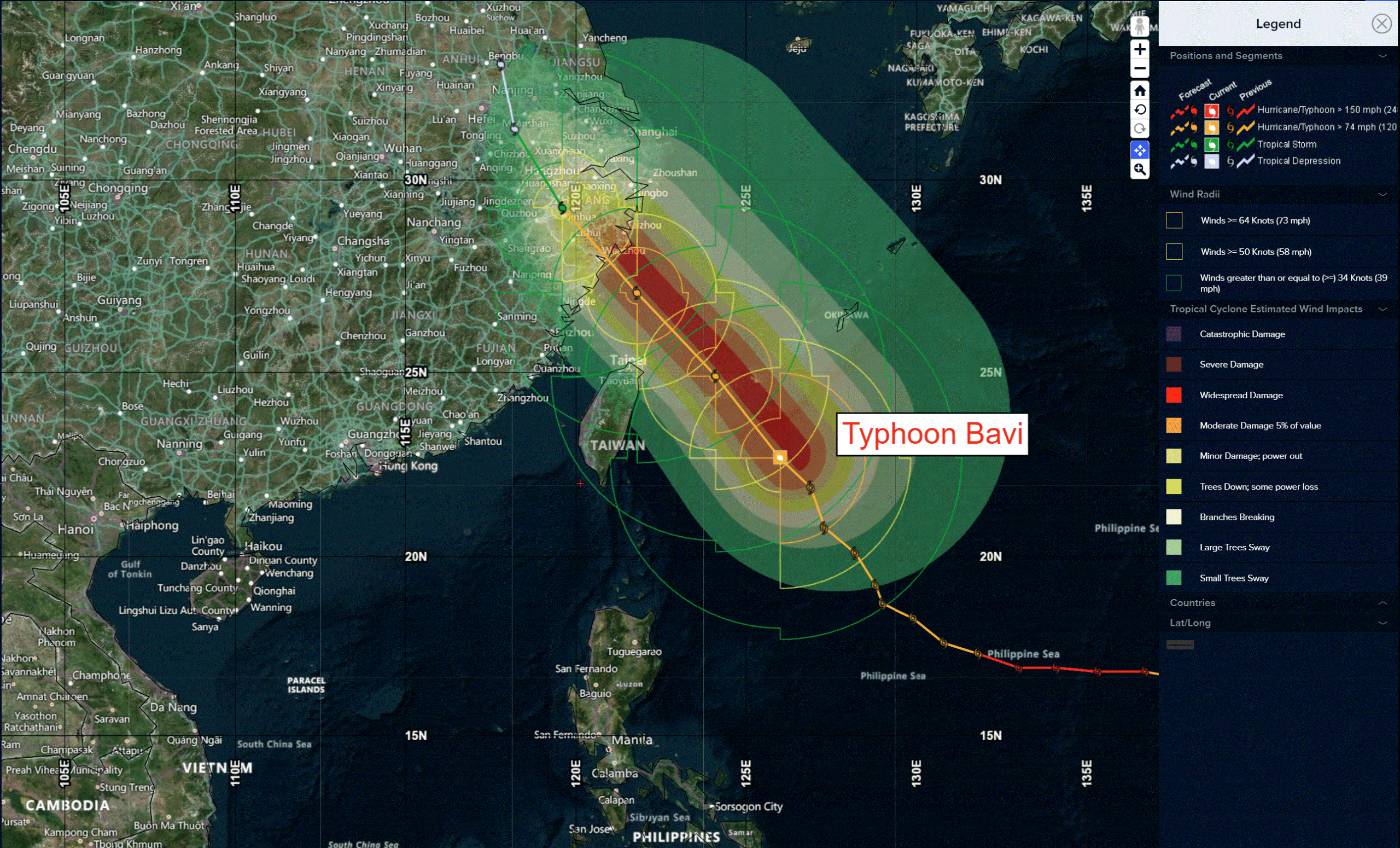
Typhoon 09W (Bavi)
According to the JTWC Warning Number 39, sustained winds are 80 knots with gusts to 100 knots
Animated enhanced infrared (eir) satellite imagery depicts the emergence of deep, overshooting cloud tops wrapping into the low-level circulation center. The developing core is flanked by a massive outer convective band that stretches 330 nm from end to end. The system exhibits excellent radial outflow, which has recently expanded further along the poleward side. A 100929z wsf-mmwi 37 ghz microwave image reveals a closed low-level ring surrounding the inner core, but the 89 ghz channel shows this same feature open on its south side. With the inner core now consolidating on eir imagery, it has become clear that the system did not undergo a full, traditional eyewall replacement cycle (erc). Instead, the convective structure now resembles a banding eye formation, characterized by a prominent spiral band converging inward toward a formative eye.
The system is in a favorable environment of very low vertical wind shear (vws) and warmer sea surface temperatures (sst).
Data from an rcm-1 sar pass at 100938z and an ascat-b pass at 101152z confirm that the strongest winds are still located within the outer band, roughly 60 nm from the center, though the overall wind field has become significantly less symmetric. The circulation remains massive, with gale-force winds extending beyond 300 nm from the center and storm-force winds out to as far as 230 nm. Peak observed wind gusts have climbed to over 60 kts in some parts of the southern Ryukyu islands.
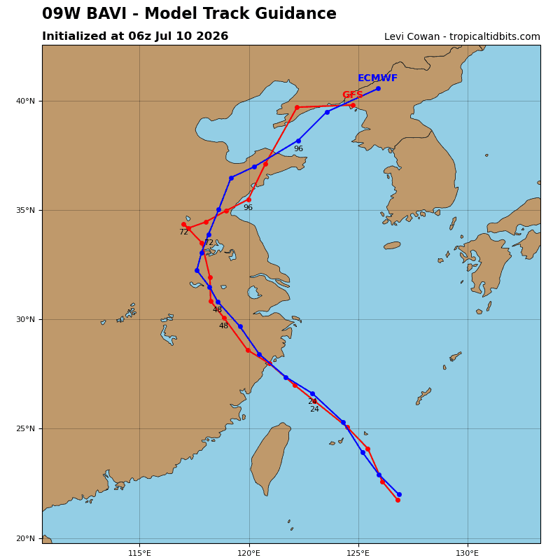
After a brief northward jog, TY Bavi has resumed its expected northwestward trajectory. Steered by a deep-layer str positioned south of Honshu, the system will maintain this motion, passing very near or directly over the southern Japanese island of Ishigaki before making landfall over Wenzhou, China. A final turn towards the north will occur at 60 hours as the
circulation crosses the low- to mid-level ridge axis.
The supportive conditions of low vws and warm sst will prevail over the next 24 hours, helping the system to maintain its intensity through landfall. Potential partial erc events may cause fluctuations in track and intensity on final approach to mainland China.
Rapid weakening will commence once the system moves inland, with dissipation predicted by 60 hours. Even after the center of the system moves far inland, the massive scale of the circulation means a broad fetch of elevated winds will travel northward over the offshore waters of China and push into the Yellow Sea.