

Current Snapshot
For all the latest updates visit: DisasterAWARE
2e
7e
2ee
7ee
e
2c
7c
csat
bavi
close
09W_111200sair
09W_tracks_latest
By PDC’s Senior Weather
Specialist Glenn James

The Pacific Disaster Center’s (PDC Global) Saturday, July 11, 2026, Tropical Cyclone Activity Report…for the Pacific Ocean, the Indian Ocean, and adjacent Seas
Current Tropical Cyclones:
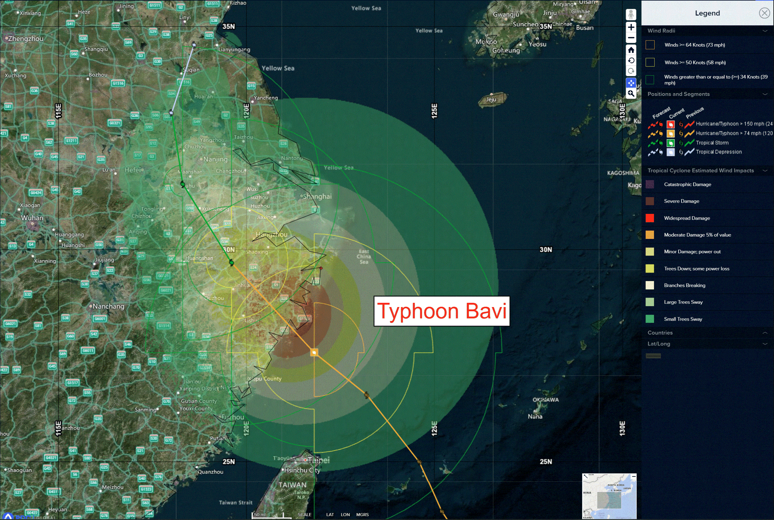
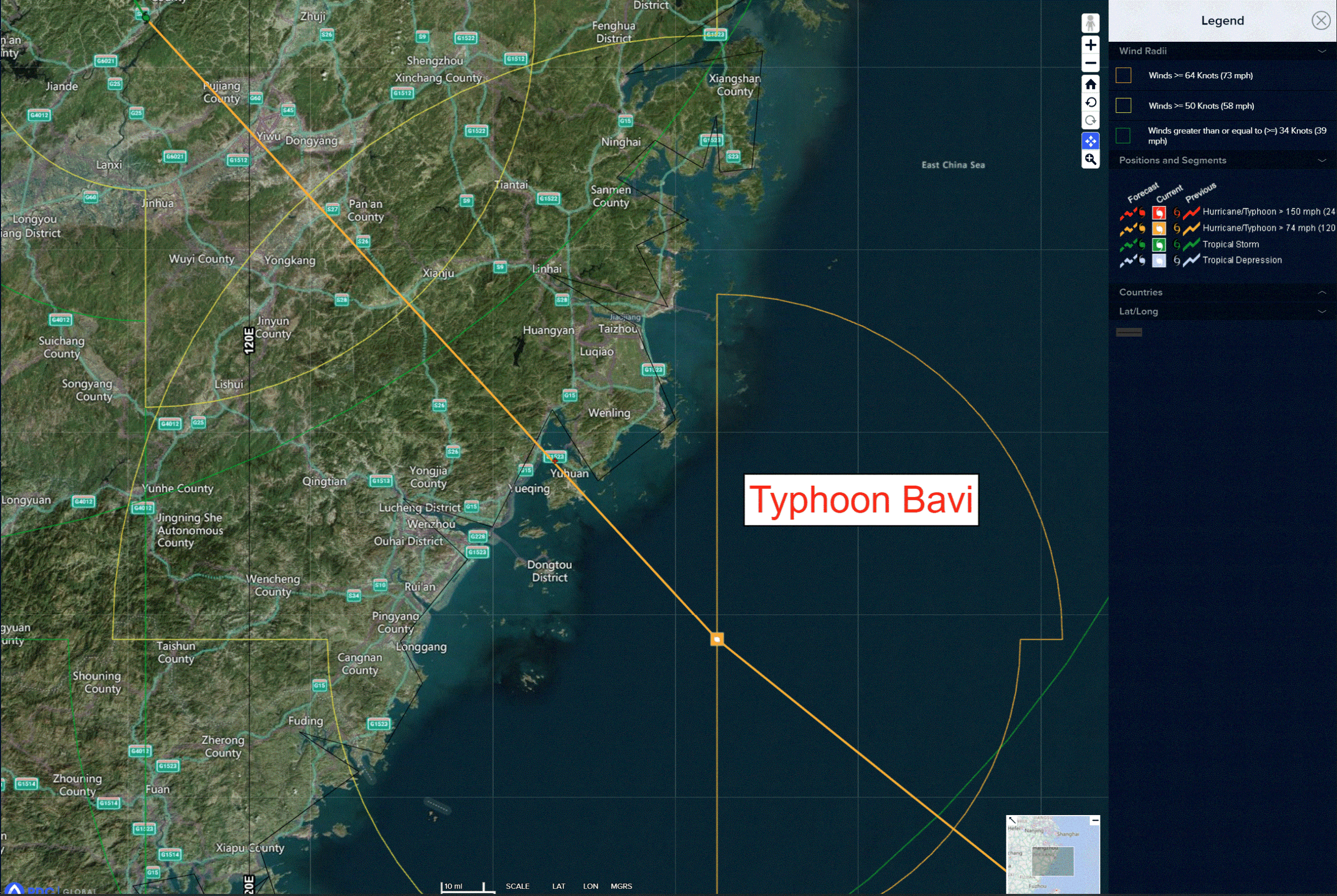
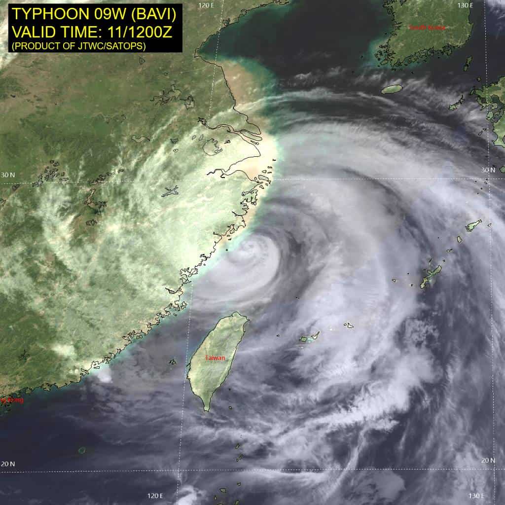
Tropical Cyclone 09W (Bavi) is located approximately 415 NM west-northwest of Kadena AB – Final Warning
Northeast Pacific Ocean: There are no Tropical Cyclones
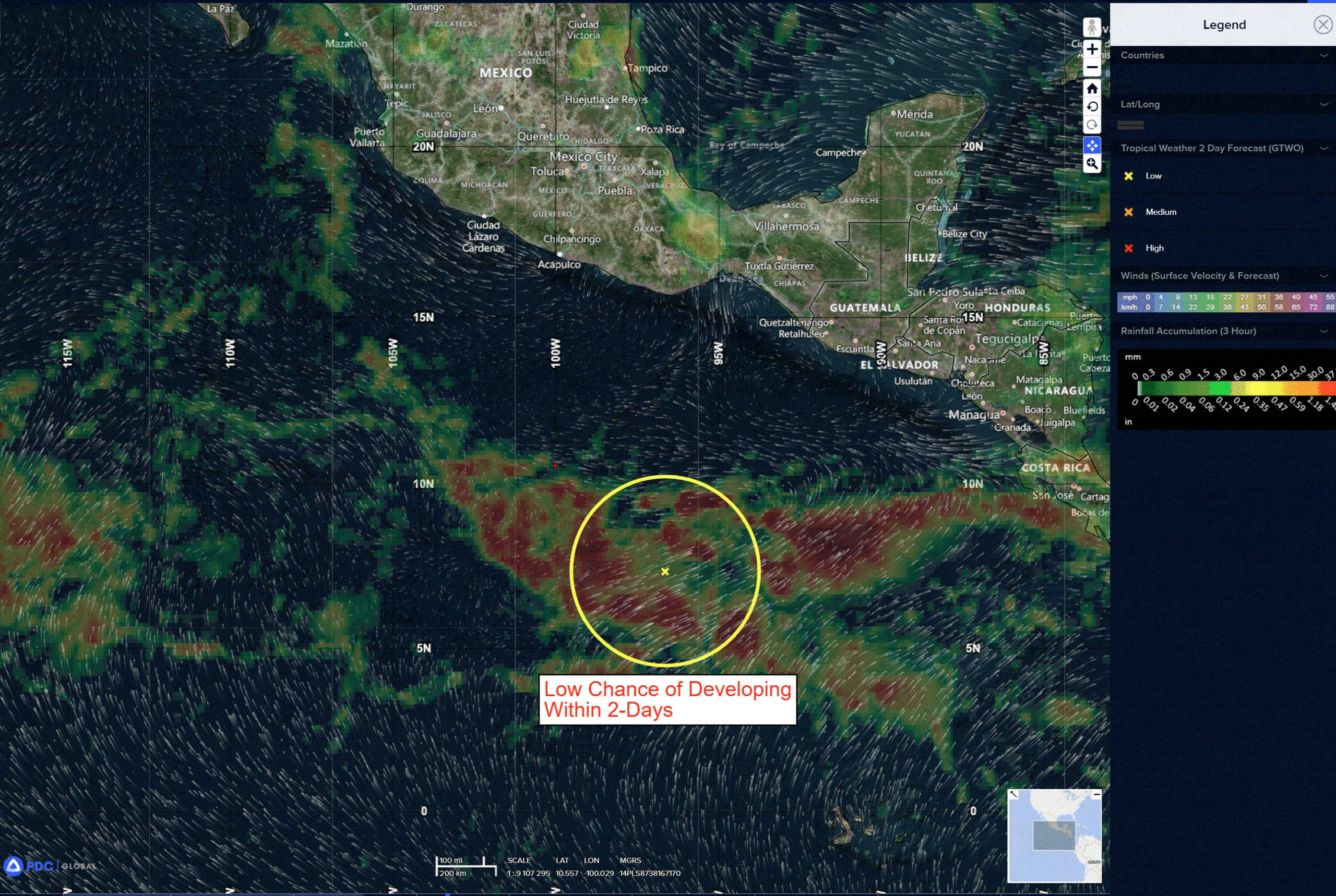
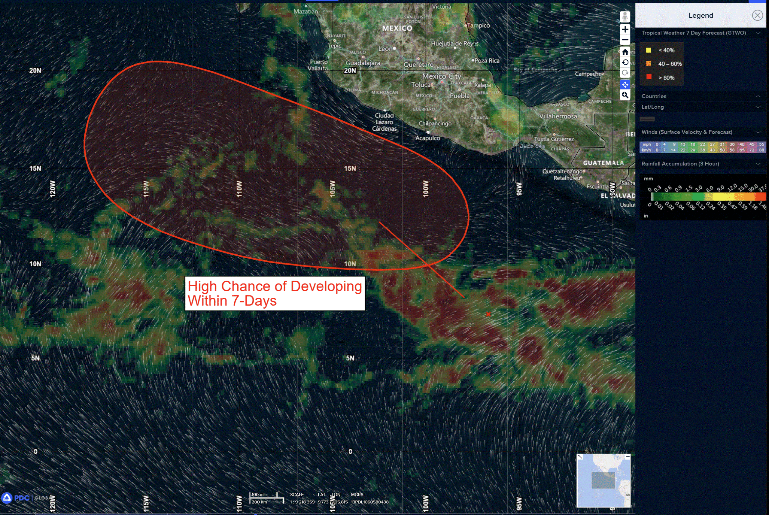
>>> Offshore of Southwestern Mexico:
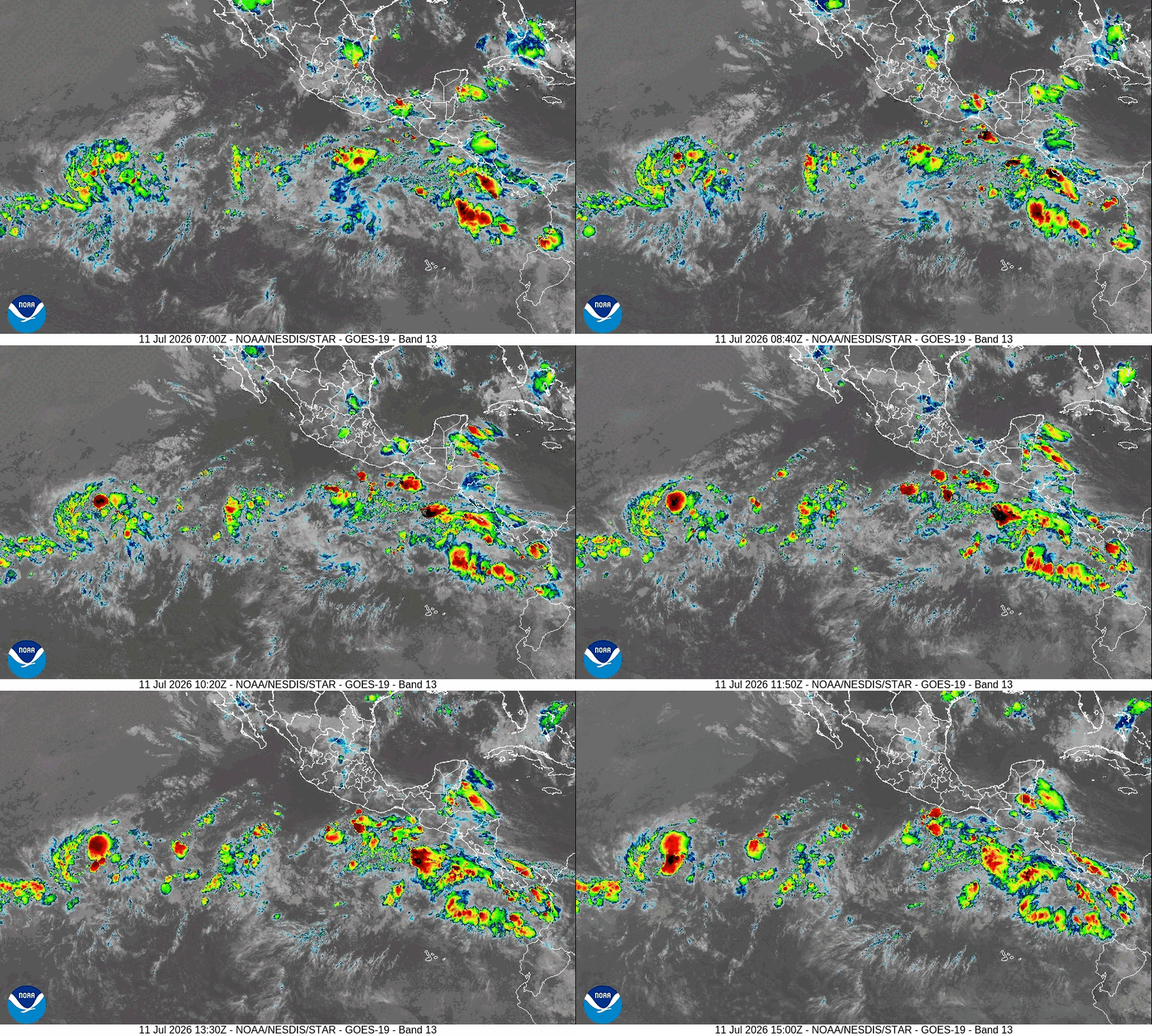
A broad area of low pressure located several hundred miles south of the southern coast of Mexico is producing a large area of disorganized showers and thunderstorms. Environmental conditions appear favorable for gradual development of this system, and a tropical depression is expected to form during the early or middle portions of next week while the system moves generally west-northwestward well off the coast of Mexico.
* Formation chance through 48 hours…medium…40 percent
* Formation chance through 7 days…high…90 percent
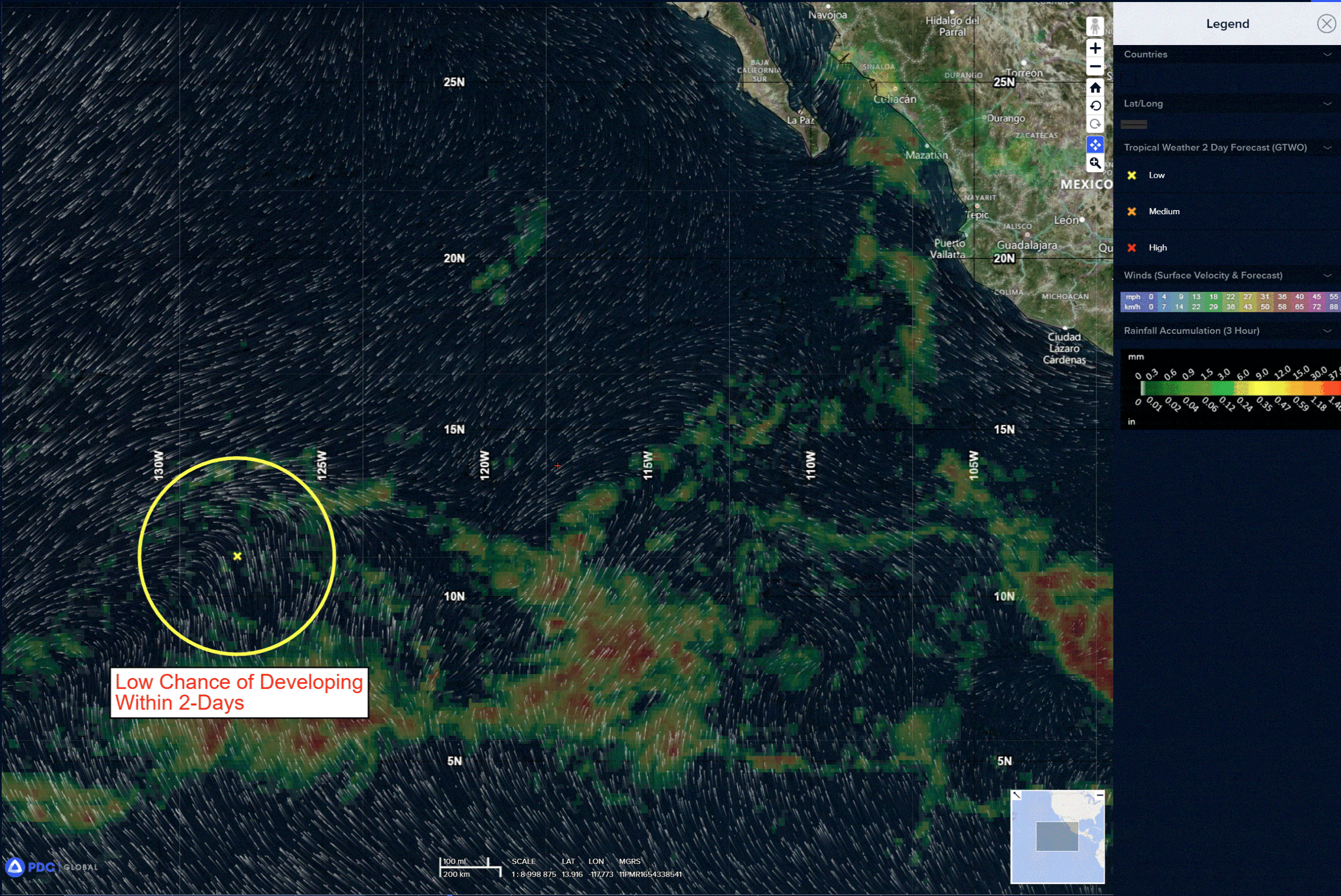
>>> Central and Western East Pacific:
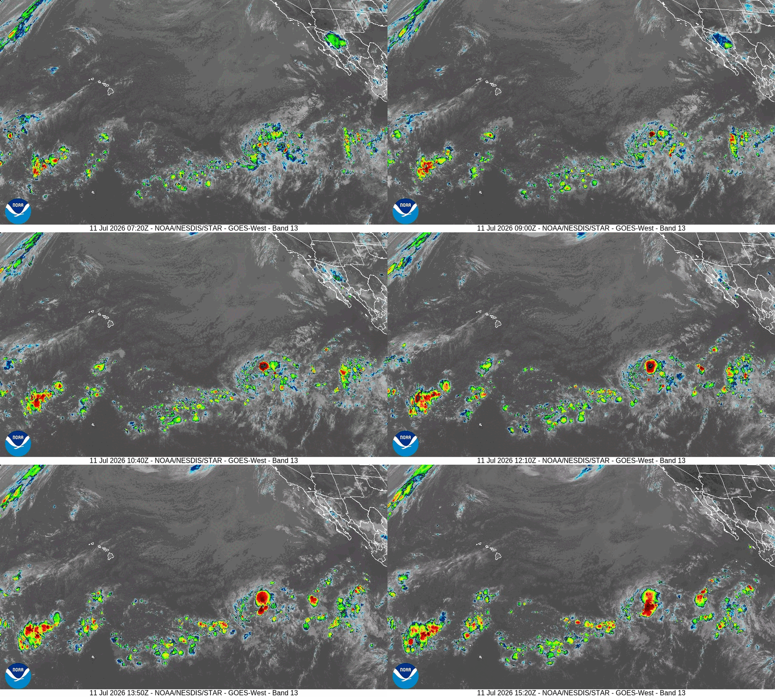
A weak and elongated area of low pressure located about 1500 miles southwest of the Baja California peninsula continues to produce showers and thunderstorms. Some additional development is possible over the next couple of days before the system moves west-northwestward into a region of strong upper-level winds and drier air.
* Formation chance through 48 hours…low…20 percent
* Formation chance through 7 days…low…20 percent
Central Pacific Ocean: There are no Tropical Cyclones
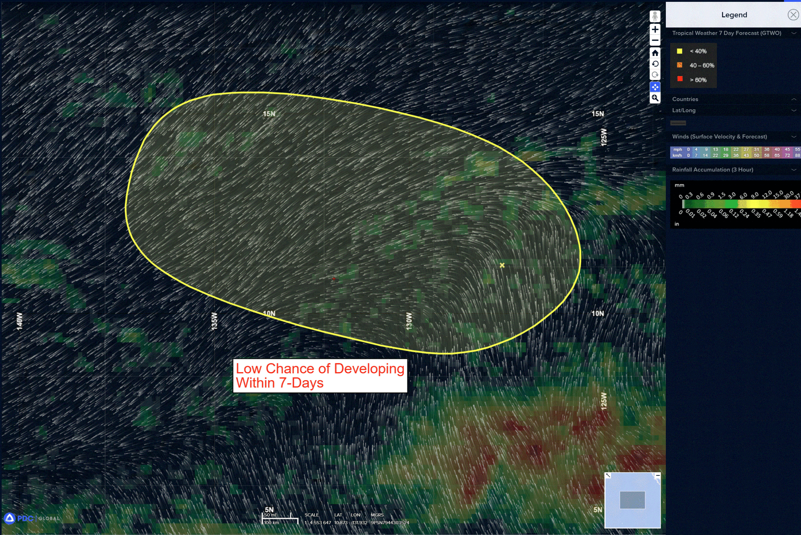
>>> Well Southeast of the Hawaiian Islands:
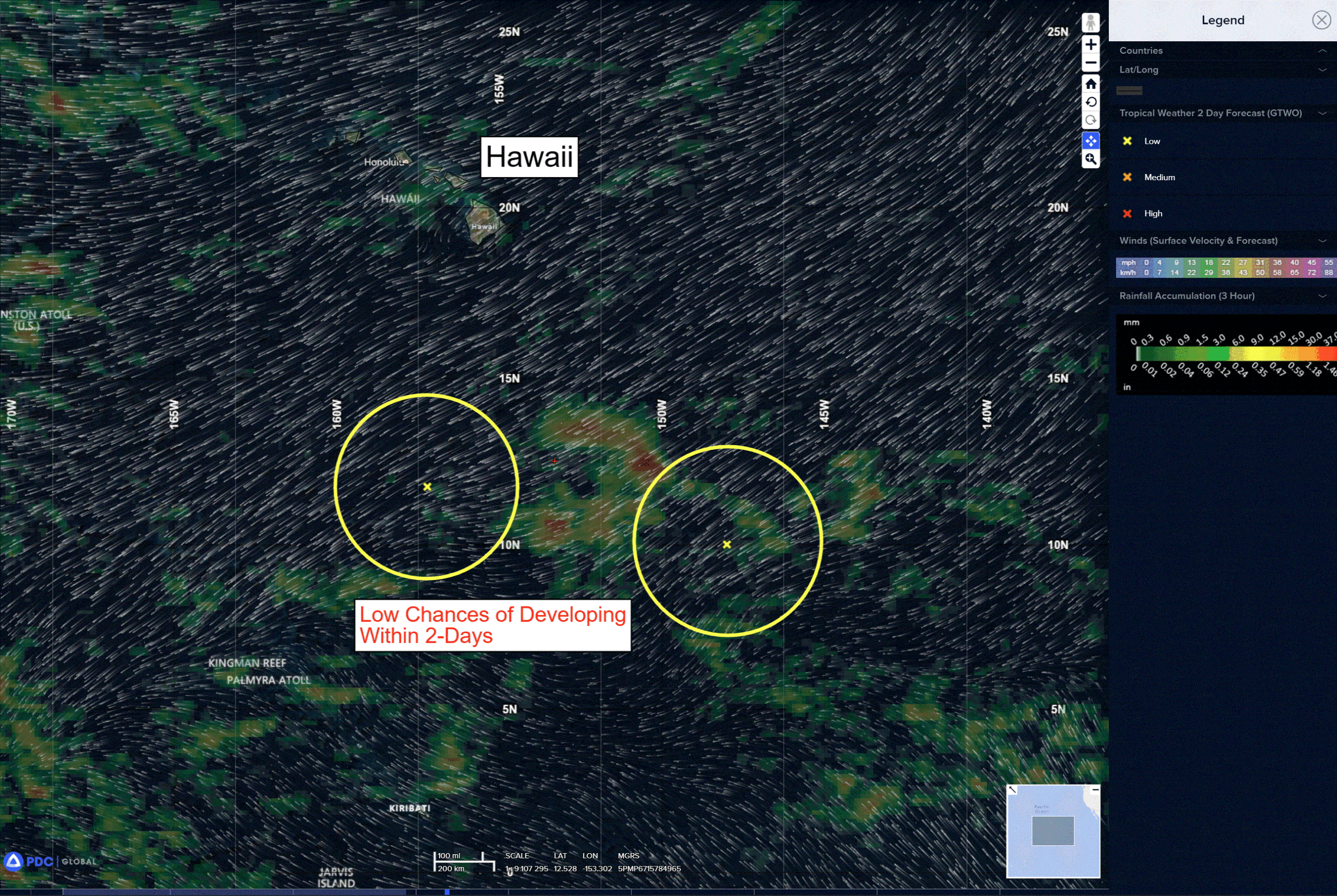
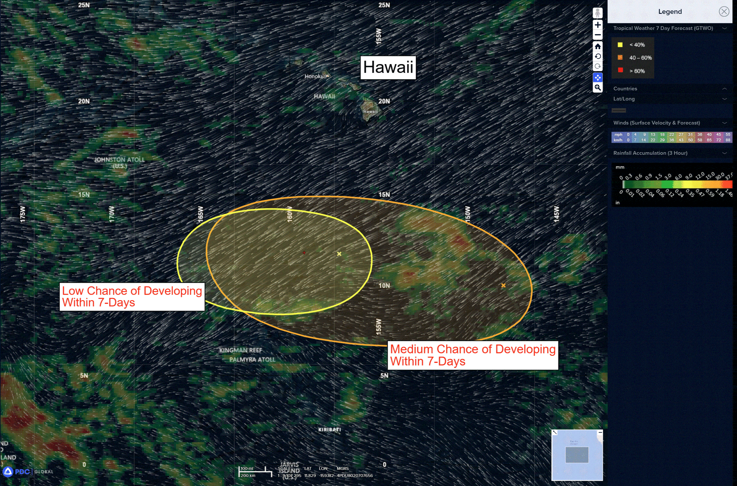
A trough of low pressure located several hundred miles southeast of the Hawaiian Islands is producing disorganized showers and thunderstorms. Environmental conditions appear favorable for gradual development of this system, and a tropical depression could form by mid-next week while it moves generally westward across the central Pacific, remaining well south of the Hawaiian Islands.
* Formation chance through 48 hours…low…10 percent
* Formation chance through 7 days…medium…40 percent
Western Pacific, Indian Ocean, and adjacent Seas:
Western Pacific
Typhoon 09W (Bavi) – Final Warning
According to the JTWC Warning Number 44, sustained winds are 60 knots with gusts to 75 knots
The system made landfall approximately 180 nm south-southwest of Shanghai, China at
approximately 111500z. Animated enhanced infrared imagery depicts a very large tropical storm with deep convection persisting around the center of the vortex.
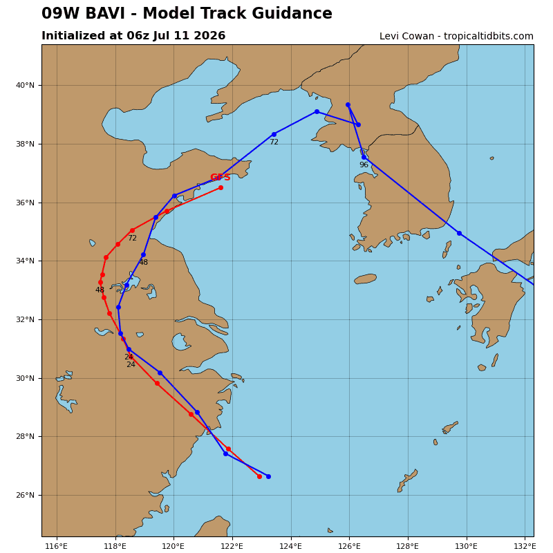
Animated radar imagery shows a similarly large region of precipitation associated with the system as it moves inland. TS Bavi is expected to continue northwestward over the next 18 hours then turn poleward and northeastward as it steadily decays over land. 09W is expected to be fully dissipated by 48 hours.
After 48 hours, there is some uncertainty about the ultimate fate of the system as a result of
its trajectory over land. Some numerical model guidance suggests a potential for the remnants of 09W to emerge over the Yellow Sea while retaining some tropical characteristics within the next 48 hours.
>>> There’s an area of disturbed weather being referred to as Invest 97W, which is located approximately 178 NM south-southeast of Guam
Maximum sustained surface winds are estimated at 18 to 23 knots.
The potential for the development of a significant tropical cyclone within the next 24 hours remains low.
>>> There’s a second area of disturbed weather being referred to as Invest 98W, which is located approximately 388 NM east-southeast of Kwajalein
Maximum sustained surface winds are estimated at 23 to 28 knots.
The potential for the development of a significant tropical cyclone within the next 24 hours remains low.