

Current Snapshot
For all the latest updates visit: DisasterAWARE

1800×1080
ias
close
081456_earliest_reasonable_toa_34

1000×1000
081456WPCQPF_sm
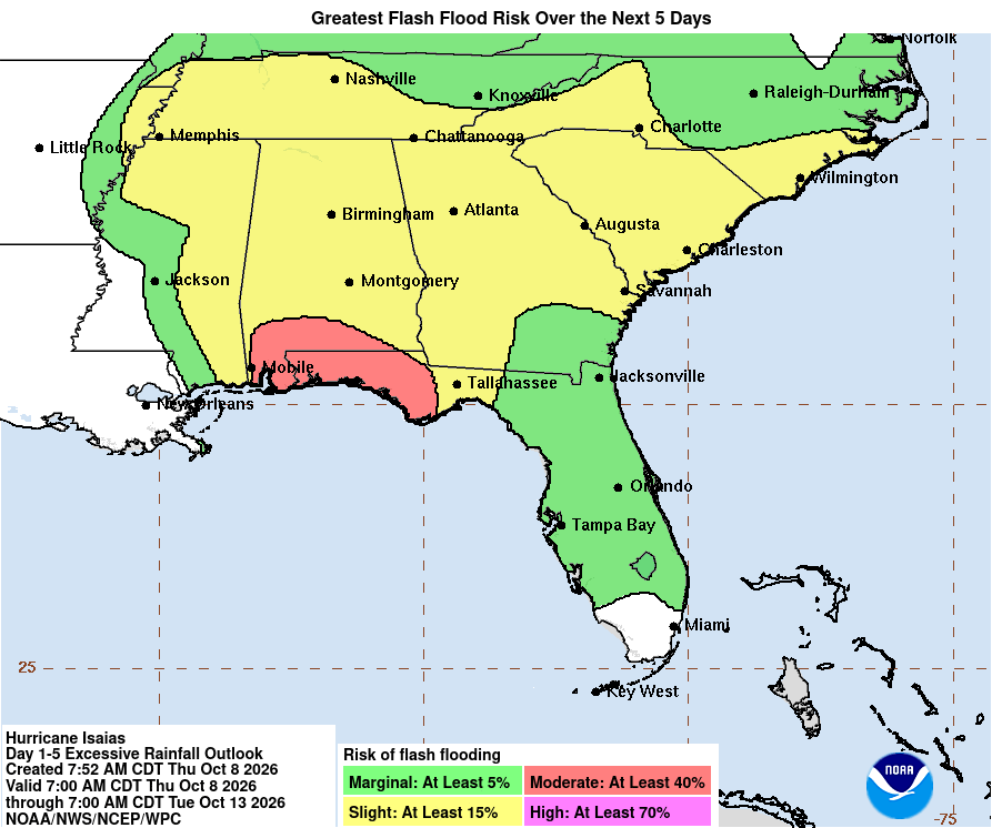
081456WPCERO_sm
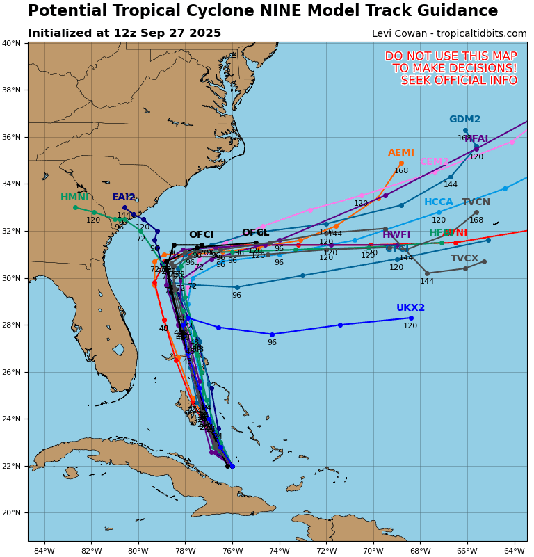
09L_tracks_latest
By PDC’s Senior Weather
Specialist Glenn James

The Pacific Disaster Center’s (PDC Global) Thursday, October 8, 2026, Tropical Cyclone Activity Report…for the Atlantic Ocean, the Caribbean Sea, and the Gulf of America
Current Tropical Cyclones:
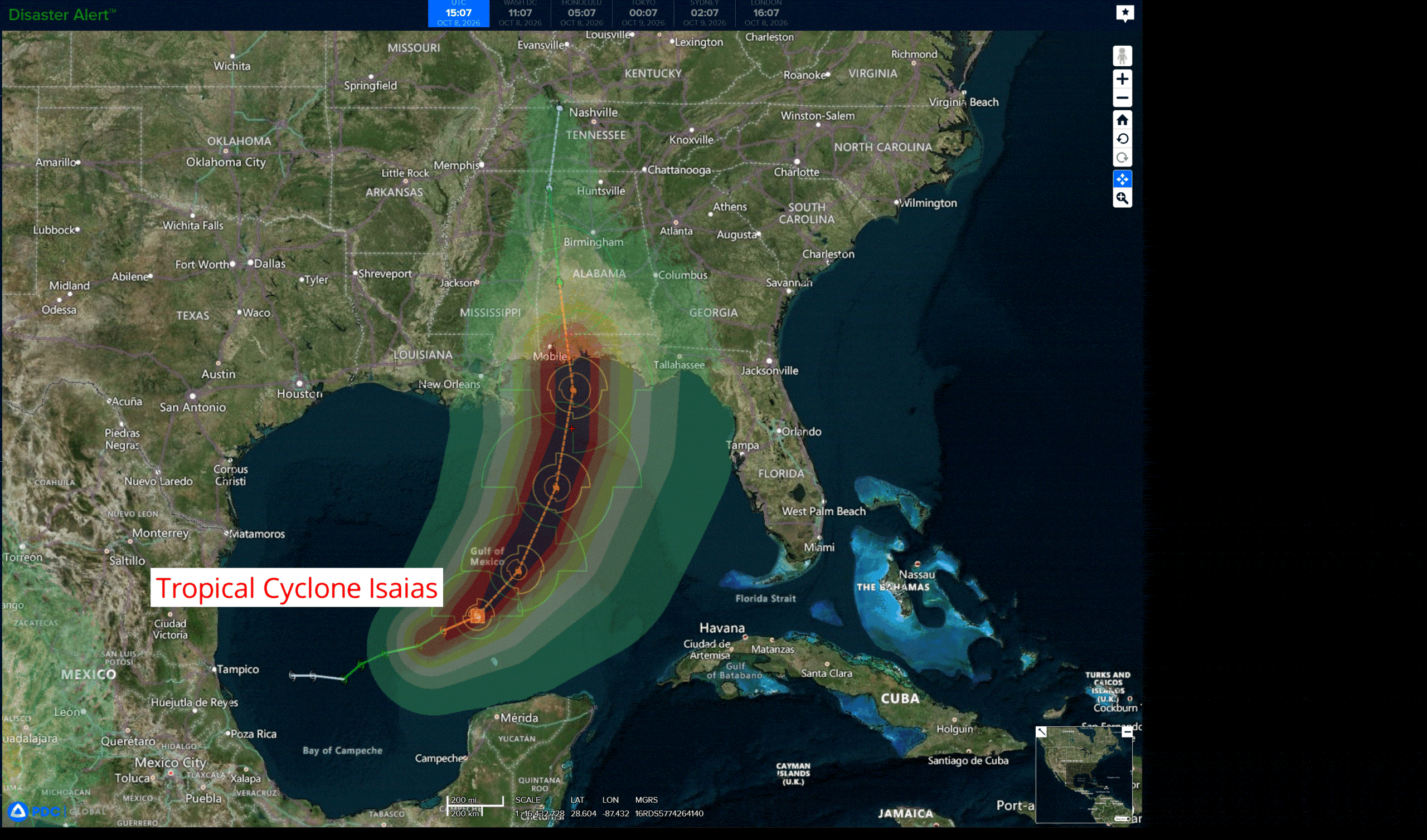
Tropical Cyclone Isaias…is located about 380 miles south of the Mississippi River
Atlantic Ocean: There are no active tropical cyclones
Tropical cyclone formation is not expected during the next 7 days.
Caribbean Sea: There are no active tropical cyclones
Tropical cyclone formation is not expected during the next 7 days.
Gulf of America:
Tropical Cyclone Isaias
ISAIAS STRONGER …PREPARATIONS TO PROTECT LIFE AND PROPERTY FROM STORM SURGE AND DAMAGING WINDS IN THE WARNING AREA SHOULD BE RUSHED TO COMPLETION TODAY
According to the NHC advisory number 8
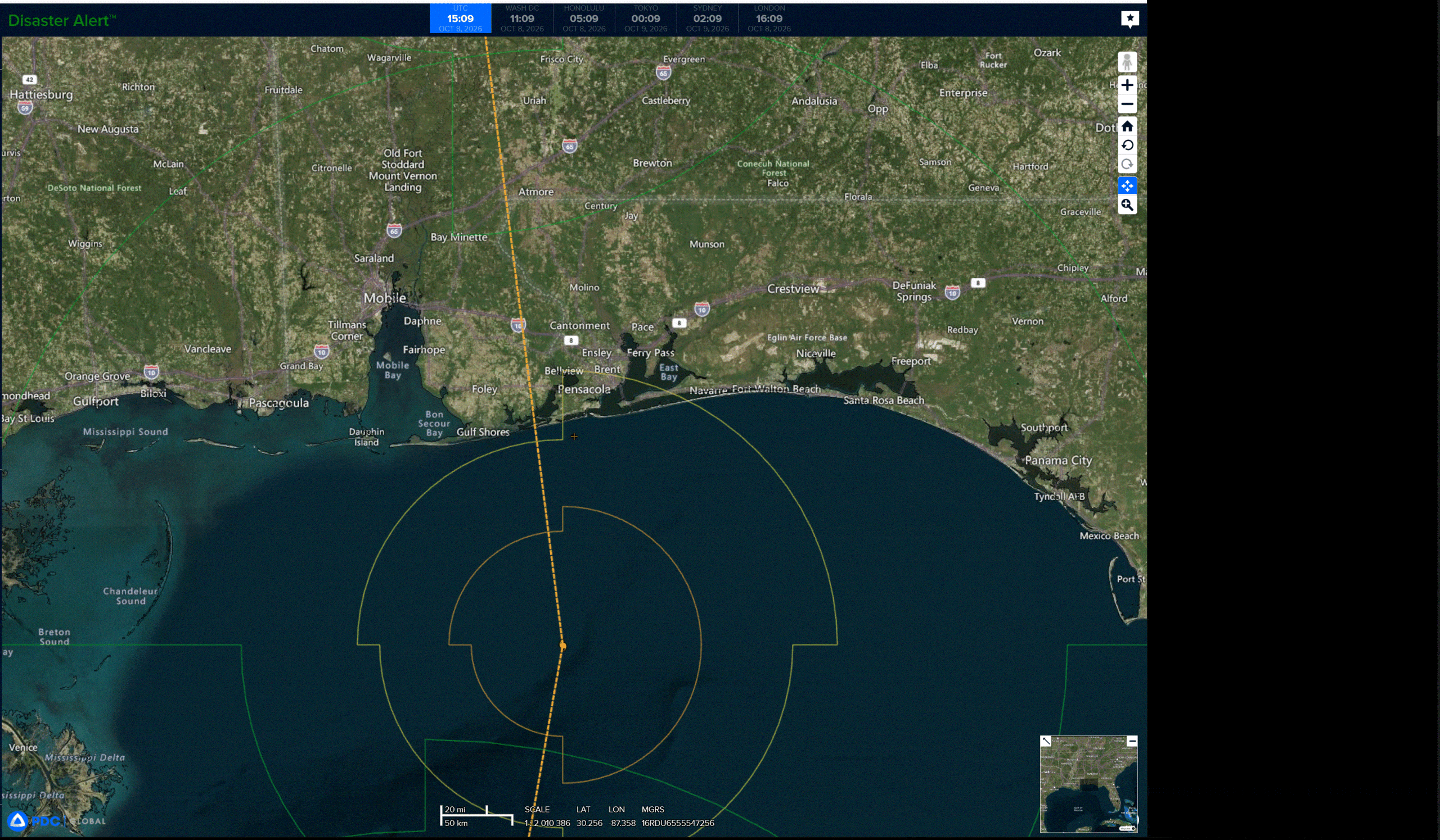
Isaias is moving toward the east-northeast near 10 mph (17 km/h). A turn toward the northeast is expected later today followed by a turn northward on Friday. On the forecast track, Isaias is expected to pass to the north of the Yucatan Peninsula later today and make landfall along the U.S. northern Gulf Coast within the warning area late Friday or early Saturday.
Maximum sustained winds have increased to near 85 mph (140 km/h) with higher gusts. Additional strengthening is expected through early Friday, and Isaias should remain a dangerous hurricane as it approaches the northern Gulf Coast Friday night.
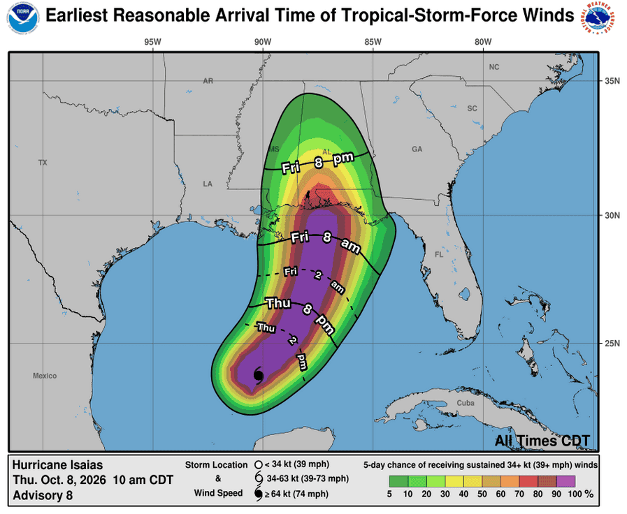
Hurricane-force winds extend outward up to 15 miles (30 km) from the center and tropical-storm-force winds extend outward up to 90 miles (150 km). The estimated minimum central pressure is 975 mb (28.80 inches).
HAZARDS AFFECTING LAND
STORM SURGE: The combination of a dangerous storm surge and the tide will cause normally dry areas near the coast to be flooded by rising waters moving inland from the shoreline. The water could reach the following heights above ground somewhere in the indicated areas if the peak surge occurs at the time of high tide…
Ocean Springs, MS to Indian Pass, FL…5-7 ft
Mobile Bay…5-7 ft Indian Pass, FL to Steinhatchee River, FL…4-6 ft
Mouth of the Mississippi River, LA to Ocean Springs, MS…3-5 ft
Steinhatchee River, FL to Suwannee River, FL…3-5 ft
Suwannee River, FL to Yankeetown, FL…2-4 ft
The deepest water will occur along the immediate coast near and to the east of the landfall location, where the surge will be accompanied by large and dangerous waves. Surge-related flooding depends on the relative timing of the surge and the tidal cycle, and can vary greatly over short distances.
WIND: Hurricane conditions are expected within the Hurricane Warning area Friday night into early Saturday, with tropical storm conditions beginning on Friday. Tropical storm conditions are expected in the warning areas on Friday and Friday night
Gusty winds are possible in portions of the Yucatan Peninsula on Thursday.
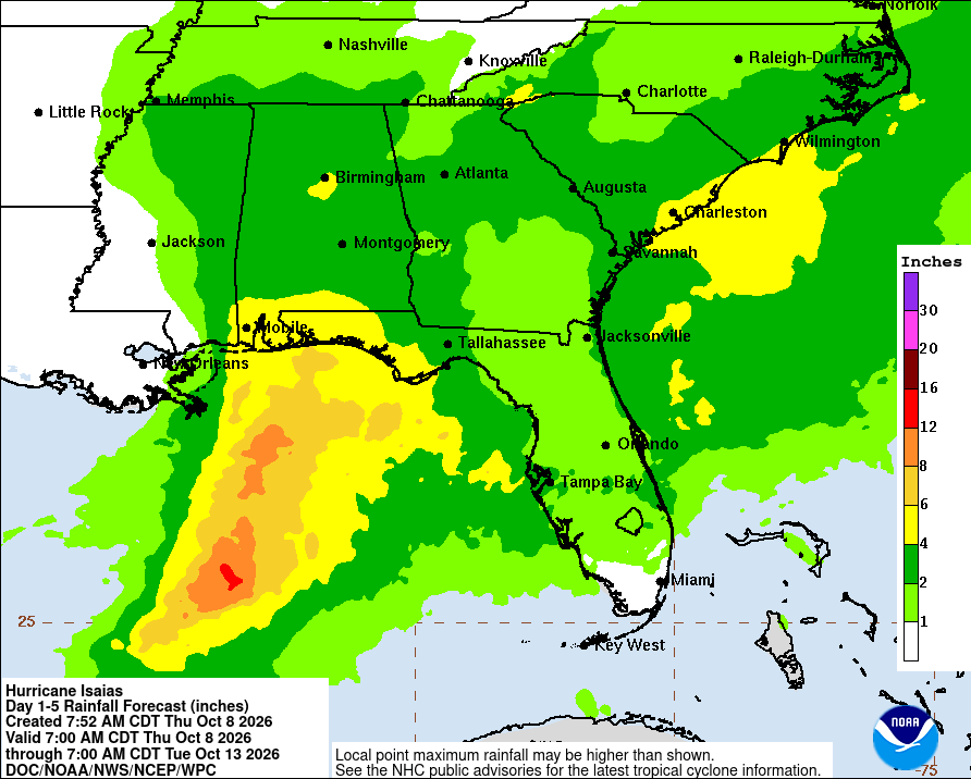
RAINFALL: Isaias is expected to produce rainfall amounts of 2 to 4 inches through Thursday across coastal portions of the Bay of Campeche with isolated higher amounts possible in the states of Campeche and western Yucatan.
From Friday through the weekend, Isaias is expected to produce rainfall amounts of 3 to 7 inches across the central U.S. Gulf Coast extending from far southeastern Louisiana to the Florida Big Bend region. Localized totals up to 15 inches are possible, particularly within banding across the Florida Panhandle and Big Bend. Rainfall amounts of 1 to 3 inches, with localized amounts up to 5 inches, are possible across much of the Southeast as far north as the Tennessee Valley and the Carolinas. Flash and urban flooding is possible across the region, with considerable impacts possible across much of southern Alabama and the Florida Panhandle into southwestern Georgia. River flooding is also expected, some of which could be significant.
TORNADOES: Isolated tornadoes will be possible Friday night in coastal areas of Alabama and the Florida Panhandle and far southwestern Georgia. The tornado threat will continue Saturday for eastern Alabama, Georgia and northern Florida.
SURF: Swells will affect the western and northern portions of the Yucatan Peninsula beginning later today and spread northward toward the Gulf Coast on Friday. These swells are likely to cause life-threatening surf and rip current conditions.