
")
Current Snapshot
For all the latest updates visit: DisasterAWARE
e
c
222
07W_261200sair
himawari9_ir_07W_202606261510_lat28.5-lon129.3
07W_tracks_latest
08W_261200sair
himawari9_ir_08W_202606261510_lat31.8-lon136.1
08W_gefs_latest
95w
himawari9_ir_95W_202606261510_lat7.0-lon174.0

95W_tracks_latest
By PDC’s Senior Weather
Specialist Glenn James

The Pacific Disaster Center’s (PDC Global) Friday, June 26, 2026, Tropical Cyclone Activity Report…for the Pacific Ocean, the Indian Ocean, and adjacent Seas
Current Tropical Cyclones:
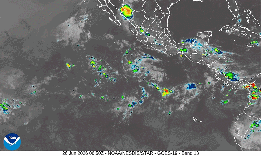
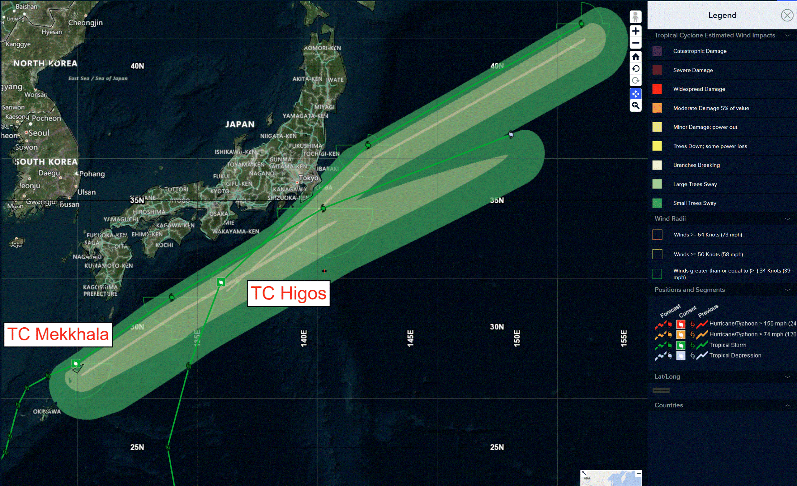
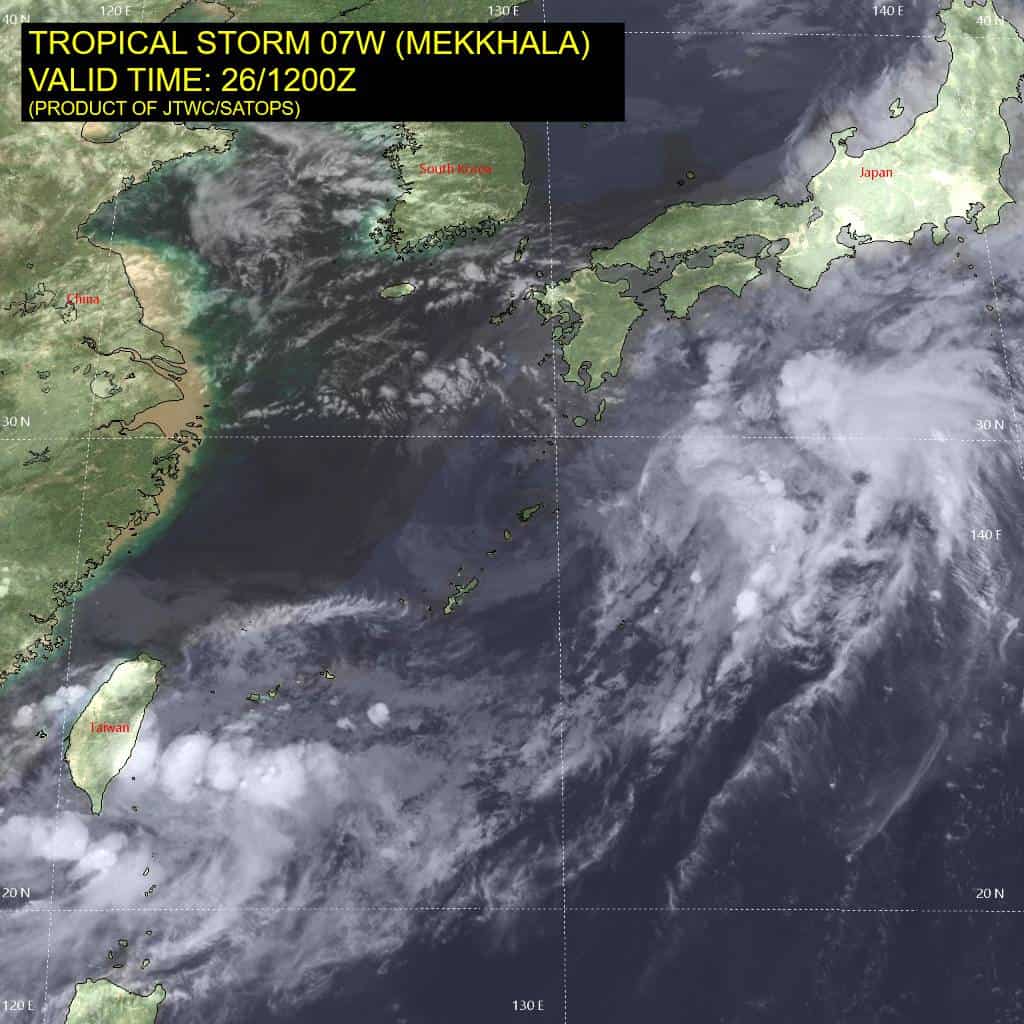
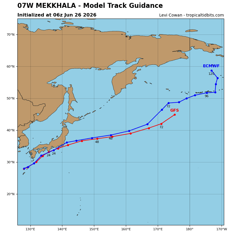
Tropical Cyclone 07W (Mekkhala)…is located 394 NM west-southwest of Yokosuka, Japan
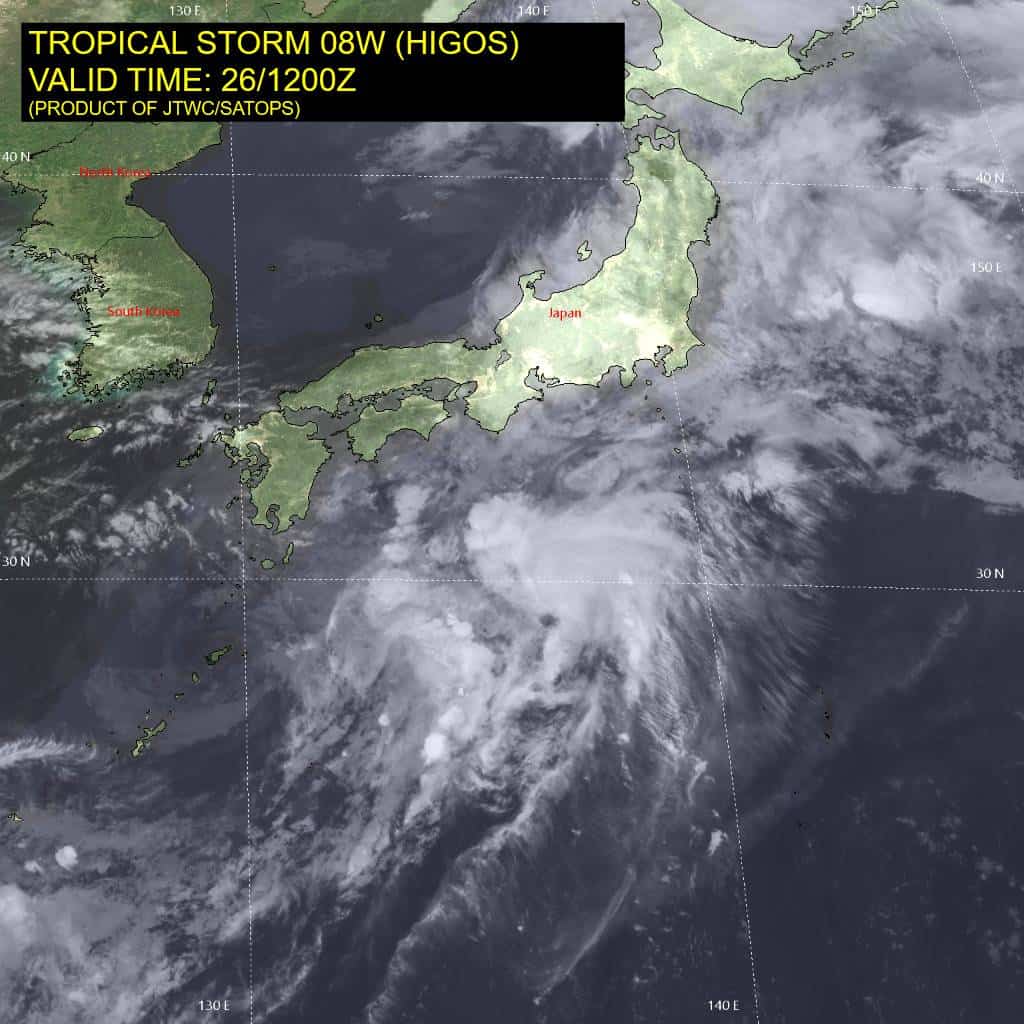
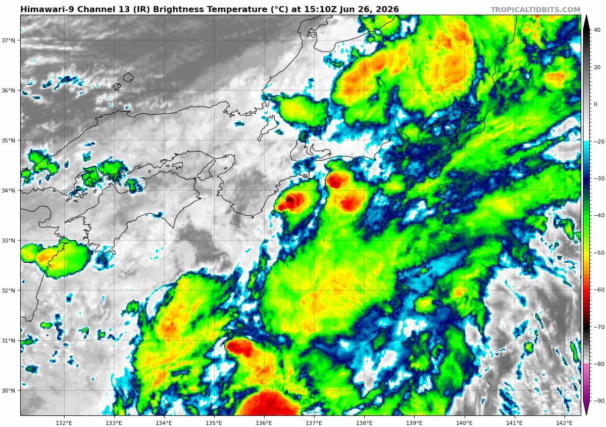
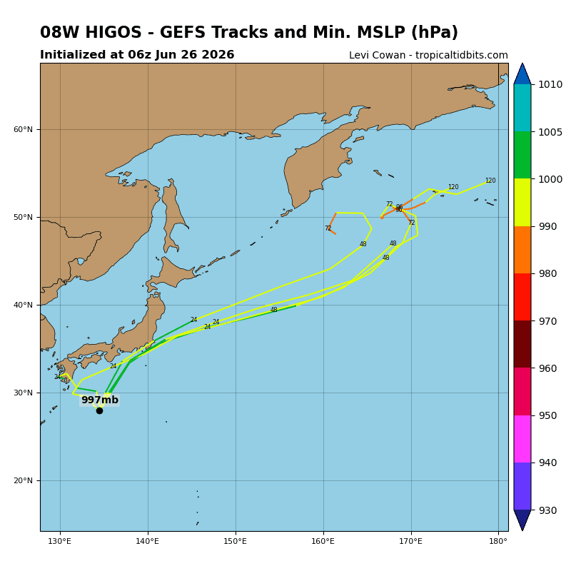
Tropical Cyclone 08W (Higos)…is located 169 NM east-northeast of Yokosuka, Japan – Final Warning
Northeast Pacific Ocean: There are no Tropical Cyclones
Central and western East Pacific:
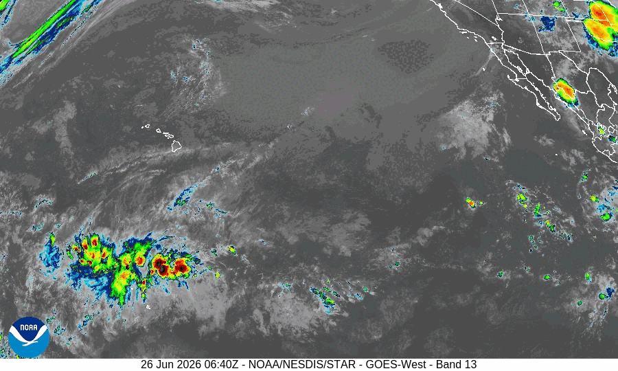
>>> A tropical wave located several hundred miles south-southwest of the southern tip of the Baja California Peninsula continues to produce disorganized shower and thunderstorm activity. Gradual development of this system is possible during the next several days as it moves generally west-northwestward, and a tropical depression could form during the early to middle part of next week. By late next week, the system is expected to reach a much less favorable environment for development.
* Formation chance through 48 hours…low…near 0 percent
* Formation chance through 7 days…medium…50 percent
Central Pacific Ocean: There are no Tropical Cyclones
Central and western East Pacific:
>>> A tropical wave located several hundred miles south-southwest of the southern tip of the Baja California Peninsula continues to produce disorganized shower and thunderstorm activity. Gradual development of this system is possible during the next several days as it moves generally west-northwestward, and a tropical depression could form during the early to middle part of next week. By late next week, the system is expected to reach a much less favorable environment for development.
* Formation chance through 48 hours…low…near 0 percent
* Formation chance through 7 days…medium…50 percent
Western Pacific, Indian Ocean, and adjacent Seas:
Western Pacific
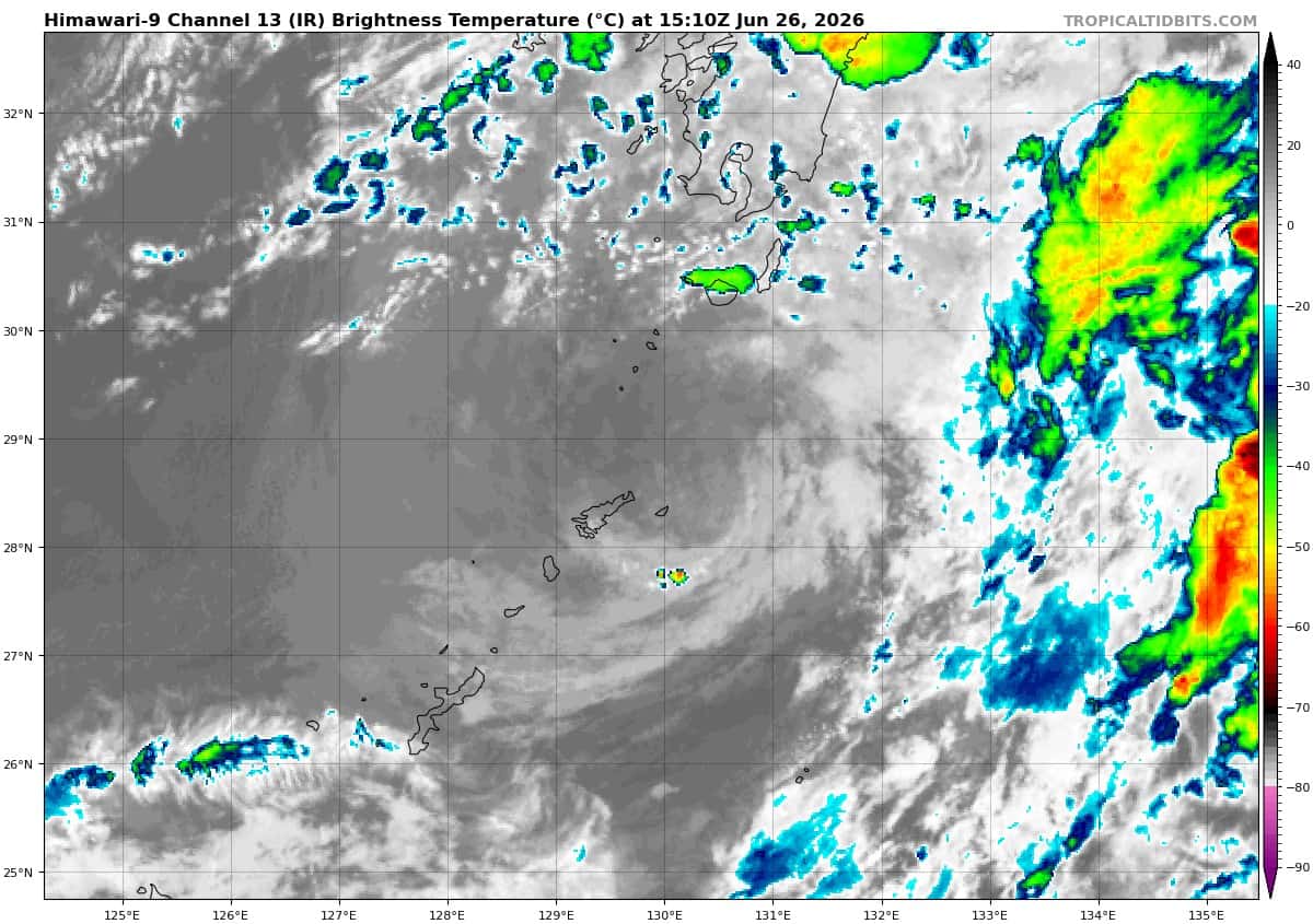
Tropical Cyclone 07W (Mekkhala)
According to the JTWC Warning number 34…sustained winds are 35 knots with gusts to 45 knots
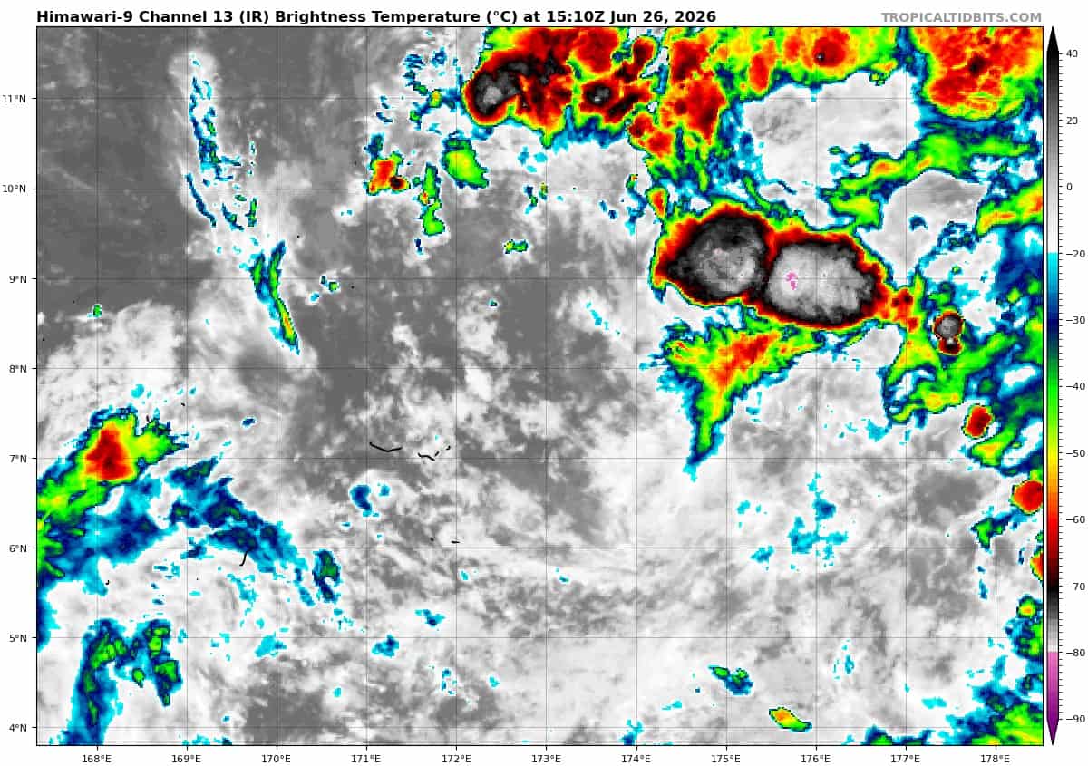
Animated enhanced infrared (eir) satellite imagery depicts tropical storm 07W (Mekkhala) as a fully exposed and elongated low-level circulation center (llcc). The system made landfall in Amami Oshima at 261200z; the surface observation recorded on Amami Oshima at that time was 24 kts, which was also the maximum wind speed the site reported as 07W approached it. The 261142z ascat pass confirms the elongated center and reveals a highly asymmetric wind field, with the maximum winds confined to the southeastern quadrant and displaced approximately 75 NM from the center.
Environmental analysis reveals an inhospitable environment, characterized by high (20-25 kts) vertical winds shear (vws), poor outflow, and a relatively drier environment that is beginning to entrain into the core from the west. the sea surface temperatures are still favorable (26-27 c), but do little to improve the conditions.
TS 07W is forecast to continue tracking generally northeastward for the duration of the forecast period as it is steered by the str to its east. Mekkhala is currently undergoing extratropical transition (ett), as it is fully embedded in the upper-level westerlies, displays an elongated low-level with an asymmetric wind field, and has begun to demonstrate temperature advection.
ETT is anticipated to be complete no later than tau 24, but likely well before. regarding intensity, Mekkhala is forecast to maintain its intensity through 24 hours while it completes ett and weaken slightly by 36 hours; however, the possibility for earlier weakening is possible as the system tracks deeper into the hostile environment.
Western Pacific
Tropical Cyclone 08W (Higos) – Final Warning
According to the JTWC Warning number 19…sustained winds are 45 knots with gusts to 55 knots
Animated multi-spectral satellite imagery (msi) depicts a very compact circulation with a poleward outflow channel and deep convection under 50-70 kts of vertical wind shear. The convective signature has become frontal, and the sea surface temperature is sub-24 degrees celsius.
These factors indicate that Higos has transitioned into a strong, gale-force extratropical cyclone. The remains of 08W will rapidly become absorbed by a baroclinic system near the Kuril Islands at 24 hours.
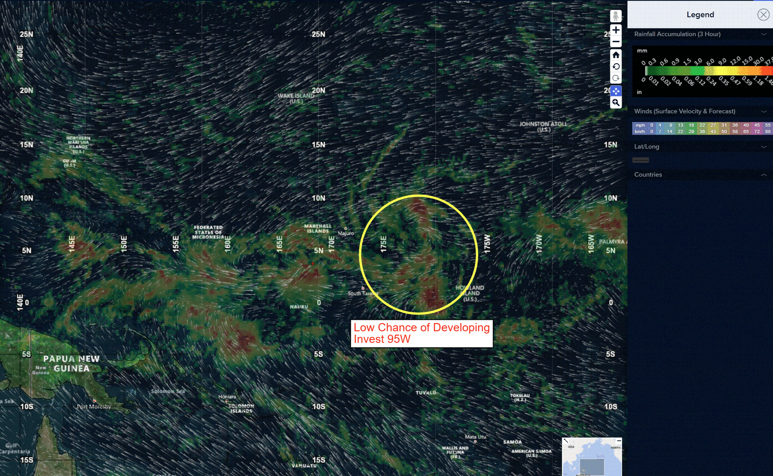
>>> There’s an area of disturbed weather being referred to as Invest 95W, which is located approximately 220 NM south of Kwajalein
Animated multi-spectral satellite imagery depicts a broad area of disorganized convection with a westerly wind burst to the south of the low level circulation center (llcc).
Environmental analysis reveals a favorable environment for development with low vertical wind shear, moderate poleward outflow aloft, and warm sea surface temperatures (29-30c).
Global models depict a quasi-stationary circulation that remains broad with gradual development over the next 48-72 hours.
Maximum sustained surface winds are estimated at 13 to 18 knots.
The potential for the development of a significant tropical cyclone within the next 24 hours remains low.