
")
Current Snapshot
For all the latest updates visit: DisasterAWARE
7
e
c
wpac
07W_251200sair
07W_tracks_latest
08W_251200sair
08W_tracks_latest
95w

95W_tracks_latest
By PDC’s Senior Weather
Specialist Glenn James

The Pacific Disaster Center’s (PDC Global) Thursday, June 25, 2026, Tropical Cyclone Activity Report…for the Pacific Ocean, the Indian Ocean, and adjacent Seas
Current Tropical Cyclones:
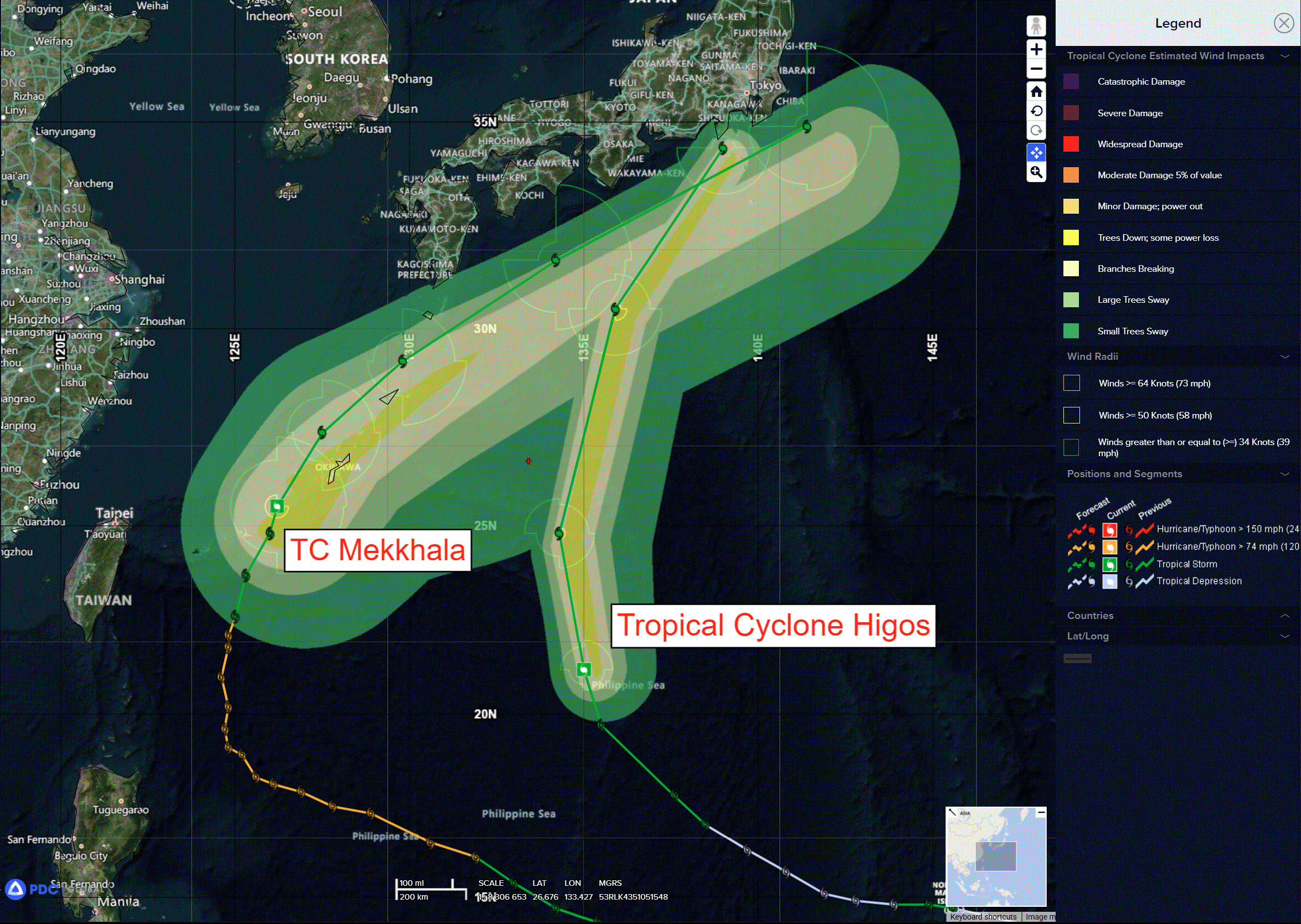
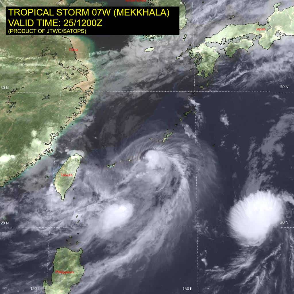
Tropical Cyclone 07W (Mekkhala)…is located 800 NM west-southwest of Yokosuka, Japan
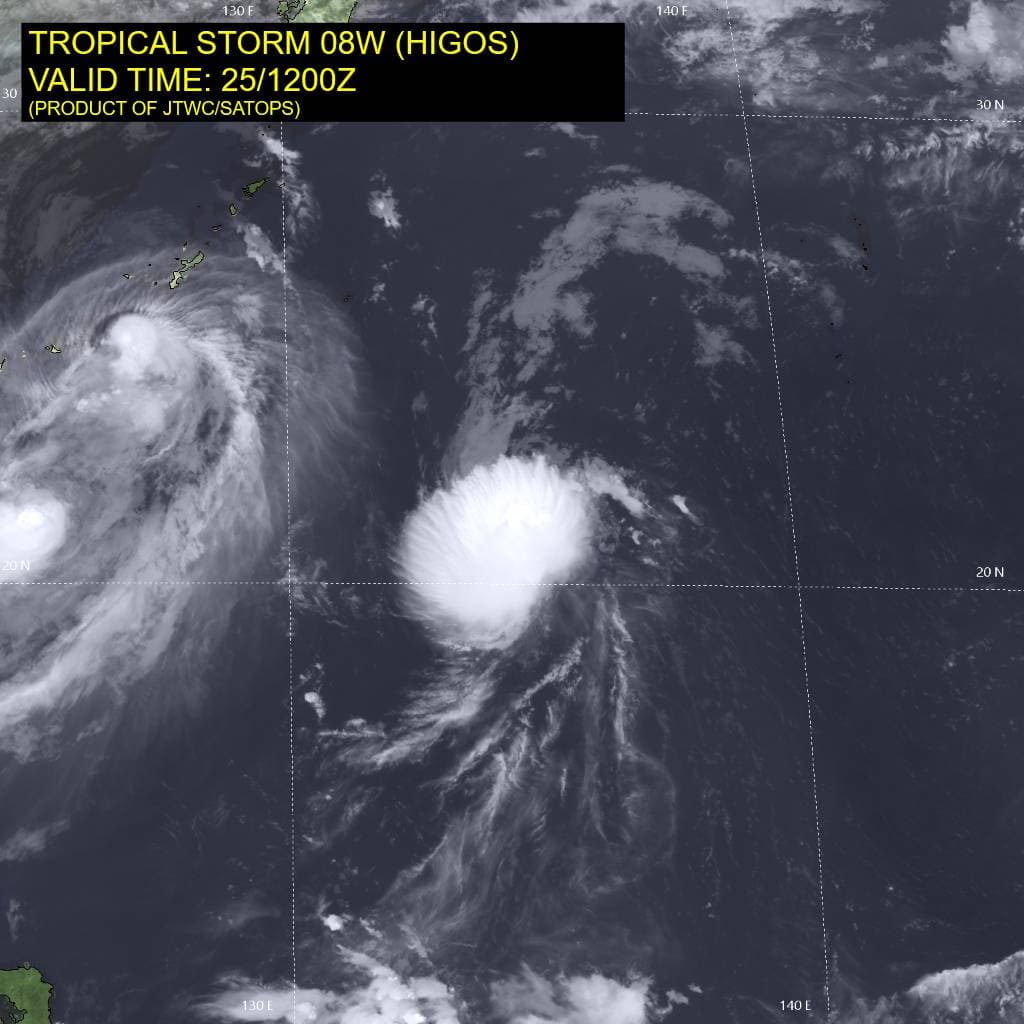
Tropical Cyclone 08W (Higos)…is located 326 NM east-southeast of Kadena AB
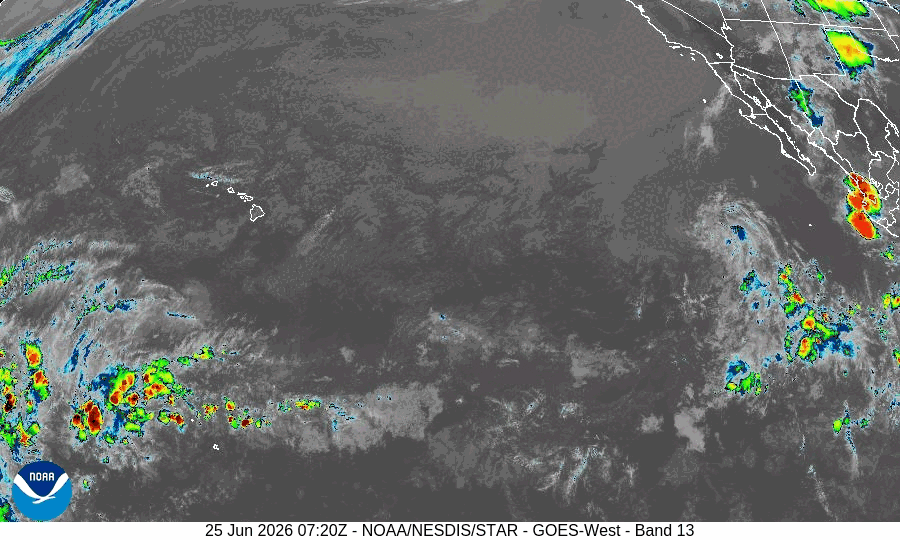
Northeast Pacific Ocean: There are no Tropical Cyclones
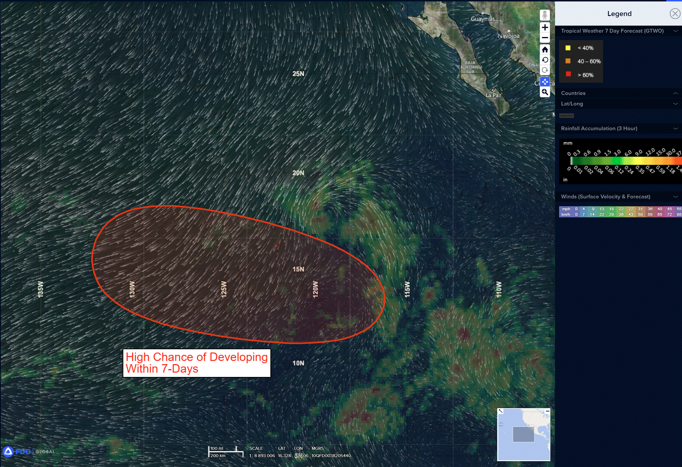
Central and western East Pacific:
>>> A tropical wave centered several hundred miles south of southwestern Mexico is producing disorganized showers and thunderstorms. This system is expected to encounter more favorable conditions for development over the weekend across the central portion of the East Pacific basin. A tropical depression is likely to form by the early to middle part of next week while the wave moves westward to west-northwestward at 10 to 15 mph into the western portion of the East Pacific.
* Formation chance through 48 hours…low…near 0 percent
* Formation chance through 7 days…high…80 percent
Central Pacific Ocean: There are no Tropical Cyclones
Central and western East Pacific:
>>> A tropical wave centered several hundred miles south of southwestern Mexico is producing disorganized showers and thunderstorms. This system is expected to encounter more favorable conditions for development over the weekend across the central portion of the East Pacific basin. A tropical depression is likely to form by the early to middle part of next week while the wave moves westward to west-northwestward at 10 to 15 mph into the western portion of the East Pacific.
* Formation chance through 48 hours…low…near 0 percent
* Formation chance through 7 days…high…80 percent
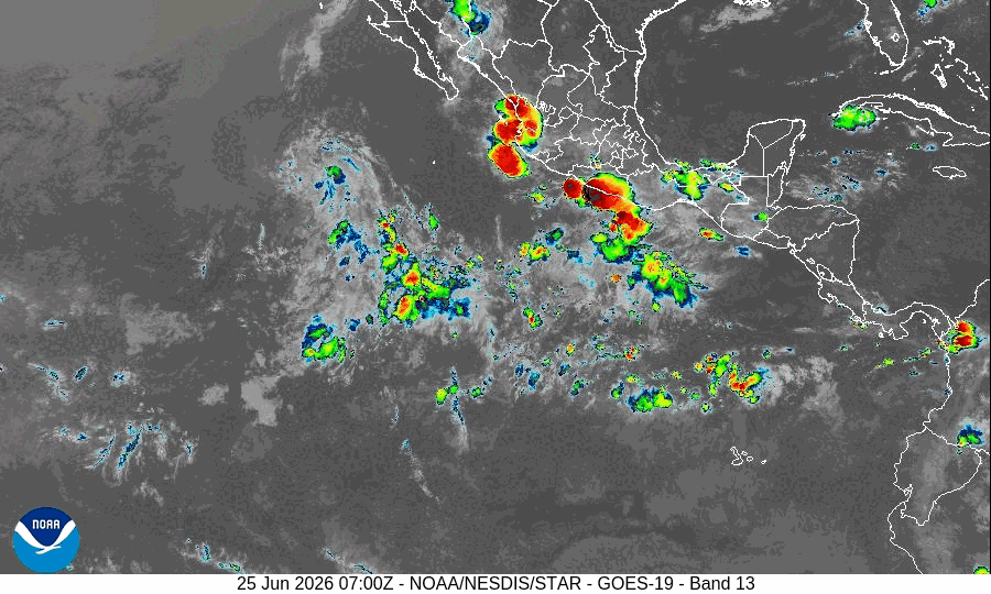
Western Pacific, Indian Ocean, and adjacent Seas:
Western Pacific
Tropical Cyclone 07W (Mekkhala)
According to the JTWC Warning number 30…sustained winds are 35 knots with gusts to 45 knots
Animated enhanced infrared (eir) satellite imagery depicts tropical storm 07W increasingly sheared with the deep convection displaced far to the southeast. The partial 251202z metop-b ascat data revealed the strongest wind speeds in the swath are confined to the southwestern quadrant. Additionally, surface observation stations from Naha and Kumejima are reporting maximum 23kt southeasterly winds, however, the storm is still approximately 100 nm away from both stations.
Environmental analysis reveals an unfavorable environment characterized by the vws, moderate outflow, and dry air entrainment in the northern hemis, marginally offset, but the warm (27-28 c) sea surface temperatures.
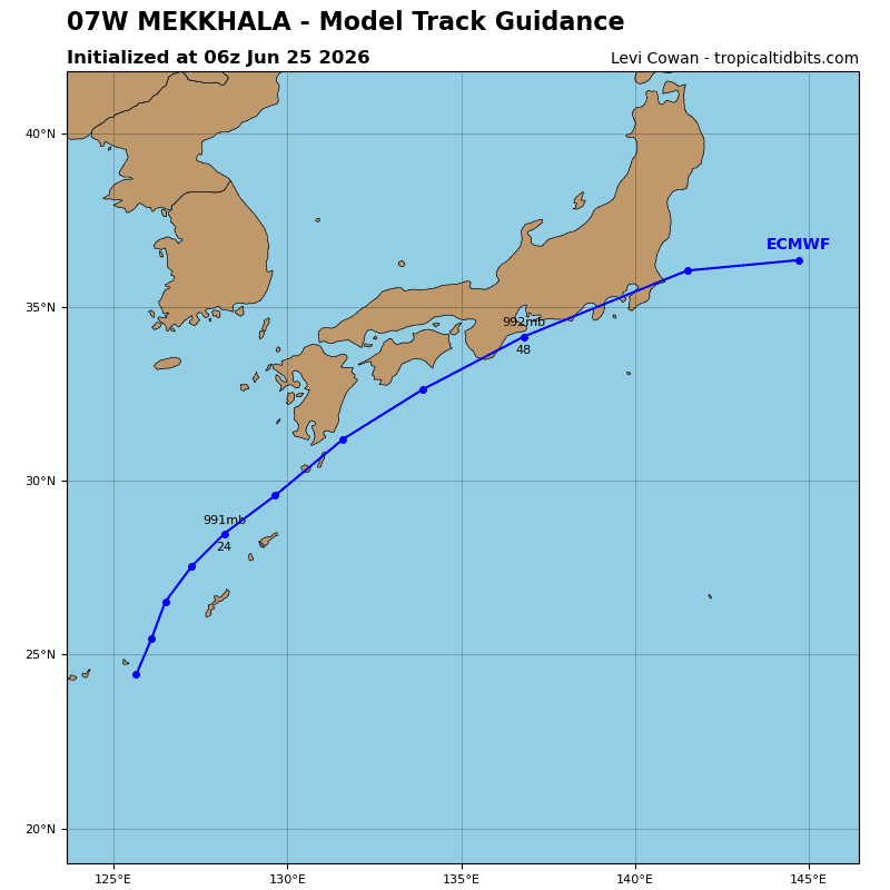
TS 07W is forecast to continue rounding the steering str centered to the east and accelerate northeastward. Mekkhala is expected to reach its closest point to Okinawa just before 12 hours, before tracking along the southern coast of mainland Japan. At around 24 hours, 07W will encounter high (30-35 kts) vws associated with the upper-level westerlies and significant dry air entrainment, shallowing the vortex, and inducing extratropical transition (ett). Mekkhala is forecast to complete ett by 48 hours as the storm passes south of Tokyo.
Regarding intensity, 07W is forecast to gradually weaken from through the end of the forecast period at 48 hours. despite the hostile environment, 07W will likely maintain its intensity fairly well as it undergoes and completes ett, maintaining gale force winds through 48 hours.
Western Pacific
Tropical Cyclone 08W (Higos)
According to the JTWC Warning number 15…sustained winds are 55 knots with gusts to 70 knots
Animated enhanced infrared (eir) satellite imagery depicts the low-level circulation center of tropical storm 08W (Higos) fully obscured beneath a shallow, but persistent, elongated central dense overcast. additionally, animated eir depicts drier air surrounding the system, identifiable by the complete lack of convection outside the immediate vicinity of the storm. A 25120z partial metop-b ascat pass reveals the highest wind speeds measured by the swath are confined to the southeastern quadrant.
Environmental analysis reveals a marginally favorable environment, characterized by low (10-15 kts) vertical wind shear (vws), warm
(29-30 c) sea surface temperatures, offset by weak equatorward outflow and the relatively drier surrounding environment.
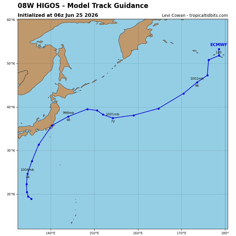
TS 08W is forecast to continue tracking to the north-northwest along the southwestern periphery of the str positioned to the northeast and cross the ridge axis prior to 12 hours, before tracking north-northeastward until 36 hours. At around 12 hours, 08W will encounter an increasingly hostile environment that will initiate a quick extratropical transition (ett) as the system becomes fully embedded in the mid-latitude westerlies. Increased upper-level support will assist in sustaining surface intensities near 45 kts by 36 hours as TS 08W becomes a very shallow, symmetric
cold-core low.
The possibility for the surface circulation to fill into an open trough persists; however, elevated surface intensities are forecast to remain until the end of the forecast period regardless of the ultimate fate of Higos. Additionally, TS 08W may interact with TS 07W (Mekkhala) as the two storms approach each other off the coast of mainland Japan; however, it is not expected that the two storms will merge.
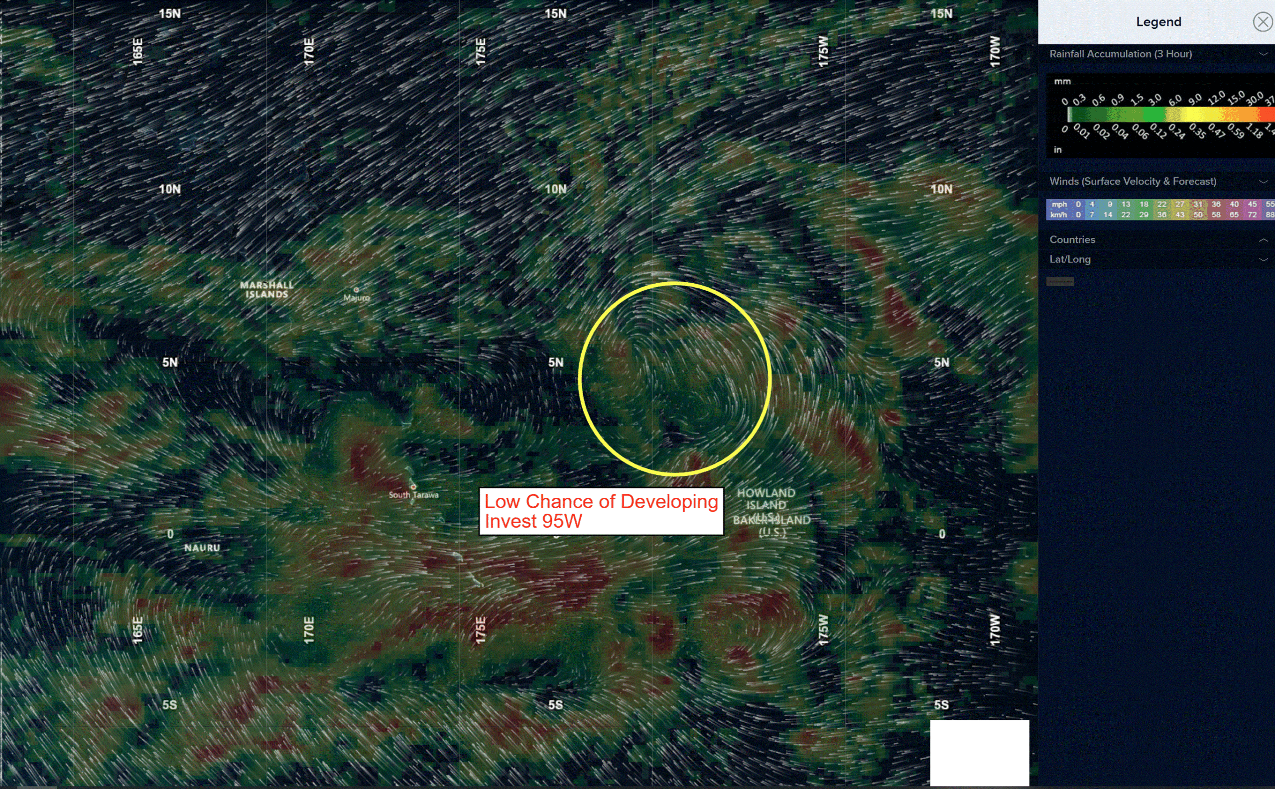
>>> There’s an area of disturbed weather being referred to as Invest 95W, which is located approximately 668 NM east-southeast of Kwajalein
Animated multi-spectral satellite imagery (msi) depicts a wave feature within a trough with bursts of flaring convection associated with 95W.
Environmental analysis for the area indicates a favorable environment for development, with low vertical wind shear (1015 kts), good poleward outflow aloft, and warm sea surface temperatures (29-30c).
Global ensemble and deterministic models are in agreement on gradual development and intensification into a tropical cyclone within 24-48 hours, with the exception of the ecmwf deterministic, which portrays a broad and poorly defined circulation for the next 72 hours.
Maximum sustained surface winds are estimated at 13 to 18 knots.
The potential for the development of a significant tropical cyclone within the next 24 hours remains low.