
")
Current Snapshot
For all the latest updates visit: DisasterAWARE
e
c
mekk
07W_201200sair

07W_tracks_latest
By PDC’s Senior Weather
Specialist Glenn James

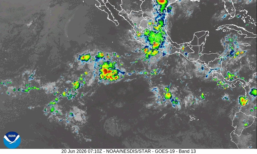
The Pacific Disaster Center’s (PDC Global) Saturday, June 20, 2026, Tropical Cyclone Activity Report…for the Pacific Ocean, the Indian Ocean, and adjacent Seas
Current Tropical Cyclones:
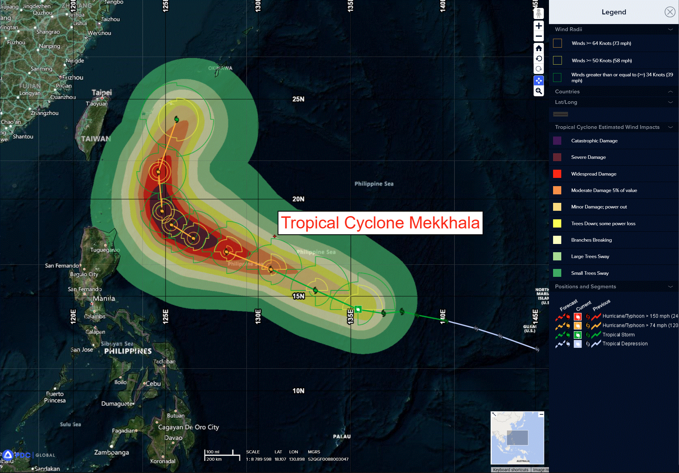
Tropical Cyclone 07W (Mekkhala)…is located 727 NM south-southeast of Kadena AB
Northeast Pacific Ocean: There are no Tropical Cyclones
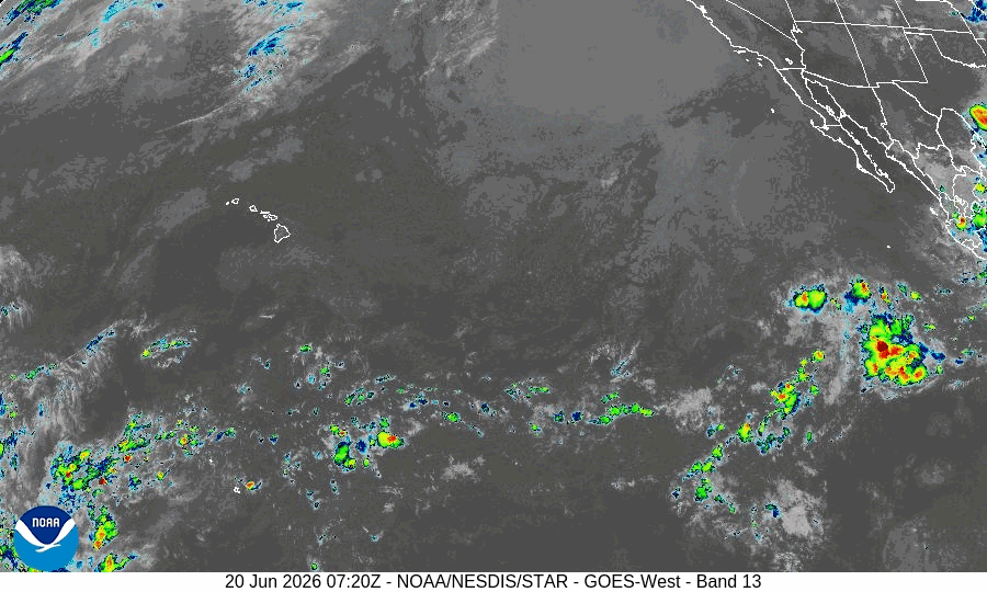
Central and Western Portion of the East Pacific:
A broad area of low pressure is forecast to form well southwest of the Baja California peninsula during the middle to latter part of next week.
Some gradual development of this system is possible thereafter while it moves west-northwestward at 10 to 15 mph across central and western portions of the East Pacific basin.
* Formation chance through 48 hours…low…near 0 percent
* Formation chance through 7 days…low…20 percent
Central Pacific Ocean: There are no Tropical Cyclones
Tropical cyclone formation is not expected during the next 7 days.
Western Pacific, Indian Ocean, and adjacent Seas: There are no Tropical Cyclones
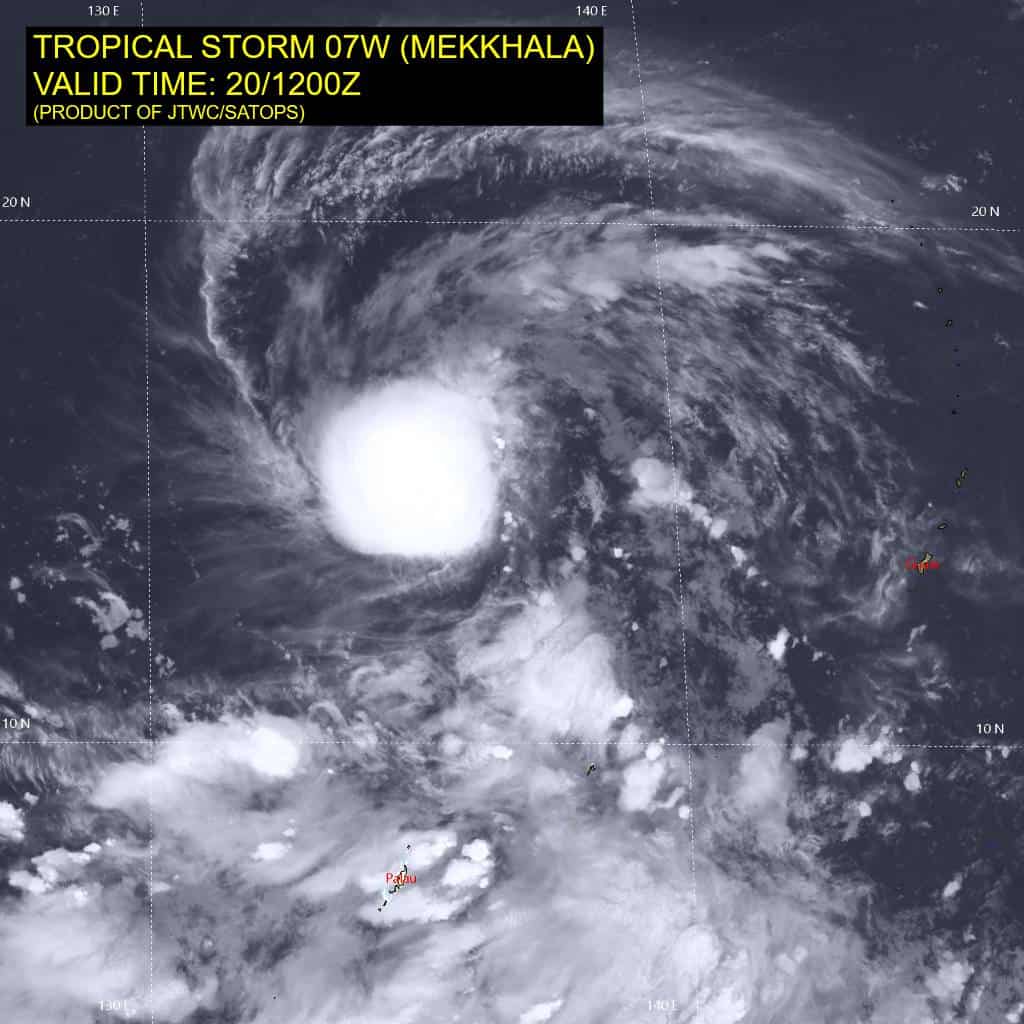
Tropical Cyclone 07W (Mekkhala)
According to the JTWC Warning number 10…sustained winds are 55 knots with gusts to 70
Animated enhanced infrared imagery (eir) depicts tropical storm 07W (Mekkhala) with a symmetric central dense overcast completely obscuring the low-level circulation center. A 200903z partial sar image of the eastern half of 07W reveals a highly asymmetric windfield, with the peak winds confined to a small patch in the northeastern quadrant and no gale force winds in the southeastern quadrant. Additionally, the sar reveals the llcc was still quite elongated along the northwest-southeast axis at 0903z. A 1202z metop-b partial pass of the center and eastern periphery of the storm confirms the highly asymmetric windfield, but also reveals the vortex has become less elongated and gale force winds have appeared in the southeastern quadrant within the past few hours.
Environmental analysis reveals a favorable environment, characterized by warm (29-30 c) sea surface temperatures, low to moderate (15-20 kts) vertical wind shear (vws), and good outflow aloft supported by an upper-level anticyclone.
TS 07W is forecast to maintain its west-northwestward track through 60 hours as it remains under the influence of the str centered to the north. Around 72 hours, Mekkhala will begin to round the ridge, causing it to slow its speed of advance. 07W is expected to round the ridge axis between 60-96 hours and subsequently accelerate north-northeastward through the end of the forecast period.
Regarding intensity, 07W is forecast to steadily intensify through 24 hours while it continues to organize. following 24 hours, 07W is forecast to rapidly intensity (ri) in the favorable environment until peaking at 105 kts at 60 hours. Following the peak intensity, Mekkhala is forecast to swiftly weaken as it encounters an increasingly unfavorable environment dominated by high upper-level easterly vws. Upwelling and dry air entrainment may contribute to additional weakening, though the driving factor is anticipated to be vws.