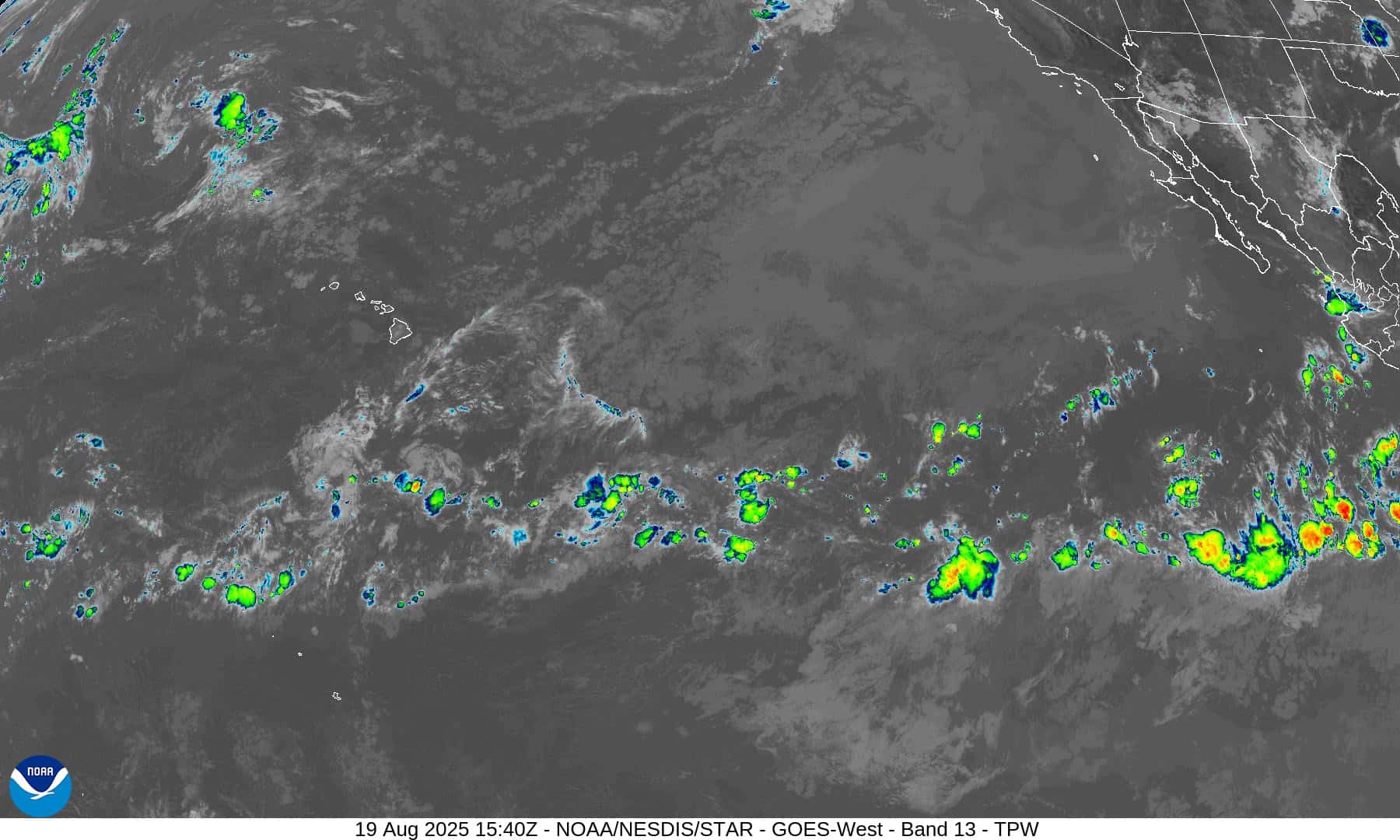
Central north Pacific: There are no Tropical Cyclones
Tropical cyclone formation is not expected during the next 7 days.


By PDC’s Senior Weather
Specialist Glenn James

The Pacific Disaster Center’s (PDC Global) Sunday, August 2, 2026, Tropical Cyclone Activity Report…for the Pacific Ocean, the Indian Ocean, and adjacent Seas
Current Tropical Cyclones:
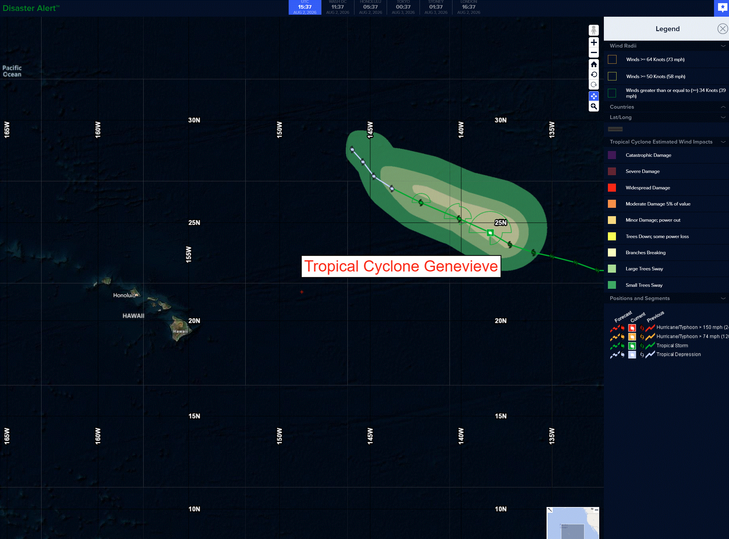
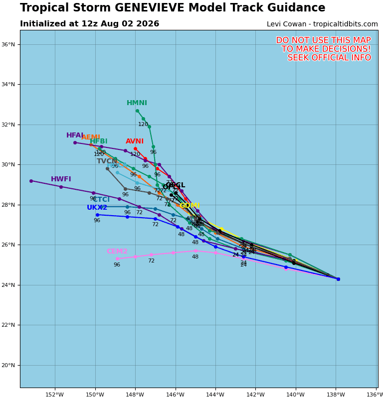
Tropical cyclone 07E (Genevieve)…is located about 1800 miles west of the southern tip of Baja California
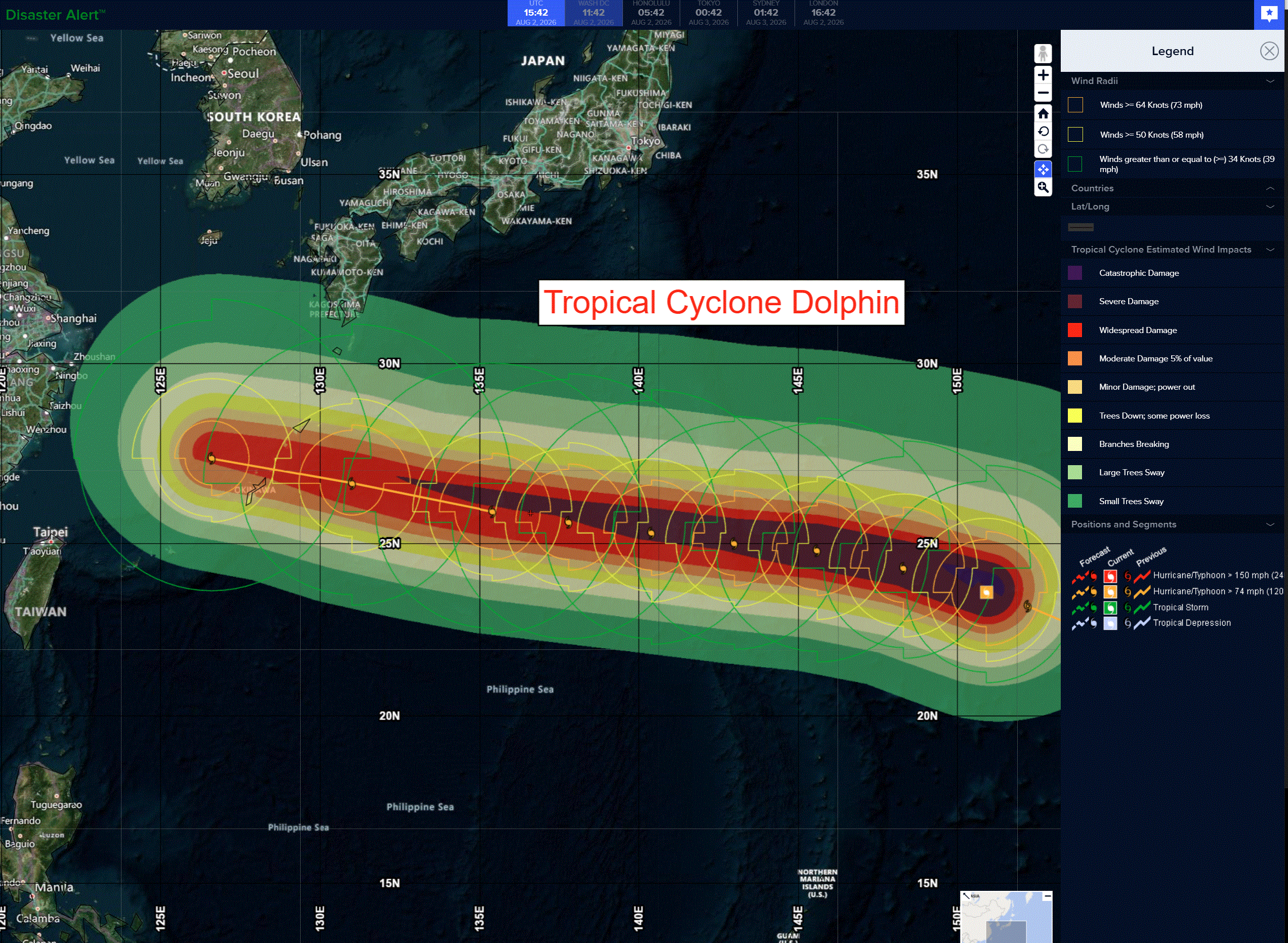
Tropical cyclone 12W (Dolphin)…is located approximately 530 NM east of Iwo To
Northeast Pacific:
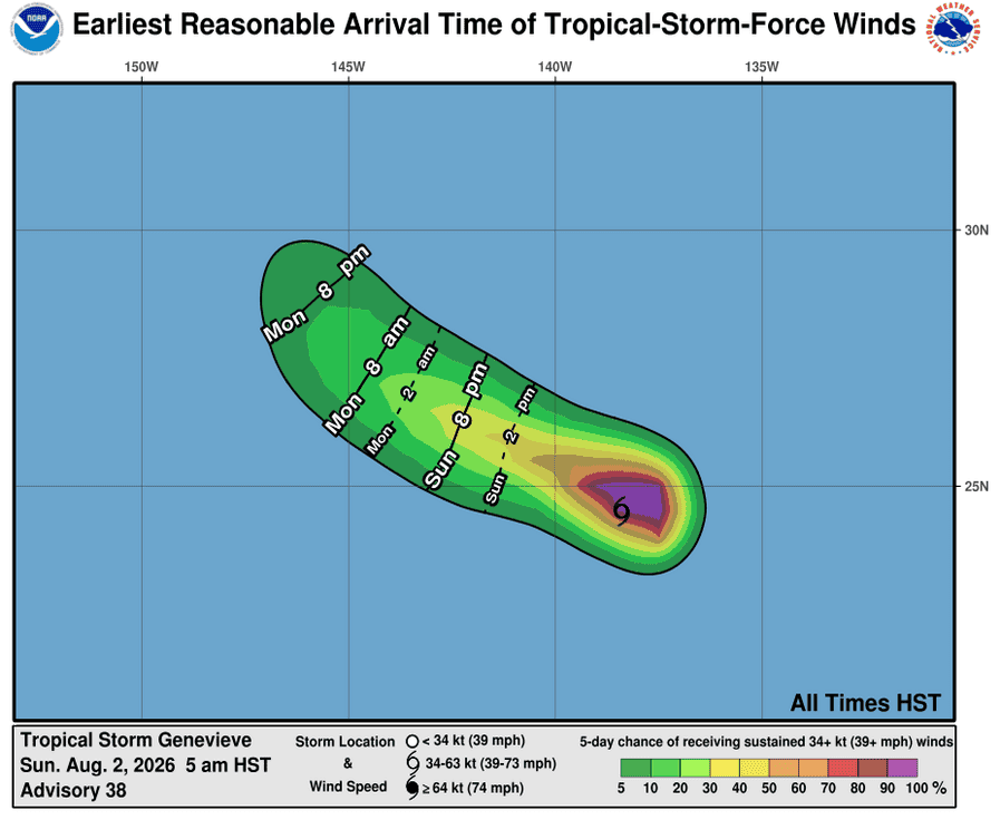
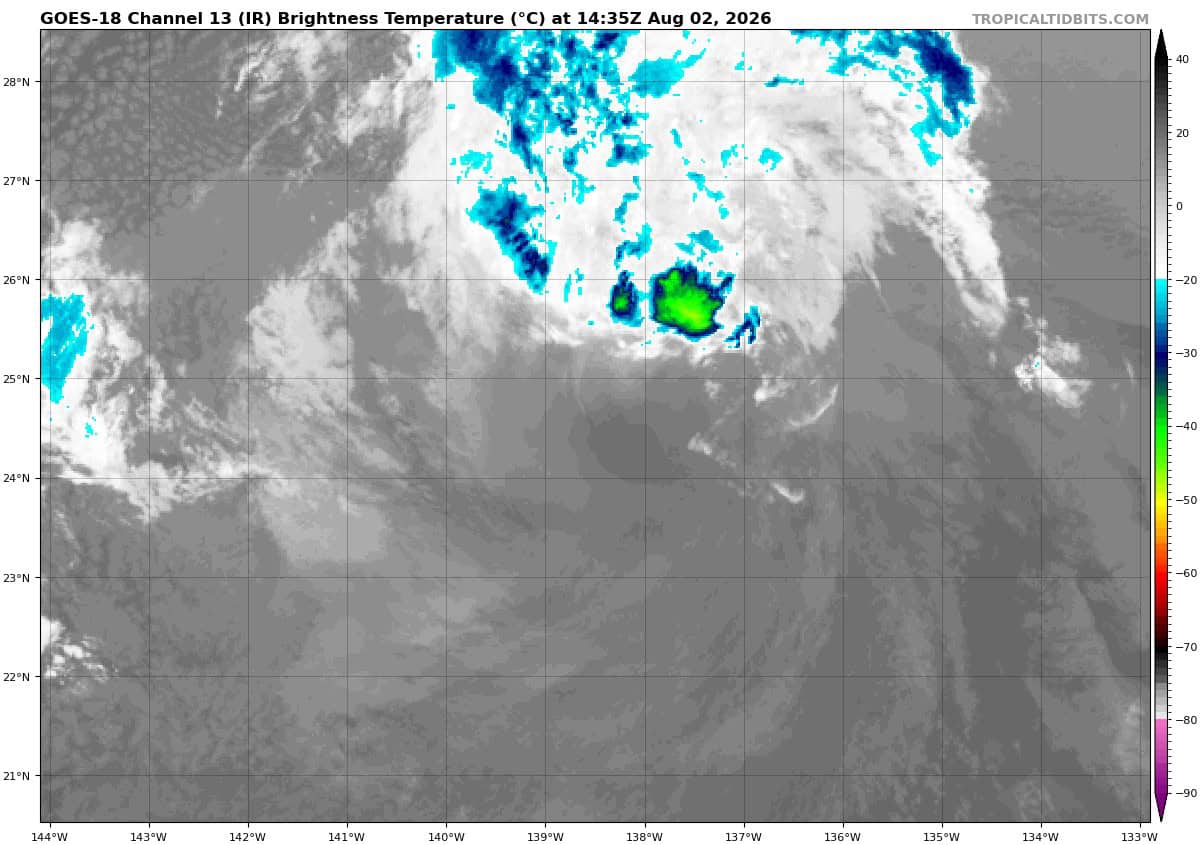
Tropical cyclone 07E (Genevieve)
GENEVIEVE FORECAST TO BECOME POST-TROPICAL LATER TODAY
According to the NHC Advisory number 38
Genevieve is moving toward the west-northwest near 14 mph (22 km/h). This general motion is expected to continue over the next day or so, followed by a decrease in forward speed and a turn toward the northwest by Tuesday.
Maximum sustained winds are near 45 mph (75 km/h) with higher gusts. Gradual weakening is forecast, and Genevieve is expected to become a post-tropical cyclone later today.
Tropical-storm-force winds extend outward up to 80 miles (130 km) from the center.
The estimated minimum central pressure is 1006 mb (29.71 inches).
Central north Pacific: There are no Tropical Cyclones
Tropical cyclone formation is not expected during the next 7 days.
Western Pacific, Indian Ocean, and adjacent Seas:
Western Pacific
Tropical Cyclone 12W (Dolphin)
According to the JTWC warning number 27, sustained winds were 110 knots…with gusts to 135 knots
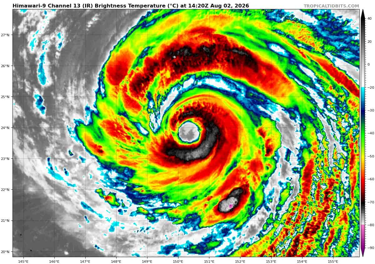
Animated enhanced infrared (eir) satellite imagery depicts typhoon (ty) 12W midway through its fourth eyewall replacement cycle (erc), with a distinct moat already wrapped most of the way around the inner eyewall. The cloud shield is becoming more sparce as the deepest convection has collapsed and cloud tops have warmed to -75c or less. This ongoing erc is expected to take longer and may weaken
the storm more significantly than previous cycles.
Environmental analysis reveals a favorable environment, characterized by low (10-15 kts) vertical wind shear (vws), warm (30-31 c) sea surface temperatures, and robust divergence aloft.
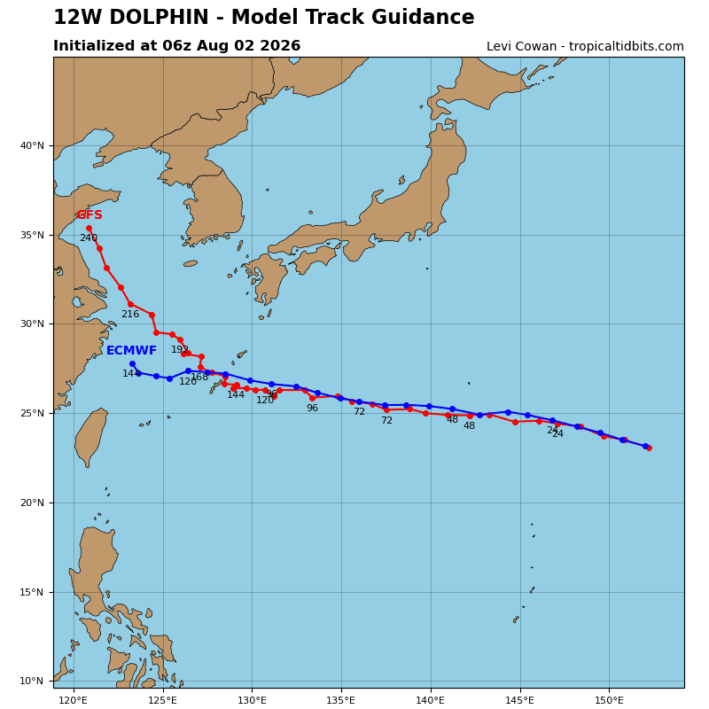
TY 12W (Dolphin) is forecast to continue tracking west-northwest as it is steered by the southwestern
extension of the str situated to the northeast. Around 36 hours, the steering influence will shift to the southeastward extension of a second str centered over the Korean Peninsula, which will continue the west-northwestward track motion through 120 hours. Between 72-120 hours, a strong, deep-layer cyclone north of the polar front jet will weaken the steering ridge, inducing slightly slower track speeds for 12W.
Regarding intensity, 12W is forecast to gradually weaken through the forecast period, as it contends with lower ohc values and, in later hours, its cold wake as the speed of advance slows. With all other environmental factors remaining similar to the current conditions, ohc is expected to be the primary driver for weakening. values are expected to be between 50-75 kj per cm squared beginning before 12 hours.
In the likely scenario that dolphin fails to complete the ongoing erc, it could hasten weakening and compound the negative effects of lower ohc. The eye and windfield will remain quite large through 120 hours, bringing impacts to the entirety of the Japanese Rryuku Islands regardless of center position.
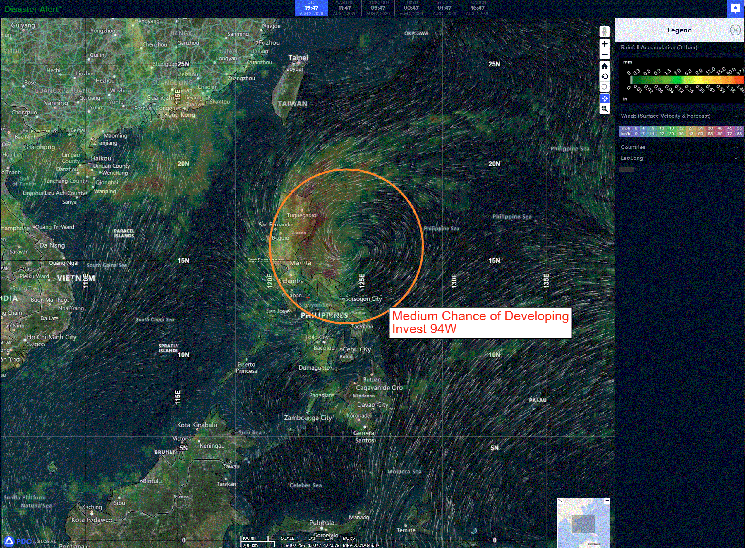
>>> There’s an area of disturbed weather that’s being referred to as Invest 94W, which is located approximately 524 NM east-southeast of Iwo To
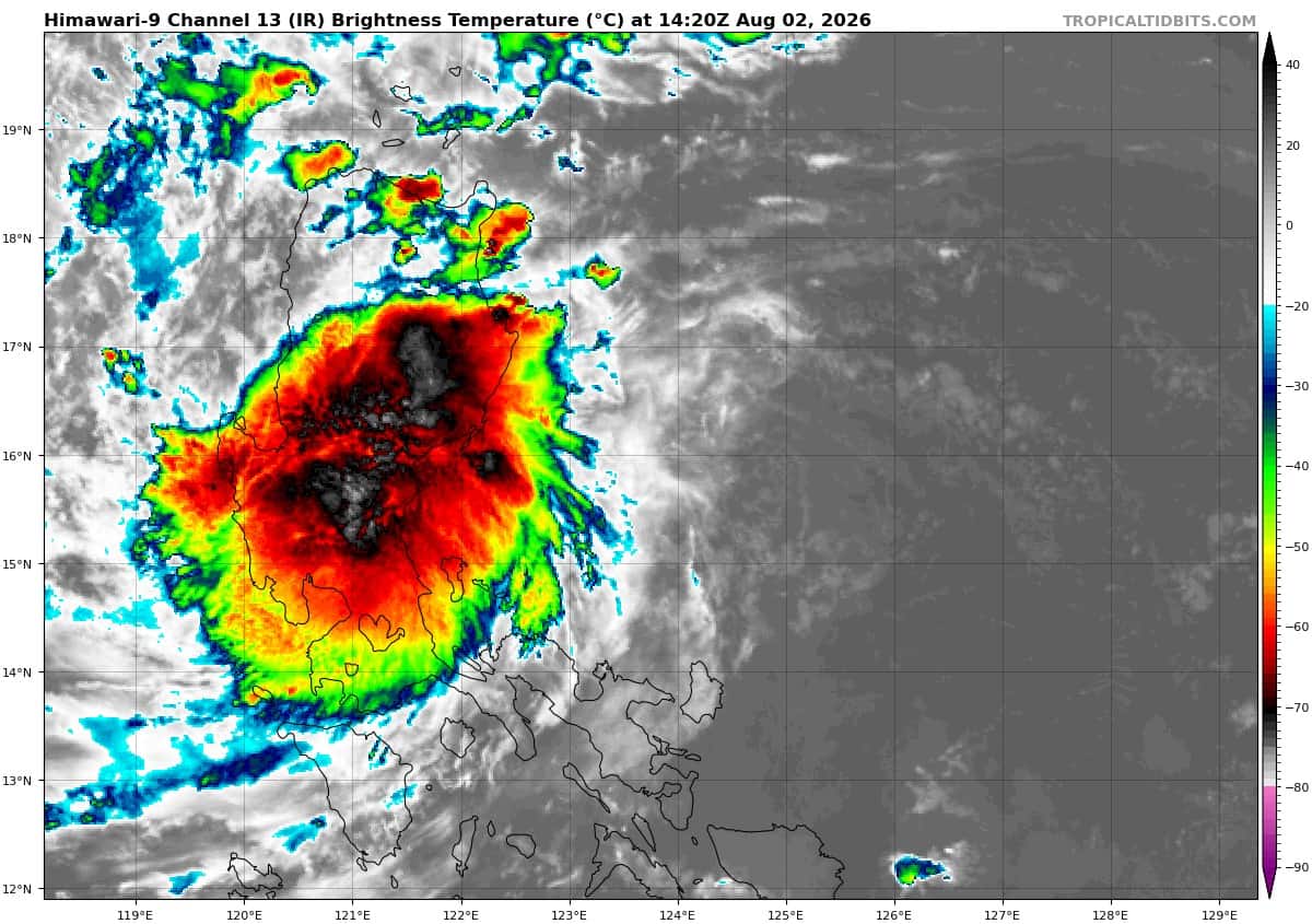
Animated enhanced infrared imagery (eir) depicts deep convection associated with a mid-level circulation displaced southwest of the slowly consolidating low-level circulation center.
Environmental analysis for the area indicates favorable conditions for development with warm sea surface temperatures (29-30 c), low vertical wind shear (10-15 kts), and good equatorward outflow aloft.
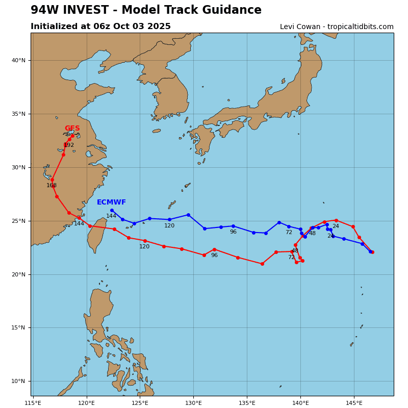
The ecmwf deterministic model depicts gradual development of 94W into a tropical depression or weak tropical storm over the next 36 hours. The ecens and deepmind ensembles concur on a slow to quasi-stationary motion near southern Luzon and possible interaction with TY 12W in a couple of days.
Maximum sustained surface winds are estimated at 15 to 20 knots.
The potential for the development of a significant tropical cyclone within the next 24 hours remains medium.