
")
Current Snapshot
For all the latest updates visit: DisasterAWARE
01e
h
goes18_ir_01E_202606022145_lat9.3-lon-126.6

01E_tracks_latest
med
GOES19-EEP-13-900×540
jang
06W_021200sair
himawari9_ir_06W_202606021520_lat32.2-lon133.1

06W_tracks_latest
By PDC’s Senior Weather
Specialist Glenn James

The Pacific Disaster Center’s (PDC Global) Tuesday, June 2, 2026, Tropical Cyclone Activity Report…for the Pacific Ocean, the Indian Ocean, and adjacent Seas
Current Tropical Cyclones:
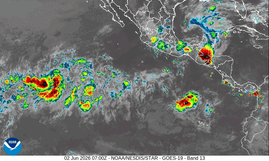
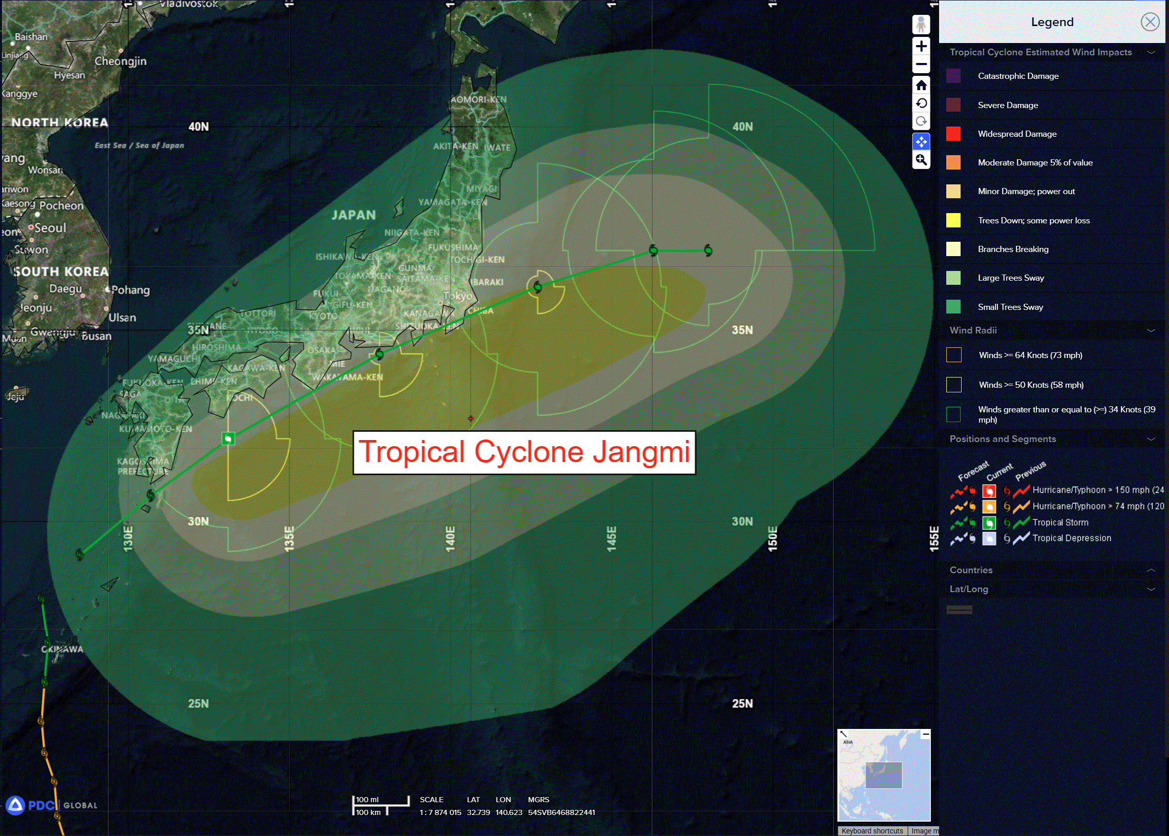
Tropical Cyclone 06W (Jangmi)…is located approximately 115 NM southwest of Yokosuka, Japan
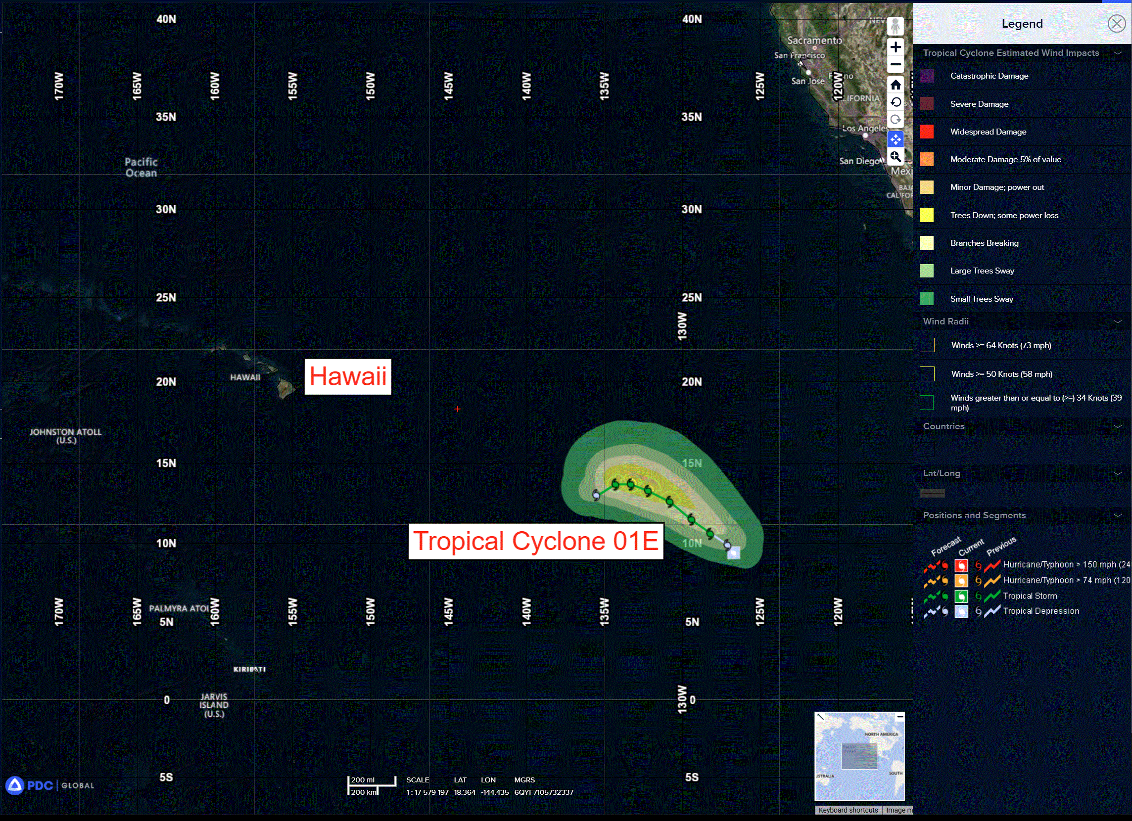
Tropical Cyclone 01E…is located approximately 1440 miles southwest of the southern tip of Baja California
Northeast Pacific Ocean:
Tropical Cyclone 01E
DEPRESSION EXPECTED TO BECOME A TROPICAL STORM ON WEDNESDAY
According to the NHC advisory number 2…sustained winds are 30 mph with gusts to 40 knots
The depression is moving toward the northwest near 3 mph. A slightly faster northwestward to west-northwestward motion is forecast through Friday.
Maximum sustained winds are near 30 mph with higher gusts. Some strengthening is forecast during the next couple of days, and the system is expected to become a tropical storm on Wednesday.
>>> Eastern East Pacific:
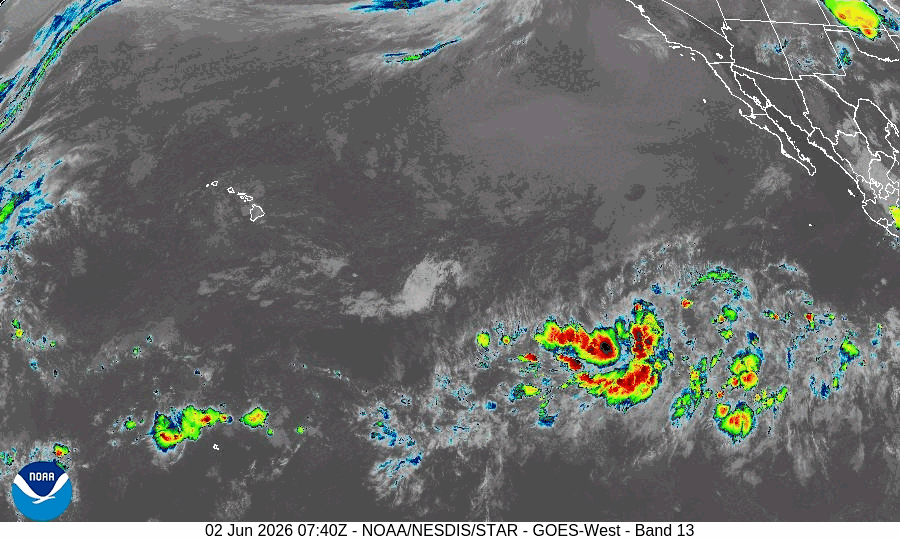
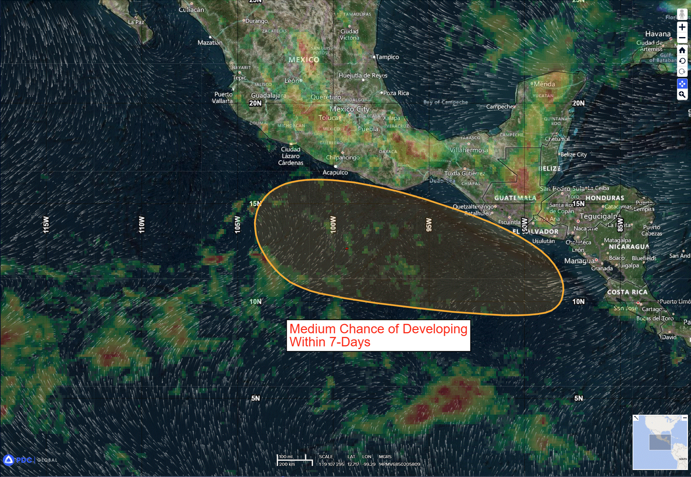
An area of low pressure is likely to form offshore of Central America and southern Mexico late this week or over the weekend.
Environmental conditions appear favorable for some development of this system thereafter, and a tropical depression could form by early next week while it moves generally northwestward at around 10 mph.
* Formation chance through 48 hours…low…near 0 percent
* Formation chance through 7 days…medium…50 percent
Central Pacific Ocean: There are no Tropical Cyclones
Western Pacific, Indian Ocean, and adjacent Seas:
Western Pacific
Tropical Cyclone 06W (Jangmi)
According to the JTWC warning number 28 sustained winds were 50 knots with gusts to near 65 knots
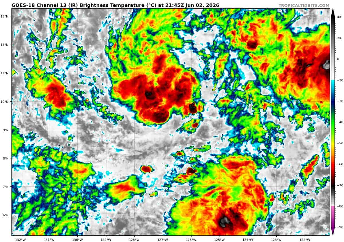
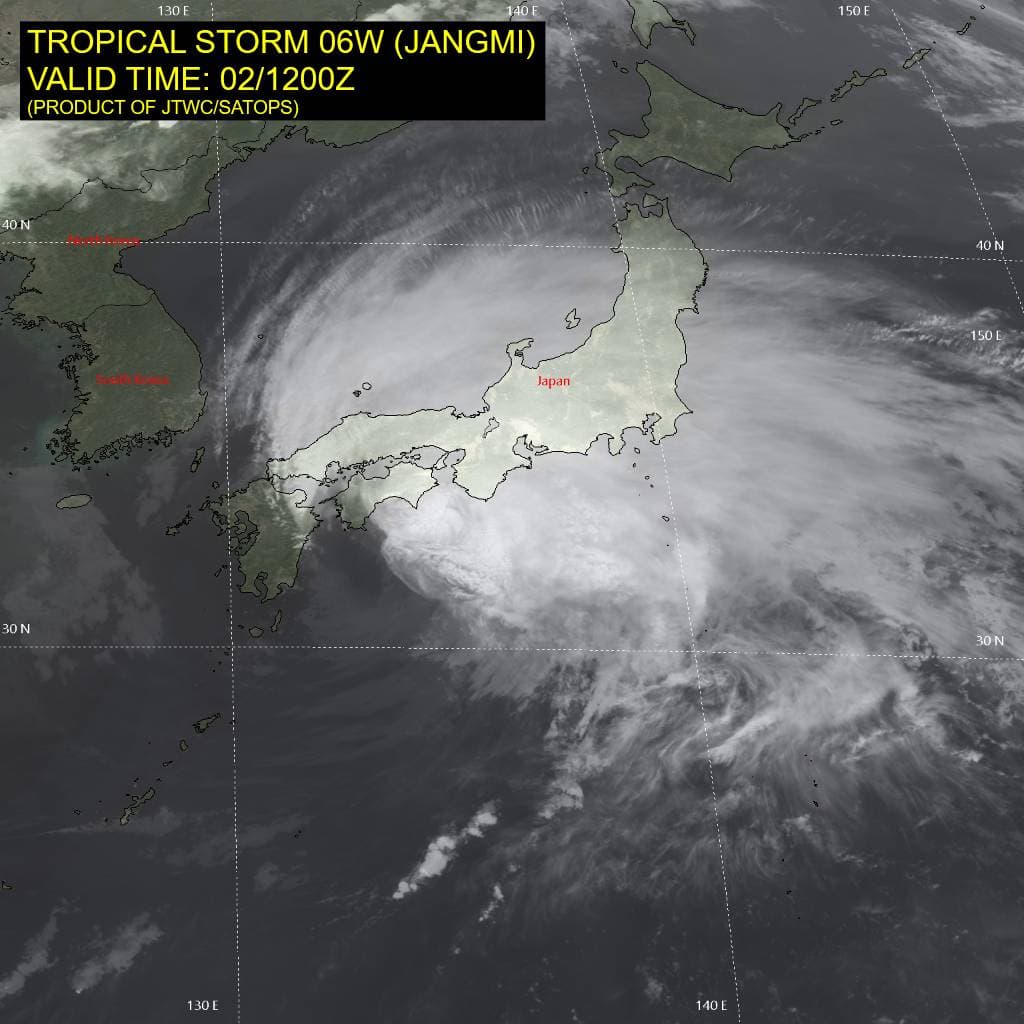
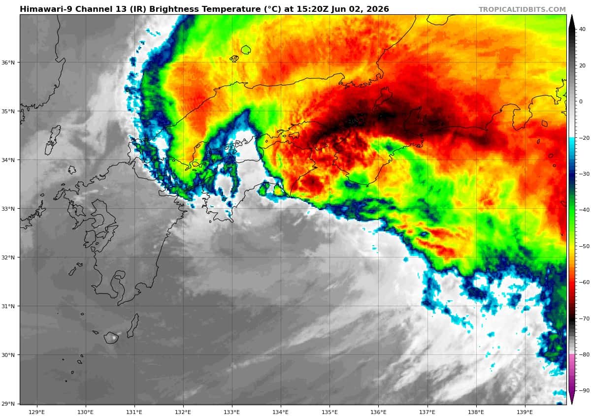
Animated enhanced infrared (eir) satellite imagery presents tropical storm 06W (Jangmi) rapidly translating along the southern coastline of Japan. The low-level circulation center (llcc) is virtually fully exposed with an asymmetric decoupling of the convective structure driven by moderate to high (20-25 kts) vertical wind shear (vws), which has displaced the bulk of the active deep convection poleward and eastward. Injected dry air is proven by mid-level thermodynamic sensing, evidencing intense dry air entrainment on the southwest flank originating from an upstream synoptic-scale dry air mass located to the west.
While the translation over the warm Kuroshio Current provided some residual ocean heat content (ohc), the llcc is now transiting over much cooler (24-25 c) sea surface temperatures (sst), while approaching area with ssts lower than 24 c. Aiding in the sustainment of the storm is persistent and robust divergent outflow, temporarily enhanced by a passing upper-level trough to the north.
TS 06W is propagating to the northeast along the northwestern periphery of the subtropical ridge (str)
positioned to the southeast. The llcc is expected to follow a track south of the Japanese mainland, where brief cyclonic landfalls are possible across the Kii Peninsula, the head of Suruga Bay, and the
southern portion of the greater Tokyo metropolitan region.
Structural asymmetry will concentrate the maximum severe winds chiefly within the eastern semicircle. translational velocity will continue to accelerate over the next 24-36 hours, as the system commences extratropical transition (ett). The intensity is expected to initially remain around 50 kts, with weakening beginning as soon as 24 hours.
Post-ett, the thermal structure will rapidly degenerate as the storm aligns underneath a subtropical jet maximum, causing destructive vertical wind shear (vws). the system is expected to begin slowing down around 36 hours, as a result of complete decoupling and gradual decay. systemic decay will be further catalyzed by low sst values coupling with unabated southwest-quadrant dry air entrainment.