

Current Snapshot
For all the latest updates visit: DisasterAWARE
1800x1080a
2a
251445_earliest_reasonable_toa_34G
goes19_ir_06L_202609251435_lat30.1-lon-42.3F
06L_tracks_latestF
251444_earliest_reasonable_toa_34F
goes19_ir_07L_202609251435_lat14.6-lon-22.6

07L_tracks_latest
By PDC’s Senior Weather
Specialist Glenn James

The Pacific Disaster Center’s (PDC Global) Friday, September 25, 2026, Tropical Cyclone Activity Report…for the Atlantic Ocean, the Caribbean Sea, and the Gulf of America
Current Tropical Cyclones:
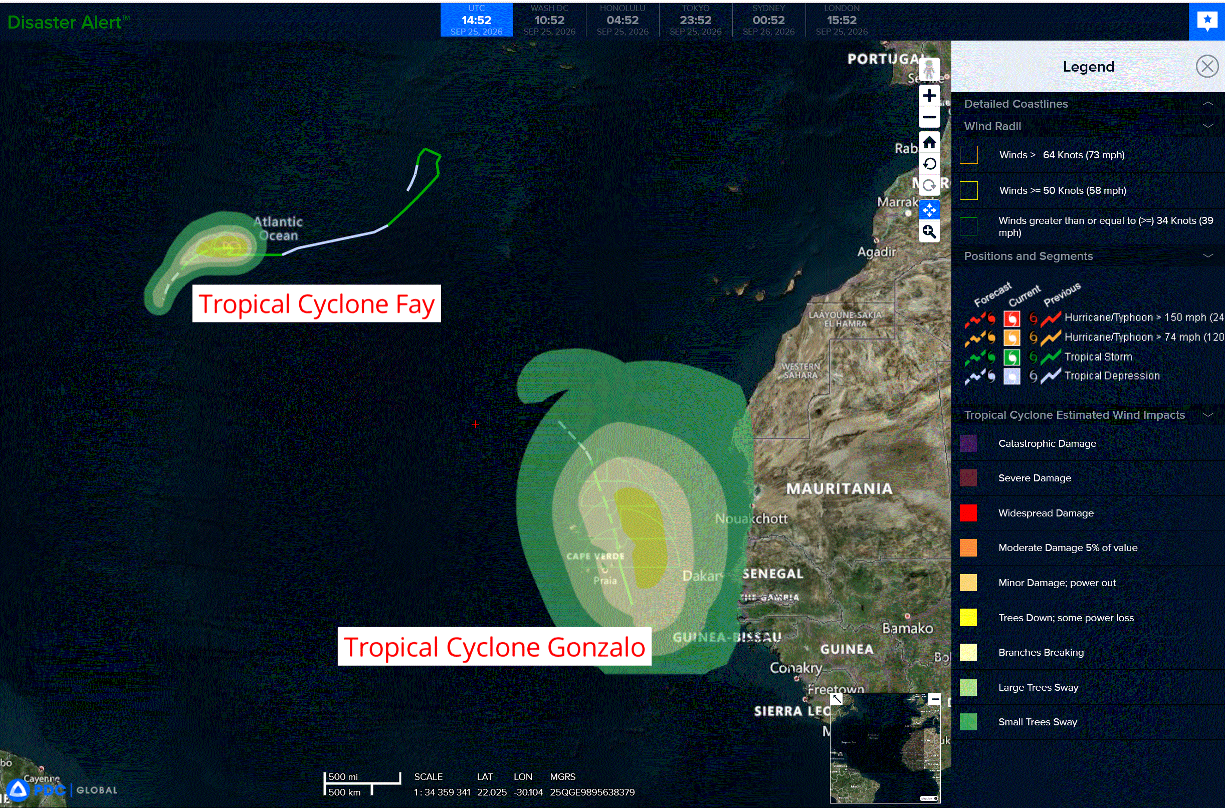
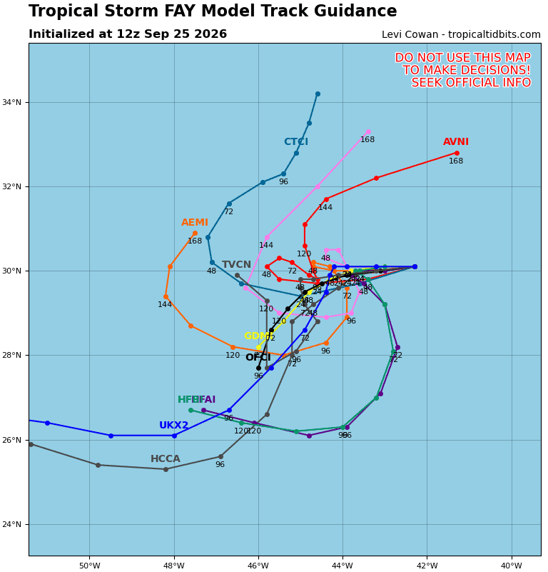
Tropical Cyclone Fay…is located about 990 miles west-southwest of the Azores
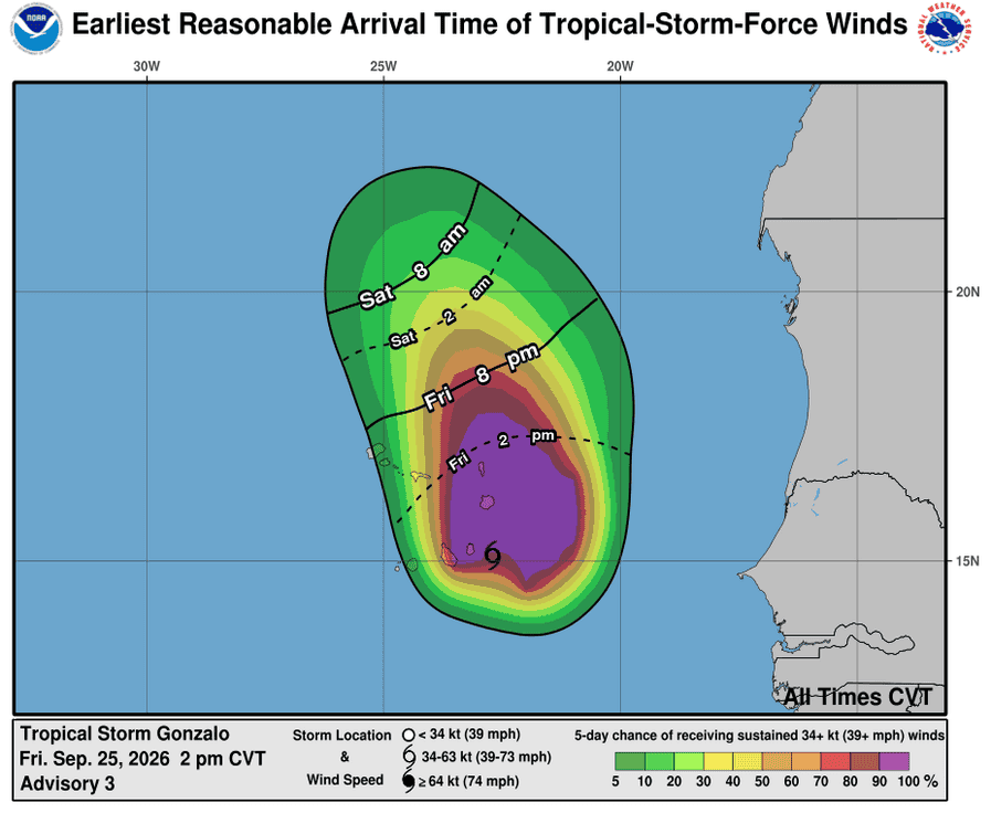
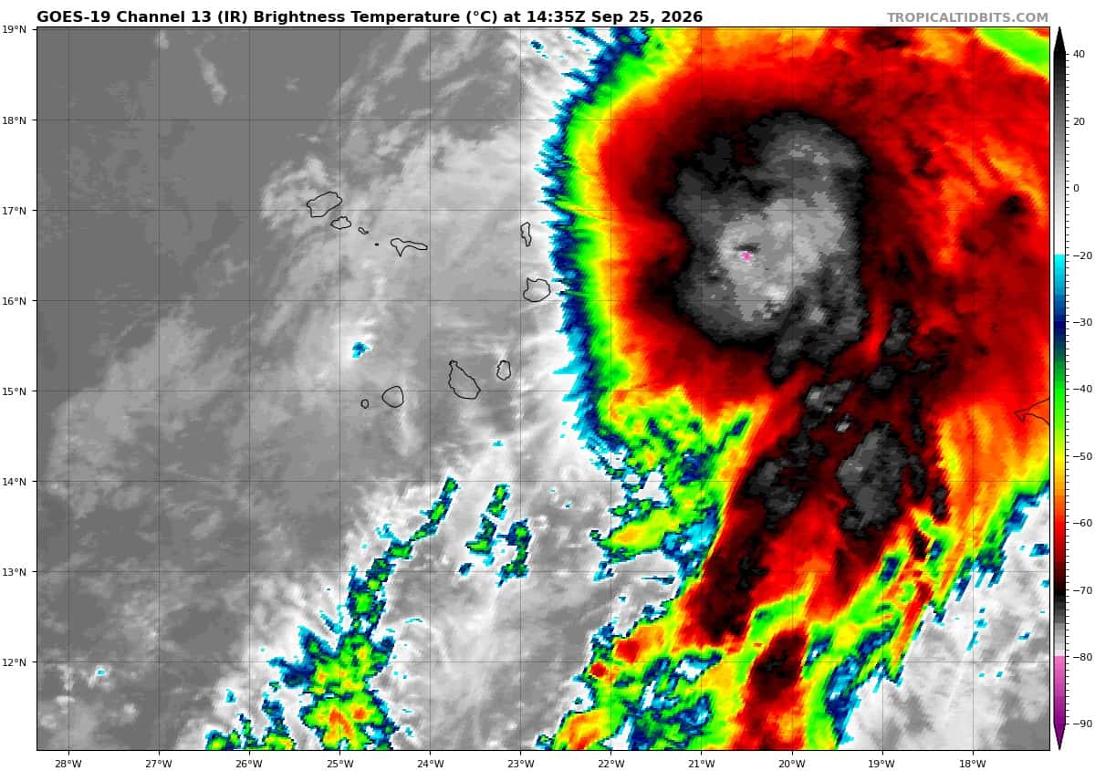
Tropical Cyclone Gonzalo…is located about 115 miles south of Sal Cabo Verde
Atlantic Ocean:
Tropical Cyclone Fay
FAY SLIGHTLY STRONGER
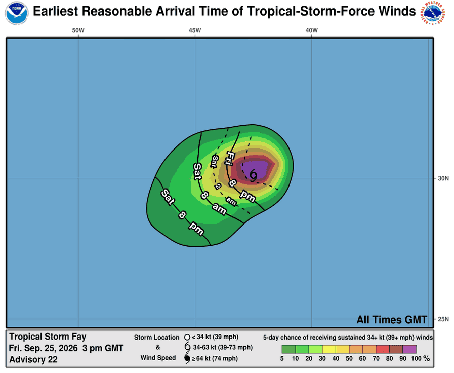
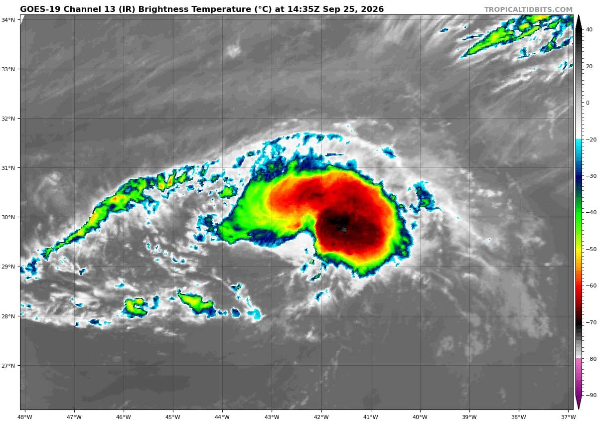
According to the NHC advisory number 22
Fay is moving toward the west near 3 mph. A gradual turn to the west-southwest then southwest at a slower forward speed is expected over the next few of days. Maximum sustained winds have increased to near 60 mph with higher gusts. Some slight strengthening is possible over the next few hours. Gradual weakening, however, is still expected through the weekend. Tropical-storm-force winds extend outward up to 80 miles from the center. The estimated minimum central pressure is 1002 mb (29.59 inches).
Tropical Cyclone Gonzalo
GONZALO SPREADING GUSTY WINDS ACROSS THE CABO VERDE ISLAND
According to the NHC advisory number 3
Gonzalo is moving toward the north-northwest near 10 mph (17 km/h). This general motion is expected to continue over the next few days, with a slower forward speed this weekend. On the forecast track, the center will pass near or over portions of the Cabo Verde Islands later today and tonight.
Maximum sustained winds are near 50 mph (85 km/h) with higher gusts. Little change in strength is expected today. A gradual weakening trend is forecast to begin tonight and continue through the weekend.
Tropical-storm-force winds extend outward up to 205 miles (335 km) primarily to the northeast of the center. The official observing station on Sal in the Cabo Verde Islands recently reported a sustained wind of 32 mph (52 km/h) with a gust to 45 mph (72 km/h). The estimated minimum central pressure is 1000 mb (29.53 inches).
HAZARDS AFFECTING LAND
WIND: Tropical storm conditions are spreading over the Cabo Verde Islands and will continue through today.
RAINFALL: Tropical Storm Gonzalo is expected to produce rainfall totals of 1 to 3 inches (30 to 75 mm) across the eastern portions of the islands of Cabo Verde on Friday and Saturday with less than 1 inch anticipated for the western side of the island chain. Heavy rain along the coastal areas of Guinea-Bissau, Gambia, and Senegal will produce totals between 2 to 4 inches (50 to 100 mm) with isolated higher amounts along the immediate coast.
SURF: Swells generated by the storm are expected to affect the Cabo Verde Islands through Saturday. These swells are likely to cause life-threatening surf and rip current conditions.
Caribbean Sea: There are no active tropical cyclones
Tropical cyclone formation is not expected during the next 7 days.
Gulf of America: There are no active tropical cyclones
Tropical cyclone formation is not expected during the next 7 days.