The Pacific Disaster Center’s (PDC Global) Friday, July 24, 2026, Tropical Cyclone Activity Report…for the Pacific Ocean, the Indian Ocean, and adjacent Seas
Current Tropical Cyclones:
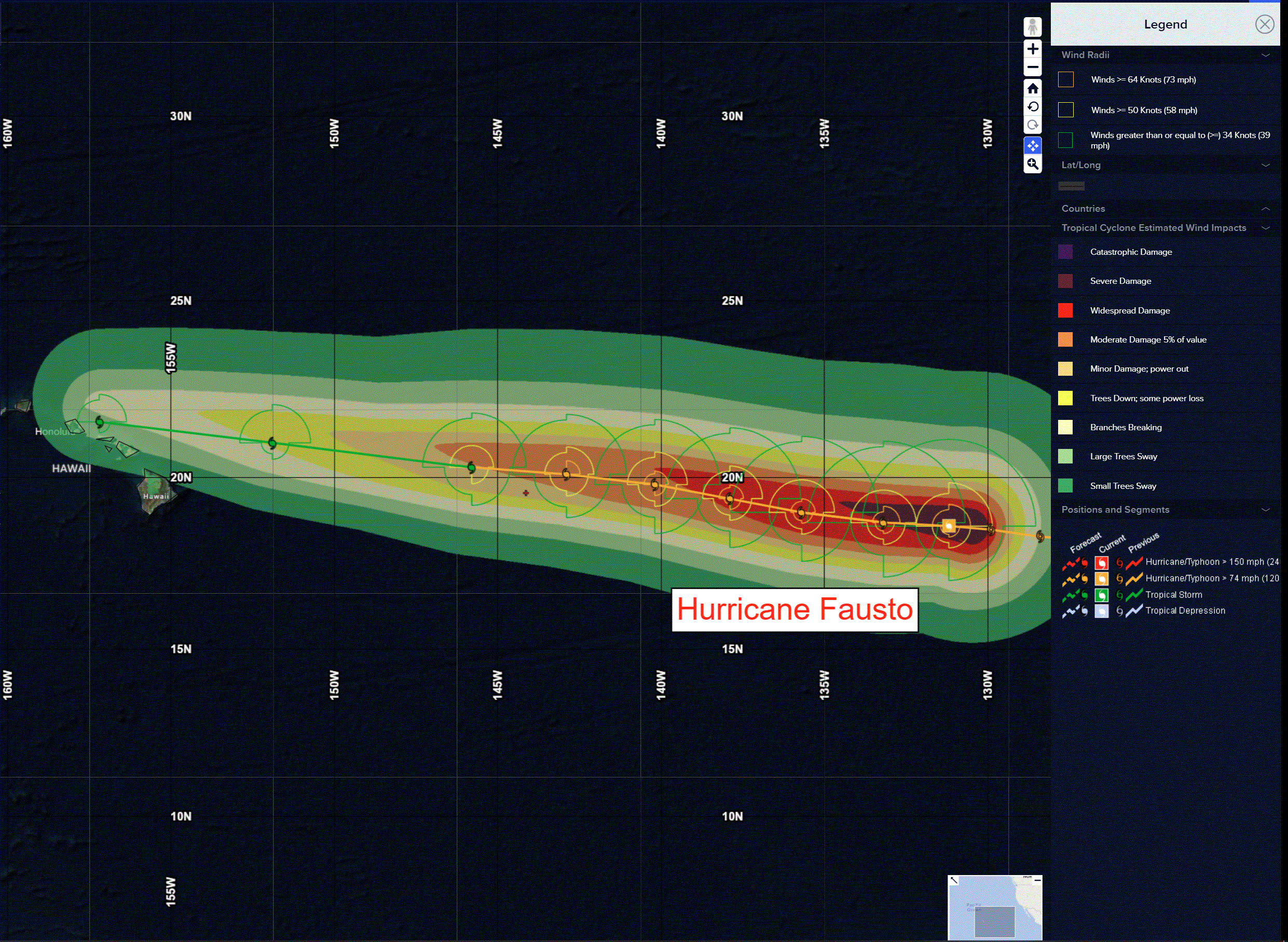
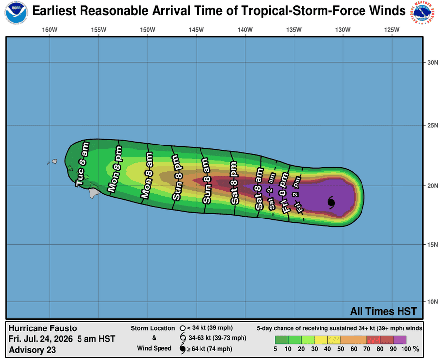
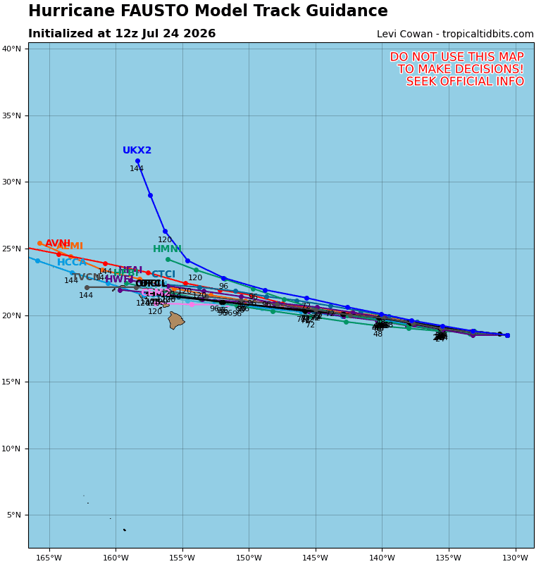
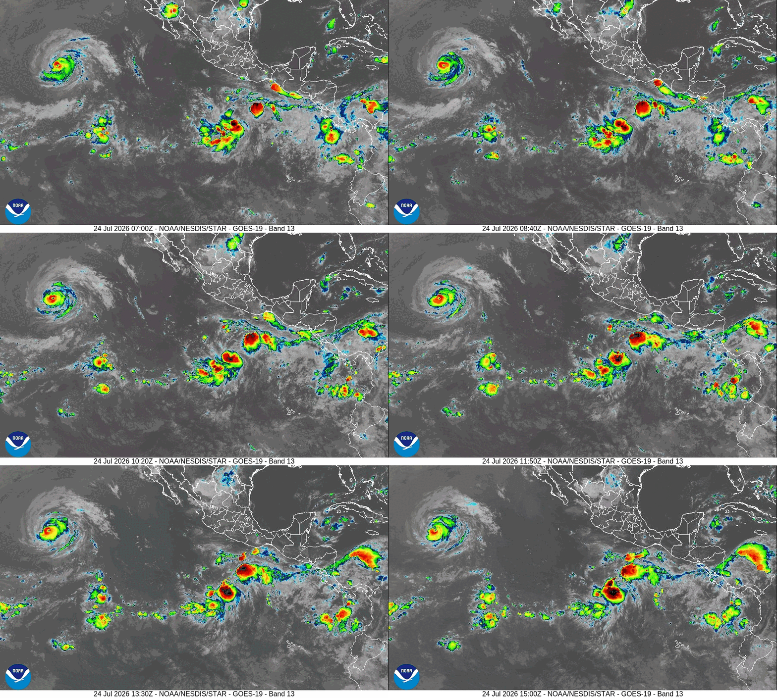
Tropical cyclone 06E Fausto…1560 miles east of Hilo, Hawaii
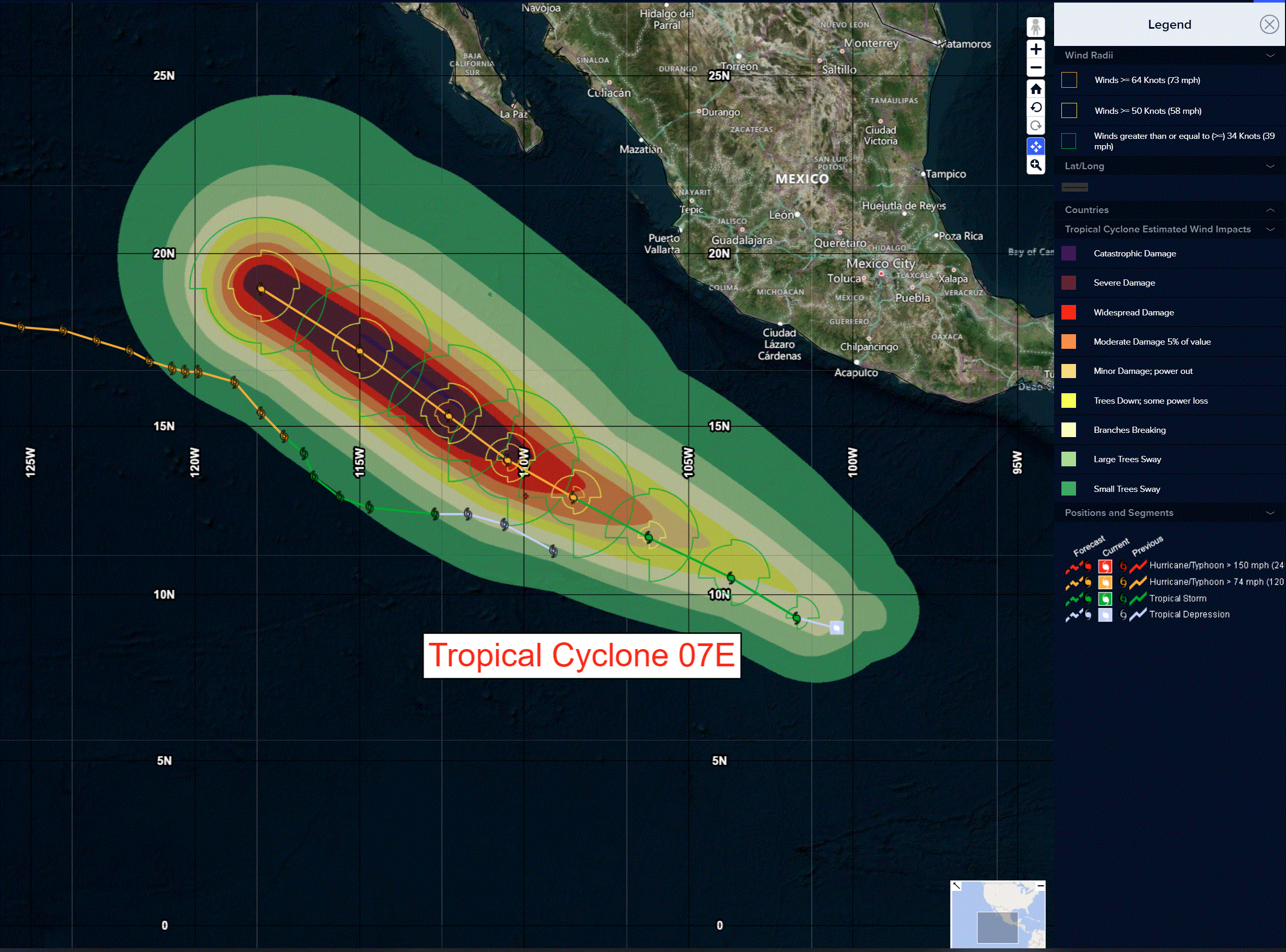
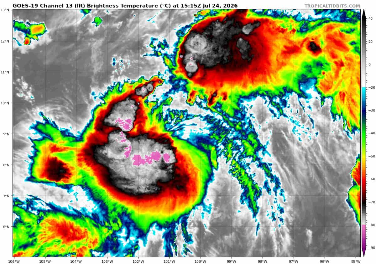
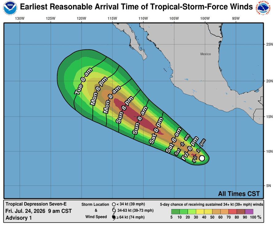
Tropical cyclone 07E…605 miles south of Zihuatanejo, Mexico
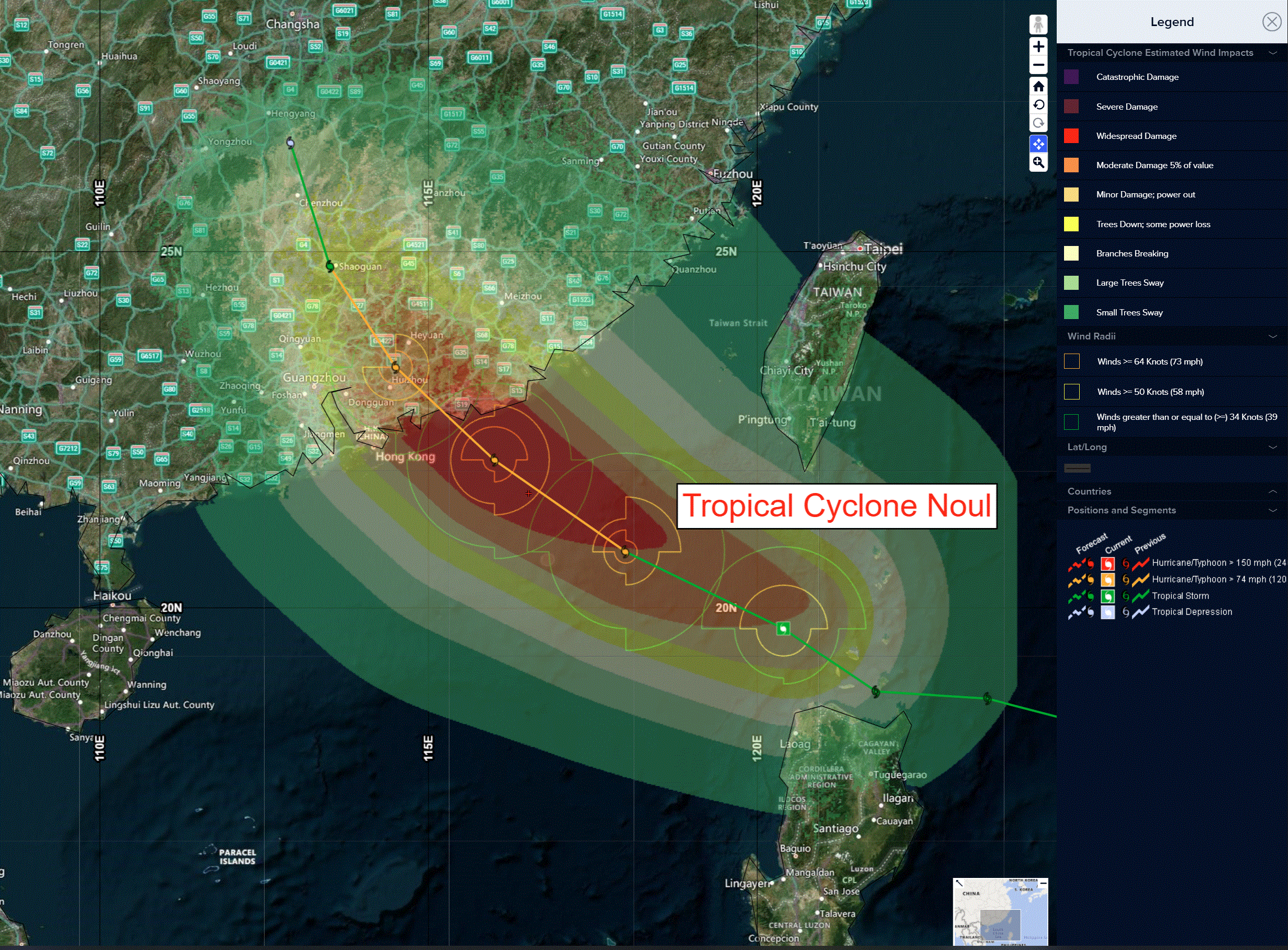
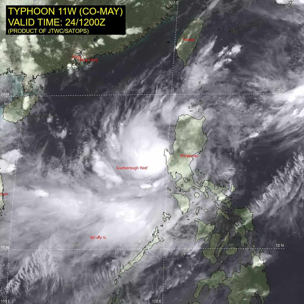
Tropical cyclone 11W (Noul)…is located approximately 381 NM east-southeast of Hong Kong
Northeast Pacific:
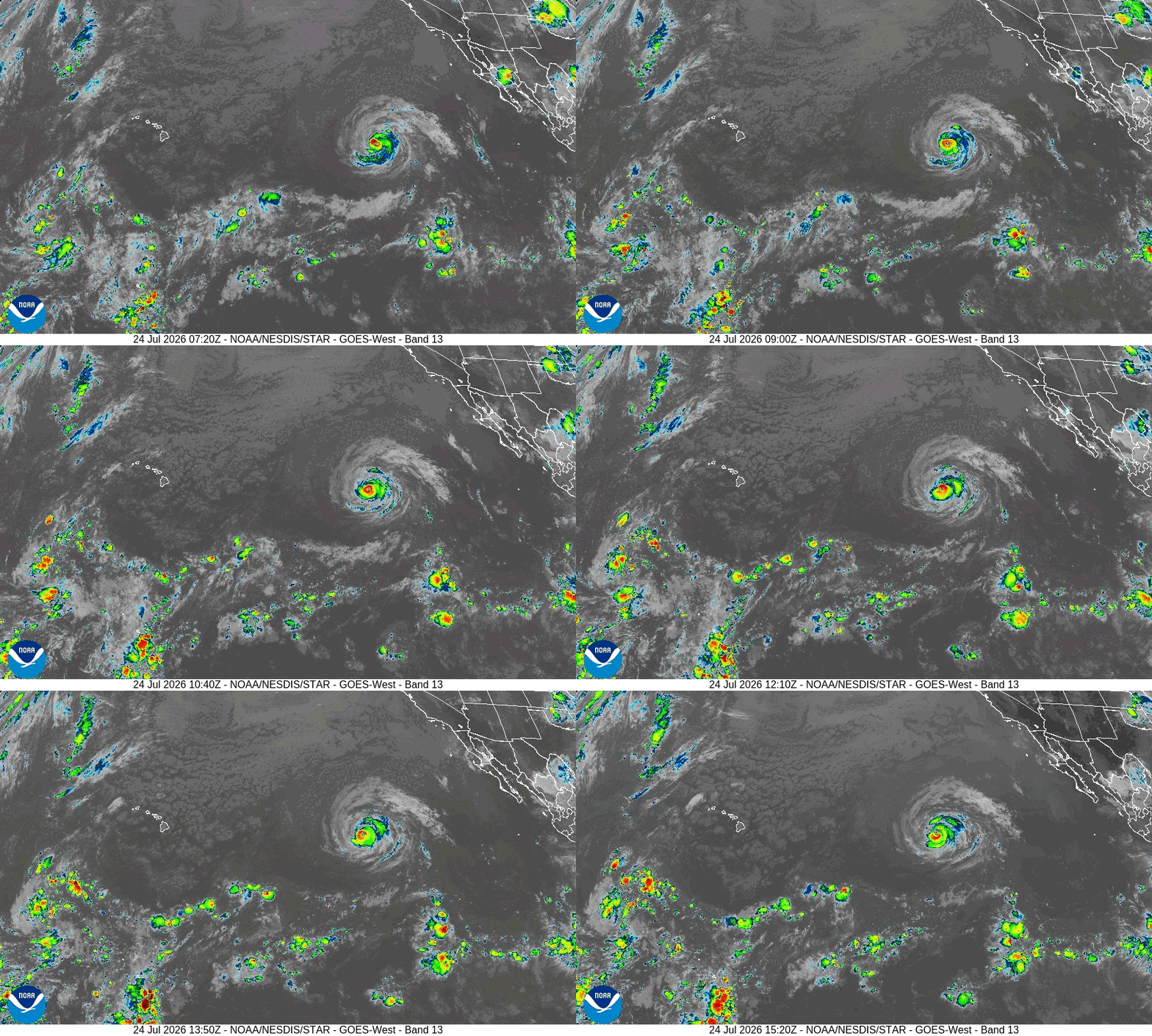
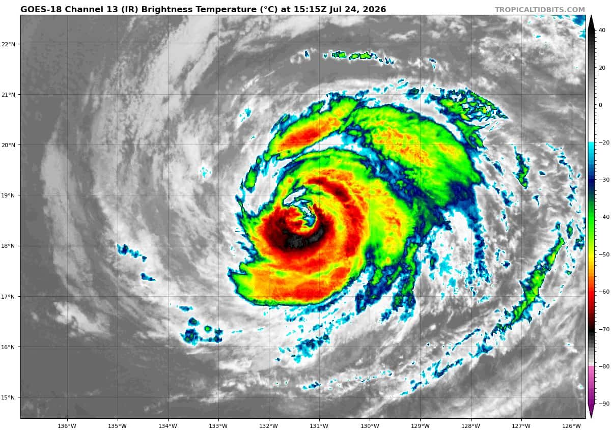
Tropical cyclone 06E (Fausto)
STRENGTHENS A LITTLE MORE
According to the NHC Advisory number 23
Fausto is moving toward the west near 16 mph (26 km/h) and this motion is expected to continue over the next few days.
Maximum sustained winds are near 105 mph (165 km/h) with higher gusts. Gradual weakening is expected during the next several days.
Hurricane-force winds extend outward up to 45 miles (75 km) from the center and tropical-storm-force winds extend outward up to 185 miles (295 km).
The estimated minimum central pressure is 967 mb (28.56 inches).
HAZARDS AFFECTING LAND
SURF: Swells generated by Fausto are affecting portions of the west coast of the Baja California Peninsula and the coast of southern California. These swells are likely to cause life-threatening surf and rip current conditions.
Tropical cyclone 07E
TROPICAL DEPRESSION FORMS OVER OPEN WATERS OF THE EASTERN PACIFIC…EXPECTED TO QUICKLY STRENGTHEN DURING THE NEXT FEW DAYS
According to the NHC Advisory number 1
The depression is moving toward the west-northwest near 12 mph (19 km/h), and this general motion is expected to continue for the next several days. Maximum sustained winds are near 35 mph (55 km/h) with higher gusts. Significant strengthening is forecast during the next few days.
The system is expected to become a tropical storm later today or tonight and could reach hurricane strength by late this weekend.
The estimated minimum central pressure is 1005 mb (29.68 inches).
Central Pacific: There are no active tropical cyclone
>>> Well Southwest of Hawaii:
An area of low pressure located well southwest of the Hawaiian Islands is producing disorganized showers and thunderstorms.
Environmental conditions appear conducive for some gradual development of this system while it moves slowly west to west-northwestward, and a tropical depression is likely to form after it enters the western Pacific basin over the weekend or early next week.
* Formation chance through 48 hours…low…20 percent
* Formation chance through 7 days…high…70 percent
Western Pacific, Indian Ocean, and adjacent Seas:
Western Pacific
Tropical Cyclone 11W (Noul)
According to the JTWC Warning number 6
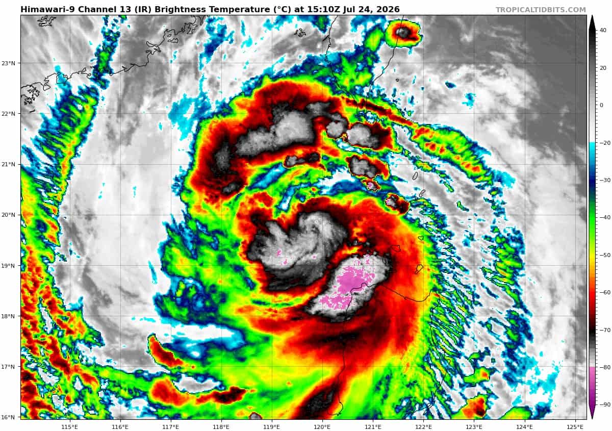
Animated enhanced infrared (eir) satellite imagery depicts tropical storm 11W (Noul) as a quickly consolidating system with upper level convection beginning to wrap around the center. The 240850z 37 color composite gpm microwave image reveals a defined, but ragged, microwave eye. The surface observation reported by the station at Calayan, Philippines from 241000z indicated sustained southerly winds at 31 kts, gusting to 66 kts.
Environmental analysis indicates a highly favorable environment characterized by low (5-10 kts) vertical wind shear (vws), very warm (30-31 c) sea surface
temperatures (sst), and robust radial outflow.
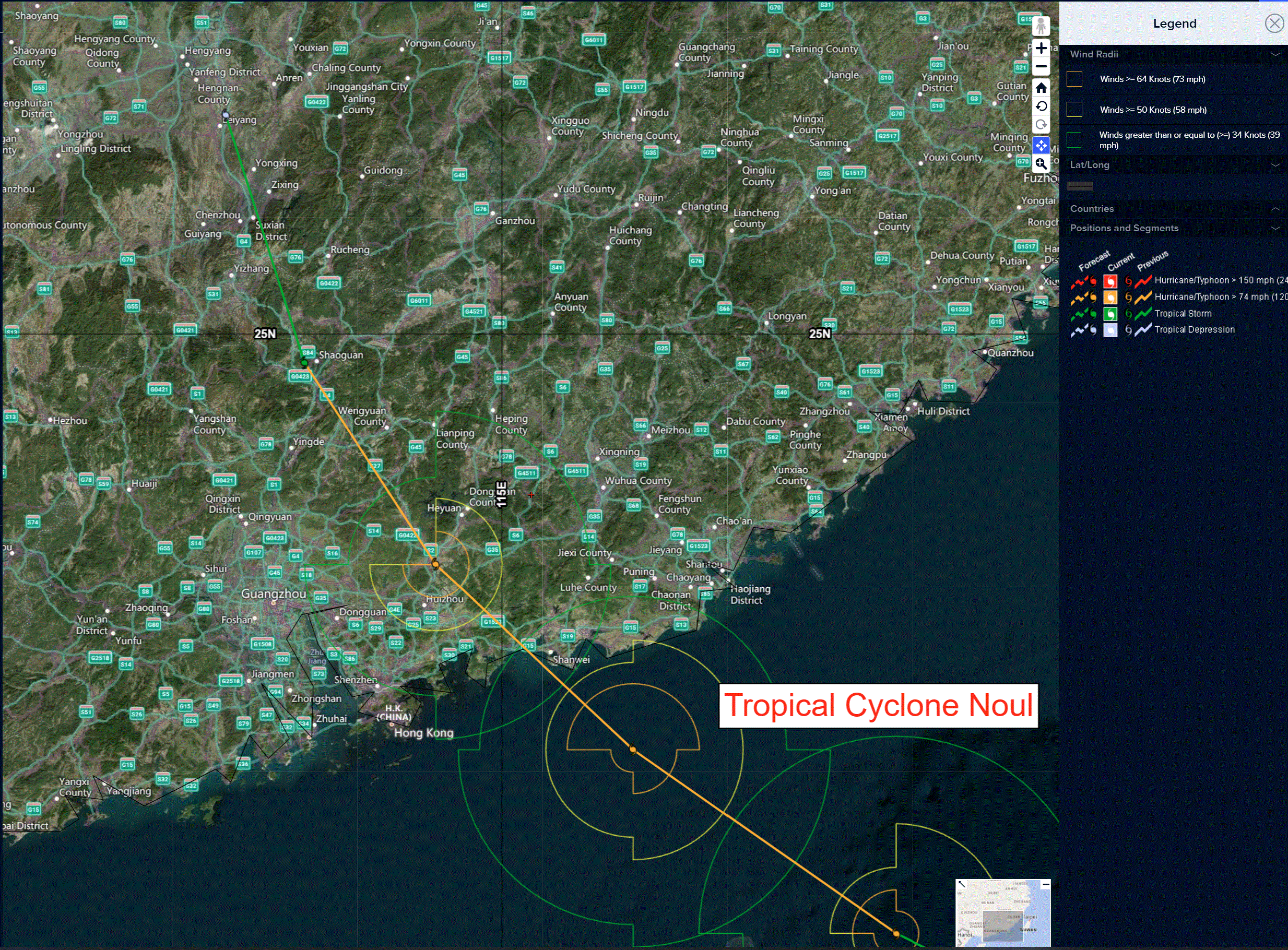
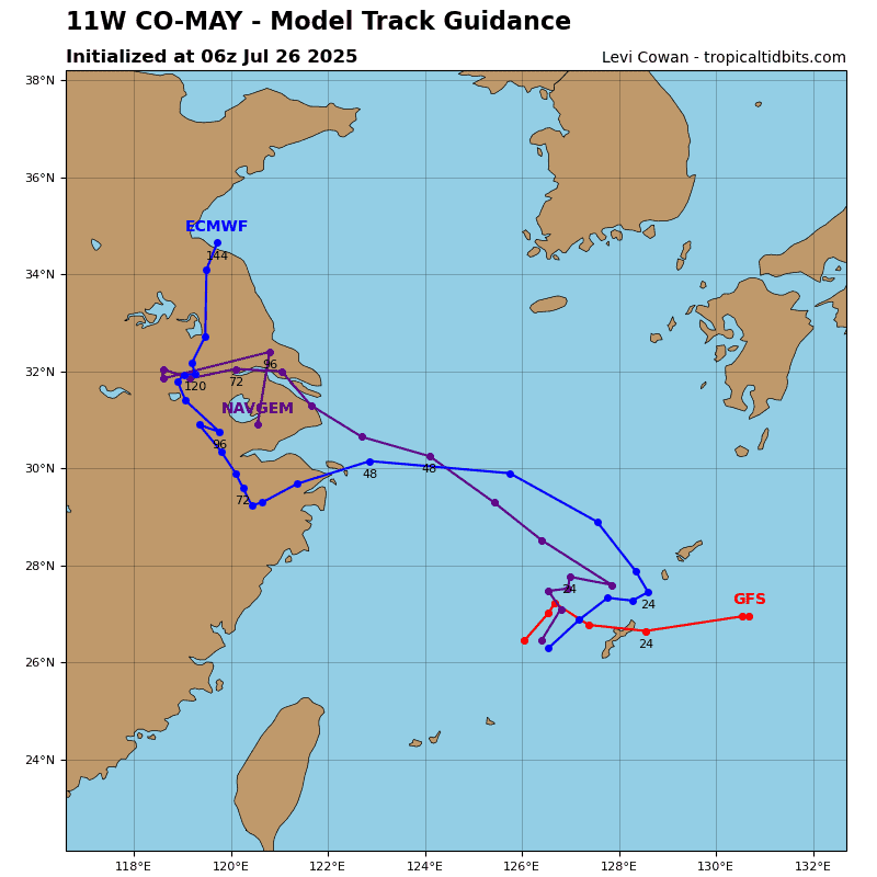
TS 11W will continue tracking northwestward while it remains steered by the southwestern periphery of the steering ridge through landfall. Landfall is expected between 24-26 hours, at which point, storm motion may become more erratic than reflected in the forecast, as land interaction can unpredictably impact track speed and trajectory.
Regarding intensity, Noul is forecast to steadily intensify for the next 24 hours as it tracks away from land and into the highly favorable environment in the
South China Sea. 11W may undergo a brief period of rapid intensification, however, with landfall expected in 24-36 hours, intensification is limited by time. Noul is forecast to reach its peak intensity at 24 hours at 85 kts, just prior to making landfall to the northeast of Hong Kong. 11W is forecast to rapidly weaken
post-landfall, with dissipation expected no later than 60 hours.