The Pacific Disaster Center’s (PDC Global) Saturday, July 25, 2026, Tropical Cyclone Activity Report…for the Pacific Ocean, the Indian Ocean, and adjacent Seas
Current Tropical Cyclones:
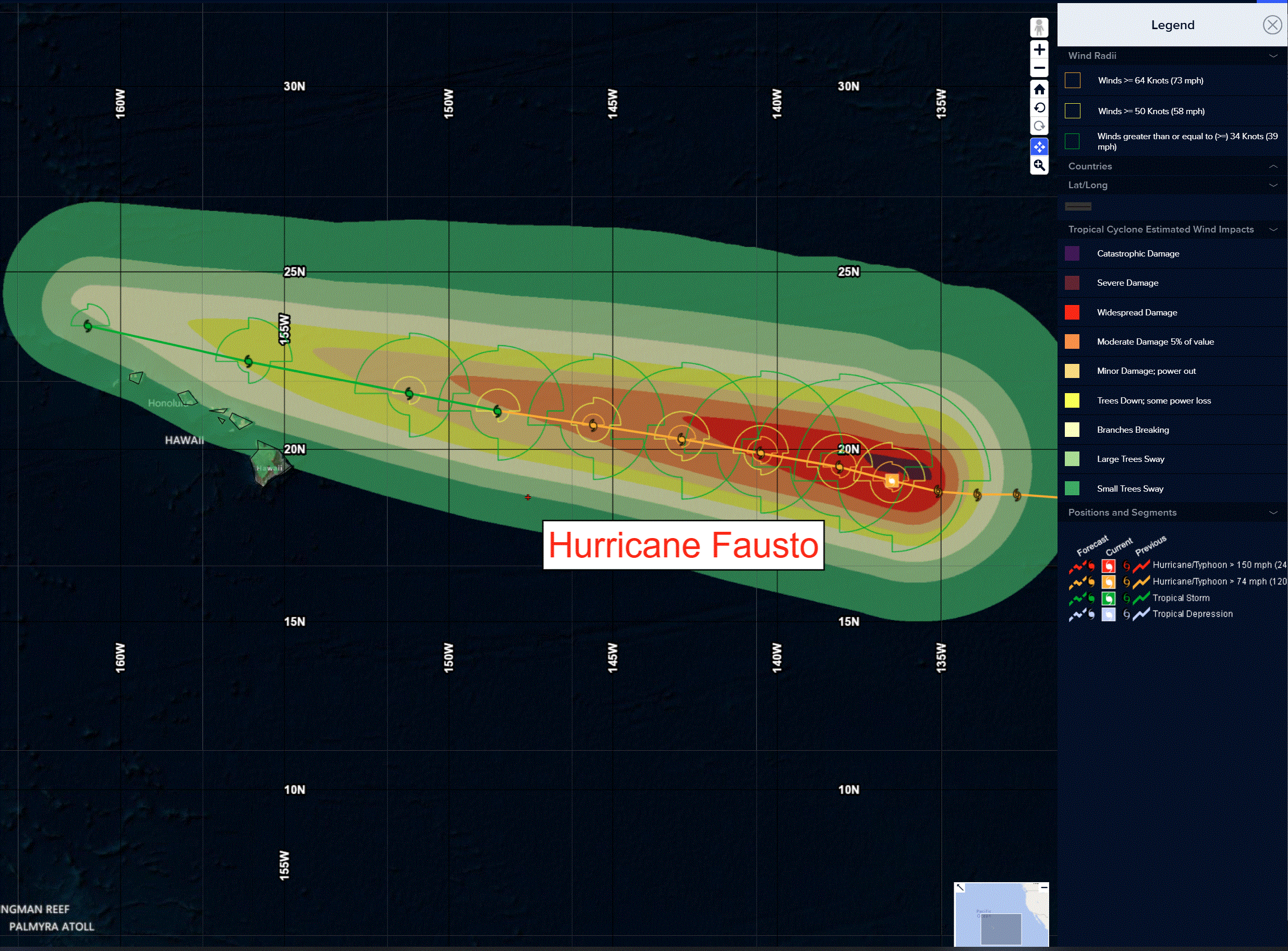
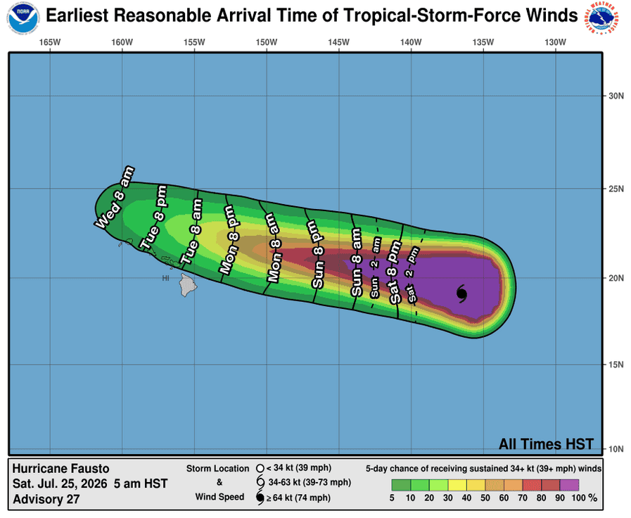
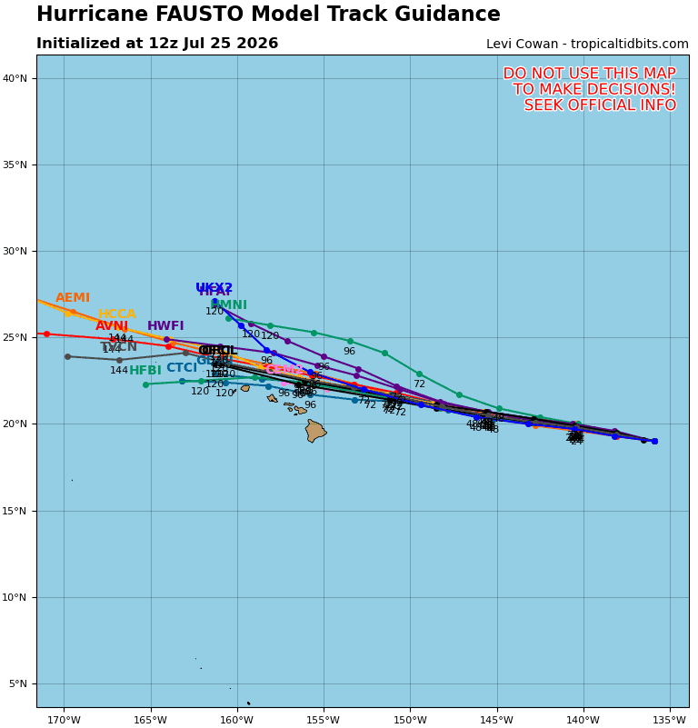
Tropical cyclone 06E Fausto…1060 miles east of Hilo, Hawaii
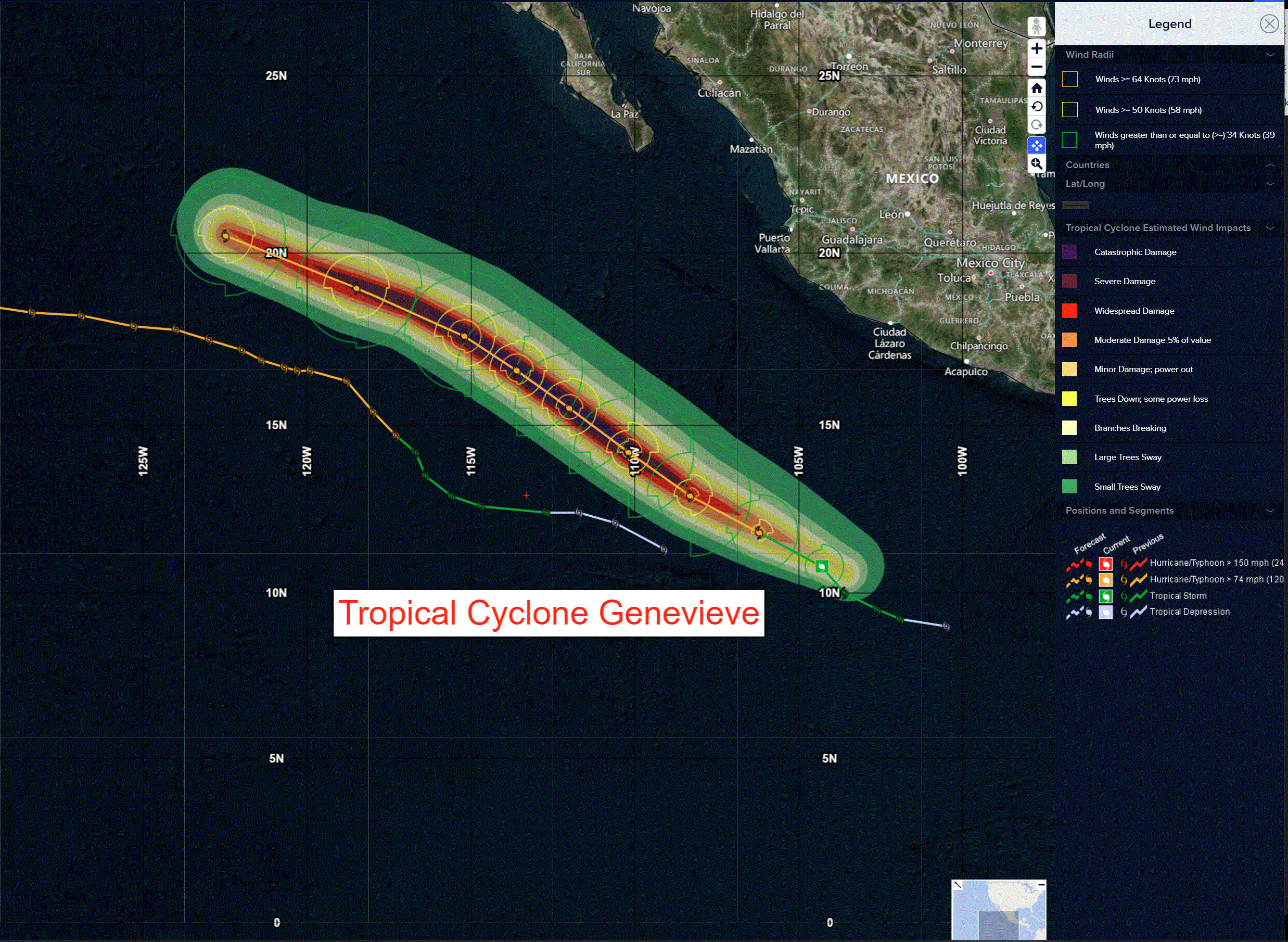
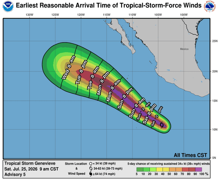
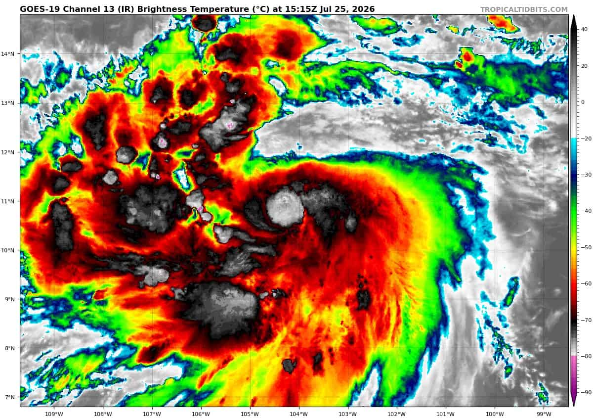
Tropical cyclone 07E (Genevieve)…500 miles south-southwest of Manzanillo, Mexico
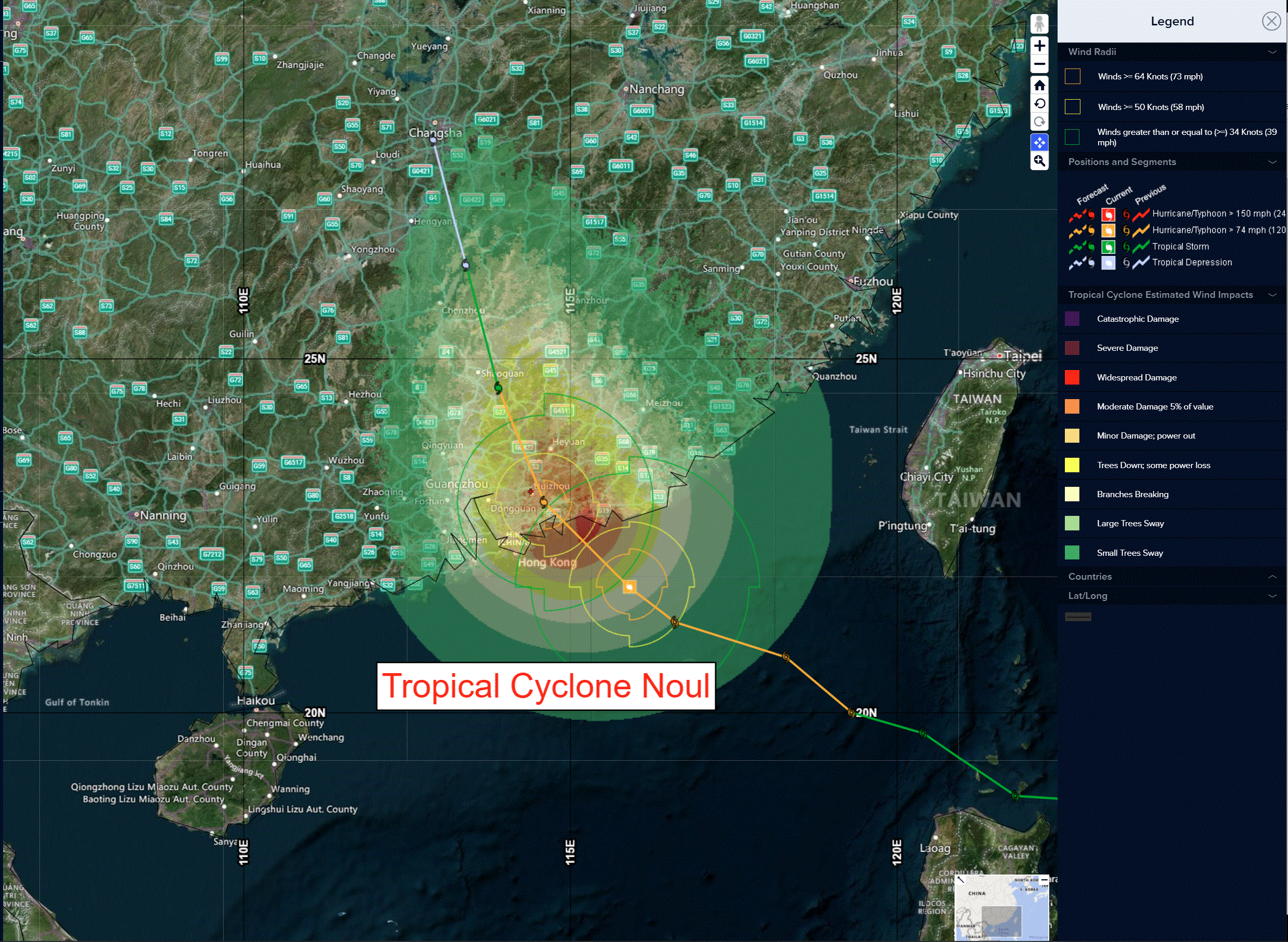
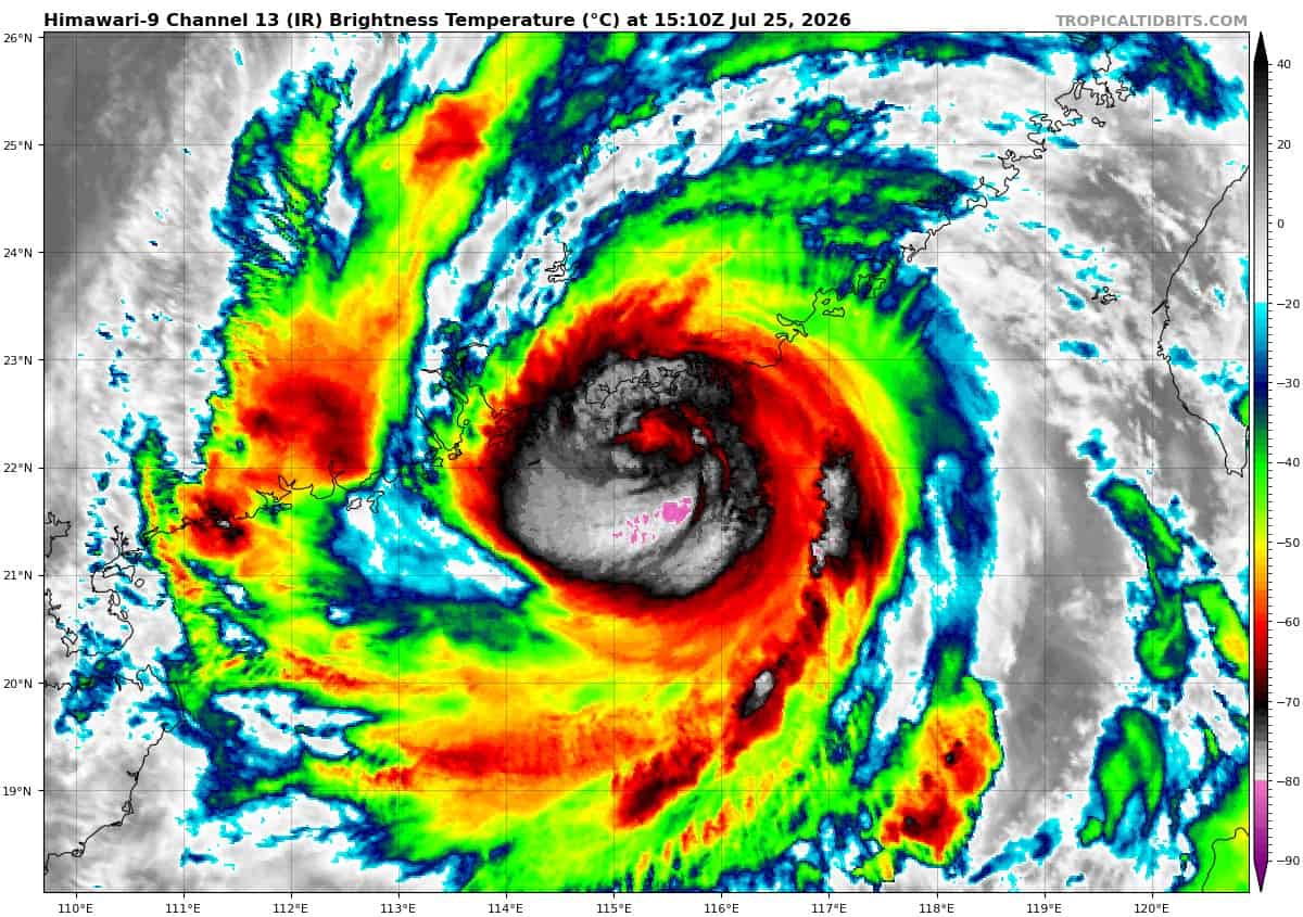
Tropical cyclone 11W (Noul)…is located approximately 99 NM east-southeast of Hong Kong – Final Warning
Northeast Pacific:
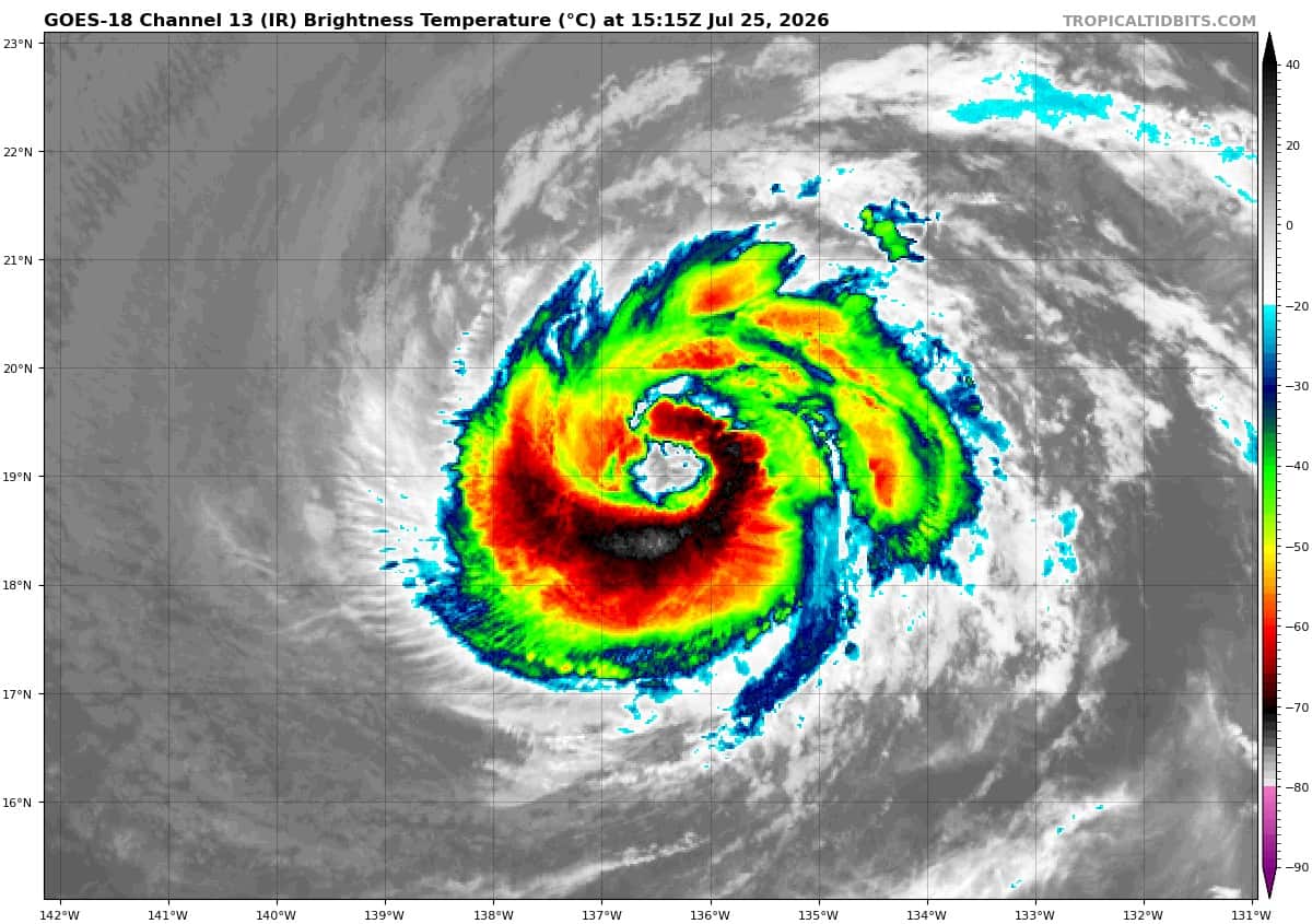
Tropical cyclone 06E (Fausto)
FAUSTO HOLDING STEADY…EXPECTED TO MOVE INTO THE CENTRAL PACIFIC EARLY SUNDAY
According to the NHC Advisory number 29
Fausto is moving toward the west near 13 mph (20 km/h), and this general motion is expected to continue for the next several days.
Maximum sustained winds are near 100 mph (155 km/h) with higher gusts. Gradual weakening is forecast during the next several days.
Hurricane-force winds extend outward up to 50 miles (85 km) from the center and tropical-storm-force winds extend outward up to 185 miles (295 km).
The estimated minimum central pressure is 971 mb (28.68 inches).
HAZARDS AFFECTING LAND
SURF: Surf generated by Fausto is expected to begin building across east-facing shores of the eastern end of the state on Sunday, spreading westward Sunday night into Monday, and continue building through Tuesday as Fausto approaches and moves into the area. These swells are likely to cause life-threatening surf and rip current conditions.
Tropical cyclone 07E (Genevieve)
GENEVIEVE NOW A HURRICANE…FORECAST TO RAPIDLY INTENSIFY OVER THE NEXT DAY OR SO
According to the NHC Advisory number 7
Genevieve is moving toward the west-northwest near 15 mph (24 km/h). A west-northwestward to northwestward motion with some decrease in forward speed is expected during the next few days.
Maximum sustained winds have increased to near 80 mph (130 km/h) with higher gusts. Rapid intensification is expected during the next day or so, and Genevieve is forecast to become a major hurricane by late Sunday.
Hurricane-force winds extend outward up to 15 miles (30 km) from the center and tropical-storm-force winds extend outward up to 125 miles (205 km).
The estimated minimum central pressure is 987 mb (29.15 inches).
Central Pacific: There are no active tropical cyclone
>>> Well Southwest of Hawaii:
Invest 92C
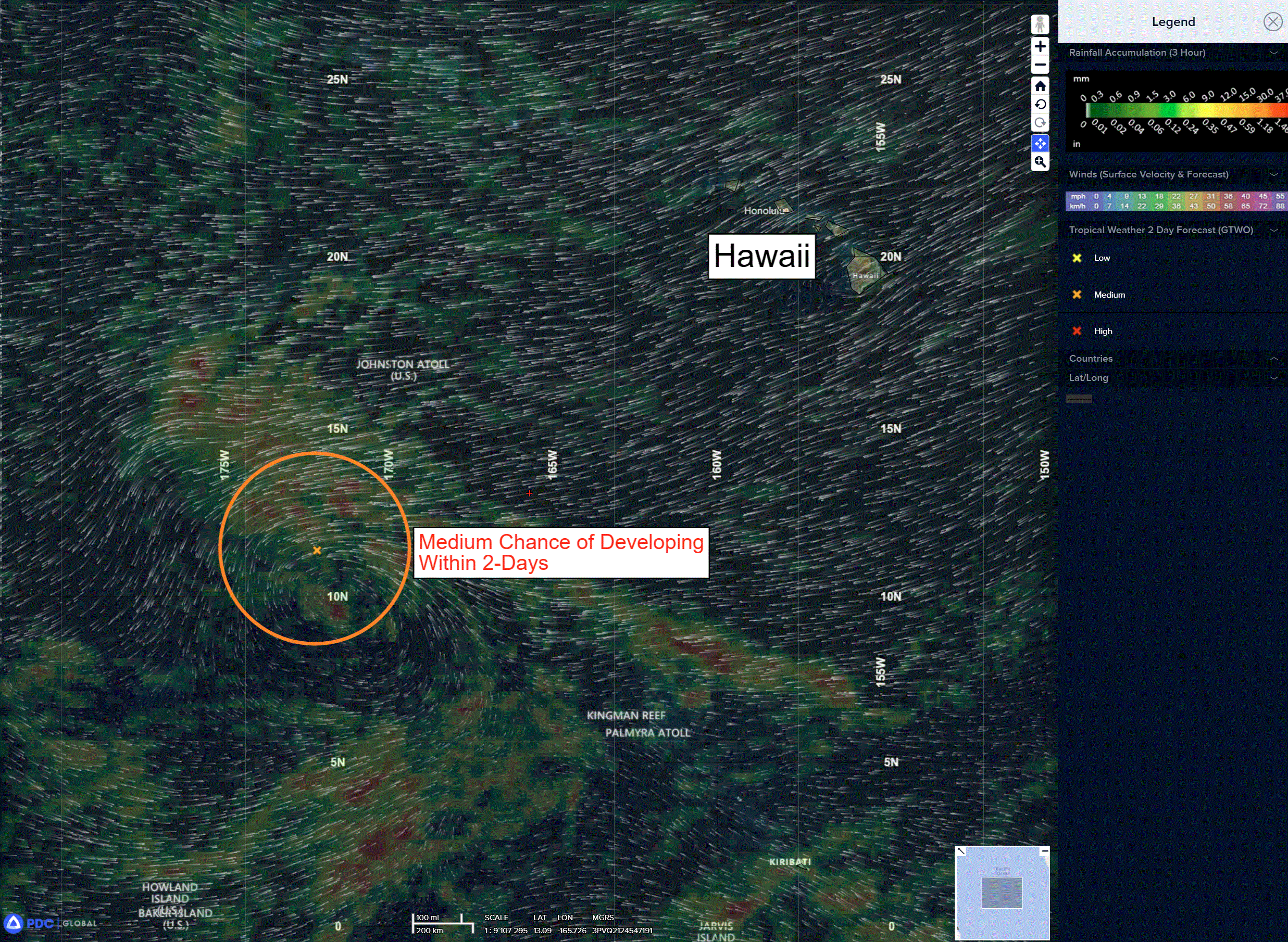
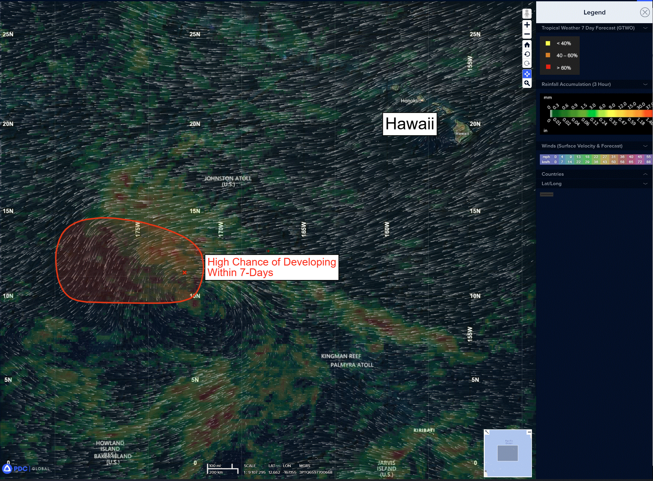
A large area of disorganized showers and thunderstorms located well southwest of the Hawaiian Islands is associated with a broad area of low pressure.
Environmental conditions appear conducive for gradual development of this system while it moves generally westward at about 10 mph toward the International Date Line, and a tropical depression is likely to form in the western Pacific basin early next week.
* Formation chance through 48 hours…medium…50 percent
* Formation chance through 7 days…high…80 percent
Western Pacific, Indian Ocean, and adjacent Seas:
Western Pacific
Tropical Cyclone 11W (Noul) – Final Warning
According to the JTWC Warning number 13
Animated multi-spectral satellite imagery (msi) and radar imagery depict spiral bands of deep convection persisting around the central vortex as Typhoon 11W tracks inland over southeastern China. The msi and radar also confirm that the eye has filled completely.
The system is forecast to continue tracking north-northwestward as it rapidly decays over land. Despite the rapid weakening of TY 11W, heavy precipitation is evident in the radar and wind speeds of 30 kts gusting to 40 kts have been reported in Hong Kong over the past few hours.
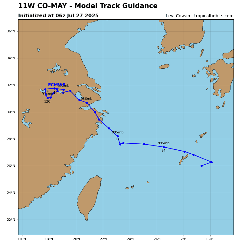
Numerical model guidance is in tight agreement about the track and dissipation of the system over the next 36 hours.
Indian Ocean
>>> There’s an area of disturbed weather being referred to as Invest 93B which is located approximately 115 NM south of Kolkata, India
According to the JTWC at 26 0030Z
Enhanced infrared satellite imagery (eir) depicts a broad low level circulation center (llcc) with persistent deep convection over the southern semicircle. A 251730z oscat image reveals a defined circulation with 20-25 knot winds over the southern periphery.
Environmental analysis reveals favorable conditions for development with low vertical wind shear (15
knots or less), good equatorward upper-level outflow, and warm (28-29c) sea surface temperatures.
Global models indicate a slow northward track and steady development over the next 24 hours with extensive southwesterly winds.
Maximum sustained surface winds are estimated at 20 to 25 knots.
The potential for the development of a significant tropical cyclone within the next 24 hours is medium.