The Pacific Disaster Center’s (PDC Global) Sunday, July 26, 2026, Tropical Cyclone Activity Report…for the Pacific Ocean, the Indian Ocean, and adjacent Seas
Current Tropical Cyclones:
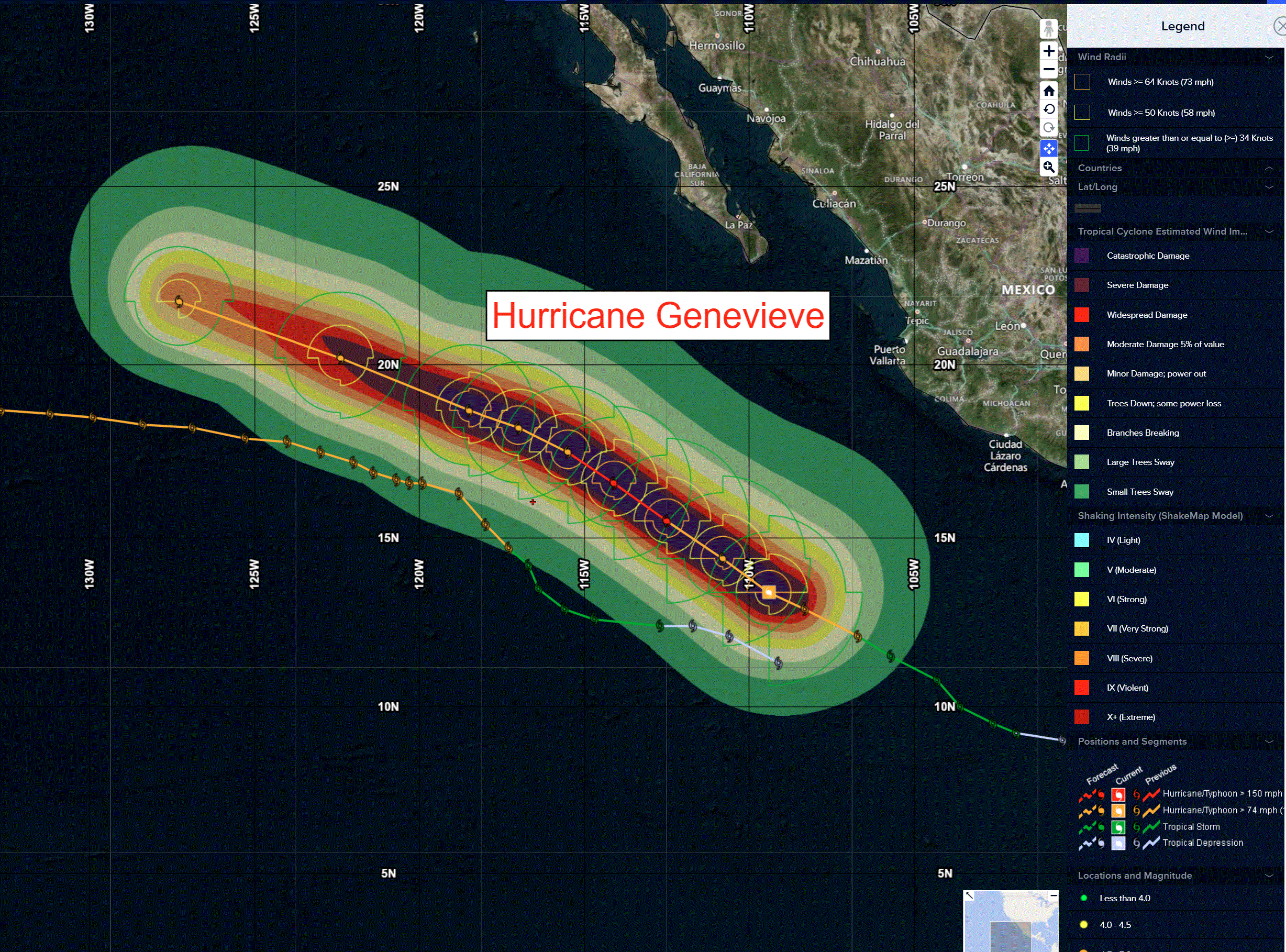
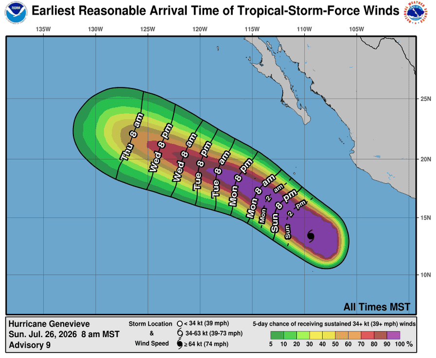
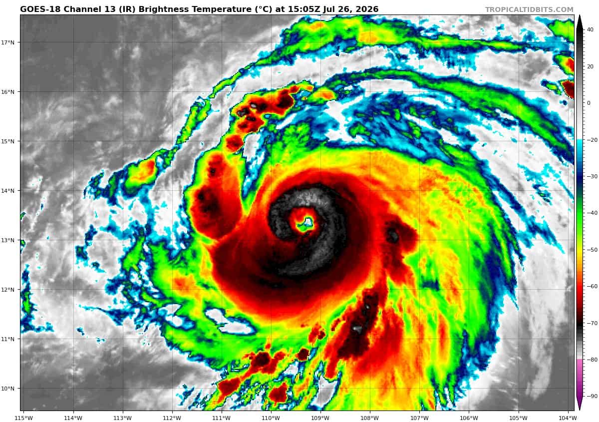
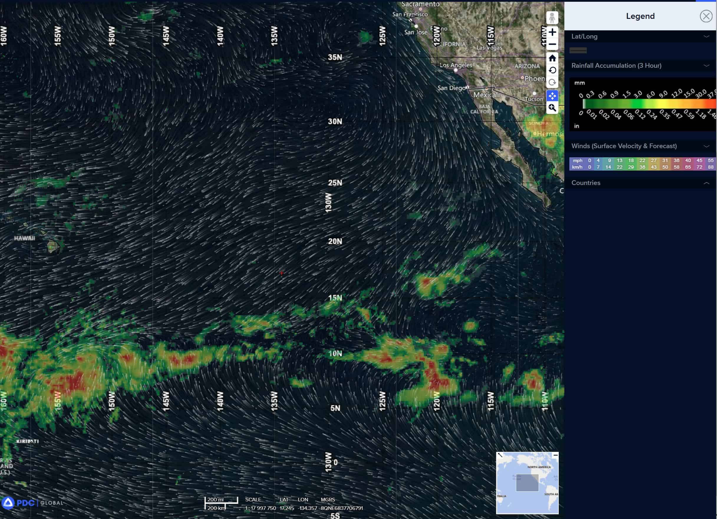
Tropical cyclone 07E (Genevieve)…575 miles south of the southern tip of Baja California
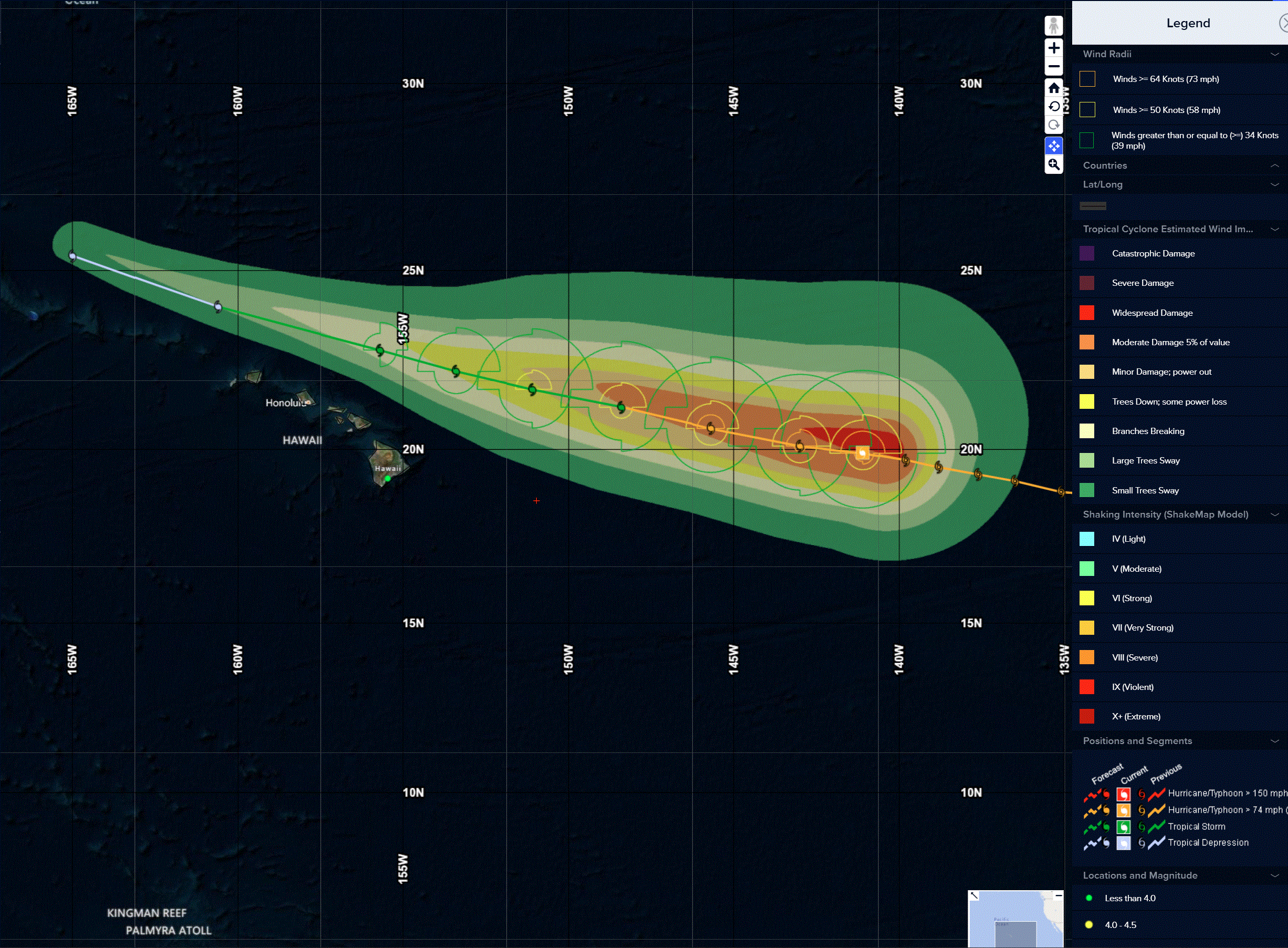
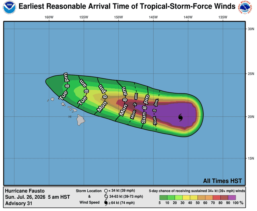
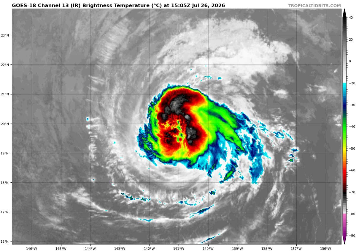
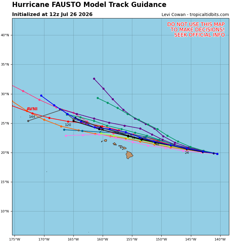
Tropical cyclone 06E (Fausto)…740 miles east of Hilo, Hawaii
Tropical cyclone 12W…is located approximately 541 NM northeast of Majuro
Northeast Pacific:
Tropical cyclone 07E (Genevieve)
GENEVIEVE IS A POWERFUL CATEGORY 4 HURRICANE
According to the NHC Advisory number 11
Genevieve is moving toward the west-northwest near 16 mph (26 km/h). A west-northwestward to northwestward motion with some decrease in forward speed is expected during the next few days.
Maximum sustained winds have increased to near 120 mph (195 km/h) with higher gusts. Genevieve is a category 3 hurricane on the Saffir-Simpson Hurricane Wind Scale. Continued rapid intensification is expected during the next day or so. Genevieve is then forecast to start weakening by the middle of this week.
Hurricane-force winds extend outward up to 45 miles (75 km) from the center and tropical-storm-force winds extend outward up to 195 miles (315 km).
The estimated minimum central pressure is 963 mb (28.44 inches).
Central north Pacific:
Tropical cyclone 06E (Fausto)
FAUSTO HOLDING STEADY AS IT CONTINUES WESTWARD ACROSS THE CENTRAL PACIFIK
According to the NHC Advisory number 33
Fausto is moving toward the west near 14 mph (22 km/h), and this general motion is expected to continue for the next several days.
Maximum sustained winds have decreased to near 85 mph (140 km/h) with higher gusts. Gradual weakening is forecast during the next several days.
Hurricane-force winds extend outward up to 45 miles (75 km) from the center and tropical-storm-force winds extend outward up to 175 miles (280 km).
The estimated minimum central pressure is 977 mb (28.85 inches).
HAZARDS AFFECTING LAND
SURF: Surf generated by Fausto is expected to begin building across east-facing shores of the eastern end of Hawaii later today, spreading westward tonight into Monday, and continue building through Tuesday as Fausto approaches and moves into the area. These swells are likely to cause life-threatening surf and rip current conditions.
Western Pacific, Indian Ocean, and adjacent Seas:
Western Pacific
Tropical Cyclone 12W
According to the JTWC Warning number 1
animated multispectral satellite imagery (msi) depicts tropical
depression 12w with a consolidating low-level circulation center
(llcc) and convective banding wrapping around the northern semicircle.
the wind field is currently asymmetric with the strongest winds to the
north and weaker winds to the south of the llcc. the initial position
is placed with medium confidence based on low-level cloud tracing in
the animated msi. the initial intensity of 30 kts is assessed with
medium confidence based on the agency dvorak fixes ranging from t1.5
to t2.0. the absence of any recent microwave or scatterometer data has
caused there to be some uncertainty in the current structure of the
system. environmental analysis indicates that 12w is in a highly
favorable environment characterized by strong poleward outflow aloft,
low (5-10 kts) vertical wind shear, and warm (29-30 c) sea surface
temperatures.
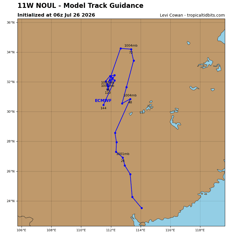
td 12w is forecast to track westward, along
the southern periphery of the str centered north of wake island,
through tau 36. afterward a separate str is expected to build
west-southwest of hawaii and will then become the primary steering
mechanism through the remainder of the forecast period. as a result,
12w will track northwestward through tau 120. in terms of intensity,
12w is forecast to steadily intensify over the next 24 hours as the
system continues to symmetrize. after tau 24, the system is forecast
to undergo rapid intensification (ri) under the effects of a highly
favorable environment. poleward outflow will be enhanced by a tropical
upper-tropospheric trough (tutt) cell positioned to the north-
northeast of the system. vertical wind shear is expected to stay below
10 kts throughout the entire forecast period, providing a highly
conducive environment for significant development. consequently, 12w
is forecast to reach super typhoon strength at around 310000z.
Indian Ocean
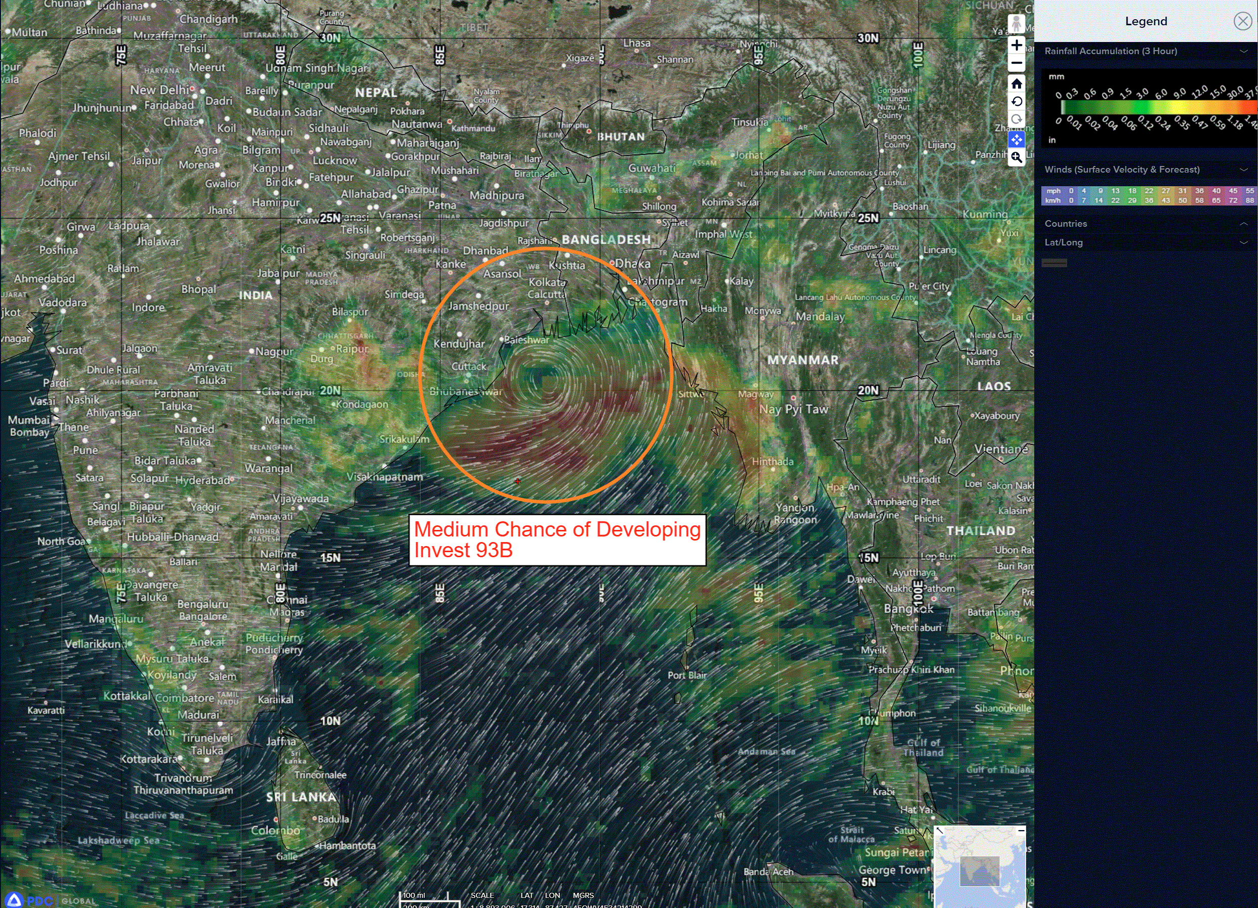
>>> There’s an area of disturbed weather being referred to as Invest 93B which is located approximately 90 NM south of Kolkata, India
According to the JTWC at 26 1800Z
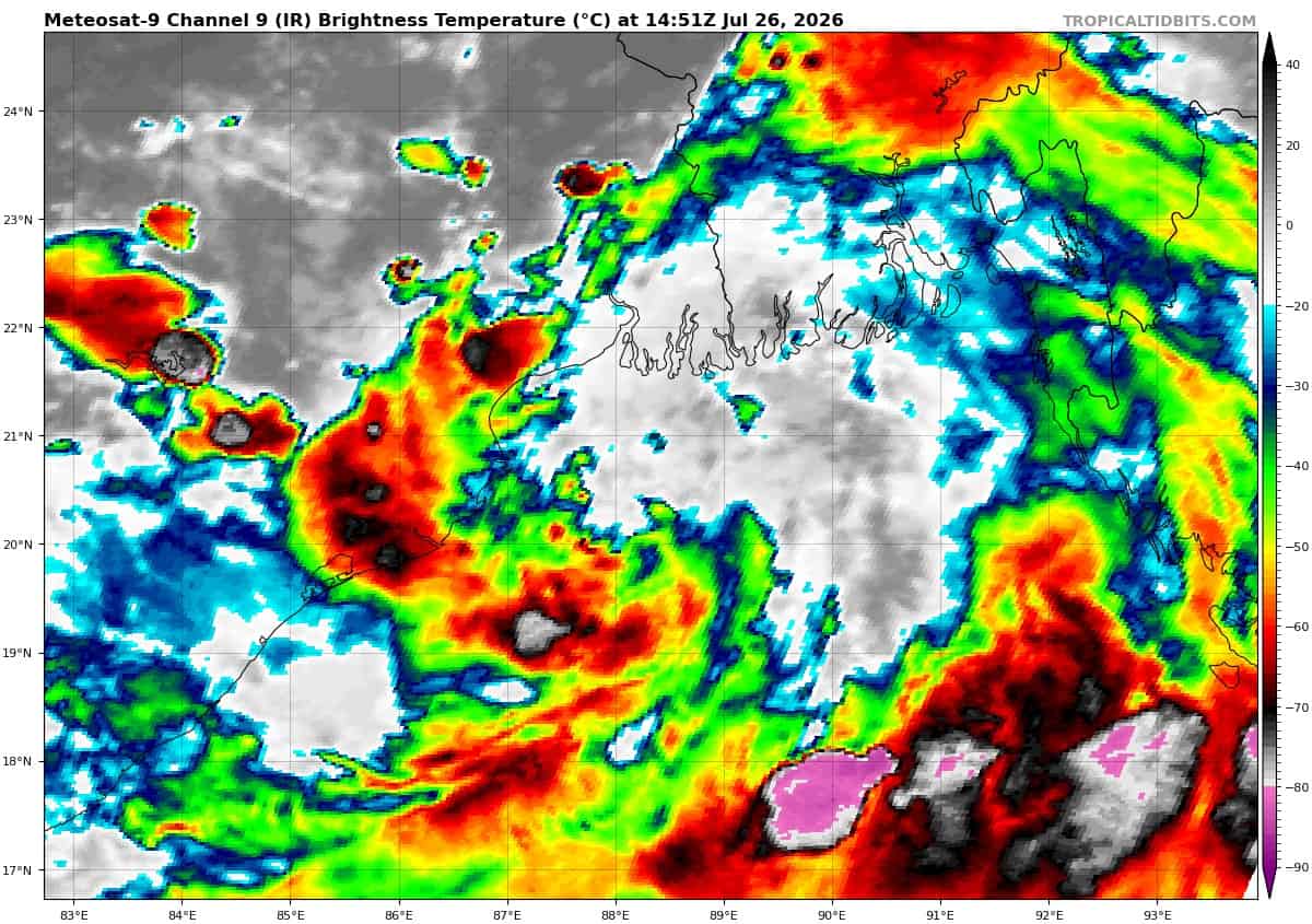
Enhanced infrared satellite imagery (eir) depicts an asymmetric low-level circulation center (llcc) with convection displaced far to the south.
Environmental analysis revels marginally favorable conditions for development with low vertical wind shear (15 knots or less), good equatorward outflow aloft, and warm (28-29 c) sea surface temperatures offset by terrain interaction with eastern India.
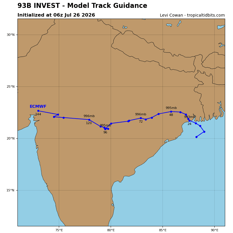
Global models depict invest 93B as a broad circulation with a northward track and making landfall within a 12-24 hour period.
Maximum sustained surface winds are estimated at 23 to 28 knots.
The potential for the development of a significant tropical cyclone within the next 24 hours remains medium.