
")
Current Snapshot
For all the latest updates visit: DisasterAWARE

mmmmm
hapupit
05W_091800sair

himawari9_ir_05W_202605091430_lat9.3-lon134.4
05W_tracks_latest
By PDC’s Senior Weather
Specialist Glenn James

The Pacific Disaster Center’s (PDC Global) Saturday, May 9, 2026, Tropical Cyclone Activity Report…for the Pacific Ocean, the Indian Ocean, and adjacent Seas
Current Tropical Cyclones:
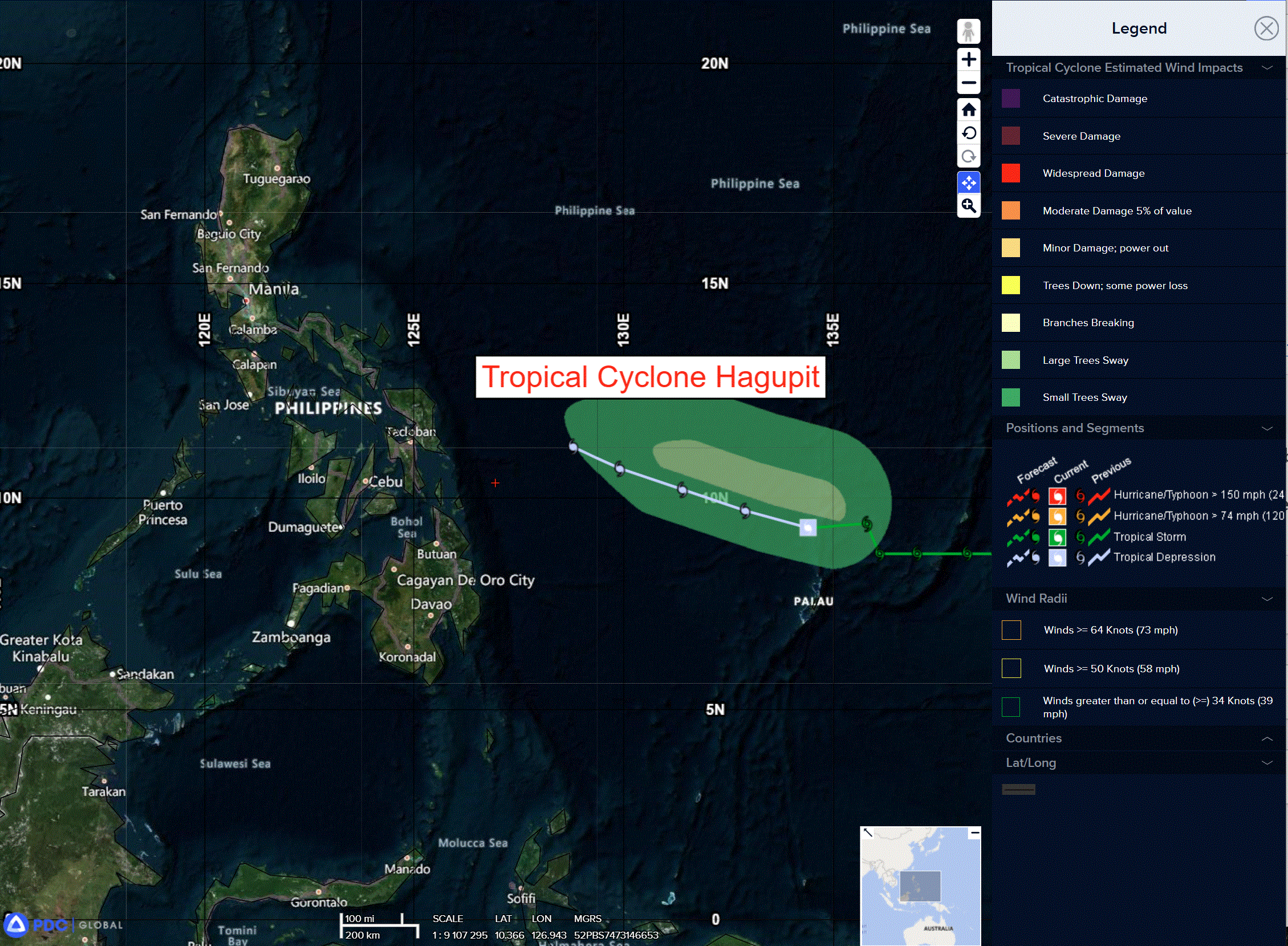
Tropical Cyclone 05W (Hagupit) is located approximately 174 NM north of Angaur
Northeast Pacific Ocean: There are no Tropical Cyclones
The last regularly scheduled Tropical Cyclone Activity Report of the 2025 eastern North Pacific Hurricane Season has been issued. Routine issuance of this section of the PDC product will resume on May 15, 2026. During the off-season, Special Tropical Weather Outlooks will be issued as conditions warrant by the NHC.
Central Pacific Ocean: There are no Tropical Cyclones
The 2025 central North Pacific hurricane season has ended. As such, the final routine Tropical Cyclone Activity Report for the 2025 season has been issued. Routine issuance of this section of the PDC product will resume on June 1, 2026. During the off-season, Special Tropical Weather Outlooks will be issued as conditions warrant by the CPHC.
Western Pacific, Indian Ocean, and adjacent Seas:
Tropical Cyclone 05W (Hagupit)
According to the JTWC Warning number 17, sustained winds are 30 knots with gusts to 40 knots
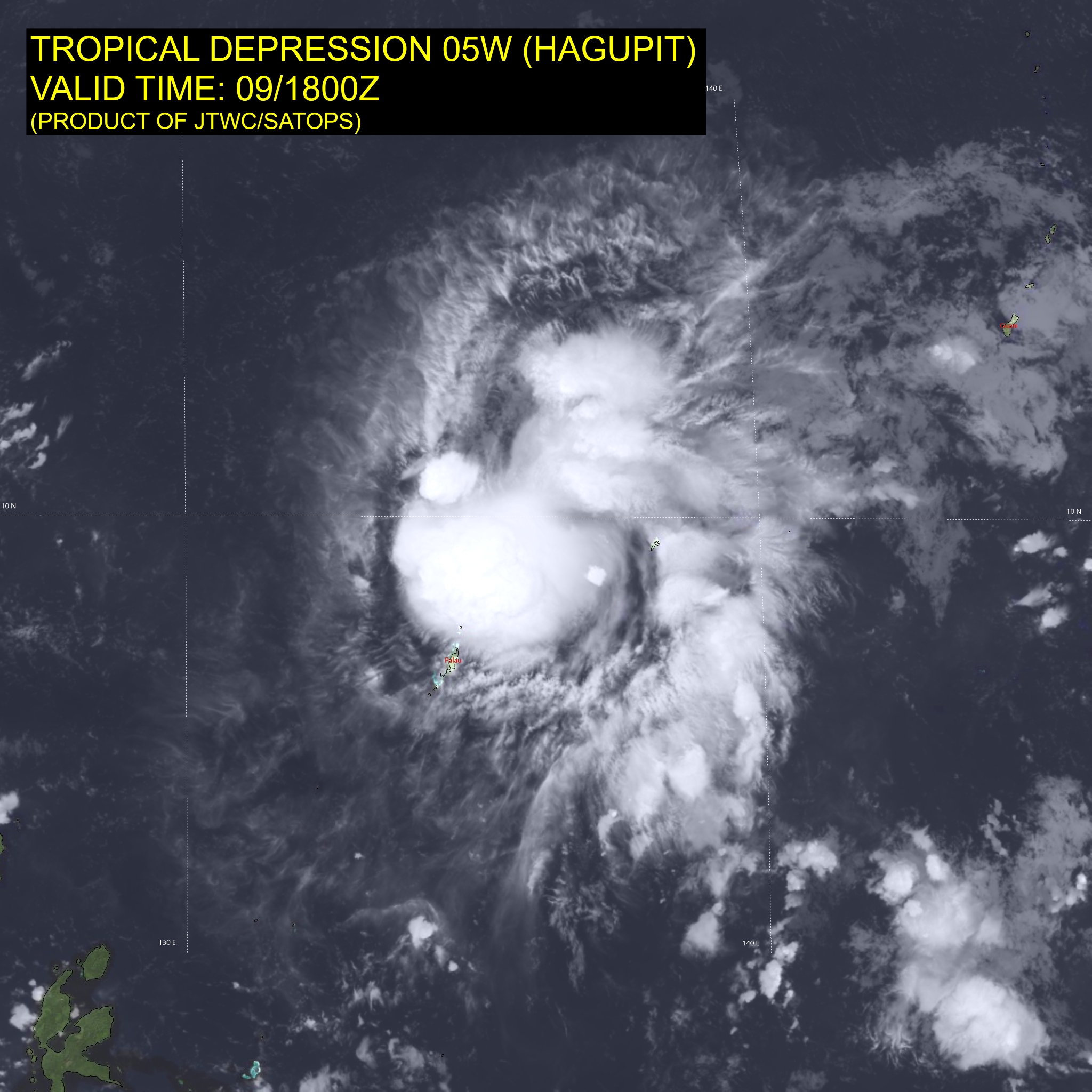
Animated enhanced infrared (eir) satellite imagery depicts tropical depression 05W with persistent deep convection over the eastern semi-circle and a partially exposed low level circulation center (llcc). A 091127z ascat image reveals the storm is highly elongated and weak, with elevated winds confined to the northeastquadrant. The ascat data also reveals that at least part of the persistent deep convection obscuring the eastern periphery and extending southward is a result of surface convergence rather than the circulation.
Environmental analysis reveals a marginally unfavorable environment, characterized by high (20-25 kts) mid-level vertical wind shear, significant dry air entrainment, and poor outflow aloft, offset by warm (29-30 c) sea surface temperatures.
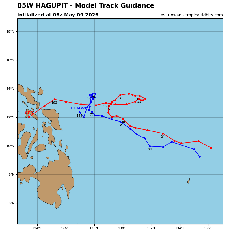
TD 05W (Hagupit) is forecast to continue tracking northwestward for the duration of the forecast period while it remains under the steering influence of the str centered far to its northeast. However, low-level southerly flow is expected to persist through 48 hours, which could introduce a more severe northward motion vector, resulting in a north-northwestward track or erratic track motion through 48 hours.
Regarding intensity, Hagupit is forecast to teeter between 30-35 kts for the next 24 hours as the marginally unfavorable environment persists and prohibits development. Around 36 hours, the environment is expected to further deteriorate into 25-30 kts of mid-level shear that will further force dry air into the core and stifle Hagupit. Ultimately, dissipation is expected no later than 48 hours.