Central Pacific: There are no active tropical cyclone
Tropical cyclone formation is not expected during the next 7 days



By PDC’s Senior Weather
Specialist Glenn James

The Pacific Disaster Center’s (PDC Global) Saturday, July 18, 2026, Tropical Cyclone Activity Report…for the Pacific Ocean, the Indian Ocean, and adjacent Seas
Current Tropical Cyclones:
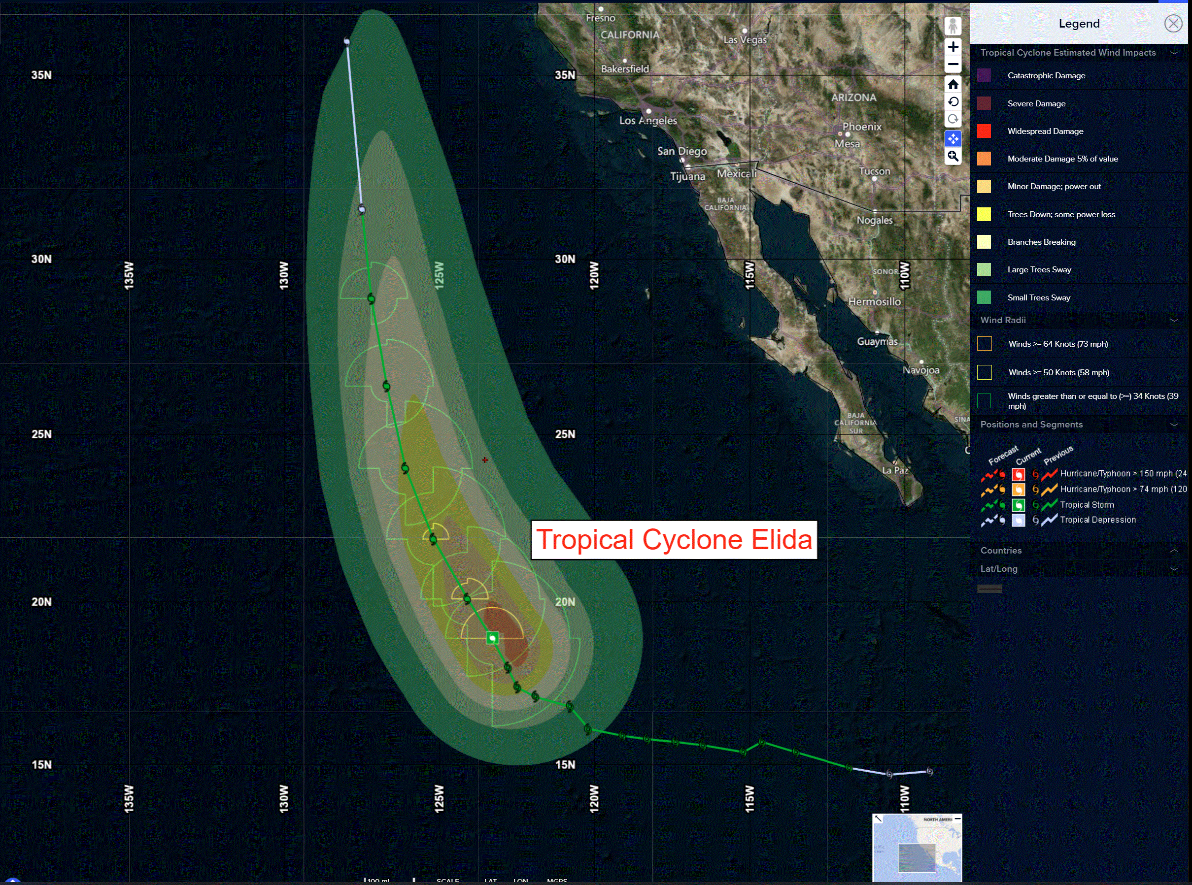
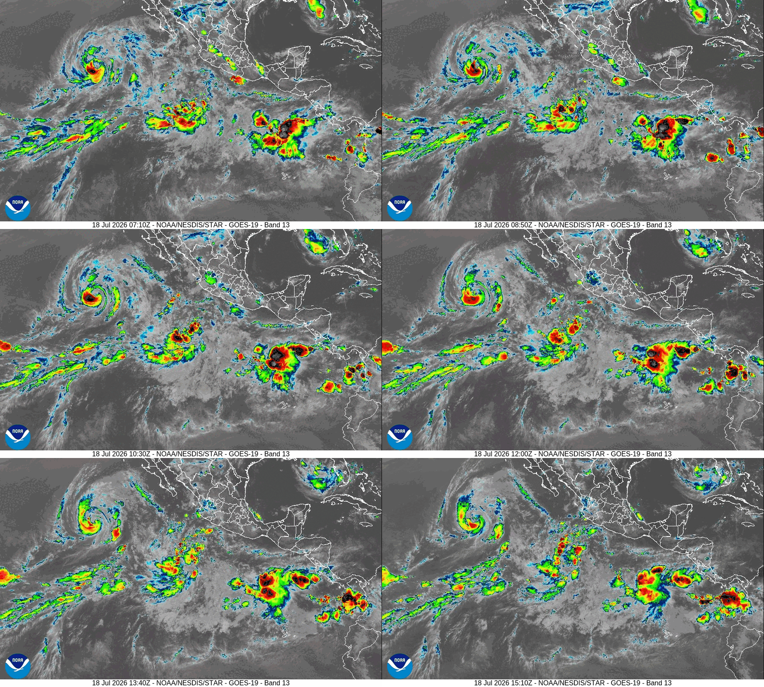
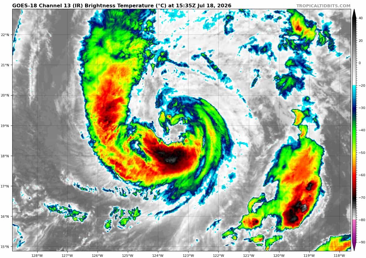
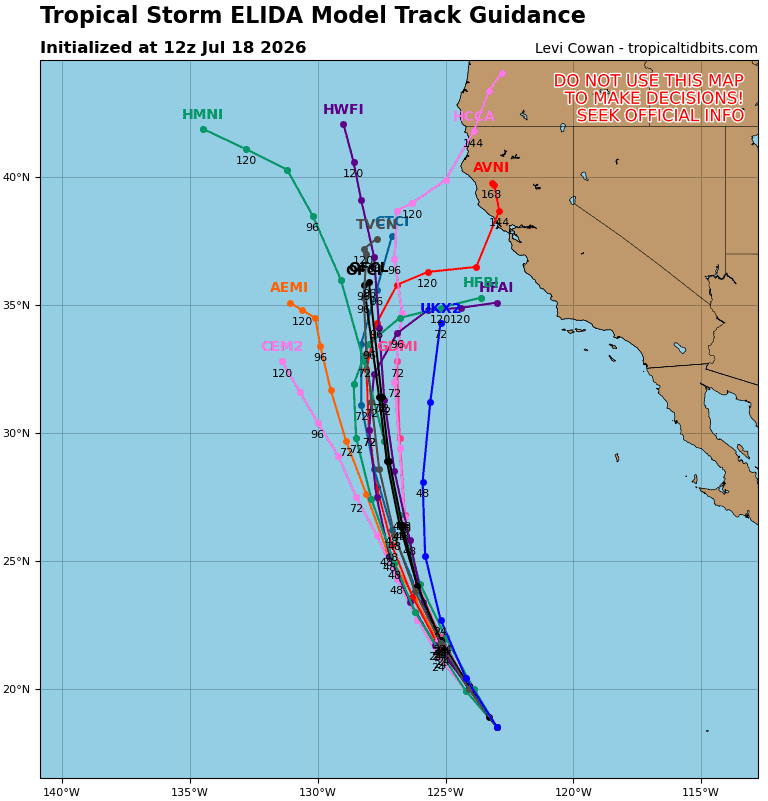
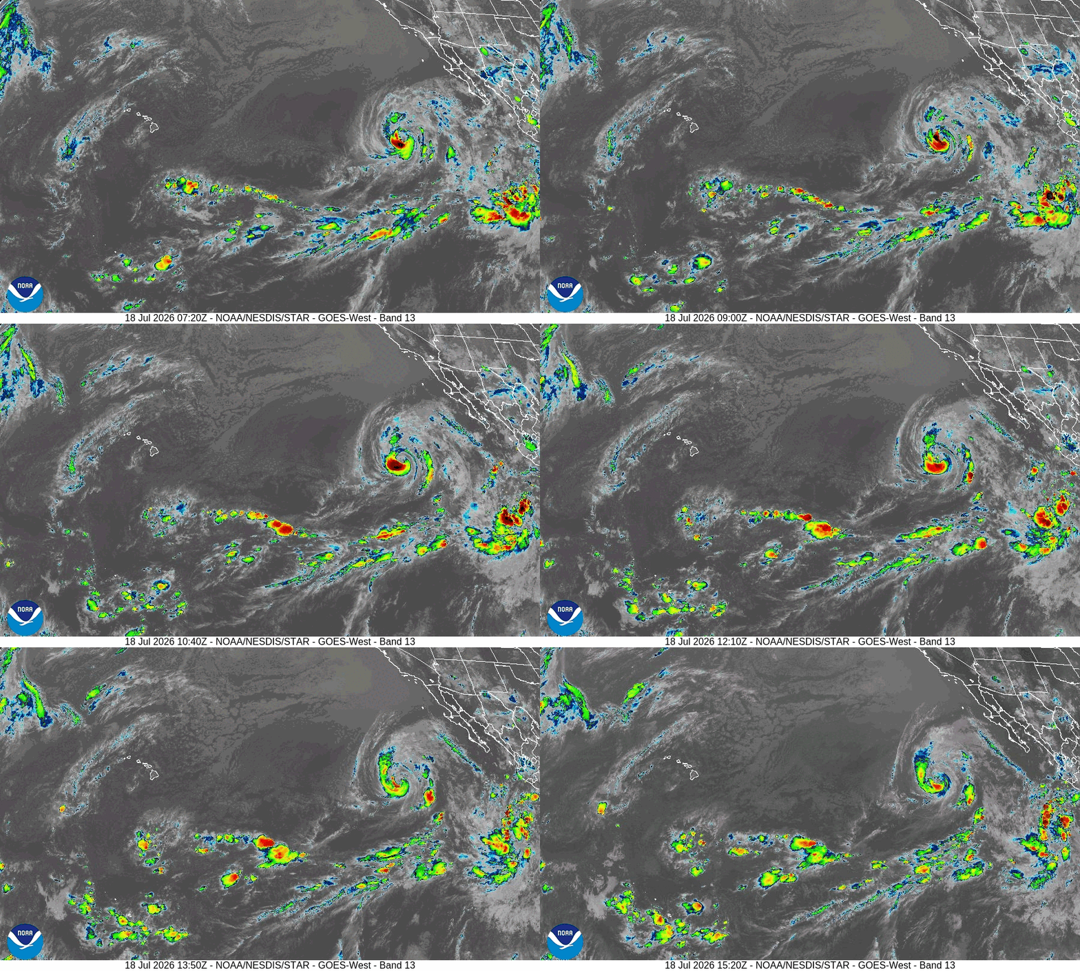
Tropical cyclone 05E (Elida)…is located about 935 miles west of the southern tip of Baja California
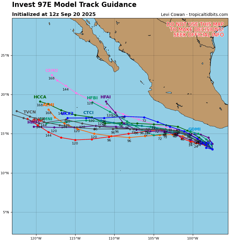
Tropical cyclone 06E…is located about 805 miles south of the southern tip of Baja California
Northeast Pacific:
Tropical cyclone 05E (Elida)
ELIDA WEAKENS SLIGHTLY
According to the NHC Advisory number 18
Elida is moving toward the north-northwest near 12 mph (19 km/h), and this motion with some increase in forward speed is expected through much of the weekend. An eventual turn to the north is forecast to occur by late Sunday. Maximum sustained winds are near 70 mph (110 km/h) with higher gusts. The system is expected to begin weakening later tonight with that weakening trend forecast to continue over the next few days as the storm moves over cooler waters. Elida is likely to become a post-tropical cyclone on Monday. Tropical-storm-force winds extend outward up to 195 miles (315 km) from the center.
HAZARDS AFFECTING LAND
SURF: Swells generated by Elida will affect portions of the west coast of the Baja California peninsula through the weekend. These swells are likely to cause life-threatening surf and rip current conditions.
Tropical cyclone 06E
SIXTH TROPICAL DEPRESSION OF THE EAST PACIFIC SEASON FORMS WELL SOUTH OF THE SOUTHERN TIP OF THE BAJA CALIFORNIA PENINSULA …FORECAST TO QUICKLY STRENGTHEN
According to the NHC Advisory number 1
The depression is moving toward the west-northwest near 12 mph (19 km/h), and this general motion is expected to continue for the next two to three days. Maximum sustained winds are near 35 mph (55 km/h) with higher gusts. Steady to rapid strengthening is forecast during the next few days. The depression is forecast to become a tropical storm on Sunday and become a hurricane by Monday night or Tuesday.
>>> Eastern and Central East Pacific:
A broad area of low pressure is forecast to develop well to the south of Mexico during the middle to latter part of next week. Some gradual development of this system is possible thereafter while it moves westward to west-northwestward across the eastern and central portions of the eastern Pacific.
* Formation chance through 48 hours…low…near 0 percent
* Formation chance through 7 days…medium…40 percent
Here’s the link to the National Hurricane Center (NHC)
Central Pacific: There are no active tropical cyclone
Tropical cyclone formation is not expected during the next 7 days
Western Pacific, Indian Ocean, and adjacent Seas: There are no Tropical Cyclones