The Pacific Disaster Center’s (PDC Global) Wednesday, July 15, 2026, Tropical Cyclone Activity Report…for the Pacific Ocean, the Indian Ocean, and adjacent Seas
Current Tropical Cyclones:
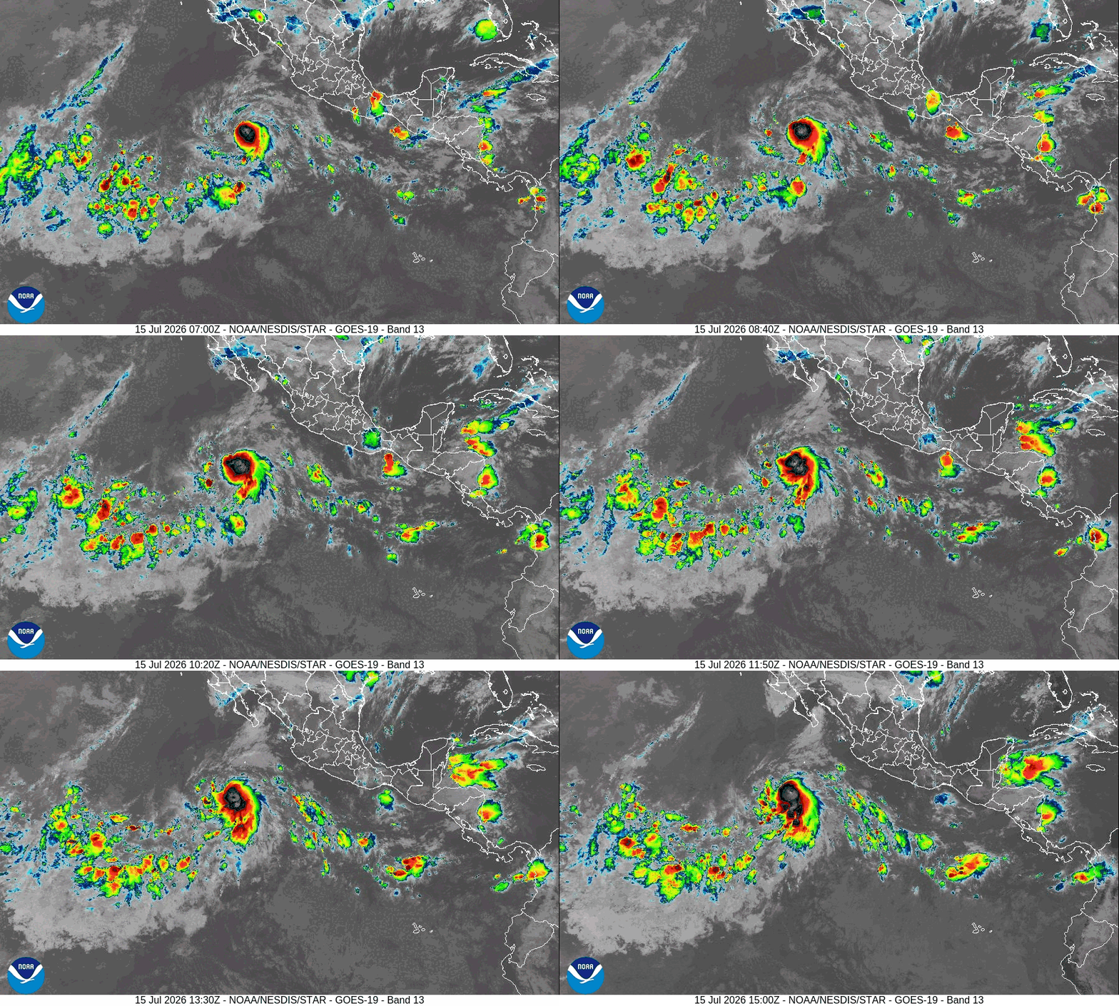
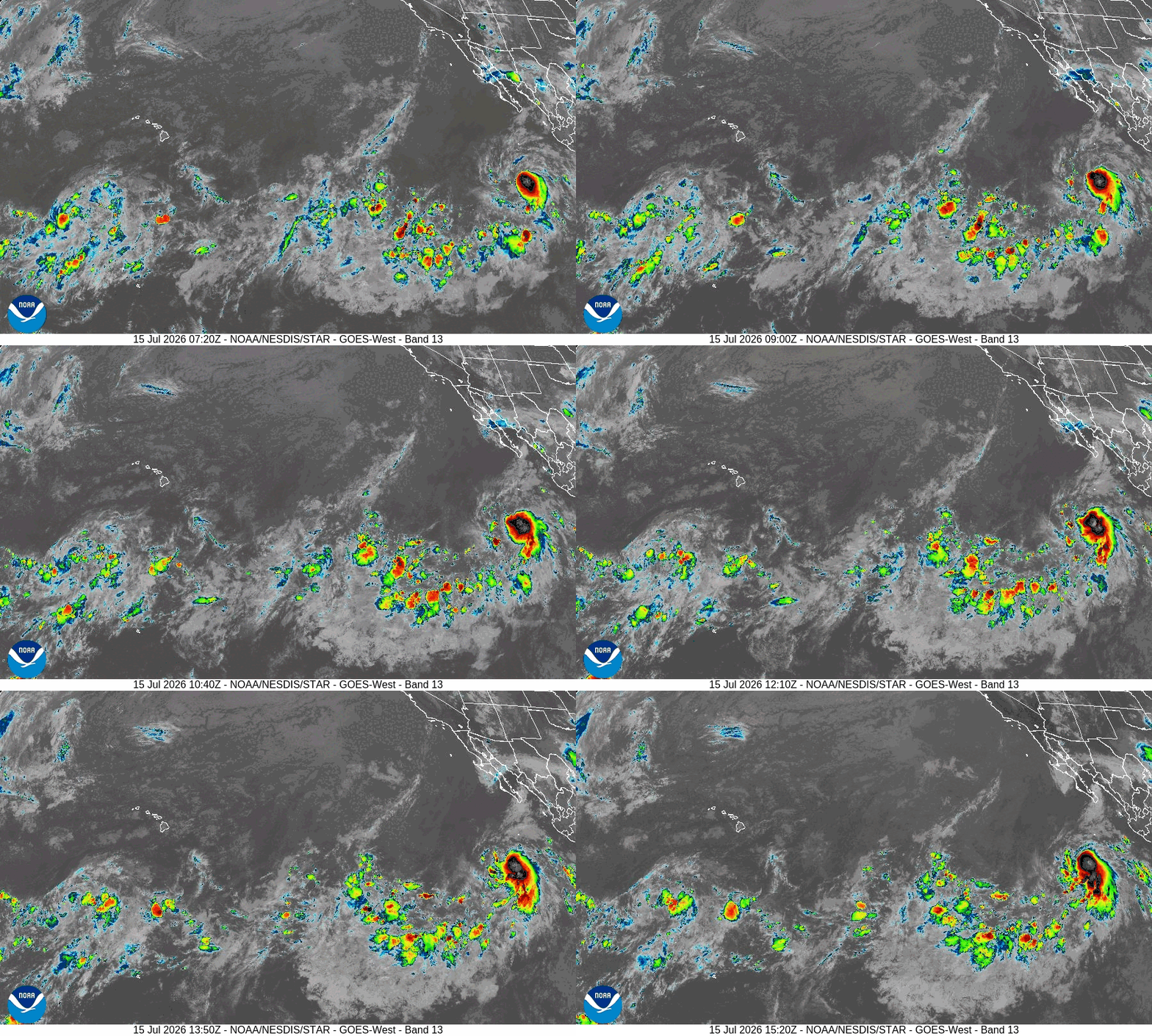
Tropical cyclone 05E (Elida)…is located about 570 miles south-southwest of the southern tip of Baja California
Northeast Pacific:
Tropical cyclone 05E (Elida)
ELIDA A LITTLE STRONGER AS IT MOVES OVER THE OPEN EAST PACIFIC
According to the NHC Advisory number 4
Elida is moving toward the west near 15 mph (24 km/h), and this general motion is expected to continue today followed by a gradual turn to the west-northwest and northwest over the next few days. Maximum sustained winds have increased to near 45 mph (75 km/h) with higher gusts. Gradual strengthening is forecast over the next day or so followed by a somewhat faster rate of intensification. Elida is forecast to become a hurricane on Friday. Tropical-storm-force winds extend outward up to 90 miles (150 km) from the center.
>>> Offshore of Southern and Southwestern Mexico:
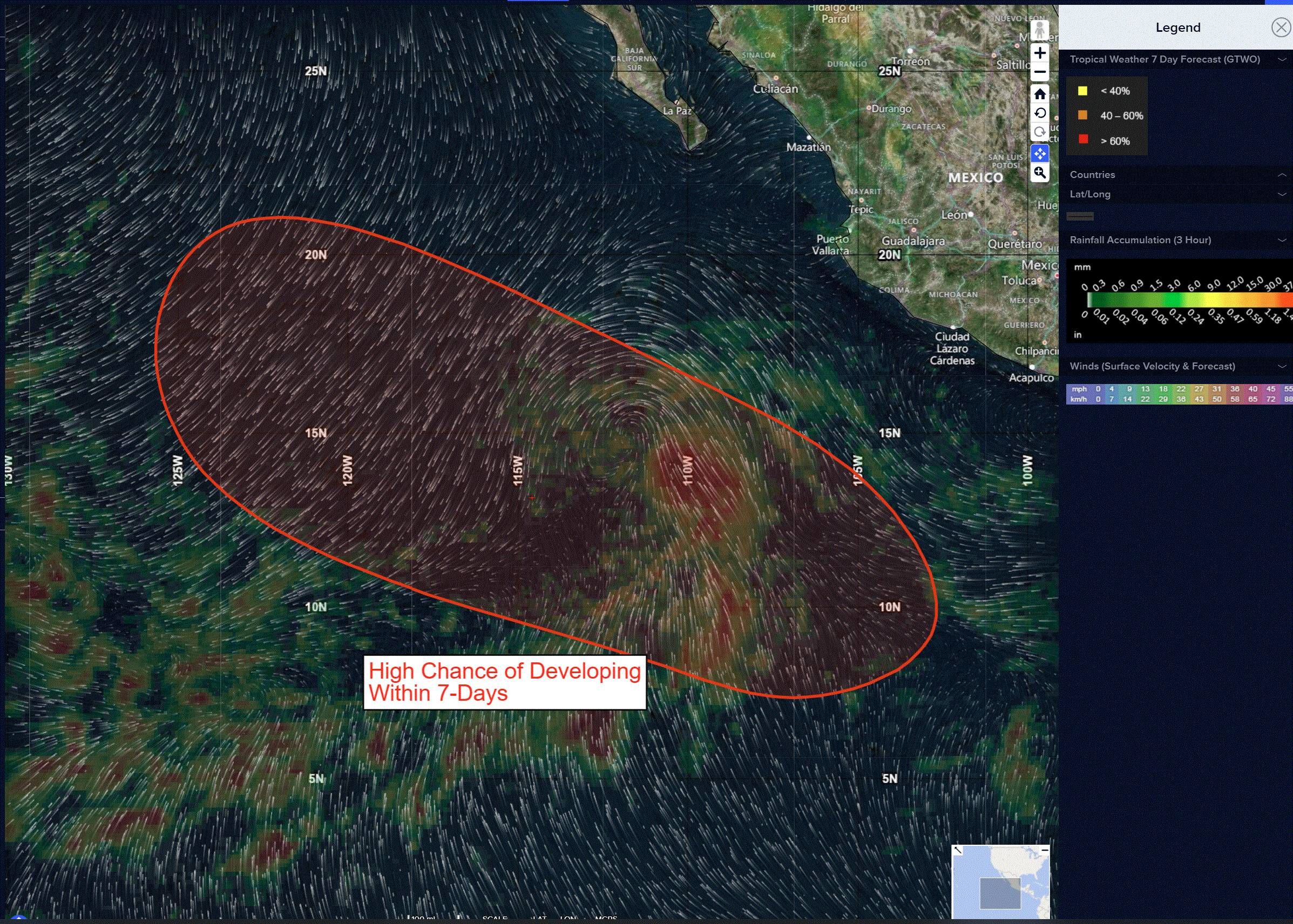
An area of low pressure is expected to form later this week several hundred miles south of the coast of southern Mexico.
Environmental conditions appear conducive for gradual development of this system thereafter, and a tropical depression is likely to form by this weekend into early next week while it moves generally west-northwestward well offshore of Mexico.
* Formation chance through 48 hours…low…near 0 percent
* Formation chance through 7 days…high…80 percent
Here’s the link to the National Hurricane Center (NHC)
Central Pacific: There are no active tropical cyclone
>>> Well South-southwest of the Hawaiian Islands:
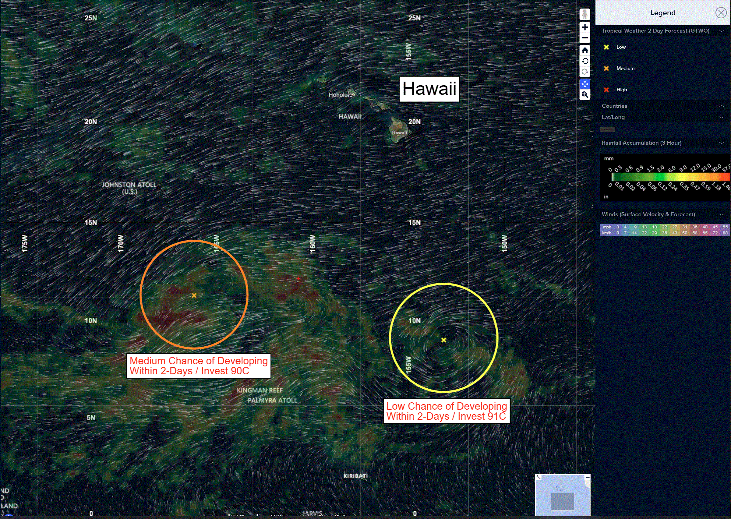
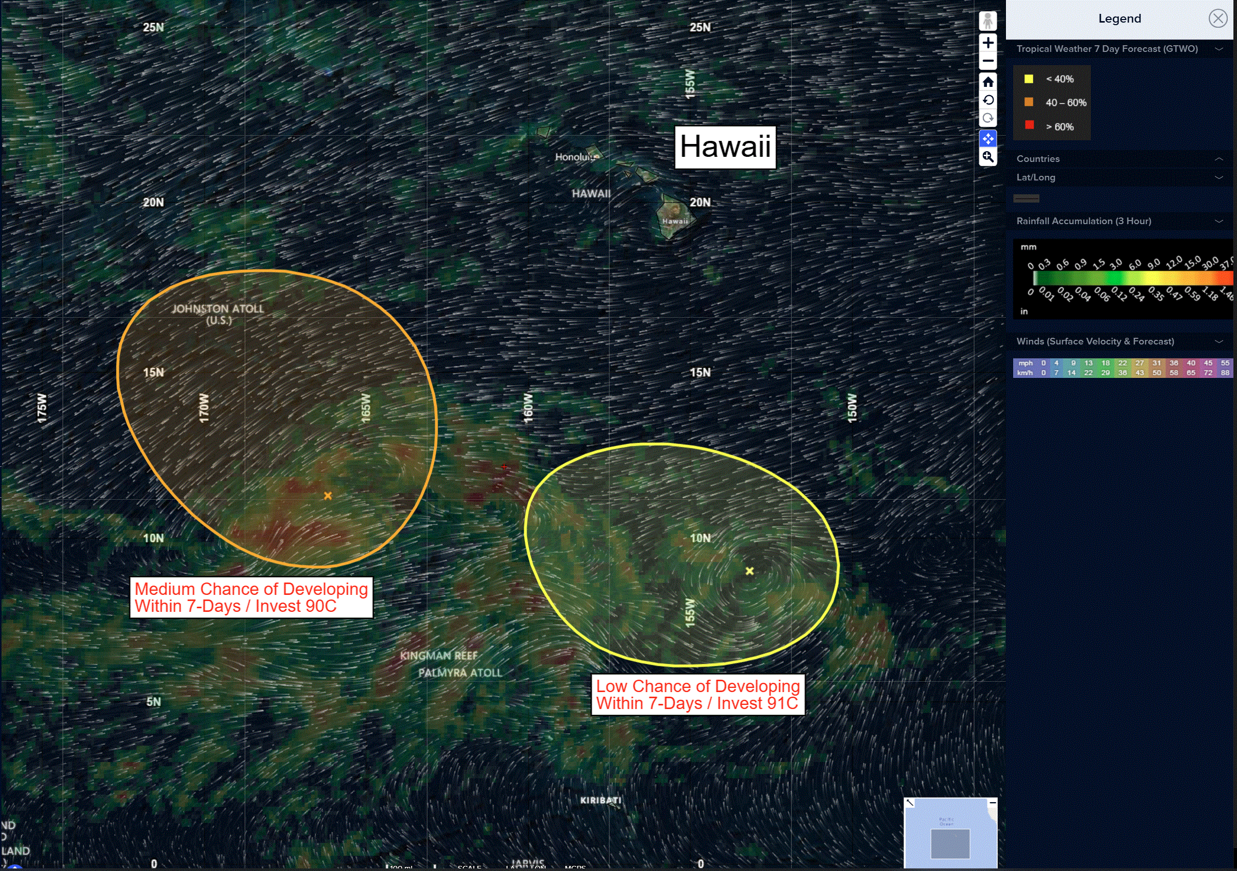
Invest 91C
A broad area of low pressure located several hundred miles south-southeast of the Hawaiian Islands is producing limited shower and thunderstorm activity.
Environmental conditions are becoming less favorable, and its chances for further development are decreasing.
* Formation chance through 48 hours…low…20 percent
* Formation chance through 7 days…low…20 percent
>>> Well Southwest of the Hawaiian Islands:
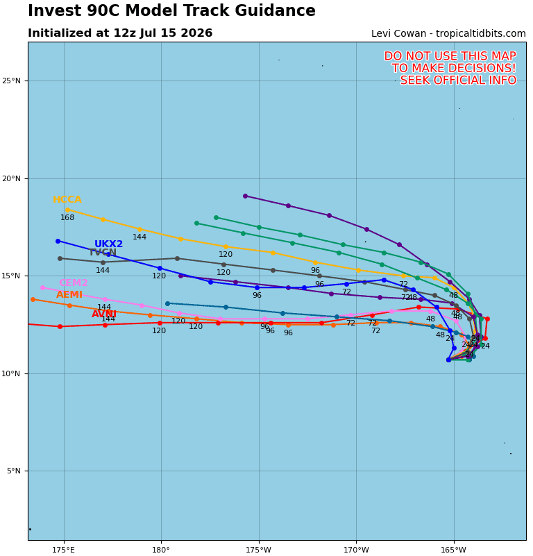
Invest 90C
A trough of low pressure located well southwest of the Hawaiian Islands and several hundred miles south-southeast of Johnston Atoll continues to produce disorganized showers and thunderstorms.
Environmental conditions appear conducive for gradual development of the system over the next several days, and it could become a tropical depression by the end of the week while it moves slowly northwestward toward the vicinity of Johnston Atoll.
* Formation chance through 48 hours…medium…50 percent
* Formation chance through 7 days…medium…60 percent
Western Pacific, Indian Ocean, and adjacent Seas: There are no Tropical Cyclones
Western Pacific
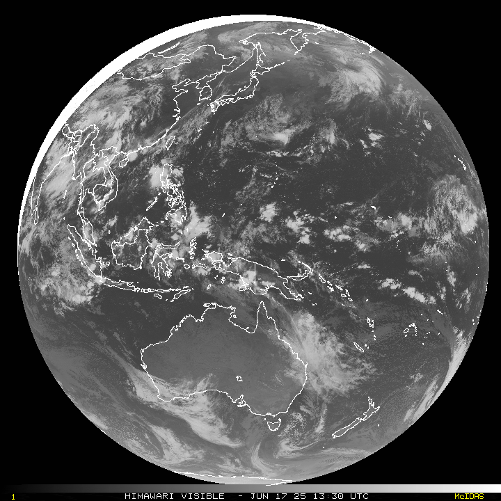
>>> There’s an area of disturbed weather being referred to as Invest 90W, which is located approximately 320 NM south of Chuuk
Maximum sustained surface winds are estimated at 18 to 23 knots.
The potential for the development of a significant tropical cyclone within the next 24 hours is low.
>>> There’s a second area of disturbed weather being referred to as Invest 91W, which is located approximately 271 NM east of Iwo To
Maximum sustained surface winds are estimated at 18 to 23 knots.
The potential for the development of a significant tropical cyclone within the next 24 hours is low.